Scan the QR code and open PeakVisor on your phone
Ski, hike and discover some of the highest mountains in the Ötztal Alps when you visit Texelgruppe Nature Park. There are 153 named mountains in Texelgruppe Nature Park. The highest and most prominent mountain is Hintere Schwärze (3,628 m/11,903 ft).
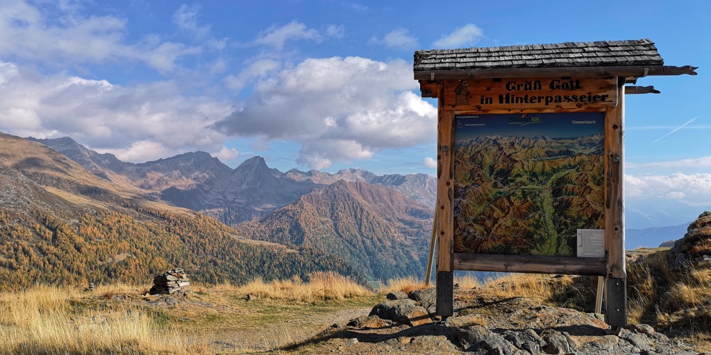
Texelgruppe Nature Park (German: Naturpark Texelgruppe, Italian: Parco Naturale Gruppo di Tessa) is a nature reserve in South Tyrol, Italy. The park covers an area of approximately 334 sq km (129 sq mi).
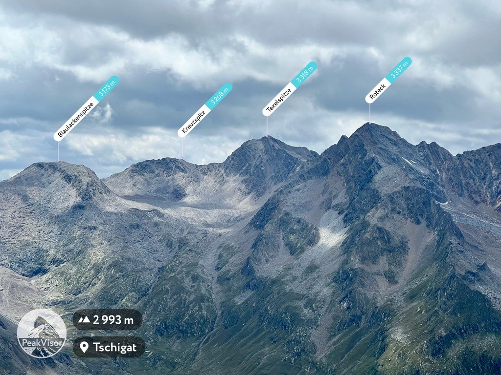
The park centers around the Texel Group (German: Texelgruppe, Italian: Gruppo di Tessa) mountains within the Ötztal Alps. Dozens of Texelgruppe Nature Park's mountains exceed 3,000 m (9,842 ft) in elevation, including Hintere Schwärze, the fourth-highest peak in the Ötztal Alps. Roteck (Monte Rosso) (3,336 m/10,948 ft) is the highest summit in the Texel Group.
As well as encompassing the Texel Group, Texelgruppe Nature Park also contains parts of the Schnalstal Valley (Val Senales) to the west and the Passeier Valley (Val Passiria) to the east. Also within the park are parts of the Stubai Glacier (Stubaier Gletscher) and the Ötztal Alps' Schnals and Gurgler ridges.
Resting on the Italian-Austrian border, Texelgruppe Nature Park is among the least famous parks in South Tyrol and is overshadowed by the majestic Dolomites, which are visible in the distance from many of the park's summits. The park borders Austria's Ötztal Nature Park (Naturpark Ötztal) to the north.
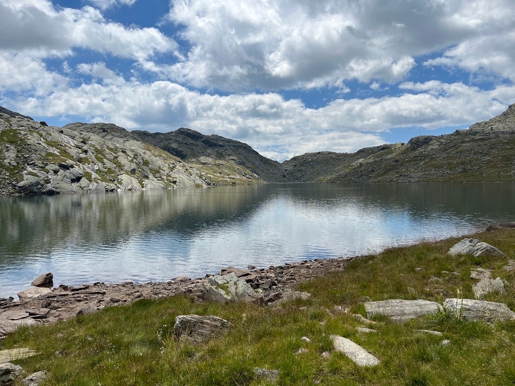
Texelgruppe Nature Park is home to the Spronser Lakes (Laghi di Sopranes), the largest lake plateau landscape in the High Alps. The Spronser Lakes are a collection of eight to ten significant lakes located between 2,120 m (6,955 ft) and 2,590 m (8,497 ft) in elevation. The largest of the lakes is Langsee, which is visible from Spronser Rötelspitze (2,628 m/8,622 ft).
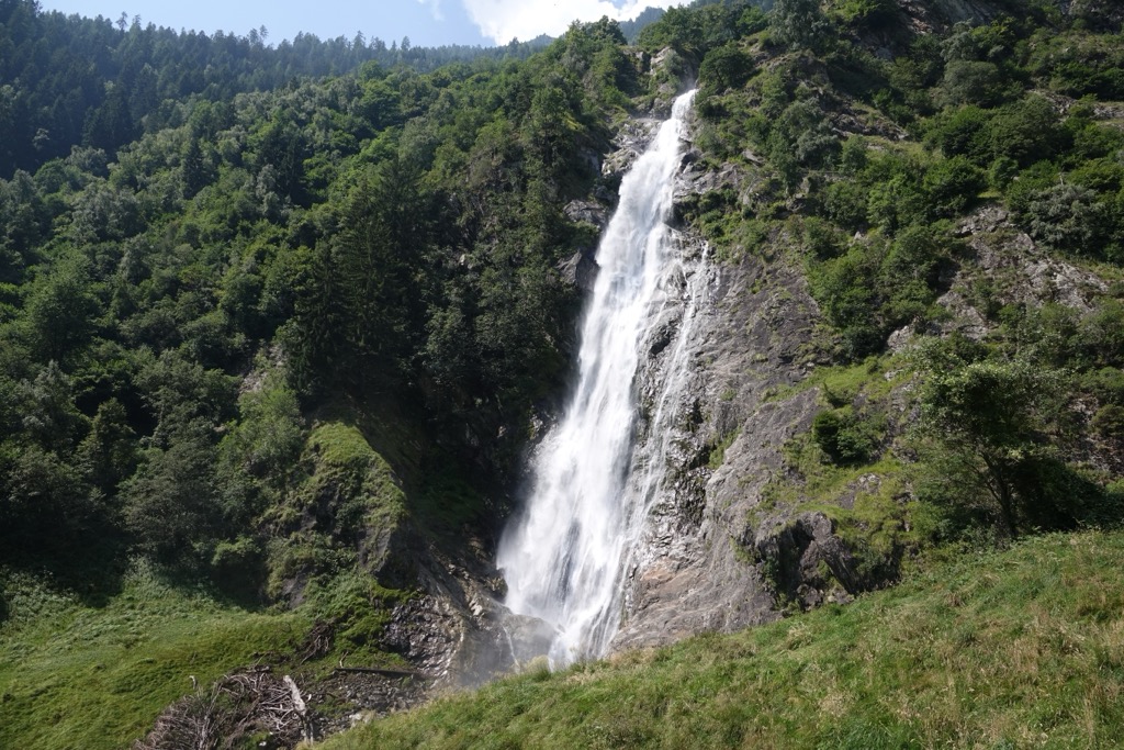
Another popular sight in Texelgruppe Nature Park is the Partschins Waterfall (Cascata di Parcines). Partschins Waterfall is considered one of the most beautiful Alpine waterfalls and has a single drop of 97 m (318 ft).
The park stretches across parts of eight municipalities: Algund, Dorf Tirol, Moos in Passeier, Naturns, Partschins, Rifiano, Schnals, and St. Martin in Passeier.
Several significant towns, villages, and resorts exist in and around Texelgruppe Nature Park, including Bolzano (Bolzen) Merano (Meran), Moos in Passeier (Moso in Passiria), and Pfelders (Plan).
The Texel Group is geologically the same as the Central Alps. The base of the park's landscape was formed during the Alpine orogeny, a mountain-building event caused by a collision between Africa, Arabia, India, and Cimmerian Plate to the south with Eurasia in the north.
Convergent movements between these tectonic plates began the formation of many mountains across Europe, including the Pyrenees, the Apennines, and the Alps. This event is relatively recent by orogeny standards, occurring approximately 66 million years ago. The Alpine orogeny is ongoing in some parts of the Alpine range.
Geologists have identified three distinct areas of crystalline rock in the Texel Group: Stubai crystalline around Timmelsjoch (2,491 m/8,172 ft) and Ötztal crystalline, which is present in the Schneeberg/Monteneve range, and the Schnalser Kamm/Cresta di Senales area.
Around Granatenkogel (Monte dei Granati) (3,304 m/10,840 ft), large garnets the size of baseballs have been uncovered. There are also marble deposits within gneisses and mica schists. Additionally, vast marble veins can be found on the slopes of the Plan Valley (Val di Plan) and within the Lodner (Cima Fiammante) (3,228 m/10,591 ft) group.
The current shape of Texelgruppe Nature Park was changed significantly by water and ice. Massive glaciers covered the Texel Group during the last glacial period, creating cirques, valleys, and carving striations in the landscape.
Ice still affects certain parts of the landscape. During the snowmelt at the start of summer, one of the park's most notable features, the Partschins Waterfall, swells significantly, with over 10,000 liters of water cascading over the falls every second.
Melted glaciers mean water is abundant within Texelgruppe Nature Park. Around 20 lakes were formed across the Texel Group by glaciers either cutting basins into the rock or filling ready-made cirques and moraines with water.
Today, Texelgruppe Nature Park contains some of the highest summits in the Ötztal Alps, making it an often overlooked hiking treasure. Notable mountains within Texelgruppe Nature Park include Similaun (3,606 m/11,831 ft), Finailspitze (Punta di Finale) (3,514 m/11,529 ft), Östliche Marzellspitze (3,555 m/11,663 ft) and Hohe Weiße (3,276 m/10,751 ft).
With a wide range of elevations, Texelgruppe Nature Park features most of the habitats seen across South Tyrol and the Ötztal Alps. Read on to learn about Texelgruppe Nature Park's wildlife.
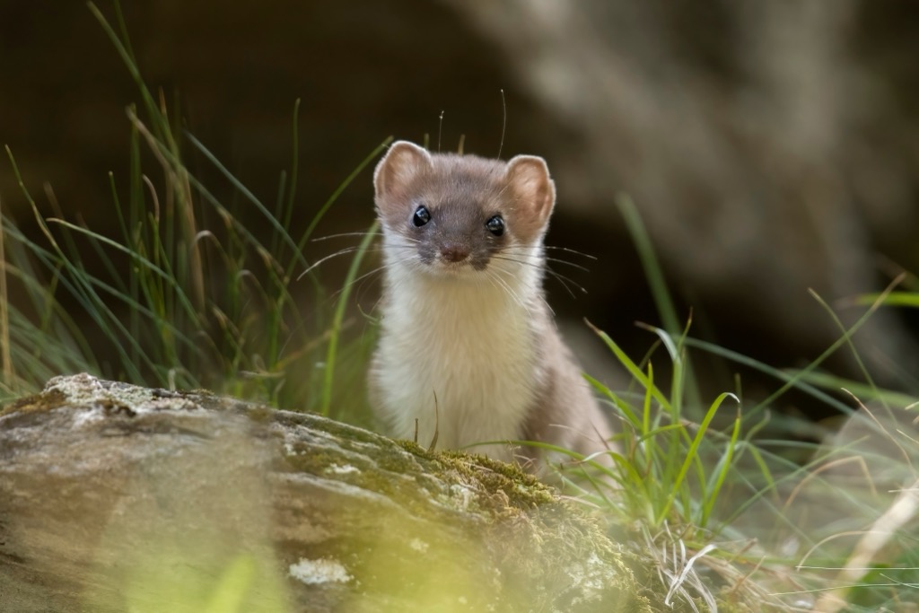
The most common mammals hikers might encounter in Texelgruppe Nature Park include deer, ibexes, and chamois. Lucky hikers may also spot marmots, ermines, and mountain hares. Mammals only active during dusk, dawn, and night include badgers, foxes, dormice, and pine martens.
Chamois live in extreme conditions on high mountain slopes. They were in danger of going extinct from South Tyrol in the seventeenth century but have been successfully reintroduced to the region.
A wide variety of birds inhabit Texelgruppe Nature Park. Rare species in the park include woodlarks, barred warblers, tawny pipits, rock partridges, and ortolan buntings.
On mountain slopes in the park's coniferous forests, crossbills, black woodpeckers, goldcrests, and gold tits can be spotted. Above 1,900 m (6,233 ft) in elevation in shrublands live black grouse and capercaillies. Other notable birds that nest in Texelgruppe Nature Park include rock ptarmigans, ravens, and golden eagles.
The most common reptiles in Texelgruppe Nature Park are green lizards and asp vipers. Notable insect species include praying mantises, adonis blues, small heaths, and Glanville fritillaries.
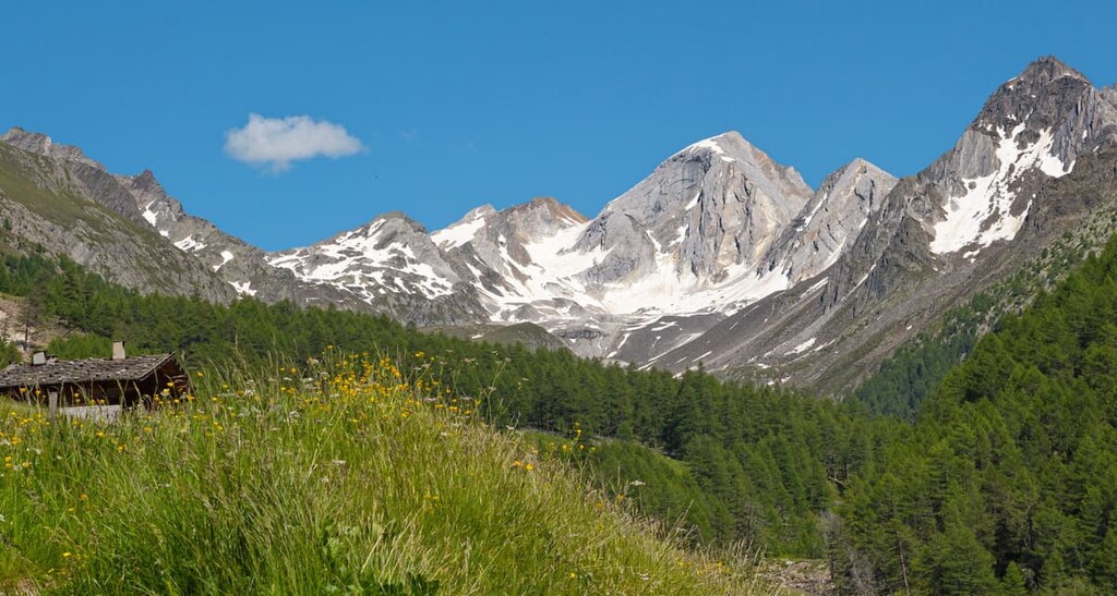
The vegetation of Texelgruppe Nature Park varies drastically from low arid valleys to high Alpine heathlands.
Around the Vinschgau Valley (Val Venosta), secondary-steppe vegetation like junipers and berry-bearing bushes are common. Meanwhile, the southern slopes of the Texel group are covered in Scots pine and mixed deciduous up to an elevation of around 1,000 m (3,280 ft).
In the moist valleys, beech and silver firs thrive, while in drier areas, hornbeams, chestnuts, downy oaks, maples, birches, sycamores, birches, and gray alders dominate.
Larch forests carpet the rugged slopes of the Vinschgau Valley and Schnalstal Valley. The Schnalstal Valley is known as South Tyrol's "valley of the larches" due to its ecological importance. The slopes of several valleys, including the Plan Valley, are coated in spruce forests between 800 m (2,624 ft) and 1,900 m (6,233 ft).
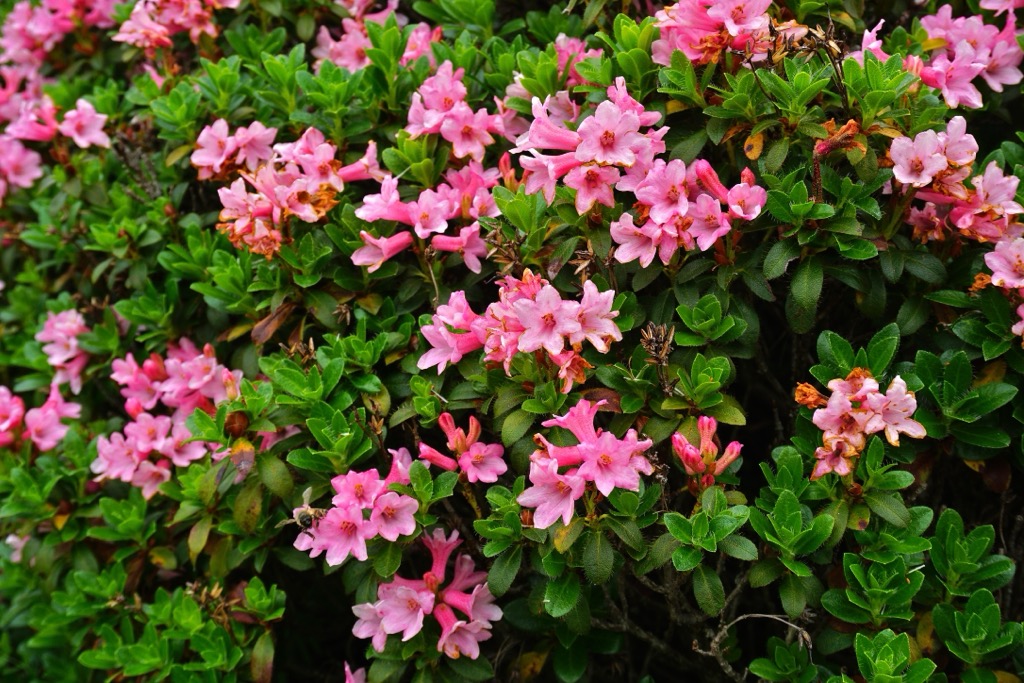
Above the tree line are areas of low dwarf shrubland where many of the region's most vibrant flowering plants grow, including Alpine roses, heather, and Alpine azaleas. Berry-bearing plants in these areas include crowberry, bearberry, and cowberry.
Humans have inhabited the Texel Group for thousands of years. One of the most important archeological discoveries in the region is Ötzi the Iceman, who was found on the eastern ridge of Finailspitze. Thought to have lived between 3,350 and 3,105 BCE, Ötzi is Europe's oldest natural mummy and has provided unmatched insights into Copper Age Europeans.
In Oberplars, the remnants of fortifications, pit dwellings, and pottery have been uncovered, dating back to before the Middle Ages. A population spike in the Middle Ages led to the establishment of permanent settlements in the Texel Group.
These settlements were for agricultural purposes and were known as schwaighöfe. They were built on Alpine pastures up to 2,000 m (6,561 ft) in elevation.
Wealthy nobles owned the schwaighöfe and rented them out to farmers. The farmers then traded their cheese, livestock, and wool with the landowners for grains and salt. There was an element of nomadism to the schwaighöfes. Once the schwaighöfes' land could no longer grow crops, it would be moved to a different elevation.
One of the most successful farming areas in Texelgruppe Nature Park is the Schnalstal Valley. This valley contains the largest concentration of sheep in South Tyrol, with over 1,000 sheep driven across nearby snowfields and glaciers in late June to summer pastures.
Several mountains are often crossed during this sheep drive, including Hochjoch (Giogo Alto) (2,462 m/8,077 ft), Niederjoch (Giogo Basso) (2,460 m/8,071 ft), and Gurgler Eisjoch (3,147 m/10,325 ft).
Early human adaptability is on full display in Texelgruppe Nature Park, with farmers building complex irrigation systems known as waales, which carry water to areas of the Vinschgau Valley with low precipitation. Some of these irrigation systems traveled for 20 km (12.5 mi) before reaching the fields.
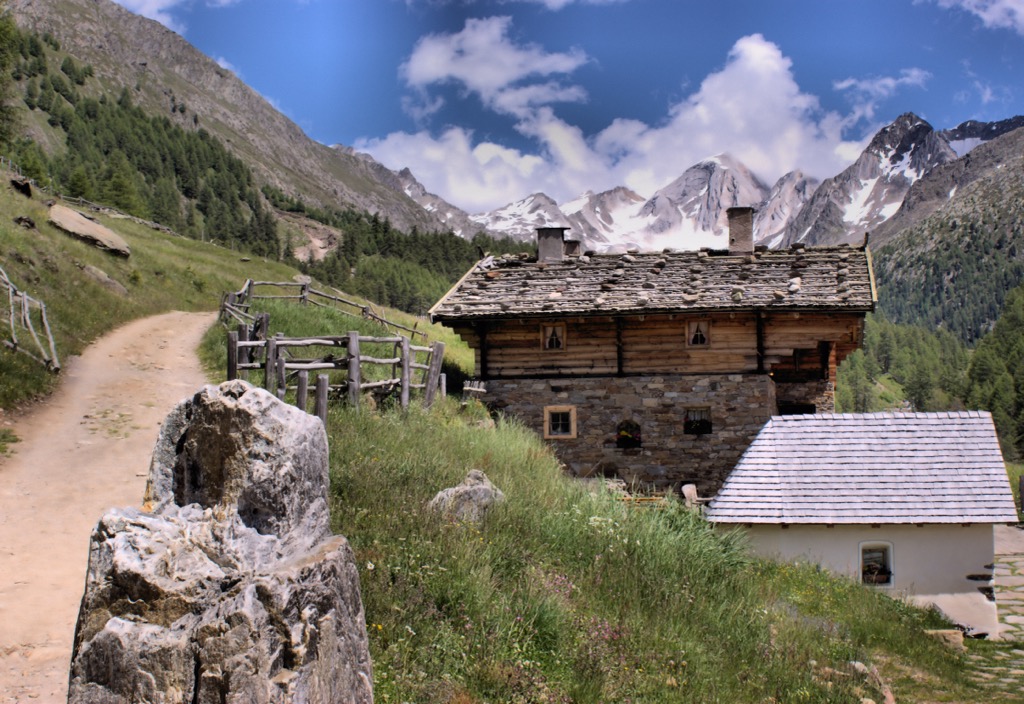
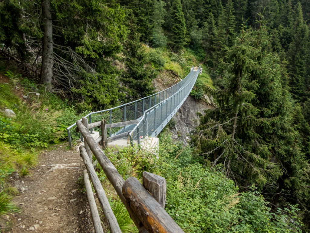
With snow capped mountains reaching over 3,000 m (9,842 ft) in elevation and numerous cozy mountain huts, Texelgruppe Nature Park is the perfect retreat from the summer heat.
Hiking in the High Alps is potentially dangerous, so ensure you come well-prepared for your hiking adventure. Bring appropriate hiking gear and plenty of food and water, and carefully map your route. Check weather forecasts, note mountain huts along your intended route, and inform others of your itinerary.
Read on to learn about the best hikes in Texelgruppe Nature Park.
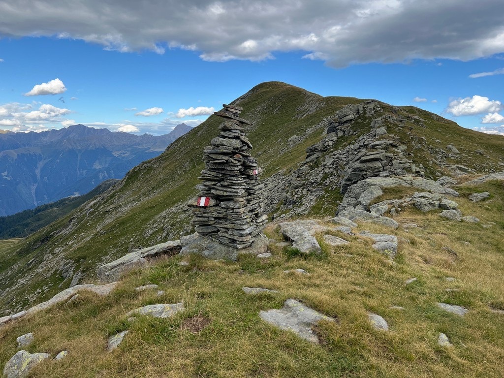
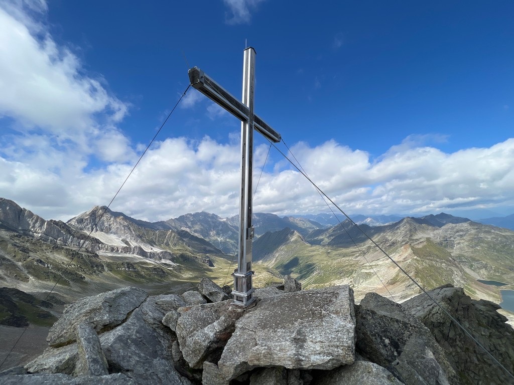
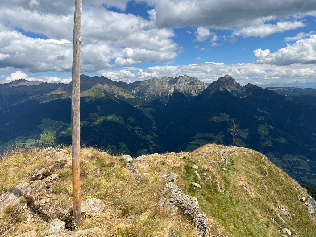
Tschigat (2,999 m/9,839 ft) is one of the Texel Group's most popular and beautiful mountains. It features a majestic peak with a distinguished pointed summit and provides stunning views of one of the gems of the Texel Group, Hohe Weiße (3,276 m/10,751 ft).
One way to scale Tschigat is from the Hochmuth Bergstation. You can take the cable car from Dorf Tirol up to Hochmuth. This is widely considered one of the most accessible routes up Tschigat.
This walk is quite steep, with an elevation gain of nearly 2,000 m (6,561 ft), but it's well worth it to pass by some of the serene Spronser Lakes, including Pfitschlacke, Kaserlacke, Grunsee, and Langsee. The walk is approximately 20 km (12.5 mi) in length.
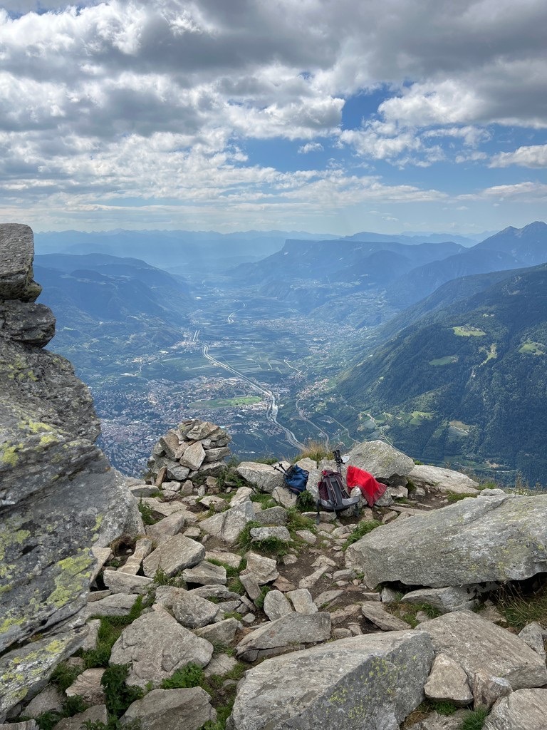
Mutspitze (2,943 m/9,656 ft) is another hugely popular mountain in Texelgruppe Nature Park. It's the local mountain of Dorf Tirol and boasts incredible views toward the city of Merano and the Etschtal, Passeiertal, and Vinschgau valleys.
The best way to climb Mutspitze is from the Hochmuth Bergstation. The walk follows the No. 22 trail past the Mountain Inn Mutkopf (Berggasthaus Mutkopf) (1,684 m/5,525 ft). At a fork in the path, you’ll bear left and follow the No. 23 trail up the eastern ridge to the summit of Mutspitze.
The summit is marked with a cross. As mentioned, the views are sublime, with neighboring Spronser Rötelspitze (2,628 m/8,622 ft) and several of the Spronser Lakes visible. Descend along the same route. This walk is approximately 7.9 km (4.9 mi) in length.
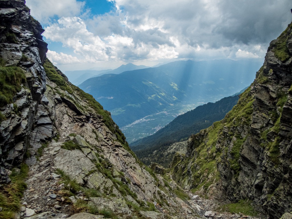
Walk in the footsteps of Ötzi the Iceman by scaling Finailspitze. Finailspitze (sometimes Fineilspitze) is the closest mountain to where Europe's oldest natural mummy was discovered, and the hike to its summit offers a fascinating tour of the Schnalstal Valley.
One possible route to the summit of Finailspitze starts from Lake Vernago (Lago di Vernago). The walk follows the trail signposted for the Similaunhütte - Rifugio Similaun (3,019 m/9,905 ft) before leading over a long crest of a ridge to the site of the discovery of Ötzi at Tisenjoch (Giogo di Tisa) (3,196 m/10,486 ft).
Finally, you'll follow unmarked trails to the summit cross of Finailspitze. This is a very challenging trek, with exposed grade I-II climbs and fixed ropes needed in areas.
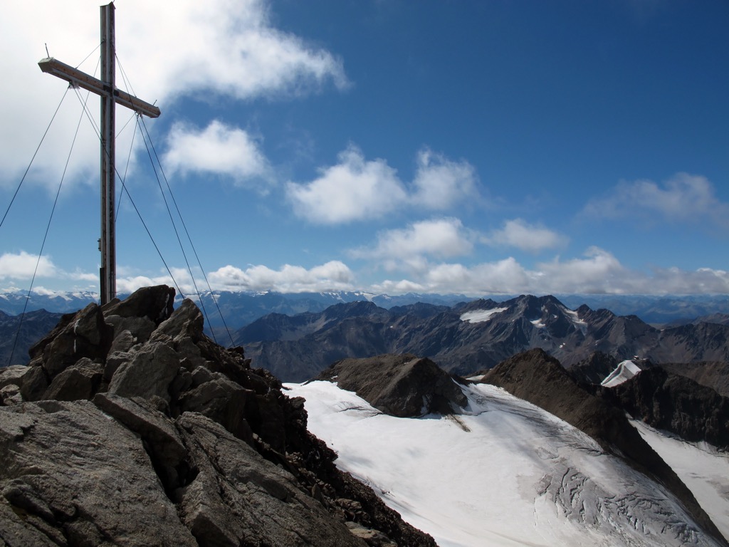
From the summit of Finailspitze, you'll be treated to panoramas of the icy Ötztal Alps, with Niederjochferner (3,299 m/10,823 ft), Similaun, Marzellspitze, and Hintere Schwärze visible to the east. You'll descend the way you came. This walk is approximately 9.8 km (6 mi) in length.
Consider a peaceful hike to the Obisellsee (Lago di Saltusio) and Olbere Obisellalm if you want to avoid the crowds in Texelgruppe Nature Park. Along this trail, you can take in spectacular views of the Merano Basin and have the option of scaling the summit of Pfitschkopf (2,125 m/6,972 ft).
One of the best places to start this hike is from the Walde Restaurant (Ristorante Walde Alm) just to the southwest of Vernuer (Vernurio). After enjoying a traditional meal at the Walde Restaurant, head to the Hahnenkammhütte (2,025 m/6,644 ft), where you can take a detour to Pfitschkopf following the No. 5A trail.
The trail continues north before you follow the partially exposed No. 5 to Obisellsee and the Olbere Obisellalm. After resting at the picturesque mountain hut, return along the No. 5 trail before looping along the path on the right side of the Saltauser Tal Valley to the Vernueralm pasture. This looped trail is approximately 12 km (7.5 mi) in length.
Texelspitze (Cima Tessa) (3,318 m/10,886 ft) is the second-highest summit in the Texel Group after Roteck (3,336 m/10,948 ft). Texelspitze offers a lengthy and technical ski tour that's popular with local off-piste skiers. It's considered difficult due to the long climb up the Pfossental Valley.
The starting point of this ski tour is from the car park at the Gasthof Jägerrast Inn. Follow the forest trail for 5 km (3.1 mi) to the Eishof-Maso Gelato (2,076 m/6,811 ft) before bearing right over the stream and crossing the Texelferner glacier. The trail ends on the southwest side of Texelspitze's summit.
Return to your starting point the way you came. This ski tour is approximately 16.3 km (10.1 mi) in length.
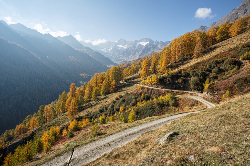
The Merano High Mountain Trail (Meraner Höhenweg) is Texelgruppe Nature Park's premier long-distance hiking trail. The trail opened in 1985 and is nearly 100 km (61 mi) in length. The entire route is marked as the No. 24 trail.
The Merano High Mountain Trail usually takes 5 to 8 days to complete and can be hiked in a clockwise or anti-clockwise direction. The best starting point for the trail is from the Hochmuth Bergstation, walking in a clockwise direction to the Leiteralm (1,549 m/5,085 ft) and Giggelberg Mountain Inn (Gasthof Giggelberg).
Some highlights from the Merano High Mountain Trail include the Partschinser Waterfall, Katharinaberg, the Pfossental Valley, Eishof, and Pfelders (Plan). You'll also be treated to some exquisite mountain views, including Matatzspitze (2,178 m/7,146 ft), Kolbenspitze (2,867 m/9,409 ft), and Hohe Weiße.
The number of mountain huts and other accommodation options along the Merano High Mountain Trail means you can travel light without needing a tent. The best time of year to attempt the Merano High Mountain Trail is between the end of June and the start of October.
Some of South Tyrol's finest Alpine villages and largest settlements are within touching distance of Texelgruppe Nature Park. Read on to learn about Texelgruppe Nature Park's main cities and towns.
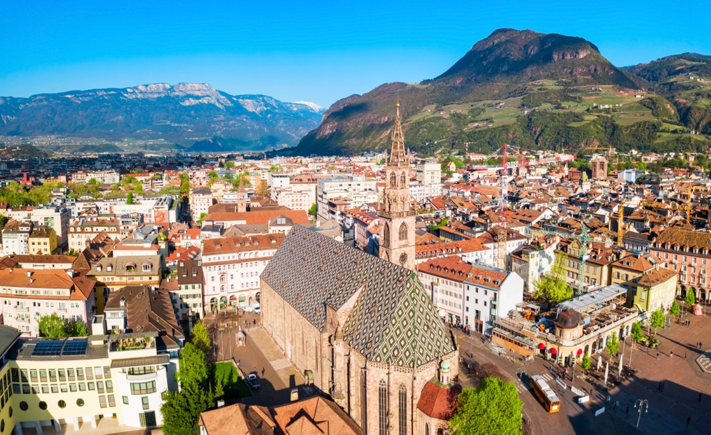
Bolzano is the capital and largest city of South Tyrol. One of the largest urban centers in the Alps, Bolzano is one of northern Italy's most culturally significant cities. It's home to architectural delights, unique Tyrolean cuisine, and three local languages (Italian, German, and Ladin).
During your stay in Bolzano, explore the fourteenth-century Bolzano Cathedral and tour the South Tyrol Archeological Museum (Museo Archeologico dell'Alto Adige), home to Ötzi the Iceman.
Bolzano is located approximately 70 km (43 mi) from Texelgruppe Nature Park. Plus, it's less than 55 km (34 mi) from Sciliar Rosengarten Nature Park (Parco Naturale Sciliar-Catinaccio) and Monte Corno Nature Park (Parco Naturale Monte Corno).
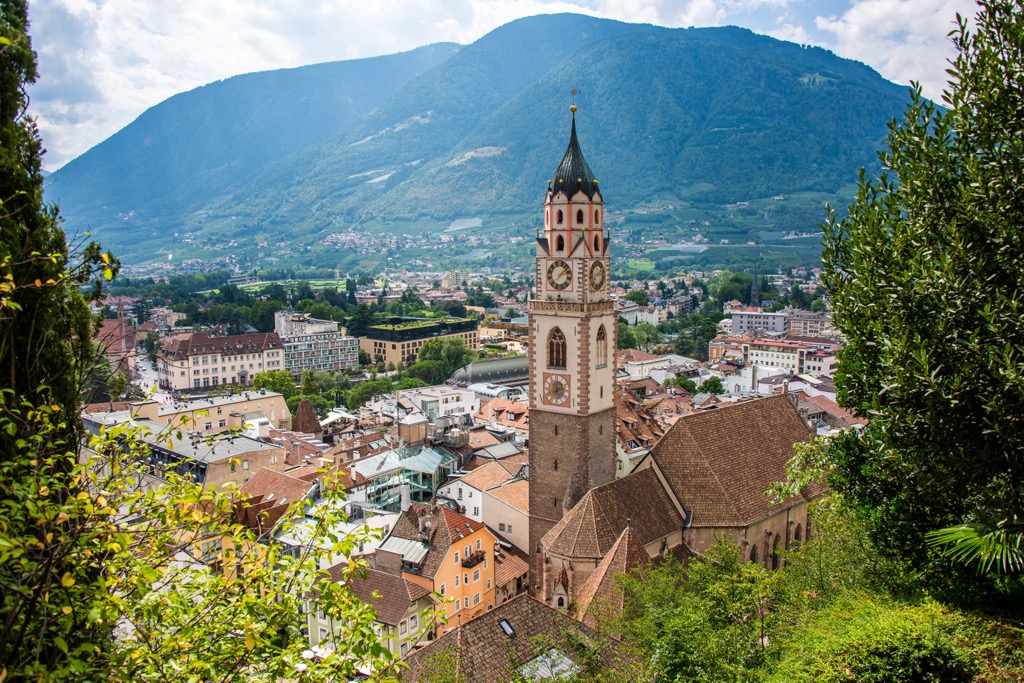
Merano is the nearest major city to Texelgruppe Nature Park. Merano is famed for its mild Mediterranean climate and healing hot springs, which have attracted many notable former residents, including Empress Elisabeth of Austria, Franz Kafka, and Ezra Pound.
The city itself is charming, with its picturesque parks, tranquil rivers, and backdrop of snow-capped mountains. You'll find no shortage of attractions to keep you entertained in Merano, from the Trauttmansdorff Castle Gardens to the Terme Merano.
There are few better places to stay if you're planning a hiking adventure in Texelgruppe Nature Park than Merano, with the park's heart located less than 40 km (24 mi) away.
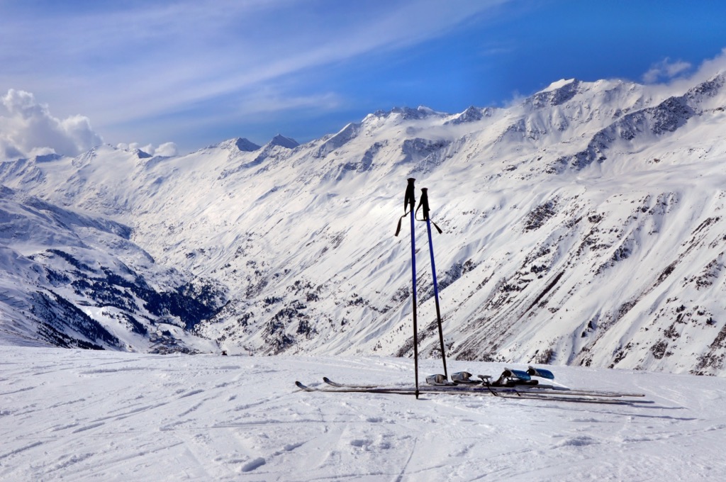
Avid skiers and snowboarders will find several high-quality ski resorts in and around Texelgruppe Nature Park. Read on to find out about the ski resort near Texelgruppe Nature Park.
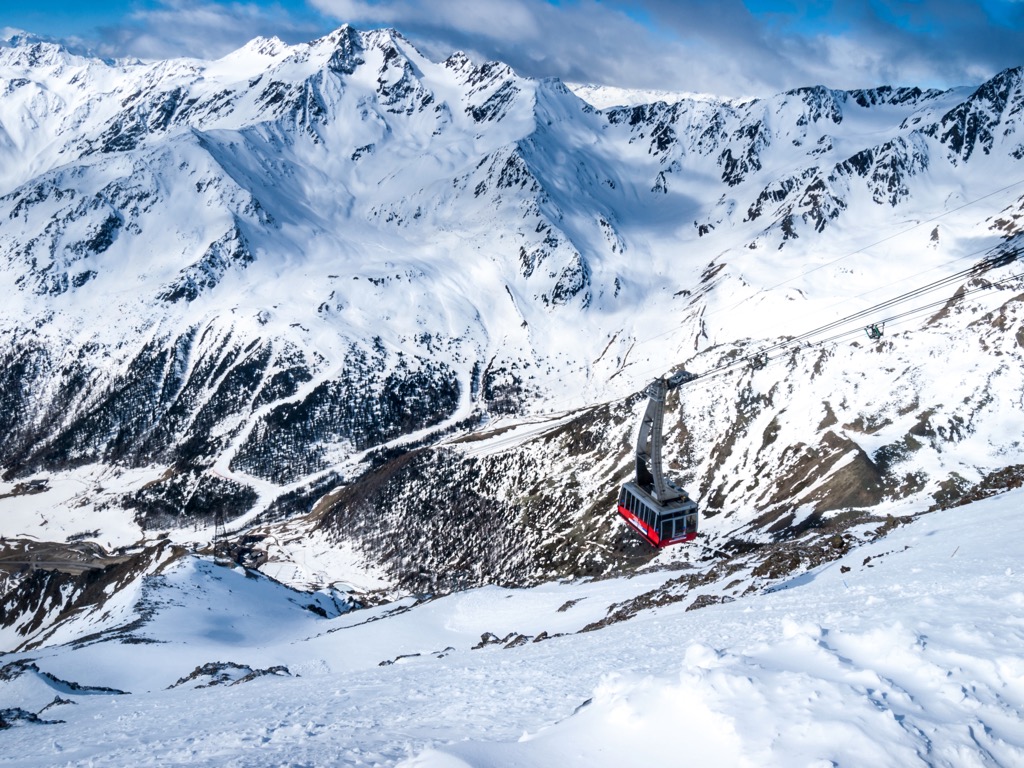
The fairytale village of Pfleders (Plan) features the only ski resort in Texelgruppe Nature Park.
The Pfleders ski resort is just 0.3 km (0.2 mi) from the village center and contains 18 km (11 mi) of slopes and 4 lifts for skiing and snowboarding. Most of the resort's ski runs are located on the slopes of Sefiarspitz (2,852 m/9,357 ft)
Book a room at one of Pfelders' quaint mountain inns and enjoy a quiet ski vacation in this car-less village. Or visit in the summer and discover the trails of the Passeiertal Valley.
The village Maso Corto (Kurzras) sits just outside Texelgruppe Nature Park on its western boundary.
It's home to the largest ski resort near Texelgruppe Nature Park on the Italian side of the border, the Alpin Arena Schnals Senales in Val Senales.
The resort boasts 27.6 km (17.1 mi) of skiable terrain across 22 slopes with 11 lifts. Maso Corto itself serves as an excellent starting point for several hikes in and around Texelgruppe Nature Park, including trails to Lake Vernago.
At over 2,000 m (6,561 ft) in elevation just across the Austrian border, Obergurgl-Hochgurgl is one of the Alps' most dependable skiing destinations. Tourists flock from across Europe to the Gurgl ski resort, the largest ski resort bordering Texelgruppe Nature Park. Gurgl ski resort contains 53.9 km (33.4 mi) of skiable terrain across 99 slopes with 25 lifts.
This area of Austria's Tyrol opposite Texelgruppe Nature Park is a haven for winter sports enthusiasts. Located approximately 17 km (10.5 mi) north of Gurgl is another major ski resort, Sölden.