
Scan the QR code and open PeakVisor on your phone
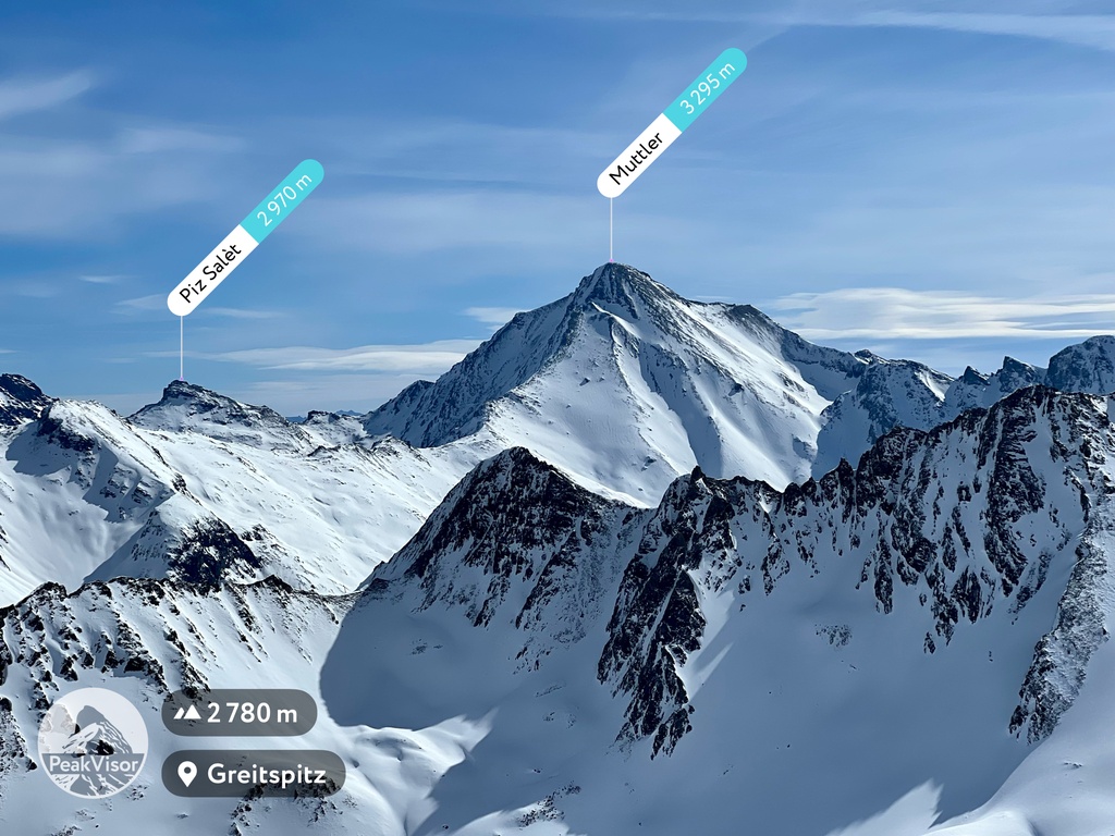
The Samnaun Alps include 197 named peaks. The highest is Muttler at 3,295 m. Other notable peaks include Piz Tschütta, Piz Mundin and Piz Rots.
The Samnaun Alps span the Austrian-Swiss border and are famed for their many 3,000ers and world-class ski resorts. There are 197 named peaks in the Samnaun Alps; the highest and most prominent mountain is Muttler (3,294 m / 10,807 ft).
The Samnaun Alps (Samnaungruppe) are positioned just north of the tri-border point between Austria, Italy, and Switzerland within the Western Rhaetian Alps. The Samnaun Alps take their name from Samnaun village, the only inhabited settlement within the range's interior.
Over two-thirds of the Samnaun Alps belong to Austria's Tyrol (Tirol); however, most of the Samnaun Valley and the range's three highest summits are entirely within Switzerland's Grisons (Graubünden) canton.
Situated at the heart of the Central Eastern Alps, the Samnaun Alps are bound by five other mountain ranges. The Paznauntal Valley separates the Samnaun Alps from the Lechtal Alps and the Verwall Alps to the north. To the south, across the Engadine Valley, are the Sesvenna Alps. Over Fimberpass (2,608 m / 8,556 ft) to the west are the Silvretta Alps. To the east, beyond the Oberinntal, are the Ötztal Alps.
The Inn River, the Danube's third-largest tributary, drains the entire Samnaun Alps. The Brancla, Fimbabach, Trisanna, and Schergenbach streams flow into the Inn.
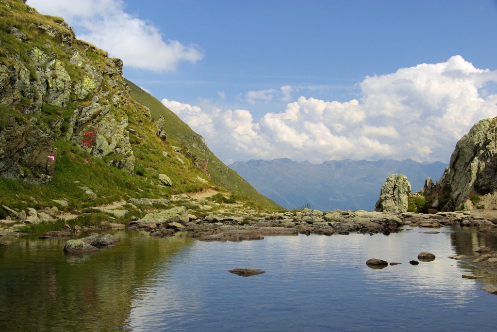
Unlike the neighboring Silvretta Alps, the Samnaun Alps are home to no significant glaciers. The Samnaun Alps also contain no large bodies of water; however, there are a few small glacial lakes, including Grübelesee and Gmaiersee.
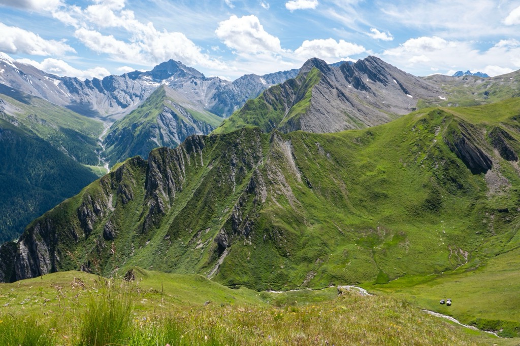
The Samnaun Alps are comprised of two notable ridges and three subgroups. The Samnaun Ridge runs from north to east and is the longer but lower of the two. Running from south to west is the Muttler Group, which is shorter but contains many of the Samnaun Alps' highest summits.
The Main Samnaun Ridge is a developed ski destination, with resorts such as the Silvretta Arena and Serfaus-Fiss-Ladis partly within the range. The Muttler Group has no substantial winter sports infrastructure.
The northern ridge of the Samnaun Ridge is generally split into two halves by the Flathjoch pass near Hexenkopf (3,034 m / 9,954 ft). The Eastern Samnaun Ridge is the northernmost area of the Samnaun Alps and stretches to Landeck.
The Eastern Samnaun Main Ridge branches off into two parts. The Seekopf Ridge to the north culminates at Rotpleiskopf (2,936 m / 9,632 ft), while the Sattelkopf Ridge's highest summit is Planskopf (2,803 m / 9,196 ft). Both offshoots join the main ridge near Furgler (3,004 m / 9,855 ft). Hexenkopf is the Eastern Samnaun Main Ridge's highest peak.
The Western Samnaun Main Ridge reaches from the Zeblasjoch (2,539 m / 8,330 ft) pass to the Flathjoch pass. It splits into several more sub-ridges than its eastern counterpart, including the Minderkamm, Frudigerkamm, and Karlesspitze ridges.
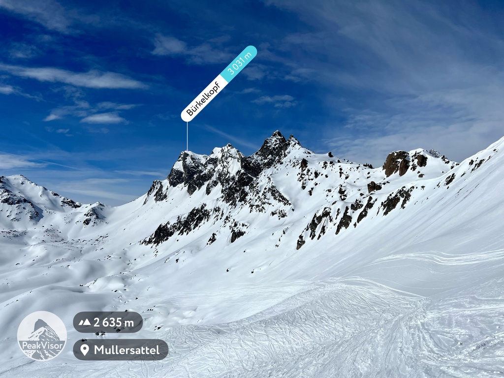
Despite occupying the Samnaun Alps' central area, the Western Main Ridge contains only two 3,000ers: Bürkelkopf (3033 m / 9,950 ft) and Vesulspitze (3089 m / 10,134 ft).
Several mountains on this ridge, including Greitspitz (2,871 m / 9,419 ft), Palinkopf (2,864 m / 9,396 ft), and Pardatscher Grat (2,617 m / 8,585 ft), are part of the Silvretta Arena ski resort near Ischgl.
The Muttler Group forms the southern extent of the Samnaun Alps on the Swiss side of the border. It's triangular in shape and contains seven 3,000ers, including the Samnaun Alps' highest summit, Muttler. Its main ridge runs from east to west, with a few offshoots to the north.
The Muttler Group is far more isolated and less visited than the Samnaun Main Ridge. The outlying Piz Arina (2,828 m / 9,278 ft) is one of the most visited summits in the sub-group, with a trail leading to the summit.
Some mountains, like Spi da Chöglias (Piz Chöglias) (2,926 m / 9,599 ft) and Spi dal Mundin (Piz Mundin) (3,146 m / 10,321 ft), have retained their original Rhaetian names due to the Muttler Group's position near the Italian border.
The Samnaun Alps are part of the Central Eastern Alps and formed during the Alpine Orogeny. The Alpine Orogeny is a mountain-building event that began approximately 66 million years ago during the Late Mesozoic Era.
The Arabian, African, Cimmerian, and Indian tectonic plates to the south colliding with the Eurasian plate to the north started the Alpine Orogeny. This mountain-building event helped create many of the world's largest mountain ranges, including the Carpathians, the Himalayas, and the Atlas Mountains. Convergent movements between these plates helped form the Alps. The Alpine Orogeny is a relatively recent orogeny that's ongoing in some parts of the Alps.
The Central Eastern Alps are sandwiched between the Southern and Northern Limestone Alps but have a completely different geological make-up. Most of the Samnaun Alps are composed of gneiss and slate with Jurassic and limestone intrusions.
For example, Hexenkopf, the highest summit on the Eastern Samnaun Main Ridge, comprises slate gneiss rich in mica with pegmatite, granite, and hornblende veins.
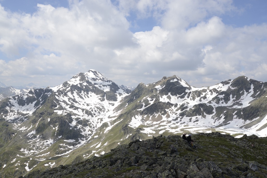
Today, the Samnaun Alps are lower and less glaciated than their neighbors but still boast more than ten summits exceeding 3,000 m (9,842 ft) in elevation.
Little to no glaciation and varied landscapes in the Samnaun Alps mean a less harsh climate where diverse flora and fauna can thrive.
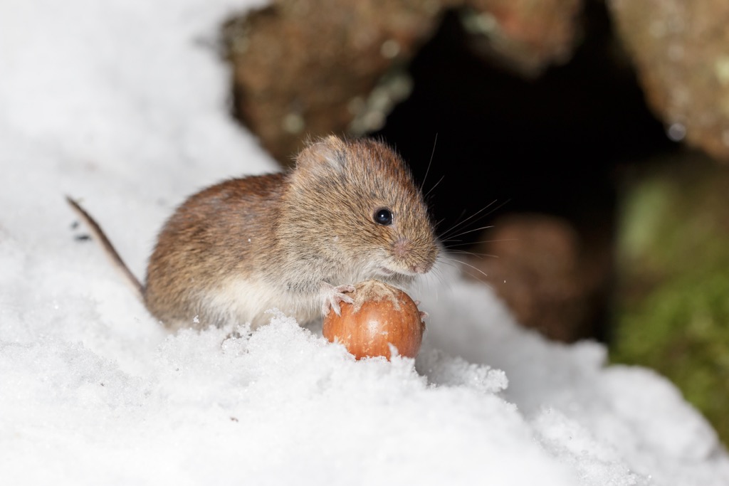
Common mammals in the Samnaun Alps include chamois, red deer, ibex, and marmots. Foxes and stone martens are the main predators in the Samnaun Alps. Snow voles are among the mammals that live at the highest elevation in the Alps, ranging between 1,000 m (3,280 ft) and 4,000 m (13,123 ft).
Lynxes, wolves, and bears disappeared from the region in the 20th century, with the last bear shot by hunters in Val Mingèr in 1904. Recently, bears have been reintroduced to Italy's Adamello-Brenta Nature Park, with two bears spotted as far north as the Swiss National Park in 2007. Meanwhile, the wolf has also made a comeback in the Alps. Over the past thirty years, the species has recolonized the southwestern Alps of France and Italy, with sightings becoming more sporadic as you head north and east.
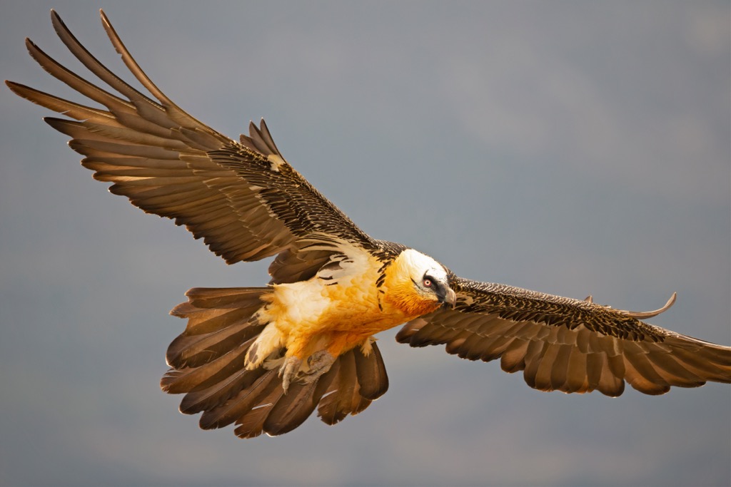
Golden eagles and bearded vultures, with wingspans over 2 m (6.5 ft), are some of the most impressive birds of prey in the Samnaun Alps. Other notable birds in the Samnaun Alps include peregrine falcons, nutcrackers, ptarmigans, Alpine choughs, and black grouses.
Common European adders are the only venomous snakes found in the Samnaun Alps. They usually inhabit boulder fields up to 3,000 m (9,842 ft) in elevation.
Despite being venomous, an adder's bite is rarely lethal, and they're not considered aggressive. Other reptile and amphibian species that inhabit the Samnaun Alps include grass frogs, common lizards, and barred grass snakes.
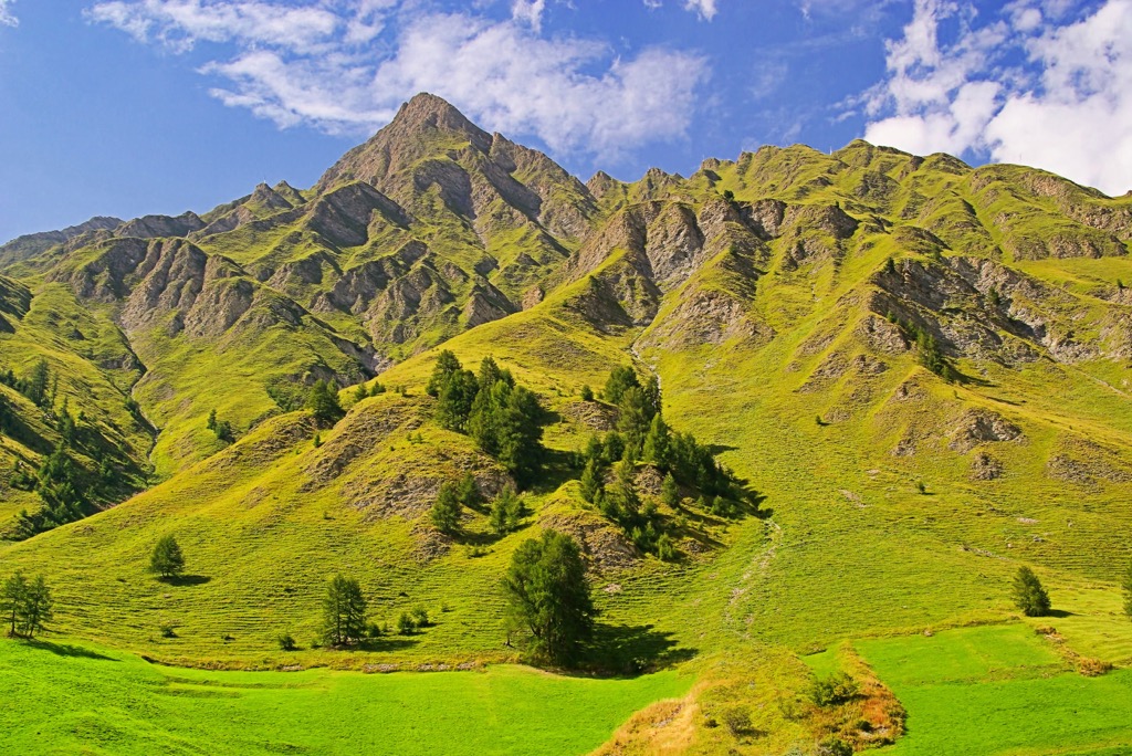
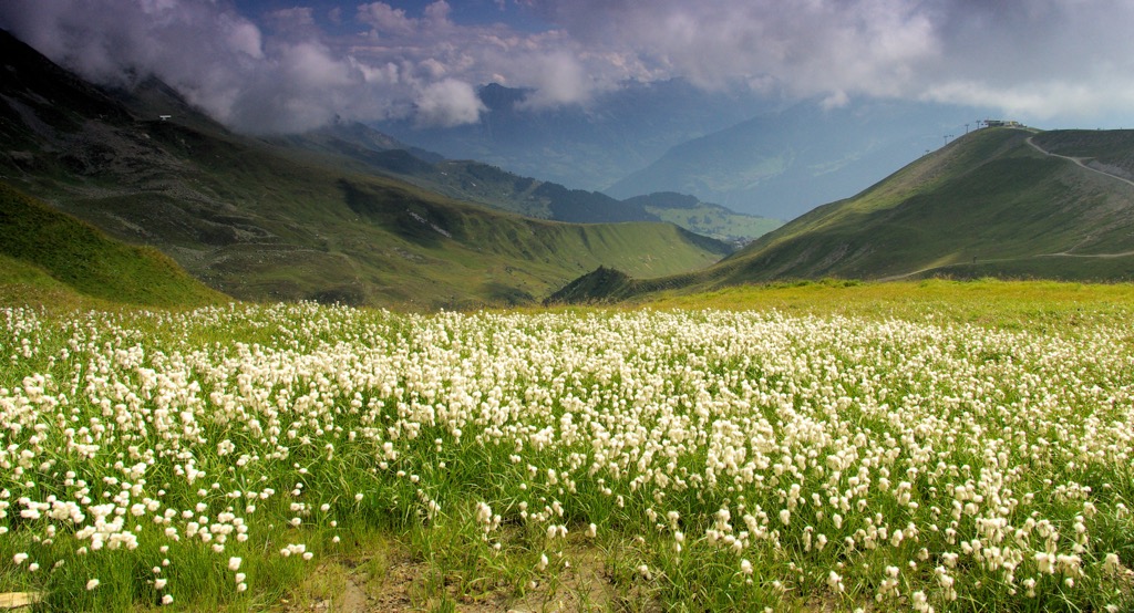
The Samnaun Alps' most typical landscapes include high alpine meadows and forests. The range's forests are composed primarily of conifers between 1,200 m and 1,400 m elevation, with deciduous forests dominating lower down.
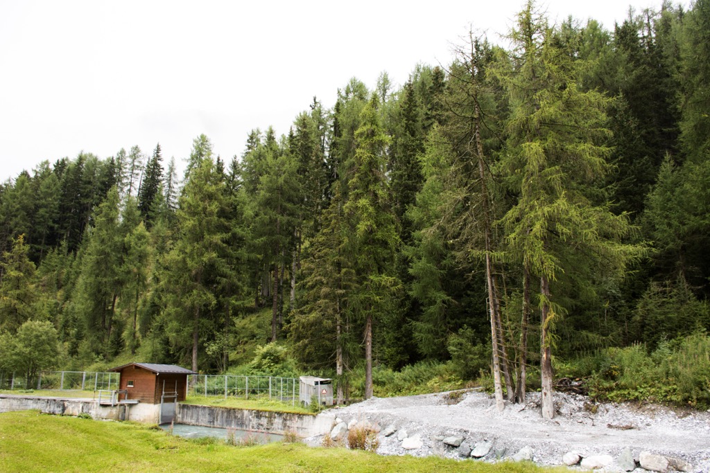
Forests in the Samnaun Alps consist mainly of cembra pine, mountain pine, spruce, and larch. Cembra pines grow right up to the treeline and are one of the hardiest tree species in the Alps, able to withstand temperatures below -40 °C (-40 °F).
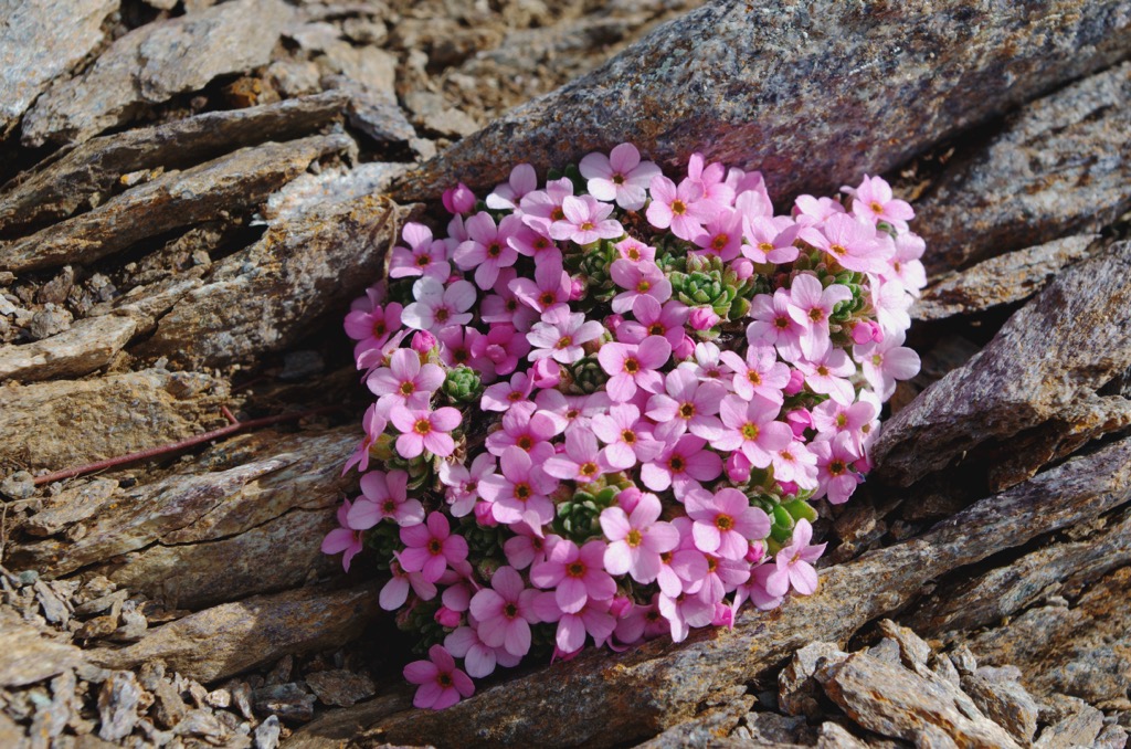
Above the treeline, alpine pastures containing flowering plants and small shrubs are prevalent. The Samnaun Alps are particularly rich in plant life, with 900 species growing between 1,400 m (4,593 ft) and 3,300 m (10,826 ft) in elevation.
Flowering plant species that grow at these high elevations include moss campion, rock jasmine, Alpine aster, edelweiss, and Rhaetian poppies.
Glacier crowfoot, or glacier buttercup, is one of the highest-flowering plants in the Samnaun Alps and has been found at 4,000 m (13,123 ft) in elevation across the range.
The Samnaun Alps' position near the Austrian-Swiss-Italian tri-border point makes it part of one of the Central Eastern Alps' most culturally fascinating regions.
Muttler, the highest summit in the Samnaun Alps, takes its name from the Romansh word muot or motta, meaning rounded peak.
Muttler was first climbed on June 29, 1858, by famed Swiss mountaineer Johann Jakob Weilenmann. Weilenmann was the first to summit many famous mountains in the Alps, including Mont Blanc de Cheilon (3,870 m / 12,696 ft), Piz Buin (3,312 m / 10,866 ft), and Crast' Agüzza (3,872 m / 12,703 ft).
While Muttler was scaled during the "silver age of alpinism," other first ascents in the Samnaun Alps were much later. For example, the first ascent of the Samnaun Alps' second-highest summit, Piz Tschütta (Stammerspitz) (3,254 m / 10,675 ft), wasn't until August 16, 1884.
Piz Mundin, the third-highest mountain in the Samnaun Alps, was summited before both Piz Tschütta and Muttler, on June 22, 1849, by Johann Coaz and Jon Rag Tscharner. Coaz is renowned for being part of the team to first ascend Piz Bernina (4,048 m / 13,283 ft), the Eastern Alps' highest summit, in 1850.
The first people to settle seasonally in the Samnaun Alps were farmers from the Lower Engadine in 800 CE. By 1200 CE, people lived year-round in the Samnaun Alps.
While Romansh, a descendant language of the Roman Empire, is spoken in the surrounding valleys, Samnauners don't speak Romansh. Instead, they speak Samnauner German, a Tyrolean dialect. Samnauner German is spoken only in this valley, making its residents one of Switzerland's smallest linguistic groups.
Switzerland, Austria, and Italy have influenced the cuisine of the Samnaun Valley. Pear bread and Samnauner Käse, a semi-hard cheese, are among the most famous local delicacies.
The Samnaun Valley has been a duty-free area since 1892 and remains so today. Until 1925, cars were banned, and horse-drawn carriages were the primary mode of transport. The first ski lift in the Samnaun Valley was built in 1954 to promote tourism.
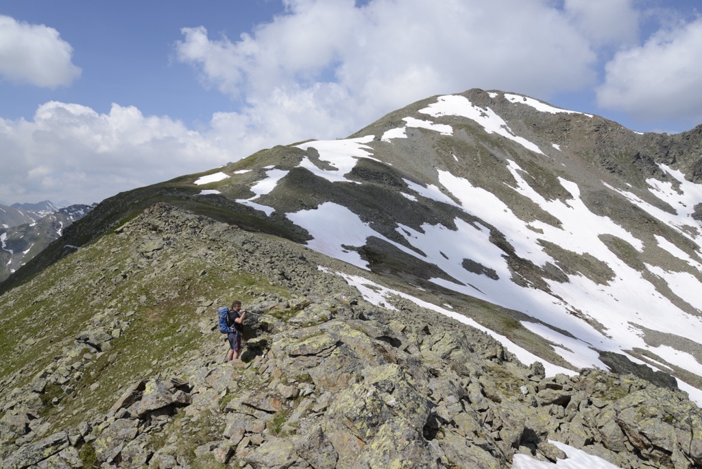
Parts of the Samnaun Alps are isolated and rarely visited, especially within the Muttler Group, where few marked trails exist.
When hiking in the Samnaun Alps, bring plenty of provisions and appropriate hiking gear. Map out your route, check local weather forecasts, and inform others of your itinerary.
The PeakVisor mobile app is the best way to keep maps, trails, ski tours, GPS tracking, weather forecasts, lift schedules, mountain huts, roads, parking lots, and more at your fingertips. We’ve worked hard over the past eight years to design a one-stop-shop app for the dedicated mountain adventurer, whether you’re a hiker, skier, or alpinist.

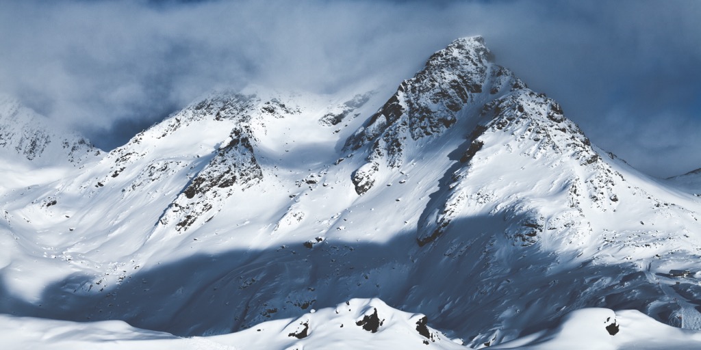
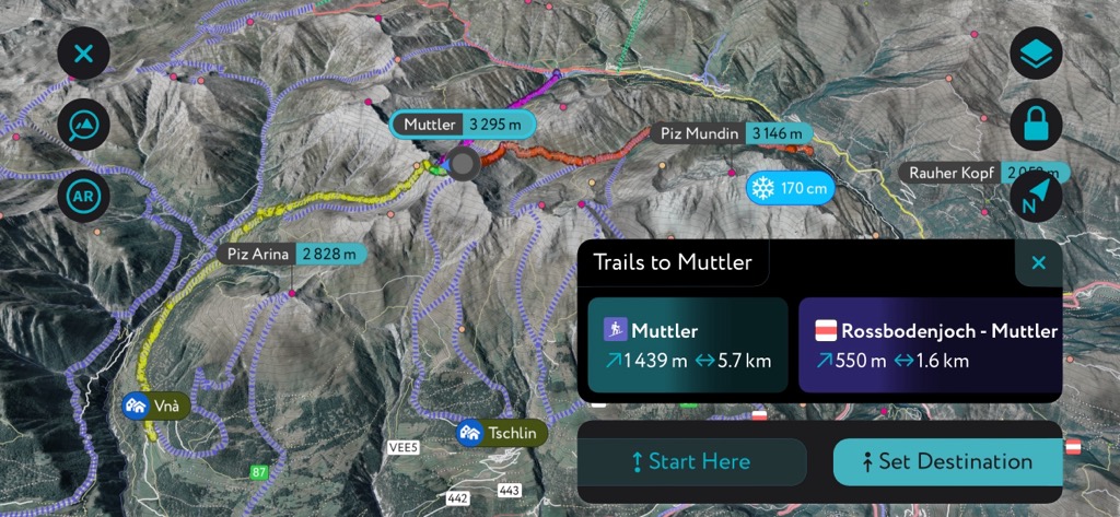
Muttler (3,294 m / 10,807 ft) is the highest peak in the Samnaun Alps. It's the home mountain of Samnaun, with its beautiful pyramidal peak towering over the valley below.
Muttler is a demanding but popular mountain to climb, with its summit affording incredible views of the surrounding ranges, with Piz Bernina, Ortler (3,905 m / 12,811 ft), and Wildspitze (3,768 m / 12,362 ft) visible on a clear day. Within the Samnaun Alps, you can spot famous mountains like Piz Tschütta (Stammerspitz) and Furgler.
Muttler's normal route starts from Samnaun village and is graded T4 on the Swiss Alpine Club (SAC) hiking scale, which isn't technical.
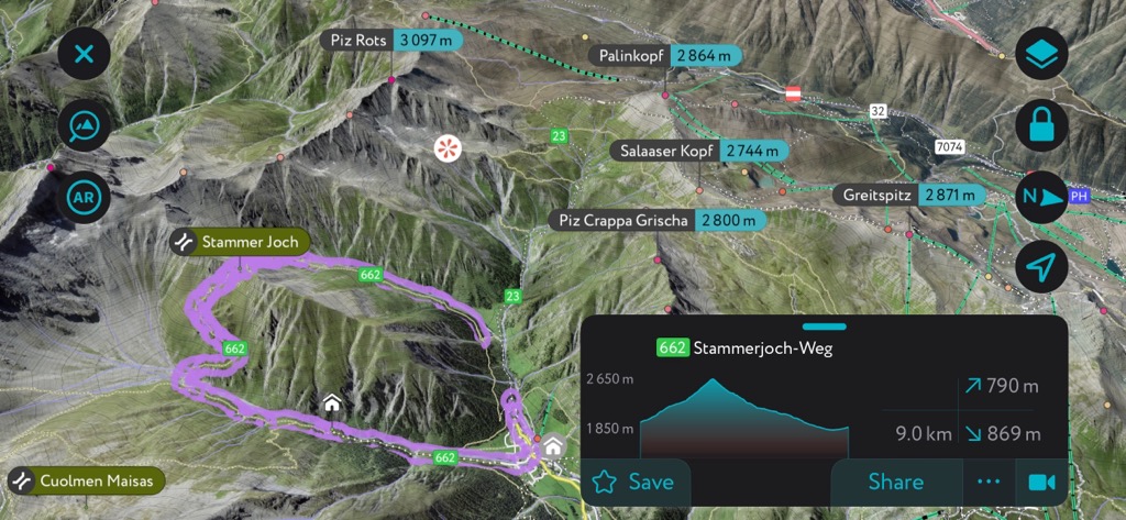
From the village, follow the marked trail straight towards Muttler and through the Val Masais. When the path splits, go left and avoid Stammer Joch (2,656 m / 8,713 ft) to the right.
The route heads up the Muttler's north flank, past the red waters of Rotes Seeli Lake, and onto the mountain's southern ridge. Follow the ridge to the summit. You can descend the way you came or via Stammer Joch. Muttler's normal route generally takes 7 to 8 hours to complete.
Furgler is the northernmost 3,000er in the Samnaun Alps. While it's not the highest of the two 3,000ers on the Eastern Samnaun Main Ridge, it's the most popular.
Furgler is the home mountain of Serfaus village, which provides easy access to the mountain. It's considered one of the easiest 3,000ers in the Samnaun Alps, with the Lazidbahn cable car giving a boost to over 2,300 m (7,545 ft) in elevation.
There are two normal routes up Furgler, one of which passes Tieftalsee and is graded T3 on the SAC hiking scale. From Lassida (2,342 m / 7,687 ft), follow the red-white-red trail markers and yellow signposts towards Scheid.
Behind Schied's chairlift is the trail leading up to beautiful Tieftalsee, where you can cool off with a quick swim. Keep following the trail steeply uphill to Furgler's large summit cross.
The views from Furgler are unmatched, with the whole Samnaun Alps visible to the south and views as far as Zugspitze (2,962 m / 9,718 ft) to the north.
You can descend via Furglerjoch (2,748 m / 9,016 ft), visiting the Furglersee on your way. This looped route is approximately 9.5 km (6 mi) in length.
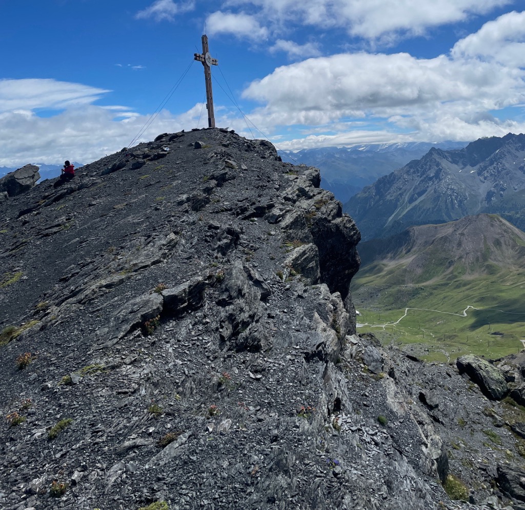
Planskopf (2,803 m / 9,196 ft) is another mountain close to Serfaus, considered one of the village's home mountains. Its long, traversable ridge and superb views make it a popular hiking destination.
The highest peak on the Sattelkopf Ridge, Planskopf offers panoramic mountain views, with Wildspitze to the southeast, Hoher Riffler (3,168 m / 10,393 ft) to the northwest, and Glockturm to the south.
Begin your hike from Fiss Village to traverse the entire Sattelkopf Ridge. The route is graded T3+. Ride the gondola to Fisser Joch (2,434 m / 7,985 ft) and follow the trail over Zwölferkopf (2,596 m / 8,517 ft) and Oberer Sattelkopf (2,596 m / 7,985 ft).
You'll then pass over Hinteren Sattelkopf (2,670 m / 8,759 ft) and Vorderen Brunnenkopf (2,682 m / 8,799 ft) to reach Planskopf's summit.
Descend to Kölner Haus (1,965 m / 6,446 ft), then to Möseralm, and ride the Möseralmbahn back to Fiss. This looped trail is approximately 4 km (2.5 mi) in length.
Piz Arina (2,828 m / 9,278 ft) is a standalone mountain within the Mutter Group, sitting on the eastern rim of the Val Sinestra.
Piz Arina's isolation and position mean its summit provides breathtaking views of the Lower Engadine Valley and the Muttler Group. It is usually climbed in the summer but can be scaled on skis in the winter.
Piz Arina is very popular with hikers and is one of the only mountains in the Muttler Group with a dedicated trail. You can pick up the looped trail to Piz Arina from Vná.
The trail leads through forests and across the Alp Pradatsch. On your descent, you'll cross the Fuorcla Pradatsch (2,661 m / 8,730 ft) and follow the alpine road across the Alp Discholas back to Vná. This looped trail is approximately 16 km (10 mi) in length.
Greitspitz (2,871 m / 9,419 ft), or Greitspitze, is Ischgl's home mountain and part of the Silvretta Arena ski resort. It isn't the area's highest mountain, but its proximity to the resort village attracts hikers.
Greitspitz can be climbed all year round and is surrounded by ski slopes in the winter. Steel cable around the Greitspitz's summit block makes the summit much more accessible.
One of the best ways to climb Greitspitz is by riding the Silverettabahn from Ischgl to Idalpe. From Idalpe, head southeast, passing near the Höllkarbahn mountain station before scaling Salaaser Kopf (2,744 m / 9,002 ft).
From Salaaser Kopf, continue along the ridge to Greitspitz's summit. Descend north, pass the Filmsattelbahn mountain station, and follow the Murmeltierbau hiking trail back to your starting point. This looped trail is approximately 11 km (7 mi) in length.
Bürkelkopf (3033 m / 9,950 ft) is the lower of the two 3,000ers in the Western Samnaun Main Ridge, but its jagged rock formations, large corrie, and excellent views make it a more rewarding climb than Vesulspitze.
Bürkelkopf is also among the most challenging popular climbs in the Samnaun Alps. It's graded T5- and you'll need a head for heights. The imposing view from Bürkelkopf's foot makes it hard to believe the mountain is traversable on a day tour.
You can pick up the trail to Bürkelkopf from the Alptrider Sattel (2,495 m / 7,529 ft), following the white-red-white markers before climbing the scree slopes up to Flimjoch (2,757 m / 9,045 m). To reach Bürkelkopf, you must cross a rocky couloir with several grade II climbing sections. Watch out for falling rocks in this section.
Descend by following the northeastern ridge dropping just below Bürkelspitzen's summit onto its western face. Continue northeast steeply downhill across scree gullies to the lakes of Bei den Seen.
From Bei den Seen, rejoin the ascent route back to Alptrider Sattel. This looped trail takes approximately 5 hours to complete.

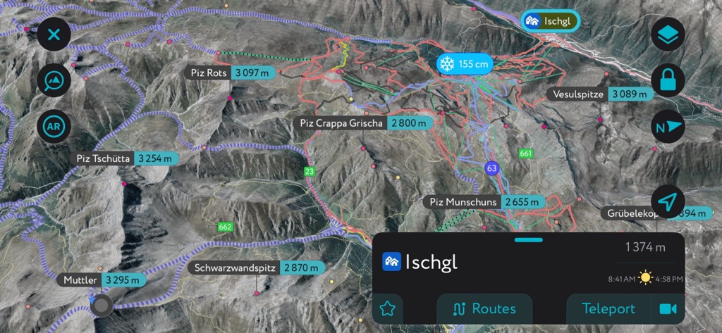
The Samnaun Alps are surrounded by popular ski destinations like the Silvretta. Thousands of ski tours are available through the PeakVisor App — not just in the Alps but globally. However, the Samnaun Alps are in the heart of one of our most thoroughly mapped areas.
Let's take a quick look at a couple of the best ski tours in the Samnaun Alps and some helpful features on the PeakVisor App that'll make your next ski tour memorable.
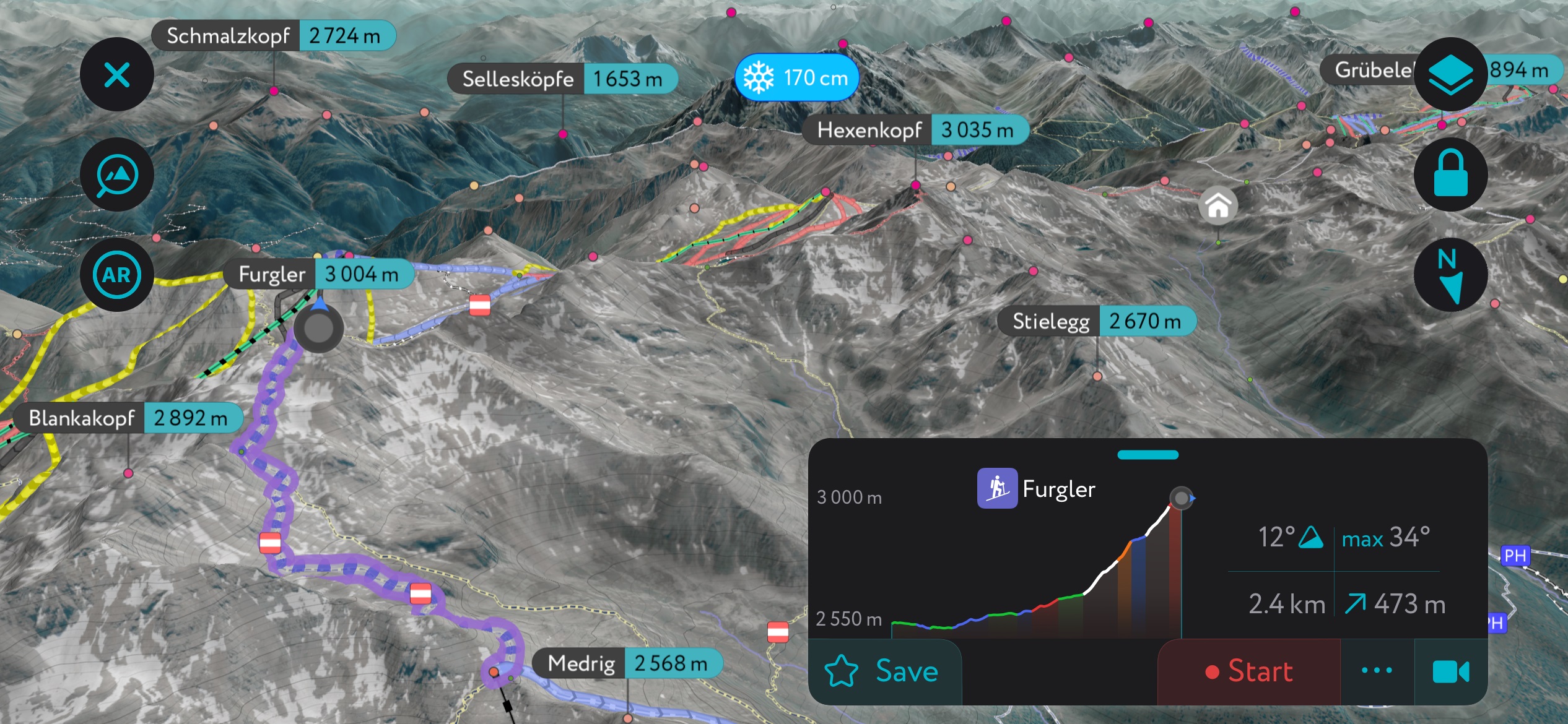
Furgler is a classic mountain for skiers and hikers. Its fantastic summit panoramas and accessibility make it arguably the Samnaun Alps' most popular ski-touring destination.
The northern exposure holds winter snow well after a storm. Moreover, the lack of sun means there's snow on Furgler from October to June. The route from the Furglerblick ski lift station, approximately 2.4 km (1.5 mi) in length, is among the most popular tours in the region.
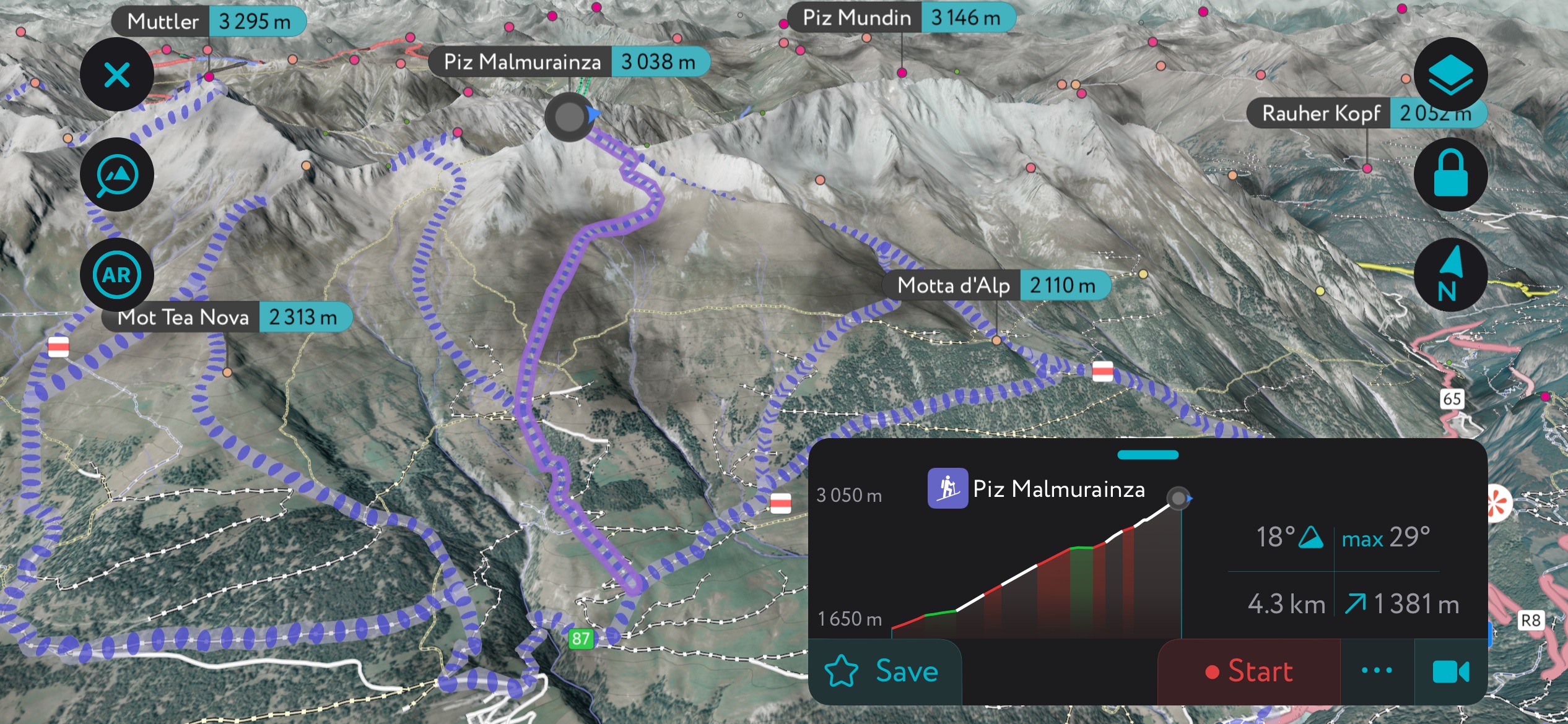
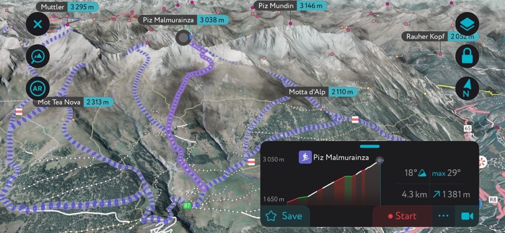
Piz Malmurainza (3,038 m / 9,967 ft) is located between Muttler and Piz Mundin in the Muttler Group. It's a popular mountain for ski tours and is worth checking out if you're searching for a 3,000er away from the Samnaun Alps' most famous peaks.
One of Piz Malmurainza's most popular ski tours begins near Tschlin to the mountain's south. The route’s southern exposure means you can find spring snow, even in mid-winter. Check out this route if it’s been warm and sunny with no recent snow. Get an early start, however, because the soft spring corn will quickly turn to mush in the afternoon. Piz Malmurainza's summit provides excellent views of the Inn Valley and Samnaun Valley. This out-and-back ski tour is approximately 4.1 km (2.6 mi) long.
We've added several new features to make the PeakVisor App even more valuable during your next ski tour.
Our 3D maps provide snow depth details and local weather reports, ensuring ideal conditions for your adventure. Plus, you'll find thousands of mountain hut schedules, including opening hours and dining options, to help you plan.
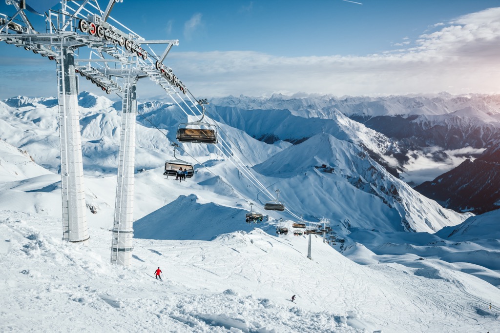
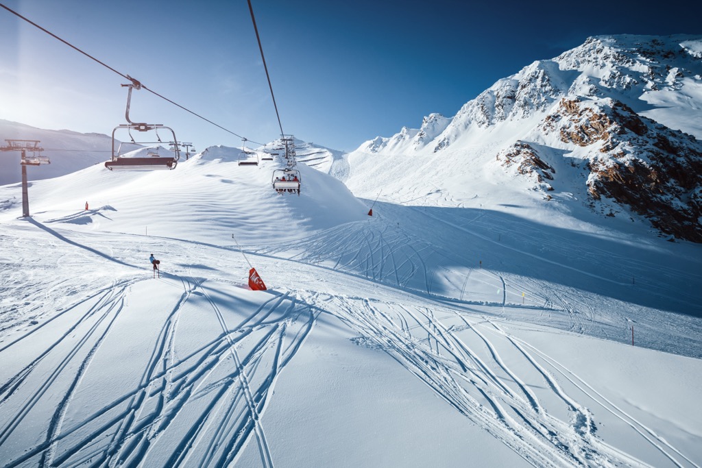
The Samnaun Alps boast some of Austria's largest and most popular ski areas. In addition to its size, Silvretta Arena is famously home to the world's first double-decker cable car, which can transport 180 people.
You'll find three main ski areas in the Samnaun Alps:
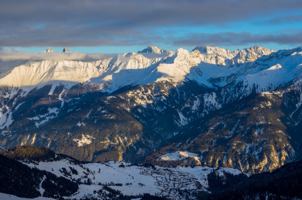
The Samnaun Alps are a fabulous destination for year-round adventures, with numerous high-alpine villages and resorts worth visiting.
The nearest major international airport to the Samnaun Alps is Innsbruck Airport, located approximately 150 km (93 mi) to the northeast. St. Gallen–Altenrhein Airport, a small Swiss regional airport, is located around 110 km (68 mi) northwest of the Samnaun Alps.
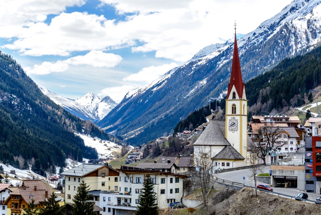
Samnaun village is the namesake of the surrounding range and the only significant settlement in Samnaun Valley. It's a small village with a permanent population of just over 750 people.
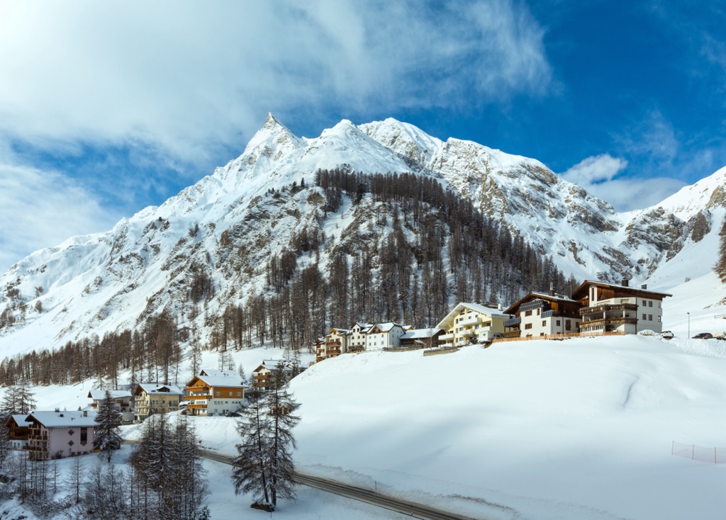
Samnaun is popular with tourists, as it shares the Silvretta Arena ski area with Ischgl. It's also an excellent base for hikers. Samnaun is sandwiched between the Muttler Group and the Samnaun Main Ridge, with Muttler located under 6 km (3.7 mi) to the south.
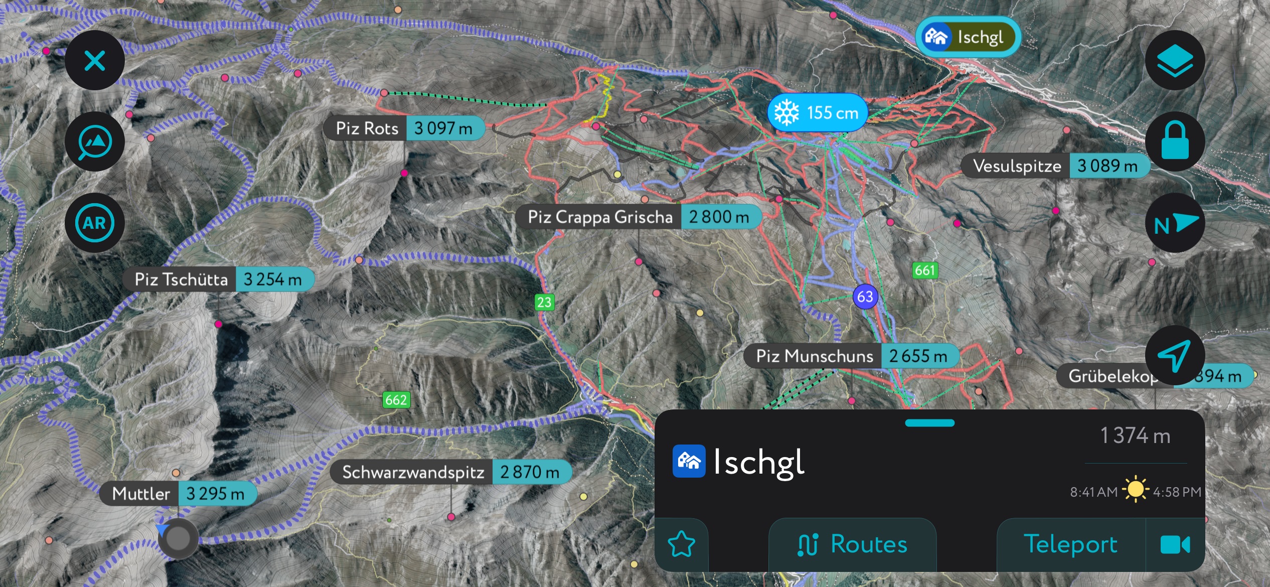
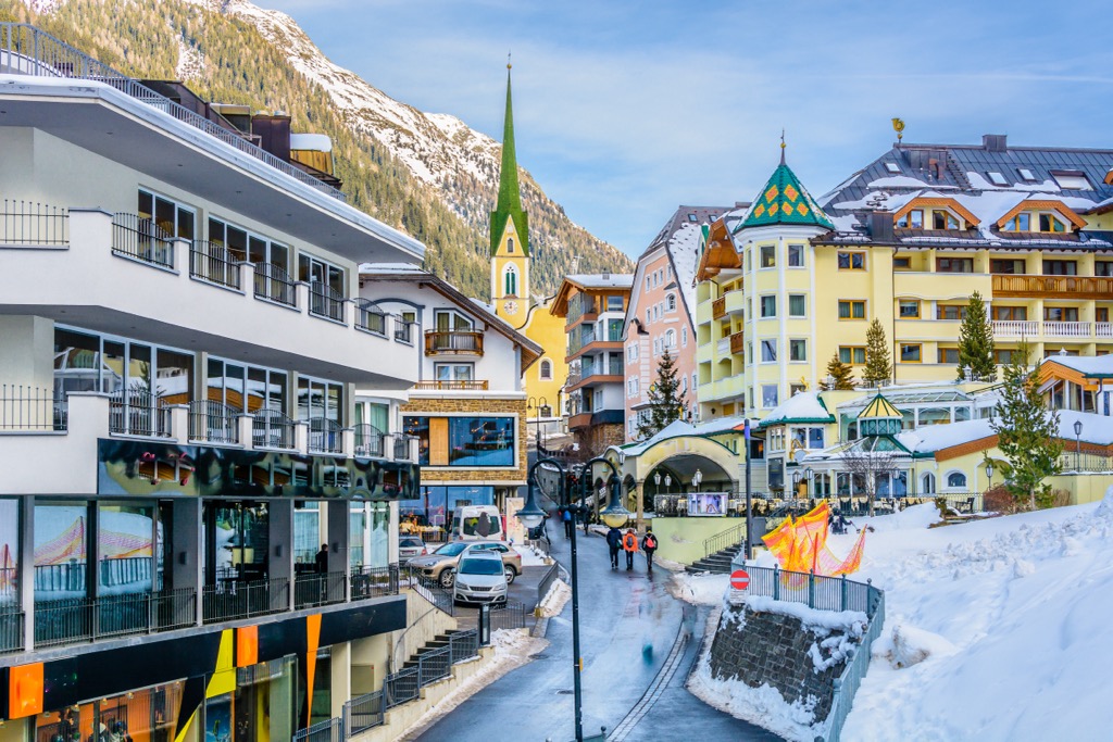
Ischgl is a Tyroleon resort town in the Paznaun Valley, on the western edge of the Samnaun Alps. Its permanent population is just over 1,500.
Visitors worldwide flock to Ischgl for its vibrant atmosphere and location near the Silvretta Arena, one of the world's largest ski resorts. Three lifts - the Pardatschgratbahn, the Fimbabahn, and the Silvrettabahn - serve the ski area directly from Ischgl.
Ischgl is great for hikers, with Bürkelkopf and Greitspitz roughly 5 km (3.1 mi) to the southeast and the Muttlet Group just across the Swiss border.
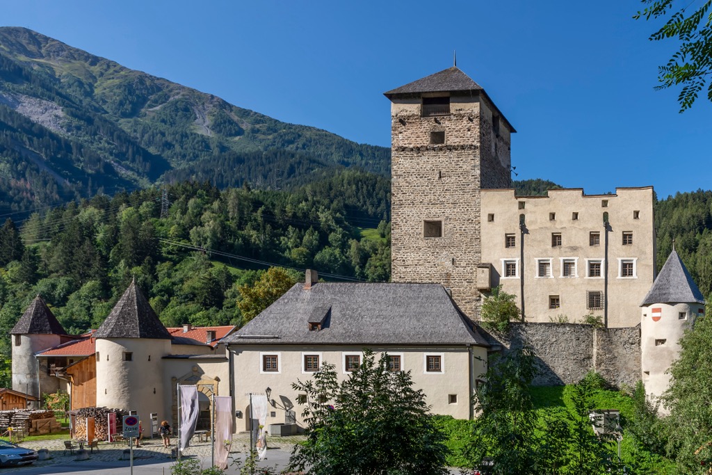
Landeck is the capital of Tyrol's Landeck district and one of the largest settlements in the Samnaun Alps, with a population of over 7,750.
Landeck is located on the northern tip of the Samnaun Alps, with the Ötztal Alps to the east and the Lechtal Alps to the west. Roughly 10 km (6.2 mi) to the southeast is the Serfaus-Fiss-Ladis ski resort.
Landeck affords easy access to many of the best summits on the Samnaun Main Ridge, with Furgler located 12 km (7.4 mi) to the south.
Pfunds is a large municipality in the Landeck district on the Samnaun Alps' eastern edge. It's a collection of roughly 15 hamlets with a total population of over 2,600 people.
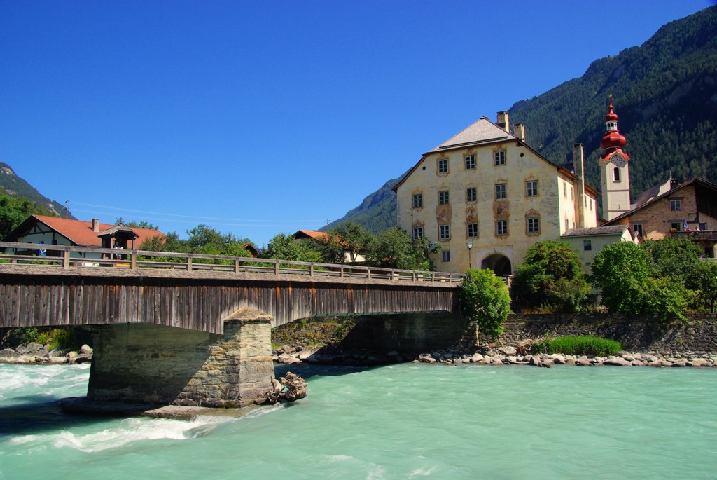
Just east of Pfunds is the Glockturmkamm, a popular hiking area within the Ötztal Alps. To the west, you'll find many of the best hiking areas in the Samnaun Alps nearby, with Muttler and Furgler within 15 km (9.3 mi) of Pfunds.


The highest peak in the Samnaun Alps is Muttler, at 3,295 m.
The Samnaun Alps have 197 named peaks.


