
Scan the QR code and open PeakVisor on your phone
The Verwall Alps include 251 named peaks. The highest is Hoher Riffler (Nord) at 3,168 m. Other notable peaks include Hoher Riffler (Süd), Kuchenspitze and Küchlspitze.
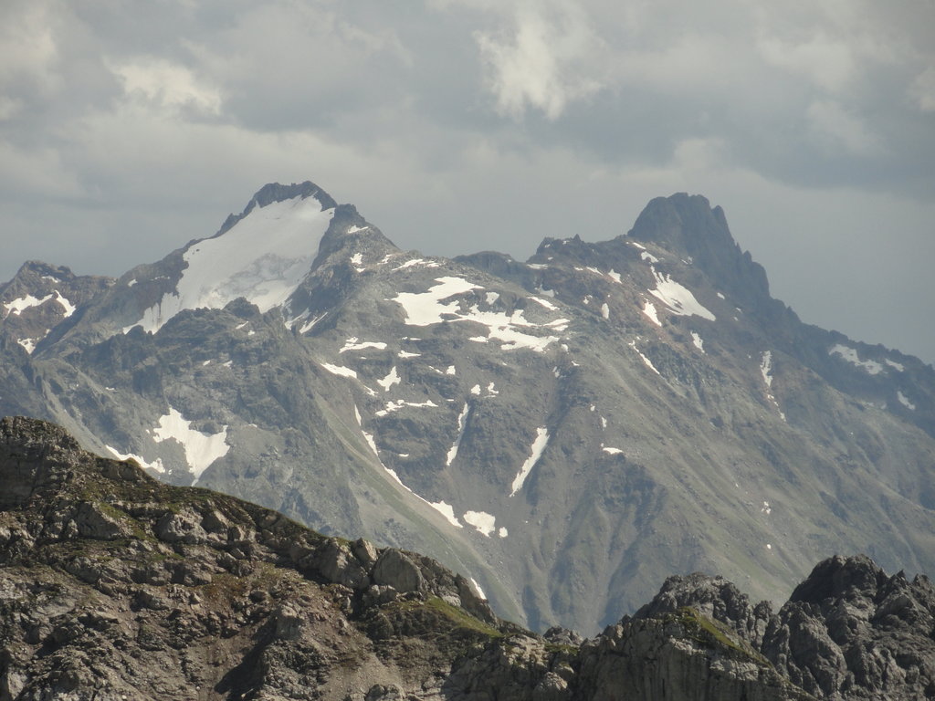
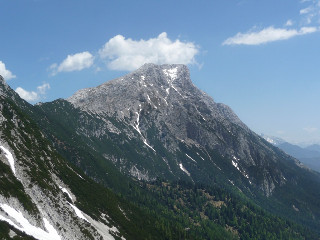
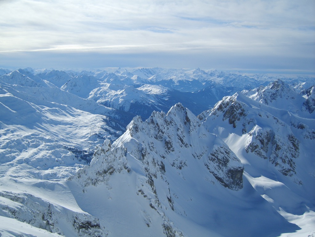
The Verwall Alps (Fervall Gruppe) are a mountain range in the Central Eastern Alps of western Austria. They’re split evenly across the states of Vorarlberg and Tyrol. The Verwall Alps are situated in the heart of the Alps. Thanks to their compact size, numerous high-altitude trails, and world-class resorts, they’re among the best ranges in western Austria for hikers and skiers. There are 251 named mountains in the Verwall Alps. The highest and the most prominent mountain is Hoher Riffler (Nord) (3,168 m / 10,394 ft).
The Verwall Alps occupy an approximately 50 km (31 mi) wide triangular-shaped region, stretching from Bludenz in the west to near Landeck in the east. It's approximately 25 km (15.5 mi) long, from the Arlbergpass (1,793 m / 5,883 ft) in the north to the Zeinisjoch (1,842 m / 6,043 ft) in the south.
The border between Tyrol and Vorarlberg follows the Verwall Alps' main ridge on the western edge of the Verwalltal. All the Verwall Alps' eight 3,000ers are on the range's Tyrolean side. Parts of the Vorarlberg side are protected as Natura 2000 nature reserves, including the 120 sq km (46 sq mi) Europaschutzgebiet Verwall.
Five mountain ranges surround the Verwall Alps:
The Verwall Alps are lightly glaciated compared to surrounding mountain ranges like the Silvretta Alps. There are roughly 20 small glaciers in the Verwall Alps, which cover a total area of 2.5 sq km (0.96 sq mi).
Several significant rivers meander through and along the borders of the Verwall Alps.
The 72 km (45 mi) long Ill River, a tributary of the Rhine, runs on the range's southwestern edge. The 42 km (26 mi) long Rosanna River springs from within the Verwalltal and runs along the range's northeastern edge. The Rosanna joins the Trisanna River near Pians to form the Sanna River.
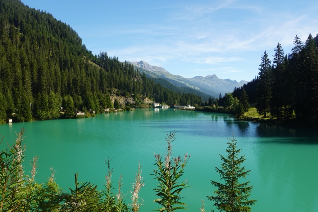
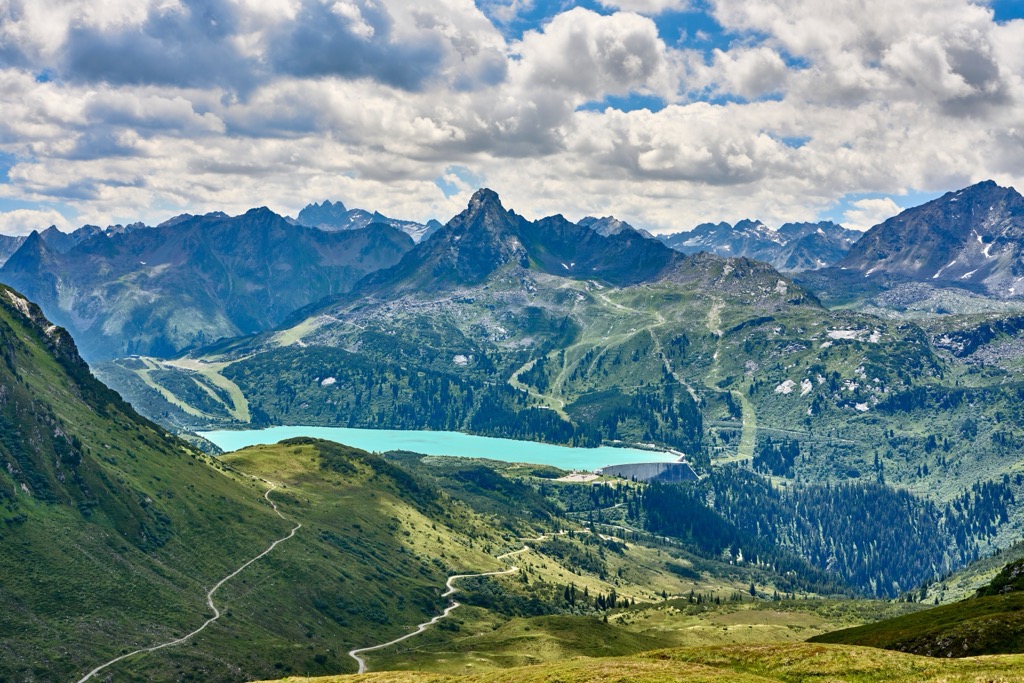
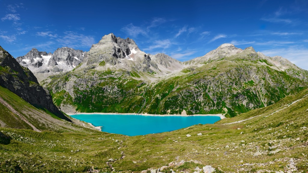
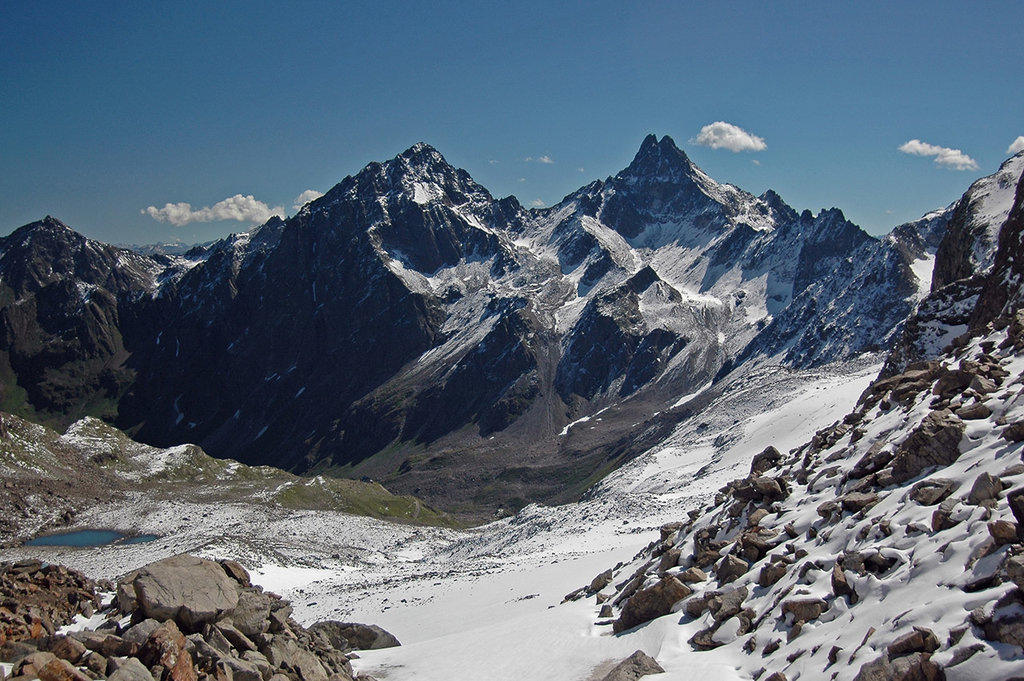
Only a handful of lakes are found in the Verwall Alps. The Verwallsee is the most famous, thanks to its natural beauty and amenities. The largest lake in the Verwall Alps is the Kartellspeicher, formed by a dam on the Moosbach River. The slightly larger Stausee Kops sits on the border between the Verwall Alps and the Silvretta Alps.
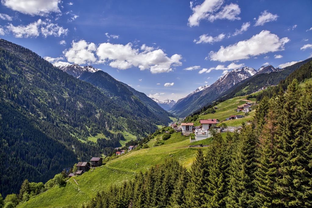
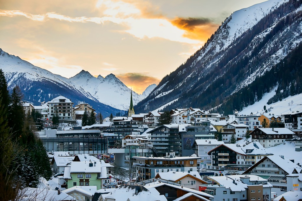
Bludenz, St. Anton am Arlberg, Schruns, Pettneu am Arlberg, and Ischgl are among the largest settlements in the Verwall Alps.
The Verwall Alps are split into two main groups: the Eastern Verwall Group (Ostverwall) and the Western Verwall Group (Westverwall).
The Eastern Verwall Group is entirely within Tyrol, while the Western Verwall Group is primarily within Vorarlberg. There are a total of 17 subgroups within the Verwall Alps.
The Western Verwall Group consists of the Verwall Alps' main ridge, which runs from north to south, and two western ridges stretching towards the Montafon.
These western ridges are the Itonskopf Group to the north and the Hochjochstock to the south. The Silbertal separates the Itonskopf Group and the Hochjochstock. Pflunspitzen (2,912 m / 9,554 ft) is the highest summit in the Western Verwall Group.
Here's a list of the subranges of the Western Verwall Group from northwest to southeast, along with their highest summits:
The Eastern Verwall Group falls entirely within Tyrol and contains the Verwall Alps' highest summits. The main ridge runs from southwest to northeast on the northern edge of the Paznaun, with several northern side ridges reaching out towards the Stanzertal.
The Faselfad Group runs from north to south along the eastern edge of the Verwalltal, separating it from the Moostal. Another significant northern-running subgroup is the Fasulkamm Ridge, which separates the Rosanna and Fasulbach valleys.
The highest summit in the Eastern Verwall Group is Hoher Riffler (Nord) (3,168 m / 10,394 ft), on the eastern tip of the Verwall Alps.
Here's a list of the Eastern Verwall Group's subgroups from southwest to northeast, along with their highest summits:
The Verwall Alps began forming approximately 66 million years ago during the Alpine Orogeny. This mountain-building event was caused by the African Plate, the Arabian Plate, and the Indian Plate to the south colliding with the Eurasian Plate to the north.
Convergent movements between these tectonic plates helped create the Alps as they exist today. The Alpine Orogeny is a relatively recent geological event that is still ongoing in some parts of the Alps.
The Alpine Orogeny also helped create many other significant mountain ranges worldwide along the Alpide belt, including the Himalayas, the Pyrenees, and the Atlas Mountains.
The Verwall Alps are varied in composition. Its westernmost subgroup, the Itonskopf Group, is composed primarily of limestone due to its proximity to the Northern Limestone Alps, like the Lechquellen Mountains.
The Verwall Alps are part of the Central Eastern Alps, which is made up of primarily metamorphic rocks, and lacks the large-scale crystalline rock formations found across the Western Alps.
The northern edge of the Verwall Alps is composed primarily of metamorphic phyllite, with a zone of quartz phyllite to the northeast near Landeck.
The rest of the Verwall Alps comprise paragenetic sequences of schists and hornblende amphibolites, with gneiss and granitic aplite intrusions stretching from east to west.
A large portion of the Verwall Alps is a protected area and a haven for many endangered bird species and native animals.
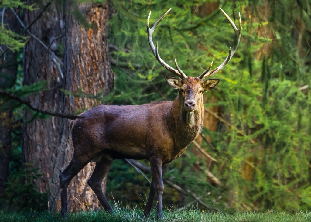
Red deer are the largest native mammals in the Verwall Alps. Males can weigh as much as 300 kg (661 lbs). They're shy and are usually spotted in forested areas. Other mammals native to the valleys and mountains of the Verwall include marmots, chamois, ibex, snow hares, and roe deer.
Wolves disappeared from Austria in the 19th century but have slowly made a comeback—there are approximately 80 wolves across the country. Recently, there have been alleged sightings of brown bears in Tyrol and Vorarlberg, which have likely wandered into the area from a bear sanctuary in Trentino, Italy.
Over half of the bird species native to the Verwall Alps in Vorarlberg are protected. Birds of prey that can be seen hunting in the Verwall Alps include peregrine falcons, bearded vultures, golden eagles, pygmy owls, and eagle owls.
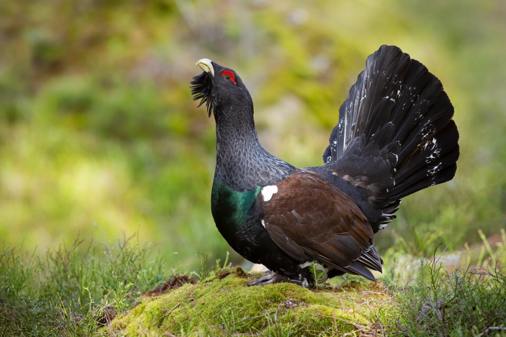
Other protected bird species include capercaillies, black grouses, rock ptarmigans, red-backed shrikes, purple herons, three-toed woodpeckers, reed warblers, hazel grouse, and wallcreepers.
The European adder is the only venomous snake species in the Verwall Alps. It's widespread across Europe, usually found hiding in bushes or under rocks, and can live at up to 3,000 m (9,842 ft) in elevation. Other reptile and amphibian species in the Verwall Alps include smooth snakes, common lizards, grass frogs, and alpine newts.
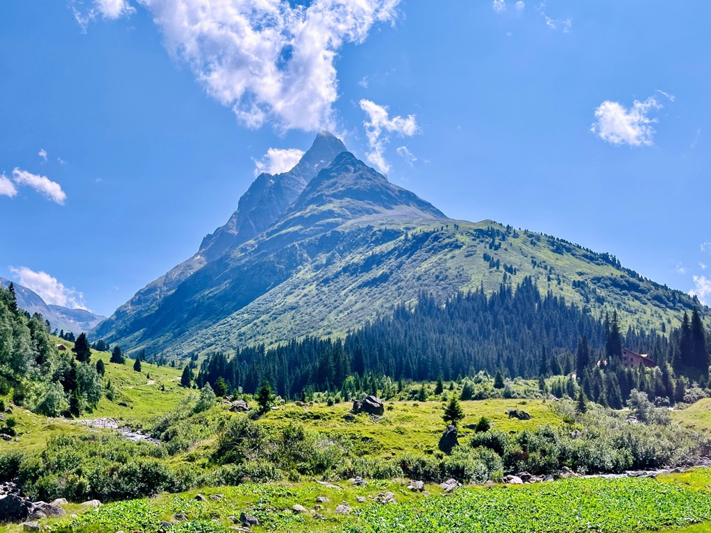
The landscape of the Verwall Alps is varied, consisting of forests, alpine meadows, heathlands, moorlands, and raised bogs.
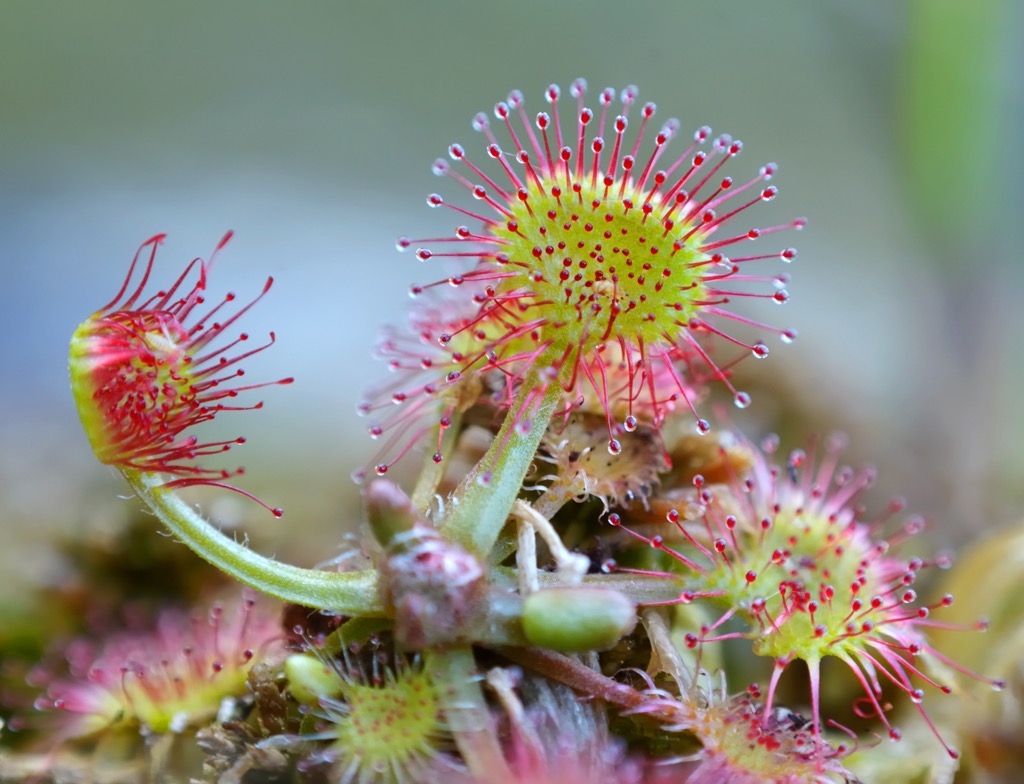
At the confluence of the Fasulbach, Rosanna, and Pflunbach rivers is an 11,000-year-old moorland that is thought to be one of the oldest of its kind in Austria. Round-leaved sundew, which is highly protected, grows in this area.
The Verwall Alps forests are mainly conifer and mixed forests, which change in composition depending on elevation. The lowest forests consist primarily of deciduous broadleaf trees, mainly English, sessile, and downy oaks.
Above 1,000 m (3,280 ft) in elevation, the Verwall Alps' forests are dominated by hardier trees, such as Norway spruces, mountain pines, European beeches, and silver birches.
Across the Verwall Alps' raised moors, heathlands, and bogs grow many fascinating plant species, including willows, beak-rush, bog-rosemary, oblong-leaved sundew, common cranberry, and natterjack grass.
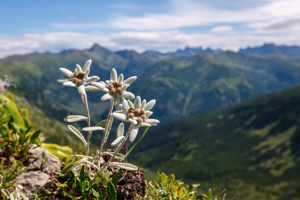
At high elevations above the treeline, the forests make way for alpine meadows that host an array of vibrant flowers, including edelweiss, dark columbines, black yarrows, blue wolfsbane, mountain arnica, and primroses.
Many of the Verwall Alps' first ascents were between 1854 and 1865. This period is known as the "golden age of Alpinism," when early mountaineers pioneered many of the highest summits in the Alps.
German mountaineer Josef Anton Specht and his guide, Franz Pöll, first scaled Hoher Riffler, the highest summit in the Verwall Alps, in 1864.
From Pettneu, they hiked south through the Malfontal and ascended to where the Edmund-Graf-Hütte (2,375 m / 7,792 ft) was built in 1885. They then crossed Blankahorn to reach the Hoher Riffler's western summit. Specht is a famous mountaineer credited for several other first ascents in the Alps, including Weißkugel (Palla Bianca) (3,738 m / 12,264 ft) in 1861, Piz Buin (3,312 m / 10,866 ft) in 1865, and Patteriol in 1874.
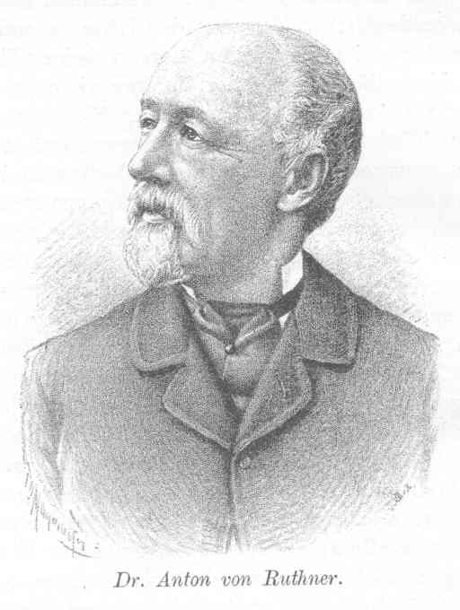
In 1867, Anton von Ruthner, one of the founding members of the Austrian Alpine Club and credited for the first ascent of Großvenediger (3,657 m / 11,998 ft) in 1841, became the first person to reach Hoher Riffler's summit from its south side.
Mountaineers scaled many of the other highest mountains in the Verwall Alps during a state survey of Austro-Hungary ordered by the Habsburgs in 1860. This survey included the Verwall Alps' main chains and most of its highest summits, including Küchlspitze.
Kuchenspitze, a rarely visited mountain due to its isolation and difficulty, was one of only a few mountains not summited in the 1860 survey. Andreas Madlener and Julius Volland first scaled it on September 3, 1877.
The name "Verwall" comes from the Romanesque "Val Bel" which means "beautiful valley." Phonetic and dialectic changes have led to it being pronounced "Verwall" or "Ferwall."
The Verwall Alps are a compact mountain range with many high-alpine trails and picturesque mountain huts.
When hiking in the Verwall Alps, ensure you bring appropriate gear, plenty of provisions, and the correct footwear. Check local weather forecasts, inform others of your itinerary, and carefully map your route.
You can find more info on the hiking and mountaineering grades referenced in this article here.
Check out our PeakVisor app for Peak Identification, 3D mapping, personalized route-finding, and adventure tracking, all with our Augmented Reality technology. The app is compatible with most smartphones and serves as your own mountain guide. Best of all, the “Discover” feature allows you to find the best trails in an area, whether planning a trip in advance or from the parking lot when you arrive.
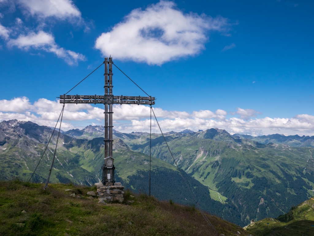
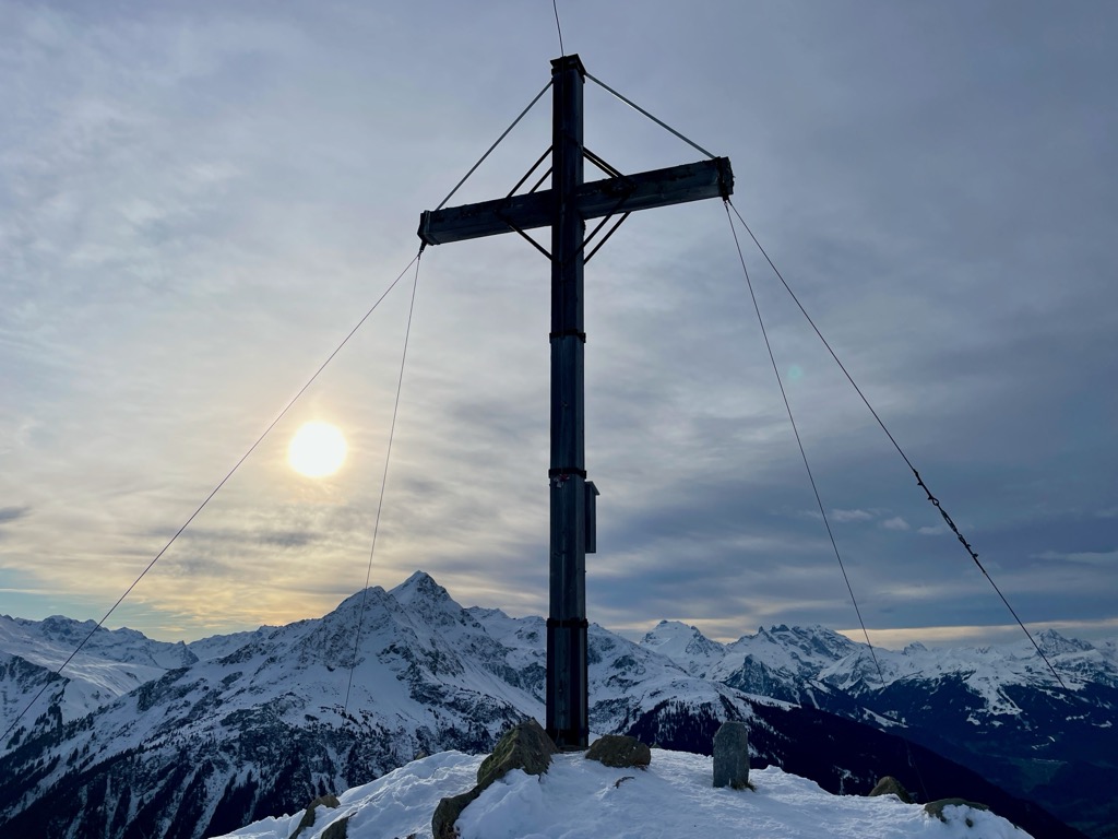
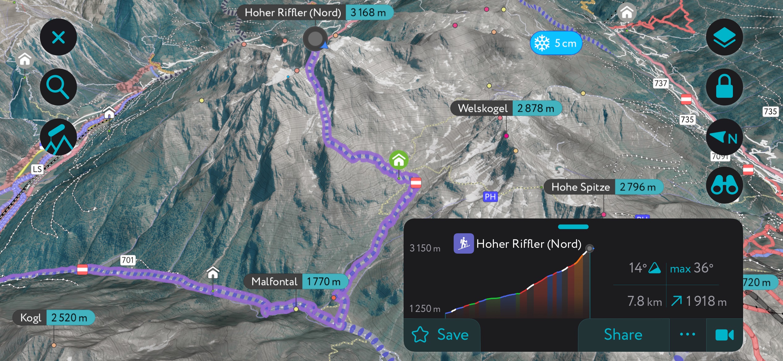
Sat on the eastern tip of the Verwall Alps is the range's highest summit, Hoher Riffler (3,168 m / 10,394 ft). Visible from nearby Pettneu am Arlberg and offering incredible panoramas, it's one of the most popular mountains in the range.
From atop Hoher Riffler, you'll have views of the Verwall Alps to the west, the Lechtal Alps and Allgäu Alps to the north, Zugspitze (2,962 m / 9,718 ft) and the Mieminger Chain to the northeast, and the Karwendel to the east, and the Silvretta to the south. On a clear day, you can even make out the Pennine Alps' Weisshorn (4,506 m / 14,783 feet), over 232 km (144 mi) to the southwest.
Hoher Riffler is a strenuous climb, but it is considered an easy 3,000er because it requires no specific mountaineering experience. A hiking trail leads to Hoher Riffler (Süd) (3,166 m / 10,387 ft), where you can sign a summit book.
Hoher Riffler (Nord) (3,168 m / 10,394 ft) is only 2 m (6 ft) higher and 30 m (98 ft) from the southern summit, but it's a challenging climb.
You can pick up from the trail to Hoher Riffler just south of Pettneu near the Parkplatz Malfontal. The trail is well-signposted. It leads south via the Edmund-Graf-Hütte (2,375 m / 7,792 ft) to Hoher Riffler's southern summit.
This trail is approximately 18 km (11 mi) in length. You can complete this hike in a day or spend the night at the Edmund-Graf-Hütte.
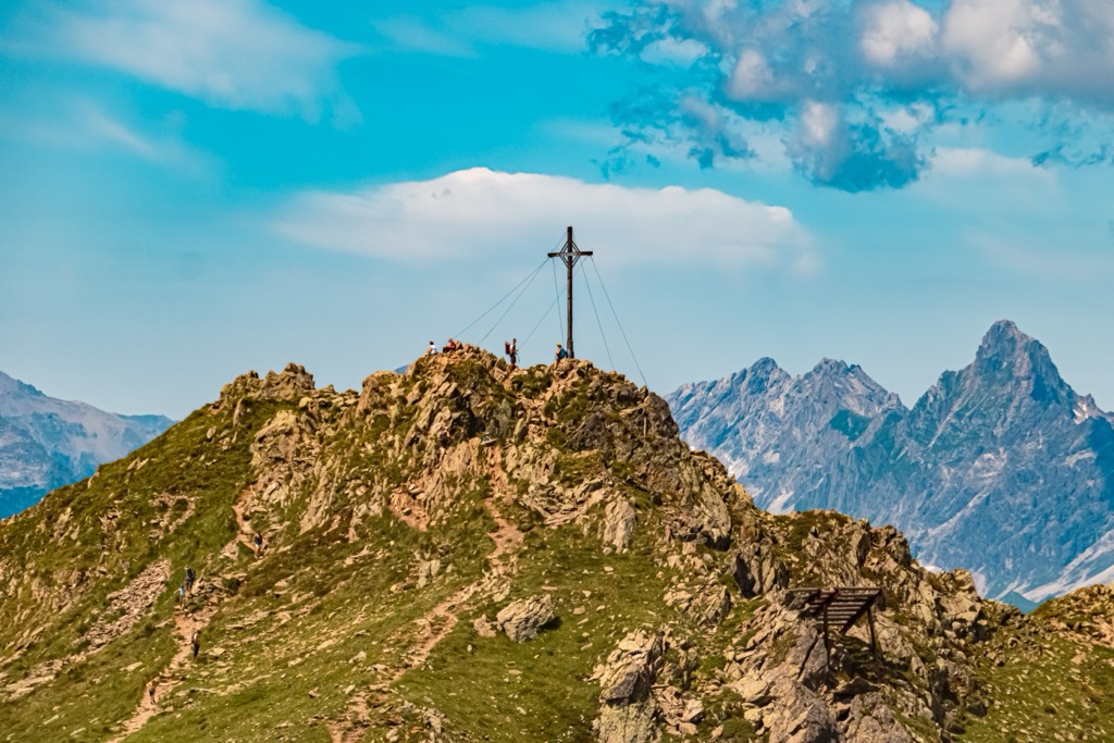
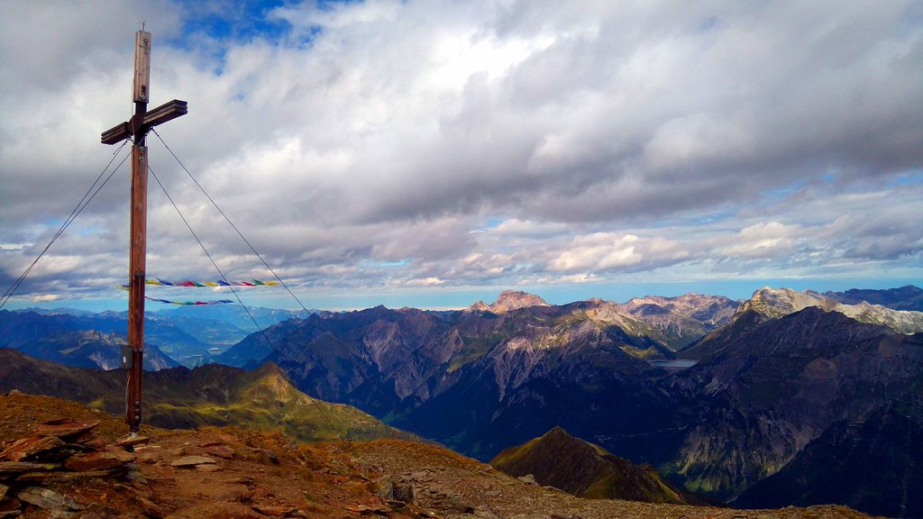
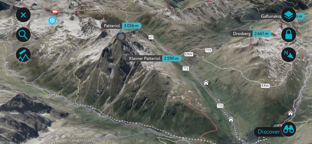
The "Matterhorn of the Verwall," Patteriol (3,056 m / 10,026 ft), is the Verwall Alps' most imposing mountain.
The highest summit on the Fasulkamm Ridge, Patteriol is a jagged cluster of three summits that casts an impressive silhouette. While it looks insurmountable at first glance, experienced mountain climbers can reach the true summit without any great difficulty.
The normal route up Patteriol is a UIAA II-graded climb up its south flank. Your starting point for this climb is the Konstanzer Hütte (1,688 m / 5,538 ft), which you can reach from St. Anton am Arlberg. Follow the Bruckmannweg from the hut to the foot of Patteriol.
From Patteriol's summit, one can see the Pennine Alps and the Bernese Alps, including the Finsteraarhorn (4,274 m / 14,022 ft), the Aletschhorn (4,193 m / 13,757 ft), and the Bietschhorn (3,934 m / 12,907 ft). The view of the Bregenz Forest Mountains and the Lechtal Alps to the north is also sublime.
The climb up Patteriol from the Konstanzer Hütte is approximately a 16 km (10 mi) round-trip.

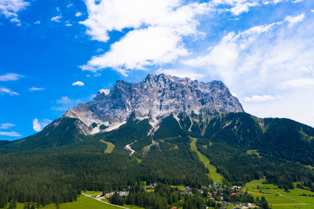
Saumspitze (3,039 m / 9,970 ft) is the seventh-highest mountain in the Verwall Alps. Located at the heart of the range, Saumspitze provides almost 360-degree views, with the entirety of the Ötztal Alps visible to the east and the glaciated Ortler Alps visible to the south-southeast. On a clear day, you can see all the way to Alphubel (4,206 m / 13,799 ft) in the Pennine Alps, over 215 km (134 mi) away.
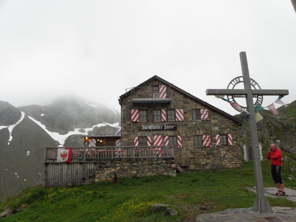
The normal route to Saumspitze is from the Därmstädter Hütte, following the Hoppe-Seyler-Weg. You can reach the Därmstädter Hütte on a day's walk from St. Anton am Arlberg. From the Därmstädter Hütte, it takes two or three hours to reach Saumspitze's summit.
Saumspitze is a demanding mountain — its summit climb graded T4 by the Swiss Alpine Club (SAC) hiking scale. To reach Saumspitze, you'll leave the Hoppe-Seyler-Weg to the left, following the clearly marked trail through scree slopes on the mountain's southwest flank.
The hike from St. Anton am Arlberg to Saumspitze is approximately a 30 km (18.6 mi) round-trip.
Itonskopf (2,089 m / 6,854 ft) is the highest summit in the Itonskopf Group. This group is among the most popular groups in the Verwall Alps, thanks to its position near Schruns and the Silvretta Montafon ski area.
The hike up Itonskopf is tiring but worth it. The summit, marked with a large cross, affords one of the finest views of the Klostertal and the Verwall's main chain. The trail to Itonskopf starts from the Panoramagasthof Kristberg at Kristbergsattel (1,483 m / 4,865 ft).
The Montafon Kristbergbahn cable car in Silbertal takes you directly to the Panoramagasthof Kristberg. From here, you'll hike northwest to Ganzalaeta and around the northern flank of Schwarzhorn (1,883 m / 6,178 ft).
The climb to the summit of Itonskopf is steep and requires a head for heights. This out-and-back hike is approximately 11 km (6.8 mi) in length.
Muttjöchle (2,075 m / 6,808 ft) is an excellent mountain for leisurely hiking in the Verwall Alps. Located just south of Wald am Arlberg, Muttjöchle is part of the Sonnenkopf - Klösterle ski area and is well-connected with cable cars.
In the summer, Muttjöchle is a popular hiking destination, with a cable car taking you directly to the summit of Sonnenkopf (1,912 m / 6,273 ft). From the Sonnenkopfbahn Bergstation, you can take an easy stroll through raised bogs and alpine meadows to Muttjöchle.
A hike up Muttjöchle is ideal for families. There are panoramic restaurants atop Sonnenkopf and Muttjöchle. Plus, the nearby Bärenland Adventure Park features a huge playground for kids to enjoy. The hike up Muttjöchle is approximately 8 km (5 mi) in length.
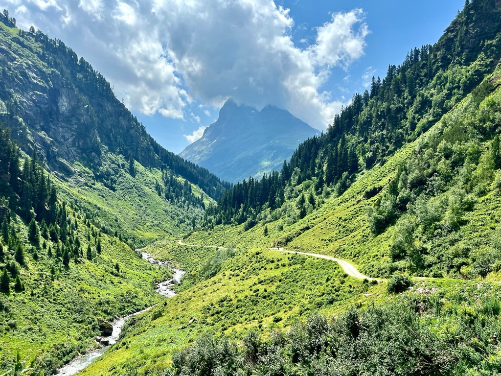
The Verwall-Runde is a beautiful, long-distance circular trail that weaves through the Verwall Alps to eight mountain huts, taking in the range's finest scenery. It's approximately 77 km (48 mi) long and is split into eight stages. Each stage is named and well-marked and can be completed as a day hike.

The Verwall-Runde starts in St. Christoph near St. Anton and ends in Pettneu. Stage 1 (Paul-Bantlin-Weg) leads from St. Christoph to the Kaltenberghütte (2,089 m / 6,854 ft). It's a short 6.4 km (4 mi) walk that provides stunning views of the Arlbergpass.
Stage 2 (Reutlinger Weg) leads to the Konstanzer Hütte (1,688 m / 5,538 ft), with views of Krachelspitze (8,812 ft), Kaltenbergsee, and towards the range's 3,000ers from Gstansjöchli (2,573 m / 8,442 ft). Stage 2 is approximately 10.5 km (6.5 mi) in length.
Stage 3 (Bruckmannweg) leads through the Falsultal and over Wannenjöchli (2,633 m / 8,638 ft) for a view of Patteriol. It ends at Neue Heilbronner Hütte (2,320 m / 7,572 ft), which overlooks Scheidsee. Stage 3 (Bruckmannweg) is approximately 12.7 km (7.9 mi) long.
Stage 4 (Friedrichshafener Weg) guides you to the Friedrichshafener Hütte (2,138 m / 7,014 ft) via the Muttenjoch (2,620 m / 8,596 ft). From the Muttenjoch, it's possible to take a 20-minute detour to the summit of Gaisspitze (2,779 m / 9,117 ft). Stage 4 is roughly 7.4 km (4.6 mi) in length.
Stage 5 (Apothekerweg) is a demanding walk to the Darmstädter Hütte (2,384 m / 7,822 ft). It passes over Schafbichljoch (2,636 m / 8,648 ft), downhill into the Fasultal, and to Kuchenjöchli (2,730 m / 8,957 ft), where it's possible to take a short detour to Scheibler's (2,978 m / 9,770 ft) summit. Stage 5 is approximately 15.2 km (9.5 mi) in length.
Stage 6 takes you to the small Niederelbehütte (2,300 m / 7,546 ft) via Seßladjoch (2,749 m / 9,019 ft) and the emerald blue Kartellspeicher. Take a brief detour to the summit of Kappler Kopf (2,404 m / 7,887 ft) from Niederelbehütte for stunning views of the Paznaun. Stage 6 is approximately 8 km (5 mi) in length.
Stage 7 (Kieler Weg) climbs up to Schmalzgrubenscharte (2,697 m / 8,848 ft) and passes Schmalzgrubensee on the way to Edmund-Graf-Hütte (2,375 m / 7,792 ft). From the hut, you can climb the towering Hoher Riffler (3,168 m / 10,394 ft). Stage 7 is approximately 8.9 km (5.7 mi) in length.
The Verwall-Runde ends in Pettneu am Arlberg. This final stage descends steeply into the Malfontal, crosses Malfonalpe, and leads to Pettneu, where a bus can take you back to St. Anton. It’s approximately 7.4 km (4.6 mi) in length.
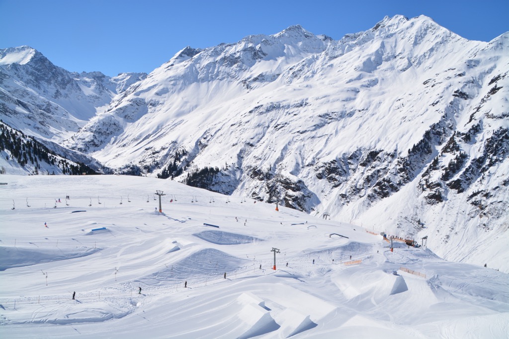
Home to Austria's largest connected ski area, Ski Arlberg, and over 500 km (311 mi) of slopes, the Verwall Alps are an unmissable Alpine ski vacation destination.
You'll find five main ski areas in the Verwall Alps:
Ski touring is a popular winter pastime in the Verwall Alps, with subgroups like the Valschavielkamm, Fluh Group, and Rendl Group serving as touring hubs.
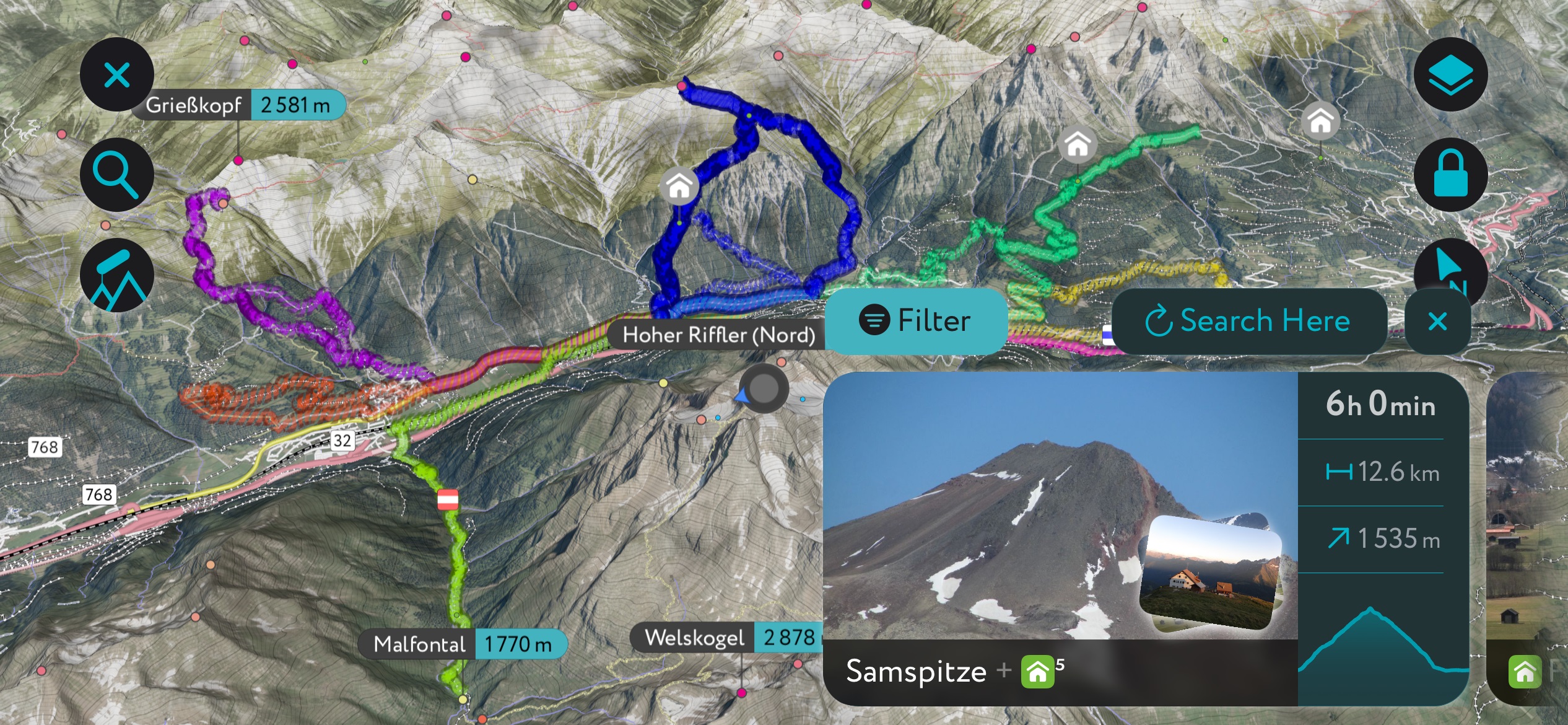
The Verwall Alps are located in the middle of our most thoroughly mapped areas, with thousands of detailed ski tours to explore across the Alps.
Let's look at a couple of the best ski tours in the Verwall Alps and some new features that make the PeakVisor App the perfect companion for your next ski adventure.
Tavamunter Augstenberg (2,489 m / 8,166 ft) is a mountain at the western end of the Valschavielkamm, bordering the Valschavietal to the south. It's a relatively easy hike in the summer and one of the Verwall Alps' most popular ski tours in the winter.
One of the most popular ski tours of Tavamunter Augstenberg starts from Gaschurn. It follows the forest path to the Neue Heilbronner Hütte (2,308 m / 7,572 ft) before crossing half of the Valschavietal to reach Tavamunter Augstenberg. The descent of the mountain's north face is one of the highlights of this tour.
This ski tour from Gaschurn to Tavamunter Augstenberg is approximately 10 km (6.4 mi) long.
Valschavieler Maderer (2,769 m / 9,085 ft), or Madererspitze, is the highest mountain in the Madererkamm. It rests on the northern boundary with the Valschavielkamm and provides views across the Valschavieltal and Silbertal. The best time to ski on Valschavieler Maderer is in spring when the snowpack stabilizes, and avalanche risk is lower.
The ski tour of Valschavieler Maderer is long and relatively difficult. However, its views and excellent slopes make it worthwhile. The most popular ski tour starts in Gortipohl and partially follows the Valschavielstraße. This ski tour is approximately 19 km (12 mi) in length.
We're constantly updating the PeakVisor App to give you the best possible experience when exploring the finest mountains in the Alps and beyond.
Get the latest weather forecasts at your location, complete with data on snow depths. You'll also have access to up-to-date mountain hut info, including opening hours, dining options, and overnight accommodation.
From quaint ski resorts to district capitals, the settlements of the Verwall Alps offer something for everyone to enjoy during their downtime.
Innsbruck Airport is the nearest major international airport to the Verwall Alps, 139 km (86 mi) east of Bludenz. The nearest regional airport is St. Gallen-Altenrhein Airport, 56 km (35 mi) northwest of Bludenz.
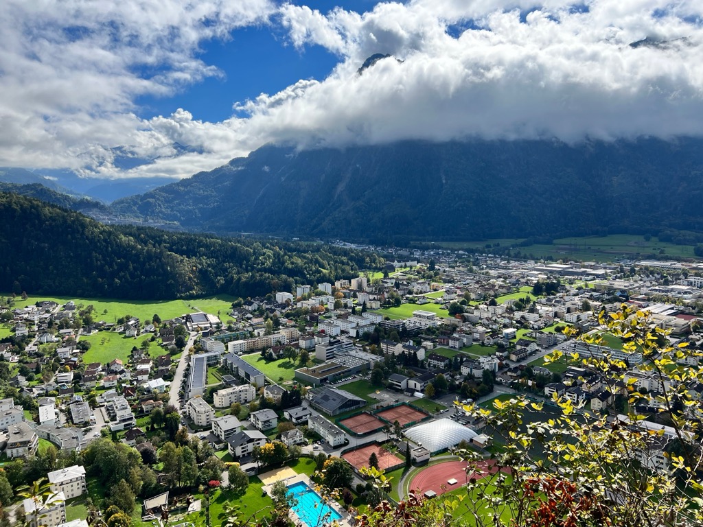
Bludenz is the largest town in the Bludenz District and the largest settlement in the Verwall Alps. Its population is roughly 15,000 people.
Located on the western tip of the Verwall Alps, Bludenz is known for its international festivals, unique architecture, and hiking opportunities.
Bludenz is encircled by mountain ranges, with the Bregenz Forest Mountains to the north, the Silvretta to the south, and the Verwall Alps to the east. Popular mountains like Rote Wand (2,704 m / 8,871 ft), Schesaplana (2,964 m / 9,725 ft), and Itonskopf are all within 15 km (9.3 mi) of Bludenz.
Vorarlberg S-Bahn regional train service connects Bludenz with Bregenz, Feldkirch, and Schruns. The Arlberg Railway connects Bludenz to Innsbruck.
Landeck is the capital of the Landeck District, with a population of over 7,700 people. It's on the eastern tip of the Verwall Alps, surrounded by the Lechtal Alps to the north, the Ötztal Alps and the Samnaun Alps to the south, and the Verwall Alps to the west.
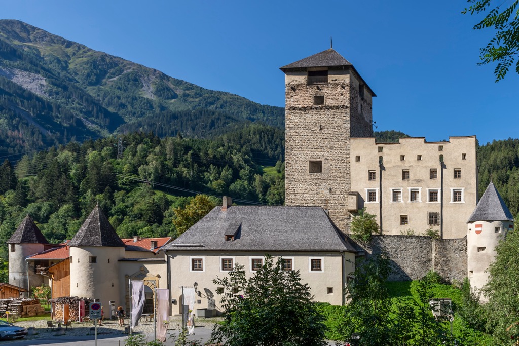
Landeck is a historically significant settlement. Over 2,000 years ago, the Roman Empire's Via Claudia Augusta road ran across the Reschenpass (Passo Resia) (1,507 m / 4,944 ft). Landeck Castle (Burg Landeck), Landeck's principal landmark, has stood overlooking the city since the 13th century.
Popular mountains within 15 km (9.3 mi) of Landeck include Hoher Riffler, Dremelspitze (2,733 m / 8,967 ft), and Rotpleiskopf (2,936 m / 9,633 ft). The Ski Arlberg ski resort is just 22 km (13.5 mi) west of Landeck.
The Landeck-Zams Railway Station connects Landeck internationally to Basel, Zürich, and Dortmund. Additionally, it offers services to St. Anton am Arlberg, Bludenz, and Innsbruck.
Schruns is a major resort in Montafon, with part of the Silvretta Montafon ski area located within the municipality. It's located in the shadow of Zimba (2,645 m / 8,678 ft), the crowning jewel of the Montafon and a popular spot for hikers.
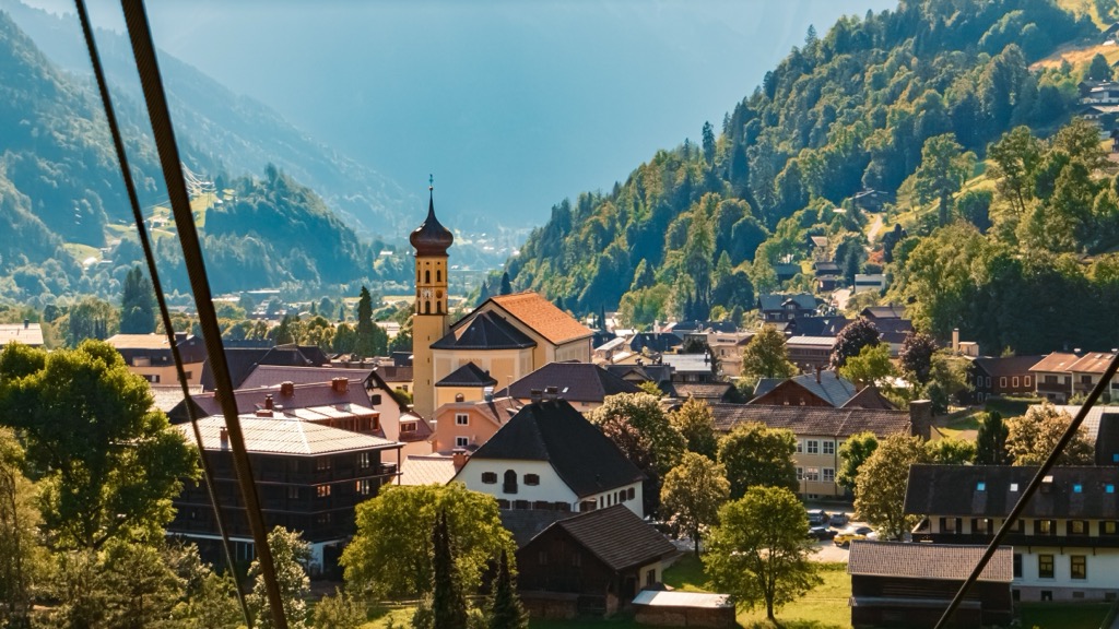
Schruns has always been closely associated with winter sports — it was Ernest Hemingway's favorite ski resort and hosted the 2012/13 FIS Snowboard World Cup. Other popular mountains within 15 km (9.3 mi) of Schruns include Hochjoch (2,520 m / 8,268 ft), Sulzfluh (2,818 m / 9,245 ft), and Madrisahorn (2,826 m / 9,272 ft).
Vorarlberg S-Bahn S4 railway line connects Schruns to Bludenz.
Tucked away in the Paznaun is Ischgl, home to one of the largest ski resorts in the Alps.
The Silvretta Arena covers over five sq km (2 sq mi) and boasts around 239 km (148.5 mi) of slopes. This cross-border ski area includes many popular mountains in the Samnaun Alps, including Palinkopf (2,864 m / 9,396 ft), Greitspitz (2,874 m / 9,419 ft), and Flimspitz (2,929 ft / 9,610 ft).
Ischgl is a vibrant resort known for its nightlife and entertainment. It hosts the annual Top of the Mountain concerts, which kicks off the ski season and attracts internationally renowned musical acts.
There's no direct train service to Ischgl — the nearest station is Landeck-Zams.


The highest peak in the Verwall Alps is Hoher Riffler (Nord), at 3,168 m.
The Verwall Alps have 251 named peaks.


