Get PeakVisor App
Sign In
Search by GPS coordinates
- Latitude
- ° ' ''
- Longitude
- ° ' ''
- Units of Length

Yes
Cancel
❤ Wishlist ×
Choose
Delete
The Bregenz Forest Mountains (Bregenzerwaldgebirge) are tucked away in the northeastern corner of the Northern Limestone Alps within Austria's westernmost state, Vorarlberg. Lush forests, low mountains, and rolling alpine pastures define the Bregenz Forest Mountains. With a gentler nature than the jagged high European Alps, these mountains are perfect for laid-back year-round adventures. The Bregenz Forest Mountains have 203 named mountains. Glatthorn (2,133 m / 6,998 ft) is the highest summit, while Winterstaude (1,877 m / 6,158 ft) is the most prominent.
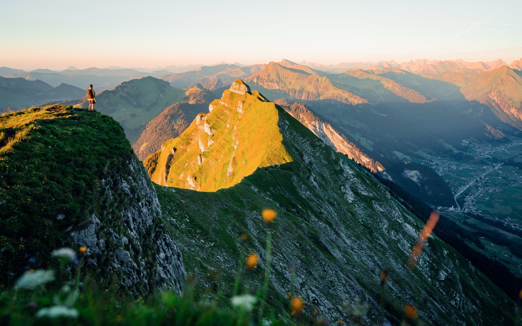
The Bregenz Forest Mountains cover an area of roughly 830 sq km (320 sq mi) and are bounded by Lake Constance (Bodensee) to the north, the Swiss-Austrian border to the west, and the Walgau and Großes Walsertal to the south.
The range takes its name from Vorarlberg's capital, Bregenz, and falls partially within the state's Bregenz Forest (Bregenzerwald) region. The Bregenz Forest also incorporates parts of the Lechquellen Mountains and the Allgäu Alps.
As part of the Eastern Alps, the Bregenz Forest Mountains are surrounded by four other mountain ranges:
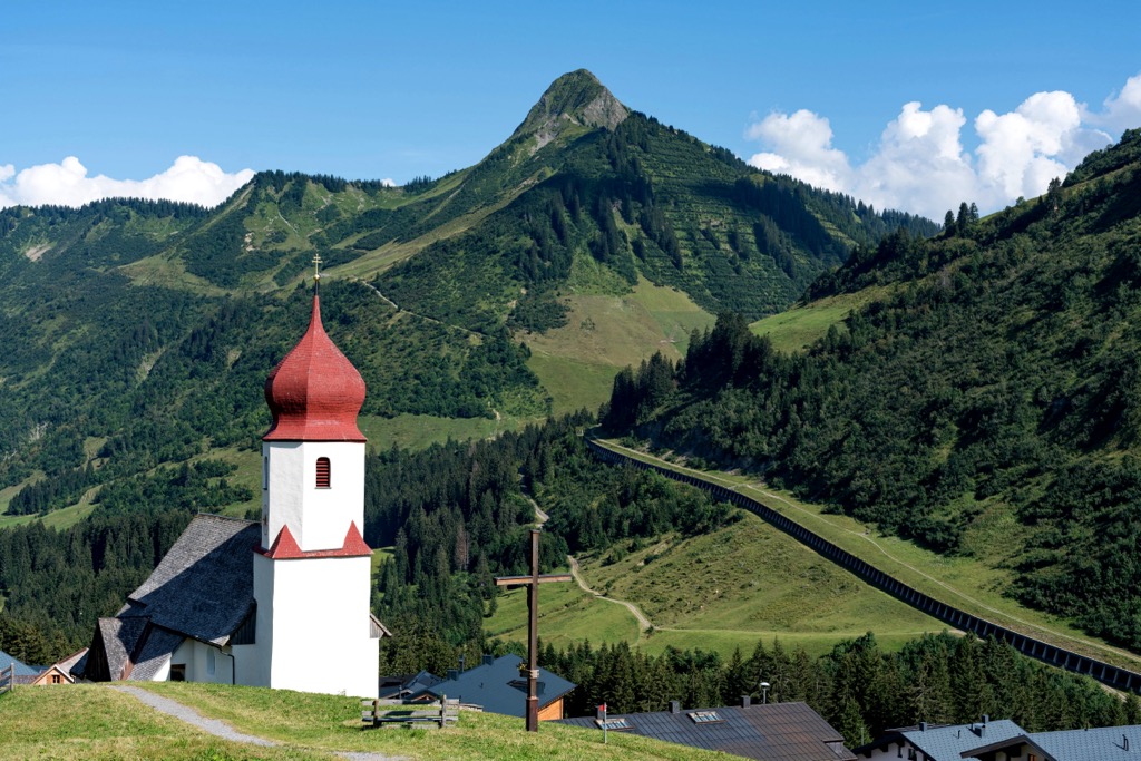
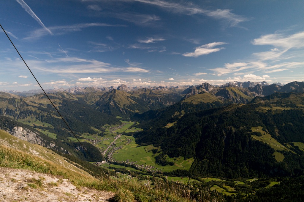
The Bregenz Forest Mountains' geography rises from low points near the Alpine Rhine Valley to the west to the highest summits near the Lechquellen Mountains to the east. The Bregenz Forest Mountains are pre-Alpine, with only 15 summits exceeding 2,000 m (6,561 ft) in elevation.
Most of the Bregenz Forest Mountains are heavily forests, low in elevation, and with sweeping alpine meadows, typical of the Mittelgebirge ranges of southern Germany. Only a small southeastern area around Glatthorn resembles the High Alps.
The Rhine, the second-longest river in Western Europe, flows into Lake Constance at the northern edge of the Bregenz Forest Mountains. The 217 km (135 mi) long Ill River, a major tributary of the Rhine, runs along the Bregenz Forest Mountains' southwestern edge.
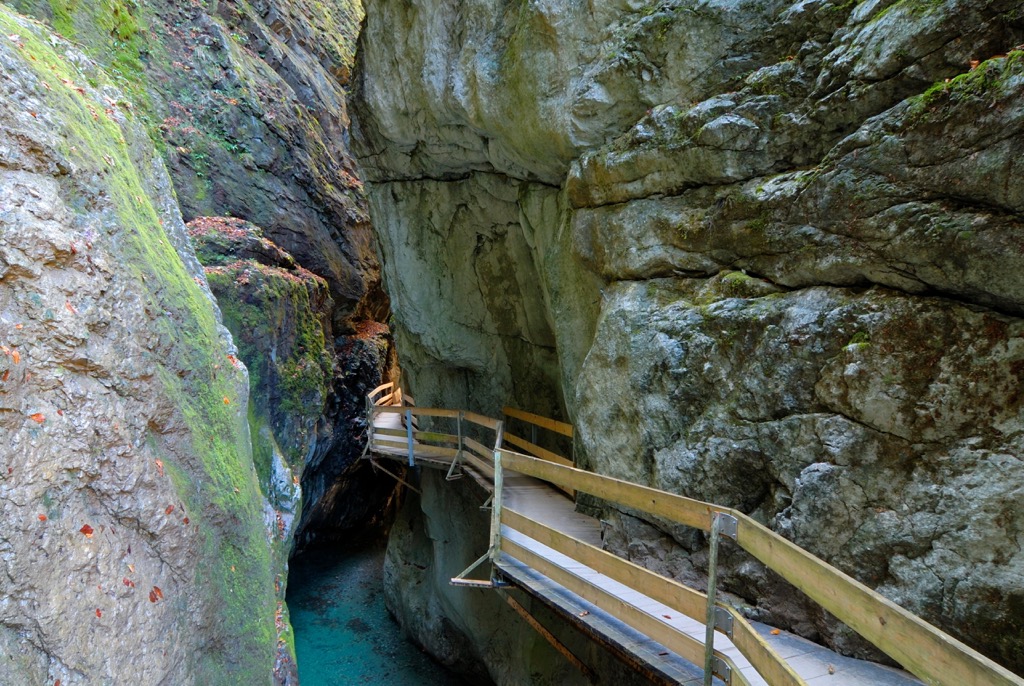
The 67 km (42 mi) Bregenzer Ach is the main river of the Bregenz Forest. The Dornbirner Ach is a 29.9 km (18.6 mi) river that flows through the Alploch Gorge and the Rappenloch Gorge within the Bregenz Forest Mountains. The Rappenloch and Alploch Gorges are among Central Europe's largest.
The main settlements of the Bregenz Forest Mountains are Bregenz, Dornbirn, Feldkirch, and Lustenau.
Nine Natura 2000 protected areas exist within the Bregenz Forest Mountains, including the 192 sq km (74 sq mi) Biosphere Reserve Großes Walsertal.
The International Unified Orographic Division of the Alps (Suddivisione Orografica Internazionale Unificata del Sistema Alpino) (SOIUSA) recognizes two main groups and 13 subgroups in the Bregenz Forest Mountains.
These two main groups are the Western Bregenz Forest Mountains and the Eastern Bregenz Forest Mountains.
The larger and higher Western Bregenz Forest Mountains include the range's main chain, which runs centrally from southwest to northeast. It also includes western and southeastern offshoots, including the ridges surrounding Laternsertal and Frödischtal.
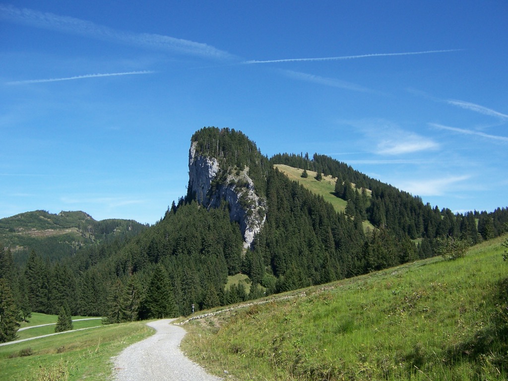
The Eastern Bregenz Forest Mountains comprise four minor standalone ridges that run parallel from west to east across the Bregenz Forest. No summits within the Eastern Bregenz Forest Mountains exceed 2,000 m (6,561 ft) in elevation.
The Bregenz Mountains formed approximately 66 million years ago during the Alpine Orogeny. This mountain-building event occurred due to the African, Arabian, and Indian tectonic plates colliding with the Eurasian Plate to the north. Convergent movements between these plates helped form the Alps.
The Alpine Orogeny is a relatively recent mountain-building event that's ongoing in parts of the Alps. It helped create many of the most prominent mountain ranges worldwide, including the Himalayas, the Carpathians, and the Pyrenees.
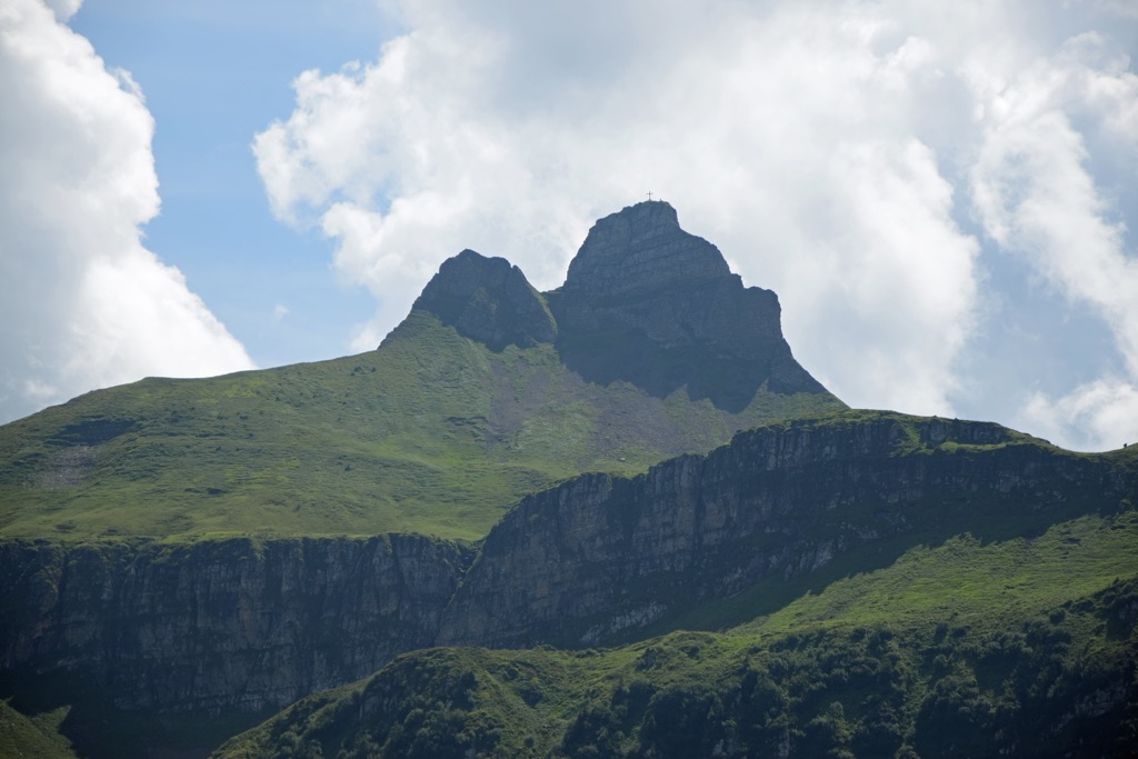
Only the central areas of the Bregenz Forest Mountains around the Kanisfluh and Mittagsfluh are made of limestone despite the range being part of the Northern Limestone Alps. Subgroups to the north and south, like the Hochälpele - Weißenfluh Group, the Glatthorn Group, and the Walserkamm, are made primarily of sedimentary flysch.
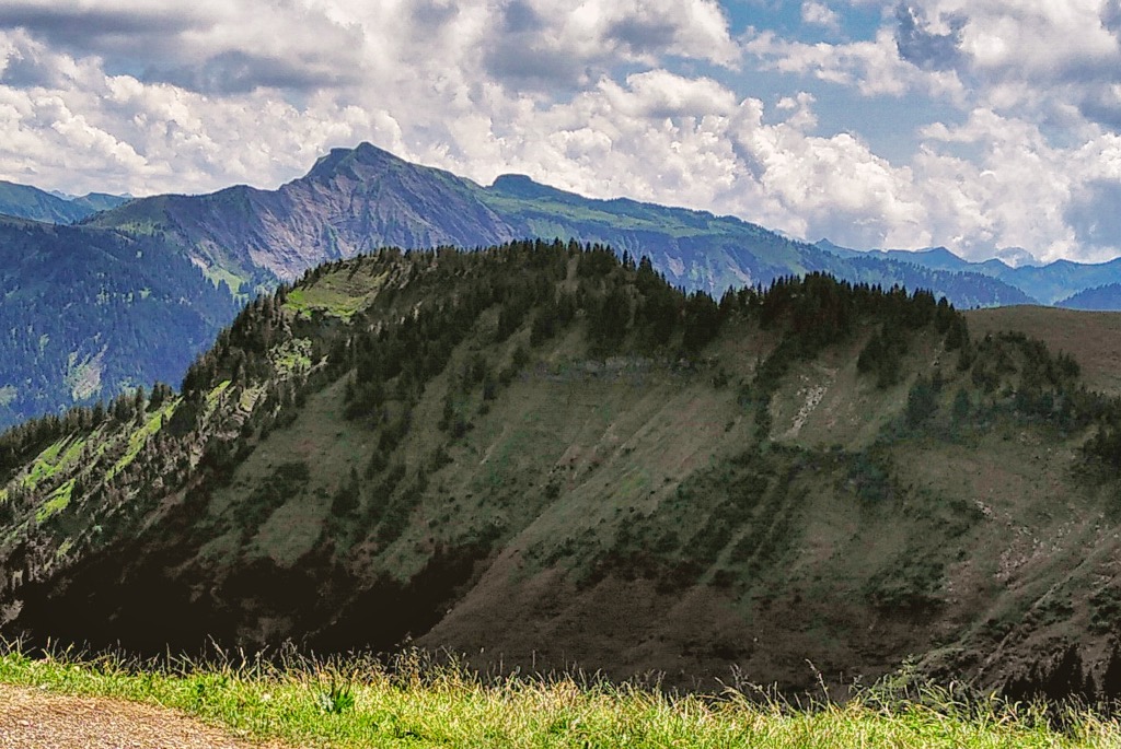
The most northerly subgroup in the Bregenz Forest Mountains, Lorenaberge, is composed mainly of conglomerates, sandstone, and marl.
Featuring varied forests and bordering Lake Constance to the north, the Bregenz Forest Mountains host a distinctive blend of flora and fauna.
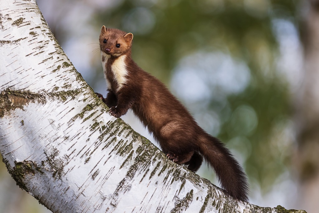
The largest mammals inhabiting the Bregenz Forest Mountains include red deer, roe deer, badgers, wild boar, ibex, and chamois. Other notable mammals include marmots, pine martens, Eurasian beavers, brown hares, red foxes, common hedgehogs, and pipistrelle bats.
Gray wolves went extinct from Austria in the 19th century but have recently made a comeback. There are now believed to be over 50 individuals across the country.
A small population of Eurasian lynx may have made their way to the Bregenz Forest Mountains, but this isn't confirmed. No brown bears reside within the Bregenz Forest Mountains.
With varied forests and Lake Constance to the north, the Bregenz Forest Mountains are home to a diverse selection of bird species. Lake Constance is a breeding ground for many bird species, including tufted ducks, great crested grebes, black kites, and orioles.
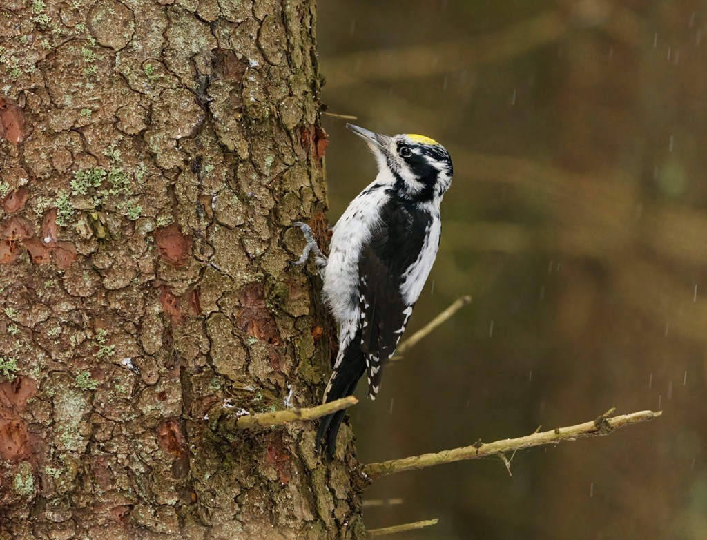
Black grouse, capercaillies, Eurasian three-toed woodpeckers, and great spotted woodpeckers live within Bregenz Forest. Notable birds of prey in the Bregenz Forest Mountains include golden eagles, peregrine falcons, Eurasian eagle owls, and Eurasian goshawks.
The common European adder is the only venomous snake in the Bregenz Forest Mountains. It generally hides in bushes and under rocks and can live up to 3,000 m (9,842 ft) in elevation. Other notable reptile and amphibian species include common wall lizards, smooth snakes, alpine salamanders, great crested newts, and alpine newts.
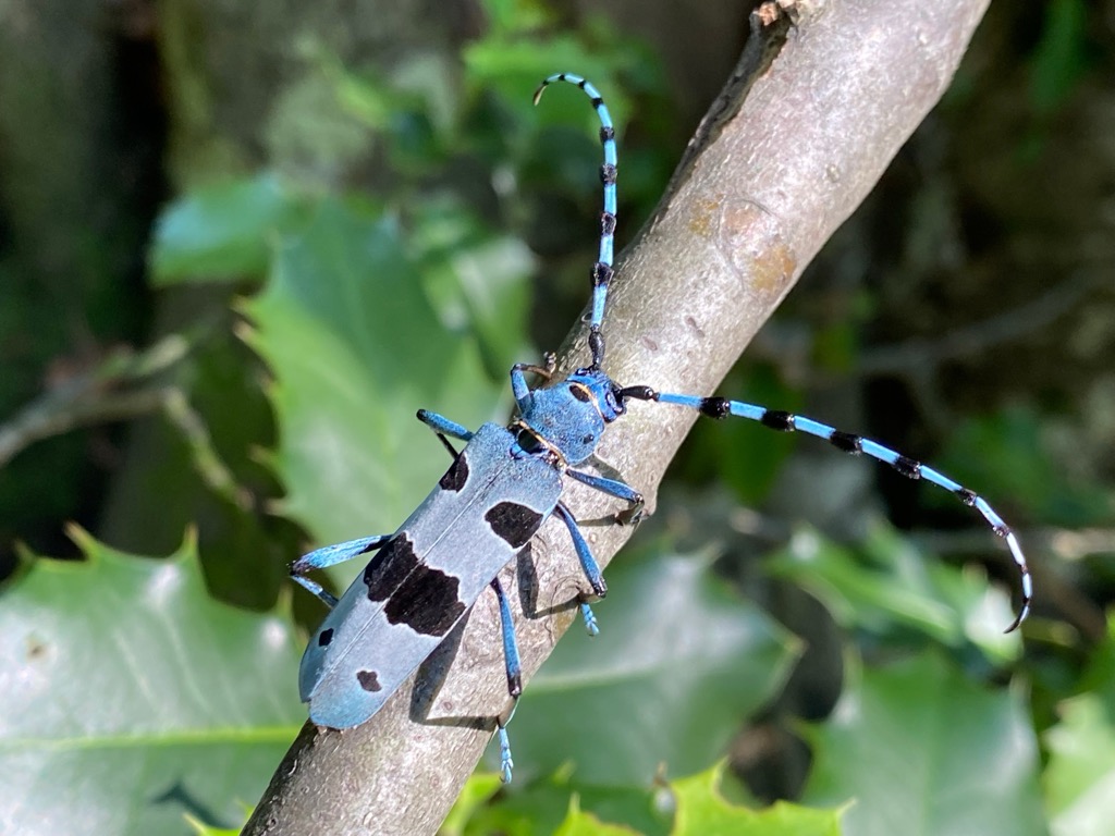
Insects are the most widespread animal class in the Bregenz Forest Mountains. Many rare and endangered species, such as Apollo butterflies, Rosalia longicorn beetles, European stag beetles, and southern damselflies, are found in the range.
The Bregenz Forest ranges from bog to gorge to alpine forests. The Bregenz Forest Mountains' alpine forests are fairly typical of the Alps and vary depending on the elevation.
At ground level, the forest comprises mostly deciduous broadleaf trees, including sessile, English, and northern red oaks. Higher up at Montane forests are a mix of silver firs, mountain pines, European beeches, Norway spruces, and sycamores.
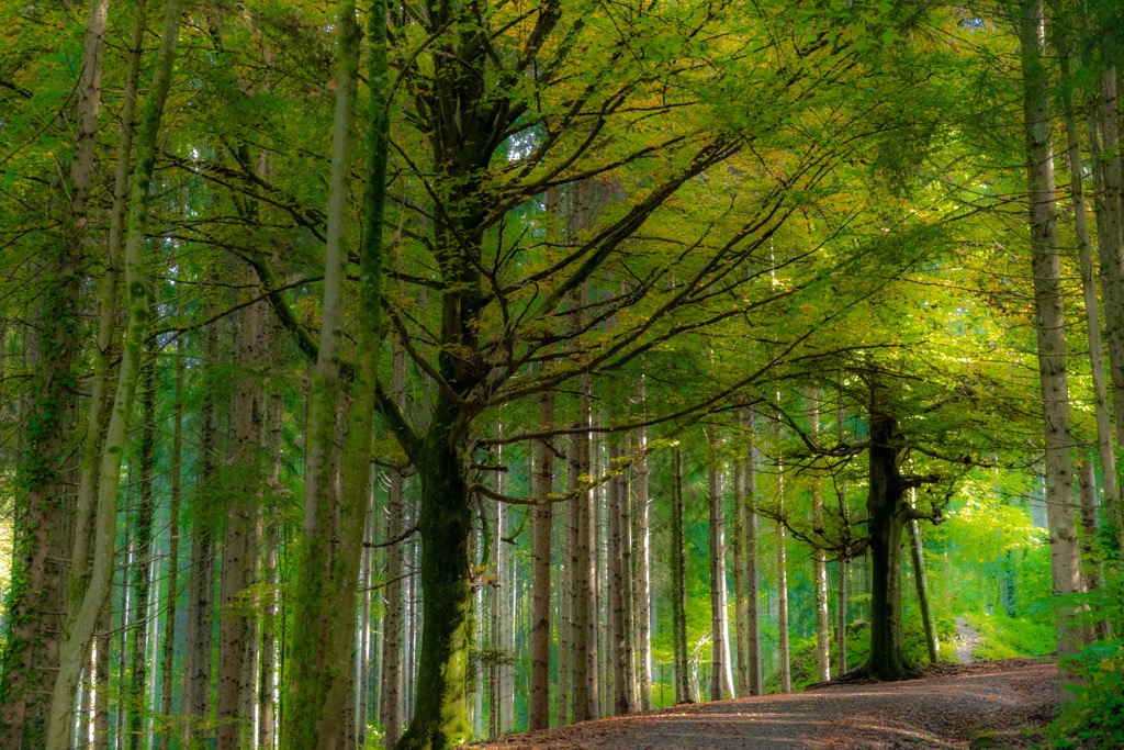
Unlike the surrounding higher ranges, the Bregenz Forest Mountains have no tree line, and forests carpet some of its highest mountains.
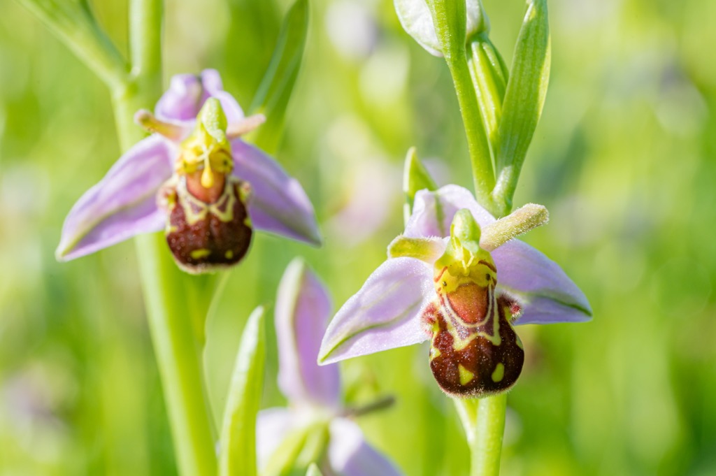
This lush corner of Austria boasts a wealth of flowering plant species to admire while hiking, including many rare and endangered species like lady's slippers, European pasqueflowers, queen-of-the-alps, bee orchids, and fen orchids.
Other flowering plant species that grow in the Bregenz Forest Mountains include eight-petal mountain avens, martagon lilies, alpine snowbells, edelweiss, field gentian, wolfsbane, marsh crane's-bill, and alpine sorrel.
Due to its position near Austria's borders with Switzerland and Lichtenstein, the Bregenz Forest Mountains have a unique history and culture.
The Bregenz Forest Mountain's hiking history is not well documented. The highest summits are too low to be considered significant to alpinists and have likely been scaled by locals for centuries. Historically, the range has been overlooked in favor of the surrounding ranges like the Allgäu Alps and the Appenzell Alps.
Humans first inhabited the Bregenz Forest around 1,000 CE, when settlers from Bregenz first began cultivating the land on Schneiderkopf and the Lorenaberge. The highest areas of the range weren't settled until Walsers from the Pennine Alps arrived in the region during the Middle Ages.
By 1380, the farmers of the Bregenz Forest had formed a "peasant's republic" within the region, with its own constitution and jurisdiction. This republic was formed because the Habsburgs granted Vorarlberg extensive political rights for self-government. The Bregenz Forest Republic even had its own Landammann (similar to a magistrate), whose town hall was located in Bezegg.

Bregenz Forest was significantly involved in developing the Baroque style in the 17th and 18th centuries. The Baroque Architect School in Au and Bezau produced architects who designed some of the most famous Baroque monasteries in Switzerland and southern Germany, including Disentis, Einsiedeln, and Weingarten.
One of the most famous Baroque painters of the 18th century, Angelica Kauffman, lived in Schwarzenberg from the age of 16. Kauffmann is also renowned for being a founding member of the Royal Academy of Arts in London.
The people of Bregenz Forest have specific Lake Constance Alemannic dialects, similar to Swiss German and Swabian. Almost every village has its own dialect. These dialects are difficult for German speakers to comprehend — even Vorarlberg natives have trouble understanding the dialects of the Bregenz Forest.
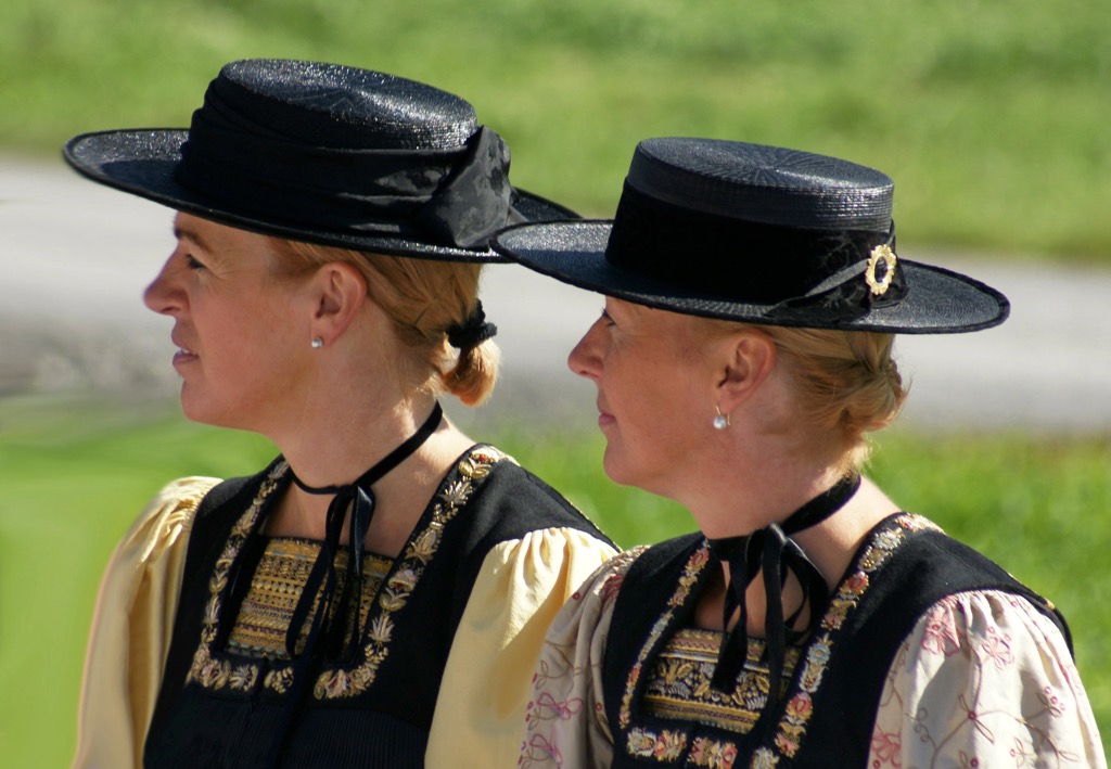
Traditionally, the women of the Bregenz Forest wear a traditional costume, or tracht, called Juppe (d'Juppa), which dates back to the 15th century. The outfit consists mainly of a pleated dress, a bodice, and a hat. It's one of the oldest traditional costumes in the Alpine region.
The village of Schwarzenberg hosts many of the Bregenz Forest's longest-running traditions. For over 400 years, Schwarzenberg has hosted the region's annual cattle parade in mid-September. On September 16, it hosts a traditional market day during which an award is given to the best Alpine cheese at a ceremony in Angelika Kauffmann Hall.
The cuisine of the Bregenz Forest is similar to the rest of Vorarlberg. Cheese is big business in the Bregenz Forest, and the Bregenzerwald Cheese Route is an association of local merchants committed to preserving traditional cheese production.
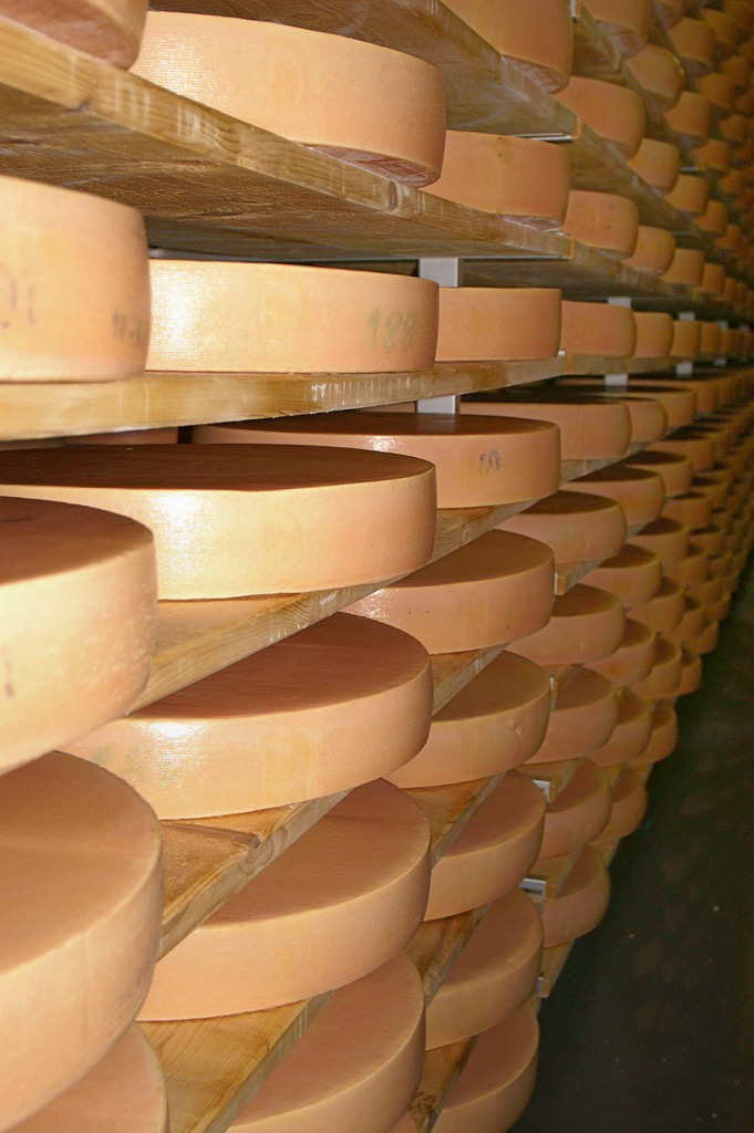
Along the Bregenzerwald Cheese Route, visitors can tour alpine pastures, cheese cellars, and the Alpine Dairy Museum in Hittisau. The most famous cheese in the Bregenz Forest is Vorarlberger Bergkäse, similar to gruyère.
A well-developed trail system and numerous charming mountain huts make the Bregenz Forest Mountains superb for a relaxing hiking vacation.
Ensure you bring appropriate hiking gear and plenty of provisions when exploring the Bregenz Forest Mountains. Map out your route, check weather forecasts, and inform others of your itinerary.
Learn more about the Swiss Alpine Club (SAC) hiking and mountaineering scales referenced in this guide here.
Check out our PeakVisor app for Peak Identification, 3D mapping, personalized route-finding, and adventure tracking, all with our Augmented Reality technology. The app is compatible with most smartphones and serves as your own mountain guide. Best of all, the “Discover” feature allows you to find the best trails in an area, whether planning a trip in advance or from the parking lot when you arrive.
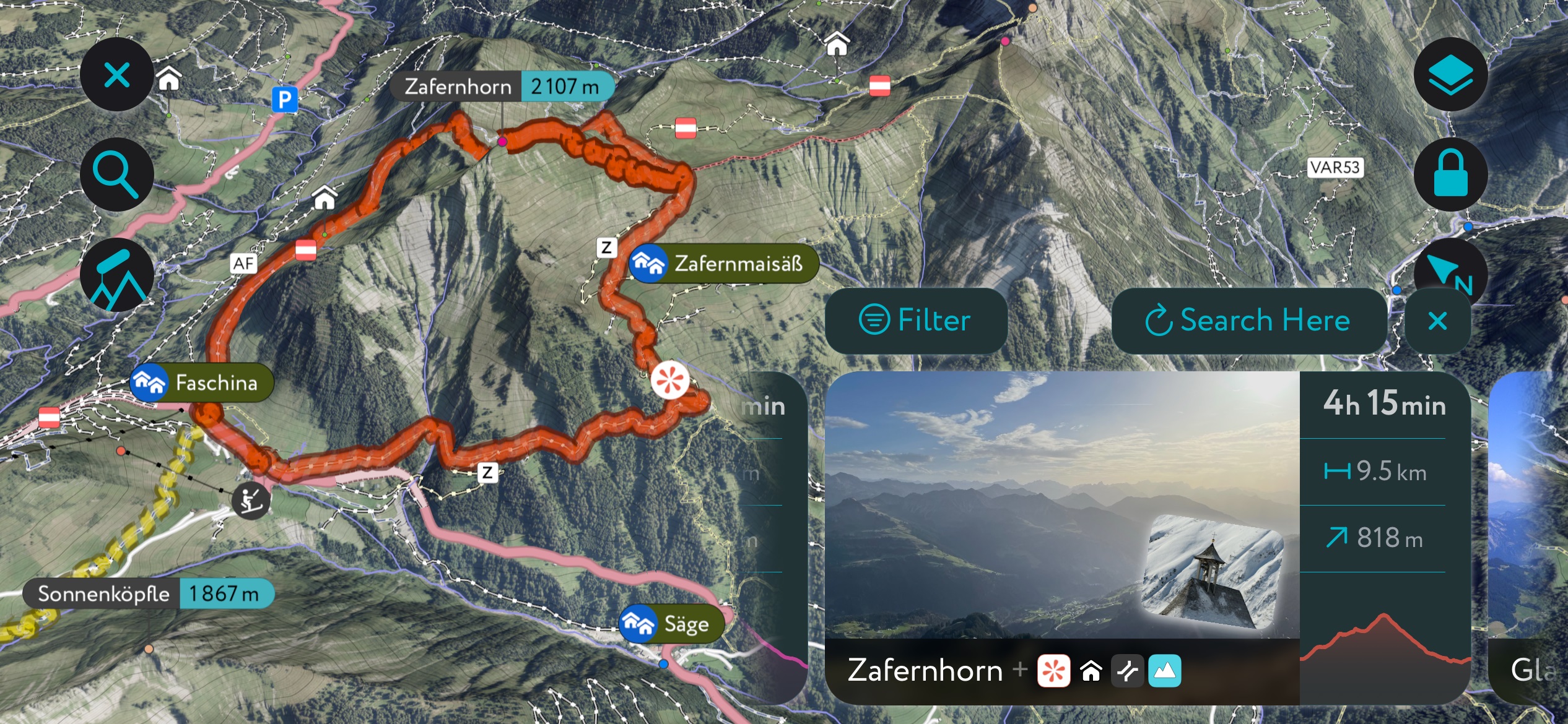
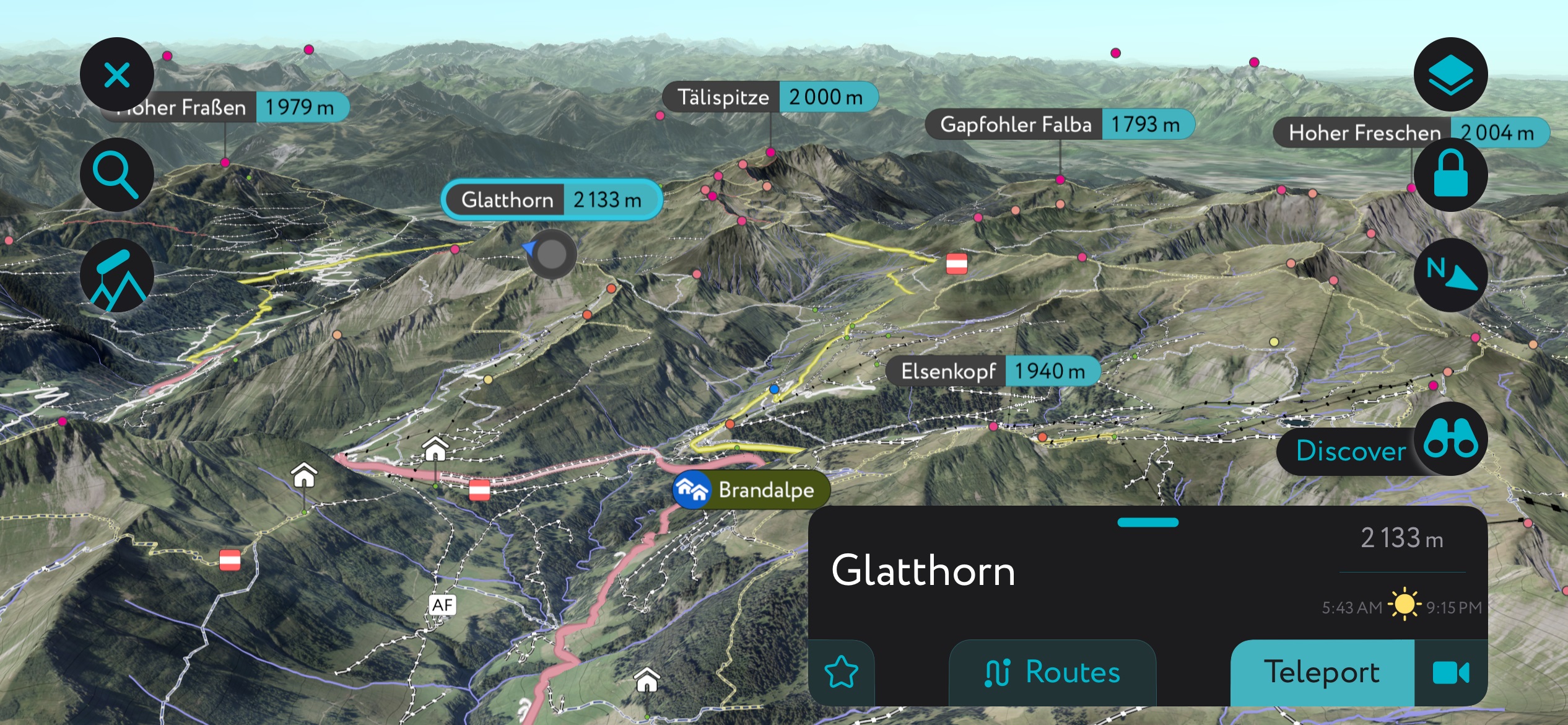
Glatthorn (2,133 m / 6,998 ft) is the highest mountain in the Bregenz Forest Mountains. It sits within the Glatthorngruppe on the range's southeastern boundary with the Lechquellen Mountains.
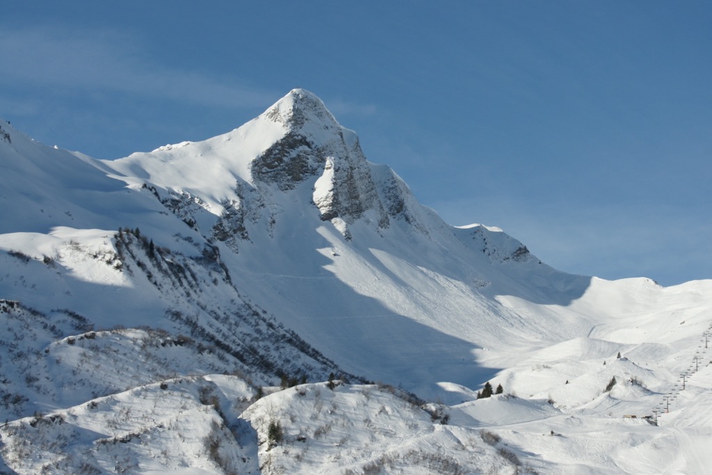
Glatthorn is a beautiful mountain that takes its name from its smooth, dramatic flanks. Glatthorn's summit affords spectacular views of the Damülser Berge - Kanisfluh, the Lechquellen Mountains, and the Allgäu Alps.
The best way to scale Glatthorn is from the Faschina - Fontanella ski area on its north side. From the Bergstation Seilbahn Stafelalpe middle cable car station, follow the flower hiking trail to the Schluchtensattel ridge.
From the Schluchtensattel, you'll walk a short distance across Glatthorn's partially rope-secured flank to reach its summit. This rope section is graded T3 on the SAC hiking scale. Descend via the other side of the east ridge to the Franz-Josef-Hütte (1,706 m / 5,597 ft). This out-and-back trail is approximately 6 km (3.7 mi) in length.
The Kanisfluh is an isolated mountain massif overlooking the Schnepfau and Bregenzer Ach valleys. Its sheer north face and gently rolling southern slopes make it the most iconic mountain in the Bregenz Forest Mountains.
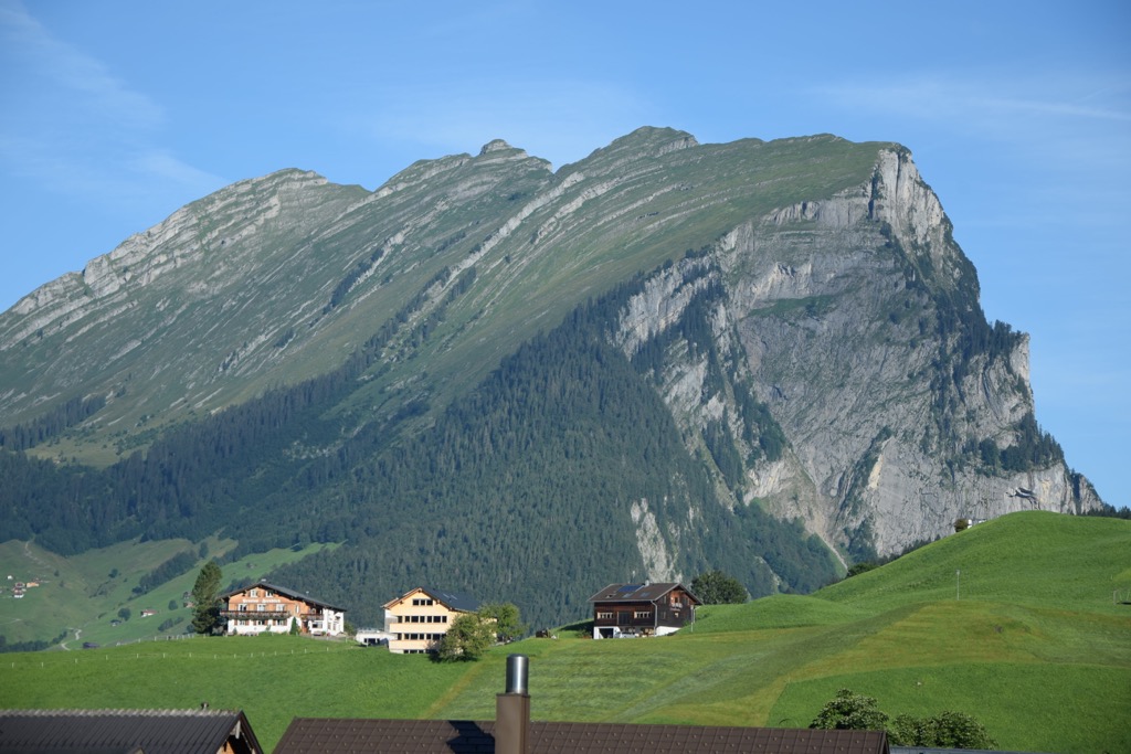
It's located just north of Damülser Berge and consists of four main peaks, from east to west: Sonnenspitz (1,965 m / 6,447 ft), Runder Kopf (2,014 m / 6,608 ft), Holenke (2,044 m / 6,706 ft), and Hoher Stoß (1,937 m / 6,355 ft).
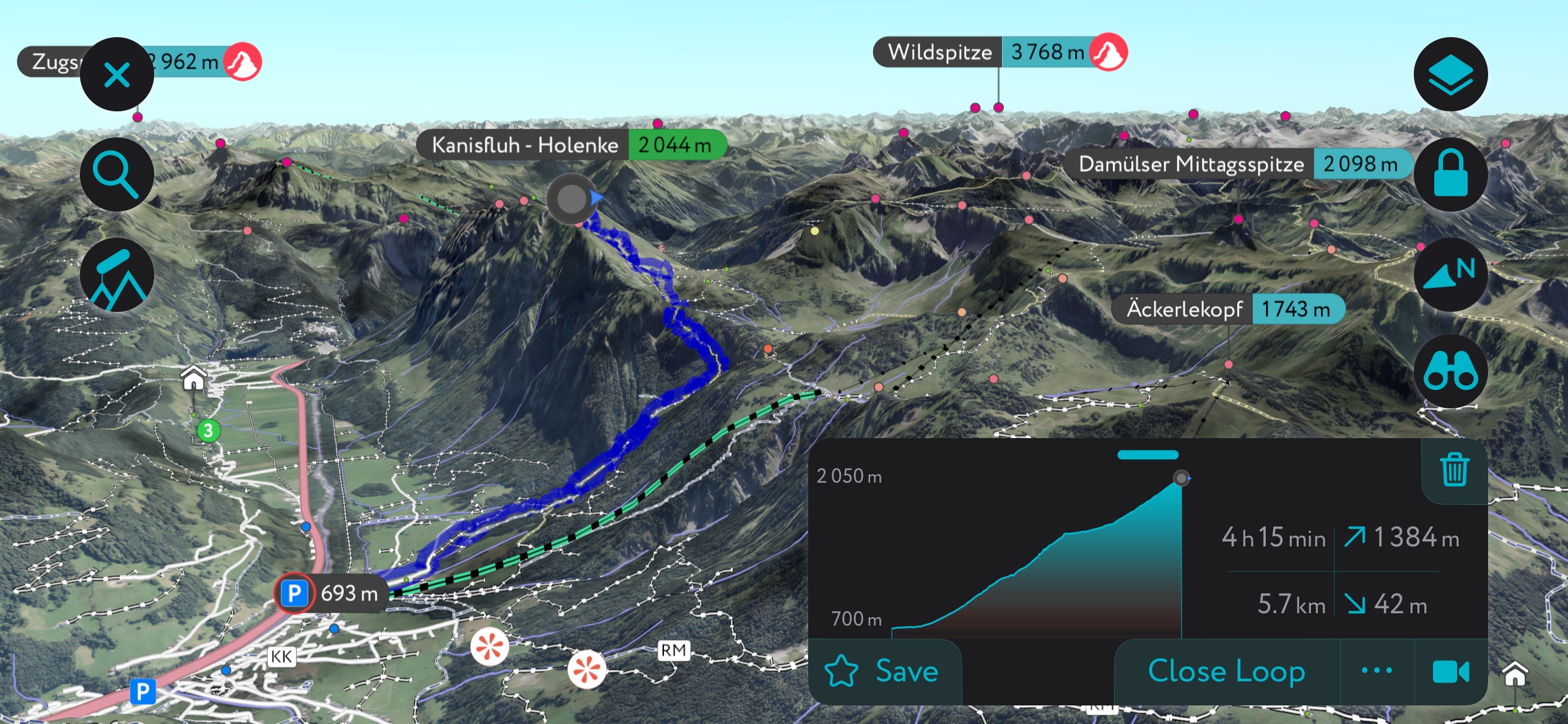
The Kanisfluh's highest summit, Holenke, is reached on a T2-graded hiking trail. The other three summits require considerable mountaineering experience. The most popular route to Holenke starts from the 100-year-old Alpengasthof Edelweiß (1,491 m / 4,892 ft).
The trail circles the mountain's western flank via the Wurzachalpe, where you can stop at the Jausenstation Wurzachalpe (1,622 m / 5,322 ft). The summit of Kanisfluh - Holenke is marked with a cross.
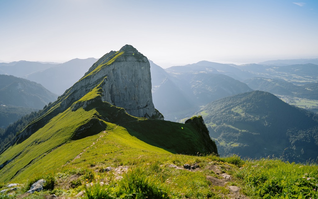
From the summit, views stretch as far as the Arlberg mountains in the Verwall Alps. This out-and-back hike is approximately 5.4 km (3.3 mi) in length.
The highest mountain in the Freschengruppe, Hoher Freschen (2,004 m / 6,575 ft), is the most westerly 2,000er in the Eastern Alps north of the Ill River. Hoher Freschen and neighboring Hohe Matona (1,998 m / 6,555 ft) are among the most popular hiking destinations in the Bregenz Forest Mountains.
There are six different routes up Hoher Freschen of varying difficulty. The most straightforward ascent is from the Freschenhaus (1,846 m / 6,056 ft) to the mountain's south. You can pick up the trail to the Freschenhaus from the Parkplatz Bergtour in Bad Laterns.
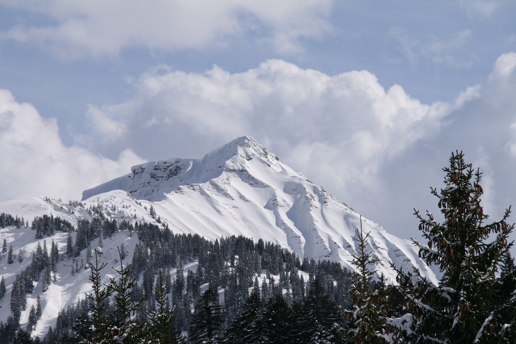
Follow the trail past the Untere Saluveralpe (1,567 m / 5,141 ft) to reach the Freschenhaus. From the Freschenhaus, it's a straightforward 45-minute walk to Hoher Freschen's summit.
The summit of Hohe Freschen provides panoramas of Lake Constance, the Rhine Valley, the Silvretta Alps, the Rätikon, and Säntis 2,502 m / 8,209 ft) in the Appenzell Alps. This out-and-back route is approximately 14.6 km (9 mi) in length.
Damülser Mittagspitze (2,095 m / 6,883 ft) is the highest summit in the Damülser Berge and the third-highest mountain in the Bregenz Forest Mountains.
Like Kunisfluh, Damülser Mittagspitze has a gently sloping southern side and a dramatic north face where different bands of limestone are visible.
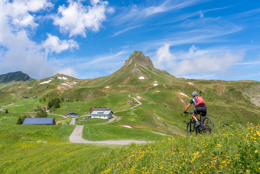
Damülser Mittagsspitze is popular as it offers one of the best views of Lake Constance from the Bregenz Forest. The normal route to Damülser Mittagsspitze starts from the Uga-Lift mountain station at Berggasthof Elsenalpstube (1,828 m / 5,997 ft).
The trail passes the Vordere Ugaaple (1,792 m / 5,879 ft), heading north straight to the summit. A cross marks the summit. You'll descend via Walisgaden to the Uga-lift Valley station. This tour is approximately 5.7 km (3.5 mi) in length.
Winterstaude (1,877 m / 6,158 ft) is the highest and most visited summit in the Eastern Bregenz Forest Mountains. It stands at the heart of the Winterstaudenkamm and is the most prominent mountain in the entire Bregenz Forest Mountains. In winter, Winterstaude is home to a ski area.
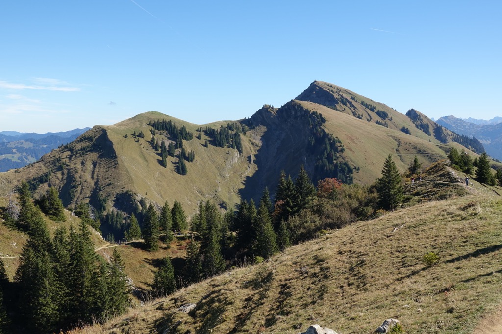
Due to its prominence, Winrerstaude is a somewhat strenuous climb. The best ascent route of Winterstaude is from the Bergstation Baumgarten atop Baumgarten (1,649 m / 5,410 ft).
The trail passes over Hintere Niedere (1,711 m / 5,614 ft) as far as Stongerhöhe (1,778 m / 5,833 ft), where the trail ends. You'll then follow a steep alpine track to the summit of Winterstaude.
The summit of Winterstaude offers sublime panoramas of Lake Constance and back across the Western Bregenz Forest Mountains. You can descend to Bezau from the Mittelstation Sonderdach. This trail is approximately 9.4 km (5.8 mi) in length.
The Northern Alpine Trail 01 (Nordalpine Weitwanderweg 01) is a 1,000 km (621 mi) trail that spans the width of Austria from Lake Neusiedl to Bregenz. It's an alternative route on the E4 European long-distance path and is well-marked with "Österreichischer Weitwanderweg 01" signposts.
The final two stages of the Northern Alpine Trail lead through the Bregenz Forest Mountains. Stage 48 of the Northern Alpine Trail 01 leads from Damüls to the Furkajoch (1,761 m / 5,778 ft) and then Alpe Portla (1,722 m / 5,650 ft). You'll then reach the Freschenhaus before scaling Hoher Freschen.
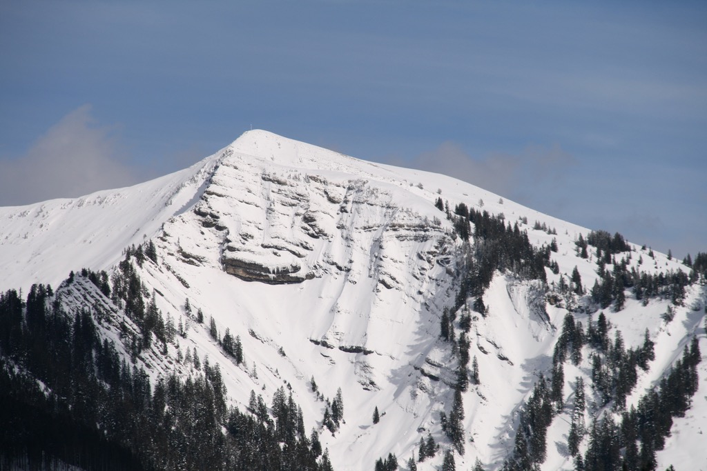
From Hoher Freschen, you'll descend north over the Binnelgrat to reach Binnelalpe (1,726 m / 5,663 ft) and Altenhofalpe (1,560 m / 5,249 ft). You'll walk along ridges over the popular Mörzelspitze (1,830 m / 6,004 ft) before finally descending to the Lustenauer Hütte (1,250 m / 4,101 ft). Stage 48 of the Northern Alpine Trail 01 is approximately 28.6 km (17.7 mi) long.
Stage 49 of the Northern Alpine Trail 01 leads from the Lustenauer Hütte to Bregenz. The trail heads east of Hochälpele and through Oberer Geißkopf village to the summit of Geißkopf (1,198 m / 3,930 ft).
After descending Geißkopf, you'll pass through Alberschwende and below Schneiderkopf (971 m / 3,186 ft) on the way to Bregenz. Stage 49 of the Northern Alpine Trail 01 is approximately 25.4 km long.
Home to the 'snowiest village of the world' and one of the largest ski areas in Vorarlberg, the Bregenz Forest Mountains provide plenty of pistes to enjoy come winter.

There are four noteworthy ski areas in the Bregenz Forest Mountains:
The Bregenz Forest Mountains are ideal for ski touring and snowshoeing, whether you're a beginner or an expert.
The Bregenz Forest Mountains are at the heart of one of our most thoroughly mapped areas, with hundreds of ski tours and hiking trails to discover across the Alps on the PeakVisor App.
Here are a few of the best ski tours in the Bregenz Forest Mountains and new features on the PeakVisor App’s winter mode that make it perfect for planning your next winter getaway.
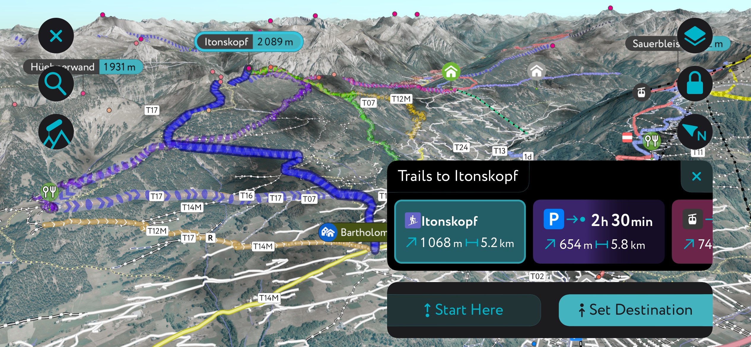
Hirschberg is the highest mountain in the Bizauer Hirschberg subgroup. Formerly the site of a small ski area, it's now popular with ski tourers of all abilities.
The best ski tour on Hirschberg starts from the Parkplatz Hirschberg Lift near Bizau. The route takes you up relatively steep slopes through spacious and peaceful forests. The ski tour ends at the former mountain station on Hirschberg's summit.
This tour of Hirschberg is approximately 7.9 km (4.9 mi) in length.
Hochälpelekopf (1,464 m / 4,803 ft) is the highest summit in the Hochälpele - Weißenfluh Group. Located on the Bregenz Forest Mountains' main ridge, Hochälpelekopf is easily accessible and great for a quick tour. The summit provides idyllic views across the Bregenz Forest Mountains and Lake Constance.
This ski tour of Hochälpelekopf starts from the Haldenlifte Schwarzenberg. The ascent leads through the Bödele ski area. At the summit, you can take a break at the Hochälpelehütte (1,460 m / 4,790 ft).
This tour is approximately 5.1 km (3.2 mi) in length.
We've been steadily tweaking and improving the PeakVisor App to make it the ultimate companion app for mountain adventures.
You can now get the latest weather reports, including information on snow depths. Plus, there are up-to-date details on local mountain huts, including opening hours, dining options, and overnight stays.
Many of Vorarlberg's largest towns and cities are within the Bregenz Forest, making the area convenient for hiking and skiing.
Zurich International Airport is the closest international airport to the Bregenz Forest Mountains, located 125 km (78 mi) from Bregenz.
Friedrichshafen Airport is the nearest major regional airport to Bregenz Forest Mountains, located 34 km (21 mi) from Bregenz. Another smaller regional airport, St. Gallen – Altenrhein Airport, is 23 km (14 mi) from Bregenz.
Bregenz is the capital of Vorarlberg. It's the third-largest settlement in the state, with a population of around 30,000 people. It's located on the southeastern shores of Lake Constance, less than 5 km (3 mi) north of the Bregenz Forest Mountains.
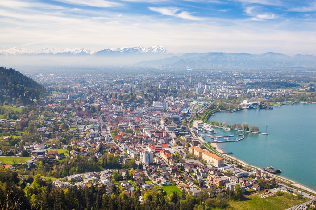
Bregenz is a picturesque, sleepy town where the top activities include strolling along the lakeside promenade and touring the Bregenz Art Museum.
The best time to visit Bregenz is in July and August during the Bregenz Festival, where you can catch an opera or orchestral performance on a large floating stage on Lake Constance.
While in Bregenz, visit the summit of Pfänder (1,064 m / 3,491 ft), one of the finest lookouts in the region.
Dornbirn is Vorarlberg's largest city, with a population of nearly 50,000. It's located near the center of the Bregenz Forest Mountains with the Alpine Rhine Valley, roughly 5 km (3 mi) west of the range's main ridge.
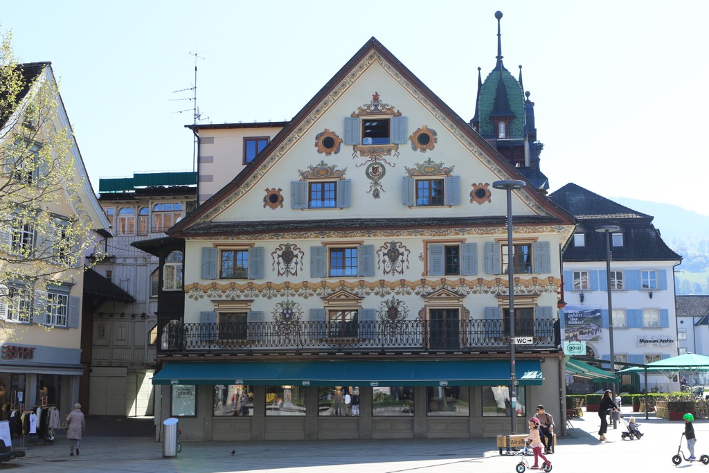
Dornbirn is one of Vorarlberg's modern cultural centers and is home to over half a dozen museums. One of the top attractions is the Mohren Brewery, which opened in 1834 and is the oldest in Vorarlberg.
Dornbirn is also a major transport hub for the Vorarlberg Railway, with four train stations connecting Dornbirn to Bregenz, Lindau, Feldkirch, and Bludenz.
Popular mountains within 15 km (9 mi) of Dornbirn include Karren (971 m / 3,186 ft), Hochälpelekopf (1,464 m / 4,803 ft), and Hoher Freschen (2,004 m / 6,575 ft).
Explore Bregenz Forest Mountains with the PeakVisor 3D Map and identify its summits.


