Scan the QR code and open PeakVisor on your phone
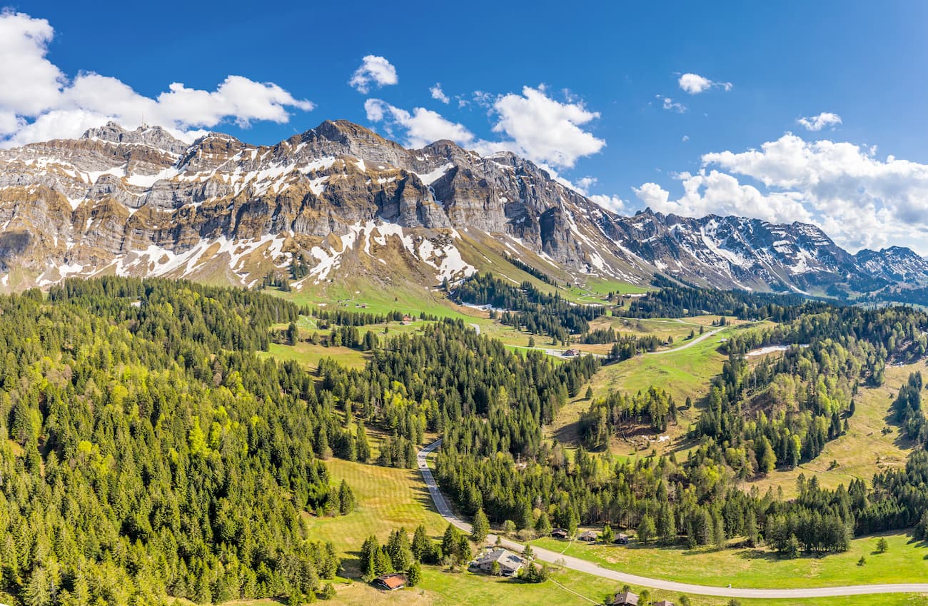
This is the case when size does not matter! The canton of Appenzell Innerrhoden is the smallest canton of Switzerland by population and the second smallest by area. The only smaller one is the canton of Basel-City. Nevertheless, Appenzell Innerrhoden scores 65 mountains with Säntis (2,509 m) being the highest and the most prominent of them. Säntis is the culmination point of the Alpstein massif and the 4th most prominent mountain in Switzerland.
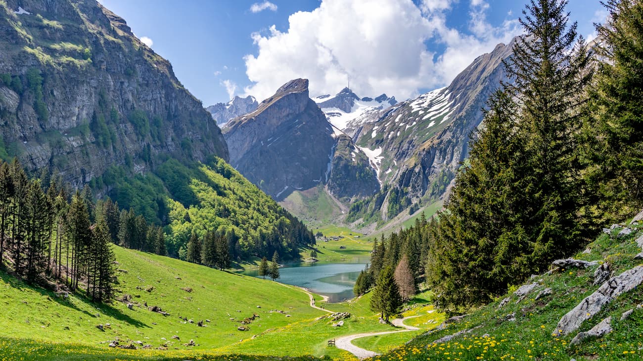
Prominent summits in Switzerland oftentimes boast panoramas covering four countries. Apart from Switzerland one can see Austria, Lichtenstein, and Germany from the same focal point. The picturesque landscapes of this region are always in the top lists of Swiss postcard quality photos. In a way, no visit to Switzerland is complete without a hike in the Appenzellerland.
Geologically, the Alpstein massif differs from the predominantly granitic central Alps. The Alpstein is predominantly made of limestone and represents a western continuation of the eastern ranges running between Germany and Austria.
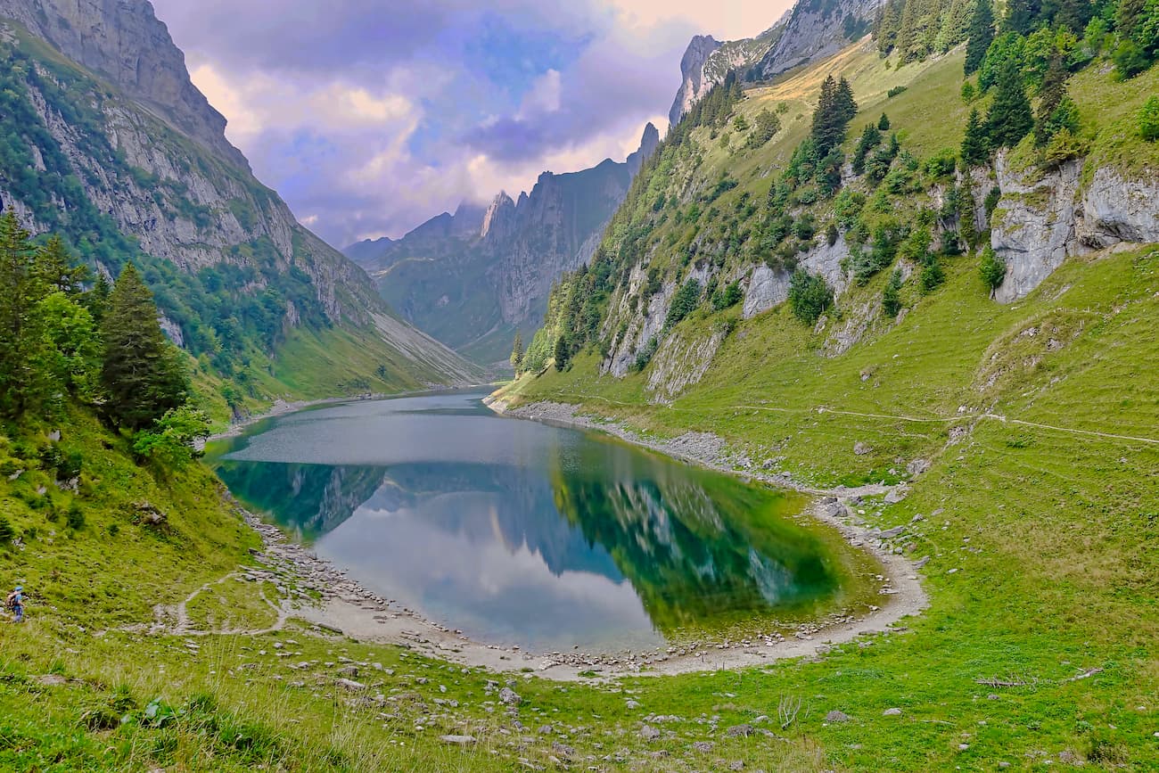
Interestingly, two of the three lakes have no surface drainage. The waters of Fälensee and Sämtisersee drain into the Rhine river underground which happens due to erosions, numerous cracks, caves and sinkholes which are frequent phenomena in the soft limestone.
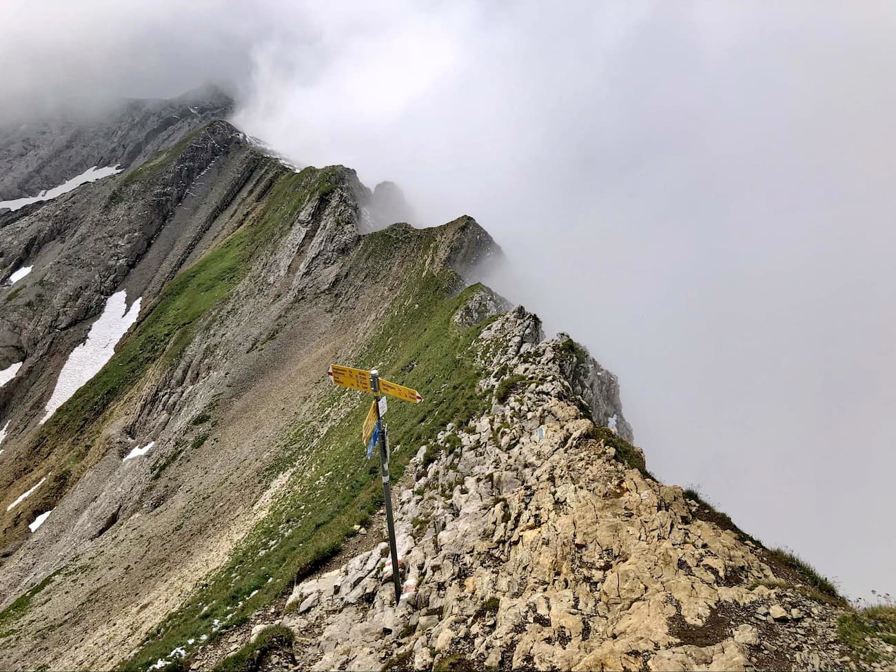
There are three main tectonic folds running in parallel from southwest to northeast. Only the Lisengrat Ridge, a popular hiking route which connects Altmann (2,423m) with Säntis runs perpendicular to the main ridge direction.
If you know German, the Geology trail will be the best way to dive deeply into the science of the Alpstein massif formation.
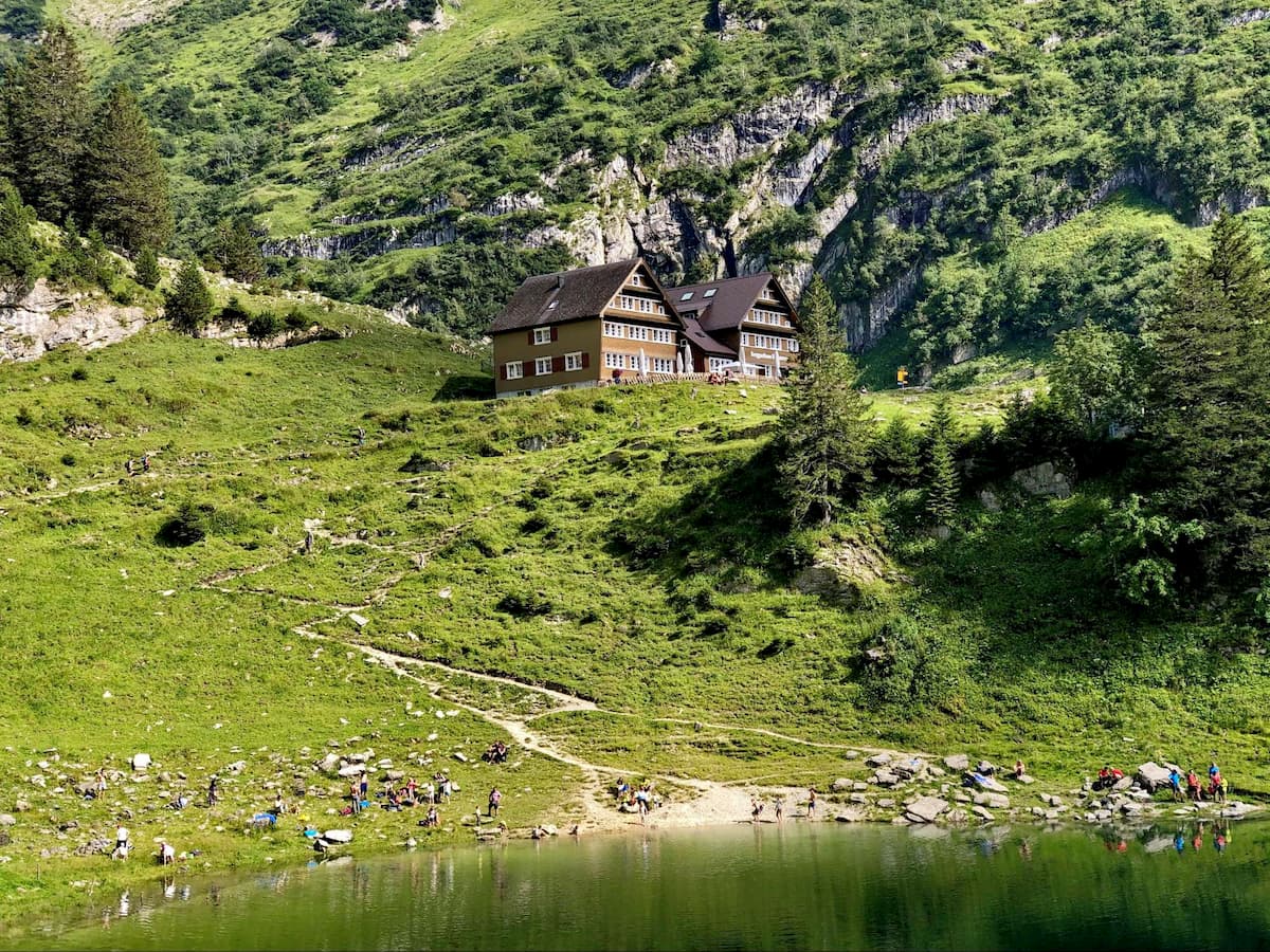
Despite being the second smallest canton, Appenzell Innerrhoden doesn’t disappoint outdoor enthusiasts. It offers ample recreational opportunities. In addition to the three picturesque alpine lakes, 25 mountain inns, and six cable cars, the canton has the densest network of hiking trails in Switzerland.
Tip: Use PeakVisor Travel Book to check-in in all 25 mountain huts to complete the Appenzell Innerrhoden Mountain Hut Challenge!
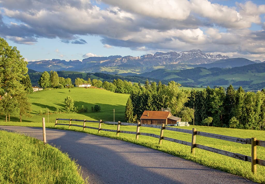
Outdoor enthusiasts can choose from countless hiking trails ranging from a simple afternoon walk to a challenging mountain climb. Additionally to the rocky Alpstein massif, there are gently rolling hills which are ideal for valley hikes. Different themed hiking trails are available such as a barefoot trail, a geological trail, etc. Finally, to relax and immerse oneself into the stunning landscapes, there over 400 benches with stunning views in Appenzell Innerrhoden.
The only way to go wrong when hiking in the Appenzellerland is to end up on an alpine trail of high technical difficulty. To prevent such a mistake there are a great many direction stands, so you can always have a choice where to proceed. Just keep an eye for the blue trail indicators describing technical difficulties and thrillingly exposed route sections.
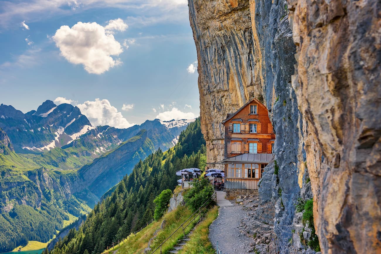
Ebenalp is the northernmost summit of the Appenzell Alps located on the end of a scenic ridge. Attracting up to 200,000 visitors, it is one of the most popular places in Switzerland thanks to the convenient cable car running from Wasserauen and the Aescher guesthouse - a mountain hostelry embedded into the sheer rock face. Being captured a thousand times on postcards and online articles about Switzerland, it has become a synonym of Swissness. The guesthouse in its present form has existed since 1860 and is one of the oldest mountain guesthouses in Switzerland.
There are many itineraries starting from Ebenalp depending on the time available and skill level. Experienced hikers might opt in for a thrilling ridge traverse to Santis. It is a 9km hike one way with almost 1500m of elevation gain and a couple of brief exposed sections. It will take at least 6 hours to reach the top of the Alpstein. It is advised to start early in the morning. The backtrip can be done through the middle ridge down to Meglisalp guest house and Schutzhutte Schrennen mountain hut. Stunning views are guaranteed.
Packed with stunning views, scenic rock formations, and thrilling passages, this day hike is my favorite in the Alpstein. You start with taking the only cable car from the Rhine Valley (Frumsen) to the Alpstein (Staubern guesthouse). A very convenient schedule from 7 a.m. to 10 p.m. allows for great flexibility in your adventures.
The first part of the trail follows the geology trail and is a ridge walk to Kreuzberg via the Saxerlücke famous for stunning photo opportunities thanks to the impressive Sax-Schwende Fault where you can see a staggering displacement of the ridge by a couple of hundred metres.
From there, the trail ascends along the teeth-like ridge of Kreuzberg peaks conveniently counted from 1 to 8 and reaches the panoramic summit of Mutschen (2,121m). After a brief pause to appreciate the geological features of Kreuzberg, the scenic Rhine Valley, Liechtenstein and Austria, it is time to proceed to Zwinglipasshutte for lunch. This little known mountain hut located at 1,999 m a.s.l. has won my heart with a delicious meal at a fraction of the cost (at least as compared to other Swiss places).

Altmann (2,423m), the third highest peak of the Alpstein, is the culminating point of the trail. The final pitch requires some climbing that is considered to be ‘easy’. Those uncomfortable with climbing or in case of weather not permitting can skip the summit and descend from Altmannsattel to Fahlensee and finally to Staubern.
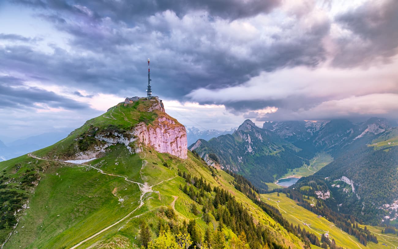
Hoher Kasten (1,782m) can be easily reached with a cable car starting at Brulisau. Located in a distance from main Alpstein ridges, the surrounding area boasts arguably the best panoramic views of the sunrise. Popular hikes include a brief trip to Kamor (1,742 m) reachable in less than half an hour and a much more demanding 5km ridge traverse to Staubern guesthouse. From there instead of returning the same way, you can make a loop and descend to Falensee and Samtisersee. Both lakes have no surface drainage.
The King’s Route or the Royal Tour of the Alpstein massif boasts all the royal qualities. A multi-day trek covers three major mountain chains, 84km (52 miles) and 5,166 metres (16,948 ft) of elevation gain. The trek follows the most popular sights through an outstandingly picturesque trail. The distance guarantees countless stunning panoramas. The route is dotted with 27 mountain huts, so you can travel light.
Königsroute is suitable not just for ambitious, high-performance athletes but also for more leisurely walkers. Most alpine huts also offer comfortable accommodation and, if desired, travelers can leave out route sections or bypass them with several cable cars.
This is the best itinerary to get a complete overview of the Appenzellerland in 3 to 5 days.
Another prominent mountain especially suited for sunset delight is Kronberg (1,659 m). It can be accessed with a cable car and while waiting for the evening sun to hit the steep north face of the Alpstein Ridge, you can hike to lower summits of Hoch Petersalp (1,569 m) and Spitzli (1,513 m) to the west or Chlosterspitz (1,321 m) to the east.
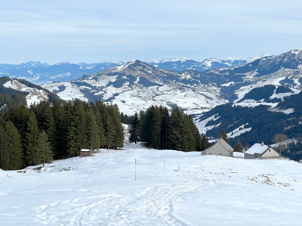
For skiing and snowboarding enthusiasts, there are more than 10 ski resorts in Appenzell Innerrhoden, which it shares with the neighboring Appenzell Ausserrhoden.
The largest ski resort in Appenzell Innerrhoden is Skigebiet Ebenalp Horn (Luftseilbahn Wasserauen-Ebenalp) with more than 10 km (6 mi) of slopes and more than 5 ski lifts. Other smaller areas for skiing in Appenzell Innerrhoden include Sollegg–Appenzell, Grub-Kaien, and Alpsteinblick–Gonten. These are also the main ski resorts near Appenzell—the capitals of the canton.
Check the Appenzell Innerrhoden ski resorts map on the larger Switzerland ski resorts map in the World Mountain Lifts section of the site. It includes information about open ski lifts / slopes in Switzerland in real-time with opening dates and hours. There are also year-round cable cars, funiculars, cog railways, aerial tramways, and all other types of mountain lifts.
Most of the accommodation options are evenly distributed throughout the area of the canton with a cluster in Appenzell - the capital village.
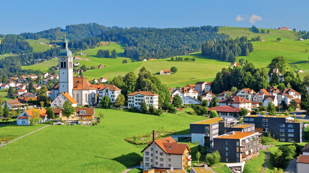
Home to about 6,000 inhabitants, the canton capital Appenzell is a lovely village surrounded by picturesque rolling hills and the rocky Alpstein massif in the background that seems to be rising from nowhere. It is best known for its rural culture and lifestyle. It is not uncommon to hear folk music and see rustic dances here. The local houses are also distinctive featuring painted façades and barns. Whether you stay here or in one of many guest houses scattered across the canton Appenzell, the village is worth a relaxed stroll.