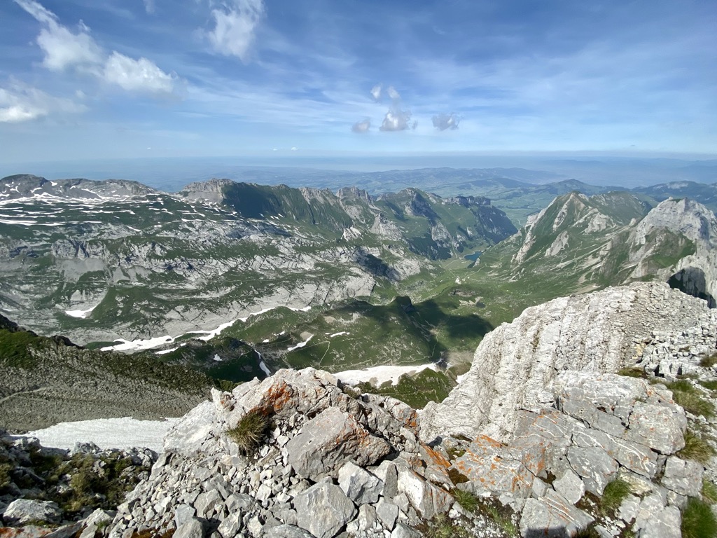
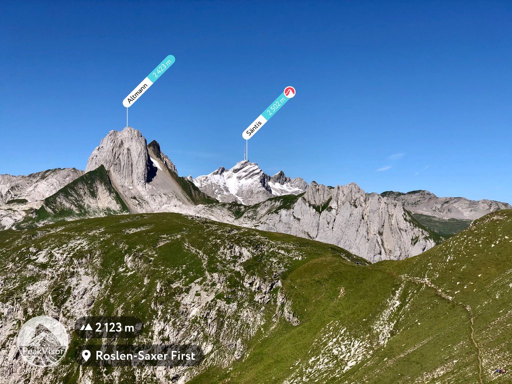
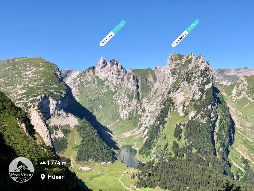
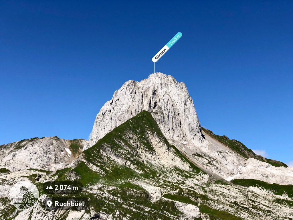
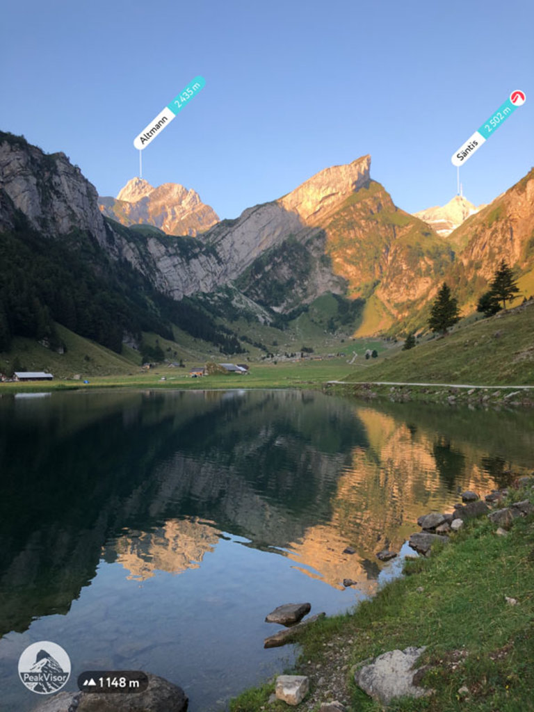
The Altmann is a mountain in the Appenzell Alps, located on the border between the cantons of Appenzell Innerrhoden and St. Gallen. It is situated in the massif of the Alpstein north of Wildhaus (St. Gallen), a few kilometres from the Säntis.
The Altmann is a steep limestone tower, which rises about 1000 metres over the valleys of the Alpstein. The normal route starts at Rotsteinpass (2,120 metres) on the north-west side and is considered an easy climb.
There's a demanding alpine trail (T5) leading to the summit.
The nearest mountain hut is Berggasthaus Rotsteinpass located 624m/2 048ft WNW of the summit.
By elevation Altmann is
# 3 out of 69 in Appenzell Innerrhoden # 2 out of 133 in Wahlkreis Toggenburg
By prominence Altmann is
# 75 out of 1882 in the Swiss Prealps # 4 out of 69 in Appenzell Innerrhoden # 5 out of 133 in Wahlkreis Toggenburg
We use GPS information embedded into the photo when it is available.
3D mountains overlay
Adjust mountain panorama to perfectly match your photos because recorded by camera photo position might be imprecise.
Move tool
Rotate tool
Zoom
More customization
Choose which peak labels should make into the final photo and what photo title should be.
Next
Photo Location
Satellitte
Flat map
Relief map
Latitude
Longitude
Altitude
OR
Latitude
°'''
Longitude
°'''
Apply
Register Peak
Peak Name
Latitude
Longitude
Altitude
Register
Teleport
PeakVisor
This 3D model of Sagarmatha National Park in Nepal was made using the PeakVisor app topographic data. The mobile app features higher precision models worldwide, more topographic details, and works offline. Download PeakVisor maps today.
Download OBJ model
PeakVisor
The download should start shortly. If you find it useful please consider supporting the PeakVisor app.
PeakVisor for iOS and Android
Be a superhero of outdoor navigation with state-of-the-art 3D maps and mountain identification in the palm of your hand!