
Scan the QR code and open PeakVisor on your phone
The Silvretta Alps include 329 named peaks. The highest is Piz Linard at 3,410 m. Other notable peaks include Fluchthorn, Mittleres Fluchthorn and Nördliches Fluchthorn.
Spanning the Austrian-Swiss border, the Silvretta Alps are among the best backcountry skiing and mountain-climbing areas in the Western Rhaetian Alps. There are 329 named peaks in the Silvretta Alps; the highest and most prominent is Piz Linard (3,410 m / 11,187 ft).
The Silvretta Alps are split between Switzerland's Grisons (Graubünden) canton and Austria's western states of Vorarlberg and Tyrol (Tirol). Most of the Silvretta Alps lie within Switzerland, with Dreiländerspitze (3,197 m / 10,488 ft) serving as the tri-border point between the Grisons, Tyrol, and Vorarlberg.
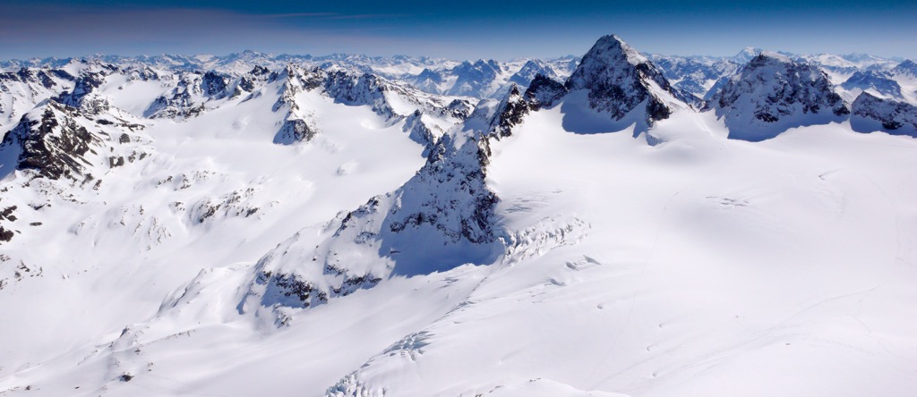
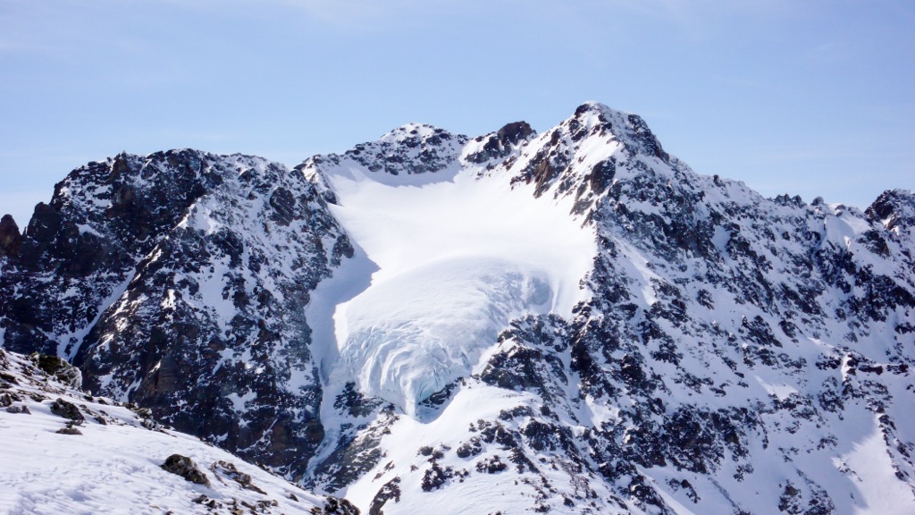
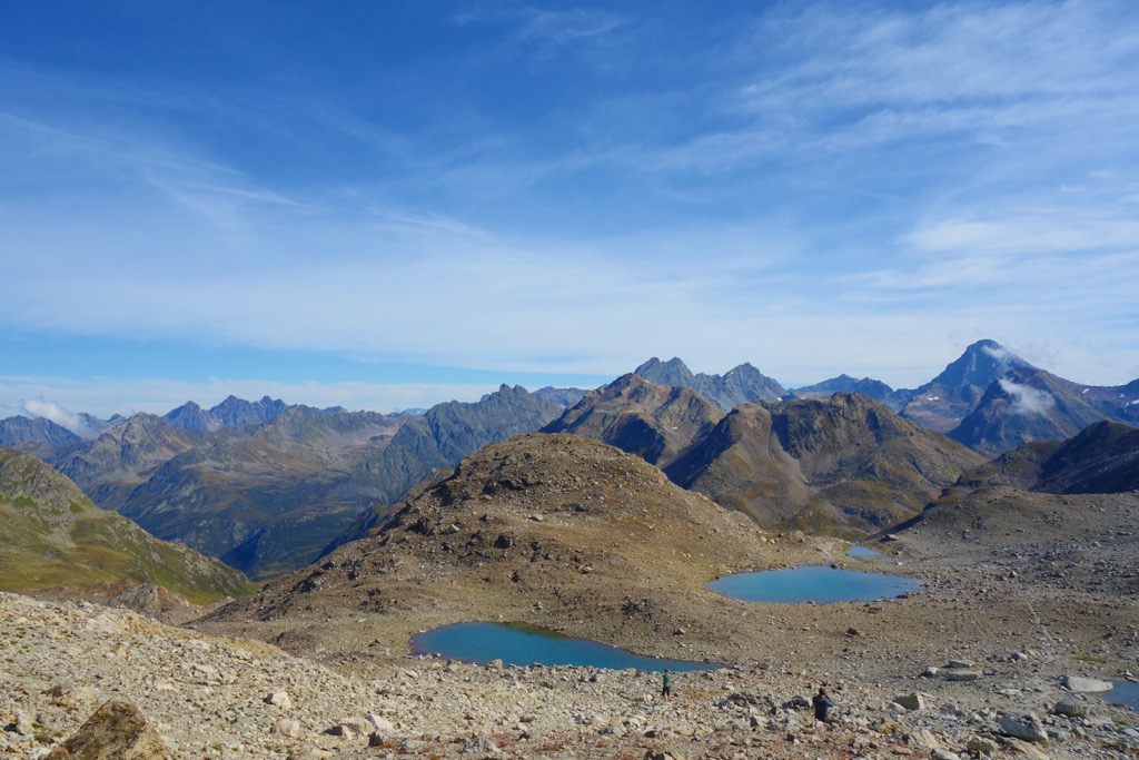
Over 50 named summits in the Silvretta Alps exceed 3,000 m (9,842 ft) in elevation, and there are around 85 glaciers in the range. The sheer number of 3,000ers and glaciers in the Silvretta Alps have earned it the nickname "Blue Silvretta."
Six mountain ranges encircle the Silvretta Alps. The Plessur Alps and the Rätikon Group are west of the Silvretta Alps. To the east are the Sesvenna Alps and Samnaun Alps. To the north are the Verwall Alps, and to the south are the Albula Alps.
The Silvretta Alps are a relatively large, rectangular mountain group. They stretch for roughly 40 km (25 mi) from Ischgl in the northeast to Davos in the southwest and for 38 km (23.5 mi) from Sankt Gallenkirch in the northwest to Ramosch in the southeast.
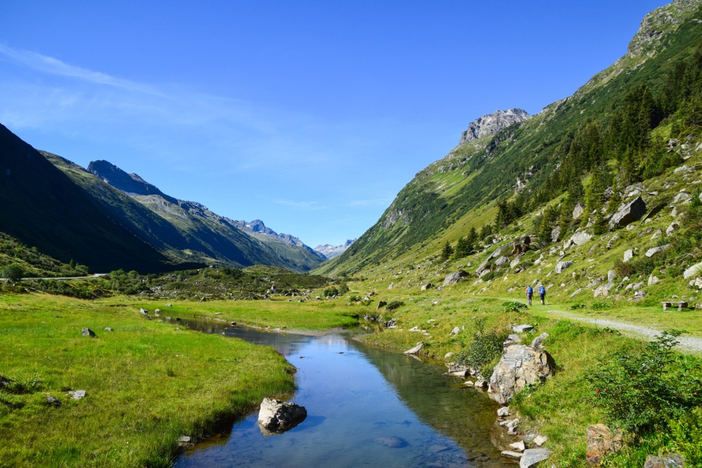
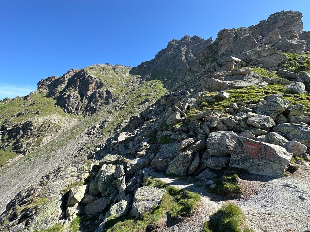
Several valleys are tucked away between the Silvretta's Alps' sub-groups, including the Montafon, Paznaun, Val Sinestra, the Jamtal, the Ochsental, and the Schlappintal.
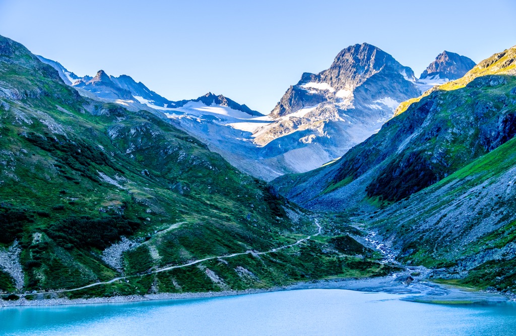
Several notable rivers flow through the Silvretta Alps, including the 38 km (24 mi) long Landquart River and the 72 km long (45 mi) Ill River, a Rhine tributary. The Silvretta Stausee reservoir is the largest body of water in the Silvretta Alps, with a surface area of 1.3 sq km (0.5 sq mi).
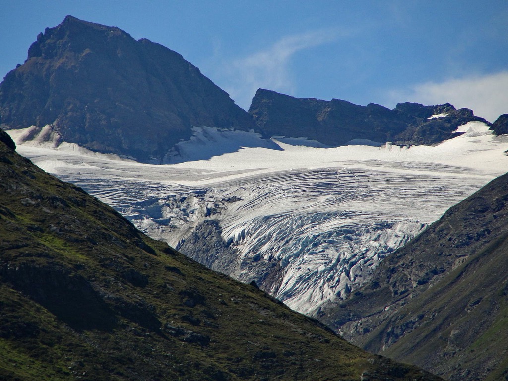
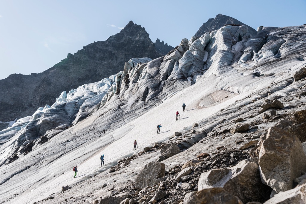
At 2.7 sq km (1 sq mi) in area and 3.2 km (2 mi) in length, the Silvrettagletscher (2,815 m / 9,236 ft) is the largest glacier in the Silvretta Alps. Measured at 3.35 sq km (1.3 sq mi) in 1973, the Silvretta Glacier is shrinking rapidly (25% decline in surface area).
As the highest mountain group in the region, the Silvretta Alps are subjected to a large amount of snowfall, especially on Piz Buin (3,312 m / 10,866 ft) and Piz Linard. Due to high snowfall, the Silvretta Alps are very popular for winter sports and home to some of the finest ski destinations in the Rhaetian Alps. Notable resort towns and villages in and around the Silvretta Alps include Davos, Klosters, Ischgl, and Galtür.
The Silvretta Alps can be divided into ten sub-groups. Piz Buin, part of the Silvretta Main Ridge, is considered the geographical center of the Silvretta Alps.
The Silvretta Main Ridge meanders from east to west along the Austrian-Swiss border. Piz Linard, part of the Linard Group, is located southwest of the Silvretta Main Ridge. Most of the highest and best mountains in the Silvretta Alps are part of the Silvretta Main Ridge.
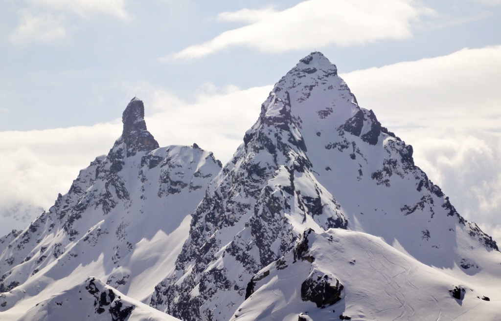
Fluchthorn (Piz Fenga) (3,397 m / 11,145 ft), the second-highest summit in the Silvretta Alps, is located in the Fluchthorn Group in the range's northeastern corner. The Vallüla Group to the north is the lowest and smallest group in the Silvretta Alps.
Here's a list of each sub-group from north to south with their highest summits:
The Silvretta Alps began forming roughly 66 million years ago during the Alpine Orogeny. At the end of the Late Mesozoic, the African, Arabian, Indian, and Cimmerian tectonic plates to the south collided with the Eurasian plate to the north. Convergent movement between these plates helped create the Alps, including the Silvretta.
The Alpine Orogeny is a relatively recent mountain-building event that's ongoing in some parts of the Alps. As well as the Alps, the Alpine Orogeny helped form mountain ranges across the Eurasian continent, including the Himalayas, the Caucasus, the Carpathian Mountains, and the Atlas Mountains.
The Silvretta Alps are a part of the Rhaetian Alps and the wider Central Eastern Alps. The Silvretta Alps differ from the adjacent Western Alps as they primarily consist of crystalline rocks, metamorphic rocks, and granites instead of limestones and sandstones.
Piz Buin comprises crystalline and metamorphic rocks, mostly gneiss and light granite. By comparison, Piz Linard and Fluchthorn are similar and made up of hornblende gneiss and schists.
The Silvretta Alps' mixed forests, high Alpine pastures, and verdant river valleys are home to a broad variety of wildlife.
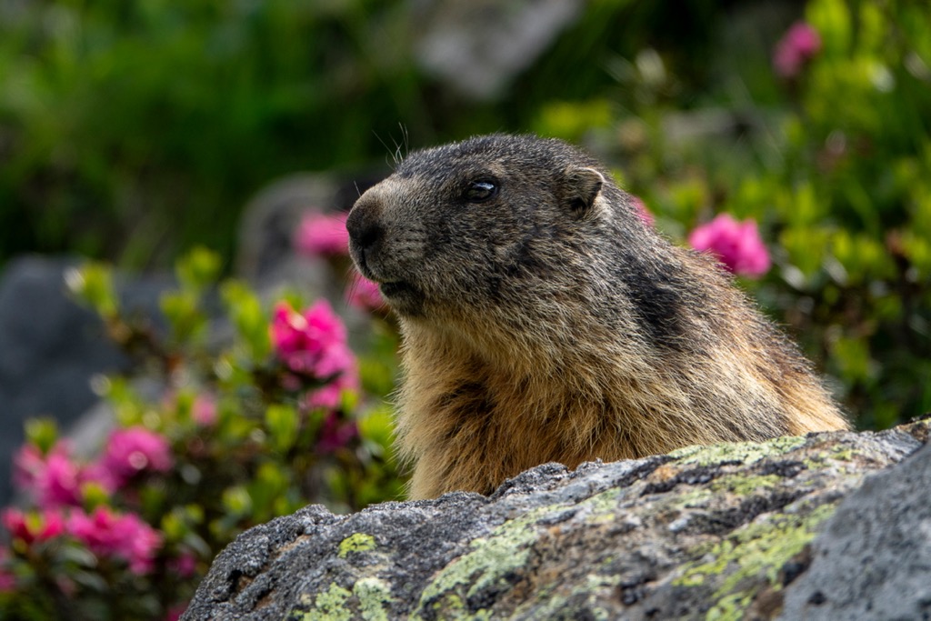
Approximately 80 mammal species inhabit the Alps. Common mammal species within the Silvretta Alps include roe deer, marmots, ibex, and chamois. The last brown bear in Switzerland died in 1904. Since then, brown bears have been reintroduced to northern Italy but rarely visit the Silvretta Alps.
Golden eagles, once on the verge of extinction, now nest across the Silvretta Alps and surrounding mountain ranges. They're still rare, with only six pairs recorded in the nearby Swiss National Park.
Other notable bird species that inhabit the Silvretta Alps include black grouses, bearded vultures, peregrine falcons, nutcrackers, and ptarmigans.
Common European adders are the only venomous snake species in the Silvretta Alps. They can be found in boulder fields as high as 3,000 m (9,842 ft). Other amphibian and reptile species in the Silvretta Alps include common lizards, grass frogs, and Alpine newts.
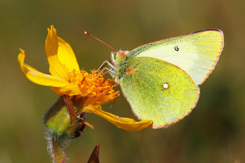
The pastures and forests of the Silvretta Alps boast a surprisingly diverse population of insect species. Many butterfly species, like clouded apollos, mountain clouded yellows, and false heath fritillaries can be spotted across the landscape.
The Silvretta Alps' forests change in composition depending on elevation. Larches, firs, and Norway spruces are most common at up to 2,200 m (7,217 ft). Hardier trees thrive higher up the mountains, like Arolla pines that withstand -40 °C (-40 °F).
Above the tree lines, the forests make way for shrublands and alpine pastures. Common shrubs found at higher elevations in the Silvretta Alps include mountain juniper, dwarf willows, and Daphne striata.
A surprisingly wide variety of flowering plant species grow high up in the Silvretta Alps. Endemism among plant species is high across the Alps; around 400 plant species are endemic.
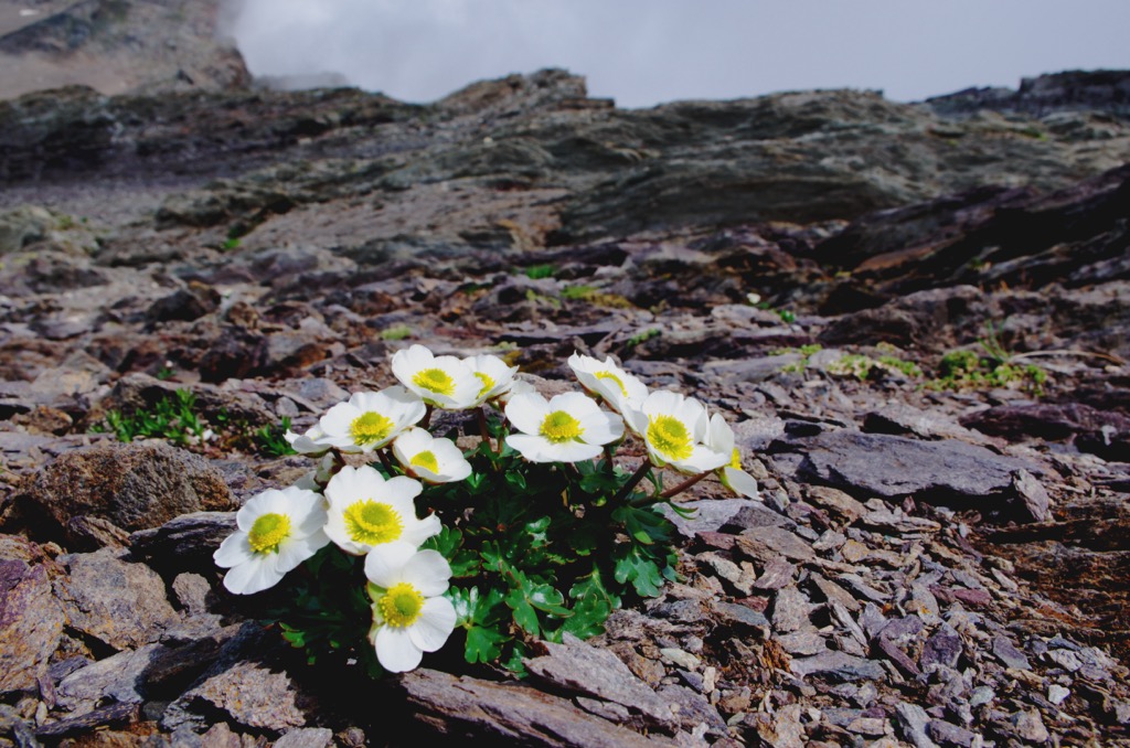
Common flowering plants that grow across the Silvretta Alps' alpine pastures include Switzerland's national flower, edelweiss, rock jasmine, Rhaetian poppies, and pygmy buttercups.
Glacier crowfoot, also known as glacier buttercups, are among the highest flowering plants in the Alps. They can be found flowering at elevations of up to 4,000 m (13,123 ft).
Piz Buin, the Silvretta Alps' most famous mountain, was first summited on July 14, 1865, by Joseph Anton Specht and Johann Jakob Weilenmann.
Accompanied by local guides Jakob Pfitscher and Franz Pöll, Weilenmann and Specht reached Piz Buin's summit via Buinlücke (3,051 m / 10,013 ft) on the mountain's west flank. They descended by returning to Buinlücke before heading to the Fuorcla dal Cunfin (3,043 m / 9,984 ft) on the saddle south of Signalhorn (3,210 m / 10,531 ft).
A well-known and prolific Swiss mountaineer, Weilenmann is credited for scaling many significant summits across the Alps, including Muttler (3,294 m / 10,810 ft), Mont Blanc de Cheilon (3,870 m / 12,697 ft), and Helsenhorn (3,273 m / 10,738 ft). Three years earlier, Weilenmann and Franz Pöll became the first people to reach Fluchthorn's summit.
The first recorded ascent of Piz Linard was several decades earlier than Piz Buin and Fluchthorn. On August 1, 1835, geologist and naturalist Oswald Heer, with local guide Johann Madutz, reached Piz Linard's peak.
However, local legends suggest that Piz Linard's summit had been visited centuries earlier. The earliest recorded mention of Piz Linard was in 1573 by local historian Ulrich Campell.
Campell refers to the Piz Linard as 'Pitz Chünard,' named after a legendary local hunter, Conrad, who supposedly conquered the mountain, carrying a large gold cross on its summit.
The Silvretta Alps' are famed for their backcountry skiing opportunities. American writer Ernest Hemingway lived in Schruns in the Rätikon Group during the 1920s and frequently skied across the Silvretta Alps. Hemingway wrote two short stories about skiing in the Silvretta Alps, which appear in his memoir, A Moveable Feast.
Piz Buin has become world famous due to the sunscreen brand of the same name. Piz Buin's headquarters are located in Vorarlberg.
The Silvretta Alps encompass some of the highest mountains in the region and are subject to snowfall year-round.
Ensure you bring the correct hiking equipment and plenty of provisions in the Silvretta Alps. Check local weather forecasts, thoroughly map out your route, note nearby mountain huts, and inform others of your itinerary.
Located at the heart of the Silvretta Alps, Piz Buin (3,312 m / 10,866 ft) is the range's third-highest mountain and a popular spot for hikers. Two main summits comprise Piz Buin: Grand Piz Buin (3,312 m / 10,866 ft) and Kleiner Piz Buin (3,255 m / 10,682 ft).
Vorarlberg's highest peak is popular due to the relative ease of its climb and the uninterrupted views it provides of the surrounding landscape. Experienced skiers can reach Piz Buin's summit in winter.
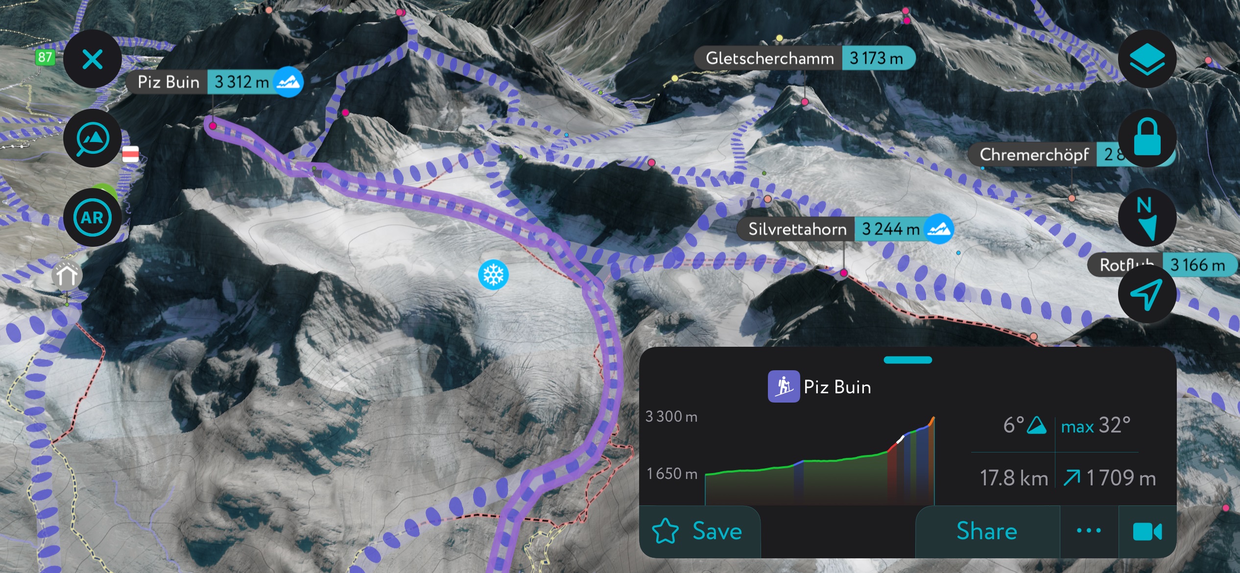
Several routes lead to Piz Buin's highest peak, including from Wiesbadnerhütte (2,442 m / 8,015 ft) to the north or Silvrettahütte (2,340 m / 7,680 ft) to the south. Despite being more straightforward than some other 3,000ers in the Silvretta Alps, Piz Buin is still challenging, with crampons and ropes as necessary equipment.
You can start your ascent to Wiesbadnerhütte from the Silvretta-Bielerhöhe. The route leads over the Ochsentaler Glacier (2,866 m / 9,403 ft) and onto Buinlücke (3,025 m / 9,924 ft). Consider spending the night at Wiesbadnerhütte on the way to Piz Buin.
You'll enjoy stunning views of the Silvretta-Stausee, Piz Linard, and Flucthorn from the summit. This out-and-back route is approximately 24.5 km (15.2 mi) in length.
The roof of the Silvretta Alps, Piz Linard (3,410 m / 11,187 ft), is located in the southern part of the range approximately 7 km (4.3 mi) south of the Austrian-Swiss border. Despite its height and foreboding pyramidal shape, Piz Linard is a straightforward climb, rated T5/PD on the Swiss Alpine Club's (SAC) hiking/mountaineering scale.
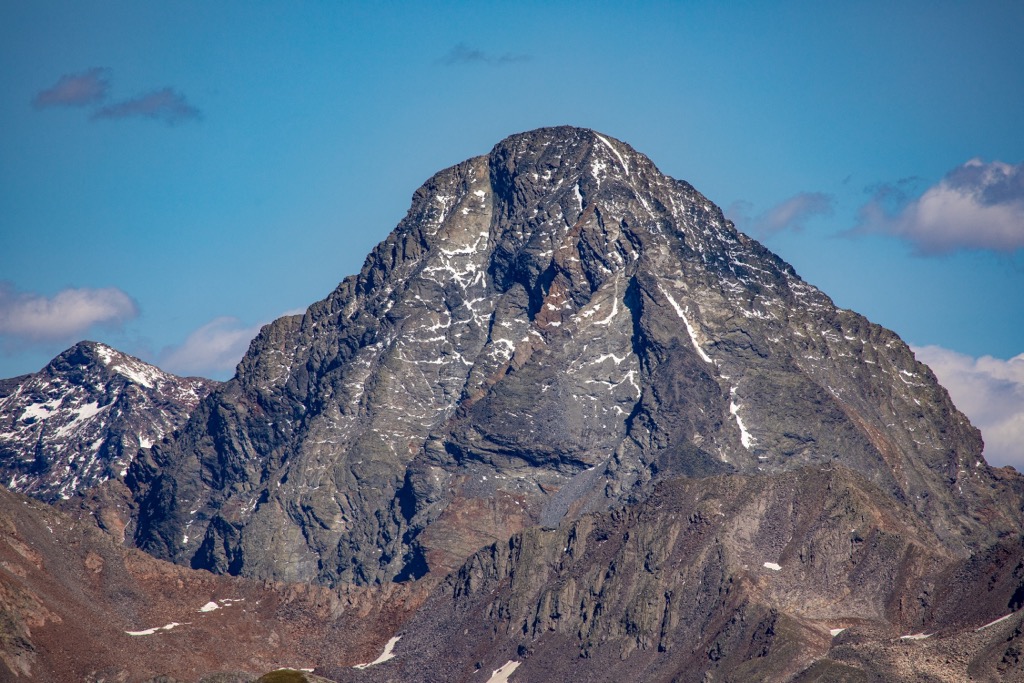
The nearest peak higher than Piz Linard is Piz Kesch (3,418 m / 11,214 ft), located 25 km (15.5 mi) away. As a result, Piz Linard provides incredible panoramas with the Bernese Alps' Finsteraarhorn (4,274 m / 14,022 ft) and Jungfrau (4,158 m / 13,642 ft) visible.
One recommended route for ascending Piz Linard is from Lavin via the Chamanna dal Linard (2,327 m / 7,635 ft) to the mountain's south. Follow the ridge from the Fuorcla da Glims (2,802 m / 9,193 ft). This out-and-back trail is approximately 20 km (12.4 mi) in length.
Älpeltispitz (2,685 m / 8,812 ft) is an often overlooked but remarkable mountain located less than 4 km (2.4 mi) northwest of the popular tourist resort, Klosters.
https://peakvisor.com/photo/alpeltispitz-summit.JPEG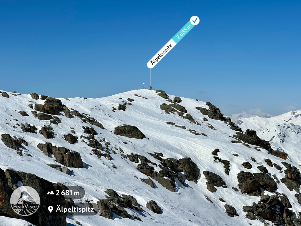
Älpeltispitz is a relentlessly steep trek, but the summit affords fantastic views of the Landwasser Valley and Klosters, as well as nearby summits like Piz Linard, Madrisahorn (2,826 m / 9,272 ft), and Pischahorn (2,980 m / 9,777 ft).
You can pick up the trail to Älpeltispitz from Fezi Maiensäss just outside Klosters. This looped trail approaches the mountain from the south before circling north via Versitspitz (2,181 m / 7,156 ft) and back to your starting point.
One highlight of this walk is the picturesque Äbisee Lake on the mountain's east side. This looped trail is approximately 13 km (8 mi) in length.
Groß Seehorn (3,121 m / 10.239 ft) is the highest mountain in the Seehorn Group and one of the best mountain climbing destinations in the Silvretta Alps. This stunning pyramidal peak offers solid rock with varied climbing opportunities and remarkable views across both sides of the Austrian-Swiss border.
The normal route up Groß Seehorn is from the Seetalhütte (2,065 m / 6,775 ft) to the southwest. The SAC rates Groß Seehorn at PB/2b on the mountaineering scale, making it a manageable climb for experienced alpinists.
It's worth noting that a rockslide in August 2022 has made it impossible to cross directly from the Seelücke pass (2,770 m / 9,091 ft) to Groß Seehorn. You must drop down 100 m (328 ft) to avoid the Seelücke pass and cross over.
From Seelücke, you'll head south toward the Seegletscher on the mountain's western side before climbing up the northwest ridge. This out-and-back route takes approximately 3 or 4 hours to complete.
Located near Davos, Jöriflüelafurgga (2.723 m / 8,934 ft) is a high alpine pass to the Jöri Valley, which contains the otherworldly Jöriseen lakes.
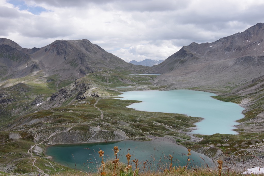
These lakes are among the most beautiful in the Silvretta Alps with their milky green and turquoise waters. You'll also be treated to gorgeous views of nearby mountains, like Flüela Wisshorn and Schwarzhorn (3,146 m / 10,325 ft).
One of the best ways to explore the Jöriflüelafurgga and Jöriseen is by following the Jöriseen Rundweg. You can pick up this trail from the Wägerhus (2,215 m / 7,270 ft) near the Flüelapass (Pass dal Flüela) (2,382 m / 7,818 ft), following the No. 788 route.
This looped trail climbs clockwise to the Jöriflüelafurgga before circling between the lakes and up the Winterlücke Pass (2,787 m / 9,144 ft) to reach your starting point.
The Jöriseen Rundweg isn't a technical hike but involves a short and straightforward via ferrata to reach the lakes. This looped trail is approximately 11 km (6.8 mi) in length.
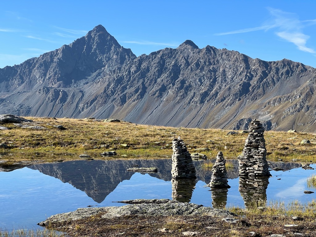
Bielerspitze (2,545 m / 8,349 ft) is one of the best mountains to climb in the Vallüla Group. The mountain sits just north of the Silvretta-Stausee reservoir, providing interrupted views from its summit.
The best route up Bielerspitze is from the Berggasthof Piz Buin on Silvretta Stausee's northern shoreline. The trail leads steeply uphill to Bielerkopf's (2,389 m / 7,837 ft) summit, marked with a cross.
The climb becomes easier on the way to Bielerspitze's summit. It's also possible to make a short detour to Vallüla's summit to the northeast. You'll descend to the east via the faint path to Vallüla's summit. This looped trail is approximately 7 km (4.3 mi) in length.
The Via Alpina is a network of five color-coded long-distance trails that traverse the Alps from west to east, covering over 5,000 km (3,106 mi). Four sections of the Via Alpina Red Trail weave through the Silvretta Alps — perfect if you're looking for a multi-day hike in the region.
The Via Alpina R63 enters the Silvretta Alps at Gargellen to the northwest. It's a strenuous hike that leads through the lush Vergaldnertal, over the Vergaldner Joch (2,514 m / 8,251 ft), finishing up at the Tübinger Hütte (2,223 m / 7,295 ft). A popular detour along this route is to Heimspitze's (2,685 m / 8,809 ft) summit. The Via Alpina R63 is approximately 16.1 km (10 mi) long.
The Via Alpina R64 leads from Tübinger Hütte over Valgraggeskamm ridge and across the Hochmadererjoch alpine pass (2,505 m / 8,219 ft). Then, it descends into a valley and crosses the Kromerbach stream.
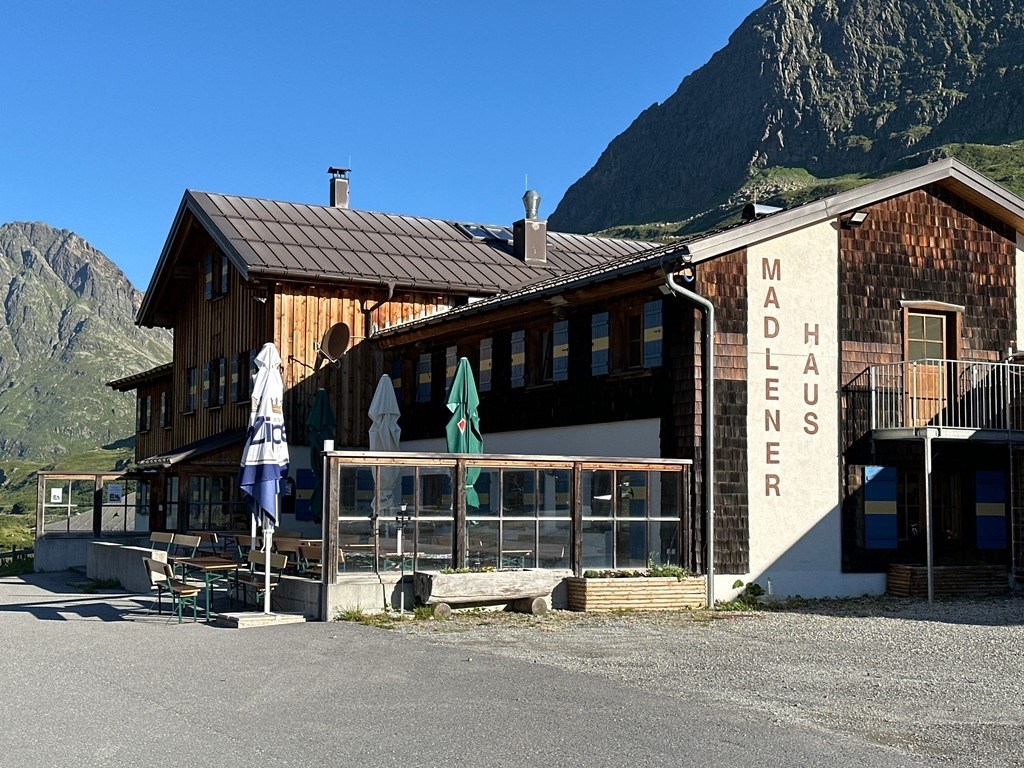
From here, follow the Bielerhöhe pass (2,037 m / 6,683 ft) to Madlenerhaus (1,987 m / 6,522 ft). You can take a two-and-a-half-hour detour to Hochmaderer's (2,823 m / 9,262 ft) summit. The Via Alpina R64 is approximately 10.5 km (6.5 mi) long.
The Via Alpina R65 is very high altitude, leading over Runder Kopf (2,382 m / 7,815 ft) and across the Getschnerscharte pass (2,838 m / 9,314 ft) to Jamtalhütte (2,164 m / 7,103 ft). It's only possible to complete this incredible Via Alpina stage during summer with snow permitting.
The final stage of the Via Alpina within the Silvretta Alps, R66, leads to Scuol on the range's southeastern edge. The trail crosses into Switzerland at the Futschölpass (2,768 m / 9,081 ft), reaching Scuol through the Ftan terrace. The Via Alpina R66 is approximately 22.1 km (13.7 mi) long.
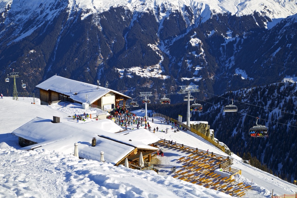
With world-famous resorts like Davos, the Silvretta Alps are among the best mountains for winter sports along the Austrian-Swiss border.
These are the six largest ski resorts in the Silvretta Alps:

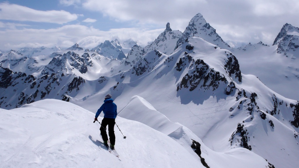
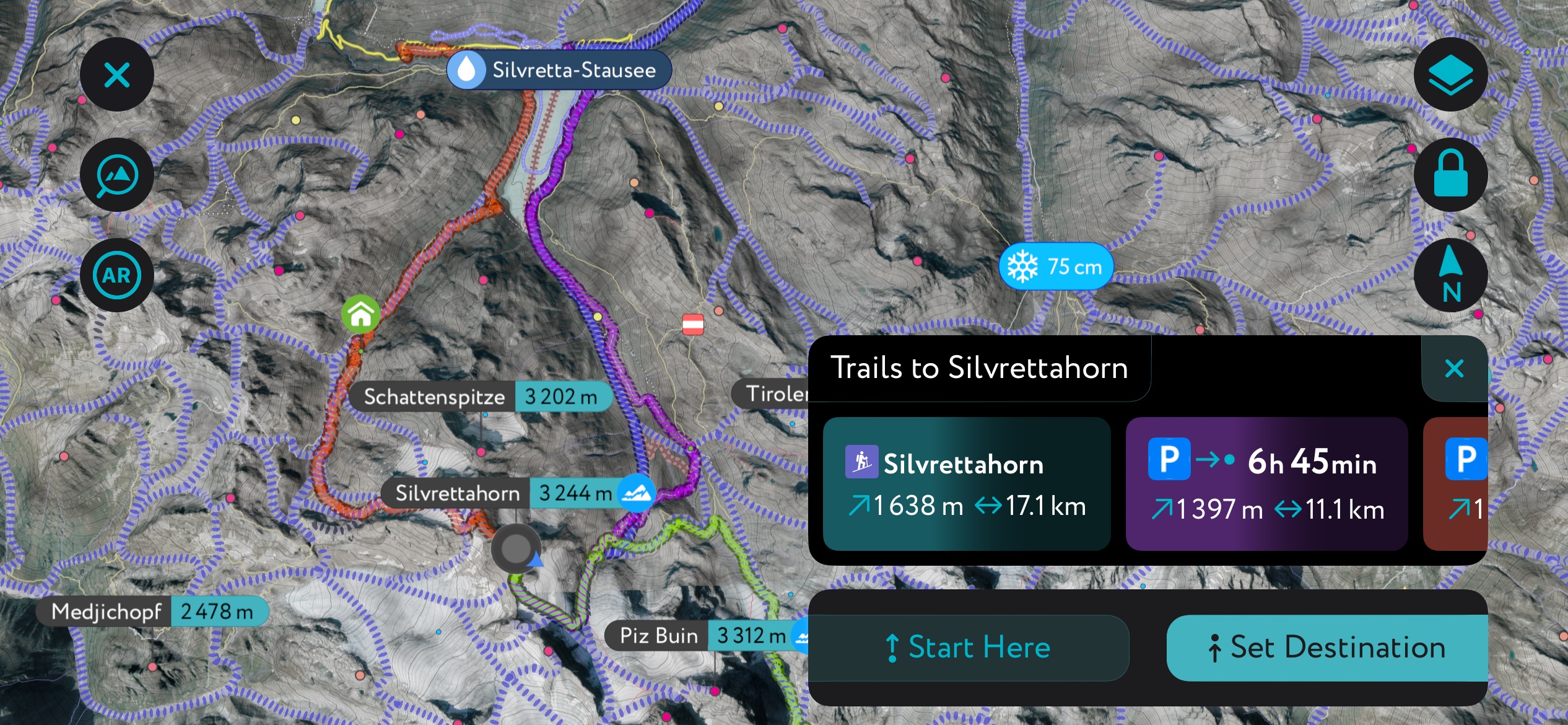
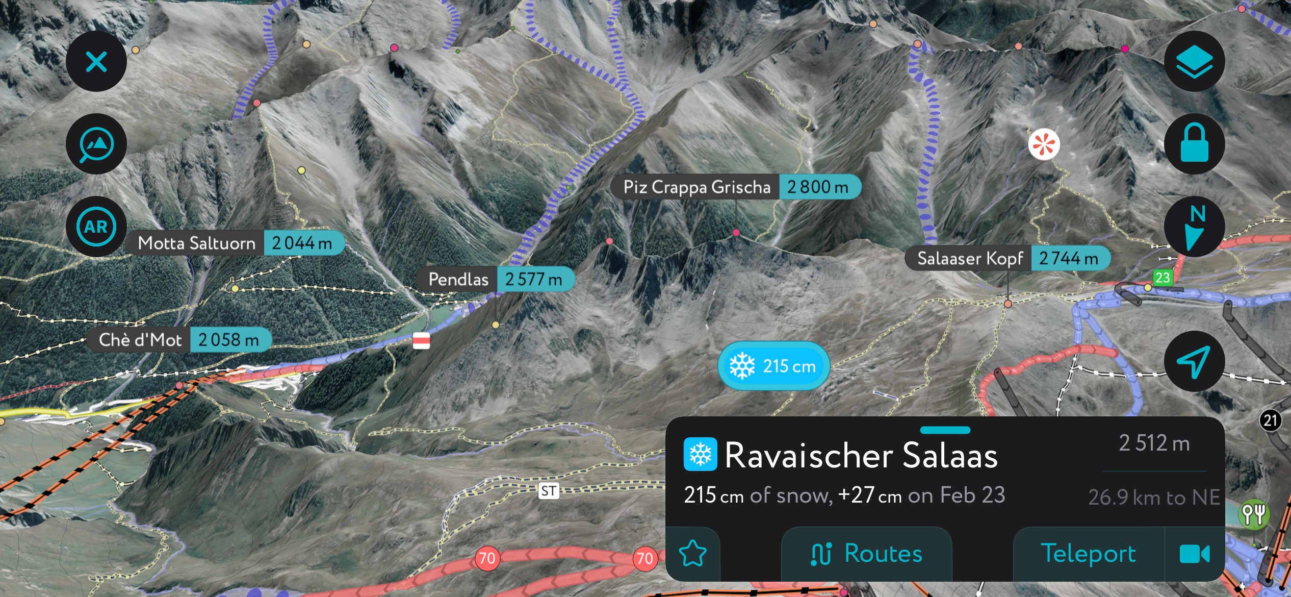
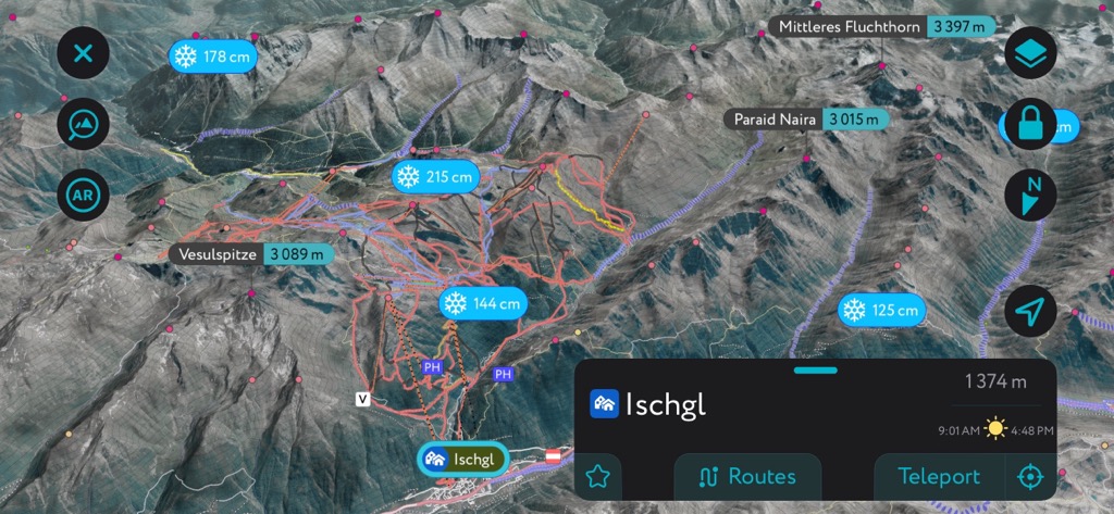
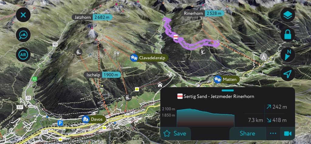
The Silvretta Alps are a mecca for ski touring, and there is no better guide than the PeakVisor App in your pocket. We’ve got tens of thousands of routes uploaded onto our servers, and the Silvretta Alps are smack dab in the middle of our most densely covered territory.
It would take an encyclopedia to cover everything the region to offer, but here’s a brief introduction to a couple of classic zones, as well as some PeakVisor App inspiration.
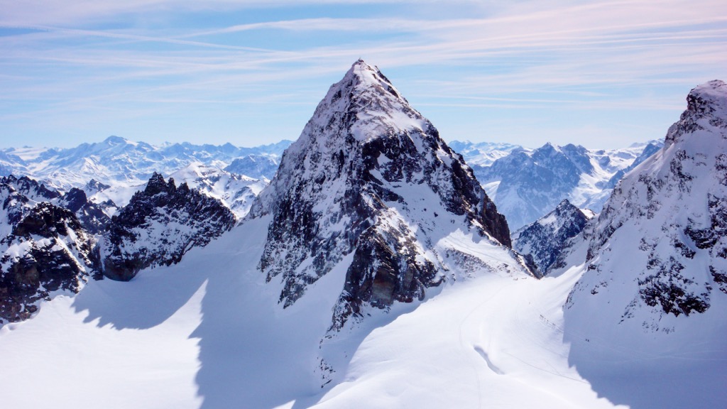
The Silverettahorn is a classic not just within the Silvretta Alps but the whole of Europe. The mountain is a satellite peak of the same massif as PIz Buin, so it’s the most famous zone in the Silvretta Alps. Moreover, there is extensive glaciation throughout the massif and plenty of north-facing terrain. Combined with epic snowfall, the aspect and cold slopes make for excellent powder skiing.
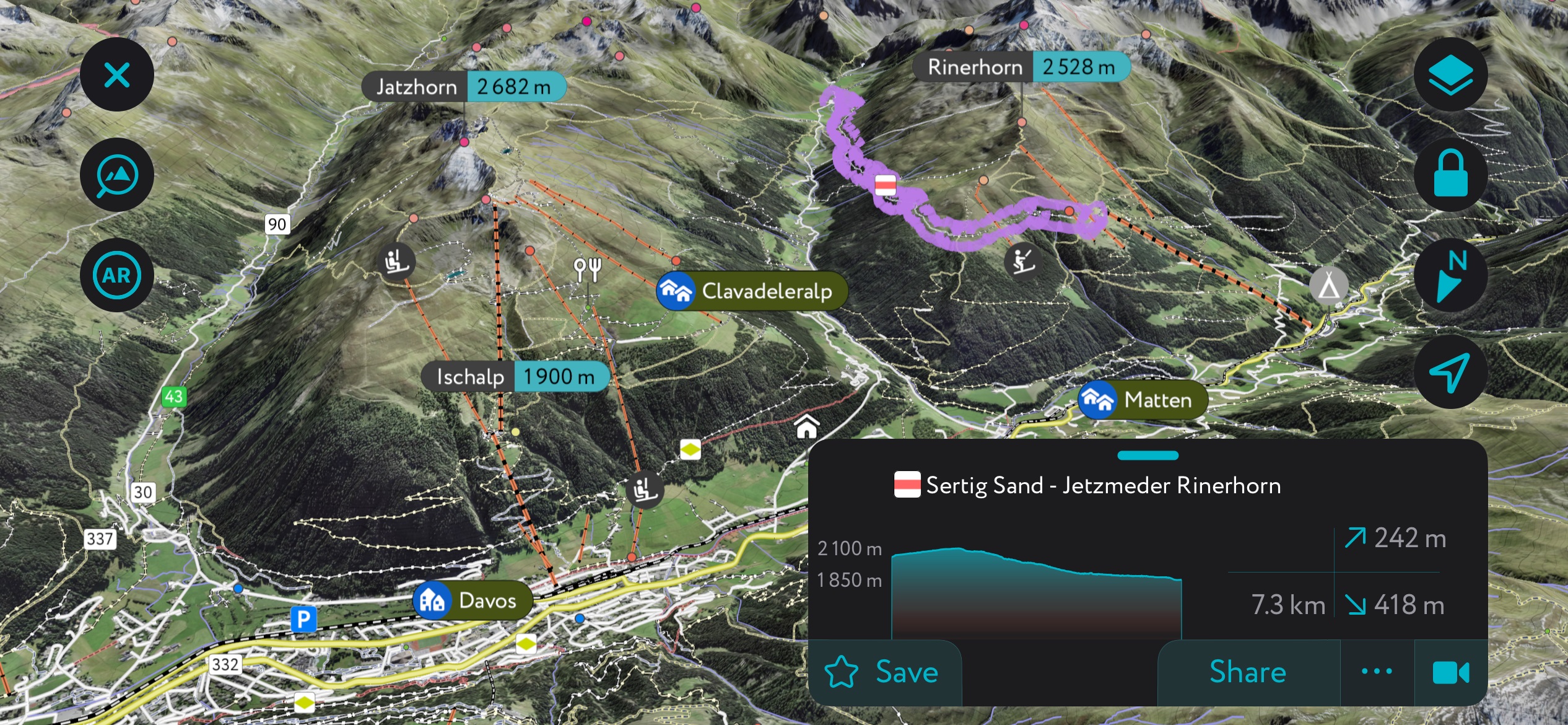
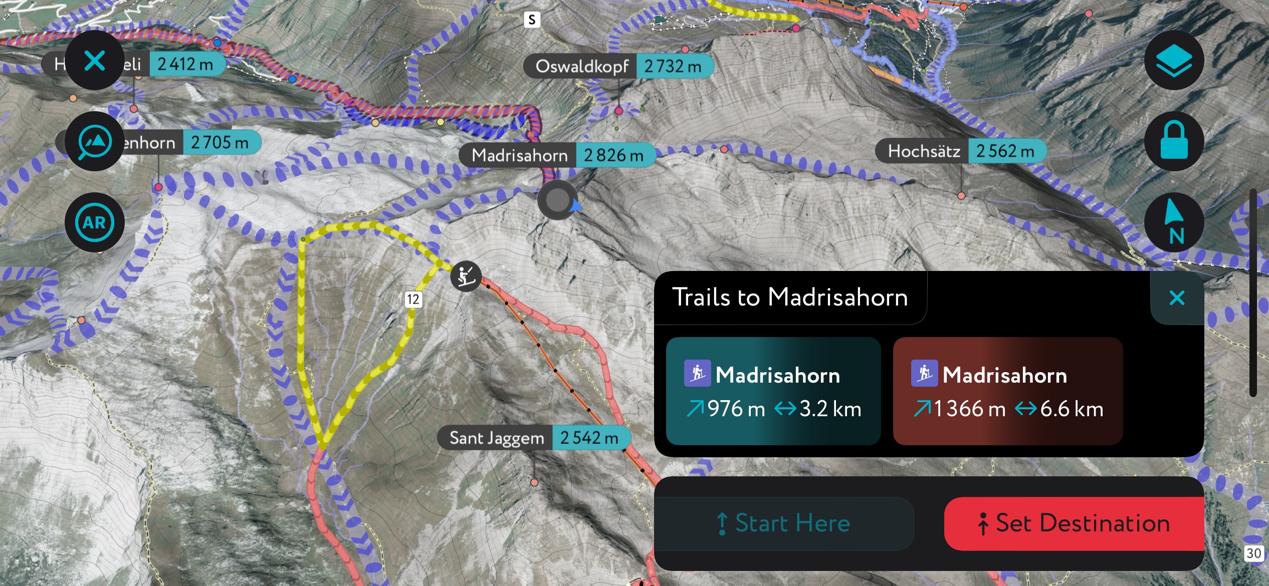
The Madrisahorn is another north-facing classic in the Silvretta Alps. The approach is brutal if coming up from the valley, as I show in the PeakVisor screenshot. However, you can shorten things up by taking the lifts from the family-friendly Madrisa Ski Resort. That said, your person will end up quite far from the car in that case.
We’ve made some recent updates to the app in an effort to increase the utility for ski touring. First, we’ve got huts - and even hut schedules - throughout the Alps and beyond. Even better, our weather module tells you the forecast for the coming days, with snowfall data provided at many weather stations throughout the Alps.
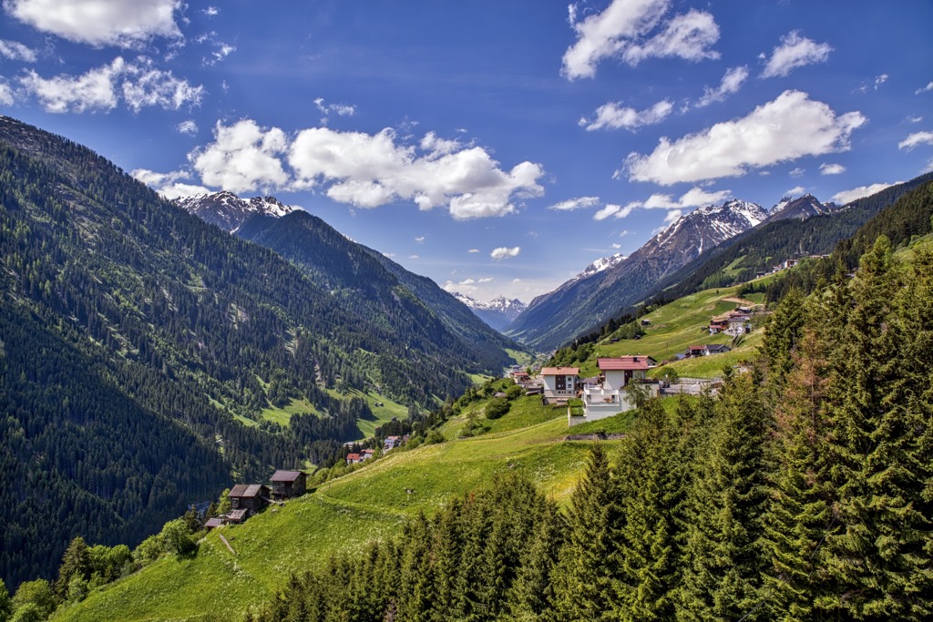
The Silvretta Alps boast several renowned Alpine villages, including Davos, Ischgl, and Sankt Gallenkirch.
The nearest international airport to the Silvretta Alps is Zurich International Airport, located approximately 160 km (99.5 mi) northwest.
Samedan St. Moritz Airport, a private airport for chartered jets, is located approximately 35 km (21.7 mi) south of the Silvretta Alps.
With a permanent population of over 10,000, Davos is one of the largest settlements in the Silvretta Alps. This world-famous resort sits on the southwestern edge of the range. It's famed for hosting the annual World Economic Forum.
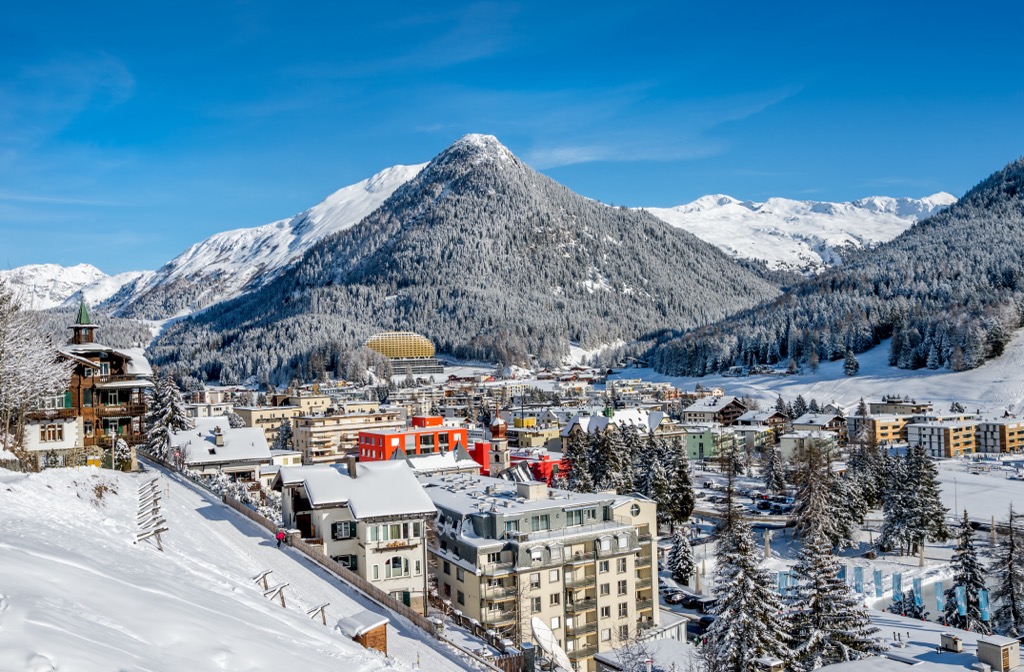
Davos is one of Europe's premier winter sports destinations, with five mountains featuring ski areas nearby. Parsenn, with 35 runs, is the largest and most modern of the five ski areas. Davos is also an excellent base for hikers, with Groß Seehorn, Piz Linard, and Piz Buin within 25 km (15.5 mi) of the resort.
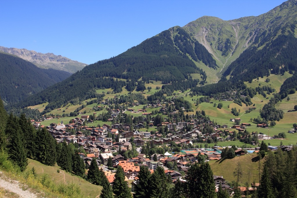
Klosters is a resort village roughly 10 km (6.2 mi) north of Davos. It forms the Klosters-Serneus municipality with neighboring Serneus and has a population of over 4,400 people.
It shares its ski resorts with Davos, with Gotschnagrat (2,299 m / 7,543 ft) just west of the village. The Jöriseen lakes are considered a part of Klosters and are located 10 km (6.2 mi) to the southeast. Älpeltispitz is situated approximately 3.5 km (2.1 mi) northeast of Klosters.
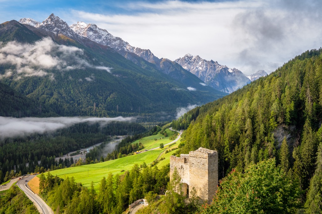
Scuol is a Romansh village that sits on the boundary between the Silvretta Alps and the Sesvenna Alps. Of its population of 4,500 denizens, over 64% speak the local Romansh language.
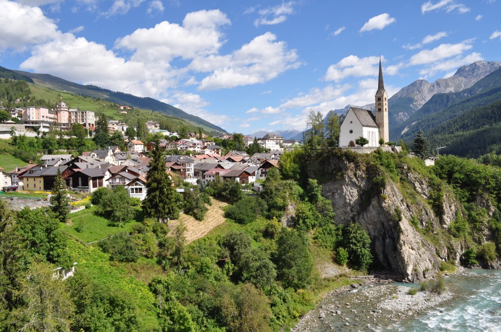
Scuol features its own ski resort, Motta Nulans, and its position on the Silvretta Alps' southeastern edge means you can easily access several popular mountains for hiking. Ochsenkopf (3,057 m/10,030 ft), Piz Buin, Piz Pisoc (3,173 m / 10,410 ft), and Piz Lischana (3,105 m / 10,187 ft) are within 15 km (9.3 mi) of the Scuol.
Ischgl is a small ski resort in the Ischgl on the northeastern tip of the Silvretta Alps. It's home to one of the largest ski areas in Austria, the Silvretta Arena, and is renowned for its vibrant nightlife and party atmosphere.
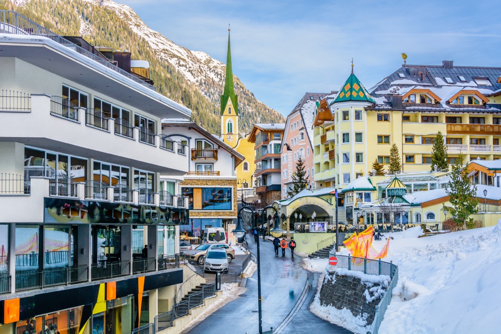
Ischgl is well-positioned to explore some of the finest summits in the Samnaun Alps, with Saumspitze (3,039 m / 9,970 ft) less than 5 km (3.1 mi) to the north. Ischgl is roughly 20 km (12.4 mi) northwest of Piz Buin.


The highest peak in the Silvretta Alps is Piz Linard, at 3,410 m.
The Silvretta Alps have 329 named peaks.


