
Scan the QR code and open PeakVisor on your phone
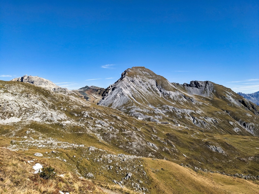
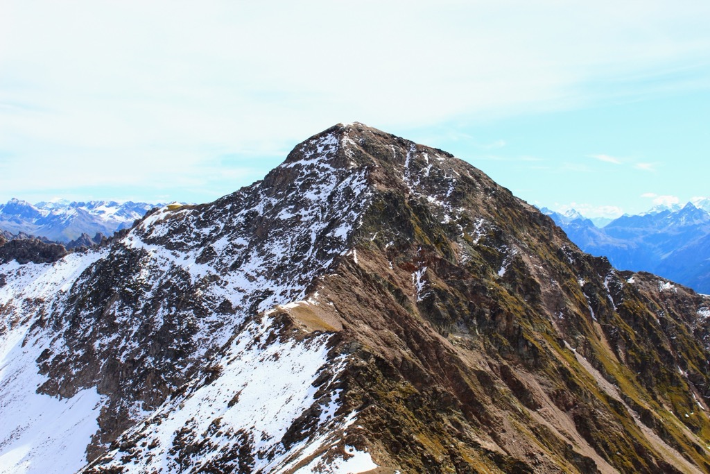
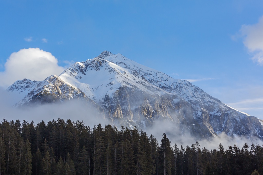
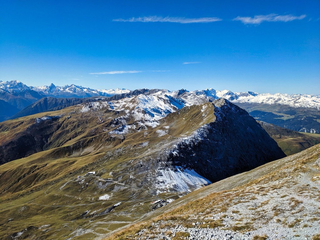
The Plessur Alps, also known as the Plessur Group, are located at the eastern end of the Western Rhaetian Alps within the Swiss canton of the Grisons (Graubünden). Home to one of the largest ski resorts in Switzerland, the Plessur Alps draw in visitors from all over the globe. There are 232 named mountains in the Plessur Alps. The highest and the most prominent mountain is the Aroser Rothorn (2,980 m / 9,776 ft).
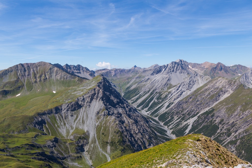
The Plessur Alps are a relatively small mountain range within the Swiss Alps, with a longitudinal length of approximately 36 km (22 mi) from Bonaduz to Klosters. Compared to many of its neighbors, it's also fairly low — none of its summits exceed 3,000 m (9,842 ft) in elevation.
The Plessur Alps take their name from the 33 km (21 mi) long Plessur River, which meanders through the heart of the range. The Plessur River's headwaters begin near Arosa and converge with the Rhine near Chur.
The Plessur Alps' position near the center of the Grisons means several other mountain ranges surround it:
The largest settlements in the Plessur Alps include the capital of the Grisons, Chur, as well as Davos, Arosa, and Klosters.
There are few significant lakes in the Plessur Alps. The largest lake is Davosersee, with a surface area of 0.59 sq km (0.22 sq mi).
The Plessur Alps consist of five mountain chains. The Parpaner-Rothorn / Lenzerhorn Chain is the central massif where most of the range's highest summits are located, including the Aroser Rothorn, the Erzhorn (2,922 m / 9,586 ft), and the Lenzerhorn (2,906 m / 9,534 ft).
To the west of the Parpaner-Rothorn / Lenzerhorn Chain is the Stätzer Horn Chain, whose highest point is the Stätzer Horn (2,575 m / 8,445 ft). To the north is the Hochwang Chain, with Hochwang (2,534 m / 8,314 ft) as its highest point.

In the northeastern corner of the Plessur Alps is the Weissflue Group and the Weissflue (2,842 m / 9,327 ft). The Weisshorn Chain is just north of the central massif. Its high point is the Weisshorn (2,653 m / 8,704 ft).
The Strela Chain runs north to south along the eastern boundary of the Plessur Alps. It's the longest chain in the Plessur Alps and is nicknamed the Arosa Dolomites. Its highest point is Guggernellgrat (2,810 m / 9,219 ft).
Gondola lifts serve many mountains in the Plessur Alps, like the Parpaner Rothorn (2,860 m / 9,386 ft), the Weisshorn, and the Weissflue.
Schanfigg is the largest and principal valley in the Plessur Alps. It's located between Chur and Arosa at the heart of the Plessur Alps and is roughly 12 km (6.8 mi) long.
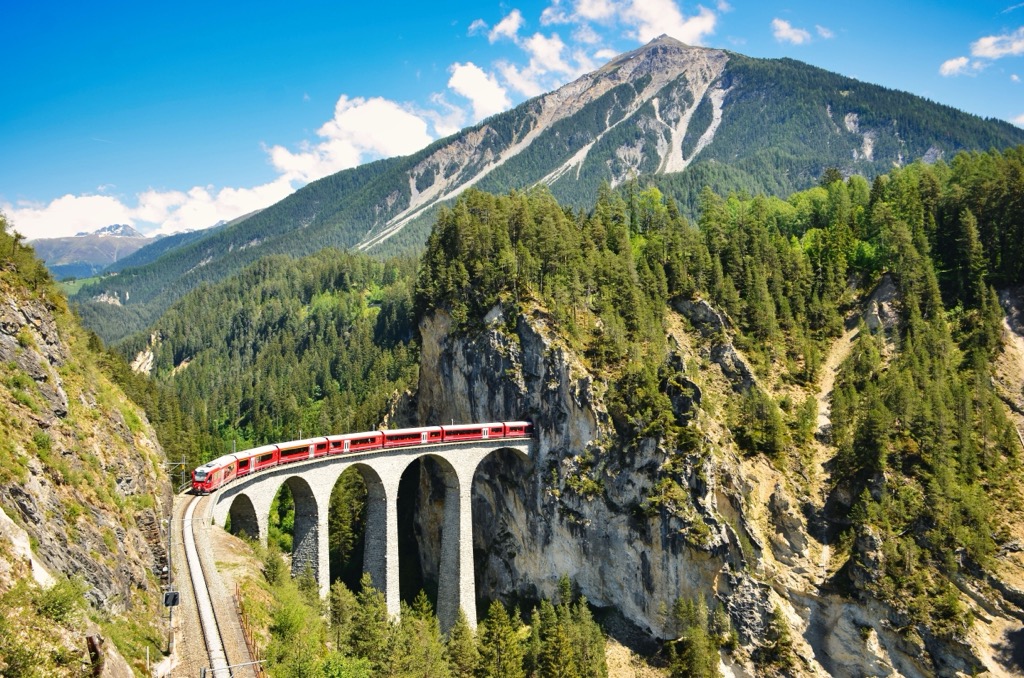
The Plessur River flows through the Schanfigg Valley. The mountains surrounding Schanfigg include Hochwang, the Mattjisch Horn (2,460 m / 8,074 ft), and Gürgaletsch (2,441 m / 8,009 ft). The Landwasser Viaduct is located in Schanfigg near Arosa.
Fondei is another significant valley in the Plessur Alps. It diverges from Schanfigg at Langwies and runs northeasterly for approximately 10 km (6.2 mi) to the Durannapass (2,117 m / 6,946 ft).
Several side valleys encircle Schanfigg and Fondei. Urdental, home to the beautiful Urdensee, is located southwest of Schanfigg between Arosa and Vaz / Obervaz.
Another side valley, Sapün, is found east of Schanfigg. Several resorts, such as Davos, Klosters, and Lenzerheide, surround Sapün. At the valley's eastern end are Weissfluh and the Strelapass (2,342 m / 7,684 ft).
The Plessur Alps and the rest of the Alps formed approximately 66 million years ago during the Alpine Orogeny. This mountain-building event began when the Arabian, African, Indian, and Cimmerian tectonic plates moved north and collided with the Eurasian Plate.
Convergent movement between these plates helped create the Alps and many other significant mountain ranges worldwide, including the Himalayas, the Atlas Mountains, and the Caucasus. The Alpine Orogeny is a relatively recent geological event that's ongoing in some areas of the Alps.
The Plessur Alps are part of the Central Eastern Alps and the Limestone Alps. They are composed primarily of limestone, marl, sandstone, slate, and gneiss.
One unique geological feature of the Plessur Alps is the eastern Strela Chain. Known as the Arosa Dolomites, this mountain chain is formed from Dolomitic rock that lay under the Tethys Sea around 200 million years ago.

Unlike the Dolomites in Italy, the Arosa Dolomites rocks have been broken and folded by moving nappe transport, meaning they aren't as good for rock climbing as their Italian counterparts.
Interestingly, geologists believe the upper reddish part of the Parpaner Rothorn was deposited from Africa during the Alpine Orogeny. Evidence of ancient precious metal mines on Parpaner Rothorn dates back to the Roman Era.
With Switzerland's largest nature park, Parc Ela, just to the south, the Plessur Alps is a haven for various flora and fauna.
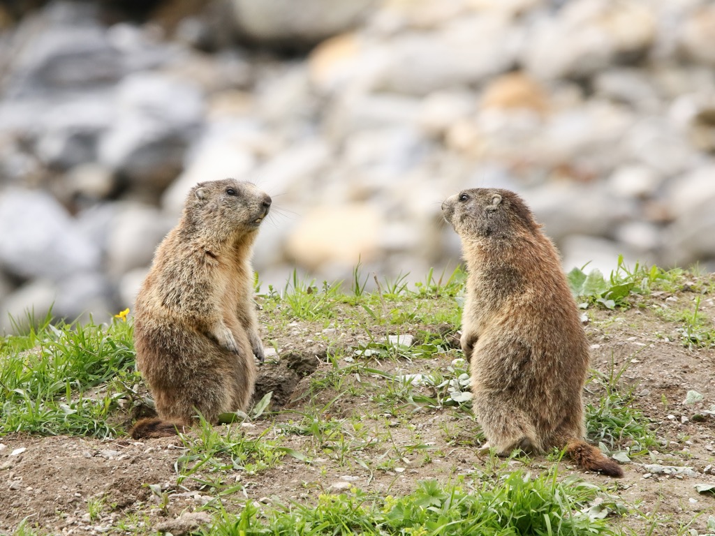
Notable mammals in the Plessur Alps include red deer, wild boar, chamois, marmots, and ibex. Ibex and lynx were both reintroduced to the Grisons in the 21st century. While ibex are commonplace, lynx are still rare.
There are currently between 12 and 14 wolf packs in the Grisons. No brown bears reside in Switzerland, but they have been spotted crossing over from Italy in the past.
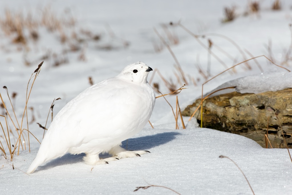
Another animal reintroduced to the Grisons is the bearded vulture, which has a wingspan exceeding 2.2 m (7.2 ft). Other notable birds in the Plessur Alps include golden eagles, black grouses, ptarmigans, and eagle owls.
The common European adder is the only venomous snake you'll likely encounter in the Plessur Alps. It can live at elevations exceeding 2,000 m (6,561 ft) and is usually found hiding under loose rocks or in bushes.
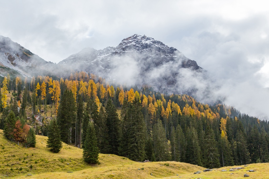
The landscape of the Plessur Alps consists mainly of forests, alpine pastures, and fields. The Alps are very biodiverse, with around 400 endemic plant species.
The forests of the Plessur Alps change with elevation. You'll get mixed forests at the lowest levels, complete with fruit trees. Above 1,000 m (3,280 ft) in the montane zone, mixed coniferous forests of mountain pine, silver firs, and Norway spruce, beeches, alders, and birches are typical.
Higher in the subalpine zone at around 1,900 m (6,233 ft), only the hardiest trees thrive, such as Swiss pines, mountain pines, and green alders.
Above the treeline, at around 2,100 m (6,889 ft), the forests give way to alpine pastures. Many flowering plants can be found high up in the mountains, including edelweiss, Switzerland's national flower, as well as mountain avens and primroses.
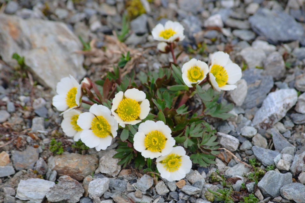
One of the hardiest plants in the Plessur Alps is the glacier buttercup, which can grow at over 4,000 m (13,123 ft) in elevation.
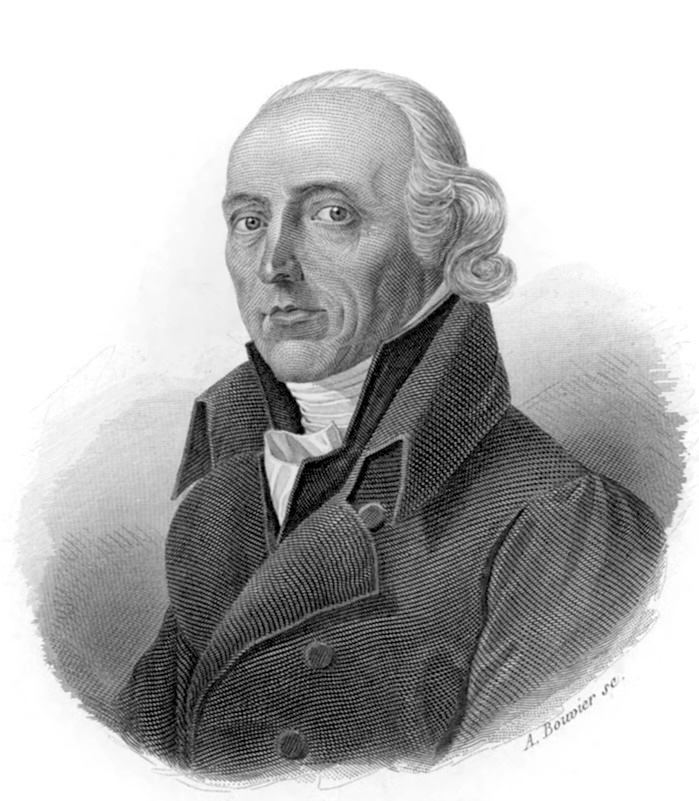
The Aroser Rothorn has a long climbing history. Due to iron mines on its slopes dating back to the Middle Ages, it's unclear who was the first to scale the summit. However, it's well-documented that Swiss geologist Hans Conrad Escher von der Linth climbed the Aroser Rothorn in 1806.
The Plessur Alps are home to Chur, likely the oldest settlement in Switzerland. There's evidence of settlements in the area dating back to 3,500 BCE. In the 4th century, Chur became the first Roman Catholic diocese north of the Alps.
Davos was first settled by Rhaeto-Roman immigrants and was first mentioned by name in 1213. Due to its climate and air quality, it became a famous destination in the 19th century as a luftkurort, or "air spa." Today, Davos hosts the annual World Economic Forum.
The iconic Landwasser Viaduct is among the most famous human-made structures in the Plessur Alps. It was built between 1901 and 1902 for the Rhaetian Railway, which still uses it today. The viaduct is 65 m (213 ft) tall and has a prominent curve. It was recognized as a UNESCO World Heritage Site in 2008.
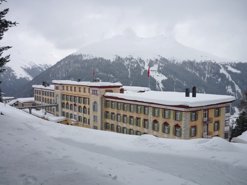
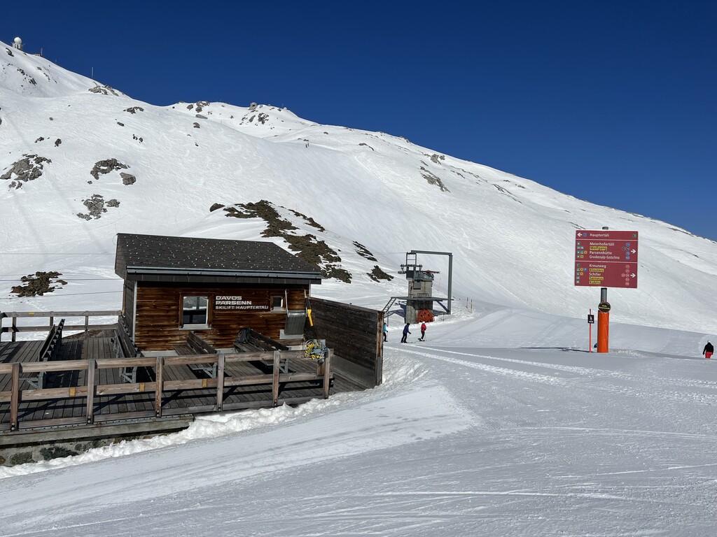
One of the most historic hotels in the Plessur Alps is the Berghotel Schatzalp. Located at 1,860 m (6,100 ft) in elevation within the Parsenn ski area, it was built as a high-tech tuberculosis sanitorium at the turn of the 20th century.
Berghotel Schatzalp is the setting of Thomas Mann's novel The Magic Mountain, considered a seminal piece of 20th-century German literature.
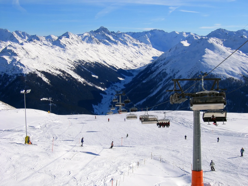
Like most destinations in the Alps, hiking is a popular pastime — you'll find over 700 km (435 mi) of trails in Davos - Klosters alone. The Plessur Alps are also among the best ranges in the Swiss Alps for alpine skiing.
When hiking in the Plessur Alps, ensure you bring appropriate equipment and plenty of provisions. Check local weather forecasts, map out your route, and inform others of your itinerary.
Here, you can learn about the Swiss Alpine Club's (SAC) ratings for hiking and mountaineering, referenced in this article.
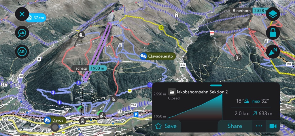
Exploring the Alps with the PeakVisor App has never been better — get the latest info on weather reports, mountain huts, ski tours, and more straight to your phone. We've been working round the clock for nearly a decade to make PeakVisor the go-to app for all outdoor adventures — whatever the weather.
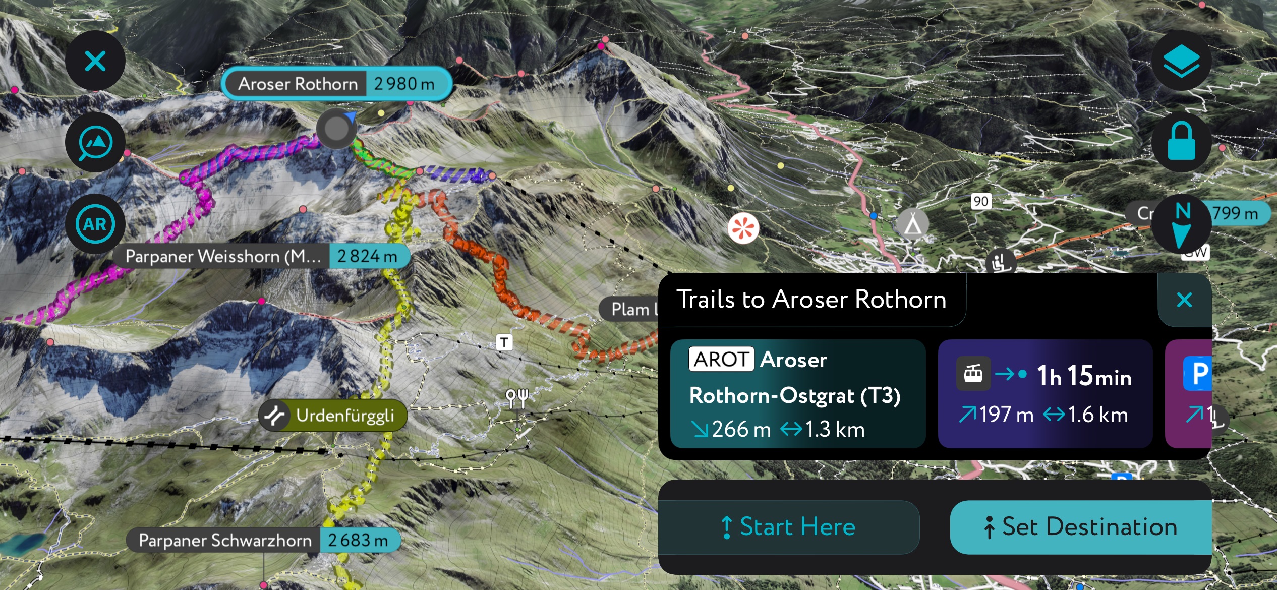
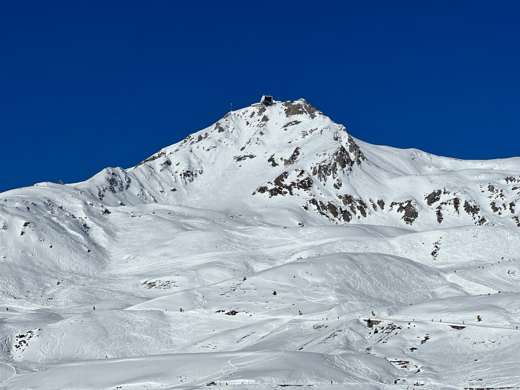
The Aroser Rothorn (2,980 m / 9,776 ft), or the Arosa Rothorn, is located at the convergence of three ridges, with the Erzhorn (2,922 m / 9,586 ft) to the northeast, Pizza Naira (2,870 m / 9,416 ft) to the south, and the Parpaner Rothorn (2,860 m / 9,386 ft) to the northwest.
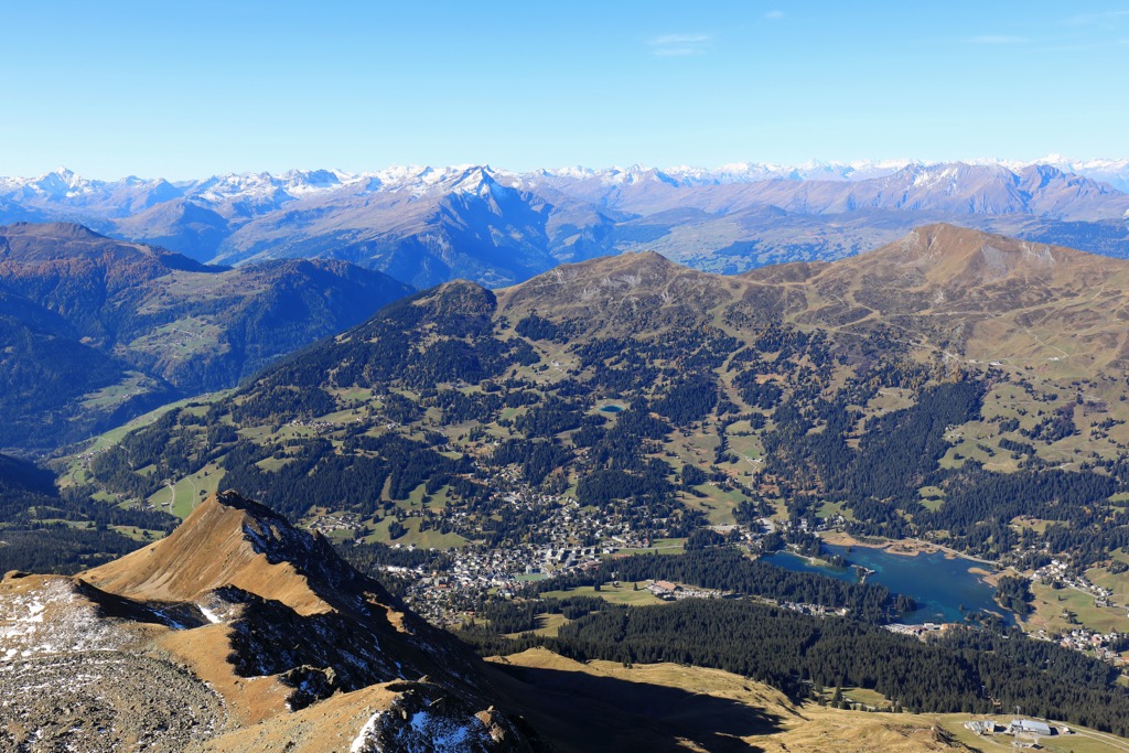
The highest summit in the Plessur Alps, Aroser Rothorn, affords sweeping views as far as the Pennine Alps' Weisshorn (4,505 m / 14,780 ft), which is over 150 km (93 mi) to the southwest.
You can climb Aroser Rothorn from any of the three surrounding ridges, but they're challenging treks. From Erzhornsattel (2,742 m / 8,999 ft) or Parpaner Rothorn, it's a T3 to T4-graded hike on the Swiss Alpine Club's (SAC) hiking scale.
One of the most popular routes to Aroser Rothorn is from Station Scharmoin near Lenzerheide. If you want to scale Parpaner Rothorn, it's a 16 km (10 mi) hike to Aroser Rothorn.
Alternatively, you can skip Parpaner Rothorn's summit directly by riding the Rothornbahn 2 gondola from Scharmoin Station, shortening the trek to roughly a 3 km (1.8 mi) round-trip.
The Lenzerhorn (2,906 m / 9,534 ft), or the Lenzer Horn, is the second-highest summit in the Plessur Alps. Situated at the southern end of the central Parpaner-Rothorn / Lenzerhorn Chain, the Lenzerhorn's summit affords stunning vistas of Lenzerheide and the Oberhalbstein Alps.
The normal route for this tri-ridged mountain is from Lenzerheide along its northwestern ridge. The SAC describes the Lenzerhorn as the "epitome of alpine hiking" — the T5-graded route should only be undertaken by experienced alpinists.
The hike starts by heading east out of Lenzerheide, through forests, and along the western banks of the Aua da Sanaspans. At Alp Sanaspans, you'll head towards the Valsertal and onto Lenzerhorn's northwest ridge.
A white-blue marked trail leads up to just below the summit. The Lenzerhorn's normal route is approximately an 8-hour round-trip.
The Aroser Weisshorn (2,653 m / 8,704 ft), or simply the Weisshorn, is one of the most popular mountains in the Plessur Alps for hiking and skiing. It shouldn't be confused with the renowned Valais Weisshorn in the Pennine Alps.
The Aroser Weisshorn is part of the Arosa Lenzerheide, one of the largest ski areas in the Plessur Alps. Along with views, Weisshorn's summit features the 360° panorama restaurant Weisshorngipfel, home to the highest bakery in Europe.
In the summer, you can reach the summit of the Weisshorn by following the Aroser-Weisshorn-Weg from the Arosa Mittelstation Weisshornbahn. The Aroser-Weisshorn-Weg is well-signposted.
From the Mittelstation, you'll head north across meadows to the Weisshorn via the Sattelhütte (2,403 m / 7,887 ft), with incredible views of the Schanfigg Valley on the way.
The trail's descent leads south via the Carmennahütte (2,135 m / 7,005 ft) and the Alpenblick Bergrestaurant (1,953 m / 6,407 ft) before ending in Arosa. This hike is approximately 10 km (6.2 mi) in length.
If you're looking for some of the finest views of Davos and the Davosersee, take a leisurely stroll from the Weissfluhjoch (2,693 m / 8,835 ft) to Schatzalp (1,858 m / 6,096 ft). Part of the Parsenn Ski Area, these mountains are well-equipped with gondolas, huts, and even funiculars.
Once the site of several laboratories for studying avalanches, the Weissfluhjoch is now popular for ski tours and hiking. A funicular railway leads from Davos directly to Weissfluhjoch's summit.
After riding the funicular to the Weissfluhjoch's summit, walk downhill via the Strelapass (2,342 m / 7,684 ft) to Schatzalp. At Strelapass, you can take a detour to the Schiahorn (2,709 m / 8,888 ft) if you want to make your hike more of a challenge.
The walk ends near the Berghotel Schaztalp, which served as a tuberculosis sanitorium and is the setting of Thomas Mann's novel The Magic Mountain.
After enjoying uninterrupted views of Europe's highest town, Davos (1,560 m / 5,118 ft), you can ride the Schatzalpbhan funicular back to Davos. This walk is approximately 7 km (4.3 mi) in length.
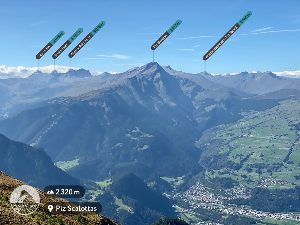
Resting on the Plessur Alps' western edge, Piz Scalottas (2,324 m / 7,625 ft) is one of the best mountains in the region for cyclists; its chair lift allows you to take a bicycle to the summit for free.
Views on both sides of Piz Scalottas are incredible, with the Domleschg Valley to the west and Lenzerheide to the east.
One of the easiest ways to explore the mountain on foot is to ride the Sesselbahn Scalottas to Piz Scalottas' summit. Then, you'll walk north along the mountain's ridge to Piz Danis' (2,497 m / 8,192 ft) summit.
From Piz Danis, continue north and loop down to the Tgantieni gondola station by following the Globi Wanderweg Lenzerheide trail near the top of Sesselbahn Lavoz. You can also extend your walk and hike to the summit of Stätzer Horn (2,575 m / 8,445 ft) from near Sesselbahn Lavoz.
Upon reaching Tgantieni, ride the ski lift down the mountain to Lenzerheide. This walk is approximately 8 km (5 mi) in length.
The Schanfigger Höhenweg is a long-distance trail that weaves through the Plessur Alps' Schanfigg Valley. The trail is approximately 47 km (29 mi) long and is usually completed in four stages.
The first stage is approximately 11 km (6.8 mi), leading from Arosa to Berggasthaus Heimeli (1,833 m / 6,014 ft) in Langwies.
Strolling along the slopes of the Weisshorn Chain, you'll pass Untersee and the Isel reservoir to Furggaalp (1,694 m / 5,558 ft). In the Walser settlement of Medergen, you can take a break at the charming Restaurant Alpenrose. On this stage, there are some beautiful views of Arosa and Chüpfenflue (2,658 m / 8,720 ft).
The second stage is approximately 13 km (8 mi) between Heimeli and Strassberg. The trail follows old mule tracks over three main mountain passes: Strelapass (2,342 m / 7,684 ft), Casannapass (2,232 m / 7,323 ft) and Durannapass (2,117 m / 6,946 ft).
The trail starts by climbing Wasserscheidi (2,623 m / 8,606 ft) before descending into the Fondei Valley. The trail also passes between two of the Plessur Alps' most popular mountains: Weissflue (2,842 m / 9,327 ft) and Weissfluhjoch.
The third stage of the Schanfigger Höhenweg is approximately 9 km (5.6 mi) from Strassberg to Skihaus Hochwang (1,958 m / 6,424 ft) in St. Peter. From the Fondei Valley's main settlement, Strassberg, the trail leads across moorlands that extend all the way to Mattjisch Horn.
You'll soon reach Blackter Fürggli (2,140 m / 7,021 ft), this hike's highest point. The views of the Fondei Valley from Blackter Fürggli are among the best on the Schanfigger Höhenweg. You'll then return to the Schanfigg via Peister Alp.
The final stage is roughly 13 km (8 mi) from Skihaus Hochwang to Maladers, just outside Chur. It's the most off-the-beaten-path stage, passing through deep gorges and untamed meadows. Maiensäss, meadows with traditional Swiss mountain huts and stable farms, are scattered across this area.
Ski areas cover large parts of the Plessur Alps, meaning there are fewer opportunities for ski tours off the beaten track than in the surrounding ranges.
Luckily, the Swiss Alps are among PeakVisor's best-mapped areas, with thousands of trails detailed across this vast range. So, you won't have any trouble finding the perfect Plessur Alp ski tour.
Let's take a look at a couple of the best ski tours in the Plessur Alps and a few of the features that make planning an adventure through the PeakVisor App easier than ever.
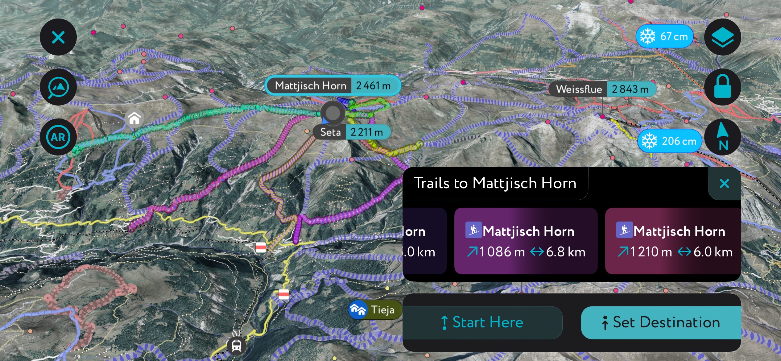
Mattjisch Horn (2,461 m / 8,074 ft) is sandwiched between the Prättigau and Schanfigg at the eastern end of the Hochwang Chain. It's easily one of the range's most popular mountains for ski touring, with its fine descents and views as far as Finsteraarhorn (4,274 m / 14,022 ft).
One popular route to Mattjisch Horn is from the north; however, snow conditions must be perfect. You can pick up the trail from Fideriser Heuberge. This out-and-back ski tour is approximately 4.3 km (2.7 mi) long.
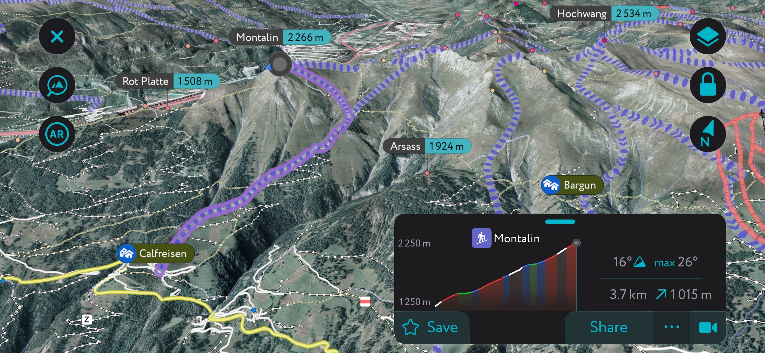
Situated at the opposite end of the Honchwang Chain to Mattjisch Horn, Montalin (2,265 m / 7,434 ft), with its modest height and location near Chur, is ideal for ski touring. However, the route is south-facing and due to the afternoon warming of the snowpack, there's a risk of avalanches on Montalin.
Montalin's normal route is from near Calfriesen to the mountain's south. This out-and-back ski tour is approximately 7.4 km (4.6 mi) long.
We've made several recent changes to the PeakVisor App to make it even more helpful when hiking or skiing in the Swiss Alps and beyond.
Get the latest information on local weather forecasts and snow depth so you know how conditions are on the slopes. Stay in the know with info about mountain hut opening hours, dining options, and more so you know the best places to relax after a day in the mountains.
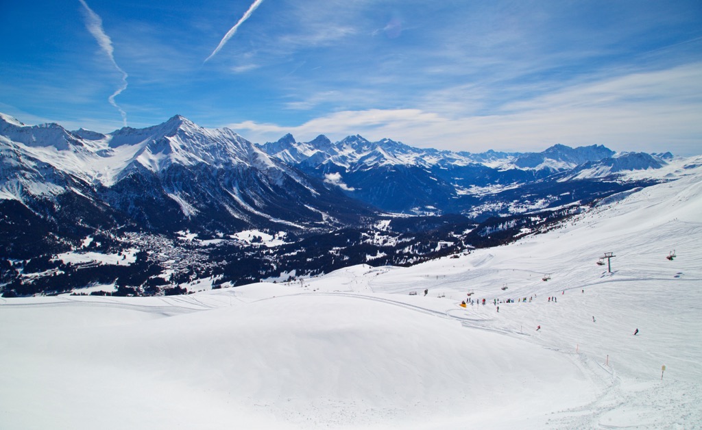
The Plessur Alps boast hundreds of kilometers of pistes, over 100 ski lifts, and world-famous ski resorts like Davos and Klosters.
Notable ski areas in the Plessur Alps include:
The nearest international airport to the Plessur Alps is Zurich International Airport, located approximately 100 km (62 mi) northwest of Chur.
The Rhaetian Railway, which runs across most of the Grisons, connects several towns in the Plessur Alps, including Chur, Davos, Landquart, Arosa, and Klosters. You can get direct trains from Basel and Zürich to Landquart.
Chur is the capital of the Grisons canton and the largest settlement in the Plessur Alps, with over 35,000 people. It sits on the right bank of the Rhine, which separates the Plessur Alps from the Glarner Alps.
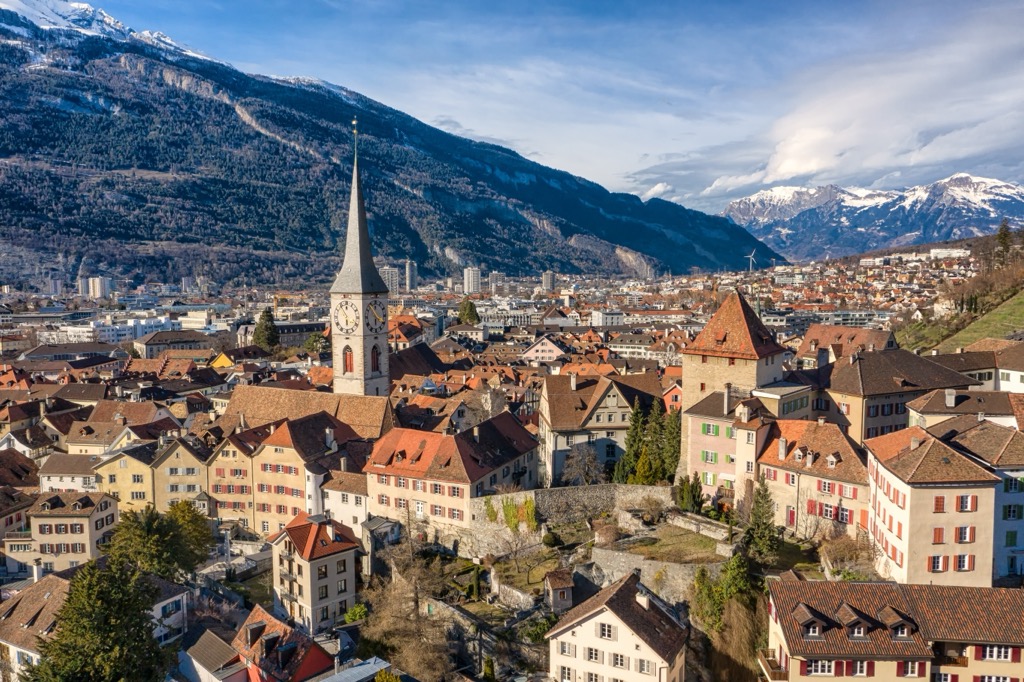
In addition to its beautiful Old Town, Chur is home to several Swiss heritage sites, including Bündner Kunstmuseum and the 12th-century Cathedral of the Assumption of Mary.
Zürich is connected to Chur by train, and its station is a junction between Swiss Federal Railways and the Rhaetian Railway. Chur is within 15 km (9.3 mi) of the Hochwang Chain, Weisshorn, and Aroser Rothorn.
Davos is the second-largest town in the Plessur Alps, with a population of over 10,000. It's also the highest town in Europe, at 1,560 m (5,118 ft).
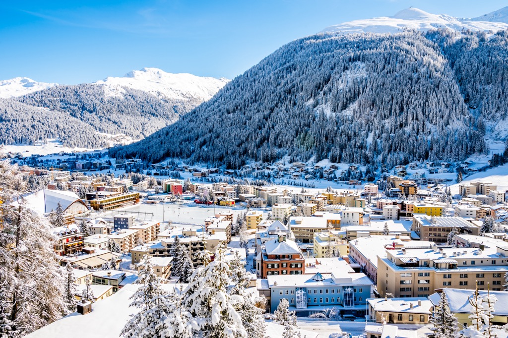
Home to one of Switzerland's largest ski resorts and the annual World Economic Forum, Davos draws visitors from all over the world.
Davos's position between the Plessur Alps, the Silvretta Alps, and the Albula Alps means it's within 15 km (9.3 mi) of some of the region's finest mountains, including Piz Linard (3,410 m / 11,187 ft), Weissflue, and Lenzerhorn.
Klosters is a famous resort bordering the Silvretta on the eastern edge of the Plessur Alps. It forms part of the Klosters-Serneus municipality and has a population of over 4,400.
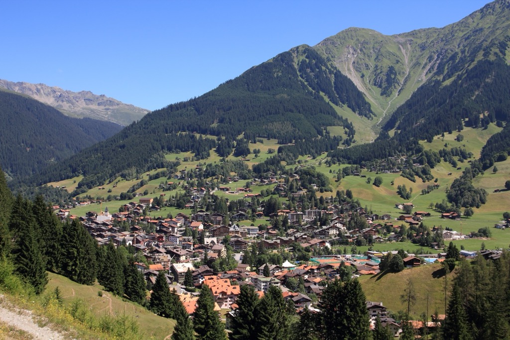
The largest village in the Prättigau Valley, Klosters, is linked with nearby Davos by the Parsenn Ski Area. Klosters is well-connected by public transport. It's on the Rhaetian Railway's Landquart-Davos Platz line, with Landquart connecting to Basel and Zürich.
Popular mountains that surround Klosters include Gotschnagrat (2,299 m / 7,543 ft), Madrisahorn (2,826 m / 9,272 ft), and Casanna (2,557 m / 8,389 ft).
Arosa is the most popular resort town in the interior of the Plessur Alps. It has a population of over 3,300 people.
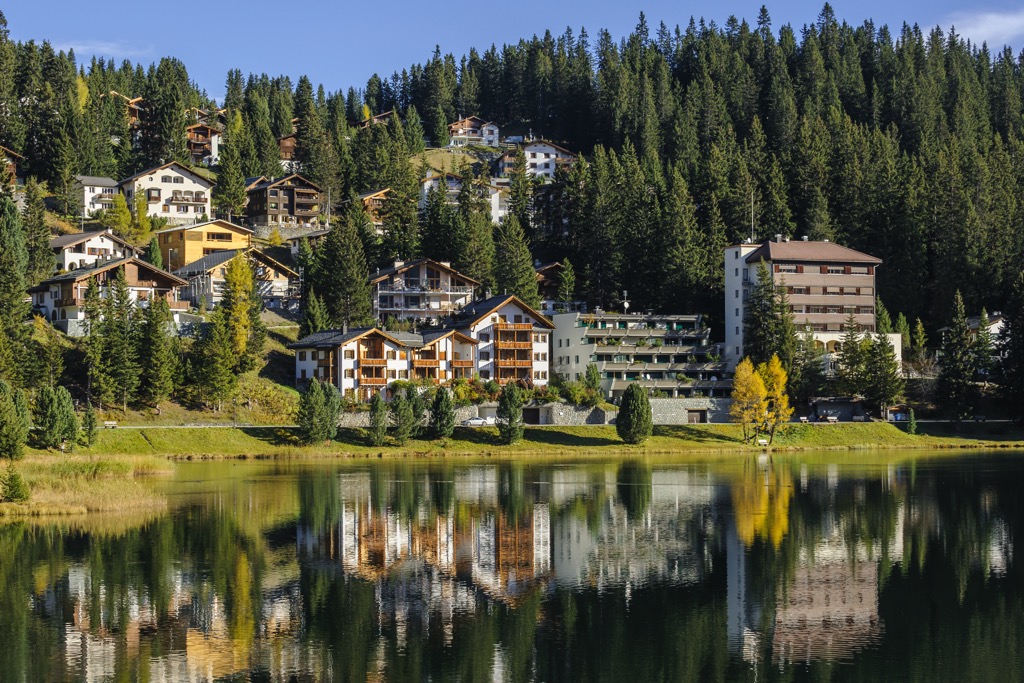
It's a picturesque town with some beautiful natural and human-made sights, including the Obersee and the Landwasser Viaduct. In 2013, a ski lift was built linking Arosa with Lenzerheide, creating one of the largest ski areas in the Grisons.
Arosa's location within the Schanfigg Valley means it's surrounded by the highest summits in the Plessur Alps, including Aroser Rothorn, Lenzerhorn, and Weisshorn.


