
Scan the QR code and open PeakVisor on your phone
The Albula Alps include 304 named peaks. The highest is Piz Kesch at 3,418 m. Other notable peaks include Piz Calderas, Aguoglia d'Es-cha and Piz Güglia.
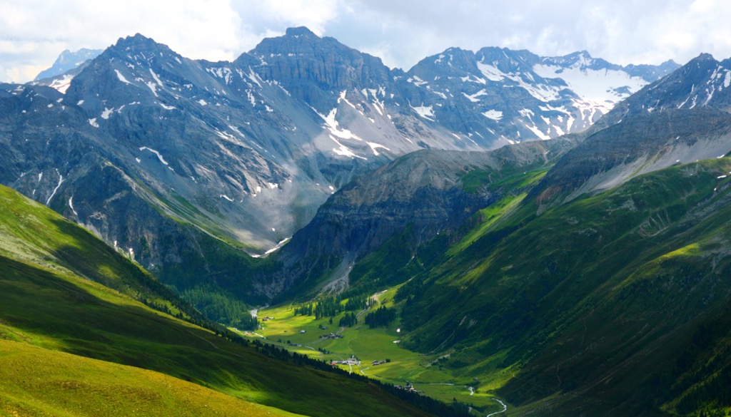
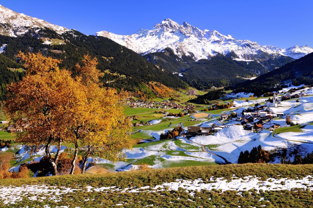
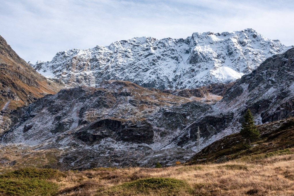
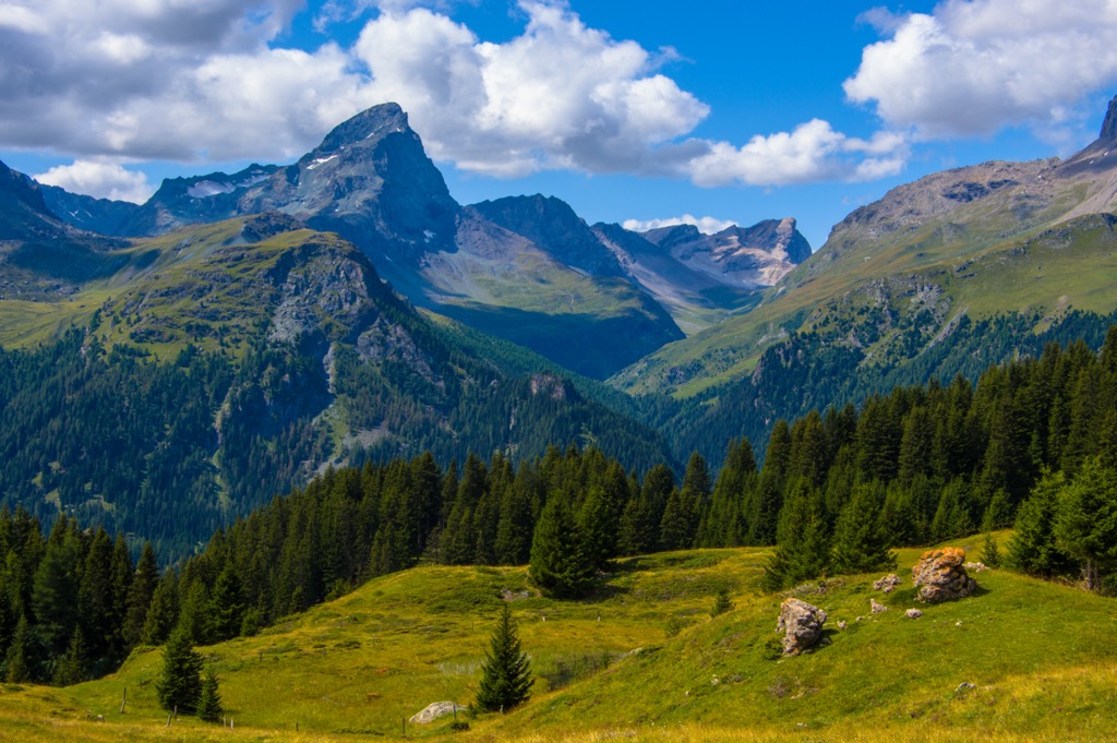
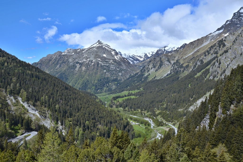
The Albula Alps (Albula-Alpen) are at the eastern end of the Central Eastern Alps within the Western Rhaetian Alps. They're situated within Switzerland's easternmost canton, the Grisons (Graubünden), near the Italian border. The Albula Alps offer some of the best ski tours and hiking trails in the Engadine. They feature over twenty 3000-meter peaks, as well as the highest summit in the Eastern Alps north of the Inn River. There are 304 named mountains in the Albula Alps. The highest and the most prominent mountain is Piz Kesch (3,418 m / 11,214 ft).

The Albula Alps stretch 40 km (24.8 mi) from Zernez in the east to Tiefencastel in the west and over 50 km (31 mi) from Davos in the north to Casaccia in the south.
The range takes its name from the 41 km (25.4 mi) long Albula River. The river's headwaters are located near the Lai da Palpuogna and flow northwest through Bergün Filisur and Albula/Alvra before joining the Hinterrhein near Thusis. The Hinterrhein is significant for being one of two initial tributaries of the Rhine (Rhein).
The Albula Alps are generally between 2,800 m (9,186 ft) and 3,200 m (10,498 ft) in elevation. As a result, the mountains of the Albula Alps feature pockets of glaciated terrain, except the Grialetsch Group, which are clustered around the Grialetschgletscher (2,738 m / 8,986 ft). The range is spread out, with large valleys and numerous isolated peaks.
Six other mountain ranges surround the Albula Alps:
Around half of the Albula Alps form part of Parc Ela, the largest nature park in Switzerland, covering an area of approximately 548 sq km (211.5 sq mi). The park's namesake is Piz Ela (3,339 m / 10,955 ft), the Albula Alps' sixth-highest summit.
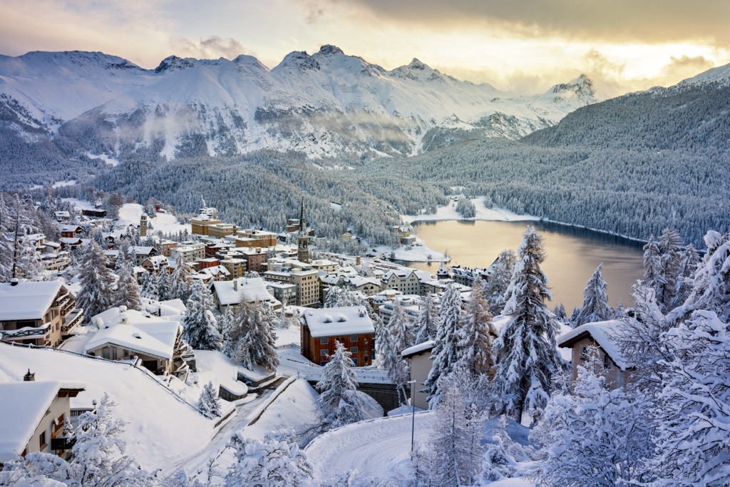
St. Moritz, one of the most popular resorts in the Swiss Alps, rests on the Inn River on Albula Alps' southern boundary. It's the largest settlement in the Albula Alps. At the far northern end of the Albula Alps, just across the boundary with the Plessur Alps, is the world-famous ski resort of Davos.
Other notable settlements in the Albula Alps include Samedan, Tiefencastel, Bergün, and Silvaplana.
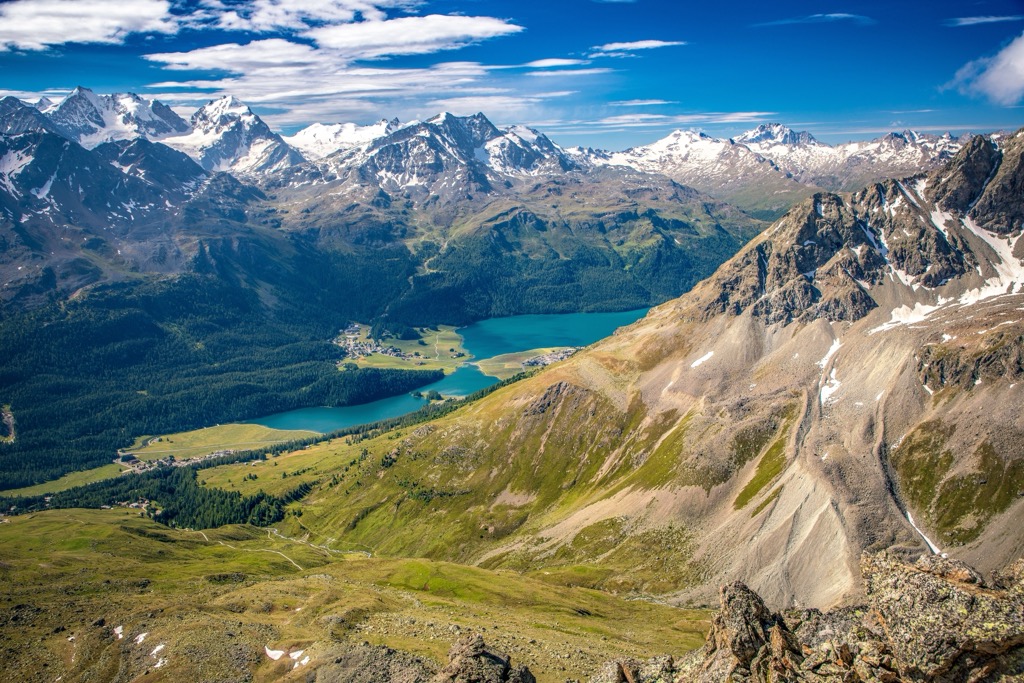
The largest lake in the Albula Alps and the entire Engadine is Silsersee (Lej da Segl), with a surface area of approximately 4.1 ㎢ (1.6 sq mi). The Albula, Gelgia, Landwasser, Inn, and Mera are the primary rivers that drain the Albula Alps.
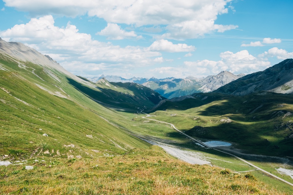
The Albulapass (2315 m / 7,585 ft) is the most significant mountain pass in the Albula Alps. It runs across the entire width of the range from La Punt to Thusis via Bergün and splits the region into two primary mountain chains.
Here's a breakdown of the two mountain chains that constitute the Albula Alps, along with their sub-groups and highest summits.
The Güglia-Err-Bravuogn Chain encompasses the entire area south of the Albulapass. It's split into three main subgroups, which, from north to south, are:
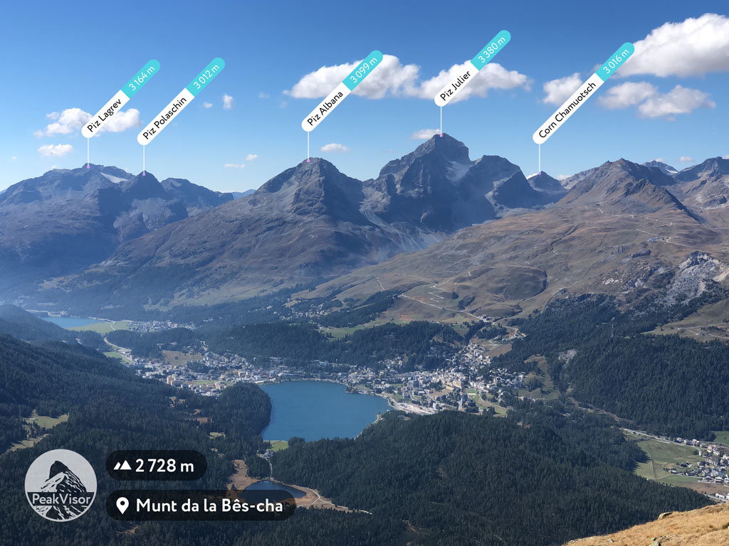
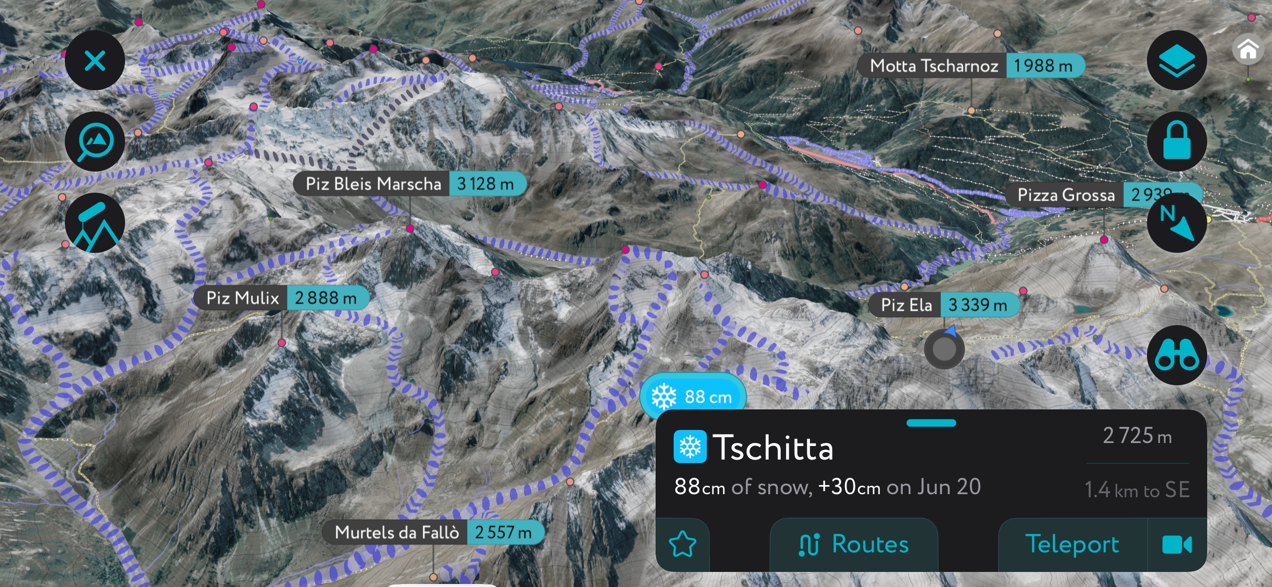
The Pizs da Bravuogn Group covers the area from Tiefencastel to around the Fuorcla da Tschitta (2,831 m / 9,288 ft). Its central valley is the Val Spadlatscha. The highest summits in the Pizs da Bravuogn Group include Piz Ela (3,339 m / 10,955 ft), Piz Mitgel (3159 m), and Piz d'Uglix (2,967 m / 9,734 ft).
South of the Pizs da Bravuogn Group is the Err-Calderas Group. It stretches from Fuorcla da Tschitta to the Val Bever and includes all mountains on the valley's north, east, and west sides, including Crasta Mora (2,952 m / 9,685 ft).
The highest summits in the Err-Calderas Group are Piz Calderas (3,397 m / 11,145 ft), Piz d'Err (3,378 m / 11,083 ft), and Piz Picuogl (3,333 m / 10,935 ft). Piz Calderas is the second-highest summit in the Albula Alps.
The southernmost mountain group in the Albula Alps is the Güglia-Ot Group. It covers the area from Val Bever down to St. Moritz. It's the largest group in the Güglia-Err-Bravuogn Chain and includes the Julierpass (2284 m / 7,493 ft) and the Piz Lagrev Group.
The highest mountains in the Güglia-Ot Group are Piz Güglia (Piz Julier) (3,380 m / 11,089 ft), Piz Ot (3,246 m / 10,653 ft), and Piz Bever (3,220 m / 10,597 ft).
The Kesch-Chüealphorn-Grialetsch Chain is the larger of the Albula Alps' chains, covering the entire area north of the Albulapass.
The Kesch-Chüealphorn-Grialetsch Chain comprises four groups:
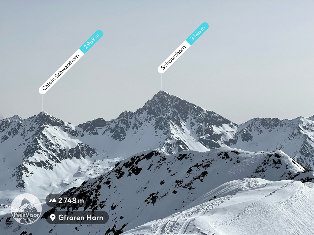
The Chüealphorn-Schwarzhorn Group is in the northwest corner of the Kesch-Chüealphorn-Grialetsch Chain, covering the area from Davos to the Flüela Schwarzhorn (3,146 m / 10,324 ft) and the edge of Val Susauna.
The Chüealphorn-Schwarzhorn Group is home to the Dischma Valley. Its highest summits are the Flüela Schwarzhorn, Piz Radönt (3,065 m / 10,052 ft), and Bocktenhorn (3,044 m / 9,987 ft).
The Grialetsch Group is in the northeastern corner of the Kesch-Chüealphorn-Grialetsch Chain. It spans the area from Val Susauna to Val Susasca and Zernez. Its highest summits are Piz Vadret (3,229 m / 10,594 ft), Piz Sarsura (3,178 m / 10,420 ft), and Piz Grialetsch (3,131 m / 10,272 ft).
The Ducan-Monstein Group is in the southwestern corner of the Kesch-Chüealphorn-Grialetsch Chain. It covers the area from the Sertig Valley to the Albulapass and from the Landwasser River to Val Tuors. It's the lowest group in the Albula Alps.
Its highest summits are Piz Ducan (3,063 m / 10,049 ft), Plattenflue (3,012 m / 9,882 ft), and the Älplihorn (3,004 m / 9,862 ft).
The Albula Alps' final group is the Greater Piz Kesch Group, located in the southeastern corner of the Kesch-Chüealphorn-Grialetsch Chain. It's the highest group in the Albula Alps and is home to Piz Kesch. The group roughly encompasses the area from the Inn River to the Val Tuors and from the Albulapass to Val Susauna.
In addition to Piz Kesch, the highest summits in the group are Piz Üertsch (3,267 m / 10,719 ft), Piz Blaisun (3,200 m / 10,499 ft), and Piz Cotschen (3,195 m / 10,482 ft).
The Albula Alps formed over 66 million years ago during the Alpine Orogeny. This mountain-building event occurred when the African, Arabian, Indian, and Cimmerian tectonic plates to the south collided with the Eurasian Plate to the north.
Convergent movement between these plates created the Alps. The Alpine Orogeny is also responsible for forming many of the world's most famous mountain ranges, including the Himalayas, the Apennines, and the Carpathians.
The rocks that comprise the Albula Alps date back 250 million years, when the region lay under a shallow ocean. Limestone and marine life deposited at the bottom of this ocean are now found on the slopes of Piz Ela. At Fil da Stidier in Bergün Filisur, archeologists uncovered fossils belonging to ichthyosaurs, marine dinosaurs that could grow up to 20 m (65 ft) long.
Following the break-up of Pangaea around 160 million years ago, the Tethys Sea separated the African and European continents. Gabbro and basalt were deposited on the floor of the Tethys to create the Penninic nappe, one of three rock layers found in the Alps north of the Periadriatic Seam fault line.
During this period, limestone and dolomite were also deposited on the flat floor of the Tethys, which became the Austrolpine nappe. These layers of limestone, dolomite, granite, gabbro, and basalt form the basis of the Albula Alps.
When the Tethys began closing during the Alpine Orogeny, The Austroalpine and the Penninic layers folded on top of one another, creating nappes. Nappes are large sheetlike bodies of rock that have been moved more than 2 km or 5 km above a thrust fault from their original position. Granite from the African continent is also present due to continental collisions during the Alpine Orogeny.
Part of Switzerland's largest nature park and home to the biodiverse Alp Flix, the Albula Alps are among the best places to appreciate the natural splendor of the Swiss Alps.
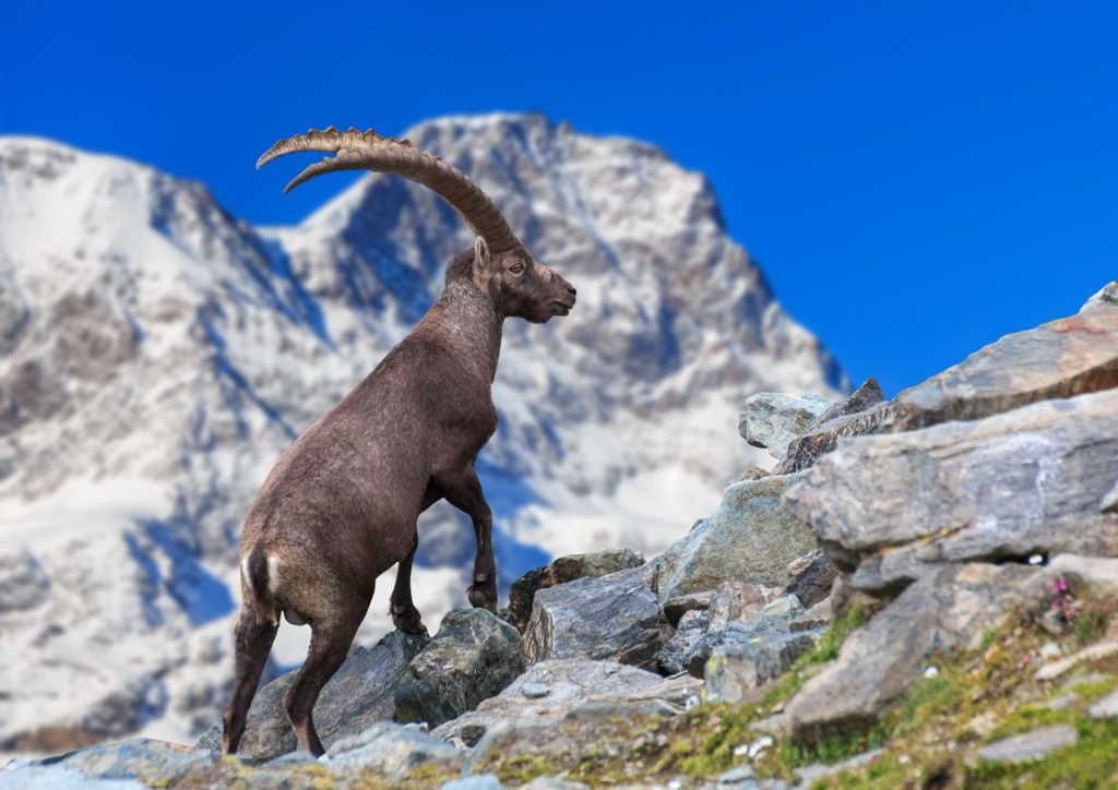
Over 70 mammal species inhabit the Albula Alps, including ibex, chamois, mountain hares, marmots, stoats, and squirrels. The largest mammals are red deer, which can weigh over 200 kg (441 lbs).
Several bat species call the Albula Alps home, including common pipistrelle bats, whiskered bats, and greater mouse-eared bats.
There are 12 to 14 wolf packs present in the Grisons, and wolf sightings are frequent. Brown bears are not currently residents of the Albula Alps; however, a brown bear named "JJ3" migrated to the region from Italy in 2007 but has since left.
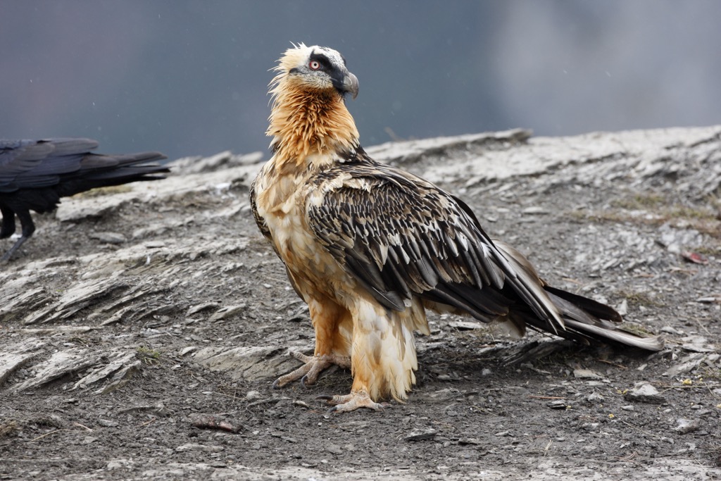
Visitors to the Albula Alps might get lucky and spot a golden eagle or bearded vulture soaring above the mountain slopes. Bearded vultures are the largest birds in the range, with wingspans up to 2.9 m (9.5 ft).
Other notable bird species in the Albula Alps include great spotted woodpeckers, nutcrackers, ptarmigans, black grouses, chaffinches, and skylarks. One of Switzerland's last significant capercaillie populations lives within the Albula Alps.
There are only four amphibian and six reptile species in the Albula Alps. The only venomous snake in the range is the common European adder, which can be found as high as 3,000 m (9,842 ft) in elevation. Other amphibian and reptile species include slowworms, green snakes, alpine salamanders, and alpine newts.
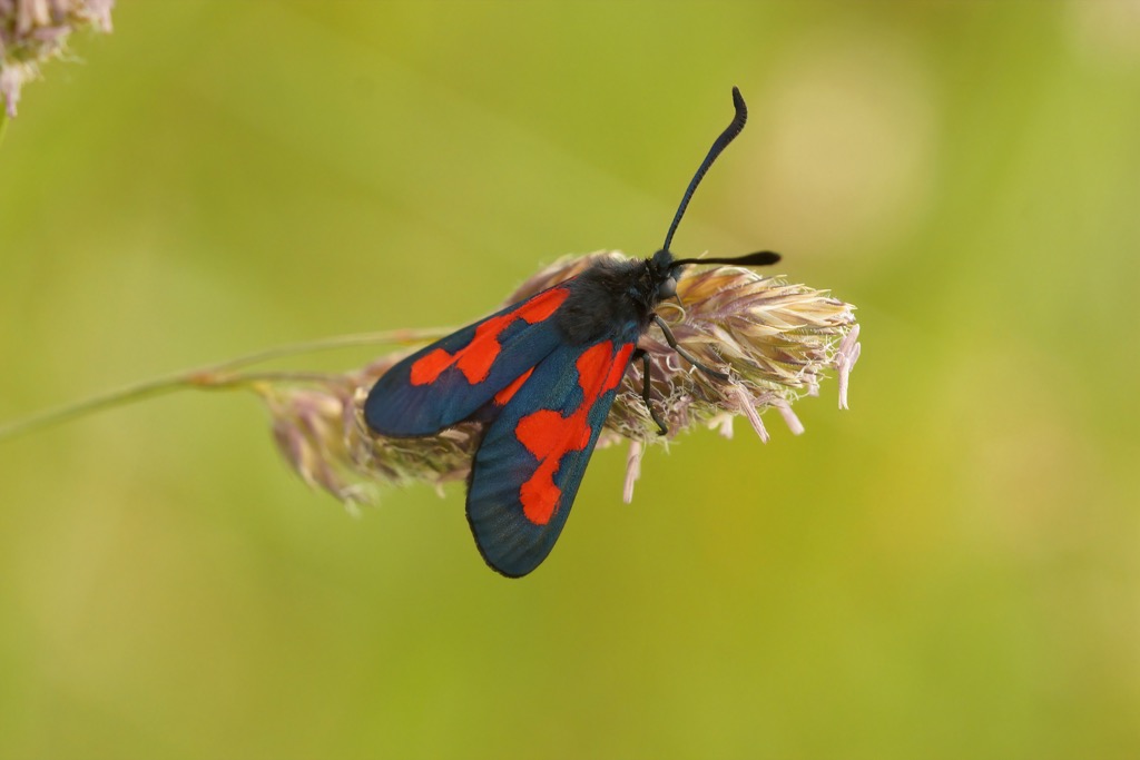
Around a third of all insect species in Switzerland live in the Albula Alps. Over 135 butterfly species are present, including marbled whites and narrow-bordered five-spot burnets. On Alp Flix, home to 2,092 animal and plant species, researchers identified a new dung fly species named Rhexoza flixella after the mountain.
The landscape of the Albula Alps comprises glaciers, forests, shrublands, and moorlands.
Undisturbed by humans, the forests of the Albula Alps carpet large portions of the range; around 25% of Parc Ela is forested.
The most common trees that form the Albula Alps' mountain forests are Scots pines, mountain pines, stone pines, spruces, and larches. In these forests, wild blueberries grow and provide food for native bird species like capercaillies. Heather also grows in abundance between the trees.
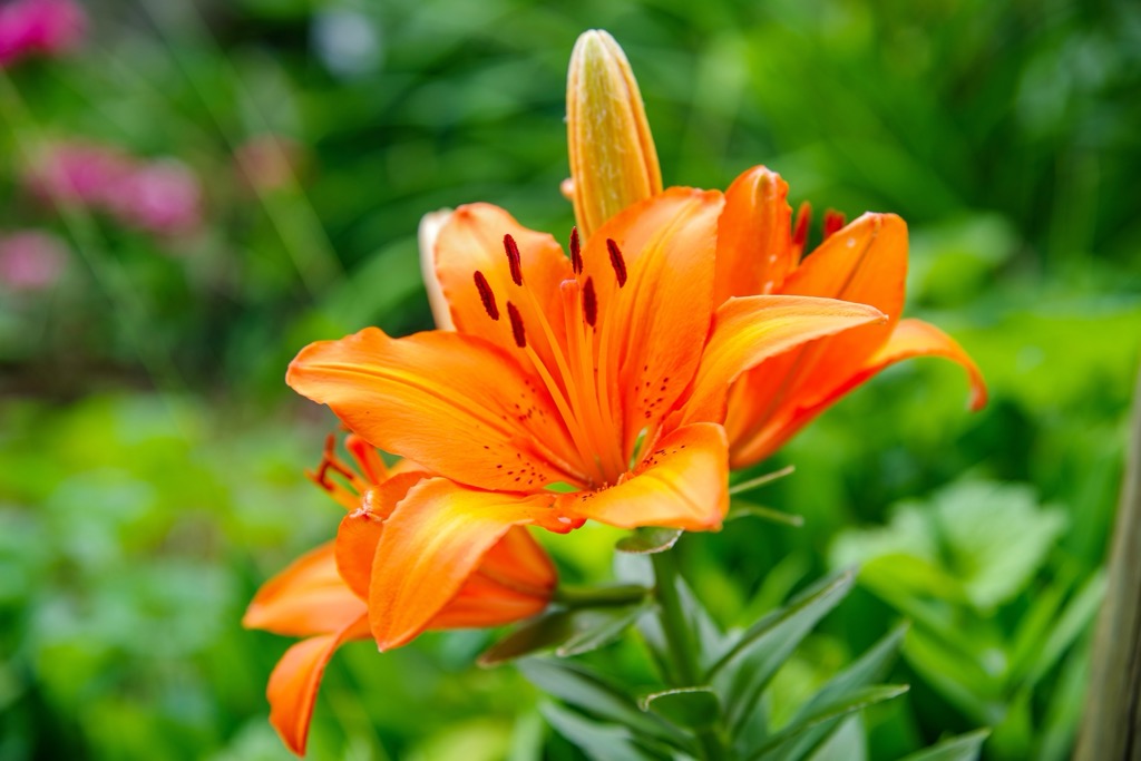
One of the most vibrant plants in the Albula Alps is the orange lily, which blooms in large numbers across the range. Several colorful orchid species blossom here, including lady slippers, globe orchids, coral roots, and twayblades.
Cornflowers, sainfoins, meadow sages, and daisies grow in vast numbers on the low meadows of the Albula Alps' valleys. High above the tree line on the Albula Alps' alpine meadows, a surprisingly large variety of flowering plants flourish, including edelweiss, paradise lilies, pasque flowers, arnicas, and gallworts.
Home to the Romansh language and mountain passes dating back to the Bronze Age, the Albula Alps have a long and fascinating history.
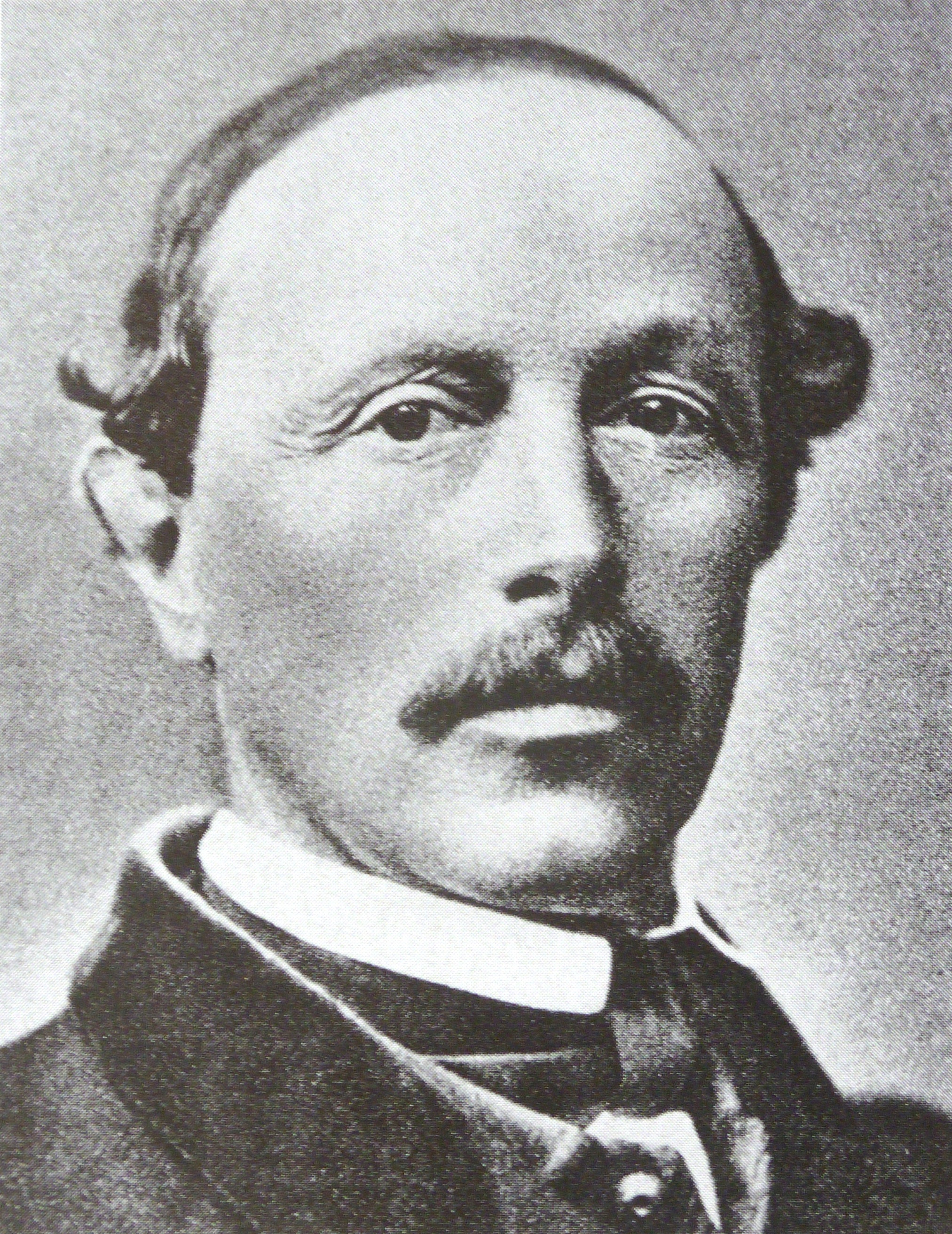
The triumphant ascent of the Albula Alps' highest summit, Piz Kesch, was by Johann Coaz, Chr. Casper, J. Rascher, and J.R. Tscharner on September 7th, 1846.
Johann Coaz is credited with being the first person to summit over 30 mountains in the Alps, including Piz Bernina (4,048 m / 13,281 ft), the highest mountain in the Eastern Alps, and Piz Calderas, the Albula Alps' second-highest summit.
However, there is some debate about whether Coaz's expedition was the first to scale Piz Kesch. In 1864, English mountaineer Francis Fox Tuckett and three companions repeated Coaz's journey. They made their ascent via Porta d'Es-cha (3,008 m / 9,869 ft).
After they easily summitted Piz Kesch, Tuckett believed Coaz had been mistaken about reaching the mountain's true summit. He believed his group was, in fact, the first to scale Piz Kesch successfully.
According to his account, Tuckett discovered a baton placed on the Piz Kesch's second summit to the southeast and found no trace of human activity on the true summit.
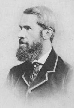
Tuckett was a key figure of alpinism's golden age and was vice-president of the Alpine Club from 1866 to 1868, the world's first mountaineering club.
The first ascent of Piz Güglia was by Gian Saratz and Jann Rüedi on July 12th, 1859. Saratz is notable for being part of the second group to scale Piz Bernina. The first ascent of Piz Ela was by Alex Flury, Peter Jenny, and Georg Jenny on July 17th, 1865.
The Albula Alps are a historically significant part of the Grisons due to their ancient mountain passes. The range features three mountain passes that have been in use since the Bronze Age: the Julierpass, the Malojapass, and the Septimerpass.
All three passes had Roman roads built along them, and remnants of 2,000-year-old cart tracks are still visible on the Julierpass and Malojapass.
Romansh is the official language of the Grisons, with the region preserving this Gallo-Romance language's culture and traditions. Many mountains in the Albula Alps still carry the Rhaetian equivalent of their name, like Piz Güglia (Piz Julier) and Piz d'Es-cha (Piz Kesch).
Two of the five main Romansh dialects exist within the Albula Alps. Surmiran is local to the Albula and Gelgia valleys, while Putèr is spoken around the village of Brail in Zernez and the Upper Engadine. Around 3,000 people habitually speak Surmiran within the Albula Alps.
St. Moritz, the Albula Alps' playground for the rich and famous, has been the filming location of numerous films and TV series. Perhaps most famously, the ski scenes in James Bond's The Spy Who Loved Me and A View to a Kill were filmed in St. Moritz.
The natural beauty of Parc Ela and dozens of breathtaking 3,000ers await hikers in the Albula Alps.
Ensure you bring plenty of provisions and the correct equipment when hiking in the Albula Alps. Check local weather forecasts, map out your route, and inform others of your itinerary.
Here are the Swiss Alpine Club's (SAC) hiking and mountaineering scales referenced in this article.
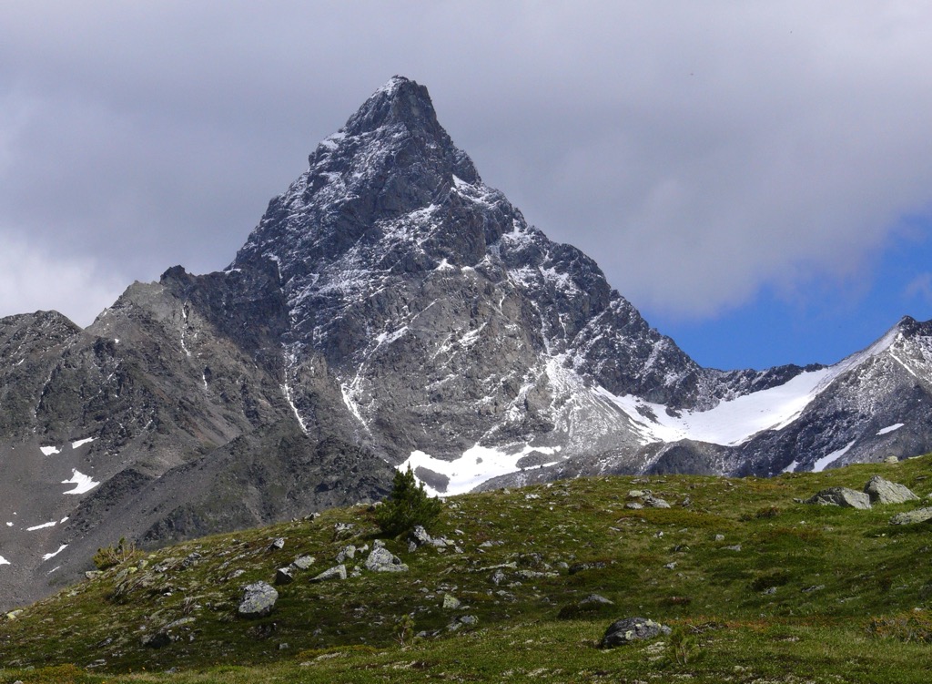
The Albula Alps' highest mountain, Piz Kesch (3,418 m / 11,214 ft), is located north of the Albulapass between the Val d'Alvra and Val Plazbi. It's one of only two mountains in the Swiss Alps north of the Inn River that's higher than 3,400 m (11,154 ft), alongside Piz Linard (3,410 m / 11,188 ft).
cPiz Kesch from the Sertigpass (2,739 m / 8,986 ft)Piz Kesch comprises three summits connected by a narrow ridge. The western summit is the highest and principal peak, while the eastern summit, Aguoglia d'Es-cha (Keschnadel) (3,398 m / 11,148 ft), is the lowest but most impressive due to its needle-like appearance.
On the mountain's north side is the Vadret da Porchabella (2,783 m / 9,131 ft), a glacier covering roughly 2.5 sq km (0.95 sq mi).
With an isolation of 22.9 km (14.2 mi) and over 200 m (656 ft) higher than its neighbors, Piz Kesch affords spectacular panoramas stretching as far as the Ortler Alps, the Pennine Alps, and the Bernese Alps.
Piz Kesch is an excellent mountain for both novices and experienced alpinists. The principal summit is a short, straightforward climb, while Aguoglia d'Es-cha is a challenging ascent, with some good sport climbing routes on its eastern wall.
Piz Kesch's normal route is via its northeastern spur, starting from the Kesch Hut (2,624 m / 8,612 ft). It's the mountain's easiest route and is graded WS on the SAC mountaineering scale.
You'll start by passing over the Vadret da Porchabella, which has crevasses, so ropes are necessary. Passing in an arc from the eastern edge to the west avoids most of the glacier's crevasses.
You'll then climb up a couloir before reaching the mountain's ridge. On the ridge, there are red markings which lead to the summit. Descent the way you came. The ascent of Piz Kesch from the Kesch Hut takes approximately three hours.
Piz Julier (3,380 m / 11,089 ft), also commonly known by its Putèr name, Piz Güglia, is a bulky granite mountain that stands tall above Silvaplana, 5 km (3.1 mi) to the west of St. Moritz.
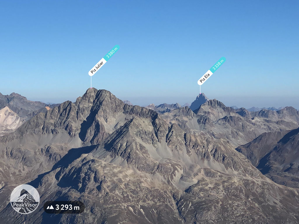
While not as lofty as Piz Kesch and Piz Calderas, Piz Güglia's seclusion and central location make it one of the finest lookout points in the entire Grisons. It's among the canton's most famous mountains.
The summit features stunning views of St. Moritz, with Piz Bernina and Piz Palü (3,900 m / 12,795 ft) to the south, Piz Languard (3,272 / 10,702 ft) to the east, and Piz Platta (3,392 m / 11,128 ft) to the west.
Piz Güglia's normal route is a challenging trek. It's graded T3/T4 on the SAC hiking scale, with some light scrambling near the summit. The hike is very exposed on the mountain ridge, with secured chains and cables to ease your climb. Despite these fixed chains, this ridge route isn't a via ferrata.
You can pick up this trail from Survetta in St. Moritz. It's possible to shorten your approach from Survetta by catching the cable car from the Suvretta Bergstation.
You'll start by hiking to Fuorcla Albana (2,869 m / 9,413 ft), which separates Piz Güglia and Piz Albana (3,100 m / 10,171 ft). From here, white-blue markers make it easy to follow the trail to the summit. Descend the way you came. Piz Güglia's normal route is roughly a 9 km (5.5 mi) round-trip.
Towering above Switzerland's largest nature park at the heart of Parc Ela is Piz Ela (3,339 m / 10,955 ft). Parc Ela's namesake, Piz Ela, is the second-highest dolomite peak in the Alps after Marmolada (Punta Penia) (3,342 m / 10,965 ft) and the highest dolomite peak in the Swiss Alps.
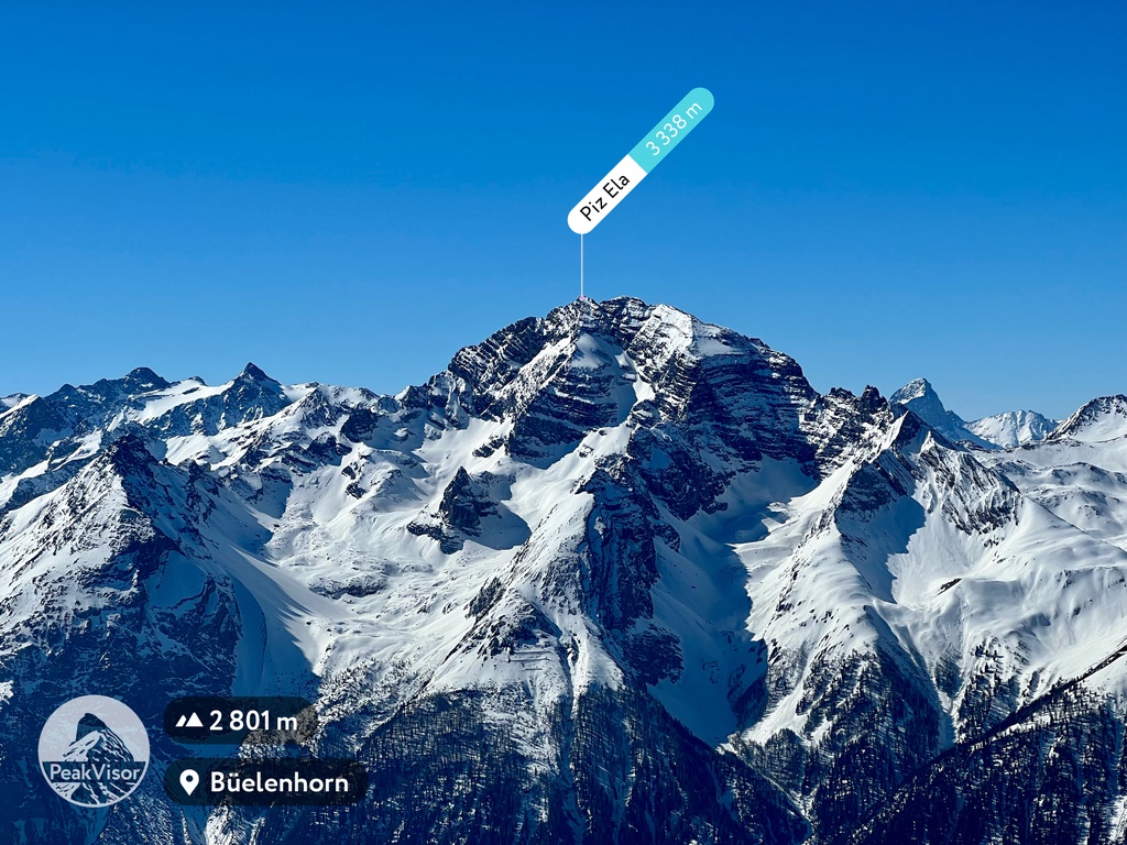
With its dome-shaped summit and narrow, sharp ridge, Piz Ela is a beautiful yet imposing mountain. You'll need to be an experienced mountaineer to reach the summit — all routes, including the normal route via the west ridge, are graded ZS or above on the Swiss Alpine Club's (SAC) mountaineering scale.
Piz Ela's summit views are the effort, with panoramas for 150 km (93 mi) and iconic mountains like Eiger (3,970 m / 13,020 ft), Mönch (4,107 m/ 13,474 ft), and Finsteraarhorn (4,274 m / 14,022 ft) visible.
If you'd prefer a long hike through this idyllic area of the Albula Alps, consider following the Ela Round Tour. Starting in Bergün, this tour leads you to Chavagl Grond's (2,443 m / 8,015 ft) summit for views of the Val Tuors and Val Tisch.
The trail then descends to the Chamonas d'Ela (7,388 ft) and the Pass d'Ela (2,724 m / 8,937 ft). Here, there are sensational vistas of Piz Ela and three glacial lakes, the largest of which is Lai Grond. Past Piz Ela, you'll ascend to the Fuorcla da Tschitta (2,830 m / 9,288 ft), which provides views of the Albulapass.
The final part of this tour crosses the meadows of Maiensäss to reach the village of Naz. You can end this hike in Preda, where there's a train every hour back to Bergün. The Ela Route Tour is approximately 24.6 km (15.2 mi) long.
The Flüela Schwarzhorn (3,146 m / 10,324 ft), or simply Schwarzhorn, is the highest mountain in the Albula Alps north of the Fuorcla da Grialetsch (2,536 m / 8,323 ft). Its position 10 km (6.2 mi) southeast of Davos makes it popular year-round — it's a classic ski tour in winter and an outstanding T4-graded hike in summer.
A clear path from the Flüelapass to the Flüela Schwarzhorn's summit means it's one of the most accessible 3,000ers in the Alps. The best place to begin this hike is from the Flüela Hospice on the shores of the Schottensee.
Walk south along the Flüelapass until you see the white-red-white trail markers. The trail passes over the Schwarzhornfurgga (2,879 m / 9,446 ft) and onto the mountain's southeast side to reach the summit. This hike is approximately 10 km (6.2 mi) in length.
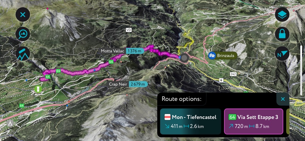
The Via Albula/Bernina is a 130 km (80 mi) long hiking trail that roughly follows the route of the Rhaetian Railway from Thusis in the Oberhalbstein Alps to Tirano on the Swiss-Italian border.
Stages 2 to 6 of this 10-stage long-distance trail lead through the Albula Alps. It's an excellent and unique hike to learn about the Albula's UNESCO World Heritage-protected railway.
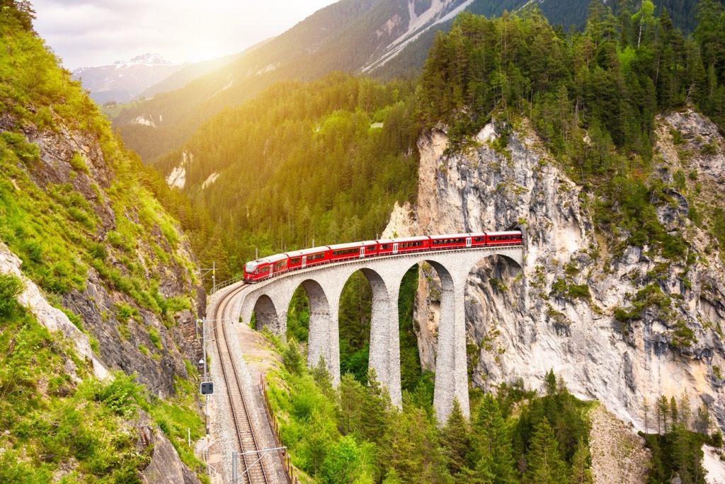
Stage 2 starts in Tiefencastel and ends in Filisur. One of the highlights of this leg is the Landwasser Viaduct, one of the world's most famous viaducts. Stage 2 of the Via Albula/Bernina is 12 km (7.4 mi) in length.

Stage 3 leads from Filisur to Bergün. The trail passes The Dancing Witch's House of Bellaluna (Tanzenden Hexen von Bellaluna) and the historic Stugl railway station. Stage 3 of the Via Albula/Bernina is 10 km (6.2 mi) in length.
Stage 4 runs from Bergün to Preda. Also known as the Historic Railway Trail, this stage passes through Parc Ela. It is excellent for learning about the Rhaetian Railway, with the Albula Railway Museum (Bahnmuseum Albula) in Bergün en route. Stage 4 of the Via Albula/Bernina is 7 km (4.3 mi) in length.
Stage 5 is from Preda to Spinas with an elevation gain of 800 m (2,624 ft), the most of any Via Albula/Bernina stage in the Albula Alps. It leads past the picturesque Palpuognasee (Lai da Palpuogna) and over Weissenstein Alp to Fuorcla Crap Alv (2,464 m / 8,087 ft). It then descends into Val Bever to reach Spinas. Stage 5 of the Val Albula/Bernina is 12 km (7.4 mi) in length.
Stage 6 is the final stage of the Val Albula/Bernina in the Albula Alps, leading to St. Moritz. Heading through the Val Bever, you'll pass along the Märchenweg (Fairy Tale Trail), known for its wooden sculptures. Following the Inn River, you'll soon arrive in St. Moritz. Stage 6 of the Val Albula/Bernina is 13 km (8 mi) in length.
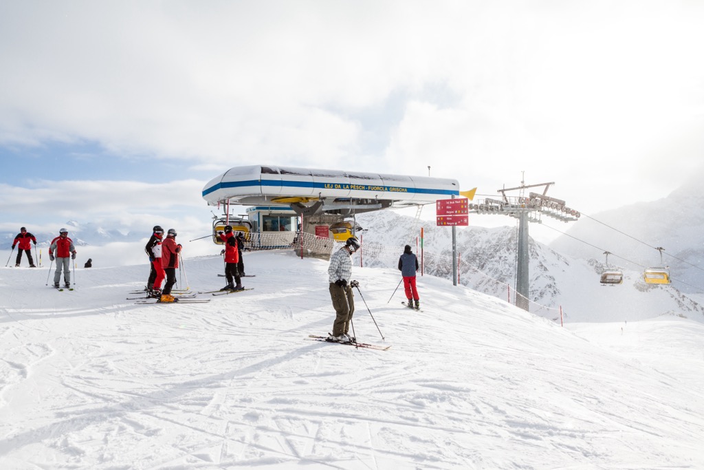
The finest ski tours between two of Switzerland's premier ski resorts, Davos and St. Moritz, are within the Albula Alps.
The Albula Alps are within one of our thoroughly mapped areas, with thousands of ski tours mapped across the Swiss Alps.
Let's take a quick look at a couple of the classic ski tours in the Albula Alps and some of the features that make the PeakVisor App perfect for planning your ideal alpine getaway.
Learn more about the SAC ski tour scale referenced in this section here.
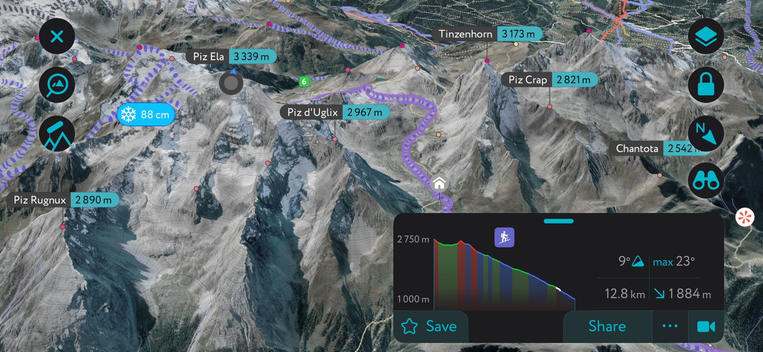
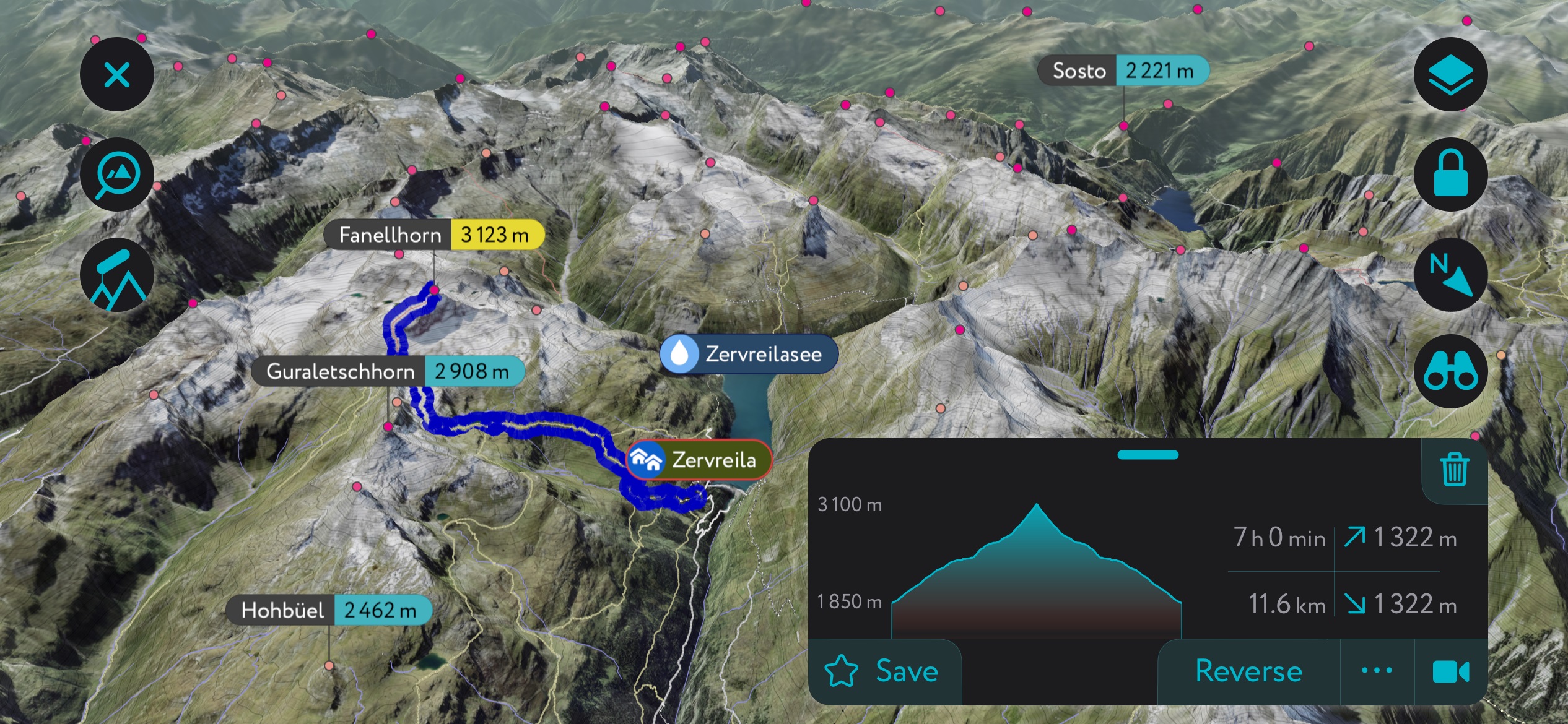
Piz Calderas is the second-highest mountain in the Albula Alps and the highest mountain in the Jenatsch area. It's located 2 km (1.2 mi) northwest of the Chamanna Jenatsch (2,651 m / 8,698 ft), the highest SAC hut in the Grisons.
Piz Calderas is a popular mountain year-round. Its summit affords fantastic views across the Sursés Valley to the Oberhalbstein Alps. The short ascent from the Chamanna Jenatsch makes it a short yet rewarding ski tour.
From the Chamanna Jenatsch, you'll pass over the Vadret Calderas glacier and onto the mountain's south flank to reach the summit.
This ski tour is graded ZS- on the SAC ski touring scale and is approximately 4 km (2.4 mi) in length.
The Büelenhorn (2,808 m / 9,213 ft) overlooks the Walser village of Davos Monstein and is one of the popular ski-touring mountains in the Albula Alps.
You'll have sweeping views of the Bergünerstöcke area from the summit, with Piz Mitgel and Piz Ela visible. The mountain is sometimes called the Büelenhorn Monstein so as not to be confused with the Büelenhorn (2,513 m / 8,245 ft) near Davos Dorf.
From Davos Monstein, this ski tour follows the Alpweg through forests to the Inneralp, then over Mäschenboden. You'll ascend the saddle to the mountain's north to reach Büelenhorn's summit.
This ski tour is graded WS+ on the SAC ski touring scale and is approximately 12.5 km (7.7 mi) long.
Need help planning your next ski adventure? We've recently updated the PeakVisor App to become the ultimate tool for planning hiking trips and ski tours.
Get up-to-date information on local weather forecasts and snow depths to ensure conditions are perfect for your next expedition. The PeakVisor App also has the latest info on hundreds of mountain huts across the Swiss Alps, including opening hours, dining options, and overnight stays.
The Albula Alps, with over 240 km (149 mi) of ski slopes and home to the famed St. Moritz, draw in skiers from around the world.
You'll find five main ski resorts in the Albula Alps:
From Bergün to Davos to St. Moritz, the Albula Alps contain some of Switzerland's best mountain resorts.
The Albulapass is a major junction on the Rhaetian Railway, which connects the capital of Grisons, Chur, with St. Moritz, Samedan, Davos, Bergün, and Filisur.
The nearest international airport to the Albula Alps is Milan Malpensa Airport, located roughly 180 km (111 mi) southwest.
Samedan Airport, 5 km (3.1 mi) from St. Moritz, is a regional airport that serves privately chartered aircraft only.
Davos is situated just across the Albula Alps' northern boundary with the Plessur Alps. It's the largest settlement in the vicinity of the Albula Alps, with a population of over 10,000 people.
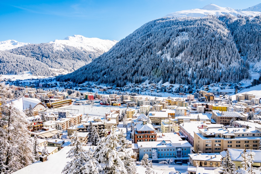
Davos sits at 1,560 m (5,120 ft) above sea level and is world-famous for hosting the annual World Economic Forum. It gained prominence as a luftkurort or "air spa" in the 19th century and is now home to one of the largest ski resorts in Switzerland, with around 300 km (186 mi) of slopes to enjoy.
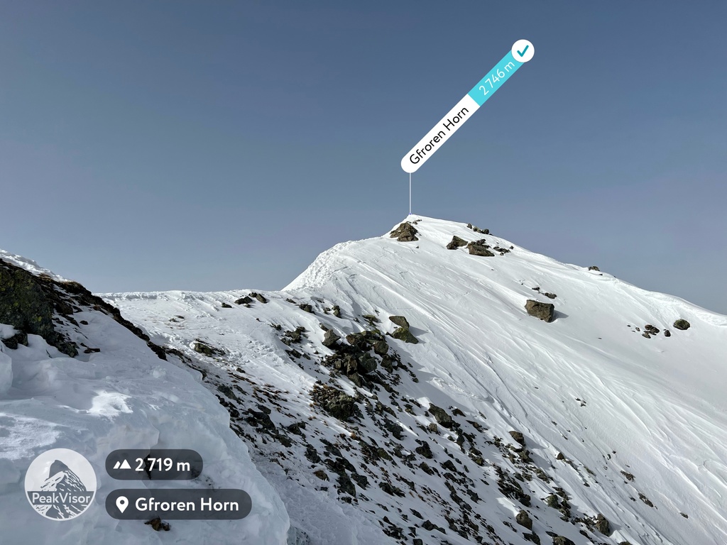
Davos is close to many famous mountains for hiking and ski tours in the Albula Alps. Flüela Schwarzhorn, the Gfroren Horn (2,747 m / 9,012 ft), and the Büelenhorn Monstein are all within 15 km (9.3 mi).
St. Moritz is the primary resort of the Albula Alps, with a population of around 5,000. It's a picturesque town resting on the shores of St. Moritzersee (Lej da San Murezzan) in the shadow of Piz Nair (3,056 m / 10,026 ft).
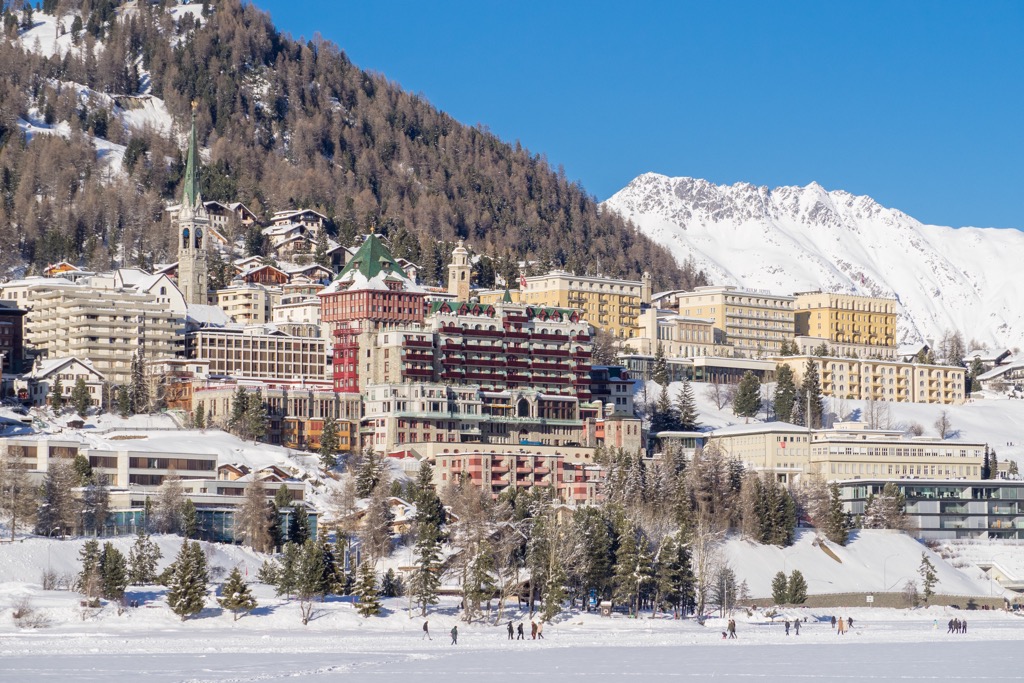
St. Moritz has been a classic skiing destination for over a century. It hosted the 1928 and 1948 Winter Olympics and Alpine World Ski Championships four times, most recently in 2017.
St. Moritz offers four ski areas, covering the slopes of mountains like Piz Nair, Piz Corviglia (3,060 m / 10,039 ft), Piz Corvatsch (3,458 m / 11,345 ft), and Piz Lagalb (2,959 m / 9,708 ft).
Piz Güglia (Piz Julier), Piz Ela, and Piz Calderas are all within 15 km (9.3 mi) of St. Moritz.
The town of Samedan is less than 5 km (3.1 mi) along the Inn River from St. Moritz. It has a population of around 3,000 and is home to Samedan Airport.
Samedan is a stop along the Rheatian Railway and is well-connected to many of the major resorts and towns in the Grisons. The Muottas-Muragl-Bahn funicular railway links Samedan to the summit of Muottas Muragl (2,569 m / 8,428 ft), home to a restaurant and hotel.
Samedan is within 15 km (9.3 mi) of Piz Kesch, Piz Ela, and Piz Güglia (Piz Julier).
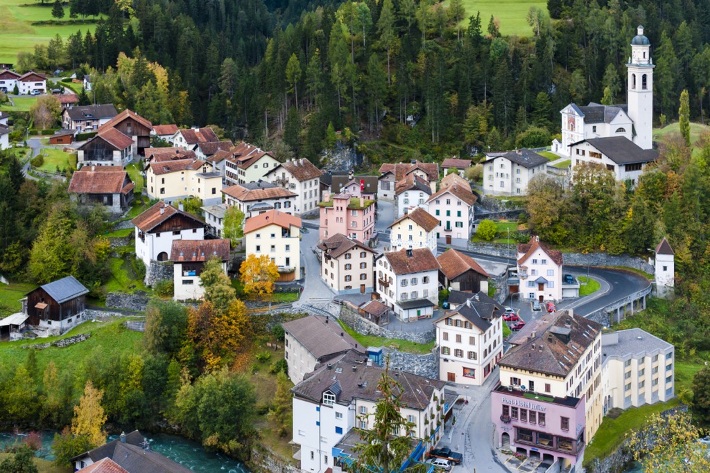
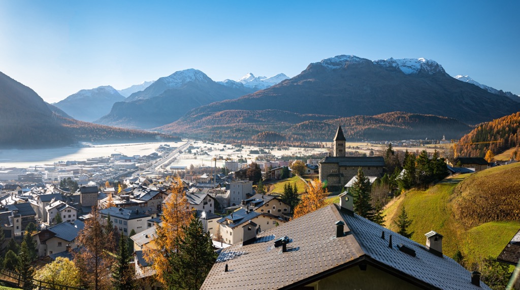
Bergün, or Bravuogn in Romansh, is the principal settlement of the Albula Valley and the largest village in the Albula Alps' interior. It has a population of approximately 480 people.
Bergün is one of the prettiest villages in the Albula Alps due to its position on the Albula River and the traditionally decorated facades of its buildings. One of its top local attractions is the Albula Railway Museum (Bahnmuseum Albula).
Bergün's central position means it's within 15 km (9.3 mi) of many of the finest mountains in the Albula Alps, including Piz Ela, the Corn da Tinizong, Büelenhorn, and Piz Calderas.


The highest peak in the Albula Alps is Piz Kesch, at 3,418 m.
The Albula Alps have 304 named peaks.


