
Scan the QR code and open PeakVisor on your phone
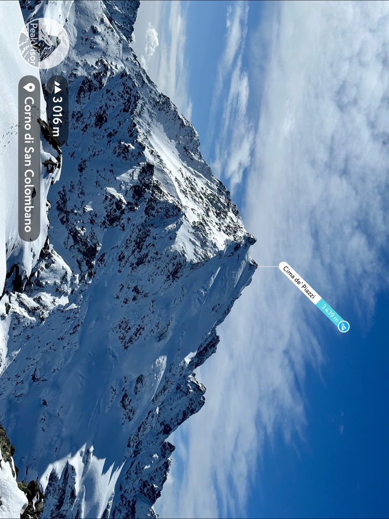
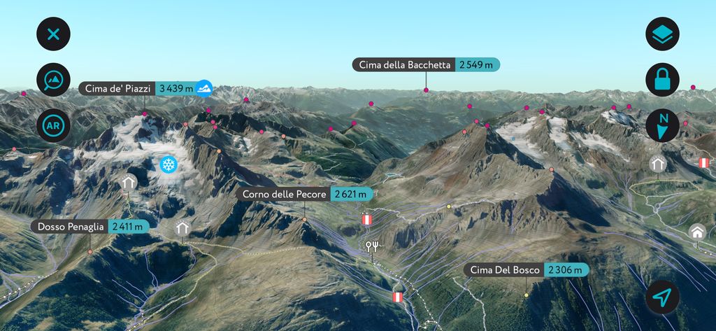
The Livigno Alps include 243 named peaks. The highest is Cima de' Piazzi at 3,439 m. Other notable peaks include Cima Viola, Cima Settentrionale di Lago Spalmo and Corni di Verva.
The Livigno Alps are a cross-border mountain group split between eastern Switzerland and northern Italy. Home to one of Italy's best winter sports resorts and dozens of peaks over 3,000 m (9,842 ft), the Livigno Alps attract hikers and skiers worldwide. There are 243 named mountains in Livigno-Alps; the highest and the most prominent is Cima de' Piazzi (3,439 m / 11,283 ft).
Part of the Western Rhaetian Alps, the Livigno Alps stretch for approximately 55 km (34 mi) from Zernez in the north to Tirano in the south. Roughly 75% of the Livigno Alps are in the Italian region of Lombardy (Lombardia), while the remaining 25% are across the Swiss border in the Grisons (Graubünden) canton. The Livigno Alps consists of a series of four primary valleys separated by mountain ridges.
Several other mountain ranges encircle the Livigno Alps. To the southwest, the Passo del Bernina (2,327 m / 7,634 ft) separates the Livigno Alps from the Bernina Range. To the northeast across the Spöl Valley is the Sesvenna Alps. The Albula Alps are to the northwest, across the Upper Engadin Valley. To the east is the Ortler Alps, with the Passo di Fraéle (1,952 m / 6,404 ft) and the Valtellina's Upper Adda River Valley serving as boundaries.
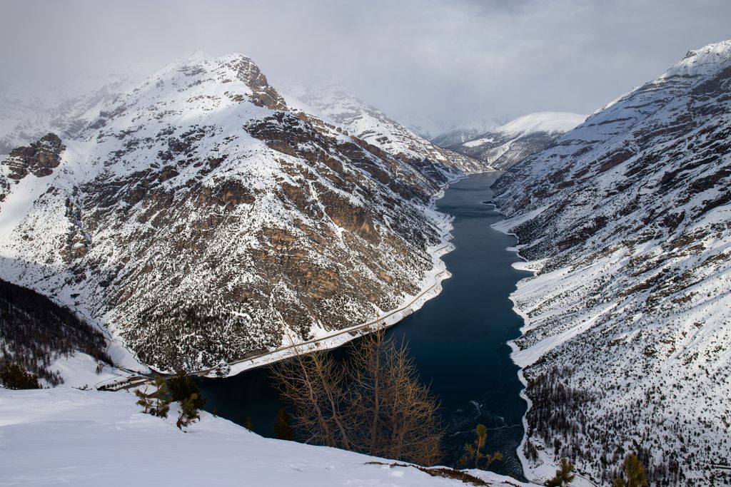
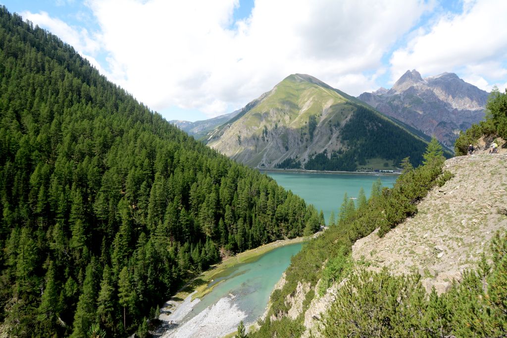
Three significant rivers drain the Livigno Alps: the Adda, the Inn, and the Rom. The Inn River is 518 km (322 mi) long and the third-largest tributary of the Danube. The Rom is a tributary of the Aldige, Italy's second-longest river. The largest lake in the Livigno Alps is the Lago di Livigno, an artificial reservoir in the Val di Livigno with a surface area of 4.7 sq km (1.8 sq mi).
The Livigno Alps don't take their name from a significant or notable summit but rather from the resort town of Livigno.
Most of the Swiss Livigno Alps fall within the boundaries of the Swiss National Park (Schweizerischer Nationalpark), the largest national park in Switzerland. Some of the Livigno Alps' westernmost summits, like Pizzo Cassana (Piz Chaschauna) (3,070 m / 10,072 ft), fall within Stelvio National Park (Parco Nazionale dello Stelvio).
The Val di Livigno is the longest and most important valley in the Livigno Alps, with a length of approximately 25 km (15.5 mi) and an area of over 150 sq km (58 sq mi). Additionally, it's the largest valley in the Alta Valtellina. It's the northernmost valley of the Livigno Alps.
The Val di Livigno is bisected by the Spöl River; the valley also contains Lago di Livigno and the town of Livigno. The Passo Forcola di Livigno (2,315 m / 7,595 ft) on the Val di Livigno's western side connects it with the Swiss resort town of St. Moritz.
Numerous 3,000ers isolate the valley from its surroundings, the highest of which is Piz Paradisin (Pizzo Paradisino) (3,302 m / 10,833 ft).

Valle di Fraele is a small valley perched on the eastern edge of the Livigno Alps, covering an area of over 53 sq km (20 sq mi). It's a plateau at around 2,000 m (6,561 ft) elevation and contains the twin lakes of Lago di Cancano and Lago di San Giacomo.
The valley has a rich iron mining history and contains two 14th-century signal towers called the Torri di Fraele. The southeastern end of the valley opens up to the town of Bormio. The valley is home to notable summits like Monte Cassa del Ferro (3,140 m / 10,302 ft) and Monte Rocca (2,807 m / 9,209 ft).
The Val Viola is the Livigno Alps' central valley. It's approximately 10 km (6 mi) long, running southwest between the hamlet of Arnoga and the Passo di Val Viola (2,431 m / 7,976 ft).
Despite being relatively small, the Val Viola is surrounded by more 3,000ers than any valley in the Livigno Alps. Mountains in the Val Viola include the Livigno Alps' highest peak, Cima de' Piazzi, and Cima Viola (3,374 m / 11,070 ft).
Val Grosina is the primary valley in the southern Livigno Alps. The Roasco Stream, a main tributary of the Adda River, crosses the valley. Val Grosina is generally divided between the Val d'Eita in the north and the Val di Sacco in the west.
It's one of the few valleys in the region whose inhabitants still practice traditional pastoral farming methods, with small isolated villages like Fusino and Eita.
At the southern end of the Val Grosina is the town of Grosio. Major summits surrounding the Val Grosina include Scima da Saoseo (3,264 m / 10,709 ft) and Sasso Maurigno (3,057 m / 10,030 ft).
The Livigno Alps share a geological history with many of the world's largest and most famous mountain ranges. They formed during the Alpine Orogeny, an ongoing mountain-building event that commenced approximately 66 million years ago during the Late Mesozoic Era.
The Alpine Orogeny occurred due to the Arabian, African, Indian, and Cimmerian plates to the south colliding with the Eurasian Plate to the north. This tectonic activity resulted in convergent movements between the plates, creating the basis of the modern-day Alps.
The Alpine Orogeny is one of history's most magnanimous tectonic events, helping create mountain ranges stretching from the Atlas Mountains in North Africa to the Himalayas.
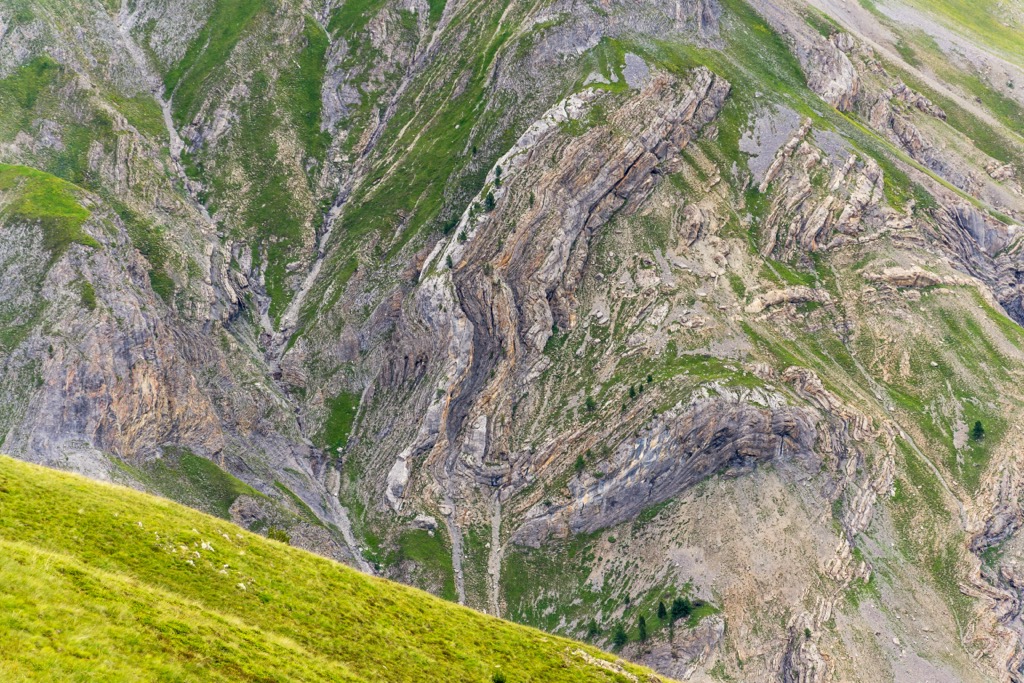
The Livigno Alps are one of the 57 mountain groups in the Western Limestone Alps. Like the rest of the Limestone Alps, the Livigno Alps consist primarily of porous limestone with dolomite, sandstone, and marl intrusions.
Each valley in the Livigno Alps takes on slightly different geological characteristics. The mountains around the Val Viola are primarily gneiss, while brown limestone is most common around Lago di Cancano. Sandstone is prevalent along the Swiss border.
The Livigno Alps are lower than some of the surrounding mountain groups, like the Albula Alps, but still contain over two dozen summits over 3,000 m (9,842 ft) in elevation.
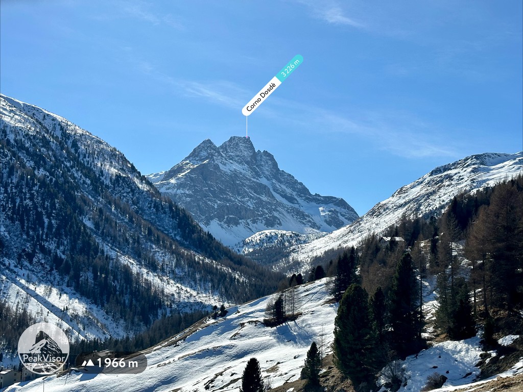
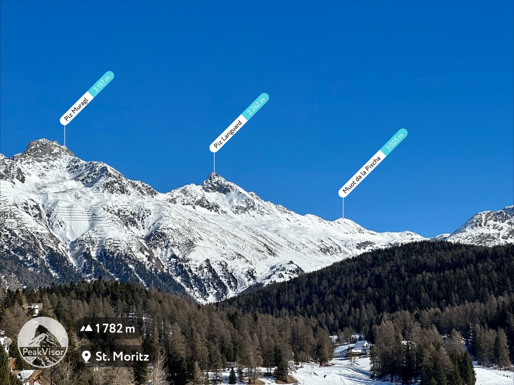
Aside from those already mentioned, notable summits in the Livigno Alps include Piz Languard (3,262 m / 10,702 ft), Corno di Dosdè (3,232 m / 10,603 ft), and Piz Quattervals (3,165 m / 10,383 ft).
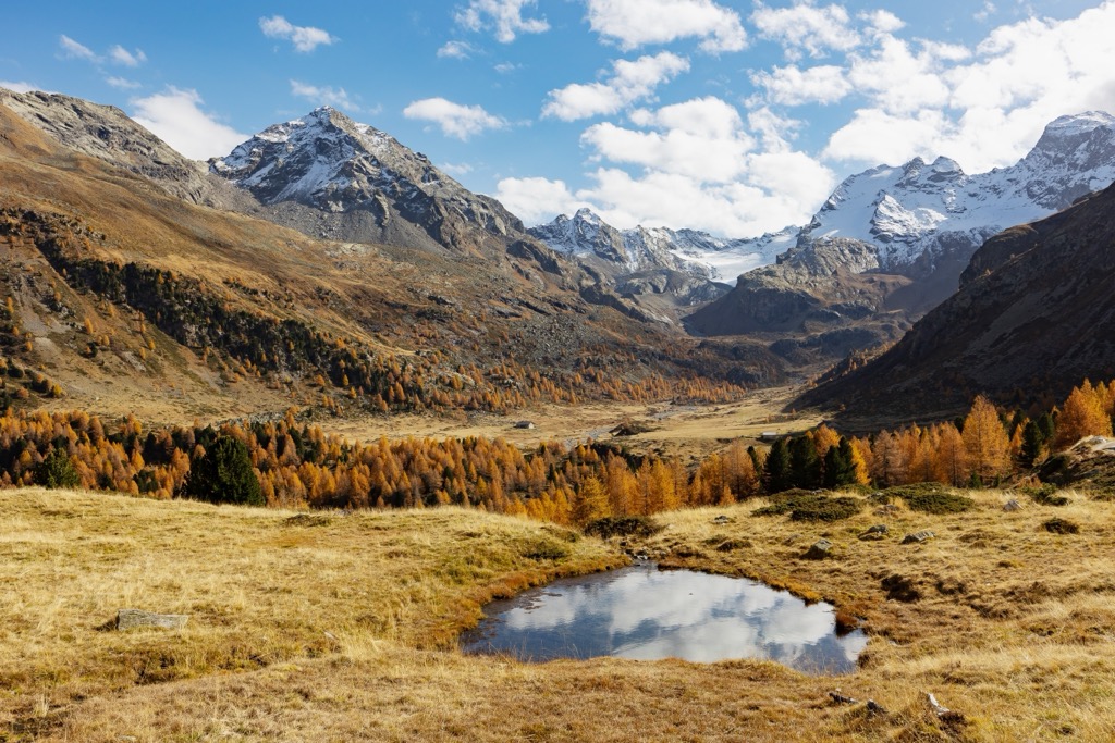
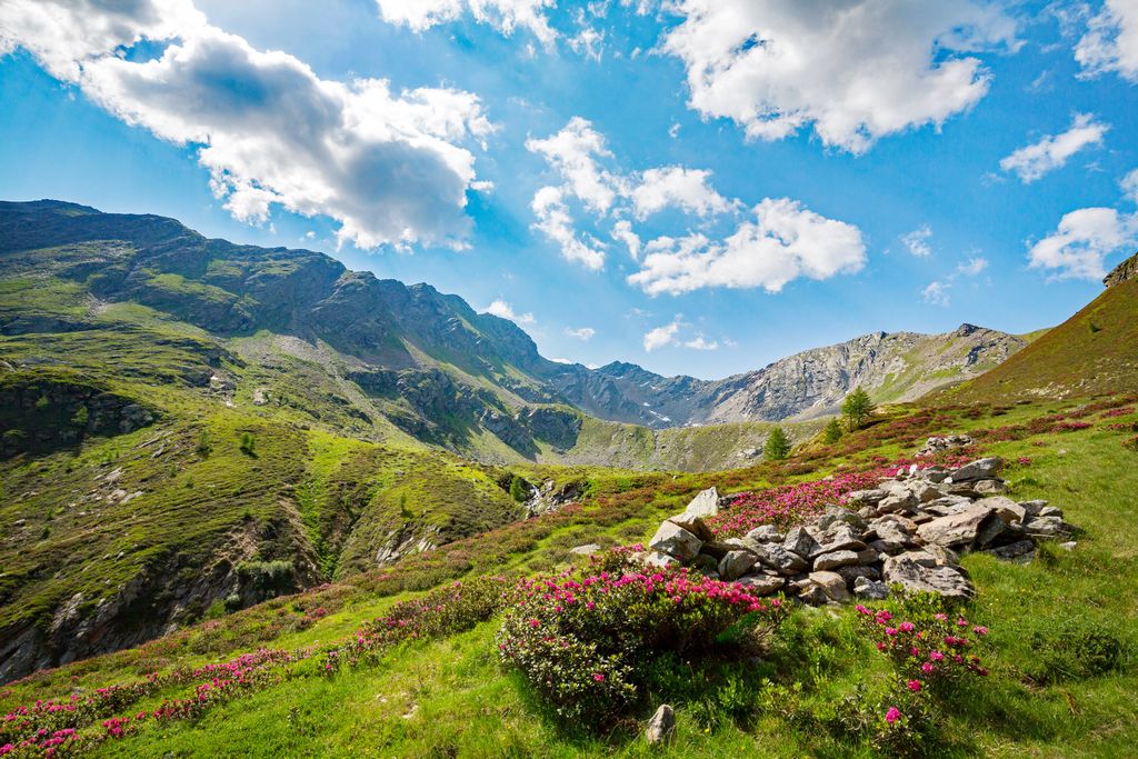
With a mixture of habitats from high mountain lakes to spruce forests to alpine meadows, the Livigno Alps hosts an array of flora and fauna.
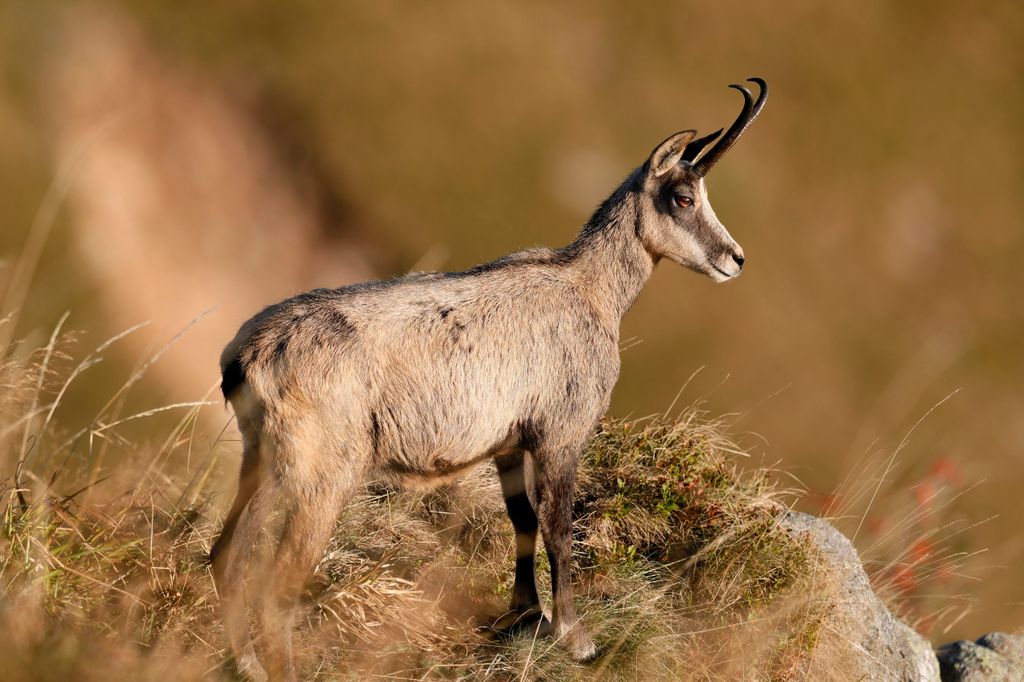
Mammal species commonly spotted across the Livigno Alps include red deer, Alpine ibex, Alpine marmots, chamois, and mountain hares.
Several elusive predator species that went extinct in the Livigno Alps and surrounding areas in the 19th century have been recently reintroduced to the region, including brown bears, Eurasian lynxes, and wolves.
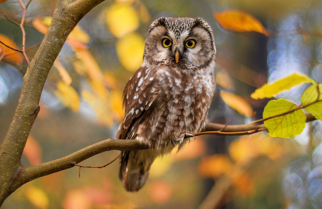
The Livigno Alps and neighboring Stelvio National Park are home to one of the largest concentrations of golden eagles in the Alps. There are an estimated 26 golden eagle breeding pairs in Stelvio National Park alone. Other notable bird species in the Livigno Alps include ptarmigans, bearded vultures, nutcrackers, boreal owls, wallcreepers, and capercaillies.
European asps, also known as aspic vipers, are the most venomous snake in the Livigno Alps; however, they're a rare sight at altitude. Other reptile and amphibian species native to the Livigno Alps include fire salamanders, Alpine newts, and common frogs.
Hikers that explore the woodlands and pastures high in the Livigno Alps may come across many Alpine butterfly species, like Grisons fritillaries, mountain clouded yellows, and small apollos. Many of these species can be found as high as 2,500 m (8,202 ft) in elevation.
Forests carpet large areas of the Livigno Alps, with shifts in elevation influencing their composition. Spruce forests are typical between 800 m (2,624 ft) and 1,400 m (4,593 ft). Higher in elevation up to around 2,200 m (7,217 ft), larch and yew forests dominate the landscape.
Above the treeline, some of the hardiest tree species, like mountain and cembra pines, still flourish. However, for the most part, these high-elevation environments consist of shrublands and alpine pastures.
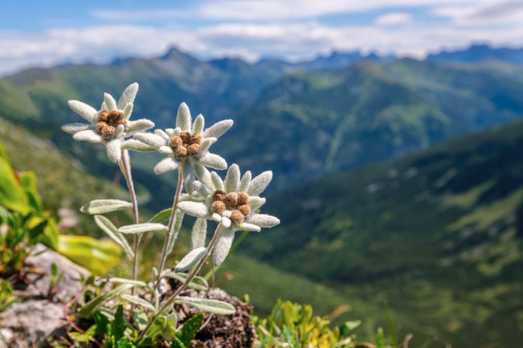
Despite their high elevation, these alpine pastures are home to a wealth of flowering plants and shrubs. Flowering plants that bloom across the Livigno Alps' alpine pastures include Alpine roses, Alpine dandelions, moss campion, Rhaetian poppies, and Switzerland's national flower, edelweiss.
One superlative plant species found in the Livigno Alps is the glacier buttercup. Also called glacier crowfoot, these flowers are seen in bloom as high as 4,275 m (15,501 ft) in elevation, making them the highest flowering species in the Alps.
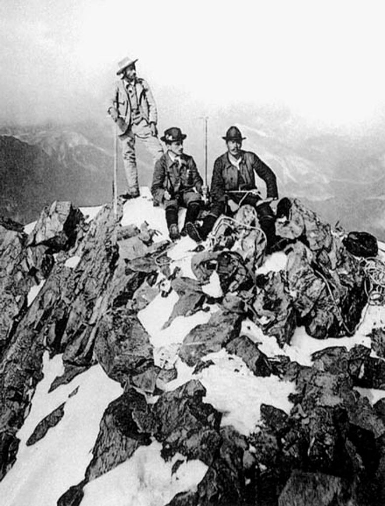
The first successful ascent of the Livigno Alps' highest peak, Cima de' Piazzi, was by Johann Jacob Weilenmann, Franz Poll, and Santo Romani on August 21, 1867.
Weilenmann is a well-known mountaineer accredited with the first ascents of many peaks, including Mont Blanc de Cheilon (3,870 m / 12,696 ft) and Fluchthorn (Piz Fenga) (3,802 m / 12,474 ft).
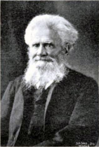
Weilenmann's ascent was during the silver age of alpinism, when mountaineers, primarily from Britain, attempted to scale the Alps' secondary peaks. Hintere Schwärze (3,628 m / 11,903 ft) and Gletscherhorn (3,983 m / 13,068 ft) were also scaled for the first time in 1867.
Famed Swiss mountaineer Johann Coaz was the first person to scale Piz Languard and Piz Quatterals in 1846 and ‘47, respectively. Coaz is known for the first ascent of the Eastern Alps' highest summit, Piz Bernina (4,048 m / 13,283 ft), in 1850 and for giving the mountain its name.
The Livigno Alps' human history is extensive, with Bormio dating back to the Roman Empire. Roman aristocracy visited Bormio for its thermal baths and mountain scenery.
Livigno is a medieval town likely founded by local shepherds and originally named "Vinea et Vineola," which is believed to come from the old German word for avalanche. The Valle di Fraele is known for its iron mining history, with its two 14th-century signal towers embodying its ancient history.
One interesting note about Livigno is that it has a duty-free status due partly to its historically isolated border location. The Livigno Alps' first two ski lifts were opened in 1959. Infrastructural developments, like the opening of the Munt la Schera Tunnel in 1965, saw the start of Livigno's rise to become a major tourist destination.
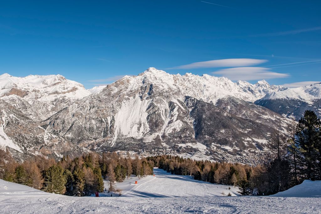
With heavy snow between November and May and numerous 3,000ers worth of scaling, the Livigno Alps are a magnificent - and potentially hazardous - hiking destination.
Ensure you bring appropriate hiking gear and plenty of provisions in the Livigno Alps. Check local weather forecasts, inform others of your itinerary, and carefully map your route.
Cima de' Piazzi (3,439 m / 11,283 ft), sometimes called Cima Piazzi, is the roof of the Livigno Alps, with a topographic isolation of over 21 km (13.6 mi).
Cima de' Piazzi is a beautiful mountain with an impressive north face, home to four glaciers. It features three lengthy ridges, including the western Cresta Sinigaglia, which includes the secondary peaks of Corno Sinigaglia (3,312 m / 10,866 ft) and Corni di Verva (3,068 m / 10,066 ft).
The regular route to Cima de' Piazzi’s summit is along its southern ridge. The starting point for this route is from the car park just south of San Carlo in Val Poschiavo. The trail starts by heading south to the Passo di Verva (2,300 m / 7,546 ft) before looping around to the Colle Piazzi on Cima de' Piazzi's southern ridge.
Cima de' Piazzi’s regular route is not well signposted, with only the occasional sign or cairn to guide you, so plan your route carefully. It's roughly a 10-hour round trip to the summit and back.
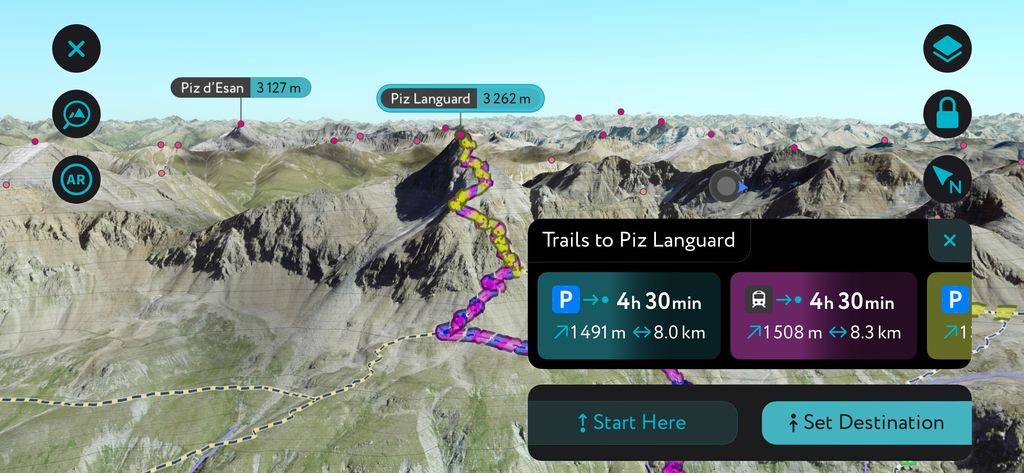
Piz Languard (3,262 m / 10,702 ft) is the highest summit west of the Passo Forcola di Livigno (2,315 m / 7,595 ft). Its height and position parallel to the Brenina Range make it one of the best vantage points in Switzerland's Engadin region. From atop Piz Languard, you can enjoy views as far as Gran Paradiso (4,060 m / 13,323 ft) over 234 km (145 m) away.
Piz Languard is among the most popular 3,000ers in the Alps, thanks to its accessibility, infrastructure, and panoramas. A well-maintained hiking trail leads to Chamanna Georgy (3,175 m / 10,416 ft), a privately owned mountain hut that serves food and drink.
The route up Piz Languard is steep and strenuous, with some scrambling to reach the summit. You can pick up the trail to Piz Languard from Alp Languard in Pontresina. This out-and-back trail is approximately 7.5 km (4.6 mi) in length.
Piz Quattervals (3,165 m / 10,383 ft) is a popular 3,000er as it's the highest accessible mountain in the Swiss National Park. It's also the highest of the Livigno Alps north of the Fuorcla Chaschauna (2,801 m / 9,190 ft).

Due to its position within the protected Swiss National Park, you'll find only one allowed route up Piz Quatterals. The route begins from Chamanna Cluozza (1,882 m / 6,175 ft) to the mountain's north before passing through Valletta. Chamanna Cluozza is the park's only Swiss Alpine Club (SAC) hut.
Much of the route leads up scree slopes and is signposted with white-blue-white markers. The hike up Piz Quatterals is only suitable for experienced hikers. This out-and-back trail is approximately 10.3 km (6.4 mi) in length.
Monte della Neve (Mont dala Nef) (2,785 m / 9,137 ft) overlooks the town of Livigno and is one of the most popular hikes in the Val di Livigno. It's a simple, family-friendly mountain with a dirt road that leads to the summit. It's not to be confused with Monte della Neve (Schneespitze) (3,174 m / 10,413 ft) in the Stubai Alps.
One of the reasons Monte della Neve is a straightforward climb is you can pick up the trail from the Mottolino Cable Car Station on the mountain's ridge. From the summit, you'll be treated to panoramas of the Val di Livigno and Livigno town. This our-and-back trail is approximately 3.5 km (2.2 mi) in length.

To the north of Bormio is Croce delle Scale (2,500 m / 8,202 ft), which provides one of the finest views of the Valle di Fraele. It's a secondary summit of the Monte delle Scale (2,520 m / 8,268 ft) to the northwest.
The hike up Croce delle Scale is long but relatively straightforward. The trail is steep and exposed in places, so you'll need a head for heights. On the way to the summit cross marker, you'll pass the Forte Monte Scale, a historic military fortress built between 1911 and 1912. You can pick up this trail from the Passo di Fraele (1,951 m / 6,404 ft) near the Torri di Fraele.
From the Croce delle Scale, you'll have beautiful views of Bormio and nearby mountains, with Cima de' Piazzi to the southwest and Cime di Campo (3,480 m / 11,417ft) to the east. On your descent, you'll pass along the shores of the Lago Scale. This looped trail is approximately 7 km (4.3 mi) in length.
La Paré (2,390 m / 7,841 ft), also known as Crap de la Paré, is a mountain summit overlooking the Val di Livigno. It's an accessible, family-friendly mountain, and dogs are welcome. La Paré offers one of the best vistas of Livigno town and the Lago di Livigno, as well as the Val Trepalle.
You can pick up the trail signposted N134 to La Paré from Passo Eira (2,207 m / 7,244 ft) near Mottolino. This out-and-back trail is approximately 4.5 km (2.8 mi) in length.
La Paré is equally accessible for winter enthusiasts; the area features guided snowmobile tours and an officially designated ski touring route that leaves directly from Livigno.
It’s difficult to say what the best ski tours in the Livigno Alps are; there are simply too many. The region takes a lot of snowfall each winter and offers terrain varying from low-angle, alpine slopes to steep couloir descents and glacier skiing. The PeakVisor app is your best friend for ski touring in this region, as we have more routes covered here than any other region on Earth.
The northern flanks of Monte Rocca offer some excellent opportunities for beginner ski tourers or those looking to venture out when avalanche danger is elevated. The approach is north-facing and holds soft snow; you can ski down the way you came or venture higher along the ridge to the summit of Monte Rocca. Best of all, this zone is a stone’s throw from the hub of Livigno.

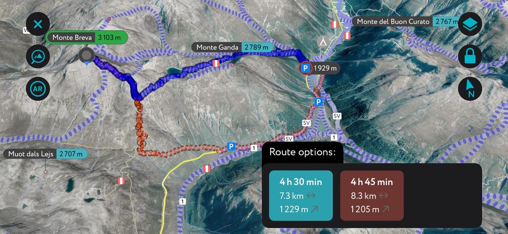
The Monte Breva is another Livigno classic and the perfect way to get your feet wet on a 3,000-meter peak. Several routes ascend, starting from various parking areas in the valley. These are long days, as it’s over 1200 m (4000 ft) from valley to summit. The approach and descent are generally south to southeast-facing, so these routes come into shape when there’s plenty of sunshine to soften up the snow.
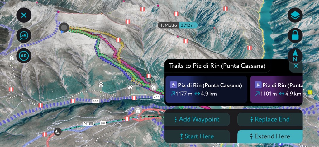
Those looking for a more thrilling descent might be interested in the Piz di Rin. The ascent follows the southeast ridge. It’s not technical, but it’s over 1,000 meters (3,300 ft) from the parking lot, so you’re in for a big day. There are various couloir descents on the west and south faces. Be weaned, however, that some descents will not take you back to where you started, so you might have to leave a car. Check out the app for details.
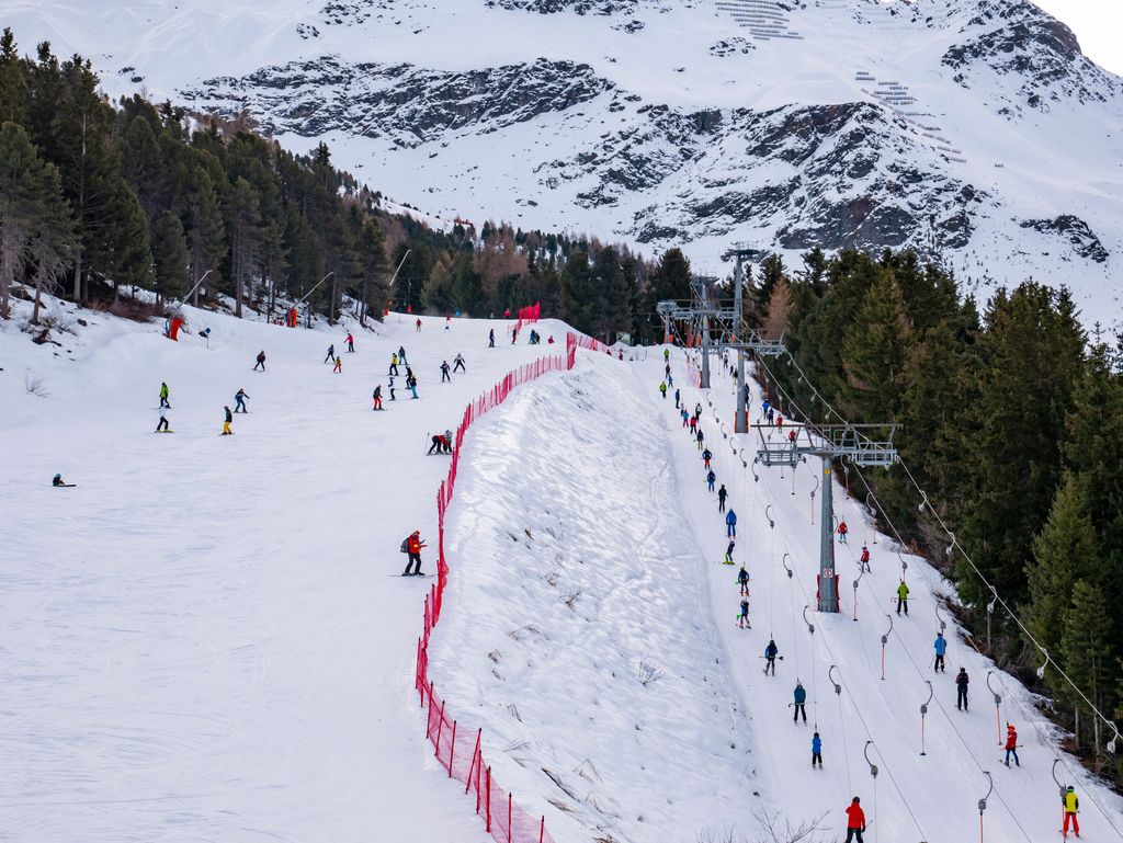
Livigno is one of Italy's most popular ski resorts. It's split into two separate ski areas: Carosello 3000 and Mottolino.
Overall, there are four significant ski resorts in the Livigno Alps:
Hidden away in the valleys of the Livigno Alps are several resort towns on the Swiss-Italian border.
Milan Bergamo Airport is the nearest international airport to Livigno Alps, located 200 km (124 mi) to the south. Bolzano Airport is the closest regional airport, located 75 km (46.6 mi) to the east. Samedan Airport, a private regional airport for chartered flights only, is located 5 km (3 mi) from St. Moritz and 55 km (34 mi) from Livigno.
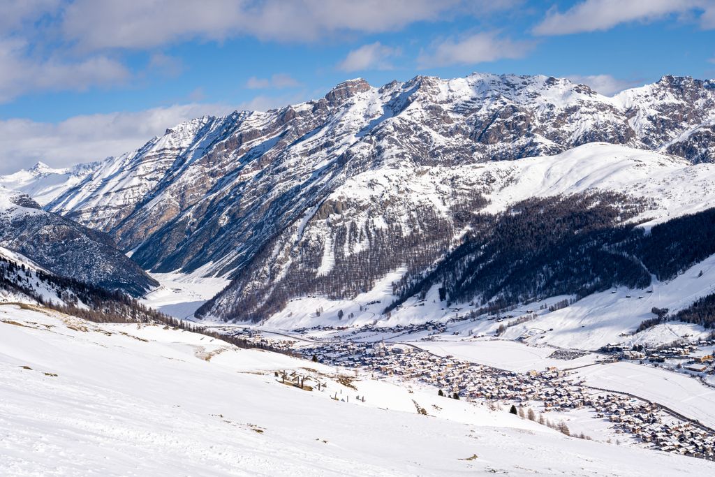
Livigno is known for being one of Italy's highest settlements. With a population of over 6,600 people, it's the second-largest settlement in the Livigno Alps.

Livigno is nicknamed "Little Tibet" due to the area's topography, which resembles the Himalayas. It's one of Italy's top ski destinations and will host the snowboarding and freestyle skiing events at the 2026 Winter Olympics.
Located at the heart of the Livigno Alps, Livigno is the perfect base for hikers, with La Paré, Monte della Neve, and Piz Paradisin within 15 km (9.3 mi) of the town.
Tirano is the largest settlement in the Livigno Alps, with a population of over 9,000. Resting on the Adda River, Tirano is at the far southern end of the Livigno Alps.
The town is home to the 16th-century Madonna di Tirano, a Catholic shrine and significant attraction. The nearest popular mountains for hiking near Tirano include Monte Combolo (Piz Combul) (2,902 m / 9,520 ft) and Monte Masuccio (2,816 m / 9,239 ft), which are both within 10 km (6 mi) of the town.
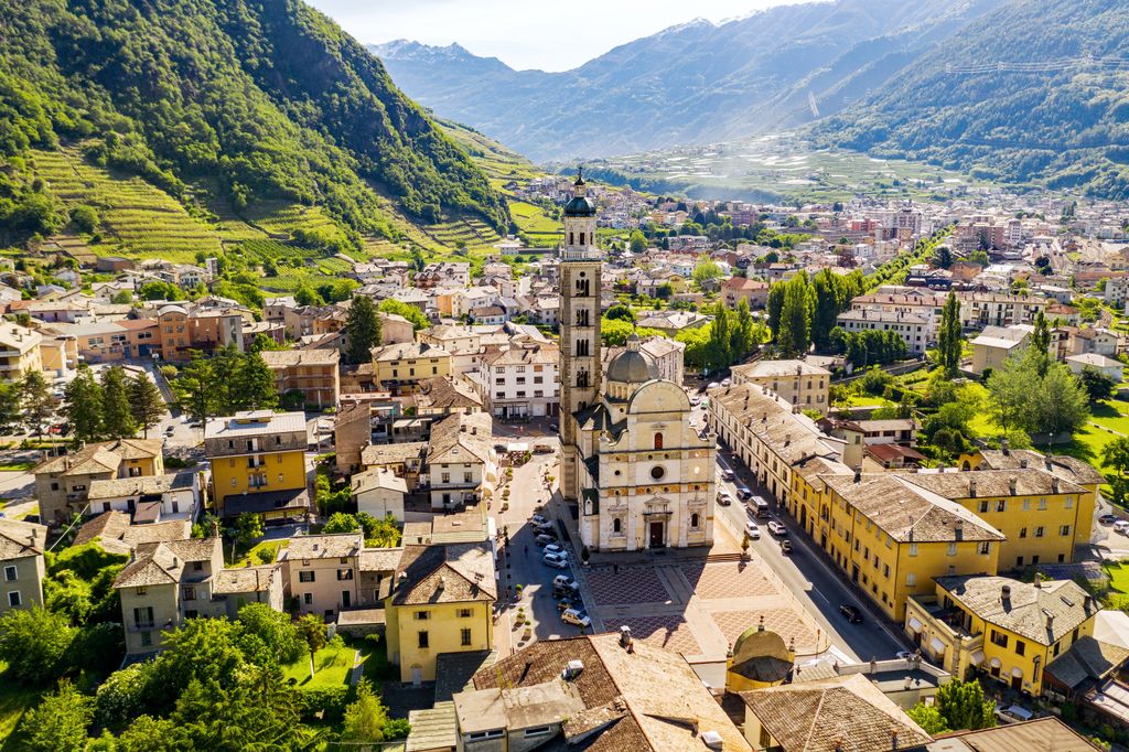
Bormio is an alpine town located on the western tip of the Livigno Alps, with a population of over 4,000.
Bormio, a popular winter sports destination, hosted the Alpine World Ski Championships in 1985 and 2005. It's also famous for its thermal baths, which have been used since the Roman Era. Bormio is the perfect base to scale Cima de' Piazzi, located less than 10 km (6 mi) to the southwest.

Grosio is a small town on the southern edge of the Livigno Alps. With a population of over 4,400, it's the Livigno Alps' third-largest settlement.
Grosio's top attraction is the Grosio Rock Engraving Park, home to the Rupe Magna, which features over 5,000 engravings dating back to between the 4th and 1st century BCE. It's the largest engraved rock in the Alps. Cima Redasco and Cima Viola are located within 15 km (9.3 mi) of Grosio.


The highest peak in the Livigno Alps is Cima de' Piazzi, at 3,439 m.
The Livigno Alps have 243 named peaks.


