
Scan the QR code and open PeakVisor on your phone
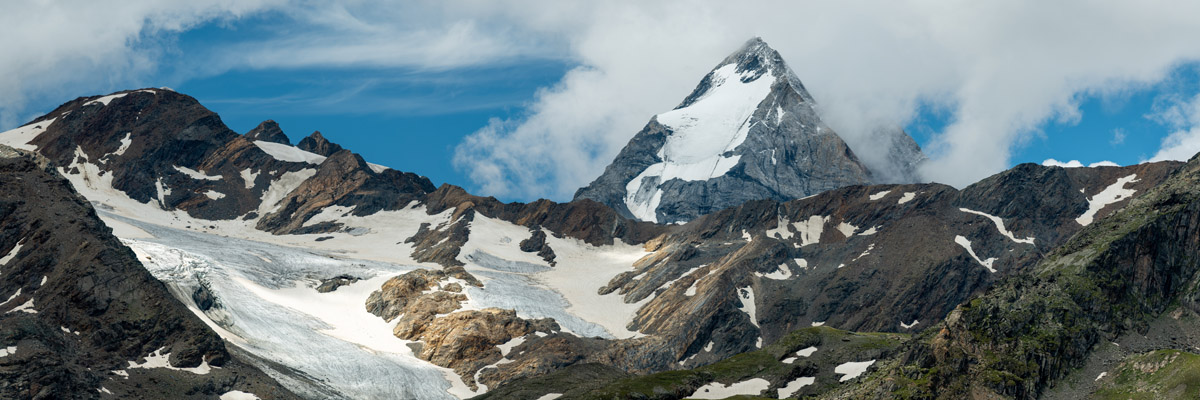
Stelvio National Park is the largest in Italy and the Alps, it is also home to the largest glacier in Italy, Forni. There are 269 named mountains in the park. At 3,905m (12,812ft) Ortler (It: Ortles) is the highest and the most prominent mountain in the park. The area covers 1,300 square kilometers of mountainous territory, and 75% of its surface is above 2,000 from the sea level.
Stelvio National Park is located in the northern part of Italy right on the border between three Italian regions: Lombardy, Trentino, and South Tyrol. The park almost entirely makes part of the Southern Rhaetian Alps. By the time it was founded in 1935, there were already 3 other national parks in Italy: Gran Paradiso, Abruzzo, Lazio and Molise, Circeo. In the northwest, Stelvio National Park borders with Swiss National Park and Biosfera Val Mustair in Switzerland.
The namesake Stelvio Pass is the highest paved tarmac road in Italy. It is a civil engineering triumph, a ribbon of tarmac is 48 km long with 70 hairpin bends soaring at 2,757m in the sky and back down. Historically, it was finished in 1825, so that Austria could control Lombardy, its imperial foothold in Italy back then. There are still the words ‘Stilfser Joch’, Stelvio’s Austrian name, on maps and on some signposts. Interestingly, the nearby Dreisprachenspitze mountain represents the old meeting point of three languages: Italian, Swiss Romansh, and German. Famous Italian auto car maker Alfa Romeo named their top SUV model after this pass. Also, Stelvio Pass is the access point to one of the largest summer ski areas of the Alps. There are more than 20 km of slopes between the Stelvio Pass and Monte Cristallo (3,439m), which are served by 6 ski lifts.
Another well known pass is Gavia Pass. Both passes are extremely popular among cyclists. Both are often included in the famous cycling event Giro d’Italia. At the top of Gavia Pass there’s a statue of Madonna delle Vette, the protector of cyclists. There are convenient parking facilities and restaurants that make them ideal trailheads for numerous excursions.
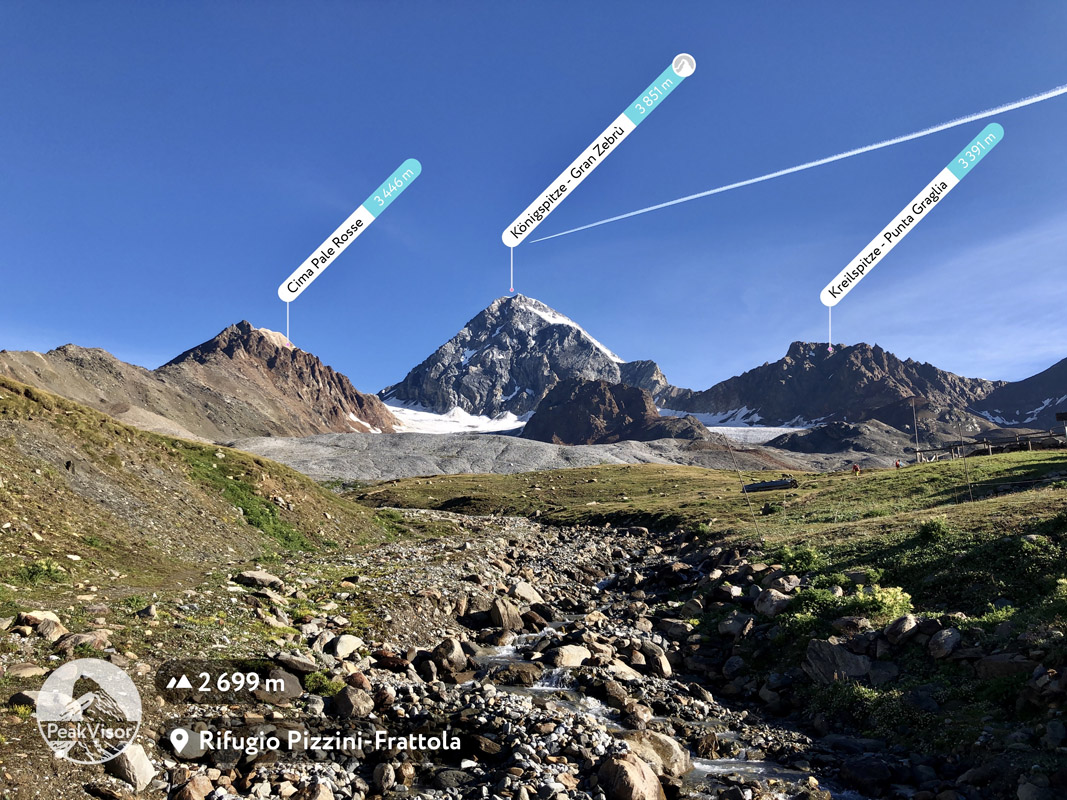
Ortler (right) and Koenigspitze / Gran Zebru (left)
Founded during the fascist government Stelvio National Park is infamous for territorial controversy. Designated territories of Italian regions Lombardy and Trentino were not populated and the park foundation didn’t oppress much of indigenous population. On the contrary, very much populated and fertile agricultural lands were taken from the German speaking province of Bolzano, i.e. the Venosta Valley. Presumably, the decision was intended to demonstrate the government authority to foreign culture of German speaking territories. Up to these days that approach still causes heated debates.
The area is notorious for some of the most fierce and bloody battles fought during the 1st World War. There are several war museums in the region and it’s not rare to see the grim reminders of the confrontation.
Barbed wire near Cima di Solda
Here’s a tip: Want to make sure you know all the mountains in the region? Want to navigate gorgeous 3D maps with all the hiking trails offline? PeakVisor can bring you those superpowers in any part of the world, Stelvio National Park included.
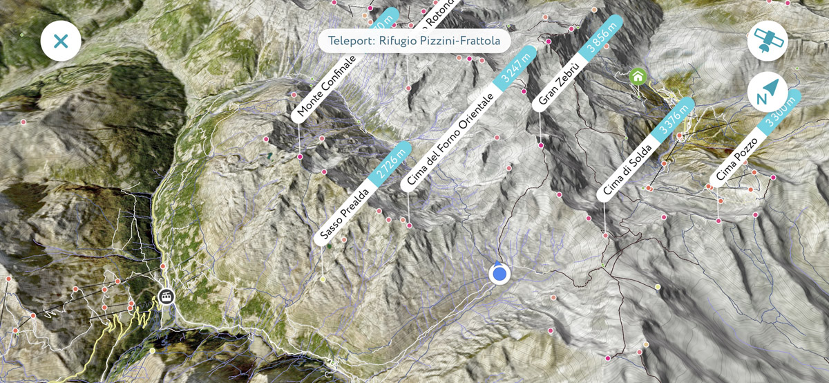
Gran Zebru in PeakVisor 3D maps. Get the app.
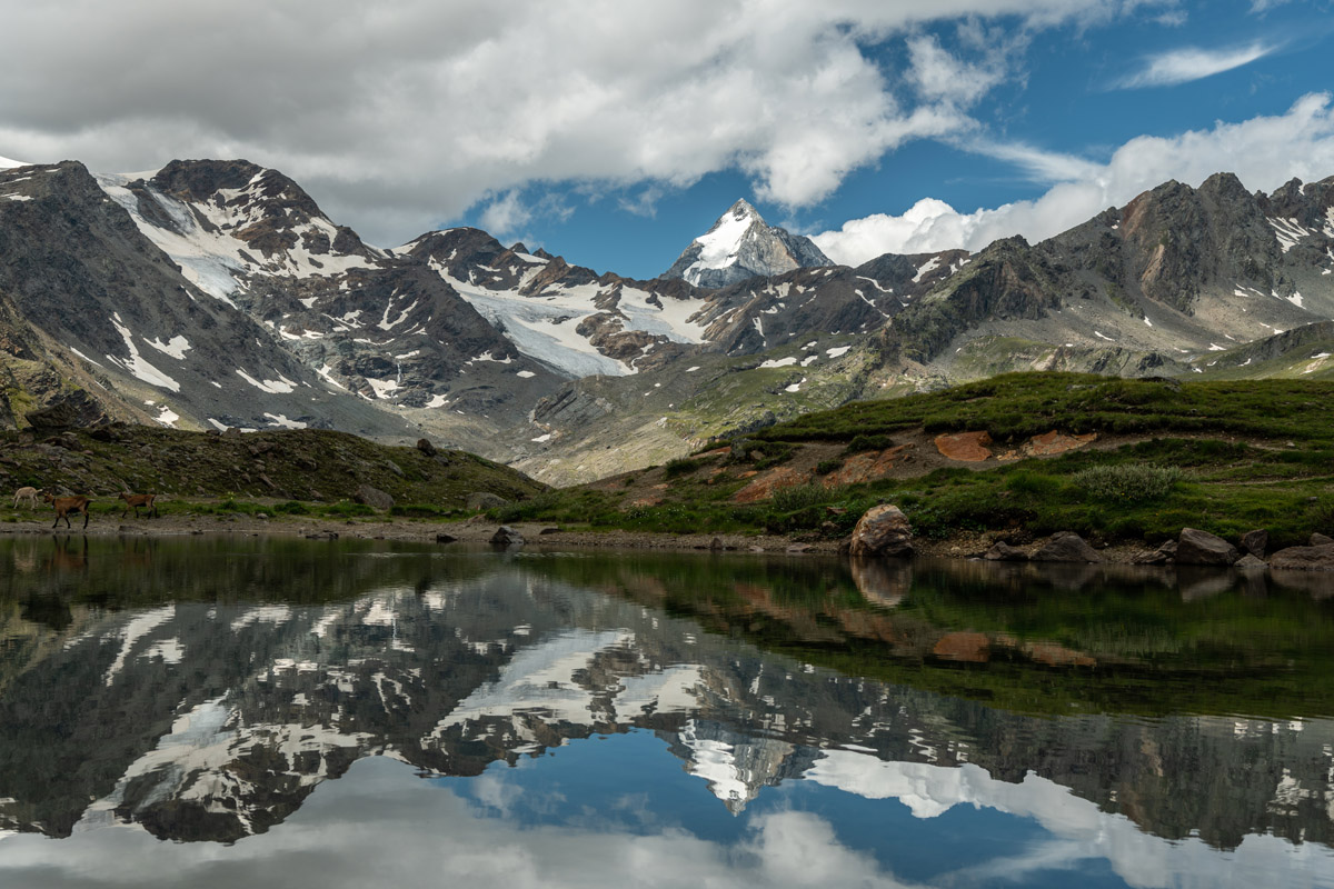
There are many legendary mountains in the national park. Koenigspitze / Gran Zebru is arguably the most spectacular of them. It dominates the landscape and is featured on numerous excursions in the Zebrù Valley and the Cedec Valley.
Koenigspitze / Gran Zebru view from the Martell Valley
The mountains of the national park are mainly composed of metamorphic rocks (gneiss, phyllite, schists) and to a smaller degree from igneous rocks (granit). In the north-western part of the park there are mostly sedimentary rocks (primarily the dolomite).
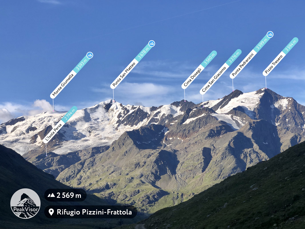
Apart from classic ascents to Ortler and Gran Zebru / Koenigspitze there’s somewhat legendary high altitude trek called Thirteen Peaks after 13 spectacular summits above 3,000m along the way. The trek runs over 17km with almost 2,000m of elevation gain (and drop) over glaciers of medium difficulty and requires alpine skills and adequate equipment (an ice axe, crampons, a cord). The trek takes 3 days and starts at Rifugio Larcher and passes through the following summits:

Stelvio National Park is under management of three different regional administrations: Lombardy, Trentino, and South Tyrol. The sections of the park are naturally divided by glaciated craggy ridges.
The topography of the Lombardy sector is more complex than the two others, so we start with it. Apart from the valleys to the west and south from the park’s highest mountain Ortler, there is the Fraele Valley with two huge artificial lakes and almost no other presence of civilization, and the area around the Gavia Pass.
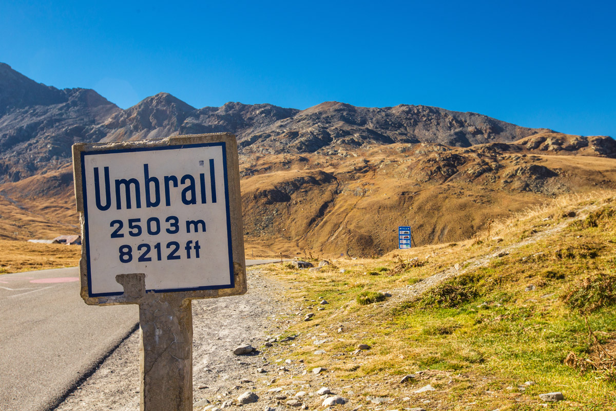
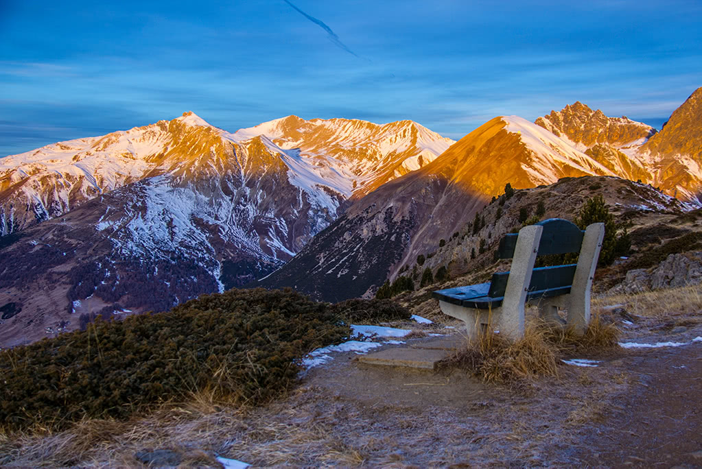
Speaking of the passes we missed an important one. Close to the Stelvio Pass there’s the Umbrail Pass between Italian Lombardy and the Swiss canton of Graubunden. Piz Umbrail right above the pass is a perfect panoramic viewpoint. The trail couldn’t be classified as easy, but still doable with some scrambling over 500m elevation gain through the severely weathered and unstable limestone.
Another convenient and relatively easy summit is Monte Scorluzzo with the trailhead at the Stelvio Pass and mere 300m above it. Finally, Dreisprachenspitze makes another perfect destination for a short and very rewarding panoramic walk.
For exploring Stelvio National Park I find the Forni mountain hut (Rifugio dei Forni) especially convenient and very comfortable. There are several trailheads right out of the gate. In my opinion, the most interesting ones are the glacial trail, Val Cedec - Rifugio Casati trail, and Monte Confinale trail in the very center of the Stelvio National Park with all the highlights in front of your eyes.
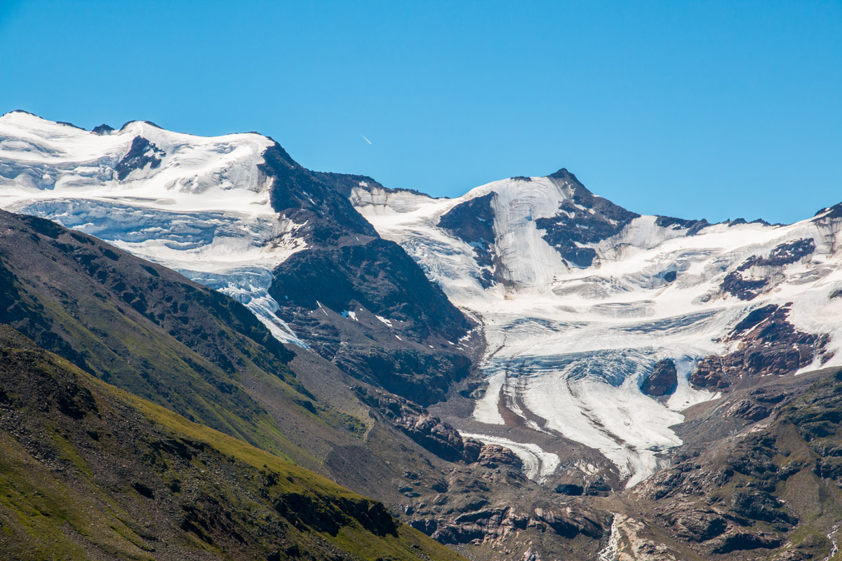
The Glacial Trail
There are two modifications of the trail - a higher and more difficult (alto) and a lower easier and less demanding (basso) one. The latter trail takes about 2 hours to complete and features the largest glacier in Italy - Forni.
The trail starts from Rifugio dei Forni and follows the dirt road to Rifugio Branca. Along the trail, you can observe the signs of glacial forces and information posts. Right after the Branca hut the trail descends to a small lake in front of the glacier.
Monte Confinale Panorama
One of the most spectacular viewpoints is available at the summit of Monte Confinale. The trail to Manzina Lake (Lago della Manzina) is relatively straightforward. The lake itself is a worthy destination. Then after additional 350m of elevation gain you can reach Piero Giampaolo bivouac and a small glacier behind it. Turn left and follow the trail to the summit of Monte Confinale for the unbeatable panorama.
The Cedec Valley - Rifugio Casati
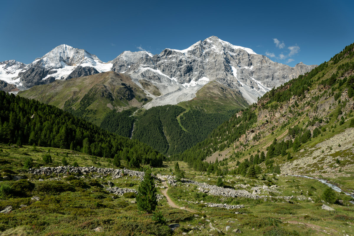
The demanding trail to Rifugio Casati doesn’t provide any technical challenges but relatively long (8.5km one way and 1.2km of elevation gain) and takes at least 4 hours to reach the high altitude world of glaciers. But the rewards of the trail outweigh any struggle during the ascent. It is better to start early in the morning to have a lot of extra time. Going up the Cedec Valley you’ll be exposed to spectacular views of Gran Zebru (Koenigspitze), a tranquil valley shaped by mighty glaciers, and funny marmot whistles.
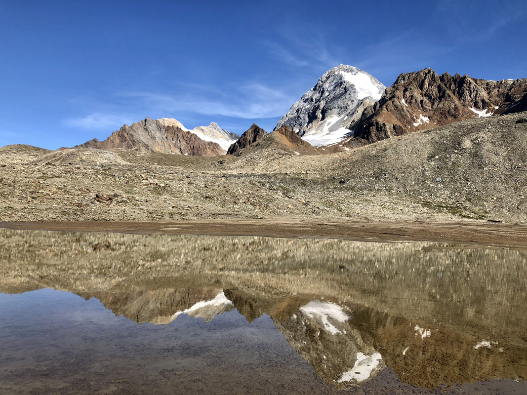
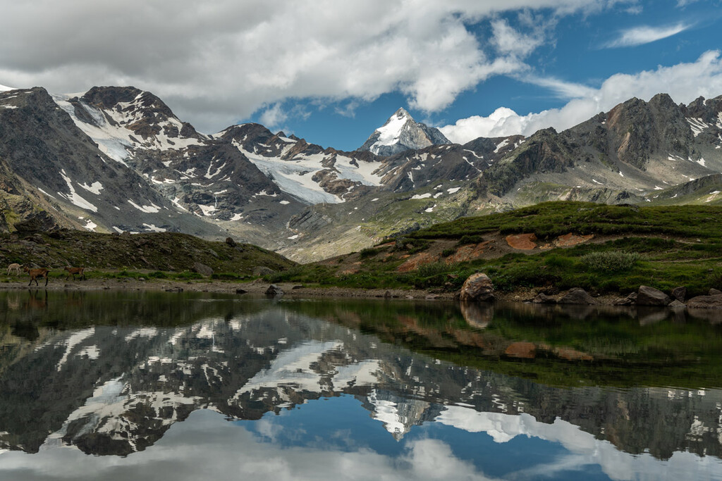
Gran Zebru / Koenigspitze reflection
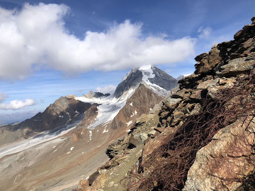
Having reached the mountain hut you can have an extension to your adventure: a glacier walk to three canons abandoned since WWI, or a hike to Cima di Solda for a closer look at Gran Zebru and Ortler. Looking south, vast glaciated plains of Monte Cevedale group is a breathtaking experience.
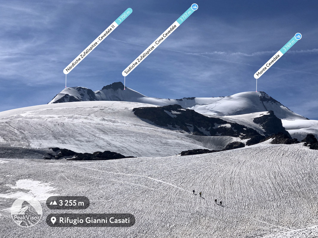
A view of Monte Cevedale and glaciers from Casati mountain hut. Südliche Zufallspitze and Monte Cevedale are the first two peaks of the 13 Peaks trek.
Gavia Pass
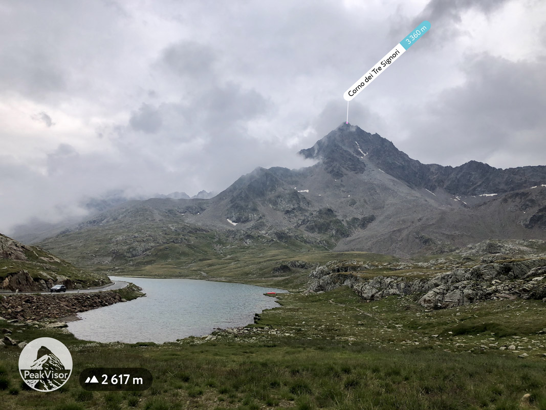
Panoramic view seekers will appreciate Monte Gaviola view. The trail starting from Gavia Pass follows the steep ascent of the mountain and quickly gains 400 meters of elevation opening a spectacular panorama of Gavia Pass and giant Corno dei Tre Signori.
For the less thrill-seeking outdoor enthusiasts there are two educative glacial trails. The first one from Rifugio Berni to a small Sforzellina glacier in the cirque under Corno dei Tre Signori takes less than 3 hours to complete (two ways). Despite the short distance (less than 3km) the trail offers immersion into high altitude alpine environment with specific flora and glacial streams. The hiking experience is augmented with didactic panels on various topics. Finally, wildlife seekers should note that chamois and ibex encounters aren’t rare on the trail.
Another glacier trail, or to be precise “ex”-glacier trail starts from Gavia Pass at Lago Bianco and leads to the adjacent cirque with Torre dei Camosci being the highest point. The trail demonstrates climate change-related development of glacial environment. For now, only small remains of the glacier are preserved under a thick cover of debris, hence the nickname of the black glacier.
The Fraele Valley
The Fraele Valley characterized by two enormous artificial lakes Cancano and San Giacomo di Fraele and presence of dolomite rock was added to the national park during the territory expansion in 1977. It is a convenient starting point for numerous excursions. Since 1391, the entrance to the valley has been protected by two medieval towers. Back then, the Imperial road passed between them. The final stretch of the road close to the towers was almost vertical and composed of removable wooden steps which could be removed in order to impede the passage. The road was almost the only connection between the upper Valtellina and Northern Europe.
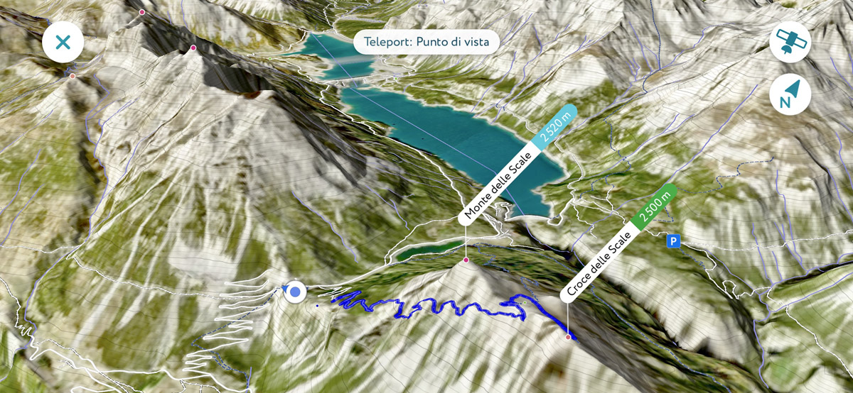
Croce delle Scale trail - 3D map from the PeakVisor mobile app
I suggest taking an itinerary to the panoramic summit of Croce delle Scale (the map above). Starting at the Towers of Fraele, the trail follows an old military road. While not imposing any particular difficulty, the trail has some exposed sections. In case of uncertainty, there’s an alternative easier path on the northern slope of the mountain. Gorgeous 360 panorama from the summit features a spectacular view over Bormio and the Fraele Valley with its lakes.
The Trentino sector of Stelvio National Park is represented by two valleys - the Peio Valley (Val di Peio) and the Rabbi Valley (Val di Rabbi).
The Peio Valley
It is a particularly large valley with numerous hiking opportunities ranging for all skill levels. This is the valley where the legendary 13 Peaks Trek starts at the Rifugio Guido Larcher al Cevedale. For those who are less into alpinism, there’s much more feasible but no less spectacular loop trail over 5 scenic high altitude lakes: Lago delle Marmotte, Lago Lungo, Lago Nero, Lago del Careser, and Lago della Lama. Finally, there are several especially panoramic summits such as Cima Boai and Cima Vegaia each taking a whole day to complete.
Monte Vioz and Palon de la Mare view from Lago Lungo
The real gem of the valley is the trail to one of the highest mountain huts in the Alps - Rifugio Mantova and then slightly higher to the summit of Monte Vioz (3,645m) for extraordinary panorama of glaciers and almost the entire traverse of the 13 peaks trek. Also, on a clear day one can observe Cima Presanella and Cima Tosa - two spectacular Italian ultra prominent mountains.
The Rabbi Valley
Famous for the Saent waterfall, the Rabby Valley is another attraction in the Trentino sector of the national park. The most popular trail in the valley is a demanding hike from the large parking area at the very end of the tarmac road up to the Saent waterfall, and then much higher to the Rifugio Silvio Dorigoni. The total elevation gain is almost 1,000m, so it is advised to start early. The target mountain hut is surrounded by the cirque of 3,000m+ towering peaks like Hintere Eggenspitze (Cima Sternai), namesake Cima di Rabbi, and Cima di Saent. A brief walk from Dorigoni mountain hut brings you to the scenic Sternai Lake.
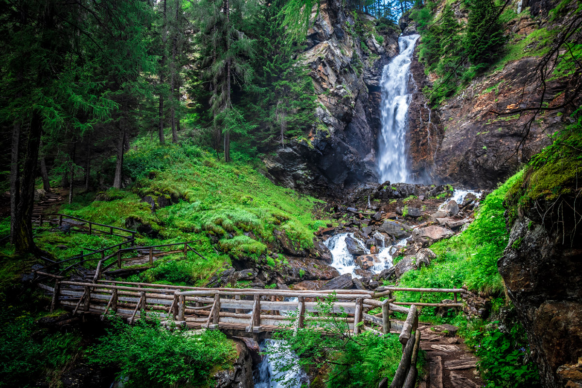
The Saent waterfall
A notable and highly recommended hike is Piz Chavalatsch located at the Swiss-Italian state border which happens to be the easternmost point of Switzerland. Thanks to a spectacular panorama from its summit, is a highly popular destination.

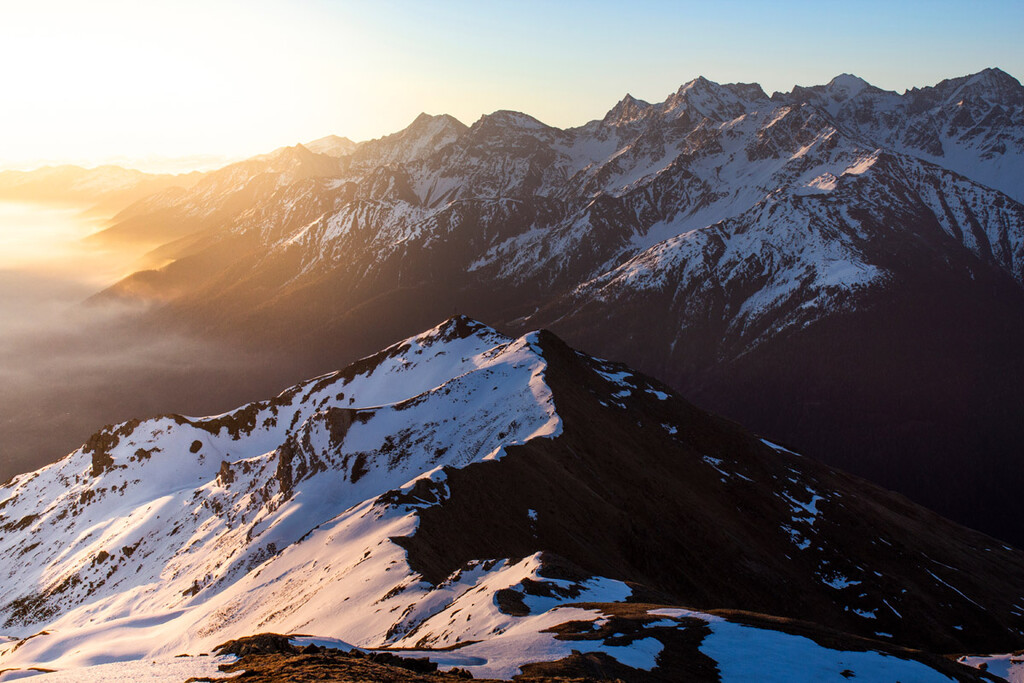
A view from the Piz Chavalatsch summit at sunrise
The Solda Valley
Named after the small mountain village at the foot of the highest mountain in the national park, the valley offers a stunning amount of hiking opportunities. Many of the trails reach peaks high above 3.000m. For an unobstructed panoramic view I would suggest embarking on demanding hikes to Cima Vertana and Hintere Schöntaufspitze.
The Martello Valley
Literally, the Hammer Valley, is an adjacent and very large valley with Martellerhütte (Rifugio Martello) being one of the most popular hiking destinations. For spectacular panoramas I suggest scaling Punta dello Scudo and Lyfispitze.
The Ulten Valley (Val d'Ultimo)
Being the last valley in our guide to the Stelvio National Park, this valley is definitely not the least in outdoor opportunities and scenic beauty. Italian spelling of the name is colloquial to the Last Valley but it is in no way related to latin "vallis ultima" (ultimate valley) and is based only on phonetic vicinity to the original German name Ulten.
The valley is famous for its untouched nature, steep meadows, lush forests, and numerous crystal clear mountain lakes. There are many picturesque wooden fences along the hiking trails in the valley. One of the most popular panoramic treks goes through the summits of Hasenöhrl (3,257m), its smaller subpeak Kleines Hasenohr (3,131m), and then to Tuferspitz (3,097m).
Alpine lakes are always attractive and the Ulten Valley has plenty of them. One can do an amazing loop trail with at least a dozen of alpine lakes of various size and color around Gleck mountain. The trail is briefly crossing into the adjacent Rabbi Valley with Corvo Lake close to the highest point of the trip.

Ultental, Weissbrun lake
Bormio will host the Winter Olympics 2026 along with Cortina d’Ampezzo in the Dolomites.
Bormio region has an ancient and rich history. There are signs of several prehistoric settlements in the region. In fact, Bormio has been well known since Roman times thanks to the thermal waters with therapeutic properties. In his work Naturalis Historia, Pliny the Elder (23-79 AD) who was born in a nearby Como very likely referred to the natural hot springs of Bormio when mentioning marvelous nature and the heat of countless hot springs between the high alpine passes. Much later in 535-536 AD, Cassiodorus also mentioned Bormio’s hot springs.
There are three SPA resorts in Bormio. In my opinion, the most important is Bagni Vecchi – The Old Baths. This interesting mix of history and wellness makes them particularly fascinating. The Bagni Vecchi Roman Baths are very likely to have seen some Roman emperors because they are really ancient ones.
Livigno is probably the most remote ski resort in the Alps. Due to the absence of highways nearby, the town is reachable only through high alpine mountain passes. In fact, there are just three roads to Livigno. Two link it to Switzerland. High altitude mountain pass Forcola di Livigno is open in summer only, and the second pass is the toll road Munt la Schera Tunnel. The third road over Foscagno Pass links Livigno to other parts of Italy.
Livigno enjoys a special tax status as a duty-free area. Italian VAT (value added tax) is not paid. Interestingly, these tax advantages were recorded as far back as the sixteenth century. For visitors and inhabitants that guarantees significantly more attractive prices.
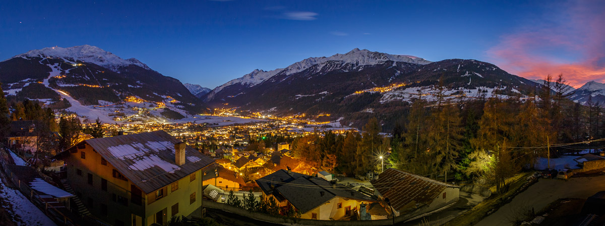
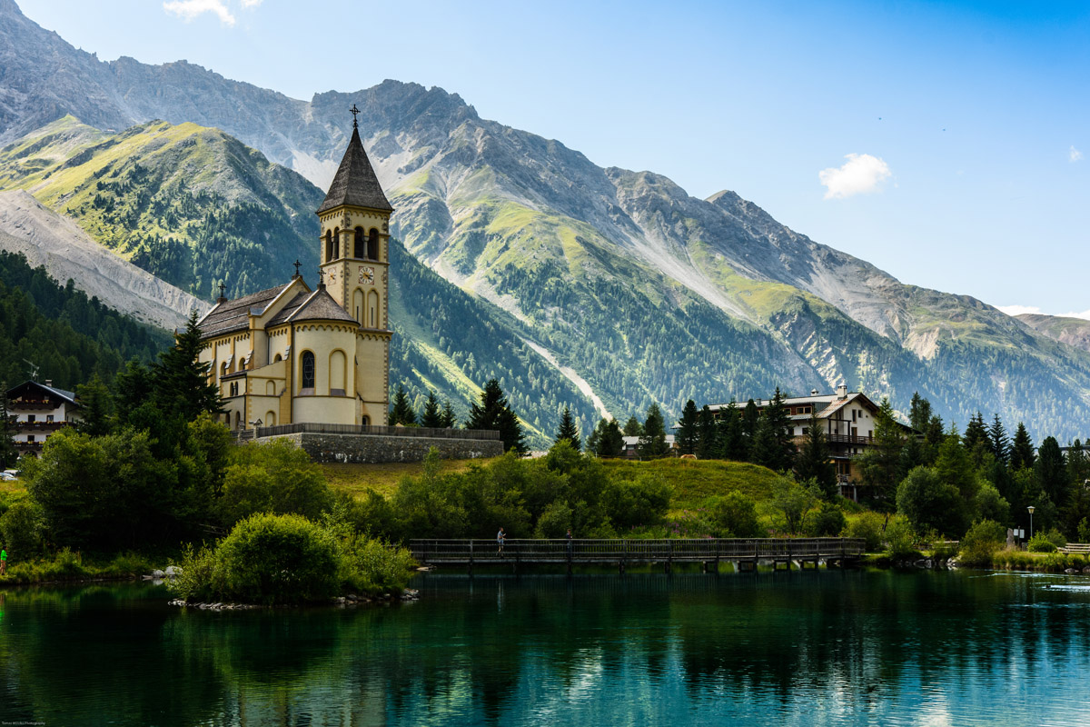
Located at 1,840m above sea level in a hollow right at the foot of the park’s highest mountain Ortler (which is also the highest for the whole South Tyrol) Solda is an original mountain village with unlimited outdoor leisure opportunities and a cutting-edge infrastructure.
Solda can be characterized by healthy air, crystal clear water, pristine nature, and sustainable life-style practised ubiquitously.
The village was absolutely unknown until 1800. Back then due to its remote location, in 1802, the Austrian newspaper "Innsbrucker Wochenblatt" compared it to "Siberia of Tyrol", "where farmers dine with bears and kids ride on wolves".
There’s the Ortler branch of the Messner Mountain Museum in Solda. And a famous mountaineer Reinhold Messner owns a herd of yaks here too.
The New Church in the village of Solda
I hope you liked this guide to the Stelvio National Park and will choose it as a destination for your next adventure. Don’t forget to update your PeakVisor app, it comes in very handy in the mountains!
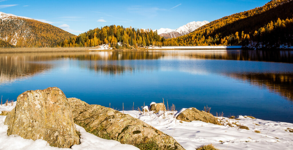
Heidersee with mountains Ortler and Gran Zebru in the background


top50
ultra
glacier
italy-ultras
top50
ultra
glacier
italy-ultras


