
Scan the QR code and open PeakVisor on your phone
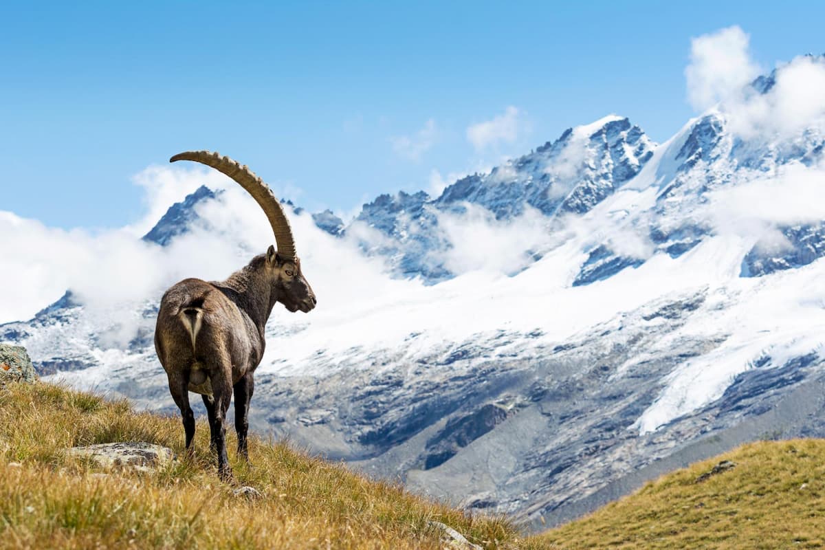
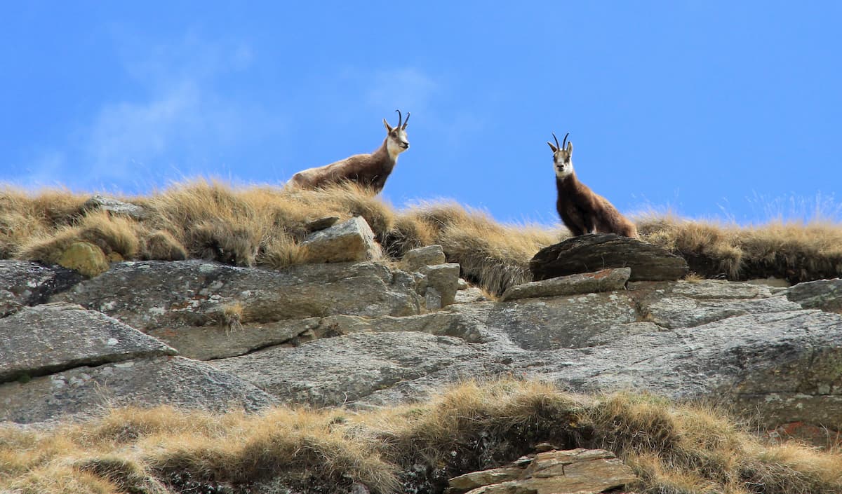
Founded in 1922 on the premises of the former royal hunting reserve of the House of Savoy, the Gran Paradiso National Park became the first national park of Italy. The ultimate first goal was to protect the population of the alpine ibex from poachers, as it was a personal hunting ground for King Victor Emmanuel II, but with time the park has extended its powers to protecting other species as well. Of 850km of the trails in the park 65% are basically former royal hunting roads built for the sovereign.
The area of the park is 703 sq.km. split between the Aosta Valley and Piedmont regions. The southwest border of the park coincides with the French-Italian state border where on the French side, the park is continued by the Vanoise National Park. Italian Gran Paradiso National Park, French Vanoise National Park, and Mont Blanc massif together constitute major part of the Graian Alps.
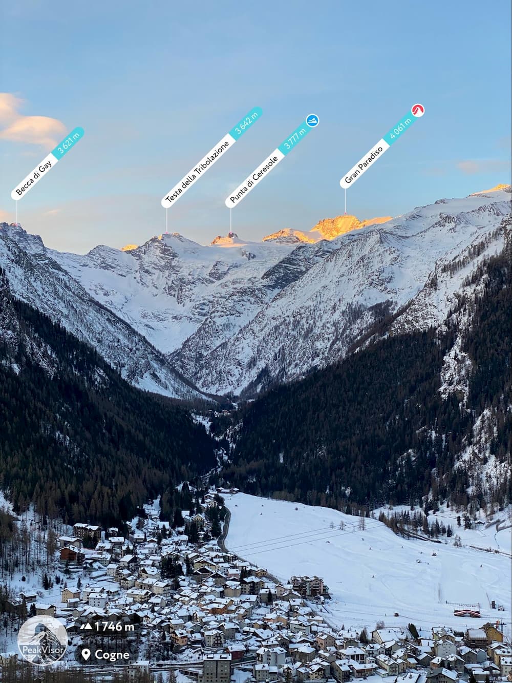
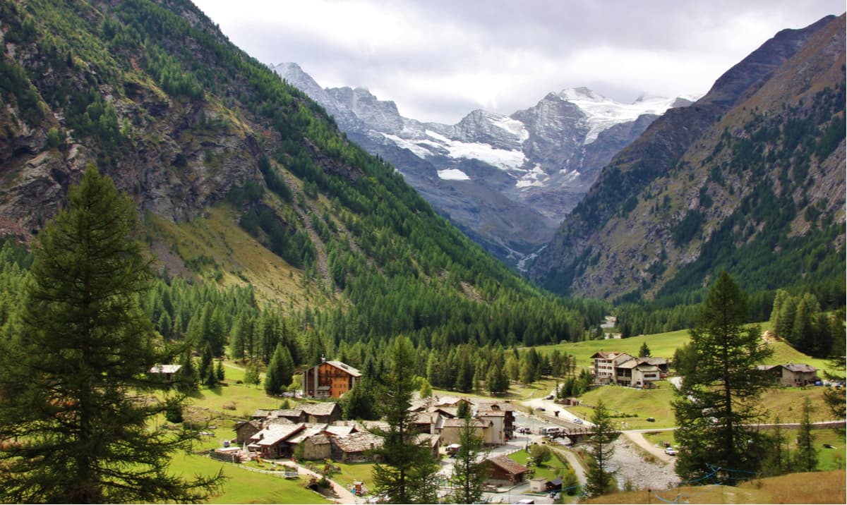
The village of Cogne.
The name of the park comes from Gran Paradiso (4,061m) - the highest and the most prominent mountain in the park. It is the only ‘proper’ four-thousander in the entire Italy, all others make part of international borders or subpeaks of such mountains. The name "Gran Paradiso" derives from Granta Parei which in the Aosta Valley dialect means the Grand Wall. It is the same etymology as of the nearby Granta Parey peak.
Gran Paradiso National Park has played a vital role in saving alpine ibex from extinction. Now the Ibex is the symbol of the park.
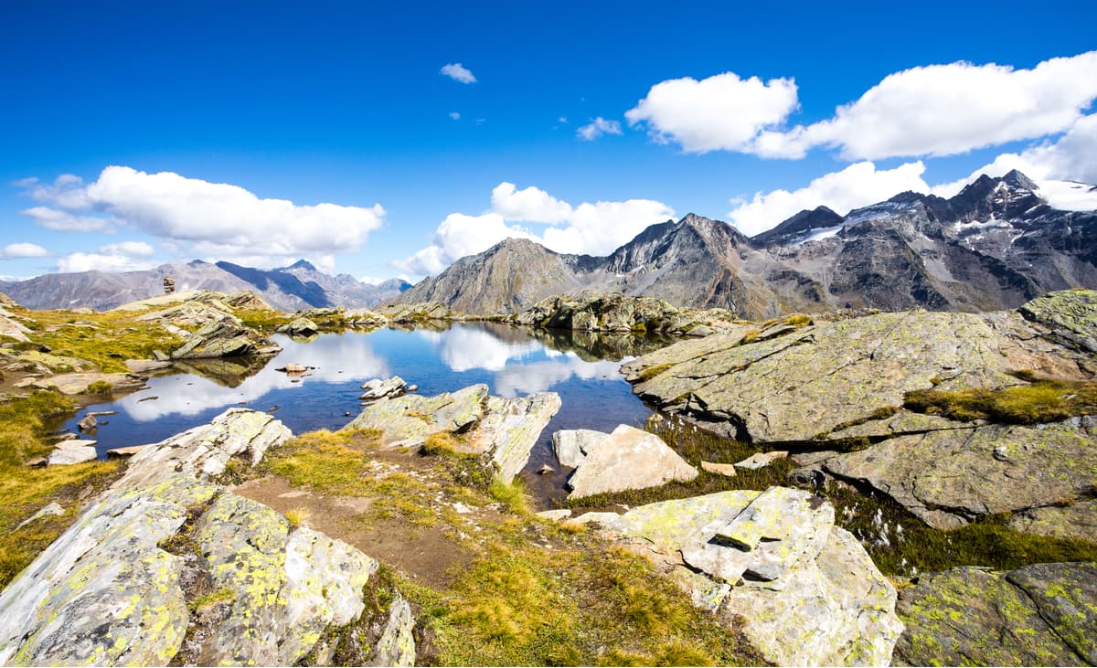
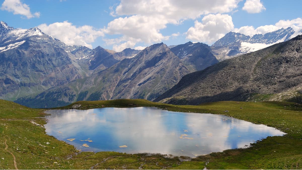
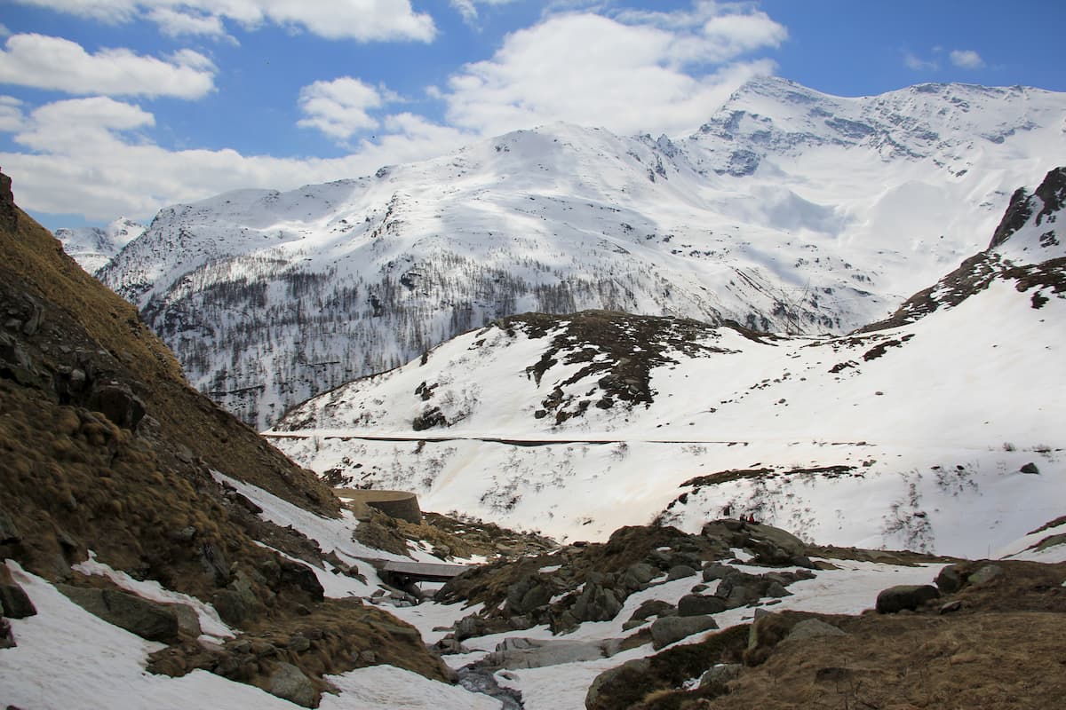
There are 120 mountains, 59 glaciers and 183 lakes in the park. Apart from Gran Paradiso, the most prominent peaks are Grivola 3,969m which is looming over the upper Aosta Valley and is the second highest in the park. Torre di Lavina 3,308m is dominating in the eastern part of the park, and Levanna Centrale 3,619m is at the extreme south, it is the symbol of Ceresole Reale Community. Many notable peaks of Gran Paradiso National Park shape a unique skyline and can be observed from viewpoints in Turin more than 60km away, such as Bric della Maddalena.
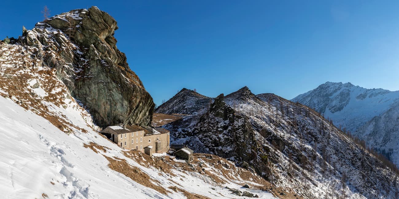
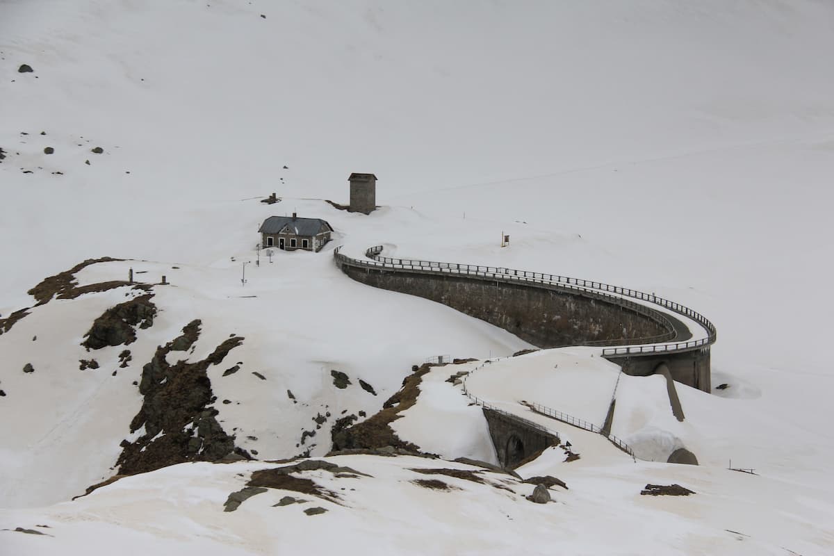
On the maps of Gran Paradiso National Park, one might notice indications of Casotto del PNGP, those are park rangers huts which they use so that they do not spend too much time on ascents and descents to the bottom of the valleys every day. There are 40 huts like this in the park, don’t confuse them with mountain huts (rifugio).
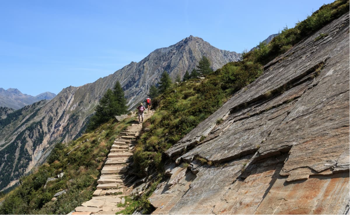
Gran Paradiso National Park features a dense network of well-marked trails which provide an exceptional variety of excursions. Families with young children and less experienced hikers can follow local and old hunting roads leading to mountain huts and spectacular panoramas while more experienced outdoor enthusiasts can undertake longer trails touching the summits higher than 3,000m.
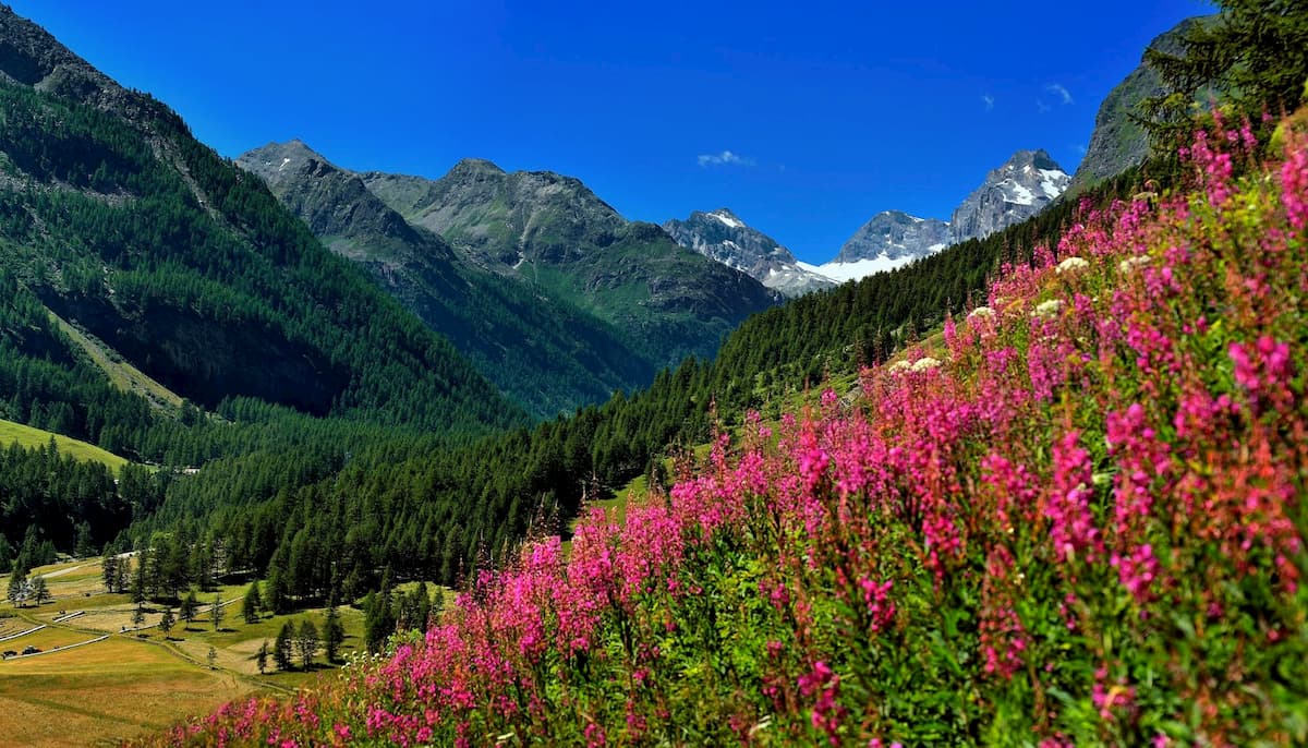
The hiking period in the park lasts from early June to late October but other months are no less interesting. In winter time, there are many opportunities for snowshoe excursions through spectacular snow wonderland. Spring scenery is especially contrasting with mountain-tops mostly covered with snow, given that the pastures and forests are already green down the valleys. Every autumn for a couple of weeks larches light up the valleys with incredible golden hues. No matter what season you go outdoors in Gran Paradiso National Park, it always has something special.
Here’s an interesting fact, Gran Paradiso National Park has its very own Mont Blanc. Located on the ridge separating the Valsavarenche and the Rhemes Valley, it is a modest mountain south of the village of Introd in Aosta Valley. Apart from one of the national park huts, the main reason to bag Mont Blanc of Introd summit (2,203m) is a stunning view of the real Mont Blanc at the end of the valley. For a slightly higher vantage point allowing better views of the Valsavarenche, one can summit Mont Paillasse 2,414m.
The Gran Paradiso massif naturally separates Aosta Valley from Piemonte. The northern part of the park in the Aosta region is more developed and more popular among visitors, meanwhile the southern part is wilder. Hiking trails in Gran Paradiso National Park can be grouped into 5 clusters based on the major valleys of their trailheads.
Hidden behind a long and narrow gorge between Grivola (3,969m) and Aosta’s Monte Emilius, the valley of Cogne opens into lavish meadows and numerous smaller branching valleys. With multiple day-hikes available, it is a perfect place to venture into Gran Paradiso National Park. No wonder it is the most visited valley in the national park.
It is highly advised to wrap your head around the Alpine basics at one of the gems of the valley - Paradisia Alpine Botanic Garden. It is located in Valnontey, a hamlet in the municipality of Cogne, in the very heart of the national park. At 1700m, rich in water bodies and natural valleys, the garden offers the best conditions for cultivating mountain and Alpine plant species. The garden is surrounded by the magnificent landscape of the Gran Paradiso massif. The blossoming period peak is from mid-June to mid-July, but it might vary depending on the season’s weather.
Right next to the Paradisia Alpine Botanic Garden is the trailhead to Vittorio Sella Mountain Hut. It is one of the classic trails in the Gran Paradiso National Park following the old mule track recommended to everyone including the families with children. The mountain hut is named after Vittorio Sella, a mountaineer and a famous photographer who took photographs of mountains which are regarded as some of the finest ever made.
Vittorio Sella was the nephew of Quintino Sella, one of the Italian Alpine Club (CAI) founders. He made a number of significant climbs in the Alps, including the first winter ascents of Matterhorn and Monte Rosa, and the first winter traverse of Mont Blanc. He took part in several expeditions farther afield, including three to the Caucasus, where Sella Peak in Russia now bears his name, to Mount Saint Elias in Alaska, to the Rwenzori in Africa, and the 1909 expedition to K2 and Karakoram. But arguably the most important factor of his fame is the extraordinary photography of the mountains. He carried bulky and fragile 30×40 cm photographic plates into remote places, and even had to invent equipment, including modified pack saddles and rucksacks, to allow these particularly large glass plates to be transported safely.
There are several opportunities to extend the hike. One is to scale Col Lauson and the nearby peak of Punta del Tuf (3,395m) for a panoramic view from the mountain ridge separating Valnontey from the Valsavarenche. Another option is to proceed to the very centre of the national park, at the foot of the majestic Gran Paradiso, where farmhouses of Herbetet are located.
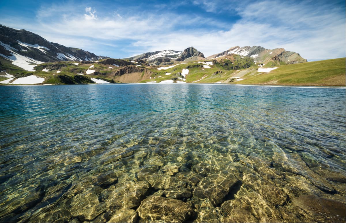
There are many trails leading to spectacular alpine lakes. Lake Loie at an elevation of 2,346m is especially famous for scenic reflection of distant Mont Blanc. The trailhead is at Lillaz and oftentimes the hike is done in a loop around Testa delle Goilles 2,367m. A popular side trip for a better vantage point is the summit of Cima di Bardoney 2,710m towering above the lake.
Much more distant and dramatically less frequented are the Miserino Lakes at the foot of Punta Miserino 2,998m. The trailhead is at the same location in Lillaz but the distance is 12km one way and it takes about 4 hours to reach the lakes.
Punta Feniliaz (3,053m) is one of the most approachable 3000ers in the national park and boasts one of the best panoramas on the Gran Paradiso massif, Tersiva, and hundreds of other peaks in the distance. The peak can be conquered through a well-marked 6km trail (one way) with 1,500m of elevation gain. Obviously, not an easy trail, especially the upper part, but it doesn’t require any technical climbing. At this elevation snow isn’t uncommon until the end of July.
Running fairly straight from north to south the Valsavarenche marks the western border of the Gran Paradiso massif. The valley is flanked with two ragged ridges with peaks reaching above 3,000 meters and it is the only valley completely within the protected area.This is the valley where Vittorio Emanuele II spent the most of his time hence the dense network of former hunting roads and mountain huts. Also, the standard climbing route to the Gran Paradiso summit starts from Vittorio Emanuele II mountain hut in this valley.
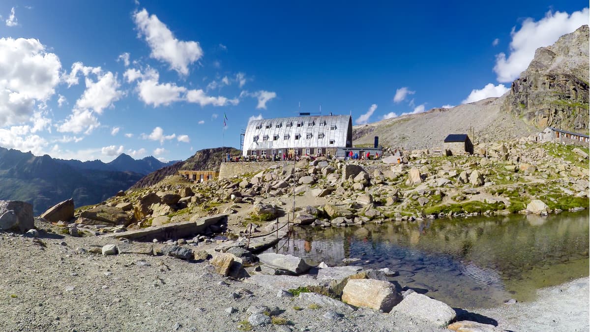
The loop through two most famous mountain huts in the valley right beneath Gran Paradiso glaciers is the adventure to be remembered for a long time. The trailhead is at the parking lot of Degioz, the administrative center of the valley. Almost immediately begins a demanding ascent to gain 1km of elevation difference. Rifugio Chabod is named after an Italian historian, politician, partisan, and alpinist Federico Chabod who played a vital role in the autonomy of Aosta Valley.
The trail winds up almost 6km to Vittorio Emanuele II mountain hut along the western slope of the Gran Paradiso massif traversing several roaring streams. The semi-barrel architecture is peculiar but doesn’t lack originality. Lake Moncorve nearby adds some extra charm to the setting which is already breath-taking. You will see scenic triangular shapes of Tresenta and Becca di Moncorve with a huge glaciated dome of Ciarforon in between. Take a delicious lunch here and descend on the trail to Pont and then along the Savara stream at the valley floor down to Degioz.
The trail also starts at Degioz. It takes about two hours to reach the first destination - the former royal hunting lodge Orvieille located on a panoramic high-altitude meadow. After a devastating avalanche in 1982, the lodge was reconstructed and used as a hut for park rangers (“casotto”). Right from the start up to the Colle della Ment (mountain pass), the trail follows the former royal hunting road built for the sovereign . In fact, the hunting lodge even had a telegraph line back then, so the king was able to perform his duties while being in the mountains.
The second part of the trail winds through alpine meadows to the Djouan lakes. This part is especially attractive in June and early July when all the flowers are blooming. Grivola reflecting in the lake waters is the icing on the cake of your perfect adventure.
From Lake Djouan, it is highly advised to summit Monte Chandelly with an extra 300m of elevation gain. At an altitude of 2,809m the panorama from the top is incredible, one peak is nicer than another. Grivola, Gran Paradiso, and Ciarforon are especially attractive.
Cima dell’Arolley loop skirts the namesake mountain. The trail’s high point is Grand Collet pass, from there one can deviate to the summit of Monte Giansana 3,047m to bag a 3,000er and enjoy a higher viewpoint. This itinerary is overshadowed by other more popular trails around but such lower fame makes it less crowded, closer to nature, and improves chances of wildlife encounters which are already pretty high in Gran Paradiso National Park.
At the end of the valley, there are trailheads of many hikes leading to the Nivolet Plateau which can also be reached by car from the Piemonte’s southern side.
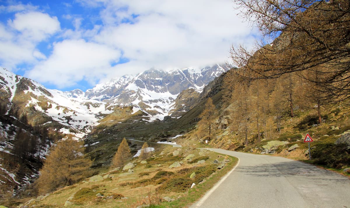
High-altitude plateau Nivolet extends between the altitudes of 2,300m and 2,600m and boasts plenty of natural lakes. It is one of the most popular hiking areas in the region, partially thanks to the paved road from Ceresole Reale in Piemonte’s Orco Valley. The primary starting point for most of the hikes is Savoia mountain hut and the parking lot by the Nivolet Lakes.
A short hiking trail from Savoia mountain hut leads to two spectacular lakes - the Rosset and the Leita. But more adventurous hikers can extend the trip to the nearby summits of Punta del Leynir to the north or Punta Basei to the south.
A demanding trail to Monte Taou Blanc 3,438m is totally worth the effort. The reward is the unparalleled panorama of the Gran Paradiso massif and the Mont Blanc massif. On a clear day, one can recognize astounding silhouettes of famous 4000-ers in the distance: Matterhorn, Dom, and Dent Blanche.
Another advantage of the Nivolet plateau is very low light pollution, which makes it especially beneficial for stargazers.
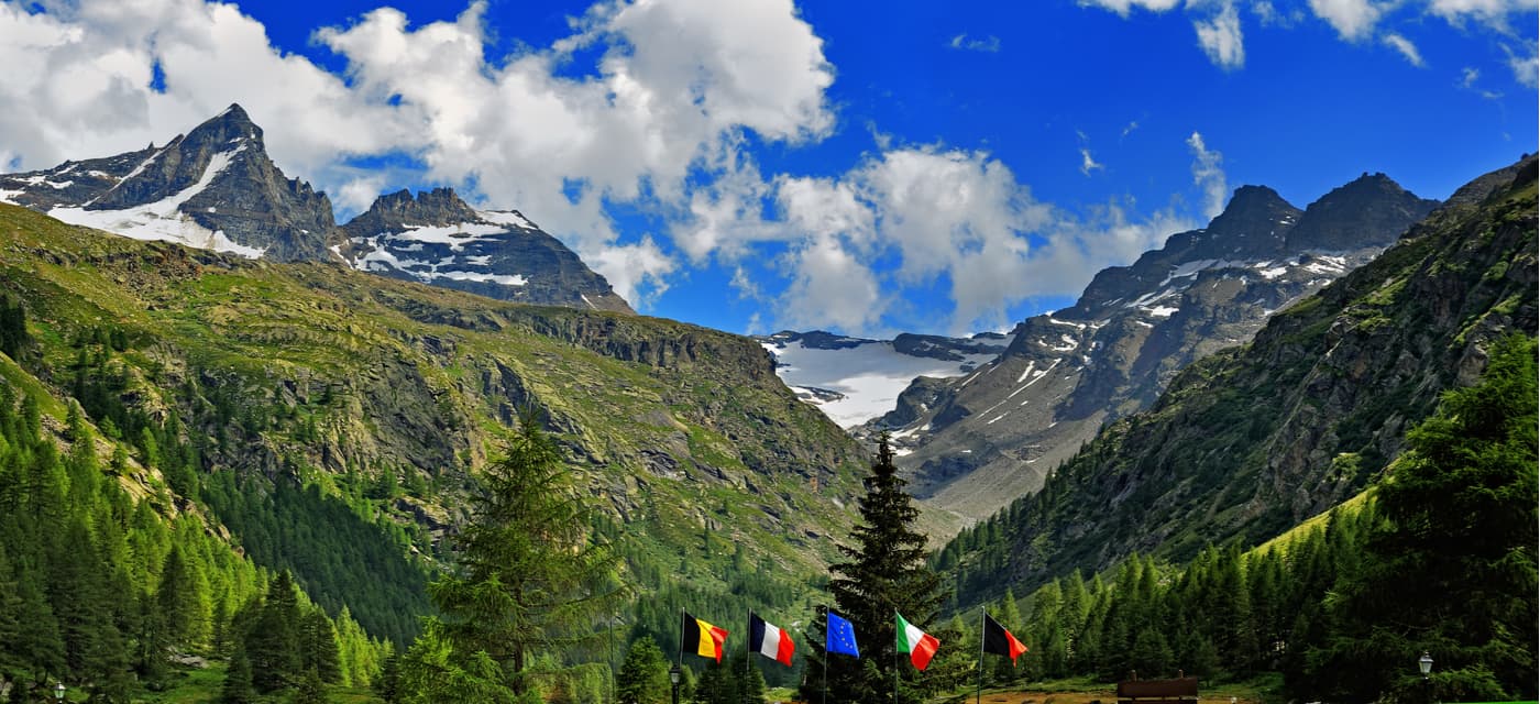
It is the westernmost valley of Gran Paradiso National Park. Impressive Granta Parey dominating the valley is its symbol and appears in most of the photos of this area. Only the eastern part of the valley belongs to the national park and several trails cross the ridge through high altitude passes into the neighboring Valsavarenche and the Nivolet Plateau offering spectacular panoramic views.
One of the popular hikes is Col Bastei which can be slightly extended to the summit of Punta Basei (3,387m). From the top, one can have a magnificent panorama of Gran Paradiso, Ciarforon , the Levanna group, the Nivolet Plateau, countless lakes and glaciers.
Punta del Leynir (3,238m) and Monte Taou Blanc (3,438m) are some of the alternatives for splendid summit panoramas.
The first inhabitants of nowadays famous Cogne Valley reached it from almost unknown Soana Valley. The trade connections were much better between these two valleys than with much closer yet hostile Aosta Valley. Today Soana is the least visited valley in the park, which makes it a perfect destination for quiet outdoors aficionados who wish to get much closer to the true alpine wilderness experience. The wildlife appreciates the calm even more than humans.
The Soana Valley marks the eastern border of the Gran Paradiso National Park and it is the area where it shares the border with Mont Avic Nature Park separated by the easternmost ridge of the Gran Paradiso massif. Rosa dei Banchi is the easternmost 3,000er in the national park. There’s a highly advised trail to the summit from the Mont Avic nature park. The summit panorama is breath-taking.
There are three principal trailhead locations in the the valley (from east to west): Piamprato, Campiglia Soana, and Forzo. Most of the trails here lead to high altitude mountain passes and abandoned hamlets but don’t reach mountain summits. One of the rare exceptions is Punta del Vallone 2,479m. From its summit one can admire not only the nearby prominent mountains such as Torre Lavina and the craggy peaks on the ridge towards Monte Colombo, but Turin metropolitan area, famous Monviso almost 100km to the south, and the northern Apennines 170km southeast.
One itinerary of a particular religious interest is the San Besso Sanctuary trail. It does not lack naturalistic and landscape benefits in the least, it offers plenty of everything. The legend has it that San Besso was a Roman soldier in the 3rd century AD. His army was ordered to subdue local Celtic riots. However, as these proud soldiers did not agree to profess their deep Christian faith, they were eventually condemned and persecuted. The survivors dispersed into several Alpine valleys, especially in Piedmont (Piemonte in Italian).
San Besso managed to escape the massacre that took place in the Valais and took refuge in the Soana Valley. He started to evangelize local salassi shepherds. In the end, the emperor's soldiers found and killed him barbarously, throwing him from the top of the cliff of Monte Fantono. It is said that his body left an imprint on the rock below. Today, in that place, at 2,019m, there is a sanctuary built close to that cliff and inside the church you can see the rock on which San Besso was martyred.
Finally, there’s Monta Arzola. It is a little known summit with spectacular panorama at the top. Reachable from the nearby Ribordone Valley it is perfect for excursions for those searching truly stunning vistas.
The Orco Valley marks the southern border of the national park. It is the key provider of hydroelectric power for Piemonte’s industries. The small village of Noasca in the middle of the Orco Valley is home to the only national park visitors centre open all year round. There’s a scenic 32-metre Noaschetta waterfall just several minutes walk above the village centre.
Ceresole Reale is the tourist focal point of the valley. The village history goes back to the Roman times. Some Latin inscriptions were found in the underground corridors of abandoned mines in the area. Nowadays, it is a convenient basecamp for excursions into the Gran Paradiso National Park at any time of the year. In wintertime, the upper Orco Valley becomes a popular destination for cross-country skiing, ice climbing, ski alpinism, and the winter version of hiking - snowshoeing.
In summertime, the road beyond Ceresole Reale snakes farther up to the Nivolet Plateau where the Savoia mountain hut and the parking lot is located by the Nivolet Lakes. Since it is a highly popular destination for citizens of Turin metropolitan area. Visitors are advised to arrive early in the morning to secure a parking place. But that’s not an issue in wintertime when the parking area is completely free and the road is under several meters of snow.
Some of the most popular trails near Ceresole Reale are the trail to Jervis mountain hut and the trail to Lago del Dres at the very edge of the Gran Paradiso National Park. Both reach alpine meadows and boast scenic vistas.
There are several opportunities for international trails as well in this part of the national park. High-altitude pass Colle del Carro 3,109m between Cima del Carro and Punta dell'Uja allows crossing into French valley Bonneval where the trail descends to Carro mountain hut with two lakes interestingly named Black and White. Another international trail is the Passo della Losa trail between the towering peak of Punta di Galisia 3,346m and Cima della Vacca 3,183m. The trailhead is located at the parking lot by Lake Serru.
Crossing French-Italian state border where the Gran Paradiso National Park meets the Vanoise National Park both trails allow visiting two exceptional national parks in one go.
There is one more trail offering amazing panorama of the southern slopes of the Gran Paradiso massif. It is formally out of the borders of the national park. The trail goes to the Bellagarda lakes.
There are a great many small towns and villages around the Gran Paradiso National Park and most of them have some accommodation options. Arguably, Cogne is the most popular place for tours in the Aosta Valley part of the park, while Turin is the optimal choice for visiting the southern part of the park in Piemonte.
Oftentimes considered as the capital of Gran Paradiso National Park, Cogne is a famous tourist destination of the Aosta Valley region. It is ideal for outdoor enthusiasts of all kinds of interest and skill proficiency. Its convenient location provides many hiking opportunities into Gran Paradiso National Park and nearby. With several valleys branching from the Cogne Valley, you’ll need at least a week to briefly explore only the major hiking trails, let alone smaller gems. Therefore, plan your visit carefully.
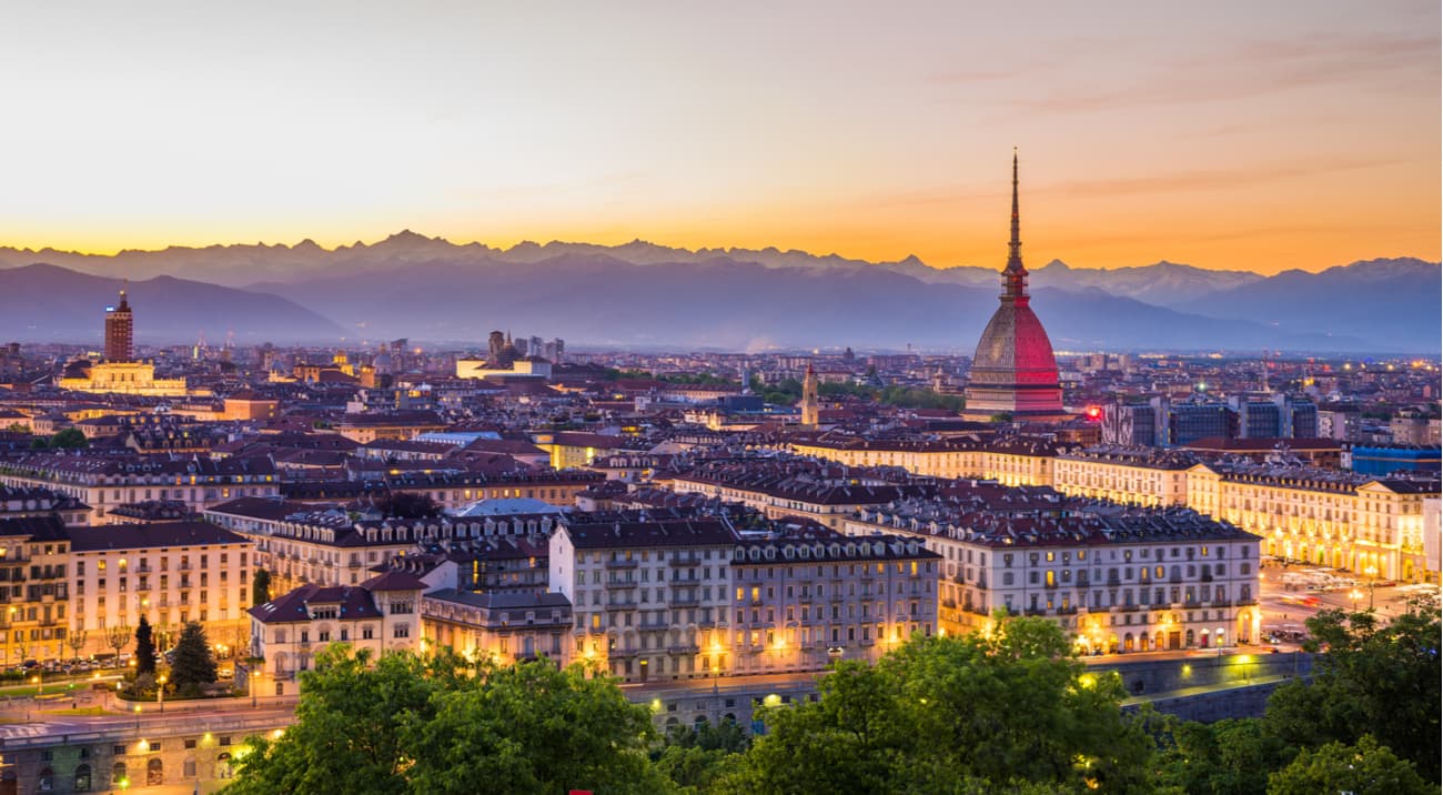
The capital of the Piemonte region, Turin isn’t the most popular in Italy. However, this city will impress any visitor. Turin is rich in historic boulevards, streets, squares, and buildings that look Parisian or Viennese. But most importantly, it is almost surrounded by the great Alpine Wall (Arc), which means almost all roads from Turin lead to spectacular mountains, including those of the Gran Paradiso National Park. It takes 1h30minutes to reach Ceresole Reale from Turin provided that you don’t spend much time visiting sideroad gems like the Noaschetta waterfall.
As mentioned earlier, one can see most of the major peaks in the Gran Paradiso National Park from Turin viewpoints e.g. from Bric della Maddalena.


top50
ultra
glacier
alps-4000ers
italy-ultras
top50
ultra
glacier
alps-4000ers
italy-ultras


