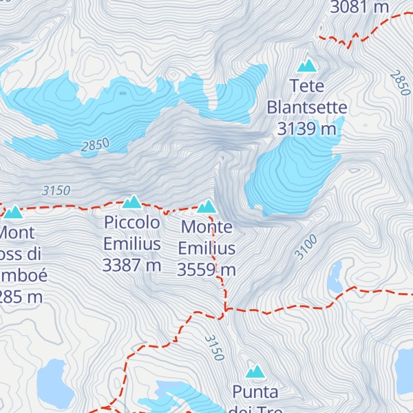
Monte Emilius (French: Mont Émilius) (3,559 m) is a mountain of the Graian Alps in Aosta Valley, north-western Italy. Located just above the town of Aosta, from where it is visible looking southwards behind the lower Becca di Nona, it is usually climbed starting from the ski resort of Pila, at a height of 1,870 m.
There's an alpine trail (T4) leading to the summit.
The nearest mountain hut is Chalet Peccoz located 1 389m/4 558ft WNW of the summit.
By elevation Monte Emilius is
# 37 out of 438 in the Gran Paradiso Massif
By prominence Monte Emilius is
# 3 out of 438 in the Gran Paradiso Massif # 18 out of 2223 in the Graian Alps # 11 out of 1186 in Aosta Valley
We use GPS information embedded into the photo when it is available.
3D mountains overlay
Adjust mountain panorama to perfectly match your photos because recorded by camera photo position might be imprecise.
Move tool
Rotate tool
Zoom
More customization
Choose which peak labels should make into the final photo and what photo title should be.
Next
Photo Location
Satellitte
Flat map
Relief map
Latitude
Longitude
Altitude
OR
Latitude
°'''
Longitude
°'''
Apply
Register Peak
Peak Name
Latitude
Longitude
Altitude
Register
Teleport
PeakVisor
This 3D model of Sagarmatha National Park in Nepal was made using the PeakVisor app topographic data. The mobile app features higher precision models worldwide, more topographic details, and works offline. Download PeakVisor maps today.
Download OBJ model
PeakVisor
The download should start shortly. If you find it useful please consider supporting the PeakVisor app.
PeakVisor for iOS and Android
Be a superhero of outdoor navigation with state-of-the-art 3D maps and mountain identification in the palm of your hand!