
Scan the QR code and open PeakVisor on your phone
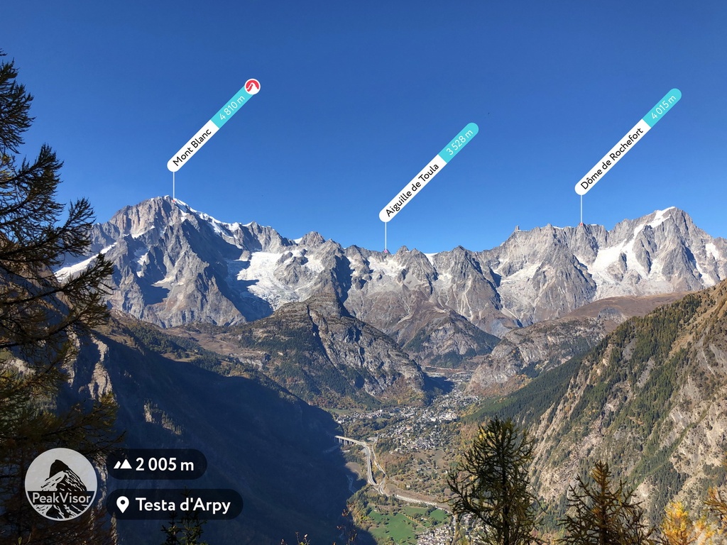
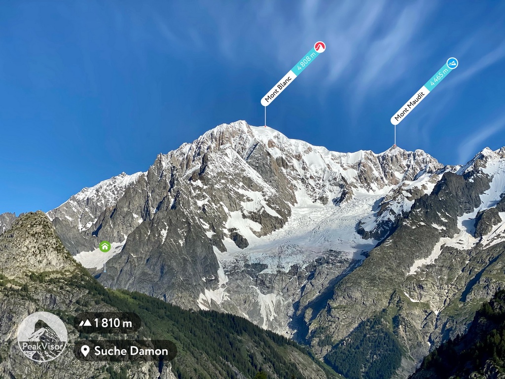
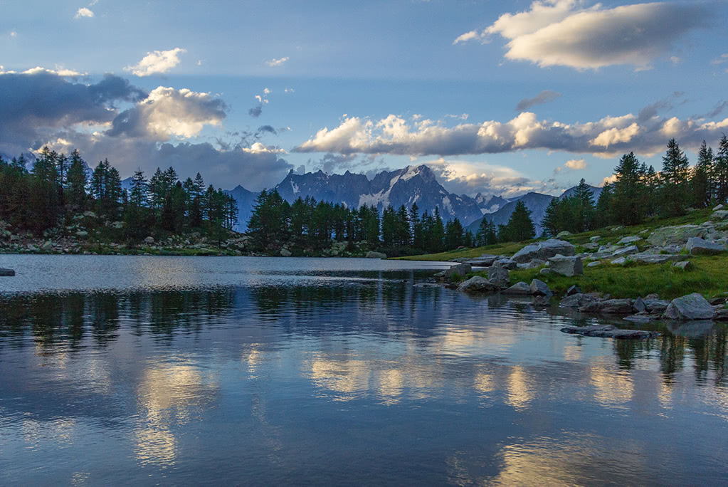
It might be the smallest and least densely populated Italian region, but the Aosta Valley really packs a punch. The Aosta Valley is an administrative region located in northwestern Italy that contains a central valley carved out by Dora Baltea, a tributary of the river Po. It’s enclosed by the Alps to the north, south, and west, and it boasts 1246 named mountains, the highest of which is Mont Blanc (4,808 m/15,774 ft).
Appearing like an island surrounded by mountains, the small but mighty Aosta Valley (Val d’Aosta) region of Italy encompasses 3,263 sq. km (1,260 sq. mi) of land and has a population of around 126,000 people. It is bordered by Switzerland, France, and the Italian region of Piedmont.
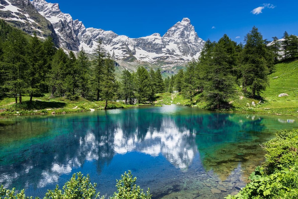
The Aosta Valley is characterized by its central valley, which is located between the communes of Saint-Vincent and Villeneuve. Its main central valley is met by side valleys that boast over 200 glaciers, including Valsavarenche, Valle di Cogne, Val Veny, Val Ferret, Valtournenche and Val D’Ayas.
The Aosta Valley is also connected to France via the Mont Blanc Tunnel. This tunnel is 11.7 km (7.3 mi) long and it passes underneath the Mont Blanc massif.
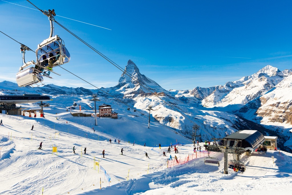
Another prominent feature of the region is the Skyway Monte Bianco, which opened in 2015 and brings visitors from Courmayeur to Helbronner point in the heart of the Mont Blanc massif. The skyway allows people of all experience levels to travel to a terrace at 3,466 m (11,371 ft) in elevation with a panoramic view across the Alps.
There are also two different subregions within Aosta Valley known as the “plaine,” which refers to the floodplains of the Dora Baltea, and “montagne,” which refers to the mountainsides and valleys.
The “montagne” occupies the majority of the land in the valley, including around 96.3 percent of the region’s territory. Meanwhile the “plaine” is the most populous part of the region due to its fertile agricultural land.
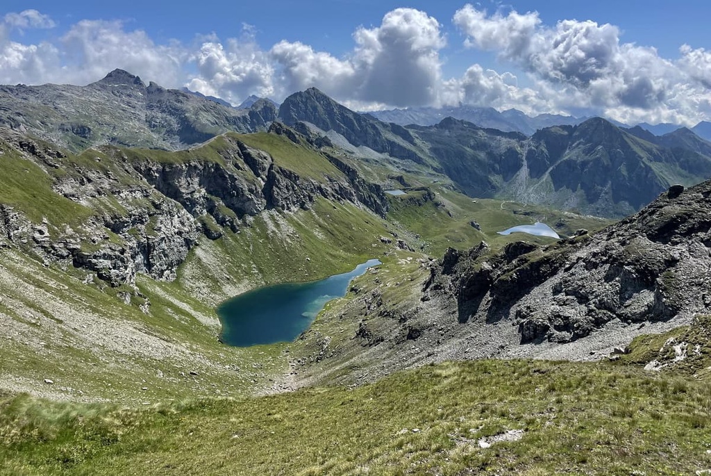
Almost a third of Aosta Valley’s territory is protected in order to preserve its landscapes and biodiversity; it therefore offers plenty of opportunity to enjoy the great outdoors. The two largest protected areas are the Gran Paradiso National Park, and the Mont Avic Natural Park.
Founded in 1922 and based in the southern part of the Aosta valley in the Graian Alps, Gran Paradiso National Park was established as Italy’s first national park.
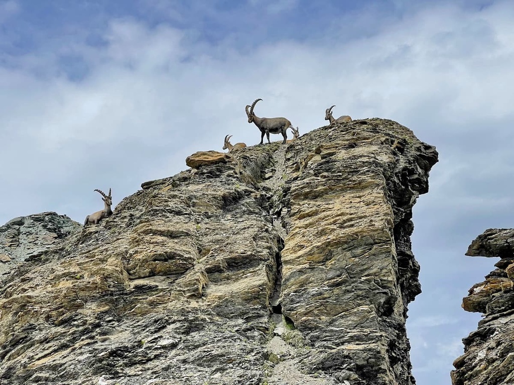
The park was primarily established to prevent the extinction of the Alpine ibex (steinbock) and other alpine flora and fauna at risk of extinction. The lands were donated to the Italian state in 1920 from King Vittorio Emanuele II. These lands had been previously used as his royal hunting reserve.
The park encompasses parts of the Aosta Valley and Piedmont regions, covering 703 sq.km (271 sq.mi) of land. It has an elevation that ranges from 800 m (2,624 ft) in the bottom of the valley to 4,061 m (13,323 ft) at the top of Gran Paradiso.
The park is home to 120 mountains, 59 glaciers, and 183 lakes. It also contains 3 visitor centers that can be found in the villages of Cogne, Valsavarenche, and Rhêmes-Notre-Dame.
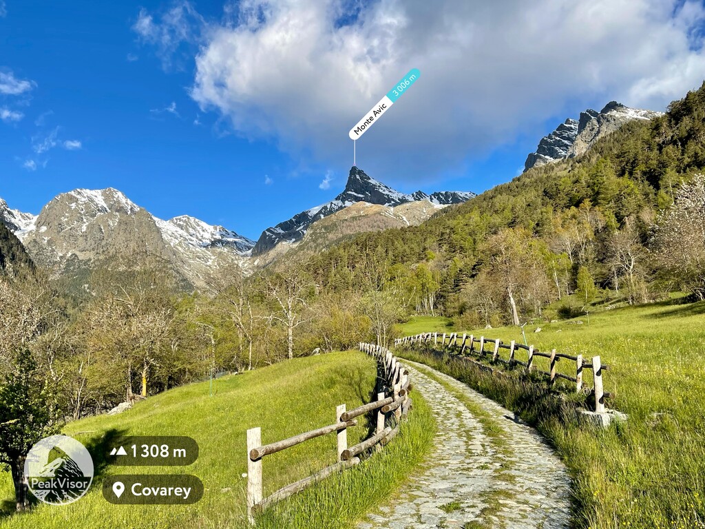
Mont Avic Natural Park was established in 1989 in order to protect the high valley of Torrente Chalamy (Champdepraz). The valley of Dondena was added to the park in 2003, further expanding its boundaries to include the mountain ridges of Val Soana and Valle di Cogne. The park covers 57,47 sq. km (22,18 sq. mi) of land and borders the Gran Paradiso National Park.
The park includes 40 named mountains, the highest of which is Mont Glacier (3,185 m/10,449 ft) and the most prominent of which is Mont Avic (395 m/1,296 ft of prominence). The park is known for its spectacular beauty, characterized by high reliefs, deep valley cuts, and steep slopes.
The Aosta Valley is also home to 10 nature reserves that were established in order to protect the region’s natural beauty and biodiversity. These reserves ensure that the nature in the area can be explored in a sustainable way, without impacting on the natural environment.
The many nature reserves in the Aosta Valley include:
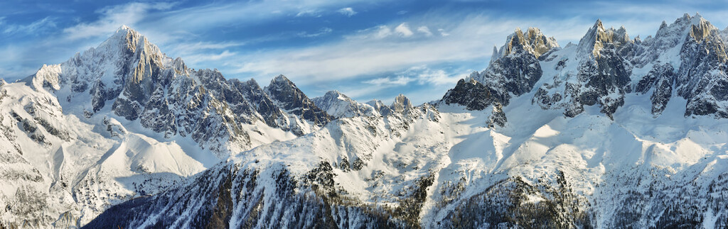
Aosta Valley hosts part of two ranges within the Western Alps: the Graian Alps and the Pennine Alps.
Both ranges cross France, Italy and Switzerland and were formed millions of years ago. The region is therefore made up of rocks of different ages and origins. The part of the Graian Alps resident in Aosta Valley can be divided into two groups, the Mont Blanc massif and the Gran Paradiso massif.
The Mont Blanc massif is snow-covered and composed of a granite core, surrounded by metamorphic rocks such as gneiss, mica schists, and limestone schists. The Gran Paradiso massif is made up of a mix of rocks, including stratified gneisses that also contain thick veins of iron. Meanwhile, the Monte Rosa massif makes up the part of the Pennine Alps in the Aosta Valley and consists mostly of granite and gneiss.
Due to its rich mineral content, the Aosta Valley is home to many old mines that are no longer in use. Materials such as gold, silver, copper, magnetite, iron, manganese, and coal were mined throughout the last few millennia.
The old mines are usually found in scenic locations and some of them still contain their original infrastructure. These mines are an interesting place for hikers to visit, as well as anyone with an interest in industrial archeology. Important mines in the region include those at Cogne, Saint-Marcel, Brusson, and La Thuile.
Of the Aosta Valley’s 656 mountains, the highest and most well-known are:
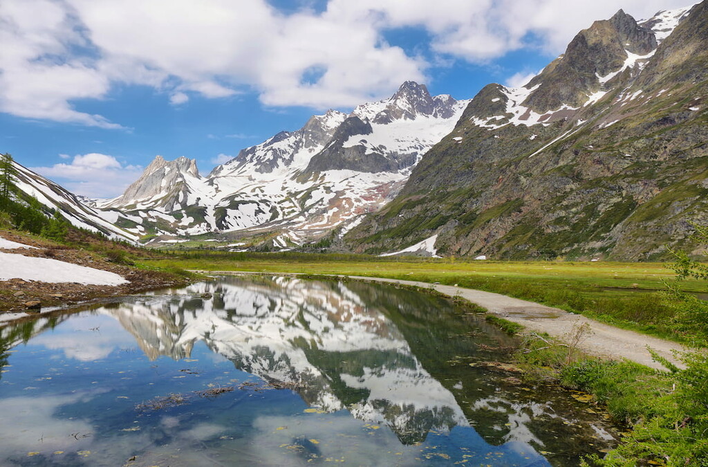
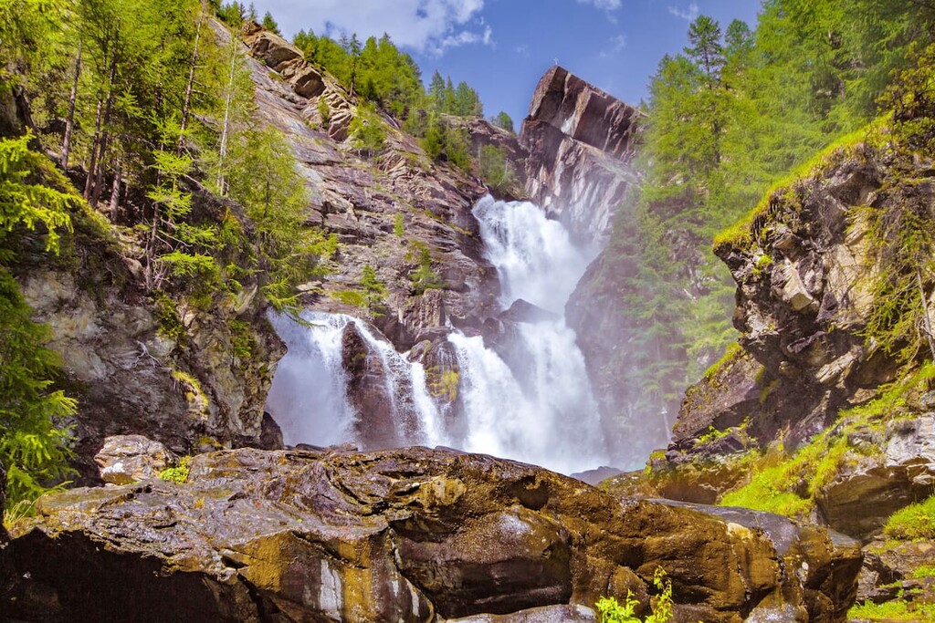
The Aosta Valley supports diverse environments comprising high altitude, woods, wetlands, alpine grasslands and xeric environments. From its glacial surfaces and Alpine pastures, to coniferous forests, larch woods, shrublands, and peat bogs, the Aosta Valley is a truly biodiverse place. The region is therefore home to a huge variety of flora and fauna.
The right side of the river Po is referred to as the “envers,” and it is rich in spruce and larch trees. The left of the river is known as the “adret,” and it is typically sunny and characterized by oak and pine woodlands as well as cultivated vineyards.
The most accessible places to spot interesting flora and fauna are in protected areas, such as the Gran Paradiso National Park, and the Mont Avic Natural Park.
The flora in Gran Paradiso National Park is characterized by larches and spruces, Swiss stone pines, and silver firs. As you ascend in elevation, the trees become more sparse, giving way to vast alpine pastures that bloom with flowers in the late spring. Further up, the pastures peter out, giving way to a rockier terrain punctuated by glaciers.
The Mont Avic Natural Park is known for its spectacular beauty, characterized by high reliefs, deep valley cuts, and steep slopes. The flora in the Mont Avic Natural Park is influenced by its large number of lakes and wetlands. It includes hook pine forests and conifers. The forests of Val Chalamay had been decimated by mining, but they are now regaining their original ecological characteristics after being included in this protected area.
Due to the variety of flora in the environment, the Mont Avic Natural Park is home to a high number of insect species, including 1,110 different varieties of butterfly.
Typical fauna in the parks include the Alpine ibex (symbol of the Gran Paradiso National Park), chamois, marmot, mountain hare, foxes, badgers, weasels, martens, and lynx, among others.
Plenty of birdlife can also be found in both parks. Common species include golden eagle, bearded vulture, buzzards, kestrels, sparrow hawks, and eagle owls, black grouse, rock partridge, and black woodpecker. More than 120 bird species have been sighted in the Mont Avic Natural Park alone.
The Aosta Valley is an autonomous region of Italy that was officially established in 1948. It’s primary industries are wine-making, milk and cheese production, and tourism.
The territory that is now part of the region of the Aosta Valley was originally home to a number of Celtic tribes. It was then dominated by the Gallic/Ligurian Salassi tribe until it was annexed by the Romans who founded the regional capital Aosta in 24 BCE.
After the fall of the western Roman empire in the fifth century, the region passed through many different hands until it was finally acquired by the House of Savoy (the future Italian royal family) in the eleventh century.
During the middle ages, the Aosta Valley was also given new religious significance as it was part of the via Francigena Pilgrim route that starts in Canterbury, England and ends in Rome.
The majority of the modern-day population of the Aosta Valley is concentrated at the bottom of the valley in the plains. Additionally, the region’s official languages are Italian and French, though the majority of locals speak a French dialect known as Valdôtain.
The region is well known for its traditional cheeses and cured meats. These include Fontina, Jambon de Bosses, Valle d’Aosta Fromadzo, Motzetta and Vallée d’Aoste Lard d’Arnad, the latter of which best served with the delicious wines that the valley has to offer.
Alongside its food and drink, the area is also known for its thermal baths, which are located in Pré-Saint-Didier and Saint-Vincent. These are well worth a visit after a long day of hiking or skiing.
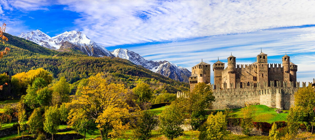
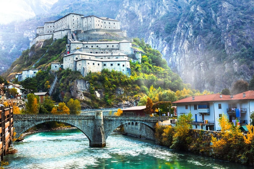
The Aosta Valley is also known for its fairytale-like castles. Some of the famous examples of the region’s castles include Fénis Castle, Issogne Castle, Verrès Castle, Saint-Pierre Castle, Fort Bard, Savoy Castle.
The government in the Aosta Valley region created a land registry of the entire network of footpaths in its territory. There are currently more than 5000 km (3,106 mi) of footpaths in the Aosta Valley. The regional council, city councils, and mountain communities all carry out regular maintenance of these paths to ensure that visitors can have the best experience.
Here are some of the best hikes in the Aosta Valley to check out during your next visit:
The Aosta Valley is also home to part of the famous Tour du Mont Blanc (TMB) route that circles the Mont Blanc massif, passing through Italy, Switzerland and France along the way.
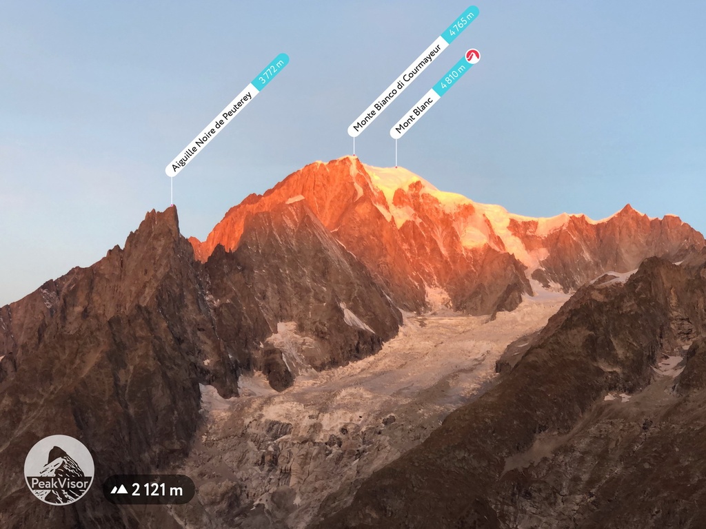
The route enters Italy anti-clockwise from Col de la Seigne (Colle della Seigne in Italian) and heads into Val Veny. From here, you can take in impressive views across the Mont Blanc massif and the Aiguille Noire de Peuterey.
You can make a pit stop on the TMB at rifugio Elisabetta to rest up along the route or simply stop at the rifugio for a lunch break before heading along the valley and down into Courmayeur. Val Veny itself is also a great area for day hikers to enjoy the incredible views of the Mont Blanc massif.
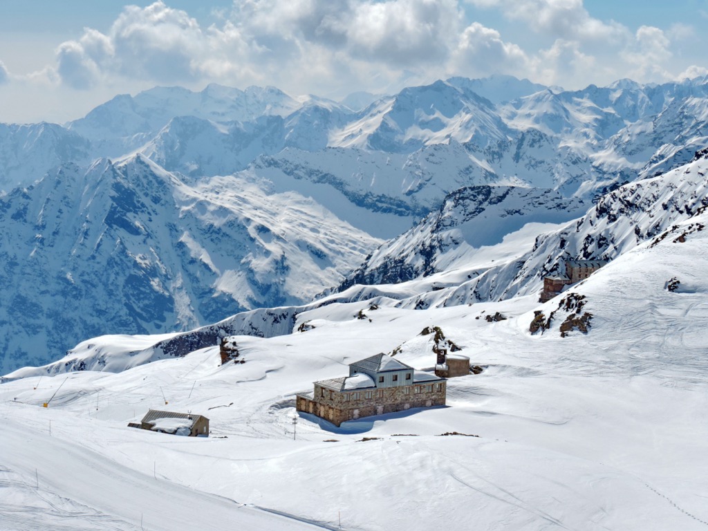
Gran Paradiso National Park offers a vast network of footpaths for hikers of all abilities to enjoy. Families with children and less experienced hikers can follow the old hunting roads, finishing up at mountain huts for lunch, while more experienced hikers can look towards the summits.
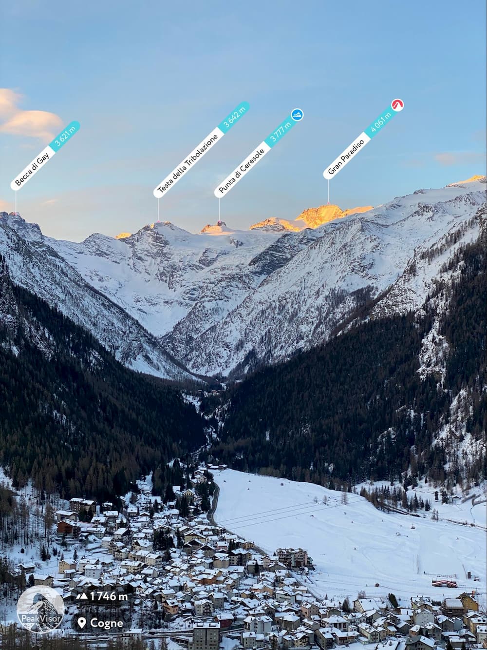
The trails to the summit of Mount Gran Paradiso start at either the rifugio Vittorio Emanuele II or rifugio Chabod where you will stay before beginning your ascent. This is known to be a good route for less-experienced mountaineers, and is often cited as a warm-up for mountaineers looking to summit Mont-Blanc.
In addition to the Tour du Mont Blanc and the many trails in Gran Paradiso National Park, some of the other most popular hikes in the Aosta Valley include:
For skiing and snowboarding enthusiasts, there are more than 20 ski resorts in Aosta Valley. Given the unique location of the region on the border with Switzerland and France sharing the highest mountains of the Alps, this is one of the main areas for skiing in the Italian Alps, French Alps and Swiss Alps at the same time.
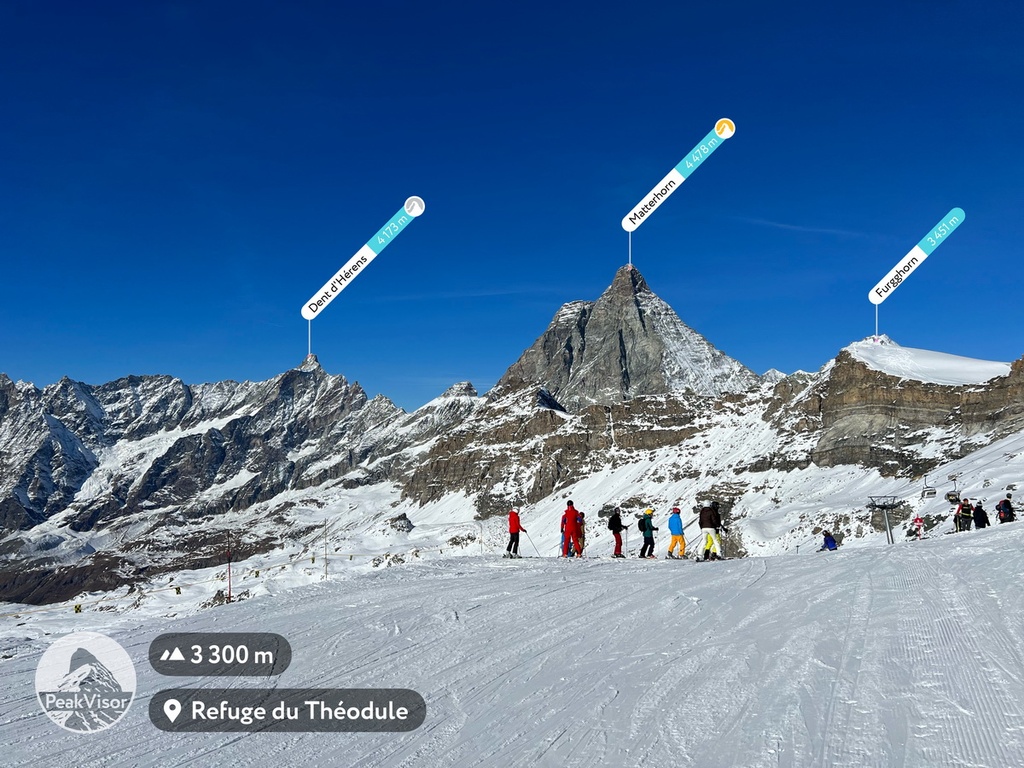
The largest ski resort in Aosta Valley is Matterhorn Ski Paradise (Zermatt, Breuil-Cervinia, and Valtournenche) with more than 320 km (199 mi) of slopes and more than 50 ski lifts.
Other two major areas for skiing in Aosta Valley with more than 130 km (mi) of slopes and more than 20 ski lifts each includes Espace San Bernardo–La Rosière/La Thuile and Monterosa Ski (Alagna Valsesia, Gressoney-La-Trinité, Champoluc, and Frachey).
The main ski resort near Aosta, the namesake town of the region, is Pila with more than 50 km (31 mi) of slopes and more than 10 ski lifts.
Check the Aosta Valley ski resorts map as well as the larger Italy ski resorts map in the World Mountain Lifts section of the site. It includes information about open ski lifts / slopes in Austria in real-time with opening dates and hours. There are also year-round cable cars, funiculars, cog railways, aerial tramways, and all other types of mountain lifts.
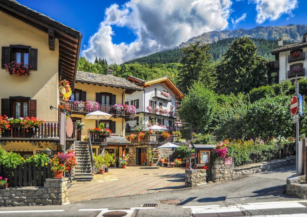
Although Aosta Valley doesn’t have a lot of big cities to visit, you’ll find plenty of small mountain towns to base yourself in. Some of the most noteworthy places to visit and enjoy the best of Italian mountain living include:
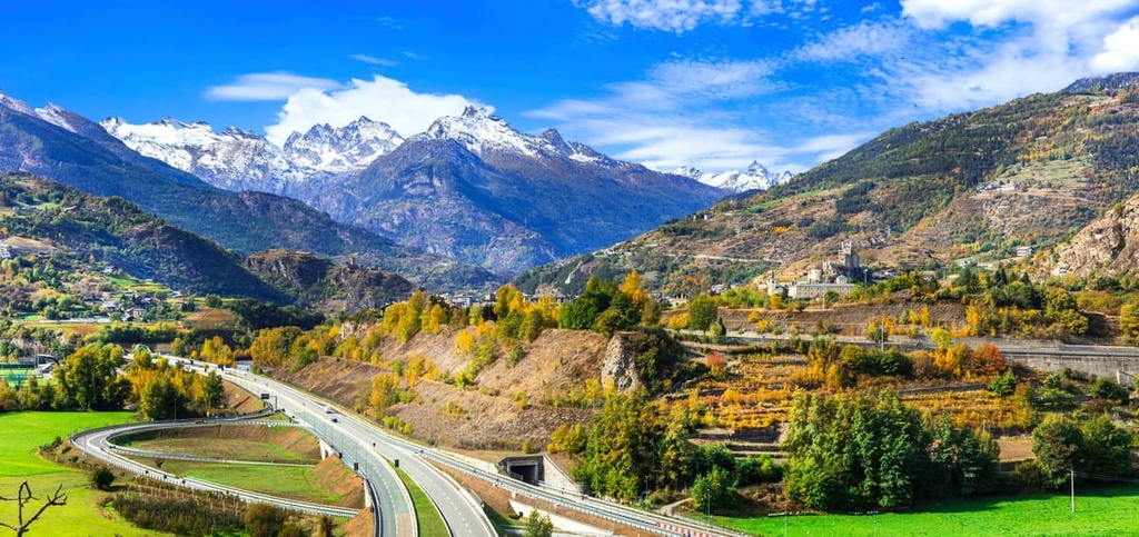
Aosta is an ancient Roman town founded in 24 BCE that gained military importance during Roman times due to its position at the end of the Little and Great Bernard passes. After the fall of the Western Roman Empire, it fell into many different hands before landing in the hands of the House of Savoy in the eleventh century.
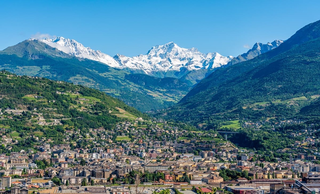
Many Roman ruins can still be seen in the city today. It’s a good base to explore the Aosta Valley as you can reach Gran Paradiso National Park and Mont Avic Nature Reserve in less than an hour of driving from the city.
Located over 1,200 m (4,000 ft) above sea level, on the south side of Mont Blanc, the community of Courmayeur is a great place to take in the beauty of the Mont Blanc massif.
Courmayeur is well renowned for its skiing opportunities in the winter. It is also a popular place to stay during the summer months due to its easily accessible hikes and panoramic views. The city is home to Italy’s highest botanical garden, and it is itself Italy’s highest comune.
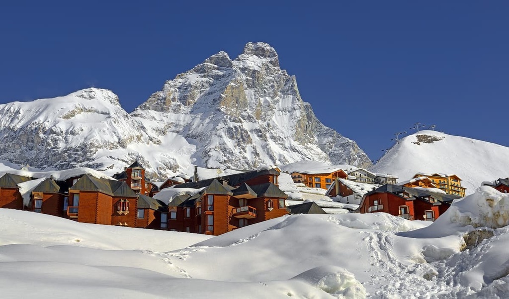
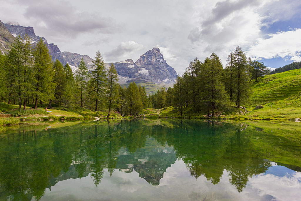
Situated in the shadow of the Matterhorn (Cervino), the resort town of Breuil-Cervinia provides access to Europe’s highest ski lifts. It is a perfect place to base yourself for a ski trip in the winter or for a high elevation hiking trip during the summer months.
Aosta Valley is within easy driving or train distance from the international airports of Turin, Milan and Geneva. Aosta and Courmayeur can also be reached by coach from Milan, as well as via Chamonix and the Mont Blanc tunnel.
The Aosta train station runs a regular service to and from Turin, and the journey takes just over 2 hours. Trains from Milan take around 3 hours and they usually include a stop in Ivrea or Chivasso.
Here are 3 great places to start your journey to Aosta Valley if you’re coming from further afield:


top10
ultra
glacier
europe-4500ers
alps-4000ers
italy-ultras
france-ultras
top10
ultra
glacier
europe-4500ers
alps-4000ers
italy-ultras
france-ultras
top50
ultra
glacier
alps-4000ers
italy-ultras


