
Scan the QR code and open PeakVisor on your phone
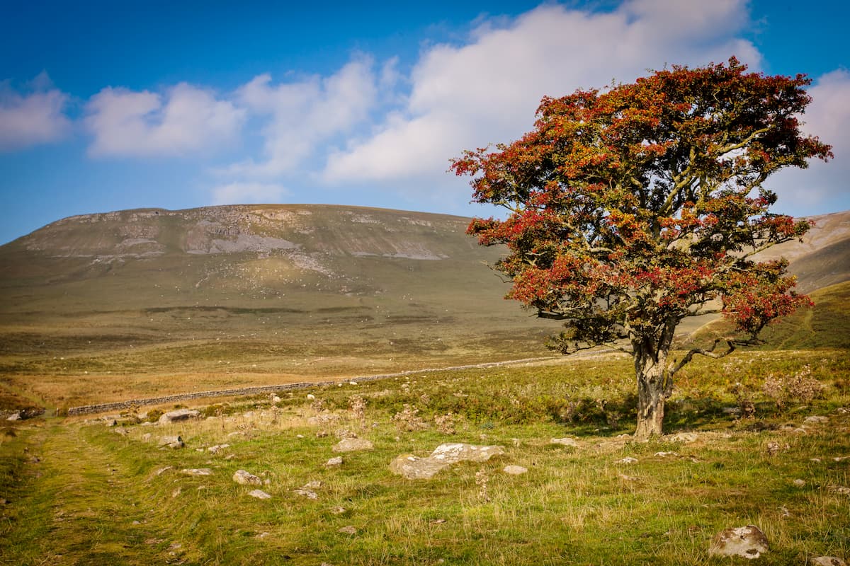
While England is relatively flat compared to its neighbors Wales and Scotland, there's still an array of challenging mountain treks and stunning hiking areas to enjoy. England is home to over 200 peaks that exceed 610 meters (2,000 feet), almost all of which are located in the north. You’ll find ten national parks in England, all of which provide unique environments, from precipitous mountains to vibrant heathlands.
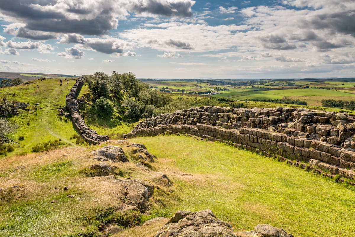
The most significant mountain range in England is the Pennines. Often referred to as the spine or backbone of England, the Pennines run through the middle of the north of the country from Derbyshire up into Northumberland. The Pennines region contains the Peak District National Park, Yorkshire Dales National Park, and Northumberland National Park.
While technically a mountain range, the Pennines are spread out, with vast upland areas separated by wide dales. The Pennines are split into two distinct sections by the Kibble and Aire rivers, near the city of Leeds. The landscape of the Pennines is mostly heathlands, marshes, and valleys. The hills and mountains are composed primarily of limestone and Millstone Grit. One of the longest trails in England, the Pennine Way, weaves through the range for 268 miles from Edale in Derbyshire to Kirk Yetholm on the Scottish border.
The northern section of the Pennines comprises the Northumberland National Park, North Pennines AONB, and the Yorkshire Dales National Park. The North Pennines is the higher of the two Pennine regions and contains Cross Fell (894 m), the highest peak in the Pennines. Other notable peaks in the North Pennines include Whernside (734 m), Ingleborough (727 m), and Pen-y-Ghent (695 m). The Cheviot Hills are located within Northumberland National Park and are often considered part of the North Pennines. The highest point in the Cheviot Hills is The Cheviot (816 m).
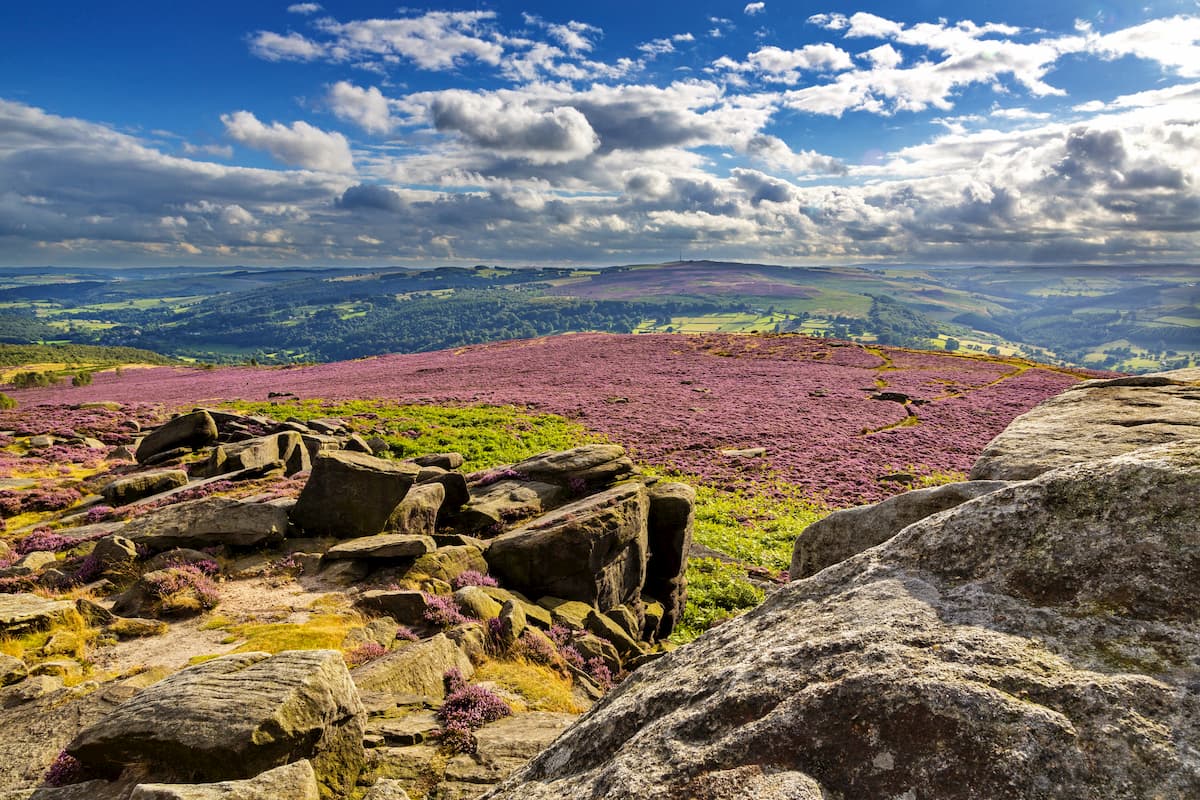
The South Pennines is largely contained with the Peak District National Park. The southern Pennines are mainly hills, with only Kinder Scout (641 m) exceeding the 610-meter mark. Regardless, the Peak District is still one of the most popular hiking areas in England, thanks to its extensive trail system, serene landscape, and fascinating history.
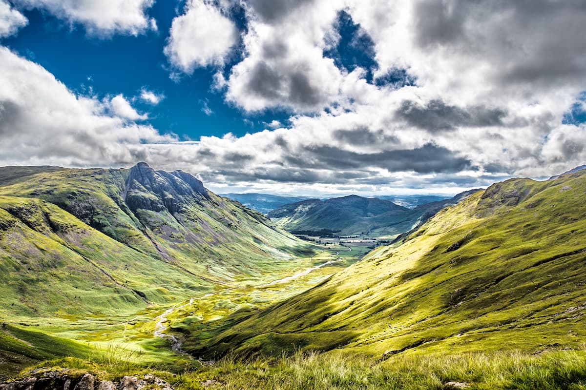
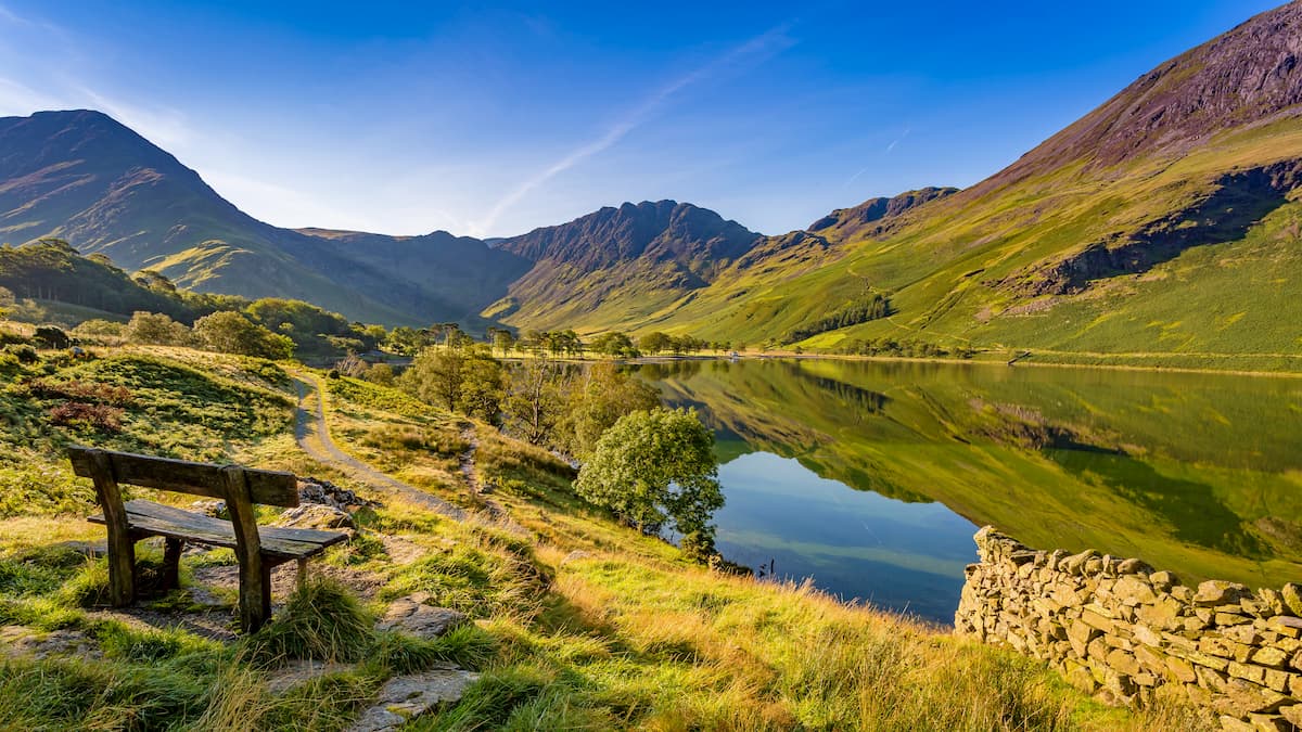
Situated just west of the Pennines is the Lake District National Park, the largest national park in England. It covers 912 square miles of vast lakes, sublime mountains, and lush woodlands. The Lake District contains 214 peaks over 304 meters (1,000 feet), known as Wainwrights or fells. The Lake District is famous for containing the six highest summits in England, all of which top out at over 915 meters (3,000 feet). Scafell Pike (978 m) is the highest mountain in England, and other notable peaks include Sca Fell (964 m), Helvellyn (950 m), and Ill Crag (935 m). The Lake District also contains Windermere, the largest lake in England.
On the eastern side of the Pennines is the North York Moors National Park. Covering 554 square miles, this national park consists of rolling hills, moorlands, and forests. While there are no mountains in North York Moors National Park, there are plenty of hiking areas and several prominent hills, like Round Hill (454 m) and Cringle Moor (435 m).
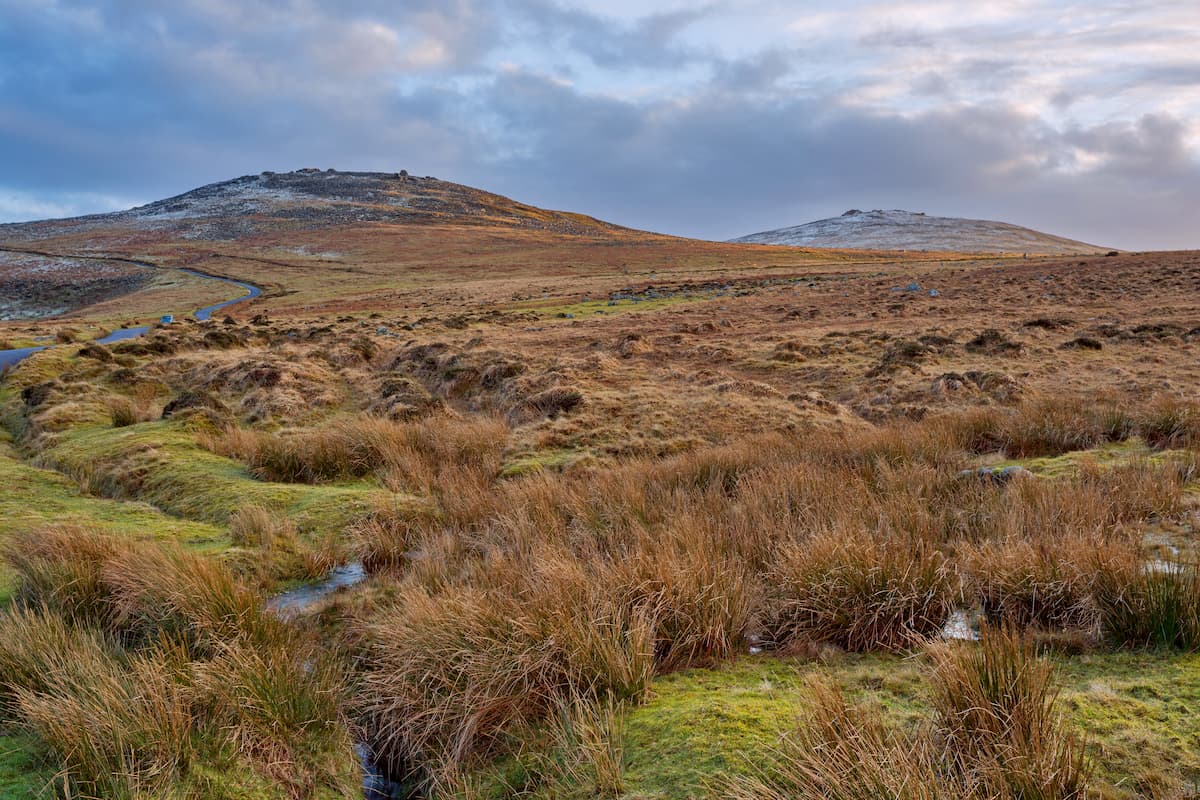
Southern England is the flattest region of the UK; however, there are still a couple of official mountains and plenty of scenic hiking areas. Dartmoor National Park is located in the southwestern county of Devon and contains High Willhays (621 m), the highest peak in the UK south of the Brecon Beacons. Dartmoor is known for expansive moorlands and stark granite hills known as tors. Another notable peak in southwestern England is Dunkery Beacon (519 m) in Exmoor National Park, situated just north of Dartmoor.
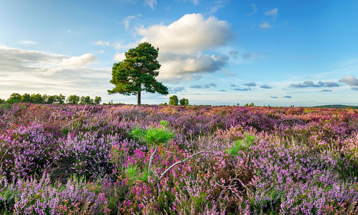
Further to the east along England’s coastline are the stunning New Forest and South Downs National Parks. The South Downs is the hillier of the two parks thanks to its numerous chalk hills. The South Downs boasts the highest point in the two parks, Ashford Hill (304 m). While the New Forest National Park is relatively flat, it's home to wonderful heathlands that turn bright purple with lavender during late summer. The only national park in the east of England is The Broads National Park. Situated in the counties of Suffolk and Norfolk, The Broads consist of 117 square miles of rivers, shallow lakes, and flooded peatlands.
England is also home to 33 Areas of Outstanding Natural Beauty. One of the most notable examples is the Cotswolds AONB, which draws hikers from across the world due to lush meadows, picturesque rolling hills, and excellent camping opportunities.
Read on to find out about some of the best mountain hikes and trails in England.
The Lake District is perfect for hikers looking for a challenging climb in England. With dizzying vistas of serene lakes from atop England’s highest summits, mountain climbing in the Lake District is the ultimate English hiking adventure. The Scafell Pike Walk takes you to the peak of England’s highest mountain and is a strenuous trek even for experienced hikers. This circular walk is 8 miles, ascends 1070 m, and takes 6 or 7 hours.
The trail will first take along part of the Corridor Route, before descending the Brown Tongue Path. You’ll start at the Wasdale Head car park, before heading northeast past St Olaf’s Church and Burnthwaite up onto the Sty Head bridleway. The walk up to Sty Head is steep and runs along the southern flanks of Great Gable (894 m). Head east from Sty Head onto the Esk Hause Bridleway. The Corridor Route is down a narrow path 300m to the right of the birdleway’s mountain rescue box. Some scrambling is required along parts of the Corridor Route.
The Corridor Route is well-worn and generally easy to follow. You’ll pass below the peak of Great End (904 m) and Broad Crag (934 m) on the way to Lingmell Col. From the col, head south to the summit of Scafell Pike. The paths are not very defined, so carefully map out a route. The peak of Scafell Pike affords sweeping views of Eskdale valley. To descend Scafell Pike, retrace your steps onto Lingmell Col, before heading in the opposite direction from the Corridor Route, onto Hollow Stone, and down the Brown Tongue Path. At Lingmell Gill, follow the path which descends steeply back to the footbridge to Wasdale Head car park.
Skiddaw (931 m) is one of the most stunning mountains in the Northern Fells and is perfect for climbers looking to test their abilities. While not as steep as its southern neighbors, Skiddaw is still the sixth highest peak in England and shouldn’t be undertaken lightly. The Jenkins Hill Path is the best way to ascend Skiddaw. The hike is 10 and a half miles there and back, ascends 970 m, and takes 6 to 7 hours.
Starting from the town of Keswick, locate the Brundholme Road. Around 500 m along the road is the start of the old Victorian pony path up the mountain. Continue past the Latrigg car park down the fenced track, heading north at the fork in the road. At the gate, you can scale the summit of Little Man (851 m), or continue west. To the north, you’ll spot the peak of Skiddaw. The summit of Skiddaw boasts sweeping panoramas of the Lake District and arguably some of the best scenery in the park. The descent down the mountain is the same way you came. The path can get misty, so ensure you map your route well and bring along a compass.
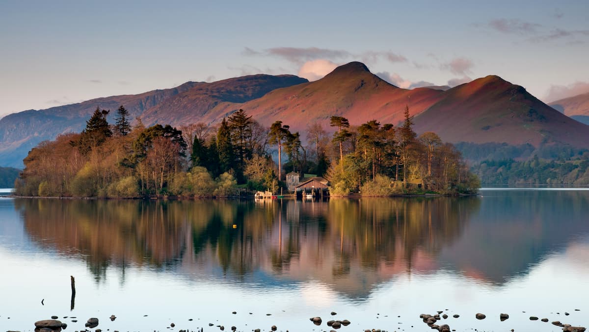
Beginner hikers looking for a fun trek that offers superb views of the Lake District should consider scaling Cat Bells (440 m). This Wainwright is one of the most popular hiking destinations in the region, as any hiker in good shape can make it to the summit. The walk is 3 and a half miles, ascends around 379 m, and takes 2 or 3 hours.
From the cattle grid near Gutherscale Lodge, head south until you reach the well-defined footpath that winds up Skelgill Bank towards Cat Bells. This section is steep in places, and some minor scrambling might be necessary. The summit of Cat Bells provides views of Derwentwater lake and Keswick town to the east, and the Western Fells to the west. When descending, head down the easternmost path from Hawes Gate. Keep left, before turning right at Brandelhow Bay. At Hawse End, you’ll be just a short walk from your starting point.
The Three Peaks Challenge is one of the hardest walks in the Pennines, taking explorers to the summit of Yorkshire Dales National Park's three highest peaks: Pen-y-Ghent, Whernside, and Ingleborough. You’ll want to carefully map your route through the mountains, and come well-prepared with ordinance maps, a compass, food, water, waterproof clothing, etc. This strenuous hike is 24 miles, ascends 1,585 m, and takes about 12 hours. If you find this route is too long or challenging, you can easily split the journey in three, and take on each peak separately, from the main roads and nearby villages.
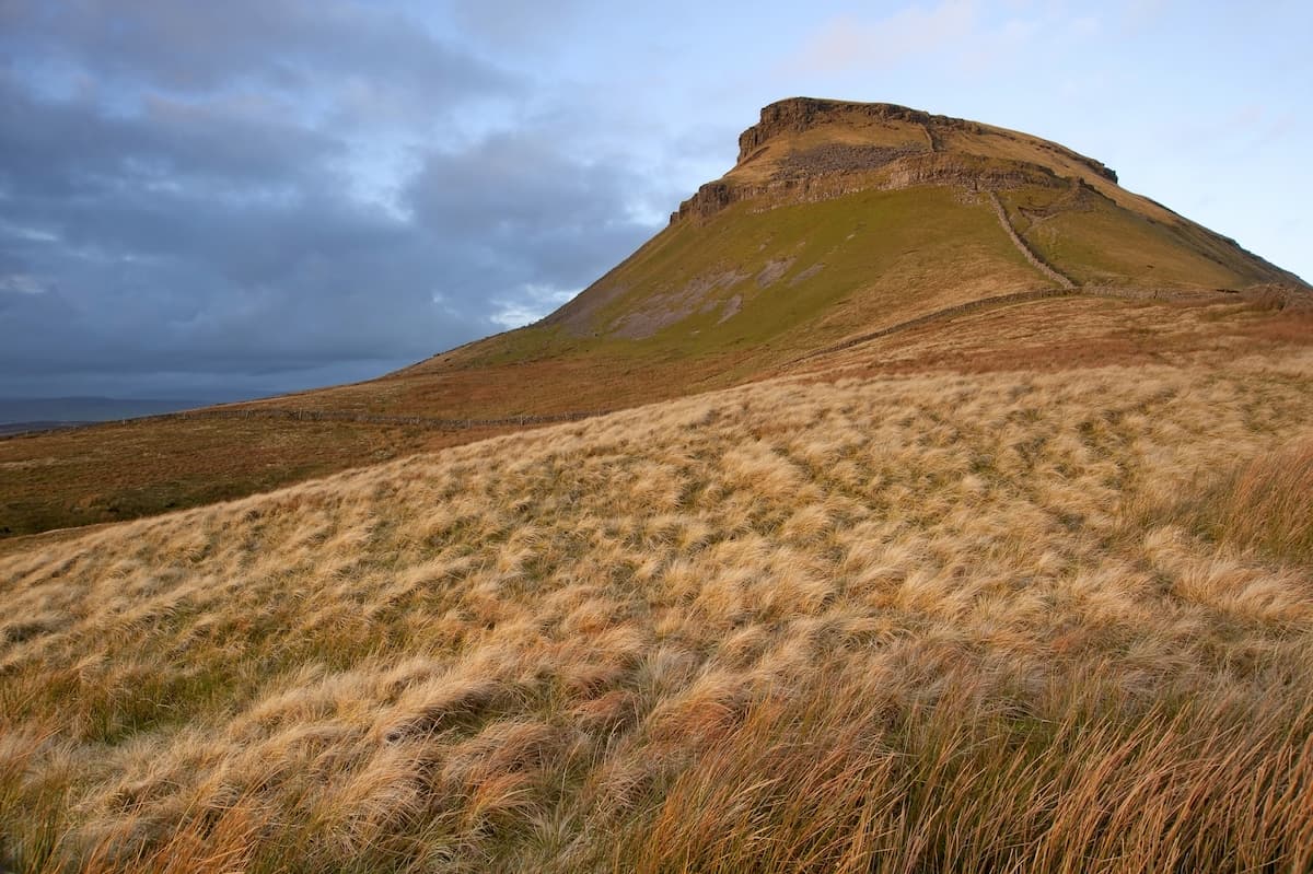
From Horton village car park, walk south towards Brackenbottom and locate the Pen-y-Ghent path to your left. Past the fields ahead you’ll spot Pen-y-Ghent’s summit. The path is fairly steady, before getting steep towards the summit of the mountain. The top of Pen-y-Ghent features a trig point and shelter in case you need to rest. Next, head north over Whitber Hill (426 m), then towards Nether Lodge via Birkwith Cave. Head down the B6479 road past Ribblehead to the Ribblehead Viaduct and follow the worn path by the railway tracks. You’ll soon reach a signpost for Whernside’s summit.
After scaling Whernside, continue along the ridge trail and turn left at the sign for Bruntscar. At the B6255 road, turn left past the Old Hill Inn and locate the grassy path to the right which leads towards Ingleborough. Follow the well-worn trail which passes through fields, gently ascending the mountain. The final stretch up Ingleborough is steep, before the trig point and a shelter where you can rest. The summit plateau is tricky to navigate in bad weather, so ensure you bring a compass and use the trig point as a bearing.
To descend, head east towards Horton-on-Ribblesdale. The path drops into a valley, which reconnects with the main track. After passing through Sulber Nick valley, you’ll be a short walk from Horton car park.
Cumbria’s Cross Fell is the highest mountain in England outside the Lake District and is one of the highlights of the Pennine Way. One popular and especially challenging method of climbing Cross Fell is via the steep Eden Scarp. This hike is about 11 miles, ascends 770 meters, and takes about 6 hours.
From Blencarn village, locate the footpath to the northeast. The path is signposted and leads towards the ridge of Cross Fell. When the path heads through a gate to the right, leave the trail and continue past Wythwaite farm. Along the grassy trail, you’ll be able to spot Great Dun Fell (854 m) once the path begins to ascend the valley. While the path here is easy to follow, be wary of the steep slopes to your left. Once you reach the scree cliffs, follow the cairns along the grassy slopes. The cairns are spaced out, so ensure you map your route well.
Once you’ve passed this section, you’ll join onto the Pennine Way at 795 meters. Follow the Pennine Way along the mountain’s plateau, heading northwesterly to the summit of Cross Fell. To descend, locate the old corpse road to the northwest. The old corpse road leads to Kirkland and is around 5 miles back to Blencairn.
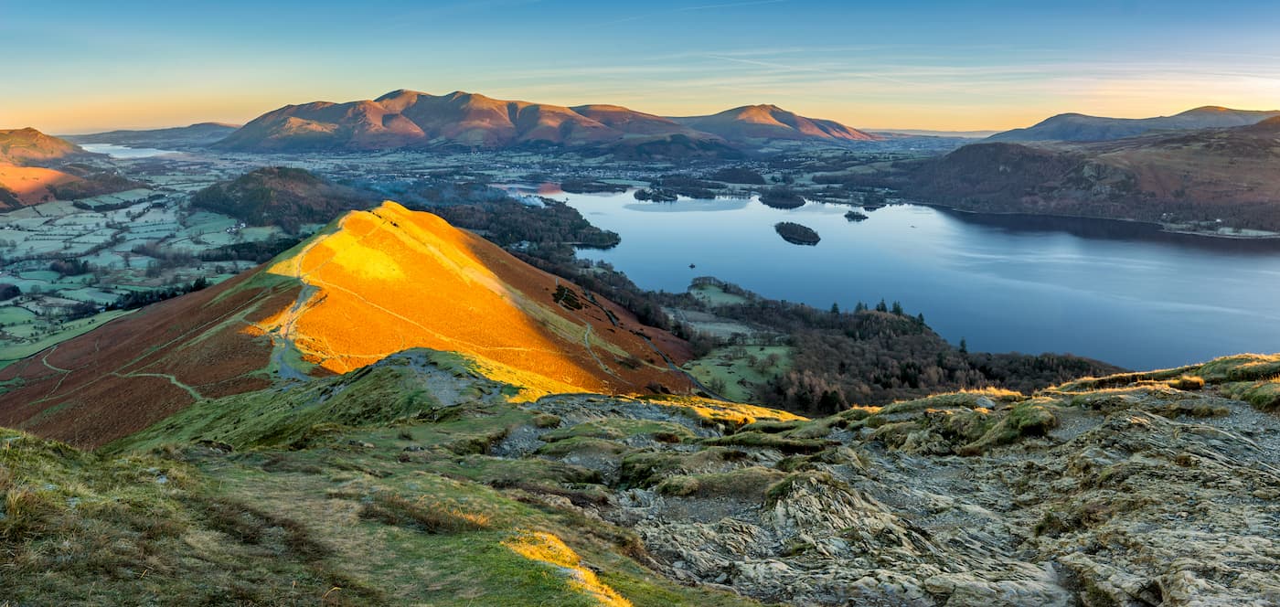
The Peak District was the first national park in England and is still one of the most popular hiking areas in the country. Kinder Scout is the highest summit in the Peak District and the South Pennines. One of the most popular ways of climbing Kinder Scout is along the circular walk from Edale. The walk is 10 miles long, ascends 535 m, and takes 4 or 5 hours.
The start of this walk is easy to locate as it’s the official start of the meandering Pennine Way. To begin, head along the Pennine Way for 5 and a half miles, from the starting point at the Old Nags Head pub. At the small bridge, you’ll have an option of heading right along the easier Pennine Way or taking the route directly to the top via Jacob’s Ladder.
Continue along the Pennine Way, past the scenic River Kinder and Edale Rocks. You’ll soon reach the trig point at Kinder Low (635 m), the highest marked point on Kinder Scout. Continue past the Kinder Downfall, a scenic waterfall that is ideal for a break. Past the waterfall, you’ll leave the Pennine Way, and traverse boglands. You’ll need to map out a route here, as the path is tough to follow. For example, you’ll need to head left at a fork in the road, which is difficult to locate due to erosion.
Pick up the path again, and you’ll see Crowden Tower (622 m) to your right. Head left and follow the rock path to Grindsbrook Clough. This scrambling area is one of the reasons Kinder Scout is so popular, and this grade 1 scramble won’t disappoint any avid climber. If you’re not keen on scrambling continue along the path which bypasses the Grindsbrook Clough and goes to Upper Tor (609 m). The path weaves through the verdant valley and woodlands, back to Edale village.
There are plenty of excellent hill walks in the Peak District, and one of the most popular is the Mam Tor Circular Walk. Also known as Shivering Mountain, Mam Tor (521 m) is one of the most popular hikes in the Peak District, as it’s simple to climb and offers gorgeous views of the region. The Mam Tor Circular Walk is under 3 miles, ascends 200 m, and takes about an hour and a half.
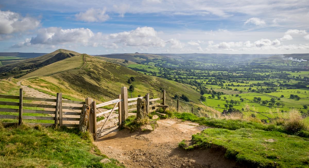
Starting from the Mam Tor car park, take the stone steps through the woods and follow the sign post for Mam Tor through the gate. Head left up more steps towards the summit of Mam Tor. From Mam Tor’s trig point, you’ll picture-perfect views of Edale and Hope Valley. To descend, take the path north past a monument, onto the famous broken road caused by a landslide. When you reach the car park, you’ll pass by Blue John Caverns, one of many limestone caverns in the area and a popular tourist attraction. Continue along the trail and follow the signposts for Windy Knoll, which will lead you back to the road to Mam Tor car park.
The Cotswolds AONB is one of the best camping areas in the UK, making it ideal for a long stroll through the lush English countryside. The Cotswold Way is a long-distance walking trail, which runs for 102 miles from Chipping Campden to the ancient city of Bath. The route follows the western edge of the Cotswold Hills and it takes most hikers at least a week to complete the whole trail. The Cotswold Way is easy to follow and very well signposted; however, it’s still worth mapping out your journey.
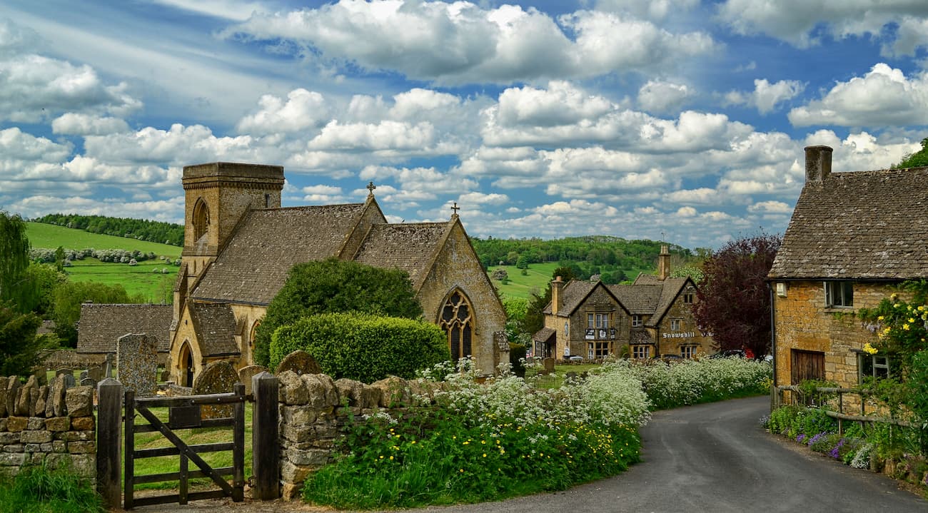
Many hikers are surprised by the incline in some places along this walk. The overall ascent of the Cotswold Way is over 10,000 meters, making this a challenging trek for any hiker. The highest point on the trail is Cleeve Hill (331 m). Despite being strenuous the journey is well worth it, with quaint market towns, postcard-perfect heathlands, and lush woodlands to admire along the way.
While southern England isn’t renowned for its mountains, there are a few excellent climbs across the region, most notably High Willhays in Dartmoor National Park.High Willhays and Yes Tor (610 m) are the only peaks in southern England over 2,000 feet high and well worth discovering if vacationing near Devon. This hike is 6 miles, ascends 385 m, and takes around 4 hours.
Pick up the trail from Meldon Reservoir car park, following the obvious path next to the reservoir. At the forks in the path, keep left. You’ll soon begin to see white and red poles to your left, which signify the Oakhampton Military Firing Range. Here the path will almost disappear, and you’ll need to use the large rock tor to guide you to the top of Yes Tor. Cross the boulder field at the top of the incline and spot the trig point for Yes Tor. Head south along the trail to the peak of High Willhays, which is marked with a cairn.
Descend by heading west/northwest to the edge of the plateau and the three outcrops, the right hand of which is Black Tor (507 m). Head down the hill to the right of Black Tor, and along the path by the West Okement River, which leads back to the reservoir.
For skiing and snowboarding enthusiasts, there are more than 50 ski resorts in England, which are located throughout the country, but these are mainly small resorts with dry slopes or covered by artificial snow with less than 5 km (3 mi) of runs and several ski lifts. Anyway, by the number of resorts, it is the main area for skiing in the UK mountains.
The largest ski resort in England is Yad Moss with more than 4 km (2 mi) of slopes and one ski lift. Other areas for skiing in England include Lake District Ski Club–Raise and Weardale Ski Club. The main ski resort near London, the largest city in England, is the Snow Center–Hemel Hempstead with more than 0.3 km (0.1 mi) of slopes and more than 3 ski lifts.
Check the England ski resorts map as well as the larger UK ski resorts map in the World Mountain Lifts section of the site. It includes information about open ski lifts / slopes in England in real-time with opening dates and hours. There are also year-round cable cars, funiculars, cog railways, aerial tramways, and all other types of mountain lifts.
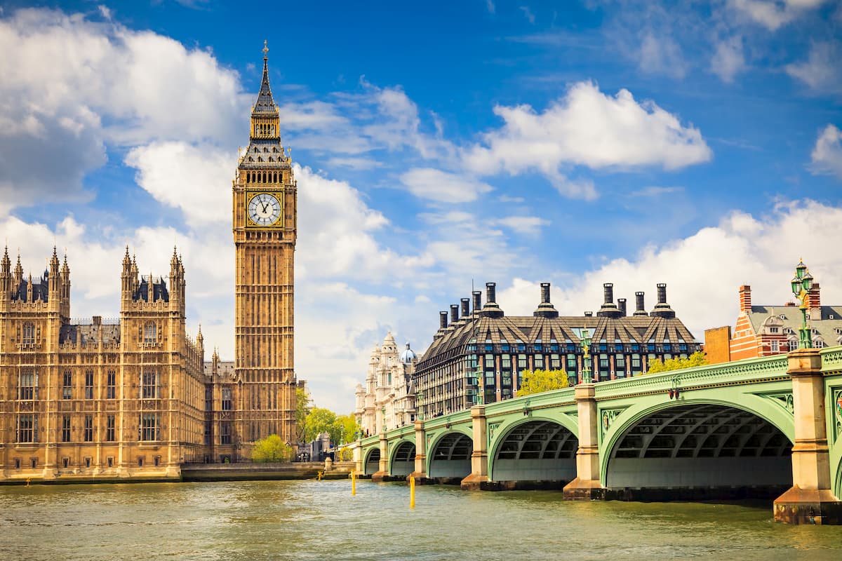
England’s capital, London, is centrally located and offers access to many nearby nature areas, as well as some of the best attractions in the country. While exploring this sprawling metropolis, make sure you stop by the historic Tower of London, visit the Queen at Buckingham Palace, and take a ride on the London Eye. There’s plenty of hiking areas within driving distance of Central London, such as the South Downs National Park, Cotswolds AONB, and New Forest National Park, which are within 100 miles of the capital. Surprisingly, London also offers a few great hikes within the city, such as Hampstead Heath and Primrose Hill, which boast superb natural views of London’s skyline. You’ll find a plethora of hotels in London, from cheap and cheerful options like the Z Hotels to the top-class hotels such as Claridge’s.
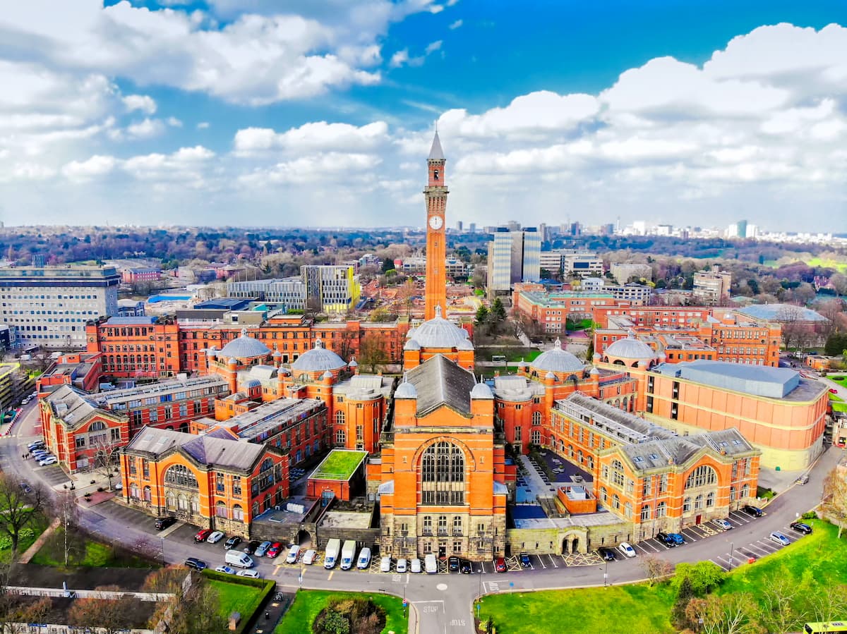
England’s second city, Birmingham’s position in the English midlands means visitors have access to some of the best hiking areas in northern and southern England. For example, Birmingham is just 50 miles from the Peak District and 60 miles of the Cotswolds AONB. While visiting Birmingham, ensure you swing by Cadbury’s World to indulge your sweet tooth, or spend the day shopping at Bullring & Grand Central Shopping Centre. Popular hotels in Birmingham include the Redmont Hotel, the Hampton Inn, and Candlewood Suites.
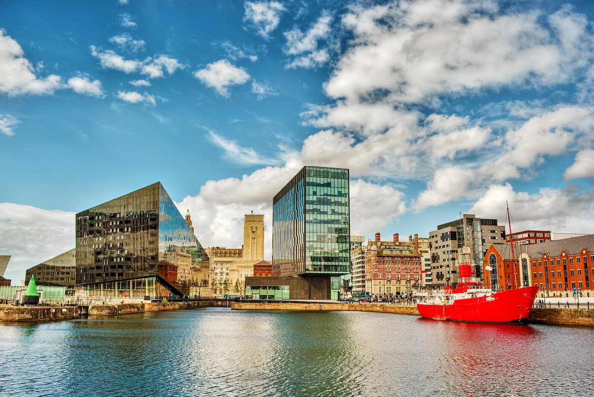
The Merseyside city of Liverpool is the third-largest city in England. This famous port city is situated in the northwest of the country, with the Peak District 50 miles east and the Yorkshire Dales 75 miles north. Liverpool is also not far from the Welsh border with Snowdonia National Park 60 miles away. During your stay in Liverpool, learn about the city’s most famous musical export at The Beatles Story, or discover the city’s fascinating history at the Museum of Liverpool. You’ll find dozens of exquisite hotels just a short walk from the River Mersey, including the Shankly Hotel, the Mercure Liverpool, and the Hard Days Night Hotel.
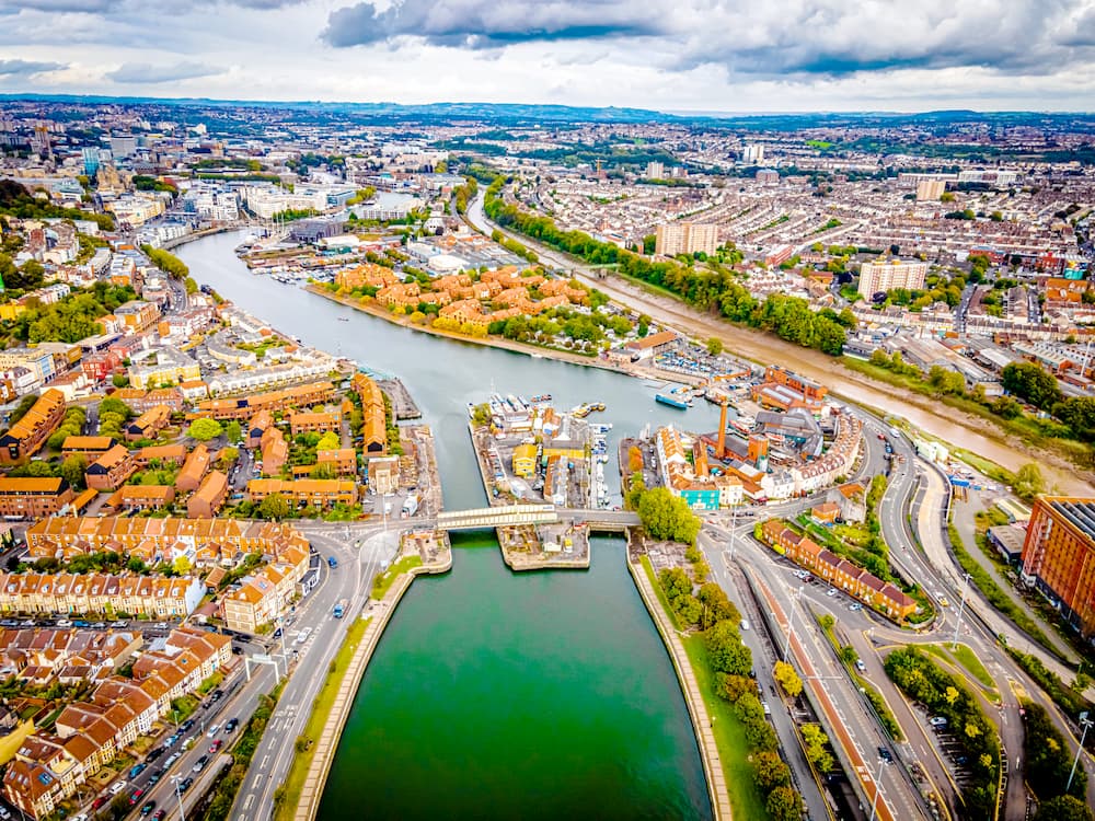
Bristol is the largest city in the southwest of England and the perfect place to stay if you’re looking to scale the highest mountains in the South. Bristol is just 20 miles from the Cotswolds, 60 miles from Exmoor National Park, and 100 miles from Dartmoor National Park. It’s also perched on the border of Wales, meaning you’ll be just 70 miles from Brecon Beacons National Park. Bristol boasts some famous landmarks and exciting attractions too, such as the Clifton Suspension Bridge, Bristol Cathedral, and Bristol Zoo. If you’re planning an escape to Bristol, consider booking a room at the Bristol Hotel or the Radisson Blu Hotel.
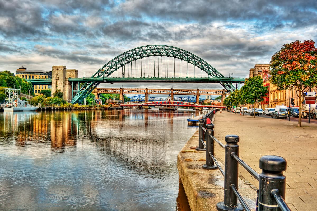
Avid explorers planning one hiking in the far north of England should consider staying in Newcastle. As the largest metropolitan area in the North East, Newcastle offers access to many of the best mountains in the north, as well as providing plenty to do around the city. Newcastle is roughly 20 miles from both the North Pennines AONB and Northumberland National Park. It’s also 60 miles from North York Moors and the Yorkshire Dales. Newcastle is home to some famous landmarks worth experiencing, such as the Angel of the North and the Gateshead Millennium Bridge. You’ll find some excellent Tyneside accommodation in Newcastle, like Hotel du Vin, Malmaison Newcastle, and The Vermont Newcastle.
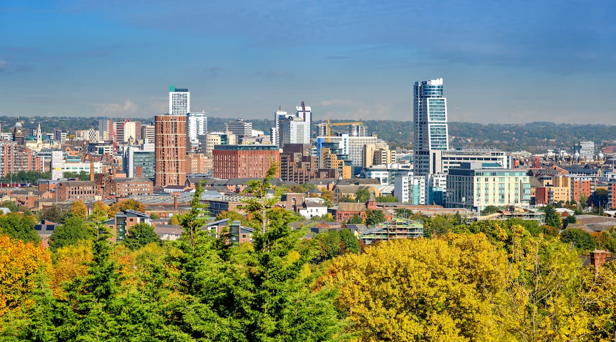
Leeds is the largest city in West Yorkshire and a great base from which to explore some of the best mountains in England. The Yorkshire Dales and Peak District are less than 30 miles away, while the Lake District, North York Moors, and North Pennines AONB are within a 100 miles of Leeds. You’ll also find plenty of fascinating historical and cultural attractions dotted across the city, including Harewood House, Kirkstall Abbey, and the Royal Armouries Museum. Leeds has a number of excellent reasonably priced hotels, like the Clayton Hotel, Park Plaza, and Quebecs Hotel.
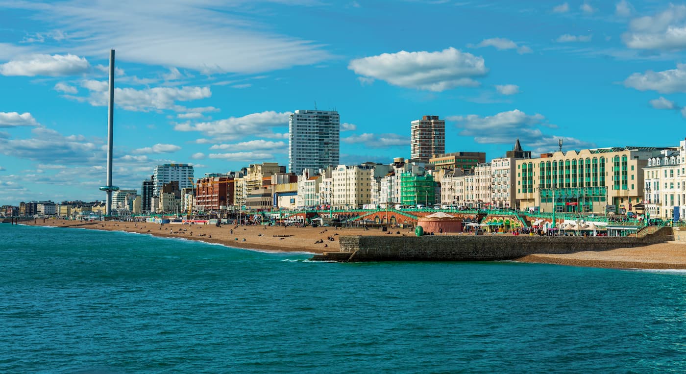
England’s south coast draws thousands upon thousands of holidaymakers every year, thanks to white sandy beaches and warm summers. Brighton is one of the largest cities along the south coast and is known for its vibrant nightlife and bohemian vibes. As well as being an exciting city to visit, Brighton is encircled by countryside, with the South Downs National Park just a few miles away. One of Bristol’s biggest attractions is the Bristol Pier, which features bars, an arcade, and even a theme park. If you fancy seeing Brighton from above, book a ride on the British Airways i360 Viewing Tower, a rotating observation platform that reaches 162 meters above the city. Many of Brighton’s best hotels are directly on the seafront, including The Mercure, The Grand Brighton, and The Hilton.


wainwrights
nuttalls
hewitts-gb
furths-ew
marilyns-gb
tgo40
wainwrights
nuttalls
hewitts-gb
furths-ew
tgo40
wainwrights
nuttalls
hewitts-gb
furths-ew
marilyns-gb
wainwrights
nuttalls
hewitts-gb
furths-ew
marilyns-gb
wainwrights
nuttalls
hewitts-gb
furths-ew
marilyns-gb
tgo40
wainwrights
nuttalls
hewitts-gb
furths-ew
marilyns-gb
wainwrights
nuttalls
hewitts-gb
furths-ew
marilyns-gb
wainwrights
nuttalls
hewitts-gb
marilyns-gb
tgo40
nuttalls
hewitts-gb
marilyns-gb
tgo40
wainwrights
nuttalls
hewitts-gb
marilyns-gb
tgo40
wainwrights
nuttalls
hewitts-gb
marilyns-gb


