Scan the QR code and open PeakVisor on your phone
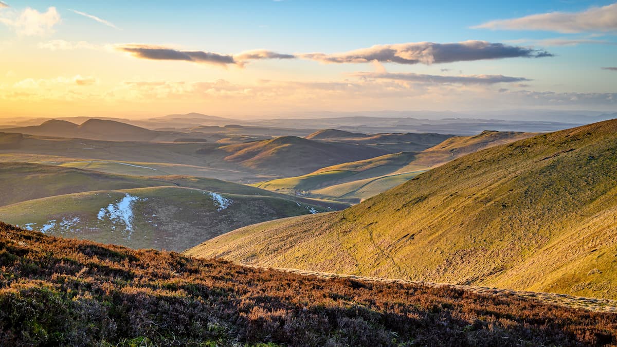
Perched on the Scottish border, Northumberland National Park is one of the remotest landscapes in England. Northumberland is the least populated of England's 10 national parks, boasting some of the cleanest air and darkest skies in the country.
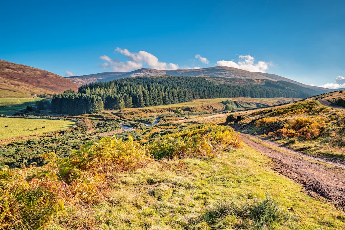
Northumberland National Park consists of 410 square miles of sweeping valleys, vibrant heather moorlands, and verdant forests. The park can be split into three distinct areas, with the Cheviot Hills dominating the north, the Hadrian’s Wall World Heritage Site to the south, and Kielder Forest to the west.
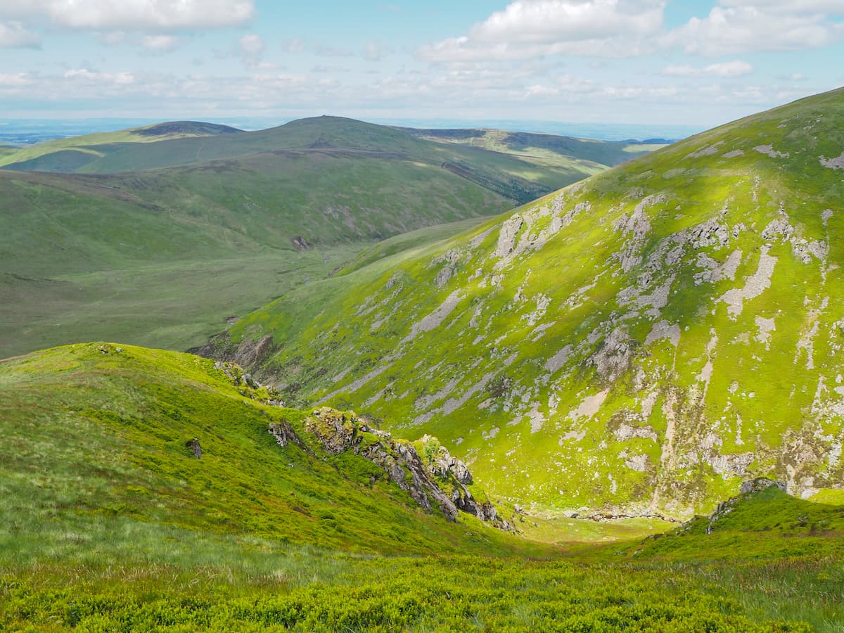
The Cheviot Hills are a favorite destination for mountain hikers and rock climbers. Often considered part of the North Pennines due to the Pennines Way running through the park, the Cheviot Hills are separated from the main range by the Tyne Gap. The Cheviot (816 m) is by far the highest and most prominent peak in Northumberland National Park. Several other summits in the Cheviot Hills reach well over 2000 ft (610 m), such as Cairn Hill (774 m), Hedgehope Hill (710 m), and Hangingstone Hill (741 m).
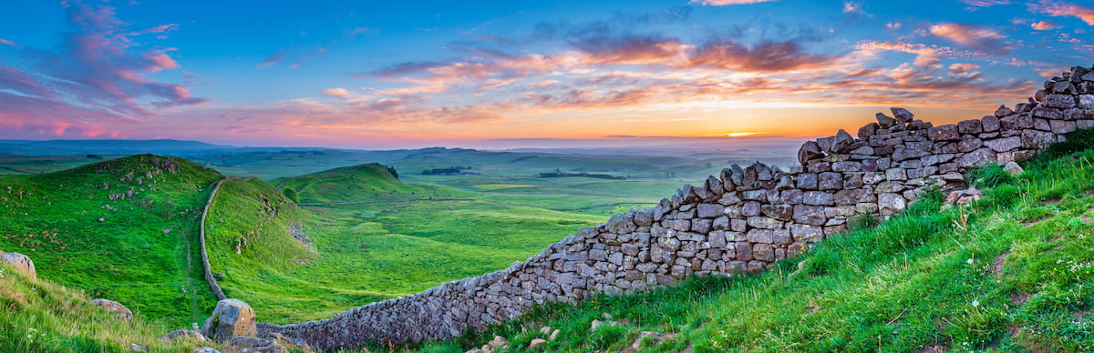
Apart from the great hiking opportunities, visitors flock to Northumberland National Park to uncover its history. Northumberland's human history dates back 10,000 years, with the remnants of Roman forts and pele towers still visible today. The most famous historic site in Northumberland National Park is Hadrian's Wall, a 73-mile long defensive wall built by the Romans in the 2nd century to fend off Caledonian forces to the north.
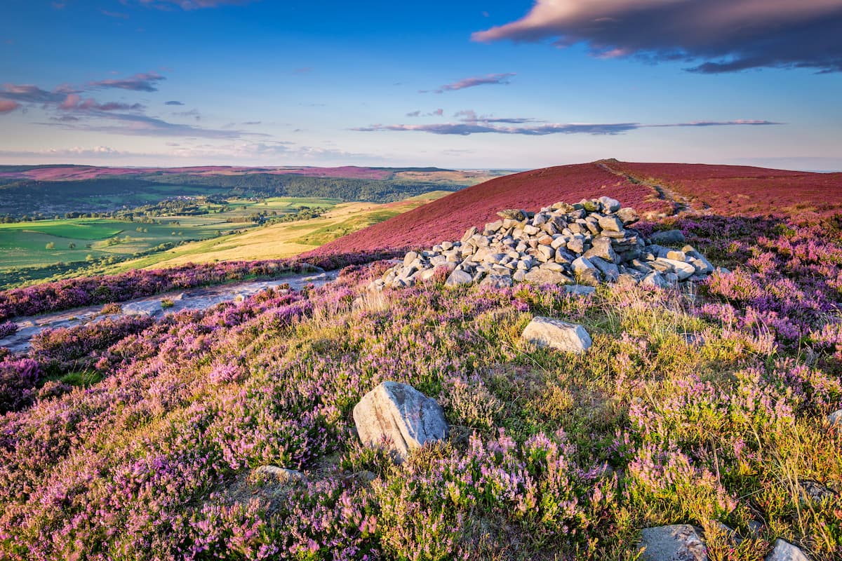
Due to its low population, Northumberland National Park was granted Dark Sky Park status in 2013. This means the park has very low light pollution levels, making it ideal for astronomers. It is the largest park of its kind in Europe. With some of the best stargazing opportunities in England, Northumberland National Park is an idyllic camping destination.
Continue reading to find out about some of the best hiking trails in Northumberland National Park.
Scaling the highest point in Northumberland is a must for any avid mountain hiker. The Cheviot is one of the remotest hill walks in England, and you're unlikely to see many other walkers along this trail. That being said, the trail to the summit of The Cheviot is well marked and easy to follow, even in poor visibility. The easiest part of this trail to follow runs along the long-distance Pennine Way. The loop trail up The Cheviot is around 8 miles, ascends 638 m, and takes about 5 hours.
You'll start this walk by parking at Langleeford by the Harthope Burn bridge. At Langleeford Farm, head through the gate with the yellow marker, and continue following the path along Harthope Burn for 3 miles. The path along this section can be hard to follow, but your route will be clear. Climbing uphill, you'll reach a fence, at which point you turn right up the steep incline. This is the steepest part of the walk.
Soon you'll arrive on Cairn Hill, where the path joins onto the Pennine Way. Along the Pennine Way, find a signpost near Scotsman’s Cairn, which tells you The Cheviot is 3/4 of a mile away. Following the Pennine Way to the trig point atop The Cheviot is straightforward. The plateau of The Cheviot is long and flat; however, some sweeping views are still available, including Simonside (428 m) visible to the south and the North Sea to the east.
To descend, continue along the Pennine Way and down onto Scald Hill (546 m) by crossing over a stile to the other side of the fence. Head left down the fence, before turning right at the gate. Stay on this path until you reach woodlands, at which point turn left to get back to Langleeford.
College Valley is one of the starkest valleys in Northumberland National Park and is one of the most popular walking destinations in the region. The hike through College Valley is moderately difficult but should be manageable for visitors who exercise regularly. The College Valley Walk is 5 miles and takes about 2.5 hours.
From the Hethpool car park, go up the road to Cuddystone Hall and pass over the Sutherland Bridge. Through a gate to the left, find the "Hethpool Mill" sign. Head along this path, which runs parallel to a fence. The track in this section is steep in places, so take care.
After a couple of miles, head downhill over the burn. Passing through a gate, bear left along the bottom of the valley. Here is an excellent area to spot one of Northumberland National Park's most famous residents, wild Cheviot goats. Return to your starting point by heading left across the College Burn to the car park.
Located on the eastern side of Northumberland National Park, the Simonside Hills are the only other significant hill range alongside The Cheviots. The walk up Simonside is a quick, steep climb, which affords picture-perfect panoramas of The Cheviots and the North Sea. The Simonside Hills are also home to an array of fauna, including red grouse and red squirrels. This hill walk is 4.5 miles and takes approximately 3 hours.
Starting at the Simonside car park at the information shelter, follow the red markers along the forested road. Staying on the main track, keep left at the fork. At the wooden barrier, consider making the short detour to historic Little Church Rock, before retracing your steps.
The track will contour around the edge of the forest before reaching the Simonside Ridge Walk. Follow this path steadily up to the stone cairn marking the summit of Simonside. Continue along the Simonside Ridge Walk, which will take you to Dove Crag (396 m) and past Thompson's Rock on the way back to the road. Turn left at the road to return to the Smithside car park.
This strenuous walk up to the top of West Hill (718) from the quaint village of Dunsdale provides hikers with the opportunity to visit three different plane crash sites dating back to the Second World War. At some of these crash sites, remnants of the aircraft are still present. The looped walk is around 5 miles and takes approximately 3 hours.
Follow the peat track opposite Dunsdale Cottage. After 3/4 mile, cut off the track to the left and locate the first crash marker, near some craggy rocks. Return to the path, and continue to the top of Bellyside Hill and then onto Bellyside Crags. At Bellyside Crags, head along the sheep track to West Hill.
On West Hill is the most famous of the plane crashes, during which local shepherds saved the lives of 7 crew members. The final crash site is located on the descent down Bellyside Crags along a fence lining at 300 m high. Continue along the same path to return to Dunsdale.
Encompassing 90 square miles along the border with Scotland, the Otterburn Range is ideal for a remote ramble. This walking trail will lead you past ancient Roman hillforts, up to stunning viewpoints, and briefly across the Scottish border. The trek through the Otterburn Range is about 8.2 miles and takes roughly 5 hours.
Park at the car park along the Roman Road near Chew Green. Walk along the track opposite, stopping to admire the remains of the Roman fort at Chew Green, before continuing up to the summit of Brownhart Law (512 m). From Brownhart Law, you'll have sweeping views of The Cheviots to the east.
Descend from Brownhart Law, cross the Scottish border, and take the short ascent to the peak of Blackhall Hill (471 m). This section of the walk is ideal for birdwatching, with merlins, skylarks, and lapwings frequenting the area. After descending slightly and heading through a gate, the track will take you up Woden Law (421 m). The top of Woden Law is adorned with the ruins of an ancient hillfort, which is better preserved than Chew Green.
To return to your starting point, retrace your steps back to the gate before Woden Law. Skirt around Blackhall Hill and back onto Deere Street. Follow the path around the hills and cross the wooden bridge at Chew Green to descend back to the Roman Road.
Retracing the footsteps of the Romans is a must while exploring Northumberland National Park. While the entire Hadrian's Wall Path stretches for 73 miles from the Irish Sea across the breadth of England to the North Sea, there are shorter walks you can take within Northumberland National Park.
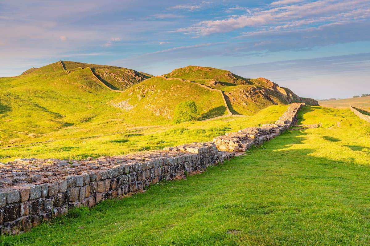
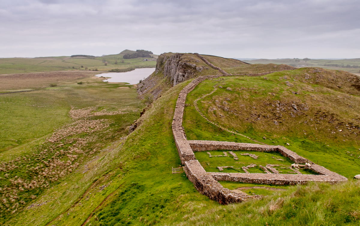
Hikers looking to mix panoramic views with ancient history should consider the Winshield Crags and Cawfields walk. This there and back trail is 6 miles and takes 3.5 hours. From The Sill Discovery Centre, head north past Peel Cottage and follow the "National Trails/ Caw Gap" sign heading west. Alternatively, take a quick detour a couple of miles east along Hadrian's Wall Path and visit Sycamore Gap, one of the most recognizable points along the wall.
Heading west towards Caw Gap, you'll pass over Winshield Crags (329 m), the highest point on Hadrian's Wall. The top is marked with a trig point. Continuing along the trail, pass over Cawfields Crags on the way to Cawfields Lake. Atop the surrounding hills, there are gorgeous vistas of the lake below, as well as plenty of picnic tables in the area in case you fancy a lakeside snack.
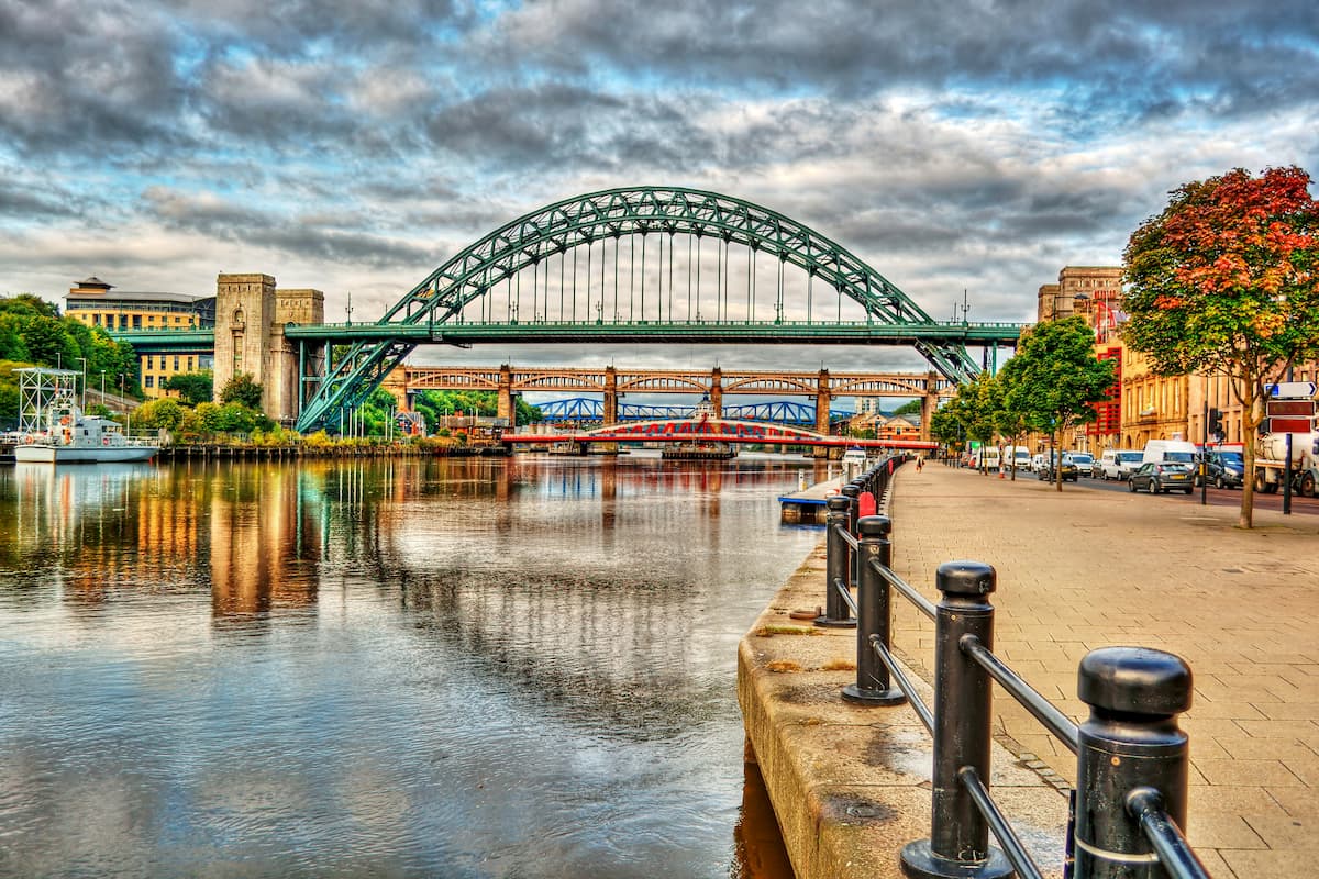
Dubbed the "Capital of the Northeast," Newcastle is by far the largest settlement within touching distance of Northumberland National Park. Roughly 30 miles southeast of the park, Newcastle affords visitors plenty to do around the city. Learn the local history at Newcastle Castle, or soak up some culture at the Baltic Centre for Contemporary Art. You won't have any trouble finding somewhere to stay in Newcastle, with dozens of hotels including the Tyneside Copthorne Hotel and the highly-rated Hemples Lodge.
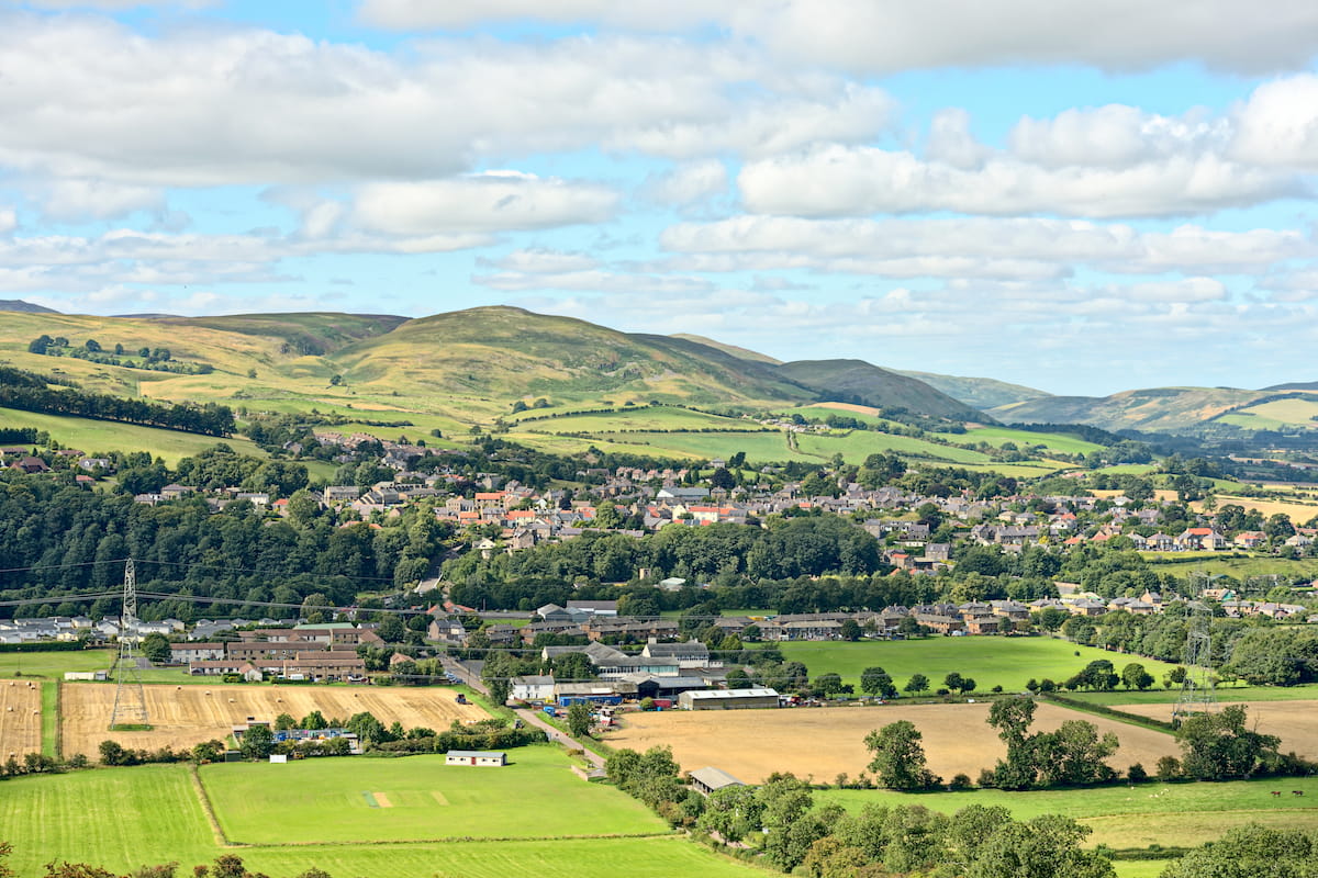
If you'd prefer to stay in a small town with plenty of amenities close to the Cheviot Hills, consider Wooler. With a population of around 2,000, Wooler is perfect for a peaceful getaway. While there's not much to do around town, Wooler is within 5 miles of Yeavering Bell (354 m) and 7 miles of The Cheviot, making it a superb base from which to explore the countryside. Wooler is home to a youth hostel as well as several hotels such as the Tankerville Arms Hotel, The Black Bull Inn, and The Red Lion.
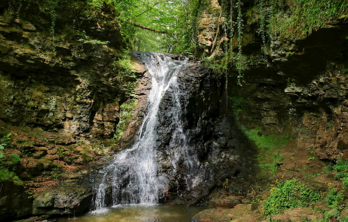
Nestled along the River North Tyne, the village of Bellingham is a popular vacation destination for hikers looking to explore Northumberland. Despite its small size, Bellingham boasts some interesting natural and historic attractions. While in Bellingham ensure you stop by the sublime Hareshaw Linn Waterfall and 17th-century Chipchase Castle. There is a small number of hotels in Bellingham, with The Cheviot Hotel and Riverdale Hall Hotel among the best options. Bellingham also has a campsite in case you fancy a night under the stars.
One of the most uniquely-named villages in England, Once Brewed is the best place to stay if you're taking a walk along Hadrian's Wall. The village is located just south of the wall within a mile of the Whin Sill Ridge and the Sycamore Gap. One of the park's best visitor's centers, The Sill is also located within Once Brewed. If you plan on spending the night in Once Brewed, ensure you book a room at the historic Twice Brewed Inn, or stay at one of the many campgrounds within a few miles of the village.