Scan the QR code and open PeakVisor on your phone
With its tor-topped mountains and extensive moorlands, Dartmoor National Park is excellent for adventurers looking to scale the highest peaks of Southern England. Located in the southwestern corner of the country in Devon, the park covers 368 square miles between Plymouth and Exeter. Dartmoor is the third-smallest of England's 10 national parks (excluding The Broads).
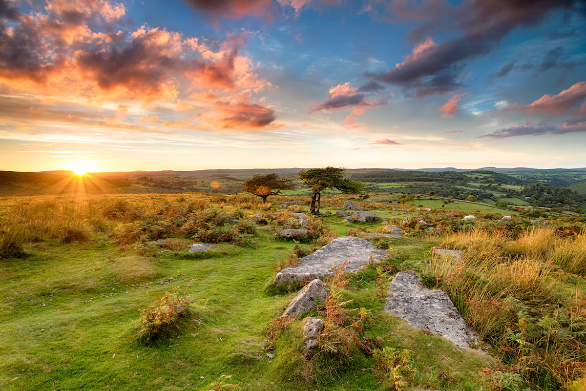
Typical of Southwest England, the landscape of Dartmoor National Park consists of vast moorlands, deep river valleys, and verdant woodlands. One notable feature of Dartmoor is it contains the largest uninterrupted moorlands in the UK.
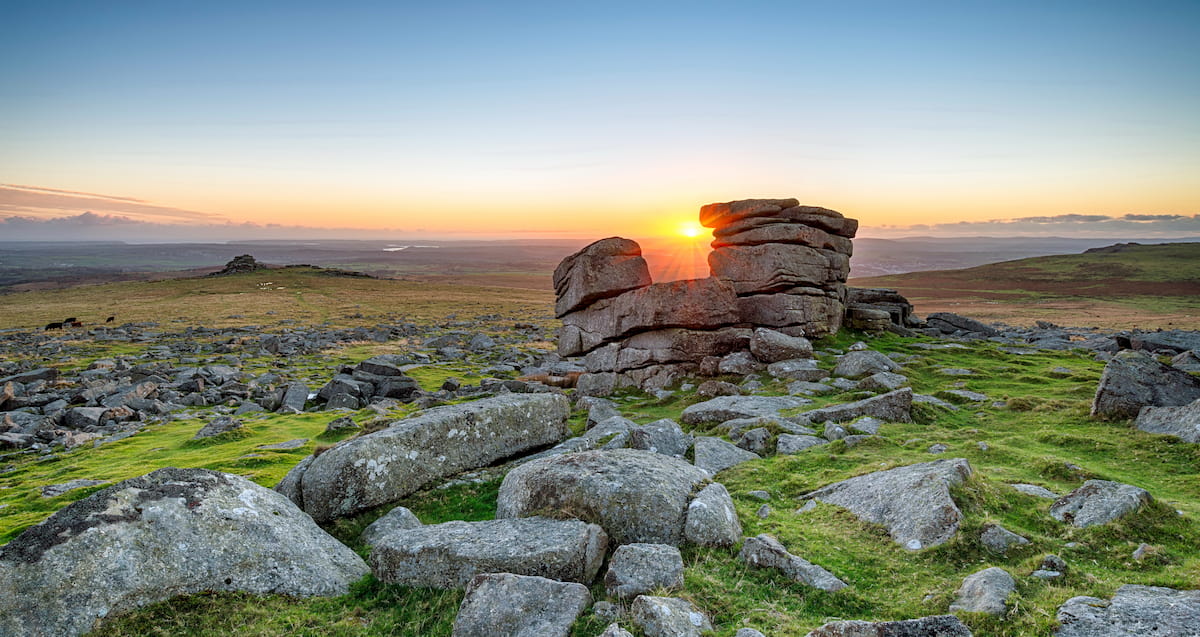
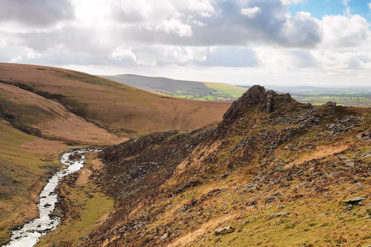
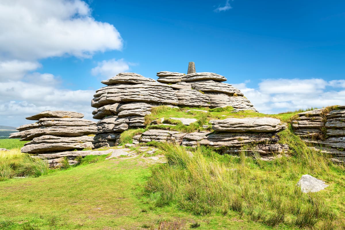
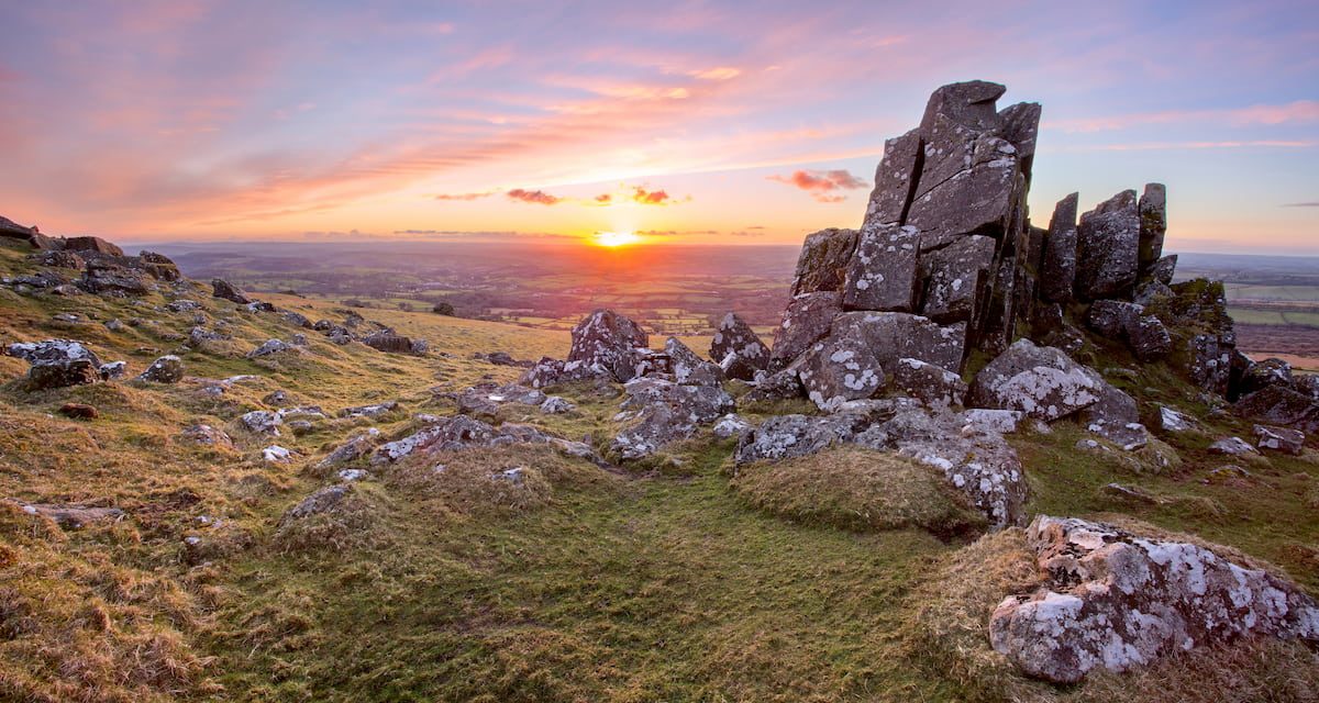
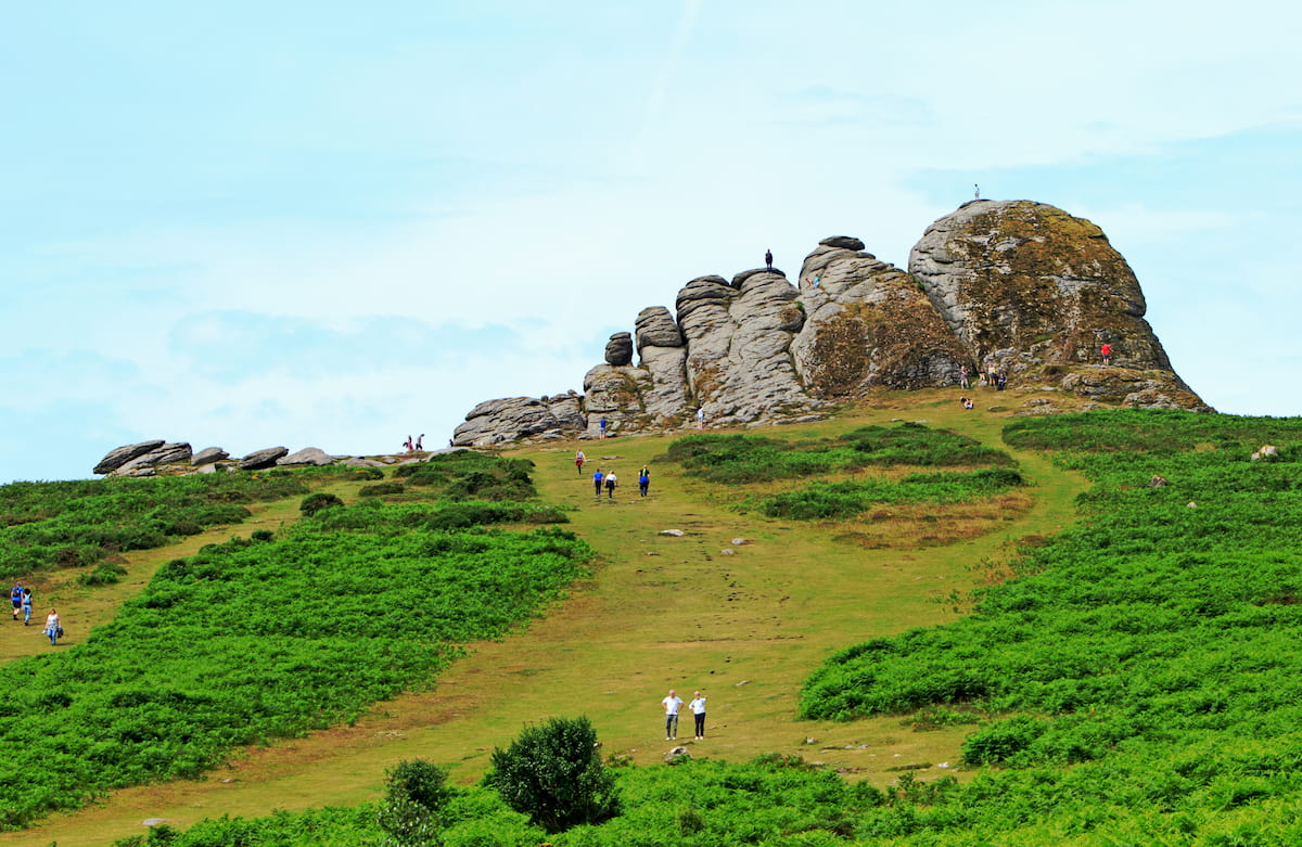
Dartmoor is also known for the granite tors that adorn the hills and mountains, giving the area a rugged and remote quality. The terrain was formed over 300 million years ago during the Carboniferous period. Dartmoor boasts the largest granite area in England at 241 square miles.
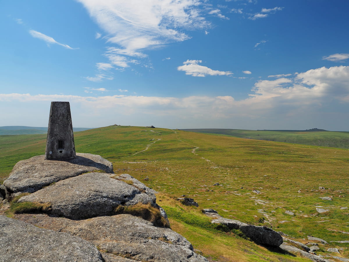
Dartmoor offers some of the best hill and mountain climbing opportunities in Southern England. The highest point in Dartmoor is High Willhays (621 m). As well as being Devon's county top, High Willhays is also the tallest mountain in Britain south of the Brecon Beacons. Dartmoor's two highest peaks, High Willhays and Yes Tor (619 m), are the only summits in England below the Peak District that exceed 2,000 feet (616 m).
Due to its fertile and varied environment, Dartmoor is integral to the survival of an array of wildlife. For example, Dartmoor is home to 16 different bat species, including three species rarely seen anywhere else. While exploring the park, ensure you keep an eye out for some of the area's familiar bird species, such as stonechats and meadow pipits.
One of the park's most famous residents is the Dartmoor pony, a breed of semi-feral pony. Once a fixture of the park, Dartmoor ponies are in decline, with only around 1,000 individuals inhabiting Dartmoor.
You'll find some of the best walking routes and areas in southern England at Dartmoor National Park. Read on to find out about some of the best trails.
Scaling the peaks of the two highest points in Southern England is a must-do for any avid hiker visiting Dartmoor National Park. The walk is quite long but relatively easy and should be manageable for hikers who exercise regularly. The loop trail from Meldon Dam is 8.5 miles and takes roughly 4 hours.
Be aware that Dartmoor is home to an active military firing range, making the walk up Yes Tor and High Willhays impossible on certain days. You should check online for firing dates to ensure you can take this route.
From the Meldon Dam car park, pass over the impressive Meldon Dam and walk in an easterly direction along Meldon Reservoir. The obvious path will first lead you up Longstone Hill (412 m) on the way up to the top of Yes Tor.
As the car park is at 330 m already, the ascent up Yes Tor is easier than it seems on paper. Dartmoor landscape is very rugged, so ensure you proceed with caution in poor weather. Approaching the summit from a westerly direction is deceptive due to false peaks—be on the lookout for a trig point and radio tower which marks the true summit.
The walk from Yes Tor to the top of High Willhays is short and flat, as High Willhays is only a couple of meters taller. The highest point is located on the mountain's southernmost tors. To descend, hike to the west onto Black Tor (506 m). Then, crossing into the Okement River valley, follow the river back towards the Meldon Reservoir. On the way back to Meldon Dam, you'll pass alongside the historic Meldon Viaduct.
This moderately challenging trek takes you up some lower tors, which afford some of the best moorland views in Dartmoor. Despite not being as prominent as the likes of High Willhays, these tors offer an equally difficult hike. The walk is 9 miles and takes around 4 hours. Like the High Willhays trail, this walk passes through an active firing range, so check ahead online to ensure you're safe to walk.
From the Lanehead car park near Mary Tavy, head northeast along the old mining company leat (a waterway) passing under Nat Tor (374 m), on the way to a stark valley known as Tavy Cleave. Heading slightly north towards Ger Tor (438 m), you'll come off the track. This area will require some scrambling over boulders. Passing by Ger Tor, head north along Rattle Brook. You can also make a detour up Fur Tor (570 m) along the river, before retracing your steps.
Past Deadlake Foot, which signifies the firing range boundary, head northwest out of the valley and then onto the right hand path and up to the summit of Hare Tor (519 m). From the top, you'll be able to spot Brat Tor (448 m) to the northwest and Ger Tor to the south.
Finally, you'll walk just under a mile to the top of Ger Tor, which is marked with a large cairn and boasts the best vistas of the cleave. Head southwest down into Nattor Down to return to the car park.
Located right at the heart of Dartmoor National Park, Bellever Forest features a mixture of moorlands, forests, and tors, making for a classic Dartmoor ramble. The Bellever Tor & Forest Circular Walk is moderate and manageable for anybody who exercises regularly. This looped trail is around 6 miles and should take about 3 hours.
Starting from the Bellever Forest car park, head south along the trail adjacent to the East Dart River. When the forest opens up onto the moors, turn west away from the river to begin your ascent of Laughter Tor (416 m). This is the steepest part of the trail. From here, head northeast to reach the top of Bellever Tor (433 m).
From atop Bellever Tor, you'll have sweeping views of Higher White Tor (520 m) and Fernworthy Forest. To descend, head on the track to the north down Bellever Tor and onto the ancient Lych Way, which will lead you back to Bellever Forest car park.
The West Devon Way is a long-distance, meandering hike which showcases the best of Dartmoor's landscape. It runs for 37 miles from Okehampton in the north, down to Plymouth. While the majority of the walk is flat and easy, it will take you several days to complete. Alternatively, you can split the walk into 8 separate sections. Several settlements along the route have accommodation and car parks, including Okehampton, Plymouth, Lydford, Tavistock, and Yelverton.
The majority of the West Devon Way is signposted and well-trodden. The first section from Okehampton to Sourton features a few points of interest, including Okehampton Church. This stage is 5 miles, and the highest point is Sourton Tors (431 m) just before Sourton village.
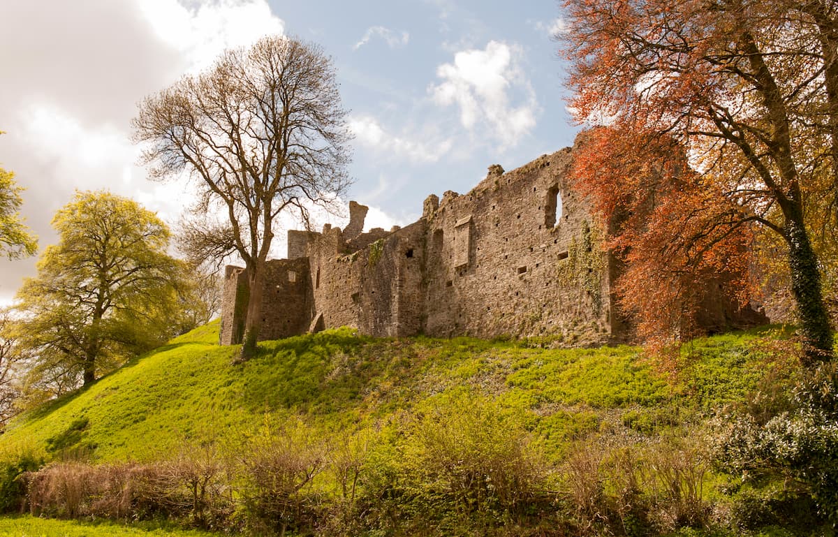
The next section from Sourton to Lydford is 4.5 miles and is generally flat. The only steep part of this journey is Lydford Tor (515 m) which takes you past the Norman Lydford Castle. From Lydford, you'll travel south 4.5 miles to Mary Tavy. Along this path, take a detour to Lydford Gorge, the deepest gorge in the southwest, which also features a sublime 30 m waterfall. There's also a detour to the beautiful Brent Tor (323 m) with Brentor Church perched on its precipice.
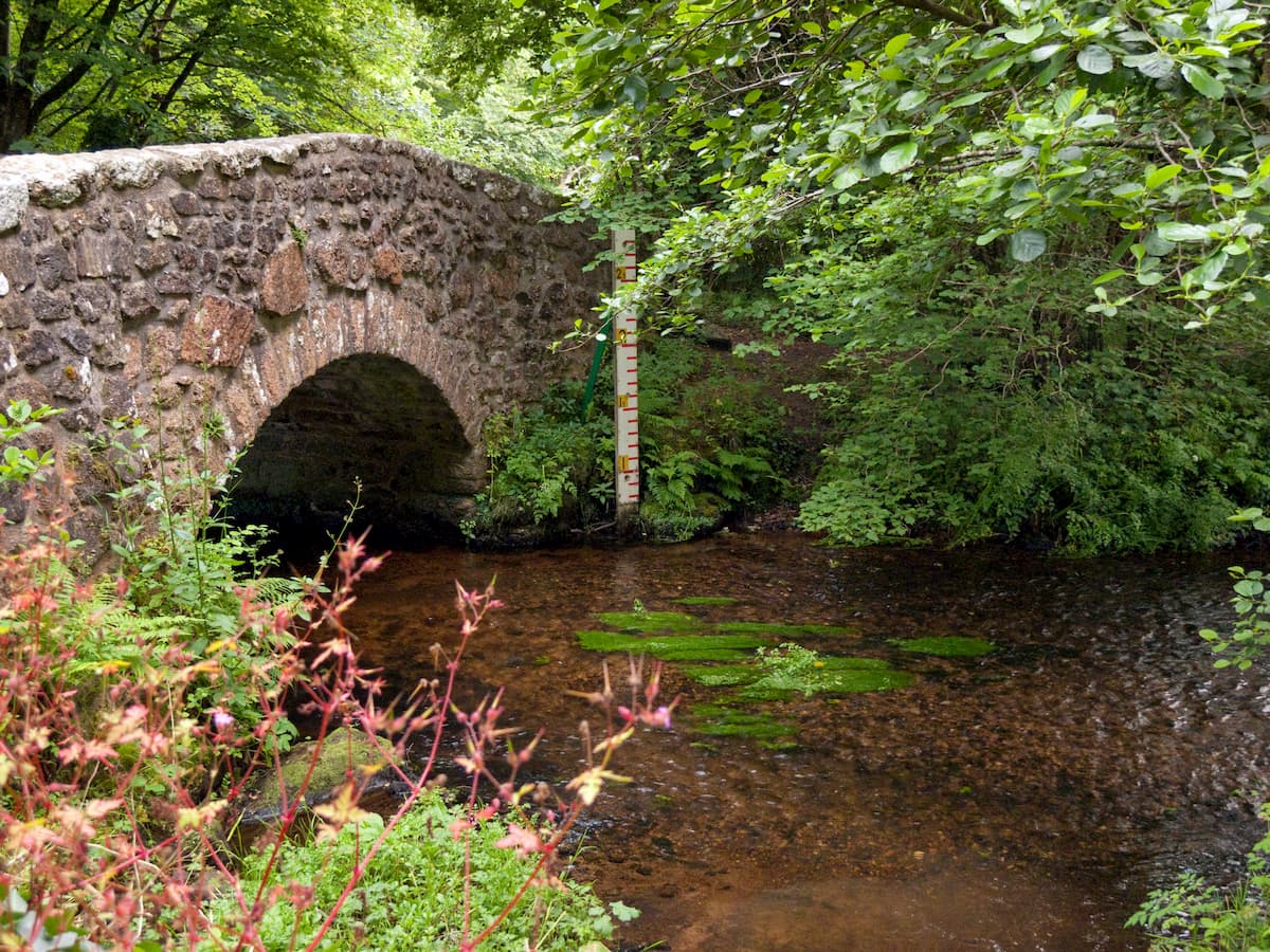
The fourth stage is from Mary Tavy to Tavistock. This 4.5-mile walk is steep near Mary Tavy and Peter Tavy but is mostly flat. The highlight is the Grade-II listed Harford Bridge which crosses the serene River Tavy. The route from Tavistock to Yelverton is 7 miles and steep in areas near River Wickham. The track weaves through West Down and Roborough Down, which are ideal areas for nature watching.
One of the flattest parts of the West Devon Way is from Yelverton to Bickleigh. The highlight here is Goodameavy, a section of the trail that runs along the River Plym and features several viaducts.
From Bickleigh, walk 4 miles to Marsh Mills. This area is great for birdwatching with Peregrine falcons nesting in the area. There are also some stunning views of the River Plym from the Plym and Riverford Viaducts. The final stretch from Marsh Mills to Plymouth is the shortest at 3 miles. It passes through the city and ends at Hooe Lake.
This circular walk in the eastern section of Dartmoor is a great way to bag several tors over the course of a few miles. Like many of Dartmoor's tors, many are subject to local legends, from runaway brides to dragon's liars. You'll also get to spot plenty of wildlife, with Dartmoor ponies common in the area. The looped walk to Hound Tor via Haytor Rocks is around 5 miles and takes approximately 3 hours.
From the Saddle Tor south car park, head north and follow the path to scale Saddle Tor (422 m). To your east, you'll be able to see Haytor Rocks (445 m). After reaching the top of Haytor, head north along the old tramway into Haytor Quarry, then to Smallacombe Rocks (384 m). Passing over Becka Brook bridge, follow the path up to the peak of Hound Tor (488 m). One of the most famous tors in Dartmoor, Hound Tor is known for inspiring Arthur Conan Doyle's The Hound of the Baskervilles.
To return to Saddle Tor car park, follow the path past Greator Rocks (355 m), keeping it on your left. After the Haytor Downs sign, cross the Becka Brook again and continue back to your starting point.
One of the few solitary tors in Dartmoor National Park, Easdon Tor (434 m) is one of the park's most prominent points and is worth visiting for panoramas of the surrounding countryside. As it's fairly isolated, Easdon Tor is a short walk. The Easdon Tor trail is around 3.5 miles and should take 2 hours.
From North Bovey, head south through the churchyard and onto the wooded track. Cross the River Bovey, and find the grassy track along the Yard Hill road. Follow this through the pine forest, and the path will eventually open onto moorlands. The trig point atop Easdon Tor will be visible up ahead.
After admiring the views off Easdon Tor, take the path north back onto the main road. At the road, head northeast to get back to North Bovey.
Plymouth is the largest city in Devon and provides a great base from which to explore Dartmoor. This port city contains some excellent local attractions, such as the National Marine Aquarium and Mount Edgcumbe House, as well as Whitsand Bay which is superb for swimming and surfing.
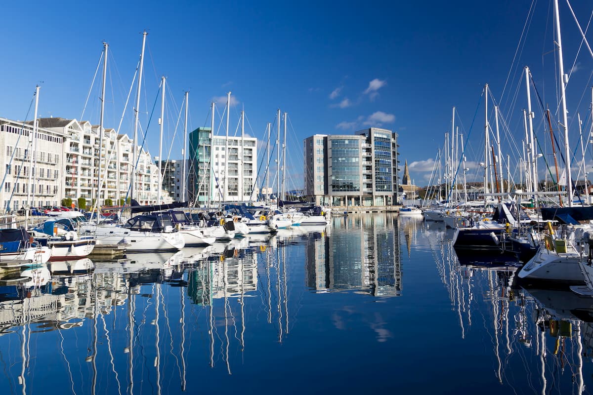
Plymouth also serves as the endpoint of the West Devon Way and is perfect if you're looking for a place to stay after completing this cross-county trek. You won't have trouble finding a room in Plymouth, with dozens of hotels, like the Invicta Hotel, St Elizabeth's House, and Future Inn.
If you'd prefer to stay in a large settlement on the opposite side of the park to Plymouth, consider Exeter. Devon's county town, Exeter is an ancient city with several attractions history buffs will love. Admire the sublime 11th century Exeter Cathedral, or take a tour of the 14th-century underground tunnels.
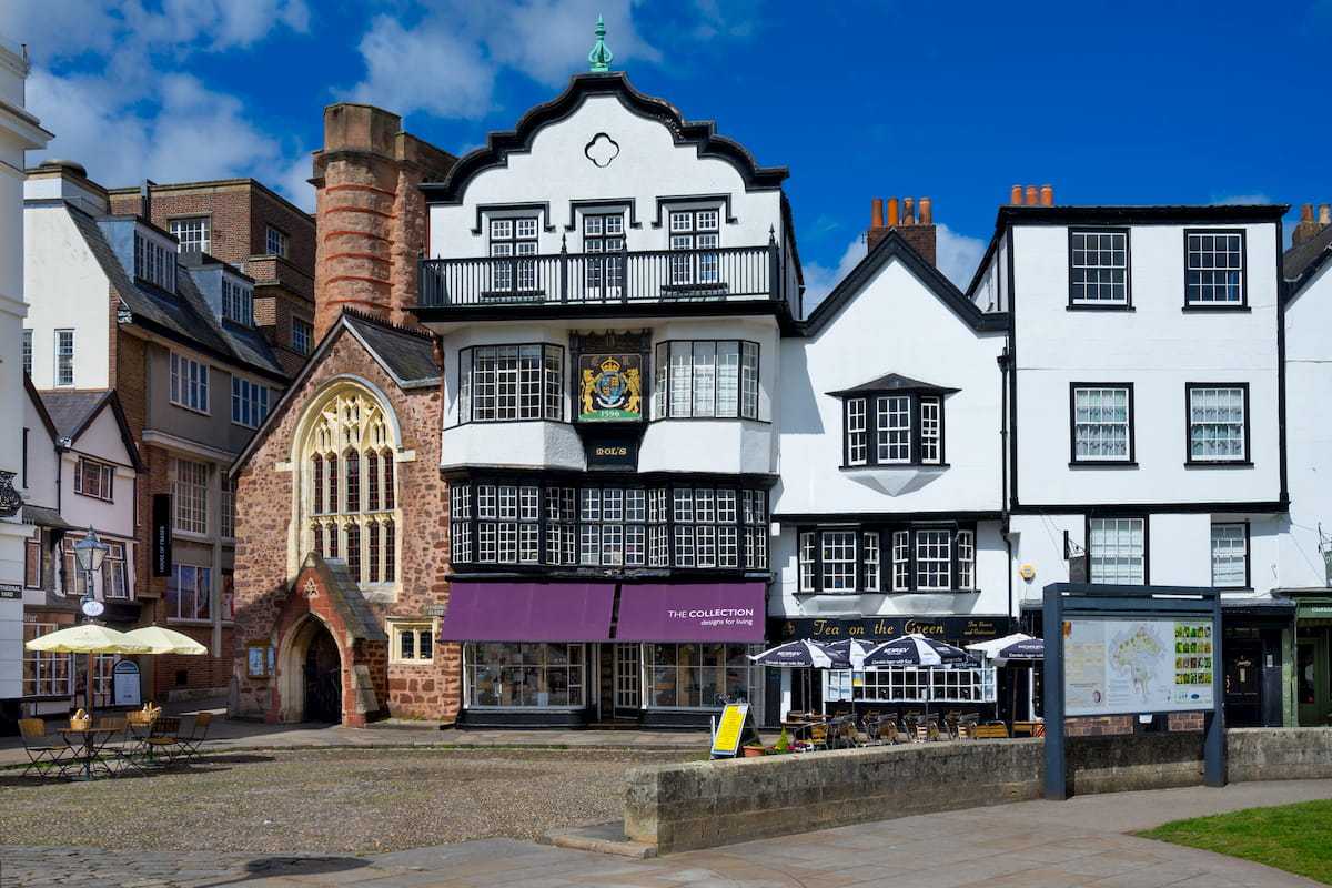
It's easy to reach Dartmoor from Exeter, with the park boundary under ten miles to the southwest. Planning on staying in Exeter? Consider booking a room at the Queen's Court Hotel or the Hotel du Vin.
Serving as the starting point of the West Devon Way, Okehampton is a superb place to stay if you're looking to see the best of Dartmoor. Okehampton is a quaint town known for its independent shops and Victorian arcade. While in town, ensure you check out the medieval ruins of Okehampton Castle. You'll also be about 5 miles from Dartmoor's highest points, High Willhays and Yes Tor. Some of the best accommodation in Okehampton includes the Meadowlea Guest House and the Oxenham Arms Inn.
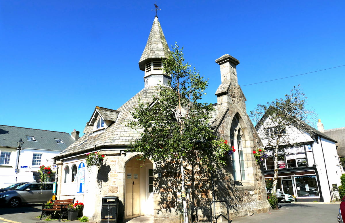
"The Gateway to the Moors", Bovey Tracey is a charming little town, ideal for a relaxing getaway. Perched on the park's southeastern border, Bovey Tracey affords access to many of the best hill walks in Dartmoor, with Hound Tor and Haytor Rocks within five miles of the town. Popular hotels in Bovey Tracey include the Dolphin Hotel and the Edgemoor Hotel.
Voted as one of the best places to live in the English countryside, Chagford is a popular destination for tourists exploring Dartmoor. Known for its yearly festivals and upscale stores, Chagford is close to many popular hiking destinations, with the long-distance Two Moors Way running through the town. If you're looking for something to do around Chagford, take a tour of the 20th-century Castle Drogo. Hotels in Chagford include the Three Crowns and the Chagford Inn.