
Scan the QR code and open PeakVisor on your phone
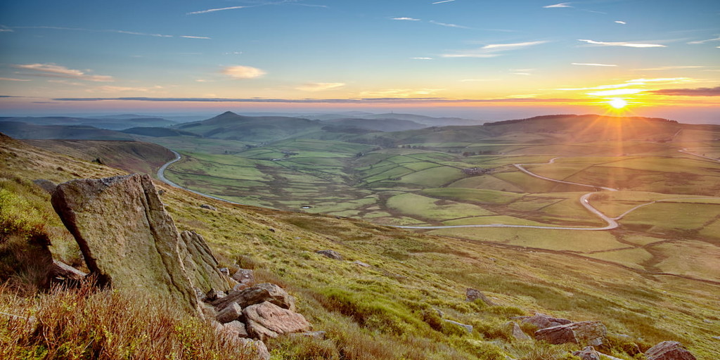
England's oldest national park, the Peak District is brimming with ancient history and breathtaking landscapes. Founded in 1951, the Peak District National Park encompasses roughly 550 square miles of sweeping moorlands and sublime valleys at the southern tip of the Pennines.
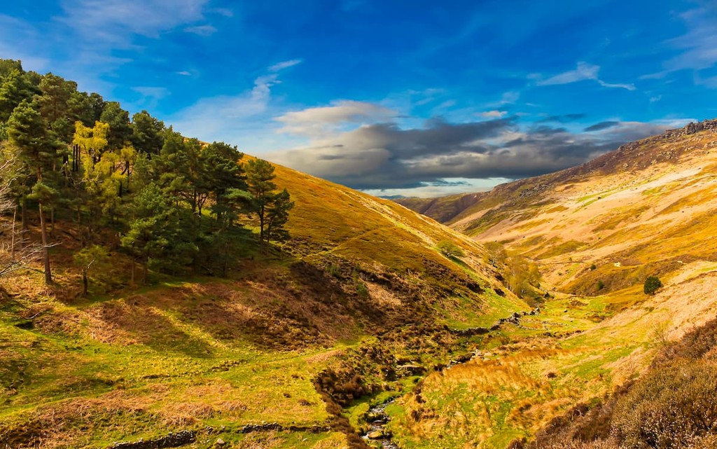
The Peak District is generally split into two distinct regions, Dark Peak and White Peak. To the north, east, and west of the park, Dark Peak is considered the wildest of the two regions and boasts many of the park's highest hills. In contrast, White Peak to the south is flatter with limestone plateaus and verdant dales. The Peak District's landscape was formed during the Carboniferous period. The park's geology consists mainly of sedimentary rocks, with Carboniferous limestone and overlying gritstone.
As mentioned, Dark Peak features many of the highest points in the Peak District National Park. For example, Kinder Scout (640 m), the highest and most prominent hill in the Peak District, is located in Dark Peak. Other notable summits situated in Dark Peak include Crowden Head (635 m), Black Hill (581 m), and Bleaklow (633 m).
The Peak District has a long and interesting history, with artifacts found in the area dating back to the Mesolithic period. The park was also integral to the formation of the UK's national park system. The Kinder Mass Trespass of 1932 was a demonstration aimed to make English moorlands accessible to the public, as most of these areas were closed-off and privatized. This protest on Kinder Scout led to the eventual formation of the Peak District as England's first national park.
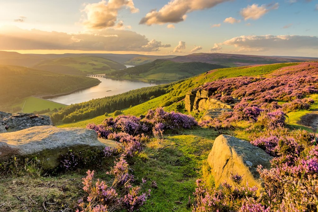
You'll find plenty to do during your stay in the Peak District, from fishing to caving to horseback riding. With such a varied landscape, the Peak District is also perfect nature watching. Look out for mountain hares in the winter, red deer during the autumn, and ring ouzel during your mountain treks.
Epic adventures await hikers in the Peak District National Park. Read on to find out about some of the best trails and hiking areas in England's oldest national park.
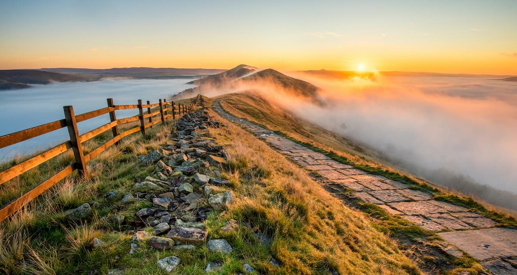
The Pennine Way is among the most popular long-distance hikes in the UK. Stating in Edale, the trail weaves for 268 miles from the Peak District, through the Yorkshire Dales and Northumberland all the way across the Scottish border. The Pennine Way runs for around 31 miles through the Peak District and is perfect for a three or four day hike.
From the Pennine Way's starting point in Edale train station, follow the short trail up to the summit of Mam Tor (524 m). This circular route can be extended to Rushup Edge, the highest point on Lords Seat (556 m). Return to Edale to rest before continuing. This section is around 3.5 miles.
The journey from Edale to Crowden is the hardest day's walk. This 16-mile stint will take up Kinder Scout and onto the plateau. From the sight of the 1932 Mass Trespass, you'll be able to spot Black Hill (581 m) to the far north and Mam Tor to the southeast. The trail will then take you north to Bleaklow Head (633 m) before descending to the picturesque village of Crowden.
The final day's walk will take you on an 11-mile trek from Crowden to Standedge (457 m). Initially, you'll follow the Pennine Way up the plateau to Laddow Rocks before continuing along the clear stone paths to Black Hill's summit. You'll finish your walk by passing two reservoirs that supply water to Sheffield and Manchester before reaching Standedge on the Derbyshire county line.
Like its sibling, the Pennine Way, the Limestone Way is a long hiking trail that takes walkers through some of the Peak District's best landscapes. The Limestone Way showcases the best of the White Peaks and is ideal for anybody looking to experience everything the Peak District's southern region has to offer. The Limestone Way is longer than the Peak District stint of the Pennine Way and runs for around 46 miles. It will take most hikers 3 or 4 days to complete.
From the postcard-perfect village of Castleton, the Limestone Way runs in a zigzag south. The trail is easy to follow and is marked with a green ram symbol. The initial route will take you south through Cave Dale before arriving at Peak Forest village. Then you'll pass through Hay Dale and Peter Dale before following the old miner's path across Taddington Moor to the village of Monyash. From Castleton to Monyash is about 13 miles, and the area around Monyash is one of the best places to find accommodation on the trail.
You'll be looking to end your next day in Bonsall. First, you'll traverse Cales Dale before following the Bradford River through Bradford Dale. While in the Harthill Moor, consider taking a detour up Robin Hood's Stride (262 m), one of the most popular tourist sites on the Limestone Way. Pass through the village of Elton before reaching Bonsall. Your journey from Monyash to Bonsall is approximately 12 miles.
The final stretch runs from Bonsall to Thorpe. In recent years, the Limestone Way has been extended to the Roman settlement of Rocester, in case you fancy continuing your walk by an extra day. From Bonsall to Thorpe, the Limestone Way crosses the long-distance Midshires Way and the High Peak Trail before passing through the villages of Brassington, Parwich, and finally Tissington on the way to Thorpe.
Hikers looking for a short yet rewarding hike will find it at Kinder Scout. Hiking to the highest point in the Peak District can be challenging but should be manageable for most hikers. Depending on your route, the hike up Kinder Scout is around 9 miles, ascends 625 m, and takes 4 or 5 miles.
To experience the best of Kinder Scout, start from the Old Nag's Head in Edale, and take the path to the left of the train station towards the Kinder Plateau. This route will take you steadily uphill to the top of Grindsbrook Clough, with Crowden Tower (621 m) a short distance ahead. At a cairn, you'll have the option to turn right and ascend Crowden Head (635 m), the second-highest summit in the Peak District.
To continue on the Kinder Scout, head north past the cairn and along Kinder River, which leads to the scenic Kinder Downfall, the tallest waterfall in the park at 98 feet. The highest point on this trail is the trig point at Kinder Low (634 m). For an easy descent, take the stone steps down Jacob's Ladder, which runs adjacent to the River Noe. You'll pass farmland through Upper Booth, with the Pennine Way acting as a guide back to Edale.
Situated between Buxton and Macclesfield, Shining Tor (559 m) is the highest point in Cheshire and boasts panoramic views and fascinating historic sights. One of the most popular ways to climb Shining Tor is on the circular trail via Errwood Reservoir. The walk is 6 miles, ascends 550 m, and takes about 3 hours.
At Errwood Hall car park, cross the bridge and ignore the path towards Errwood Hall. Instead, continue straight along a rock wall to Foxlow Edge. Continue along the ridge and onto the ancient Roman road known as The Street. Passing Pym Chair car park, continue along the path to the first summit, Cats Tor (520 m).
After a mile of walking across moorlands, you'll come to the top of Shining Tor. To descend, continue along the path as it strays left, near the Cat and Fiddle pub. Pass a small pond and follow the path down the valley. Cross Shooters Clough, and you'll come across several ruins, such as Shooters Clough Cottage and then Castedge Farmhouse. Finally, you'll reach Errwood Hall, which is just a short walk from the car park.
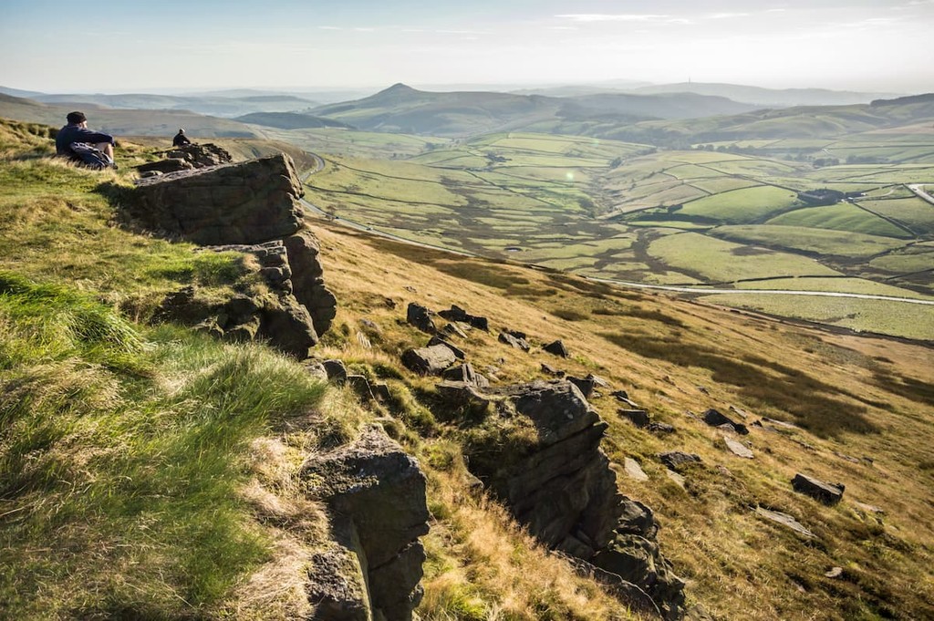
If you're an avid rock climber looking for the perfect climbing spot in the Peak District, pay a visit to Stanage Edge (456 m). This escarpment's naturally eroded millstone grit stretches for 3 miles, providing some of the most challenging rock climbing routes around. Hiking Stanage Edge is also a popular activity. The area around Stanage Edge has an intriguing literary history and is known for inspiring the works of Charlotte Bronte, including Jane Eyre. The hike up Stanage Edge is 6 miles, ascends 515 m, and takes approximately 4 hours.
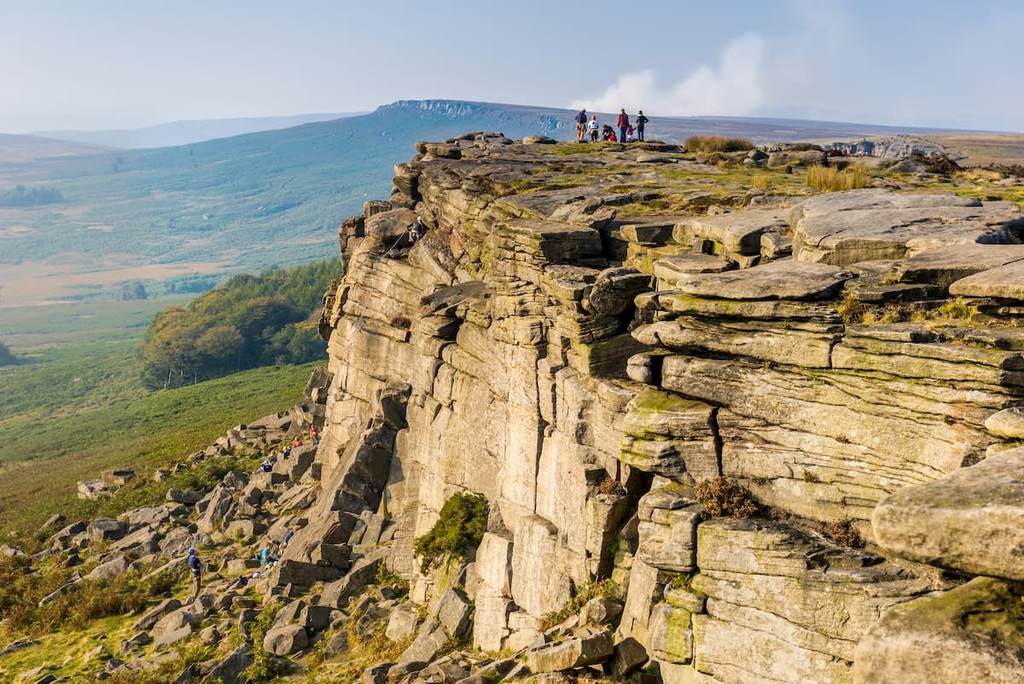
Starting from the Hathersage village car park, head to Main Street and follow the trail towards Brookfield Manor. You'll pass several iconic buildings such as Bronte Cottage and Thornfield Manor on the way up Stanage Edge. Turning right at an information panel, you'll pass the Stanage Plantation, keeping left up to the top of Stanage Edge.
The best views from Stanage Edge are at the bluff's southern trig point. From here, you can choose to extend your walk to High Neb (433 m) before rejoining the main path. To descend, take the right hand trail from the trig point to Hathersage Road, through Callow Bank, following the signposts back to Hathersage village.
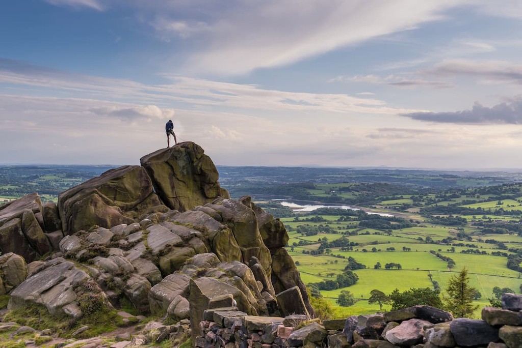
A short and sweet walk which provides spectacular views of the Peak District can be found at The Roaches (505 m). Walks up this rugged escarpment involve trekking through vibrant heather moorlands and stark gorges. Areas along The Roaches such as the “Valkyrie” are also very popular with rock climbers. The hike up The Roaches is around 5 miles, ascends 242 m, and takes about 3 hours.
From Upper Hulme between Leek and Buxton, take the narrow lane and park opposite the col between The Roaches and Hen Cloud (404 m). Take the signposted pathway uphill and onto the col. Turn left to head towards The Roaches. Along the ridge to your right you’ll be able to enjoy views of Flash, the highest village in Staffordshire, and the “Cheshire Matterhorn”, Shutlingsloe (506 m).
At Roach End, turn left to head for The Roaches’ trig point.The summit of The Roaches provides the best panoramas, with sweeping views of Staffordshire’s moorlands and the Cheshire lowlands. To descend, head southeast and follow any of the available paths as they all return back to the col.
The second-largest metropolitan area in England, Manchester is ideal for hikers looking to experience the hustle and bustle of the big city. You won't be short of things to do during your stay in Manchester, with some of northern England's best attractions, including The Lowry and The Whitworth. Football fans might also want to grab tickets to a match at Old Trafford.

While Manchester is a large city, it's surprisingly close to the Peak District. Drive just 25 miles down the M67, and you'll be at the edge of the park. Due to its size and popularity, you won't be short of places to stay in Manchester, with superb hotels such as The Midland, The Stock Exchange Hotel, and Hotel Brooklyn.
Another major city situated on the opposite side of the Peak District to Manchester, Sheffield boasts some of the best attractions in Yorkshire. Perched right on the eastern edge of the Peak District National Park, "The Steel City" is less than ten miles from popular hiking destinations, including Stanage Edge and Higger Tor (436 m).
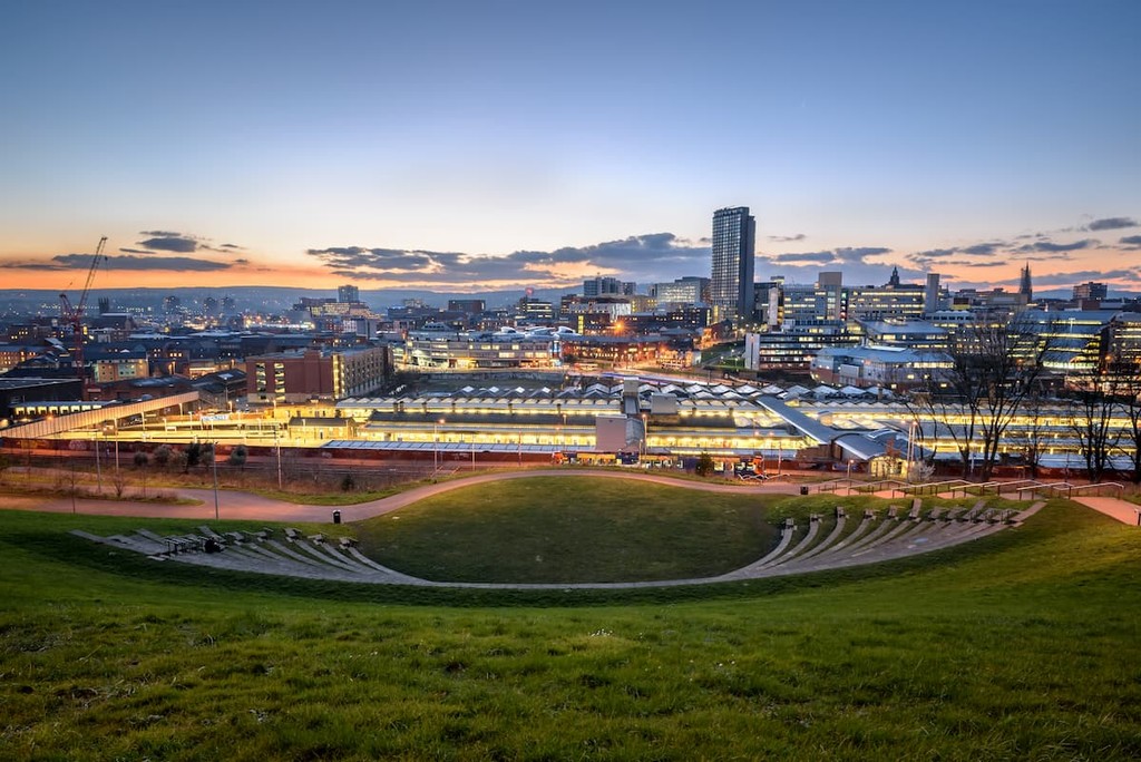
If you're looking to take a break from hiking and explore Sheffield, consider visiting the Sheffield Botanical Gardens or the medieval Sheffield Cathedral. As one of the ten largest cities in England, you'll find plenty of hotels in Sheffield, including Halifax Hall, The Crow Inn, and Brocco on the Park.
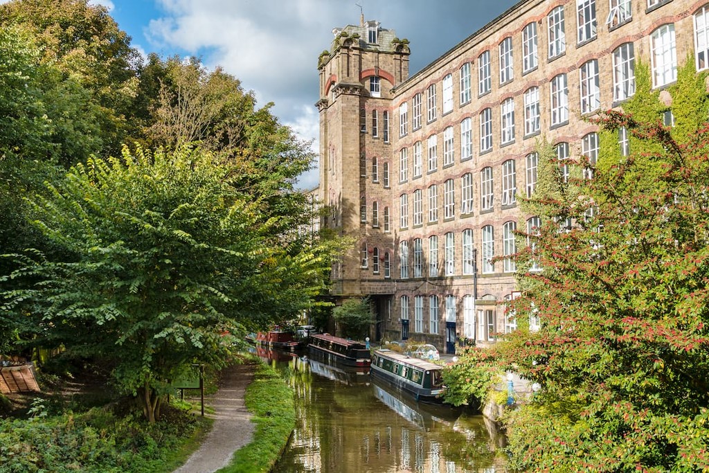
The classic Chesire market town of Macclesfield provides the perfect mix of quaint country living and big city amenities. Located just a couple of miles from the edge of the Peak District, Macclesfield affords easy access to many great hiking destinations, with Tegg's Nose Country Park and Macclesfield Forest within 5 miles of the town center. You'll also find some local attractions to keep you entertained around town, like the West Park Museum and Armoury Towers. Popular hotels in Macclesfield include The Tytherington, Mottram Hall, and The Bridge.
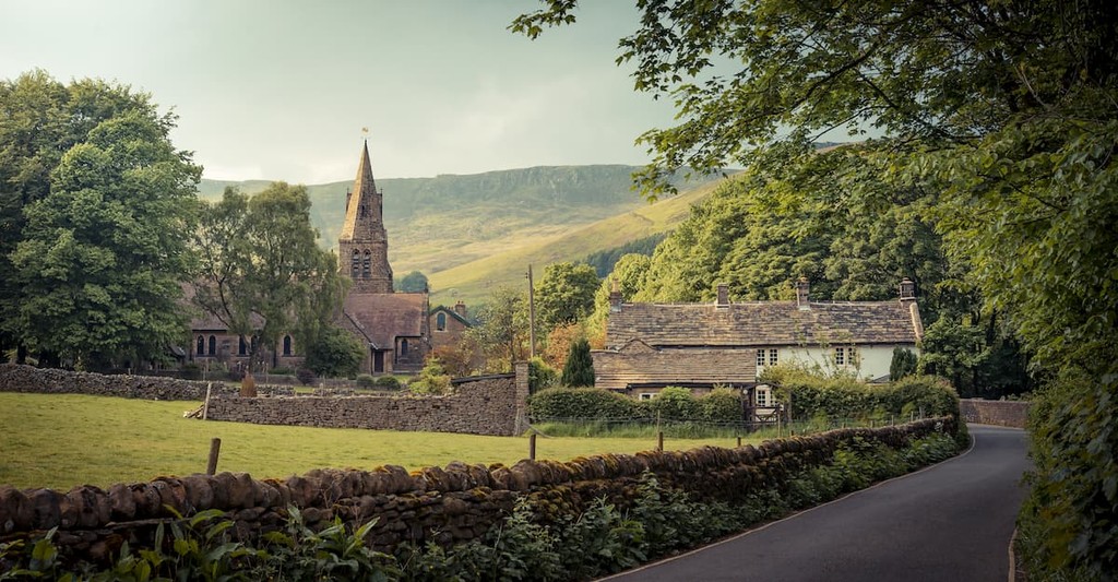
Looking to stay at the heart of the Peak District? Book a room in Edale. This tiny village is home to the Peak District's Moorlands Visitor Centre and serves as the starting point for the Pennine Way. Hikers won't be disappointed by hiking opportunities near Edale, with Mam Tor and Kinder Scout within 4 miles of the village. There are also a couple of cafes and pubs in Edale where you can put your feet up after a long day walking. You'll find a couple of charming hotels in Edale, including The Rambler Inn and Stonecroft Guesthouse.
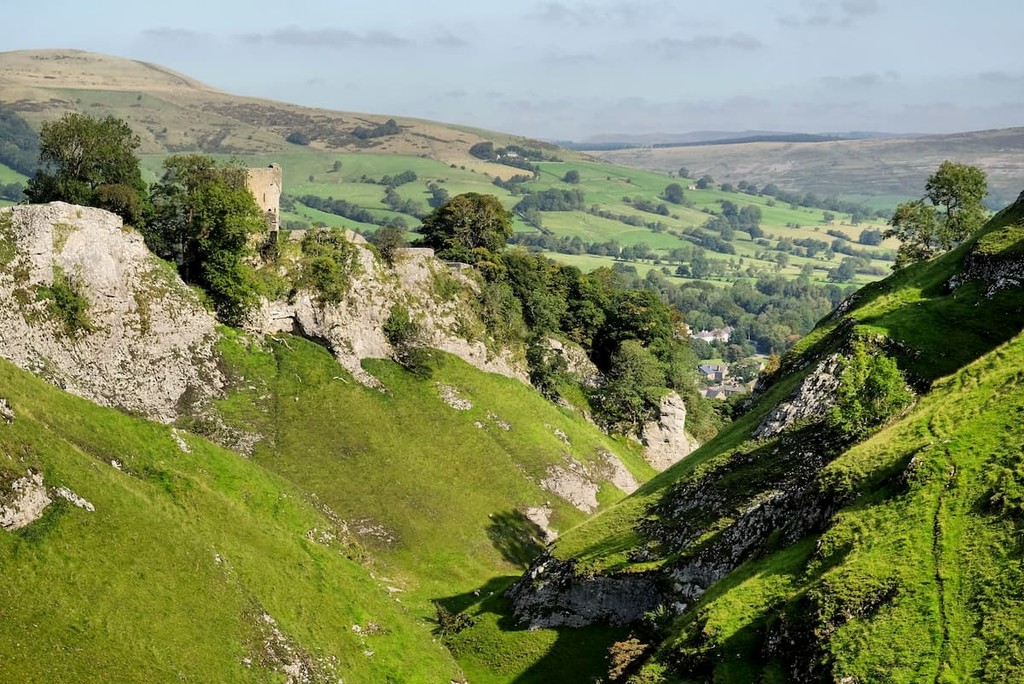
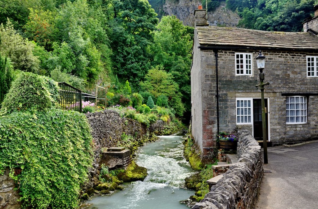
The center of the Peak District is home to several postcard-perfect villages, and another example is Castleton. Located just 6 miles south of Edale, Castleton provides similar access to the park's best hiking destinations. You'll also have the opportunity to explore the Peak District's cave systems in Castleton, with underground boat rides at Speedwell Cavern and extensive tours at Peak Cavern. Castleton is home to a couple of popular hotels, such as The Peak Hotel and Ye Olde Cheshire Cheese Inn.
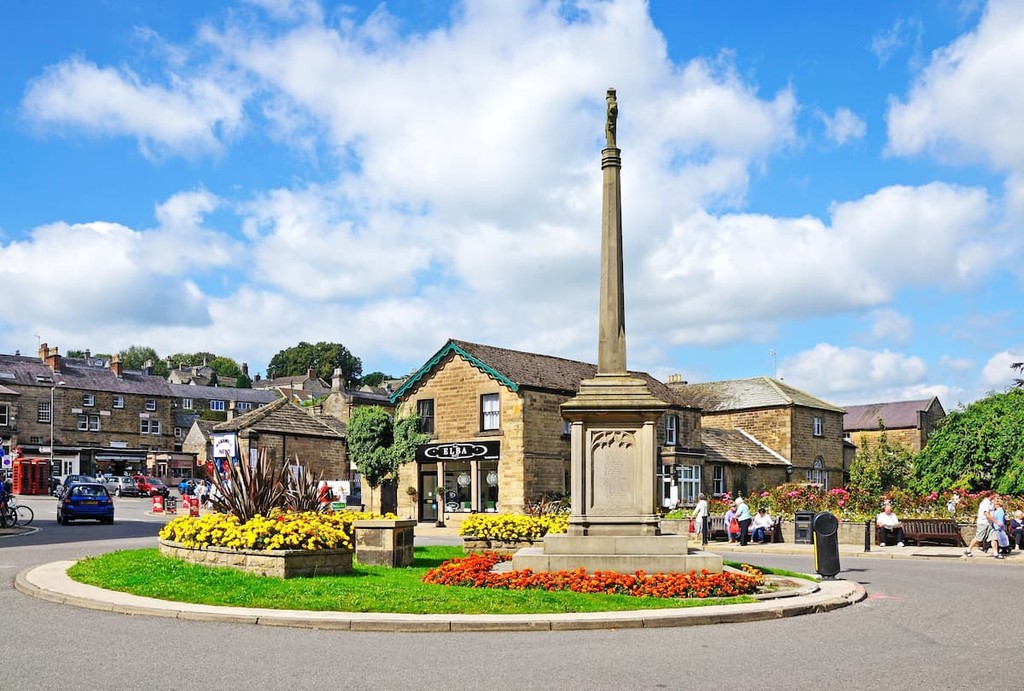
Known for its association with classic Bakewell tarts, the market town of Bakewell is one of the most popular places to stay in the White Peaks. This small town of a few thousand offers some fascinating historic attractions to enjoy, like the 17th century Chatsworth Hall and the medieval Haddon Hall. Bakewell is a stone's throw from the Limestone Way, the Monsal Trail, and Birchen Edge (311 m). If you're planning an overnight stay in Bakewell, consider Bagshaw Hall or The Rutland Arms.


tgo40
nuttalls
hewitts-gb
marilyns-gb
tgo40
nuttalls
hewitts-gb
marilyns-gb


