
Scan the QR code and open PeakVisor on your phone
Yorkshire Dales National Park has 797 named peaks. The highest is Whernside at 736 m. Other notable peaks include Ingleborough, Great Shunner Fell and High Seat.
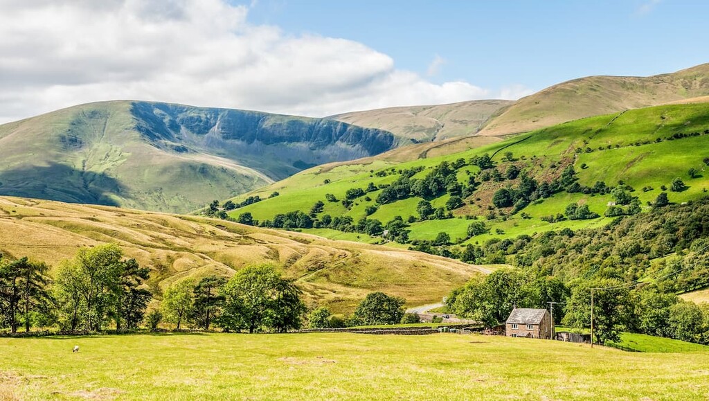
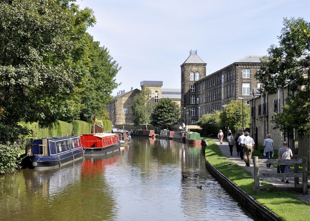
Covering 841 square miles of verdant valleys, heather-covered moorlands, and sublime cave systems, the Yorkshire Dales National Park ranks among the top hiking destinations in England. Over 8 million people visit the Yorkshire Dales each year to explore the best of the Central Pennines.
Founded in 1954, The Yorkshire Dales National Park is located mainly in North Yorkshire and covers parts of Cumbria and Lancashire. The park does not cover the entirety of the Yorkshire Dales, with sections to the south and east included in the Nidderdale Area of Outstanding Natural Beauty (AONB). The park also features the Howgill Fells and Orton Fells to the northwest, which have only recently been included in the park's boundaries.
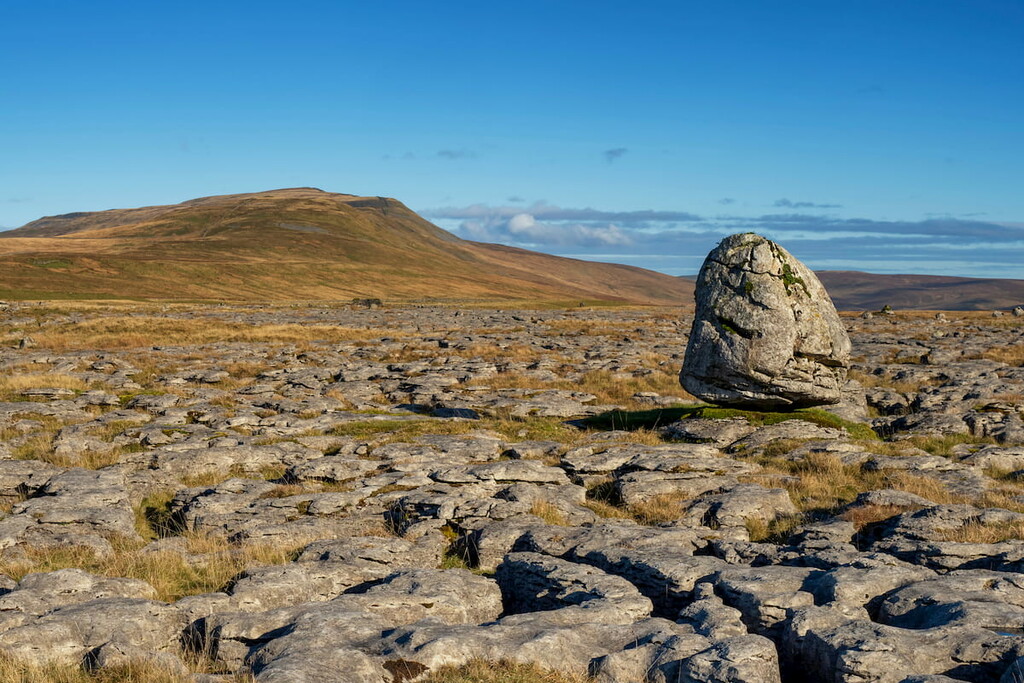
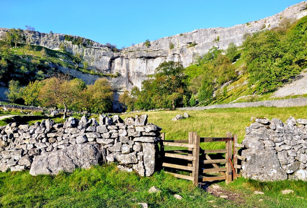
The Yorkshire Dales' landscape consists mainly of Carboniferous limestone, which formed over 350 million years ago from the remains of marine animals left on the ocean floor. High in the Yorkshire Dales' hills, this limestone is topped with millstone grit. Due to limestone's karst nature, many potholes and cave systems have formed across the park. One notable example is Gaping Gill, a 98 m deep pothole that contains the highest unbroken waterfall in England.
One of the most famous features of the Yorkshire Dales is the Yorkshire Three Peaks. Part of the Pennine Range, these three hills include the highest points in the park and are very popular with hikers. The highest of the Yorkshire Three Peaks is Whernside (736 m), followed by Ingleborough (726 m), and then Pen-y-ghent (694 m). Other significant summits within the park include Great Shunner Fell (716 m), Wild Boar Fell (710 m), and The Calf (676 m).
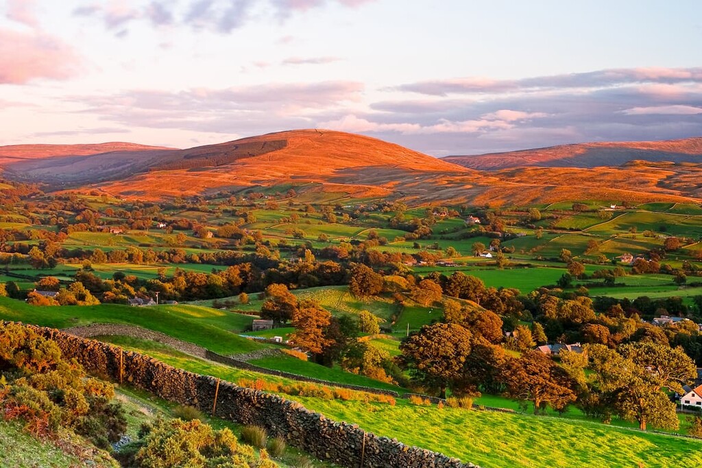
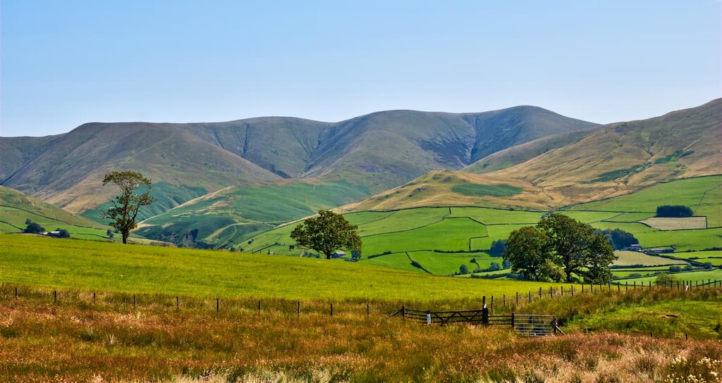
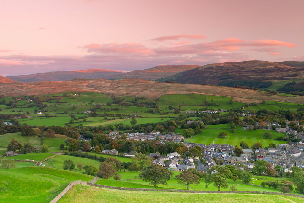
As the park's name suggests, the Yorkshire Dales are home to dozens of sweeping valleys. The exact number of valleys in the Yorkshire Dales depends on the definition of a dale; however, the Yorkshire Dales' official website names 10 official dales, and there are thought to be around 30 unofficial dales. Most dales are named after the river which runs through them; for example, Wharfedale takes its name from the River Wharfe. The largest dale is Swaledale in the park's northeastern corner.
The Yorkshire Dales boasts 17 priority habitats that are home to an array of rare flora and fauna. There are around 120 species that are considered important to conservation efforts. These species include pine martens, Peregrine falcons, and death's-head hawk moths.
Planning a trip to the Yorkshire Dales? Read on to find out about the best hiking areas and places to stay in this stunning English national park.
Pen-y-ghent is considered the easiest of the Yorkshire Three Peaks and serves as a starting point for many looking to scale these fells. Thanks to its clear path and simple navigation, it's thought to be the easiest of these hills. The walk up Pen-y-ghent is 6 miles, ascends 505 m, and takes around 3 hours.
You can pick up the trail to Pen-y-ghent from the National Park car park in Horton in Ribblesdale. Follow the path out of the village, passing the Golden Lion pub, before turning left to Brackenbottom Farm. A signpost will signal the start of the climb up Pen-y-ghent. After passing four stiles, you'll see a signpost for the Pennine Way.
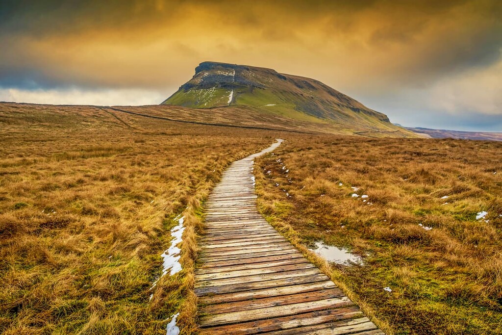
The final climb to the summit of Pen-y-ghent is the steepest part of the walk. The top of Pen-y-ghent is marked with a shelter and a trig point. From atop Pen-y-ghent, you'll have sweeping views of Whernside to the northwest and Ingleborough to the west.
To descend, cross over the obvious wall and follow the trail signposted for Horton. Along the way, you'll pass Hunt Pot as well as Hull Pot, which is the biggest natural hole in England, measuring 300 m long and 18 m deep. Hikers should take care around the edge of Hunt Pot and Hull Pot. Continue along this same trail to return to the center of the village.
Hikers looking to experience some of the most awe-inspiring features of the Yorkshire Dales will love hiking Ingleborough. While there are several shorter ways to climb this hill, the long walk from Clapham affords hikers the opportunity to visit several impressive gorges and caves. This trek up Ingleborough is 10 miles, ascends. 733 m, and takes 5 or 6 hours.
From the National Park car park near Clapham, follow the trail signposted for Ingleborough Cave. While you have to pay a small fee, it's well worth taking the lakeside route towards the cave. From Ingleborough Cave, you'll then pass the breathtaking Gaping Gill and the largest unbroken waterfall in England.
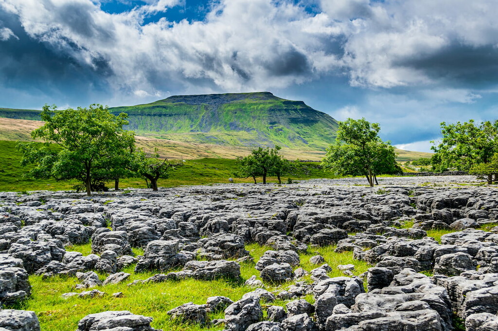
The path then climbs steeply to the top of Little Ingleborough (639 m) before the trail disappears on the plateau to the hill's true summit. Ensure you map your route across the plateau carefully, as it's easy to get lost in poor weather. The top of Ingleborough is marked with a trig point and shelter.
To descend, go back the way you came, heading east towards Horton in Ribblesdale, where the ground gets steeper. Into the valley, you'll pass a derelict cottage. Right of the cottage near a wall, you'll be able to pick a faint trail that leads to a defined grassy path. Turn right at the woodland junction to return to Clapham.
While Whernside is the highest point in the Yorkshire Dales, it's considered easier to scale than Ingleborough. This steady but steep climb passes by several quaint farmsteads, with the scenic Ribblehead Viaduct marking the walk's start and end. The hike up Whernside is 8 miles, ascends 525 m, and takes around 4 hours.
Park along the road near the Ribblehead Viaduct. Follow the path to the left of the viaduct, which runs parallel to a railway line. Continue along this path as it crosses over the railway before passing over a stile signposted for Whernside.
The path will then run up onto a ridge with a wall, which you'll follow to the summit of Whernside. The summit is marked with a trig point. As the highest of the Yorkshire Three Peaks, you'll have excellent views of the other fells as well as Lancashire's county top Gragareth (629 m) to the southwest, and on a clear day, Blackpool Tower, which is over 40 miles away.
To descend, continue along the trail and turn left towards the farm at Bruntscar. Then, turn left again at the signpost for Winterscales. After two farms, follow the track towards Ribblehead. Cross a wooden bridge, and then continue along the obvious path towards the viaduct.
Perched on the western edge of the Yorkshire Dales, the Howgill Fells have only been a part of the Yorkshire Dales National Park since 2017. In that time, it has become increasingly popular with hikers due to the range's challenging off-trail hikes, which provide sweeping views of the surrounding countryside and villages. Hiking Howgill Fells will take you off the beaten path and along dangerous ridges and fellsides, so ensure you map your route carefully. One of the best hikes in the Howgill Fells is up Cautley Spout to The Calf, the highest point in the range. The walk is 6 miles, ascends 603 m, and takes 4 or 5 hours.
To find the start of this walk, head from Sedbergh along the A683 to the lay-by just past the Cross Keys Temperance Inn. Park along the roadside and locate the signposted trail for Cautley Spout. This path will take you on a bridge across River Rawthey before turning left towards Cautley Spout. Continue along the stream until you reach Cautley Spout, the third-highest waterfall in the UK.
From Cautley Spout, there are a few different ways to reach The Calf. The best way is to follow the path to the waterfall's right steeply up to the fellside. Atop the waterfall, head west onto the col of Bowerdale Head. From the col's highest point, continue west onto The Calf's main ridge. Turn left along the path will take you to The Calf's peak, which is marked with a trig point. The views from The Calf are underrated, with panoramas of Yarlside (639 m) to the northeast and the settlements like Sedbergh to the south.
To descend, walk south on to the summit of Bram Rigg Top (674 m) and then onto Calders (673 m). From Calders' summit, ignore the main path to Sedbergh and walk east along the fence to reach your fourth summit, Great Dummacks (664 m). Take care here due to the cliffs around Cautley Crag. Walk south-east and avoid walking north until you are clear of the crag. Once you're safe to do so, head north and follow Pickering Gill before picking up the Sedbergh valley path. Cross the bridge to the left to return to your outbound path, which will lead you back to your starting point near Cross Keys.
Adventurers looking for a long-distance walk through the Yorkshire Dales should plan a ramble along the Pennine Way. This 268-mile National Trail runs along the "Backbone of England" from the Peak District all the way across the Scottish border. The Pennine Way runs from Malham on the park's southern edge for 66 miles up to Middleton-in-Teesdale. Hikers planning to complete this entire 66-mile walk should allow at least 5 days.
The first stretch of the Pennine Way is a short circular walk to see local natural attractions and get a lay of the land. This 4.5 miles walk will take you to the awe-inspiring Malham Cove, a curved limestone rock formation with an 80 m high uninterrupted waterfall.
On the second day, you'll walk 15 miles from Malham to Horton in Ribblesdale. Along the way, you'll pass the serene Malham Tarn, before scaling Fountains Fell (668 m) on the way to Pen-y-ghent. After scaling the southern face of Pen-y-ghent, descend to Horton in Ribblesdale.
Your third day's walk will take you 14 miles to Hawes. Following the path along the River Ribble, you'll see the Ribblehead viaduct before climbing Dodd Fell (668 m). Pass through the picturesque Wensleydale before reaching the village of Hawes.
The next day's hike takes you from Hawes to the highest pub in England, the Tan Hill Inn. This 16-mile stretch starts by passing the sublime Hardraw Force waterfall before taking you to the summit of Great Shunner Fell. You'll then get to enjoy a gentle descent into Swaledale, passing the postcard-perfect villages of Keld and Thwaite on the way to the 528 m-high Tan Hill Inn.
Your fifth and final day is the longest and loneliest section of the Yorkshire Dales' Pennine Way. Passing through moorlands and shallow valleys, you'll walk for 17 miles to Middleton-in-Teesdale, with superb views of the landscape during your descent to the village. From here, hikers can either end their walk or continue north for around 16 miles through the North Pennine AONB to Appleby-in-Westmorland. You can catch the train to Skipton just south of Malham on the charming Settle-Carlisle railway from Appleby.
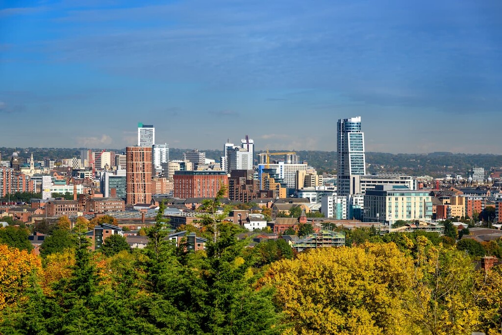
Leeds is the closest major city to the Yorkshire Dales and provides plenty of accommodation and transport options. As one of the largest urban areas in England, you won't be short of attractions to visit during your downtime. Take a tour of the 18th-century Harewood House, or peruse the collection at the Royal Armouries Museum. Despite being a bustling metropolitan city, Leeds is only 20 miles from the Yorkshire Dales National Park's southern boundary. If you're considering a stay in Leeds, book a room at the Quebecs Luxury Apartments or KSpace.
One of the largest towns in the Yorkshire Dales, Skipton provides access to the region's best hiking areas and has all the amenities you'll need for the perfect vacation. Skipton is regularly included in lists of the best places to live in Northern England and features some interesting local attractions, like the 12th century Skipton Castle and the Craven Museum and Gallery. Skipton is also within 15 miles of Malham Cove and Malham Tarn. Popular hotels in Skipton include The Unicorn and Dalesgate Lodge.
Another of the largest settlements in Yorkshire Dales, Sedbergh is an old market town in the gorgeous western dales. First established in the 13th century, Sedbergh has lots of old-world charm and a market that has been running for hundreds of years. You'll also be within five miles of hiking areas like The Calf and Tarn Rigg Hill (682 m). Those looking to spend the night in Sedbergh will want to book a room at The Black Bull Inn or The Dalesman Country Inn.
Travelers searching for a picturesque market town at the heart of the Yorkshire Dales should book a hotel in Hawes. Located within the serene Wensleydale, Hawes is within touching distance of some of the Yorkshire Dales' best natural attractions, with Hardraw Force and Great Shunner Fell within 5 miles of the town center. While in Hawes, ensure you sample the local namesake cheese, Wensleydale. Additionally, the Pennine Way runs through the Hawes, providing some of the best accommodation along the route. Popular hotels in Hawes include Cockett's Hotel and Fountain Hotel.
One of the most popular villages to visit in the north of the Yorkshire Dales is Ravenstonedale. A sleepy settlement with a population of a few hundred, Ravenstonedale is ideal for those looking to escape their busy day-to-day lives. Ravenstonedale is conveniently located at the foot of the Howgill Fells, with hills like Wild Boar Fell and Yarlside within 10 miles of the village. Due to its popularity, there are several hotels within this small village, such as The Black Swan Hotel and the King's Head.
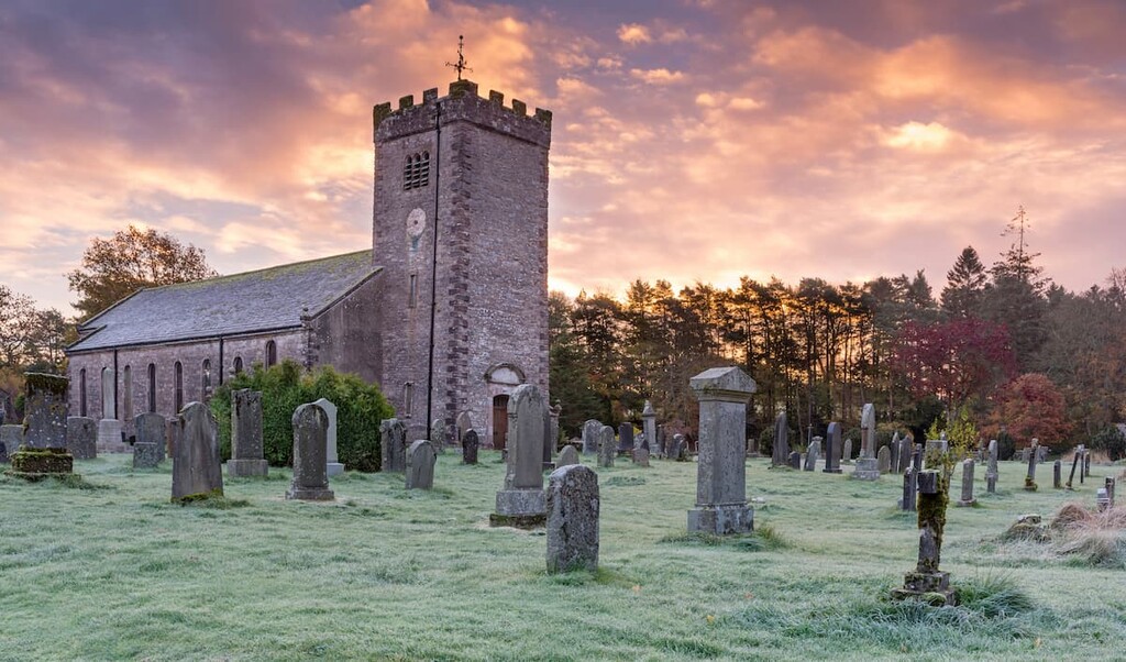
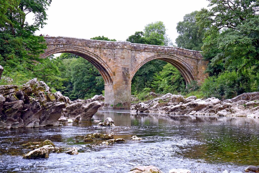
Considered by many to be one of the prettiest villages in the Yorkshire Dales, Kirkby Lonsdale is the perfect place to stop overnight while visiting some of the region's best hiking destinations. Sat on the park's southwestern edge, Kirkby Lonsdale is within 12 miles of Whernside, Ingleborough, and the Howgill Fells. There are also some great activities around the village, with walks along the Devil's Bridge and picnics at the 12th-century St Mary's Church. You'll find several superb hotels in Kirkby Lonsdale, like The Royal Hotel and The Sun Inn.


tgo40
nuttalls
hewitts-gb
marilyns-gb
tgo40
nuttalls
hewitts-gb
marilyns-gb
The highest peak in Yorkshire Dales National Park is Whernside, at 736 m.
Notable peaks in Yorkshire Dales National Park include Whernside, Ingleborough, Great Shunner Fell, High Seat and Wild Boar Fell.


