Scan the QR code and open PeakVisor on your phone
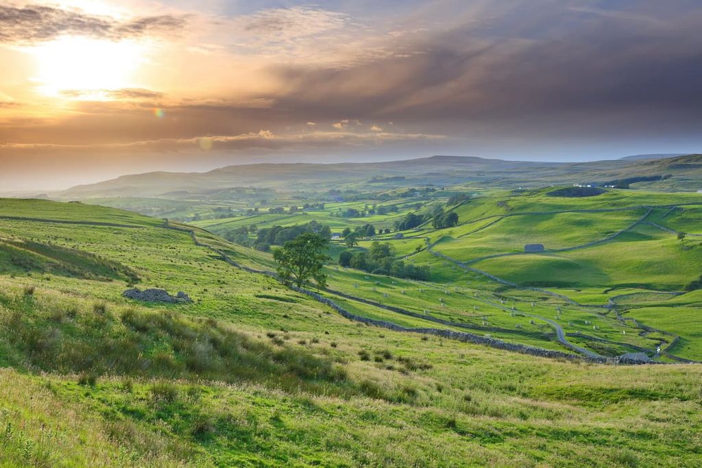
Home to deep dales, snow-capped mountains, and expansive moorlands, the North Pennines Area of Outstanding Natural Beauty (AONB) boasts some of England’s most dramatic landscapes. There are 581 named peaks in North Pennines AONB. The highest and the most prominent mountain in the area is Cross Fell (893 m/2,930 ft).
The North Pennines AONB is a protected area located in northern England. It encompasses the northernmost section of the Pennine Hills. The AONB is situated within the counties of Durham, Cumbria, and Northumberland.
Due to the geological importance of the area, the North Pennines AONB is a UNESCO Global Geopark. Natural England and local county councils manage the North Pennines AONB.
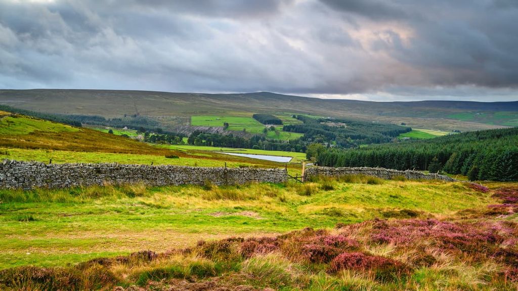
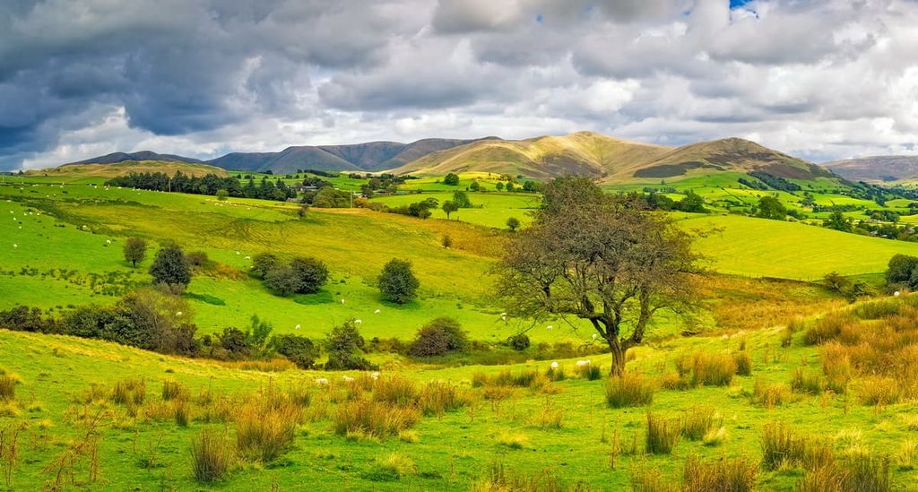
At 770 square miles (2,000 sq. km) in area, the North Pennines AONB is the second-largest of the UK's 46 AONBs after the Cotswolds AONB. The park's landscape is diverse and consists of undulating valleys, upland bogs, stark mountains, dense woodlands, and more.
Approximately 40 percent of the UK's upland hay meadows, 30 percent of England's upland heathlands, and 27 percent of England's blanket bogs are within the North Pennines AONB.
You'll find several notable natural landmarks within the North Pennines AONB. The area is home to Cross Fell (893 m/2,930 ft), the tallest mountain in England outside the Lake District. In Teesdale, there's High Force, a 21 m (69 ft) high waterfall that’s thought to be the most powerful in England.
Surrounded by the Lake District, the Yorkshire Dales, and the rest of the Pennines, the North Pennines AONB is at the heart of England's finest natural environments. The North Pennines AONB is connected to the Yorkshire Dales National Park to the south.
There are three other national parks within driving distance of the North Pennines AONB: Lake District National Park is located 12 mi (19 km) to the east, Northumberland National Park is situated 5 mi (8 km) to the north, and the North York Moors National Park is approximately 30 mi (48 km) to the southeast.
The North Pennines AONB is home to several towns and cities. The closest significant settlements include Carlisle, which is located 7 mi (11 km) to the west, and Darlington, some 16 mi (25 km) to the east. The nearest major city is Newcastle, which is around 20 mi (32 km) to the northeast of the park boundary.
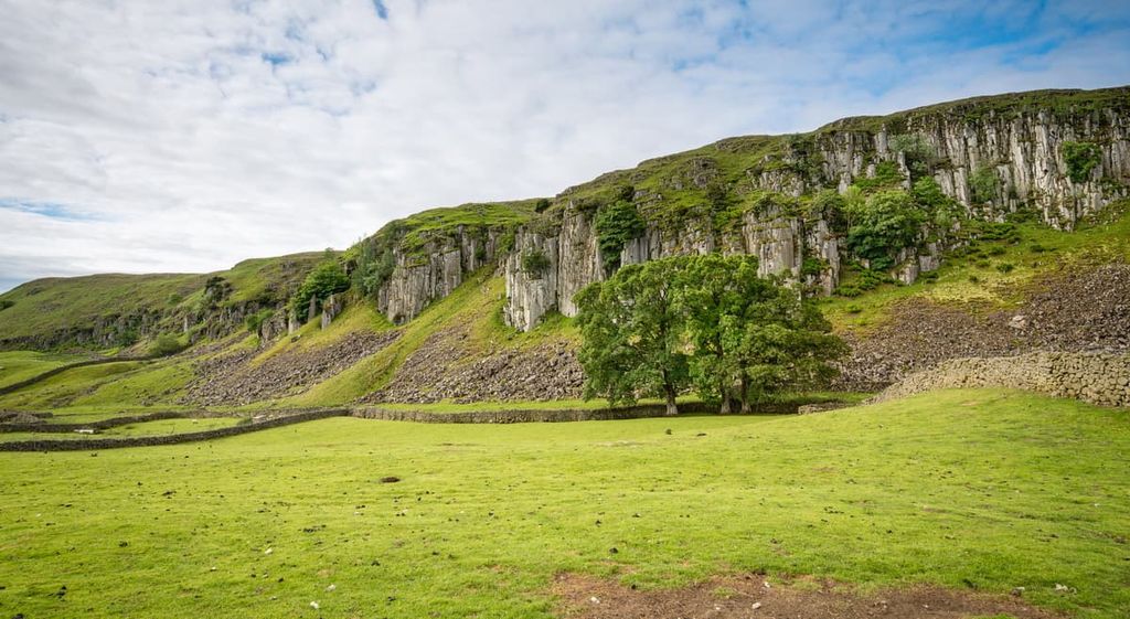
Forming a significant section of the Pennine Hills, the North Pennines AONB is an area rich with geological history.
The area is home to dozens of Hewitts (peaks over 609 m/2,000 ft) and several Marilyns (peaks with a prominence over 150 m/492 ft), including Cross Fell (893 m/2,930 ft), Great Dun Fell (847 m/2,778 ft), and Mickle Fell (789 m/2,588 ft).
The landscape of the North Pennines began forming around 500 million years ago, when mud and volcanic ash were deposited and then compressed and folded into slate.
This folding and compression resulted from the Caledonian orogeny, a mountain-building event that closed the Iapetus Ocean and caused the collision of several continents. The Caledonian orogeny helped form significant ranges across the British Isles and Scandinavia. The slate formed during this period is visible as inliers in Teesdale.
During the Carboniferous period, the area of the Earth's crust which is now England lay in shallow tropical seas near the equator. Large sediment deposits of limestone, shale, and mudstone were layered over the region during this time.
Approximately 295 million years ago, the chronological layering of the area's rocks, known as sedimentary succession, was interrupted by volcanic activity. This activity resulted in the formation of the Whin Sill, a tabular dolerite rock layer visible between Teesdale and England's northernmost town, Berwick.
About 5 million years later, around the start of the Permian period, mineral-rich waters circulated through the landscape, creating veins of lead that have been an essential part of the local mining industry for over 2,000 years.
One of the most interesting discoveries about the geology of the North Pennines is the presence of Weardale granite hidden around 6 mi (10 km) below the surface.
The granite is a batholith (a solid mass of igneous rock) formed around 400 million years ago. This batholith is one of the reasons why the North Pennines is an upland area, as the granite is less dense than other rocks and raises the landscape due to geological gravitational anomalies.

Another significant geological formation in the North Pennines AONB is the North Pennine Orefield, the second-largest zinc-lead orefield on the British Isles, covering an area of approximately 579 square miles (1,500 square km). For decades, this orefield was one of the world's leading sources of lead and zinc.
Home to significant percentages of England's upland heathlands, blanket bogs, and hay meadows, the North Pennines AONB provides essential habitats for a number of plant and animal species.
Uniquely, the North Pennines is the only place in England to have a named wind, the Helm Wind. The Helm Wind can be felt on the plateau around Cross Fell and in the Eden Valley, with its strong gusts often catching hikers by surprise.
Mammals are a common sight across the North Pennines AONB, with red squirrel and roe deer frequently spotted in wooded and grassland areas.
Otter and water voles are surprisingly common around waterways across the North Pennines, even though they tend to be rare in central and southern England. Other common mammals include badgers, red foxes, and hares.
The fish populations of the North Pennines have been thriving in recent years, with the South Tyne and River Tees are known for their salmon and trout populations. The Derwent River also has a significant population of brown trout. The River Tyne is considered one of the best salmon fishing rivers in the country.
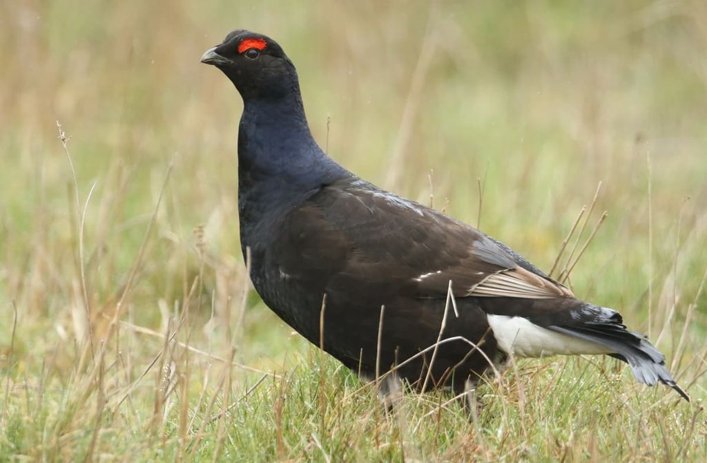
The most numerous animals in the North Pennines are birds. Approximately 80 percent of England's black grouse live within the North Pennines, and the area is also an important breeding ground for common snipe, common redshank, short-eared owl, and ring ouzel. If you stick around after nightfall, you may even spot a pipistrelle bat.
There are also around 22,000 breeding pairs of waders across the AONB. Other common birds of prey seen across the North Pennines include merlin, kestrel, and buzzard. In the summer, you may also spot migrating lapwing, golden plover, and curlew.
Across the North Pennines' diverse landscapes are a wide array of plant species. The area's hay meadows, one of Britain's rarest grassland habitats, are home to roughly 30 plant species per square meter and as many as 120 species per field. Common species include betony, great burnet, rough hawkbit, and wood crane's-bill.
The area's moorlands are among the wildest in the North Pennines, as these landscapes are difficult to turn into farmland. The AONB's blanket bogs boast various plant species, including bilberry, cottongrass, cloudberry, and deergrass. Across the uplands you may spot Teesdale violet, marsh saxifrage, and false sedge.
Covering 12,355 acres (5,000 ha) of land, ancient and semi-natural woodlands make up large swathes of the North Pennines AONB. There are four main types of woodland in the AONB: oak, upland mixed ash, wet woods, and conifer plantations. One of the most important features of these woodlands is their juniper scrub, one of the only native evergreen shrubs in Britain.
Humans have lived in the Pennine Hills for thousands of years, with evidence of Bronze Age settlements across the range. The Long Meg and Her Daughters stone circles near Penrith are among the most famous examples of artifacts from this period.
In pre-Roman times, the Pennines were controlled by the Brigantes, a coalition of local tribes that worked together to defend the land. After conquering the Pennines, the Romans began exploiting the land for agricultural purposes.
Much of the North Pennines and the surrounding areas were heavily influenced by the arrival of the Vikings, who changed the genetic and cultural makeup of the region.
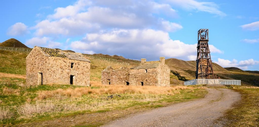
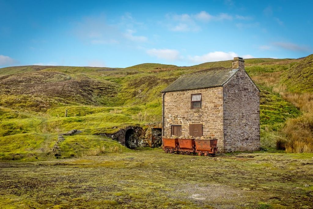
Since medieval times, the North Pennines has been one of England's biggest producers of lead. Mining has traditionally played a significant role in the area's history and economy, especially over the last few centuries.
Before the mid-eighteenth century, mining in the North Pennines was done on a small scale. However, the landscape was soon transformed by significant mining operations.
Miners dug miles deep to extract lead, with smelt mills dominating the hillsides. By the mid-twentieth century, the mining industry was in severe decline, with many of the factories abandoned. Some of the ruins have been turned into museums, like the Killhope Lead Mining Museum.
In 1988, the North Pennines was designated an Area of Outstanding Natural Beauty due to its rare moorland scenery, which has been sculpted by centuries of farming and mining across the region. In 2003, the North Pennines AONB became Britain's first UNESCO Global Geopark due to its scientifically important geological features.
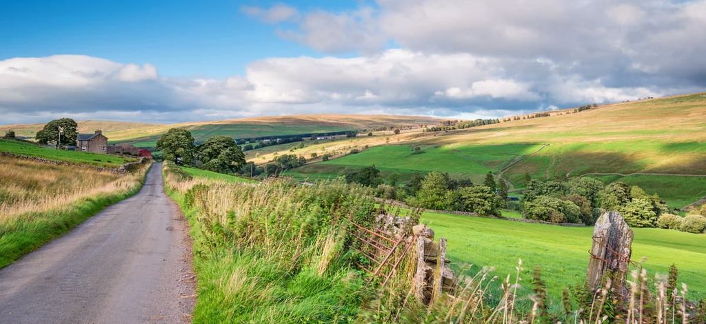
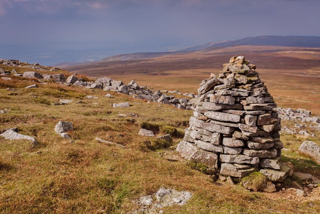
The North Pennines AONB is often overlooked in favor of the Yorkshire Dales or Lake District, but it offers some of the best hill walks in England. Here are a few of the North Pennines AONB's main hiking areas and trails.
The highest peak in England outside the Lake District, Cross Fell (893 m/2,930 ft), is a must for anyone serious about hiking. With its broad plateau and surrounding peaks, Cross Fell may not look too challenging, but the walk is more strenuous than at first glance.

Anyone attempting Cross Fell should map their route carefully. Cross Fell is also one of the most common places for snow to fall in the UK outside the Highlands in Scotland, so ensure you bring warm clothing during the winter months.
One of the most popular ways of hiking up Cross Fell is as part of the long-distance Pennine Way. This route takes hikers first over neighboring peaks like Great Dun Fell (847 m/2,778 ft) and Little Dun Fell (841 m/2,759 ft). While a popular route, the Pennine Way is very strenuous, and if not completed on schedule, involves spending the night at the Greg's Hut Bothy (699 m/2,293 ft).
Luckily, there are several alternative ways of scaling Cross Fell that hikers can complete in a few hours. One recommended route is a circular walking trail from the west side. You can pick up the trail from the village of Kirkland. The walk is 8 mi (13 km) long and takes around 6 hours.
Following the path, this route takes hikers steeply uphill, with some loose scree near the summit. A stone cross marks the summit of Cross Fell, which can be used to shelter from Cross Fell's infamous Helm Wind. On a clear day, Cross Fell provides sweeping vistas of the Lake District to the west.
You'll descend by following the path that runs just north of Grumply Hill (412 m/1,351 ft). The path will take you down into the valley, returning you to just south of your starting point in Kirkland.
The Pennine Way is one of the most famous long-distance walking routes in Britain. The path runs for 268 miles (429 km) from Edale in the Peak District National Park, through the Yorkshire Dales National Park and the Northumberland National Park to Kirk Yetholm just across the Scottish border.

The Pennine Way is the second-longest of Britain's 16 National Trails, after the 630-mile (1,014 km) South West Coast Path. While the entirety of the Pennine Way will be too challenging or time-consuming for most hikers, it's possible just to complete just the North Pennines leg of the trail.
You can start the North Pennines leg of the Pennine Way from Middleton-in-Teesdale on the park's southeast boundary. You can finish the hike in Greenhead, just between the North Pennines AONB and the Northumberland National Park. The walk is around 57 mi (91 km) and takes most people about 4 days.
Day 1: Middleton-in-Teesdale to Dufton
The first day takes you from Middleton-in-Teesdale to Dufton to just south of Cross Fell. This is considered one of the best legs on the Pennine Way. This leg is 21 mi (34 km) long and it takes you past three waterfalls, including the sublime High Force.
Strangely for the Pennines, this leg involves more descents than ascents. You'll start with a picture-perfect stroll along the River Tees before scrambling up to the first waterfall, Cauldron Snout. Take care in this area, as the ground can be slippery when scrambling.
Next, you'll cross moorlands before being greeted by one of the highlights of the Pennine Way, High Cup Nick. High Cup Nick is a U-shaped valley with breathtaking views that shouldn't be missed when visiting the North Pennines AONB. If you find the walk is too much for one day, spend the night in Langdon Beck or Forest-in-Teesdale.

Day 2: Dufton to Alston
The second day's walk from Dufton to England's highest town, Alston, is a grueling 21-mile trek across the highest points on the Pennine Way, ascending over 1,000 m (3,000 ft). It's considered the most challenging leg of the Pennine Way.
Some of the coldest weather and strongest winds ever recorded in England have been in this area, so hikers should pay attention to the weather forecast, map their route, and bring plenty of warm clothing. Ensure you stay on the path, as past mining activity has made the landscape hazardous.
The walk starts by taking you on a long ascent to the high fells before taking you up Knock Fell (793 m/2,601 ft), the fourth-highest peak in the North Pennines AONB.
You'll then pass over Great Dun Fell (847 m/2,778 ft) and Little Dun Fell (841 m/2,759 ft) before scaling the highest point on the Pennine Way, Cross Fell (893 m/2,930 ft).
The descent to Garrigill near Alston is also notoriously tricky. If you feel like this is too much for a day's walk, you can skip Knock Fell and some moorlands by heading straight for Great Dun Fell. Note that there are no accommodation options along this route—the Greg's Hut Bothy (699 m/2,293 ft) is the only possible place to spend the night.
Day 3: Alston to Greenhead
If you're tired after the previous day's trek, the 16-mile (26 km) leg from Alston to Greenhead is fairly unremarkable and can be skipped altogether. The waymarkers along this leg can also be tricky to find, so map out the route beforehand.
There are plenty of boggy patches along this section, so make you wear a decent pair of hiking boots. You'll start by passing the last hills in the Pennines, including Wain Rigg (274 m/898 ft), before passing under viaducts and over Blenkinsopp Common. Parts of the trail join onto the Maiden Way and the South Tyne Trail.
You can finish your walk in Greenhead, just a couple of miles from Hadrian's Wall. Or, if you don't feel like leaving the AONB, you can finish up slightly earlier in Lambley.
Another long-distance walk through the North Pennines is the historic Isaac's Tea Trail. This looped trail is 37 mi (58 km) long, and it takes hikers on a leisurely walk through picturesque valleys, charming hamlets, and lush woodlands that make the region so special.
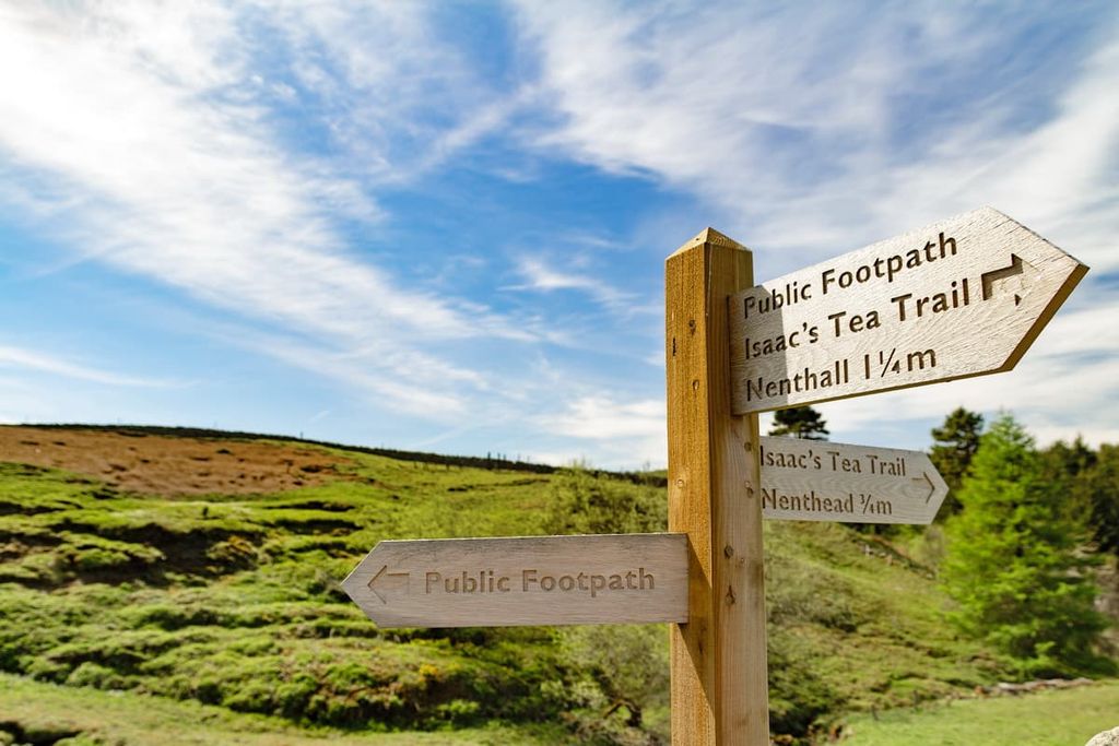
The route is named after Isaac Holden, a nineteenth-century tea-seller who travelled around the North Pennines. He went on to become a famous inventor, helping to develop the square motion wool-combing machine.
The walk starts and ends at Isaac's Well in Allendale, passing through Alston, England's highest town, and Nenthead, one of England's highest villages. While the walk is much easier going than the Pennine Way, walkers should still map out their route and bring appropriate hiking gear.
The walk is generally split into four sections, and each leg can be completed as an individual walk if you don't want to walk the entirety of the trail. Hikers usually complete Isaac's Tea Trail in 2-4 days.
Day 1: Allendale to Nenthead
The initial leg of Isaac's Tea Trail is perhaps the most strenuous, taking hikers on a riverside walk through the scenic East Allen Valley before climbing up onto high heather moors on the way to the village of Nenthead at 457 m (1,500 ft) high. The walk is approximately 11 mi (18 km) long, takes 6 hours to complete, and ascends 480 m (1575 ft).
You'll start by locating the sign for Isaac's Tea Trail near Isaac's Well and the River East Allen. Follow the paved lane by the river, paying close attention to the waymarkers. After about 3 mi (5 km), you'll reach Pry Hill (330 m/1,082 ft). Then you'll follow the signposts past the ruins of the seventeenth-century Rowantree Stob bastle before reaching the Black Way.
Finally, you'll need to pass through England's highest hamlet, Coalcleugh, before dropping into the Nent Valley on the way to Nenthead. Just before Nent Valley, you'll be treated to sweeping views of Cross Fell and the surrounding fells.
Day 2: Nenthead to Alston
The second leg is a 9-mile (14.5 km) hike from Nenthead to Alston. The walk takes around 3 hours to complete and it ascends 160 m (525 ft). You'll start by locating the signposts for Isaac's Tea Trail on Hillersdon Terrace near the Nenthead Arts and Information Centre.
This leg of the walk is fairly uneventful and starts by passing the mine entrance at Gudham Gill. Hikers should be careful where they step around this area, as rabbit holes often cause injury to walkers.
You'll then walk through a conifer plantation, bypassing the riverside path after the Lovelady Shield Hotel, which is being protected from erosion. After crossing a bridge and passing the waterfall at Blagill, you'll reach Nenthead.
Day 3: Alston to Ninebanks
The leg from Alston to the village of Ninebanks is 5.5 mi (9 km) long, takes 3 hours, and ascends 475 m (1,558 ft). It starts from Market Cross in Alston before continuing along the Pennine Way as far as the Roman fort of Epiacum, also known as Whitley Castle.
After passing Dyke House Farm, Isaac's Tea Trail separates from the Pennine Way and crosses the Kirkhaugh Bridge over the River Tyne. In Kirkhaugh, stop to visit the unique nineteenth-century Church of the Holy Paraclete.
The way then takes you through meadows and past Townfield Farm on the way to Clarghyll Hall. You'll then continue through the valley past Ouston Fell, which is an excellent spot to see nesting red grouse. Finally, after 3 mi (5 km), you'll arrive in Ninebanks.
Ninebanks to Allendale
The final return leg from Ninebanks to Allendale is 9.5 mi (15 km) long, takes 4 or 5 hours, and ascends 406 m (1,332 ft). Starting from the Ninebanks Youth Hostel, the trail takes hikers along Mohope Burn and past the Ninebanks Church, where there are some sweeping vistas of the Mohope Valley.
After Leadgate Bank you'll head for Keenley Green, enjoying along the way a stroll through the Monk Wood plantation. Then you'll pass Keenleywell House and Keenley Chapel before joining the footpath along the River East Allen back to Isaac's Well.
Looking for somewhere to stay during your adventure in the North Pennines AONB? Here are a few of the main cities and towns nearby.
Newcastle (officially Newcastle upon Tyne) is ideal for hikers looking to stay in a big city during their visit to the North Pennines AONB. Dubbed The Capital of the North East, Newcastle is less than 20 mi (32 km) away from the edge of the North Pennines AONB, making it easily reachable on a day trip.

As well as being within driving distance of the North Pennines, Newcastle is the perfect spot to soak up some northern culture. Newcastle has some of the best attractions in the North East like the Angel of the North, Beamish, the Living Museum of the North, and the Baltic Centre for Contemporary Art.
Newcastle isn't short on accommodation options either, with hotels like the Maldron Hotel, the Hampton by Hilton, and the Grand Hotel Gosforth Park.
Located 8 miles (13 km) from the Scottish border and 8 miles (13 km) from the North Pennines is the city of Carlisle. Cumbria's only city has been around since Roman times and was originally the site of a fort used to protect Hadrian's Wall.
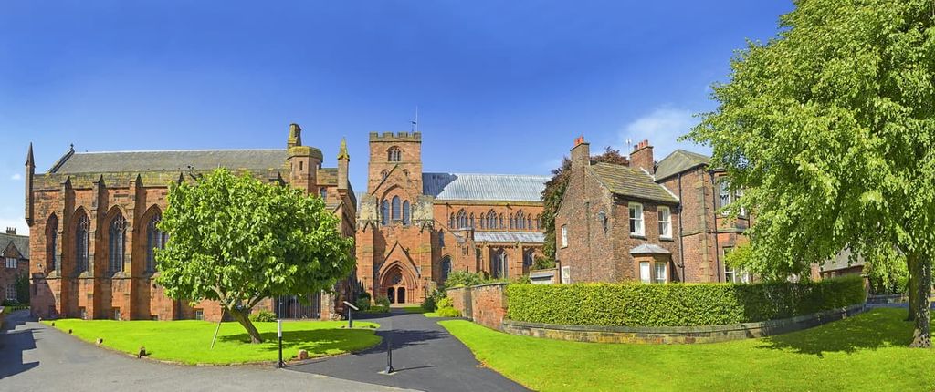
Carlisle is home to several fascinating historical attractions like the twelfth-century Carlisle Castle and the twelfth-century Carlisle Cathedral. If you're looking to spend the night in this ancient city, book a room at Willowbeck Lodge or the Dalston Hall Hotel.
Situated on the opposite side of the North Pennines AONB to Carlisle is the market town of Darlington. A classic northern English town, Darlington is ideal for hikers looking for somewhere quiet to stay with plenty of amenities.
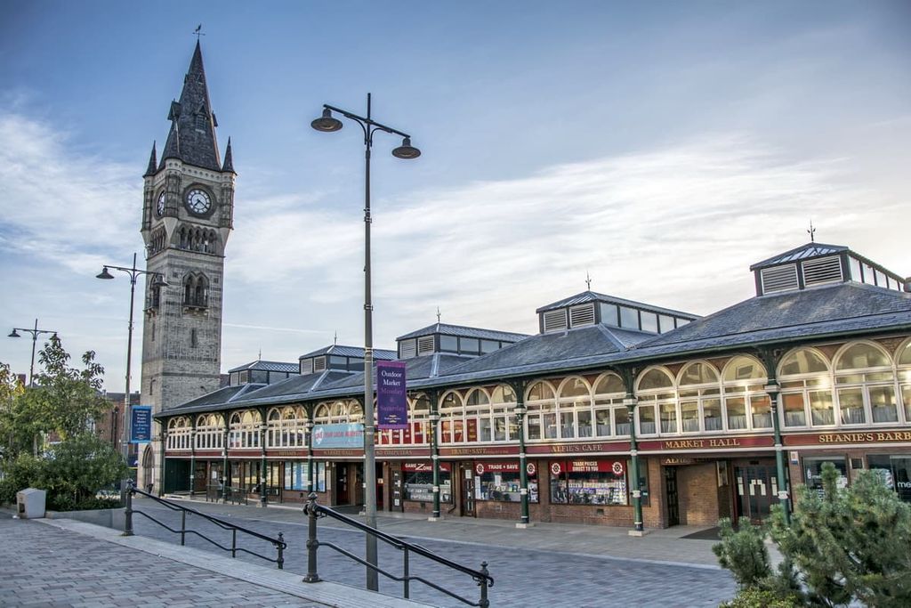
Darlington is famed for its association with the railway industry and was home to the first permanent steam-powered passenger railway in the country. Attractions include the Head of Steam Darlington Railway Museum and the Piercebridge Roman Fort. Top hotels in Darlington include the Bannatyne Hotel and the Blackwell Grange Hotel.
If you're looking to stay within the North Pennines AONB, you can't go wrong with Alston. The highest town in England (along with Buxton in Derbyshire), Alston is roughly 8 mi (12 km) from Cross Fell and is a stop along both the Pennine Way and Isaac's Tea Trail.
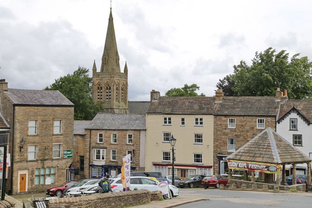
You'll find plenty of interesting sights around Alston, including the Ashgill Force waterfall and the Epiacum Roman Fort. Hotels in and around Alston include Alston House and the Lovelady Shield Hotel.
Another significant settlement worth discovering in the North Pennines AONB is Allendale. A popular tourist spot, Allendale serves as the start and end point for Isaac's Tea Trail.
As well as serving as an ideal base for exploring the North Pennines, Allendale has some fun family-friendly attractions like the Museum of Classic Sci-Fi and Allendale Forge Studio and Gallery. You'll find a few quaint inns and hotels in Allendale, like The Golden Lion Hotel and The King's Head.