
Scan the QR code and open PeakVisor on your phone
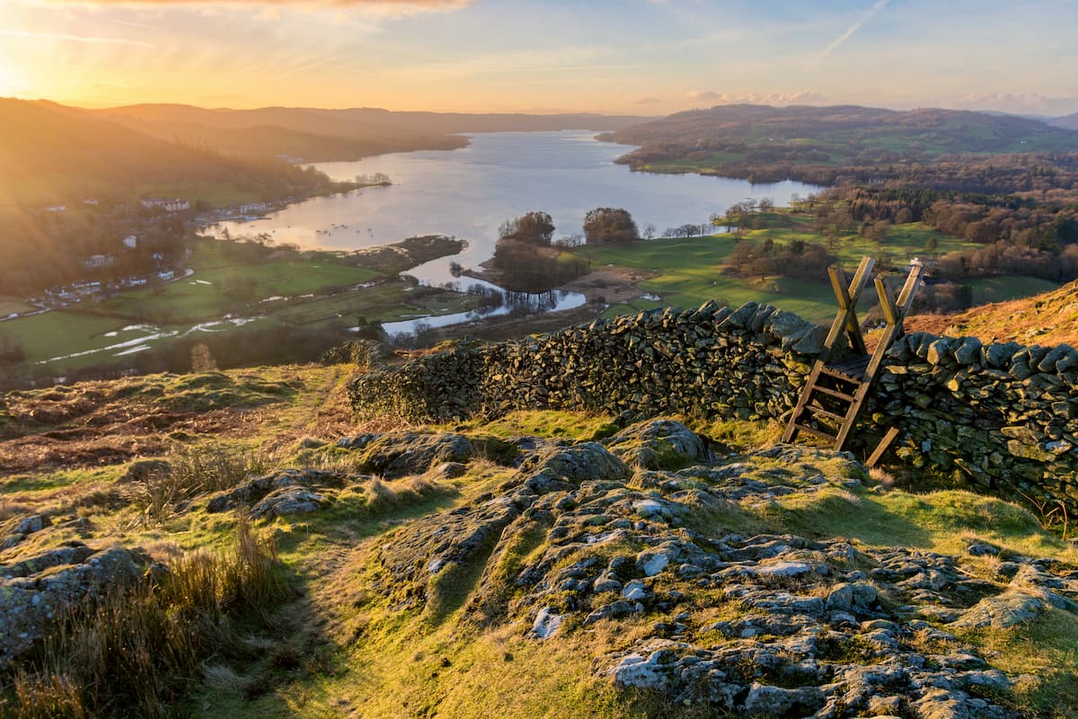
Perhaps the most scenic landscape in England, the Lake District National park won't disappoint even the most seasoned traveler. The largest national park in England and Wales, the Lake District National Park stretches for 912 square miles, encompassing serene lakes, precipitous mountains, and lush forested valleys. It's the most popular national park in England, with roughly 16 million visitors each year.
The Lake District is among the most popular hiking destinations in the UK, thanks to its 214 Wainwrights or fells, almost all of which exceed 304 m (1,000 ft) in height. The term Wainwright comes from Alfred Wainwright's Pictorial Guide to the Lakeland Fells, a book series integral in recognizing the mountains and hills of the Lake District.
These fells are split into several different geographical ranges, including the Northern Fells, Central Fells, and Southern Fells. Similar to peak bagging in Scotland, attempting to summit as many Wainwrights as possible is a favorite activity among avid mountain climbers.
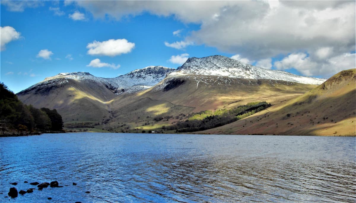
Of the Lake Districts' 214 fells, 4 mountains exceed 914 m (3,000 ft). These mountains are Scafell Pike (978 m), Sca Fell (964 m), Helvellyn (950 m), and Skiddaw (931 m). Scafell Pike is famous for being the highest and most prominent mountain in England. Other notable mountains and hills within the Lake District National Park include Great End (910 m), Great Gable (899 m), and Blencathra (854 m)
It has taken hundreds of millions of years for the Lake District's landscape to take its current shape. The park's geology consists of slate, limestone, and granite formed from volcanic eruptions and sediment from oceans. The oldest rocks in the Lake District are the Skiddaw Group, estimated to be roughly 500 million years old.
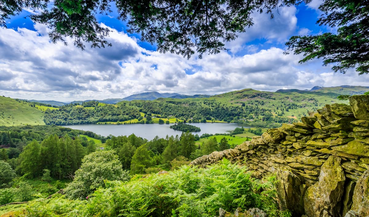
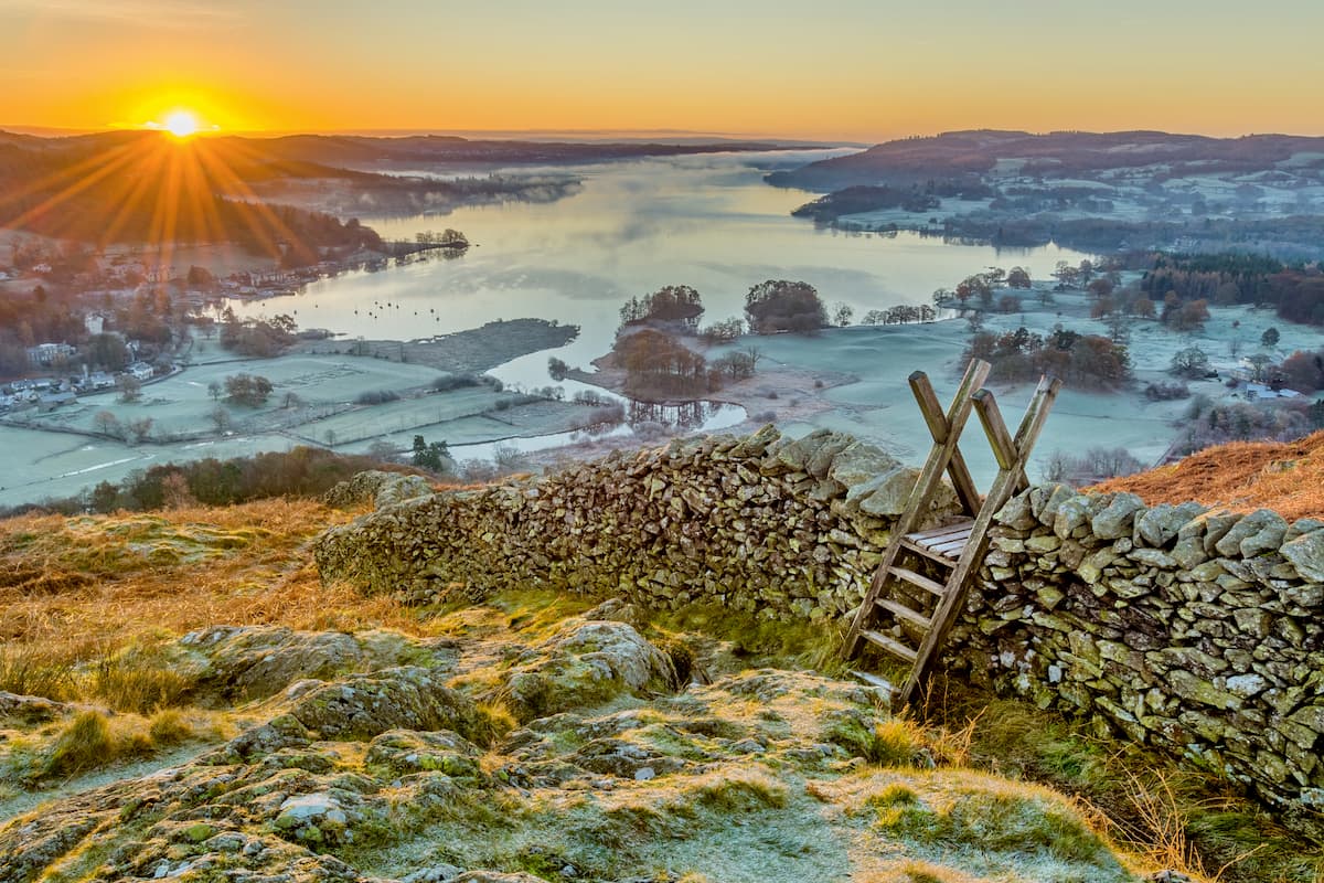
As the park's name suggests, the Lake District is also home to sixteen bodies of water. Many of these lakes are referred to as 'waters' or 'meres.' One notable example is Windermere, the deepest lake in England, reaching depths of 74 meters. It's also the longest lake in England at 10.5 miles.
Other important parts of the Lake Districts' landscape are its coastline and forests. The park is home to 26 miles of coastline and estuaries. Roughly 12% of the Lake District is forest, which equates to around 70,000 acres.
Read on to discover some of the best hiking trails and areas across the Lake District National Park.
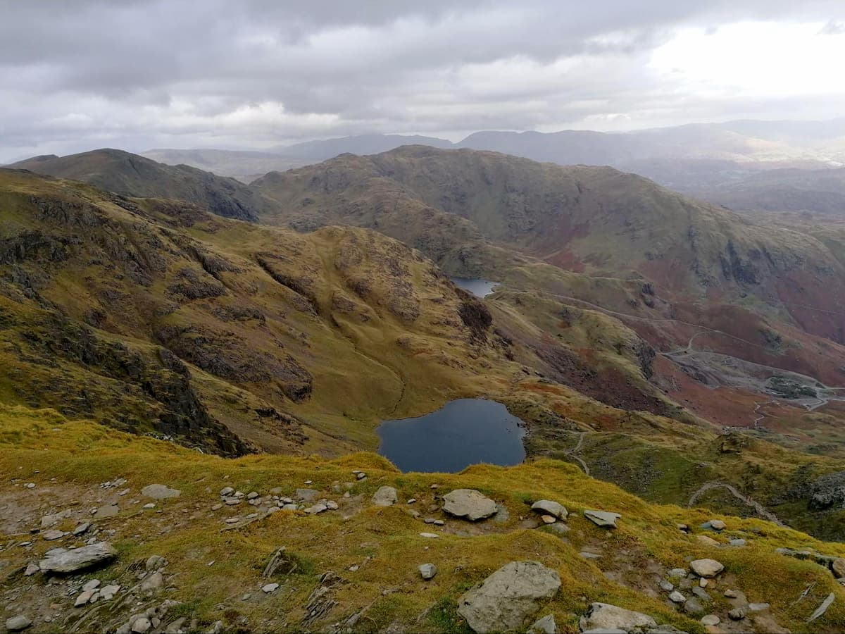
As you'd imagine from the highest mountain in England, Scafell Pike is a challenging climb and shouldn't be undertaken by inexperienced climbers. The mountain will throw you plenty of curveballs, including several false peaks and dizzying crags along the main ridge. If you're looking for the most comfortable route up Scafell Pike, climb from Wasdale directly up Brown Tongue. Another possible way to explore more of this complex mountain is the climb up to Sty Head and along the Corridor Route.
The walking trail up Sty Head to Scafell Pike is 8 miles, ascends 1070 m, and takes 6 to 7 hours. Before setting off to climb Scafell Pike, ensure you have all the necessary equipment, and thoroughly plan your route.
From the Wasdale Green Head car park, follow the clear track northeast past the farm at Burnthwaite. Along the Sty Head bridleway, you'll climb up the scree slopes of Great Gable's southern side. The Corridor Route is easily missed and can be tough to follow at times, so ensure your map out your route. The Corridor Route starts around 300m east of a stretcher box on the Esk Hause bridleway. You'll pass on the northwestern sides of Great End (903 m) and Broad Crag (934 m) on your way to Lingmell Col.
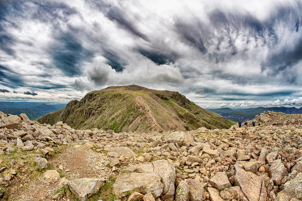
From the highest point on the Corridor Route on Lingmell Col, you'll head southeast to the summit of Scafell Pike. The peak of Scafell Pike boasts stunning views of the area. Eskdale is directly below, Skiddaw to the north, Helvellyn to the east, and Sca Fell to the southwest.
To descend, head back down the Lingmell Col before going southwest to Hollow Stones. Hikers looking for a challenge can extend their climb by climbing up from Hollow Stones to Lord's Rake, which leads to the tricky summit of Sca Fell, England's second-highest mountain. If you plan on scaling Sca Fell, ensure you plan your route as the ascent is difficult.
Your main descent down Scafell Pike is down the Brown Tongue, before passing down Lingmell Gill and over Lingmell Beck on your way back to the car park.
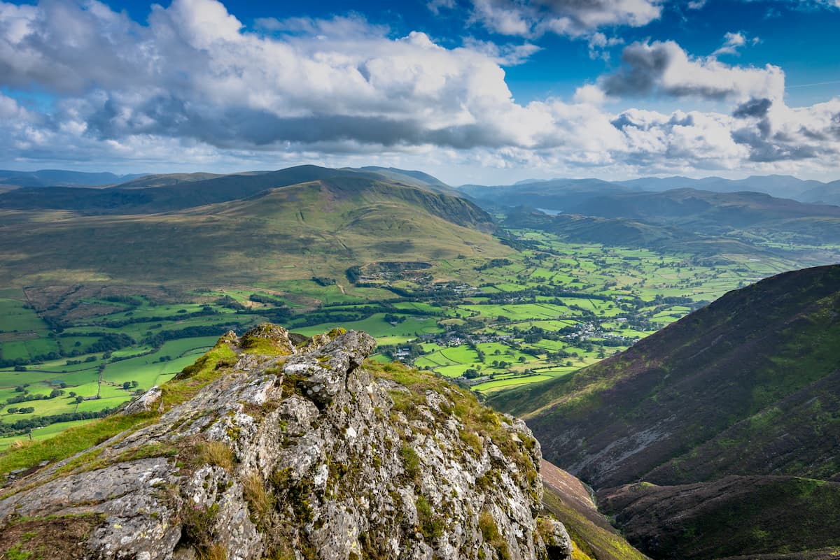
Skiddaw is one of the most picturesque mountains in England. Its isolation from the surrounding fells means you'll have excellent views of the Lake District's landscape from Skiddaw's summit. The best route up the mountain is the there and back trail via the Jenkin Hill bridleway. The walk up Skiddaw is 10.5 miles, ascends 970 m, and takes around 7 hours.
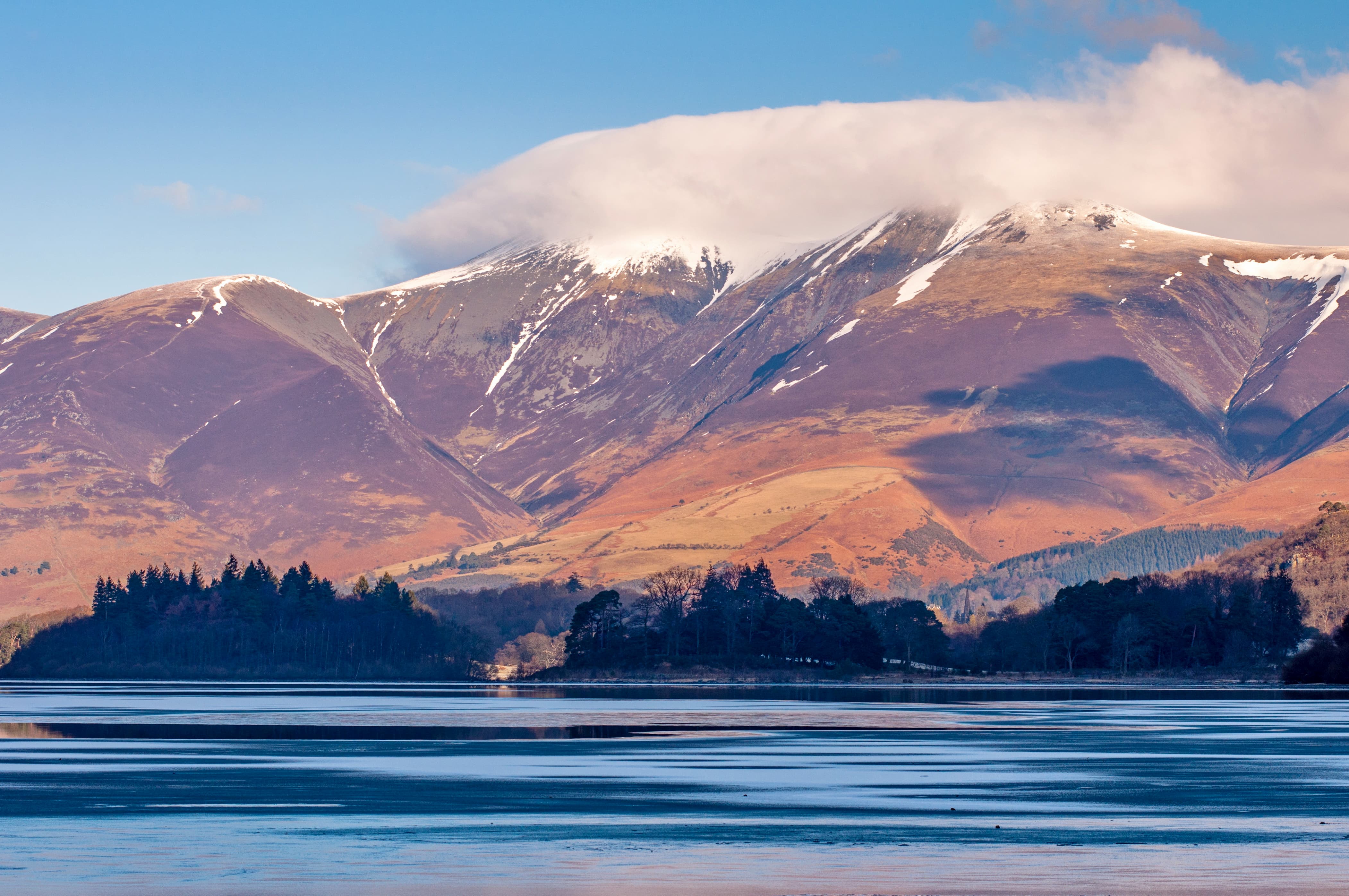
From the Brundholme Road northeast of Keswick, locate the Jenkin Hill bridleway. The bridleway will climb steadily up Latrigg (362 m), passing a car park on the way up Jenkin Hill (739 m). Here, you'll also have the option to summit Little Man (850 m) before continuing onto Skiddaw's summit to the north.
As mentioned, the summit of Skiddaw boasts some of the best mountain views in the Lake District. To the south, you'll be able to spot the likes of Helvellyn, Scafell Pike, and Great Gable to the south and Bassenthwaite Lake to the west. Return to Keswick the way you came, being mindful not to stray onto another path.
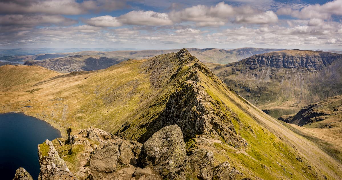
Helvellyn is an easier climb than the likes of Scafell Pike but isn't without its dangers. Helvellyn presents challenges even for experienced mountain climbers and requires you to scramble in certain areas. It's important to map out your route beforehand thoroughly. Regardless of its difficulty, many hikers consider Helvellyn to provide one of the best walks and some of the best panoramas in the Lake District. The best way to hike Helvellyn is from the Glenridding Tourist Information Centre, following the Helvellyn walking trail before descending at Swirral Edge.
This walk up Helvellyn is 8.5 miles, ascends 842 m, and takes approximately 7 hours. From the car park at the Glenridding Tourist Information Centre, head uphill past the Travellers Rest pub. Head along the path left to Hillside Farm before following the Helvellyn via Miresbeck signposts.
After passing some stonewalls at around 2 miles, you'll spot Helvellyn with Striding Edge on the left and Swirral Edge on the right. The most popular way up Helvellyn is via Striding Edge. Heading to the mountain's left, you'll spot this trail meandering up Helvellyn's flank. Striding Edge's right hand path is considered the easiest. Although it's an exposed path, it's preferred to the hazardous mountain ridge.
Hellvelyn's ridge isn't for the fainthearted and regularly defeats hikers uncomfortable with heights. The final ascent to the summit of Helvellyn is steel and requires some tricky scrambling. The panoramas from Hellvelyn are incredible, with the Irish Sea visible on a clear day.
Descending via Swirral Edge is considered the best option. When the path forks, head right to Red Tarn for the easiest route. Complete your descent and take the left hand trail at Red Tarn all the way down the valley.
Blencathra (also referred to as Saddleback) is a favorite among hikers thanks to its varied routes, numerous tops, and exciting scrambles. Perhaps the best way to scale Blencathra is via the Sharp Edge, a knife-edge arete considered the best scramble in the park. Rambling up Blencathra via the Sharp Edge is approximately 3 miles, ascends 623 m, and takes about 2 hours.
Park at Scales and follow the stone trail by the cottage up the side of Scales Fell. Continue along this path until you reach the saddle between Souther Fell (519 m) and Scales Fell. To the northwest, you'll be able to spot the Sharp Edge beyond Brunt Knott (423 m).
Continue along the trail through the valley until you reach Scales Tarn. This is a great place to snap some pictures, with Tarn Crags (662 m) and the Sharp Edge forming a stunning panorama. The way from here to Sharp Edge is clear. Once you are on this arete, you'll want to move cautiously along the crest. The Sharp Edge is especially hazardous during rain, as the mountain's Skiddaw slate becomes very slippery.
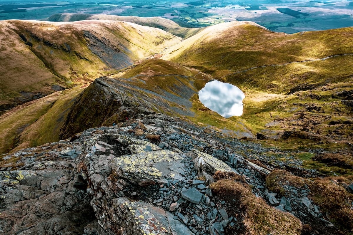
Most casualties on Blencathra happen in an area known as the 'Bad Step.' While you'll find plenty of holds in the rock, it's been worn smooth due to activity and is the most dangerous part of the Sharp Edge. Scramble across the Sharp Edge to the bottom of Foule Crag. The easiest way up this jagged rock wall is through the gully. The summit of Blencathra is just ahead and is marked with a stone ring.
If you're looking for a challenging climb, you can descend via Hall's Fell Ridge, which is a Grade 1 scramble. The easiest ways to descend from Blencathra is either down Scale Fell or Blease Fell (797 m).
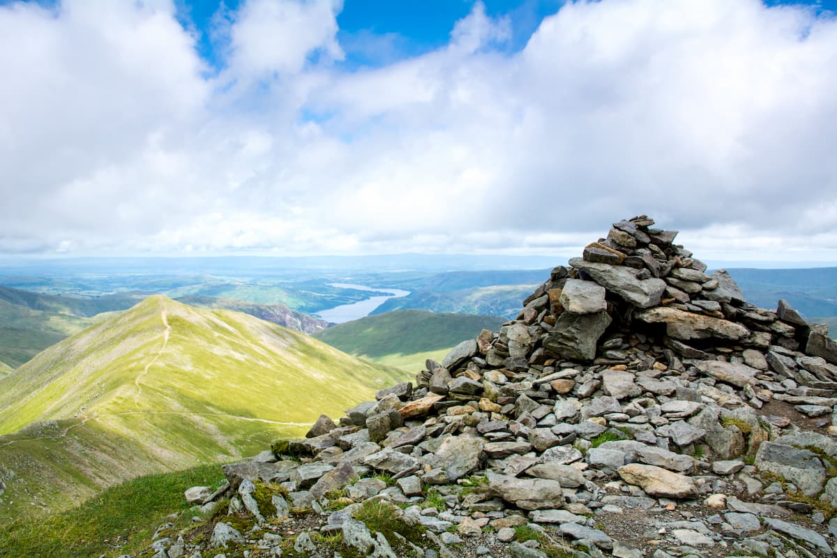
The Old Man of Coniston (791 m) is one of the most popular fells in the Lake District, as it's moderately challenging and provides excellent views without being too strenuous for most hikers. You'll also get the chance to summit several other fells along this trek. The best place to start your ascent of the Old Man of Coniston is from the Walna Scar Road just outside Coniston village. This hike is about 6 miles, ascends 780 m, and takes 3 or 4 hours.
The Walna Scar path up the Old Man of Coniston is well-trodden and easy to follow. As the trail rises up the hillside, Coniston Water will come into view on your left, along with Brown Pike (672 m) and Buck Pike (733 m) straight ahead. At the small cairn on the hill's ridge, turn right and follow the winding path to the summit of Brown Pike and then onto Buck Pike. The Old Man of Coniston comes into view from atop Brown Pike.
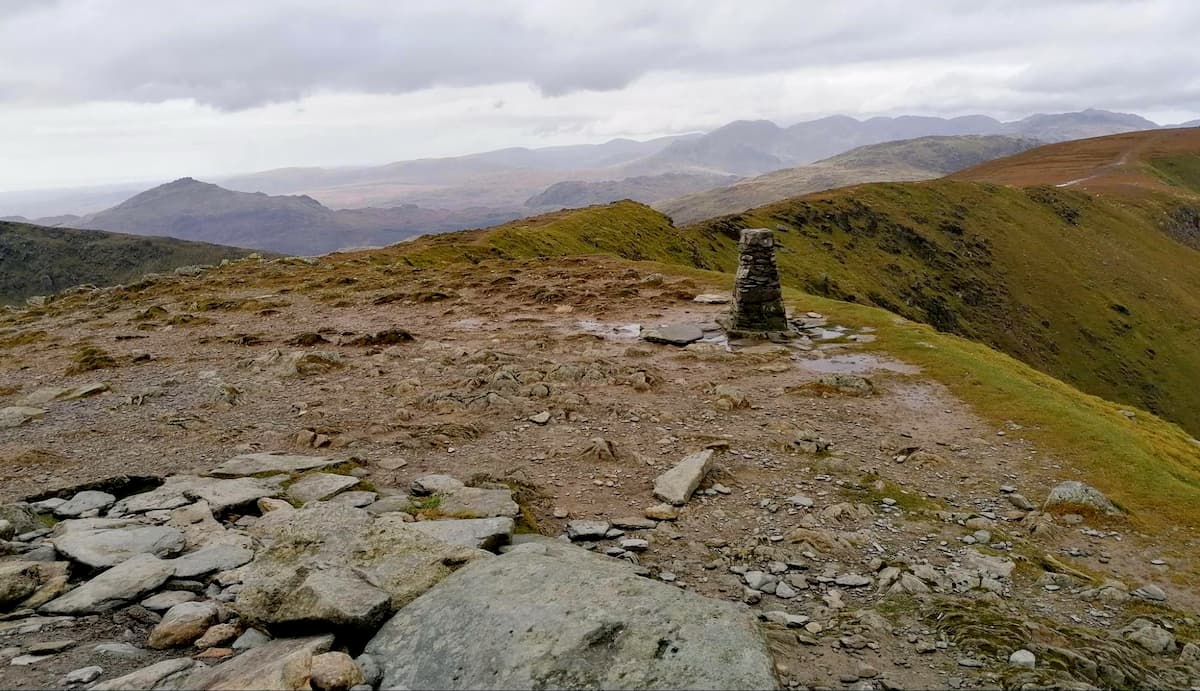
Next, you'll scale Dow Crag (763 m), which boasts picturesque panoramas of Goats Water. Continuing along the path, descend to Goats Hawse before reaching the Old Man of Coniston's summit cairn. From the Old Man of Coniston, you'll have sweeping vistas of the surrounding mountains, including Bowfell (885 m), Skiddaw, and Blencathra (854 m). On a clear day, you can even see the Isle of Man to the west.
To descend, follow the zig-zag trail past the cairn, which leads down the Old Man of Coniston towards Low Water. Continue your descent by proceeding towards Coniston Water and back onto the Walna Scar Road.
If you're looking to bag an easy fell in the Lake District, consider hiking Cat Bells (439 m). This hill provides excellent views of Keswick and Derwent Water while being a manageable hike for families. The walk up Cat Bells is around 3.5 miles and takes roughly 2 hours.
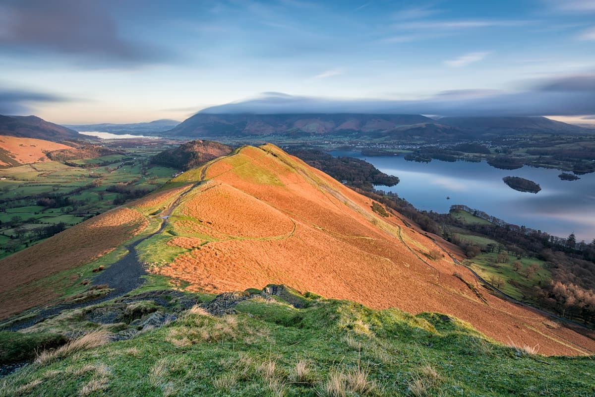
You can start climbing Cat Bells from the Hawse End ferry terminal at Derwent Water. From here, you'll follow the trail marked 'Cat Bells 1 Mile.' The route is clear and leads up onto the hill's broad ridge. After passing the memorial to Thomas Arthur Leonard, you'll be close to the summit. To reach the top of Cat Bells requires a small scrabble.
Despite being only 439 m high, Cat Bells boasts some of the best views of the Lake Districts' fells. Looking north, you'll be able to spot the peaks of Blencathra and Skiddaw, casting a long shadow over the quaint town of Keswick and Derwent Water.
Continue to follow the path south, ignoring any deviations. This path, known as the Cat Bells bridleway, hugs the side of the hills and will lead you all back to Hawse End.
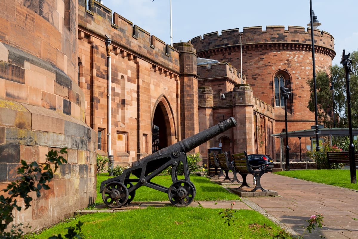
The city of Carlisle is the largest settlement within touching distance of the Lake District National Park. Located right on the Scottish border, Carlisle boasts some fascinating attractions for tourists to enjoy. Take a tour of the 12th-century Carlisle Castle, or stop by the beautiful medieval Carlisle Cathedral. Carlisle is only about 25 miles from the Lake District National Park and is reachable via the M6 or the A595. As the largest settlement in Cumbria, Carlisle has an array of reasonably-priced hotels, such as the Crown & Mitre Hotel and The County Hotel.
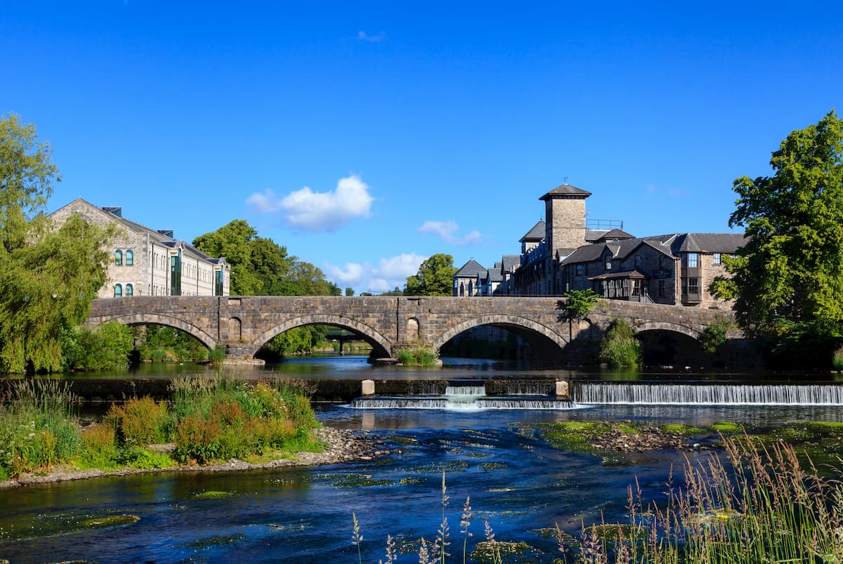
With a population of approximately 28,000, Kendal is the second biggest settlement close to the Lake District National Park. Nestled on the park's southeastern edge, Kendal is an ancient town known for its historic sites and local museums. Despite being a large settlement, Kendal is only 9 miles from Windermere and 20 miles from Helvellyn. While in town, ensure you check out Kendal Castle and Abbot Hall. Popular places to stay in Kendal include the Castle Green Hotel and the Stonecross Manor Hotel.
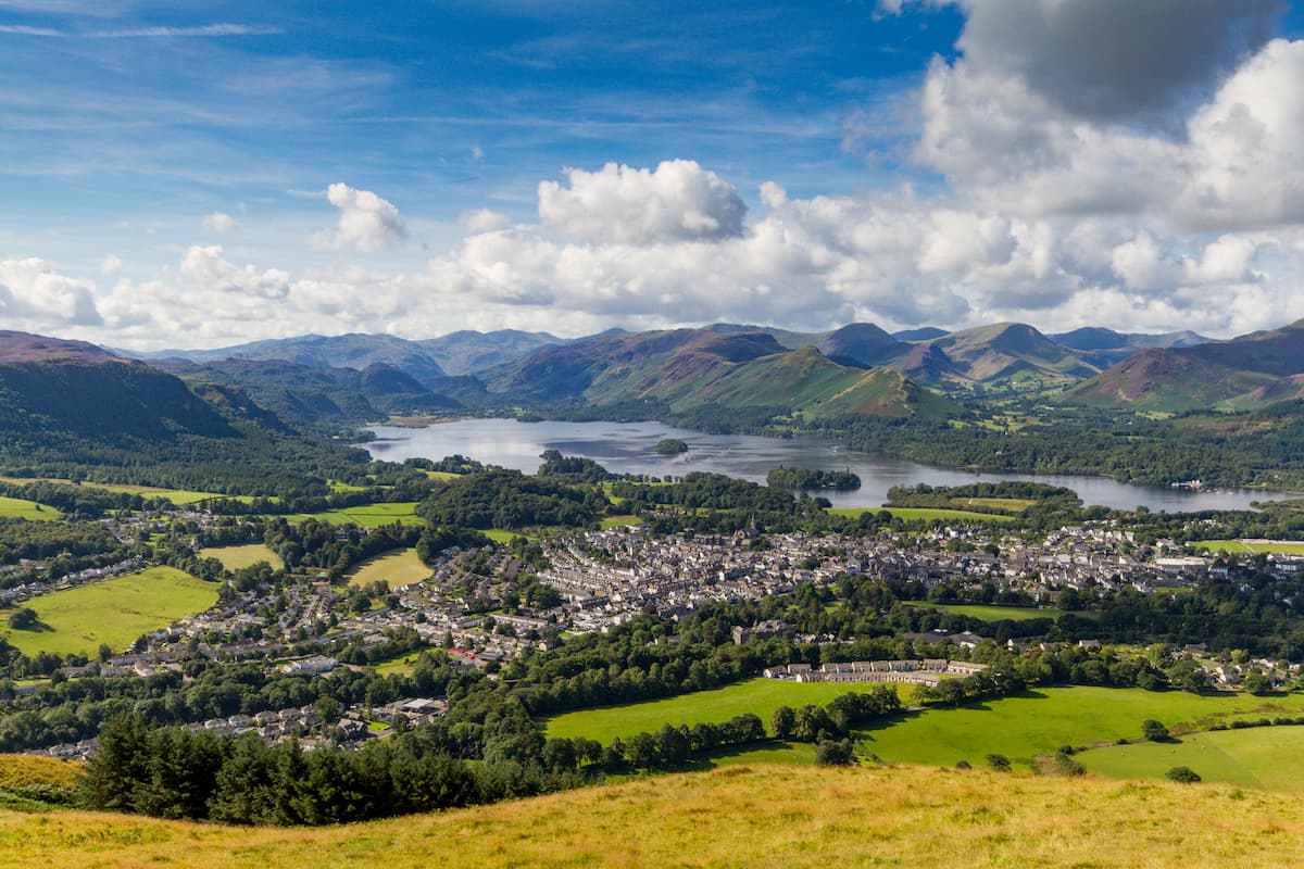
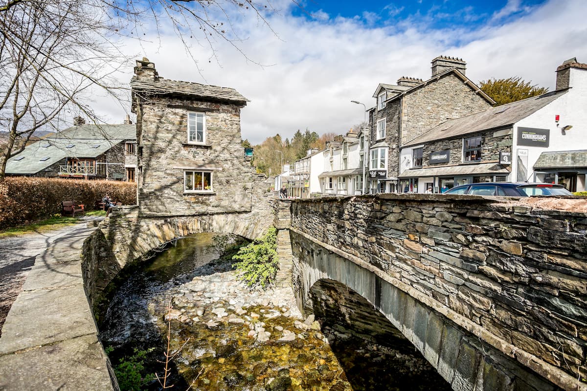
Situated just 4 miles north of Derwent Water is the charming market town of Keswick. One of the most popular vacation spots in the Lake District, Keswick is notable for its vibrant nightlife and cultural heritage. The main reason Keswick is so popular is that it's just a stone's throw from many of the best hiking locations in the Lake District, with Skiddaw only 5 miles north and Cat Bells 4 miles to the south. As a popular town for hikers, you'll find several hotels in Keswick, including The Borrowdale Gates Hotel and Ravenstone Manor Hotel.
Perched on the northern edge of the sublime Windermere, Ambleside is an idyllic town for a weekend getaway. Ambleside has some intriguing local attractions, such as the 19th-century Wray Castle and Wordsworth Grasmere, the former home of poet William Wordsworth. You'll also find some superb hiking areas within a few miles of Ambleside. Loughrigg Fell (332 m) and Baystones (484 m) are both within 5 miles of town. Travelers looking to stay in Ambleside should consider booking a room at the Regent Hotel or Wateredge Inn.
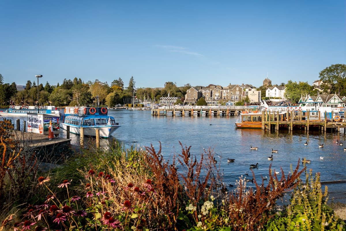
Another great town sat upon the Windermere in Bowness. Positioned directly on the longest lake in England, Bowness-on-Windermere is ideal for watersports and lakeside hiking. Bowness is famed for its association with several writers, and there's even The World of Beatrix Potter Attraction, which your kids are sure to love. With tourists flocking to Bowness-on-Windermere every year, you'll find plenty of accommodation, such as the Burnside Hotel & Spa and Macdonald Old English Hotel & Spa.
If you're looking to stay in a charming, traditional Cumbrian village, consider Hawkshead. This sleepy little village is sandwiched between Coniston Water and Windermere, affording easy access to two of the Lake District's best hiking areas. With a population of only a few hundred, don't expect many attractions other than fishing on Esthwaite Water or hiking on The Old Man of Coniston. Although it's a small village, there are a few hotels around Hawkshead like the Red Lion Inn and The Sun Inn.


wainwrights
nuttalls
hewitts-gb
furths-ew
marilyns-gb
tgo40
wainwrights
nuttalls
hewitts-gb
furths-ew
tgo40
wainwrights
nuttalls
hewitts-gb
furths-ew
marilyns-gb
wainwrights
nuttalls
hewitts-gb
furths-ew
marilyns-gb
wainwrights
nuttalls
hewitts-gb
furths-ew
marilyns-gb
tgo40
wainwrights
nuttalls
hewitts-gb
furths-ew
marilyns-gb
wainwrights
nuttalls
hewitts-gb
furths-ew
marilyns-gb
wainwrights
nuttalls
hewitts-gb
marilyns-gb
tgo40
wainwrights
nuttalls
hewitts-gb
marilyns-gb
tgo40
wainwrights
nuttalls
hewitts-gb
marilyns-gb
wainwrights
nuttalls
hewitts-gb
marilyns-gb
wainwrights
nuttalls
hewitts-gb
marilyns-gb
wainwrights
nuttalls
hewitts-gb
marilyns-gb
wainwrights
nuttalls
hewitts-gb
marilyns-gb


