
Scan the QR code and open PeakVisor on your phone
Scotland is home to 18,464 named mountains. The highest is Ben Nevis at 1,345 m.
Home to serene lochs, verdant glens, and the highest mountains in the UK, Scotland is one of Europe's most beautiful hiking destinations. There are 18,464 summits in Scotland. The highest and most prominent mountain is Ben Nevis (1,344 m/4,413 ft).
Scotland (Alba) is the northernmost country on the island of Great Britain. It covers an area of approximately 77,900 sq km (30,090 sq mi), which equals 32 percent of the United Kingdom's total landmass. Scotland has a population of over 5.4 million people.
Scotland shares one 96 mi (154 km) land border with England to the south. It's surrounded by the Atlantic Ocean to the north, the North Sea to the northeast, and the Irish Sea to the south and southwest.
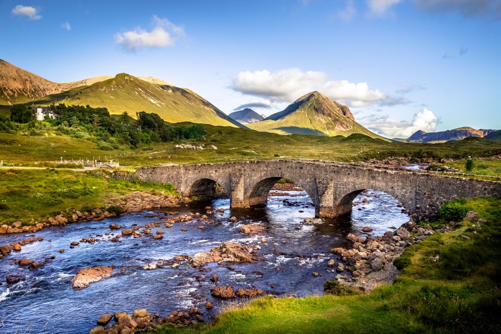
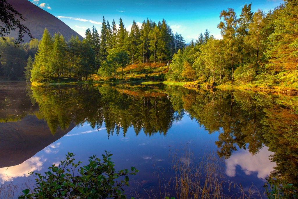
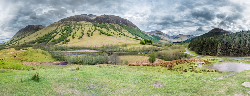
The landscape of Scotland is rugged and varied, consisting mainly of moorlands, rolling hills, rocky mountains, forests, glens, and lochs.
Geographically Scotland can be split into two areas: the Scottish Highlands (a' Ghàidhealtachd) and the Scottish Lowlands ((a' Ghalldachd). The Highland Boundary Fault separates the two regions and stretches from Arran in the west to Stonehaven in the east.
The Scottish Highlands encompasses the north and west of the country. It's the most mountainous area of Great Britain and is home to the 10 highest mountains in the UK, including Ben Nevis (Beinn Nibheis) (1,344 m/4,413 ft).
Within the Scottish Highlands are the Grampian Mountains, the largest mountain range in the UK. The 62 mi (100 km) long Great Glen valley separates the Grampian Mountains from the Northwest Highlands.
The Scottish Highlands are home to both of Scotland's national parks: Cairngorms National Park (Pàirc Nàiseanta a' Mhonaidh Ruaidh), the largest national park in the UK, and Loch Lomond and The Trossachs National Park (Pàirc Nàiseanta Loch Laomainn is nan Tròisichean), which straddles the boundary between the Highlands and Lowlands.
The Lowlands are less mountainous than the Scottish Highlands, with Merrick (A' Mhearag) (843 m/2,765 ft) in the Galloway Hills the region's highest point. The Scottish Lowlands are divided into the Central Lowlands in the north and the Southern Uplands in the south.
Between the Southern Uplands and Central Lowlands is an area known as the Central Belt. The Central Belt is a loosely defined region that cuts across Scotland's narrowest section. It's home to around 4 million people, the majority of Scotland's population.
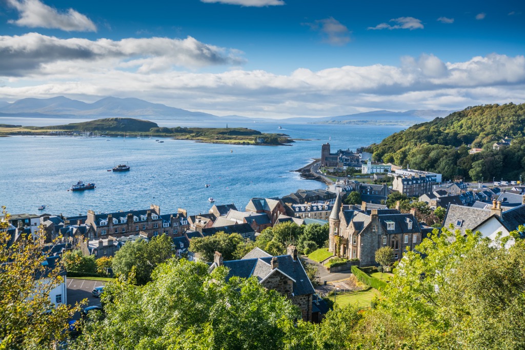
Scotland is the country with the most islands in the UK. Over 790 islands belong to Scotland, 93 of which are inhabited. Most of these islands belong to four groups: Shetland, Orkney (Arcaibh), the Inner Hebrides (Na h-Eileanan a-staigh), and the Outer Hebrides (Na h-Eileanan Siar).
The largest island off the Scottish mainland is Lewis and Harris (Leòdhas agus na Hearadh) in the Outer Hebrides, with an area of 2,200 sq km (860 sq mi). It's also the most populous Scottish island, with around 21,000 permanent residents.
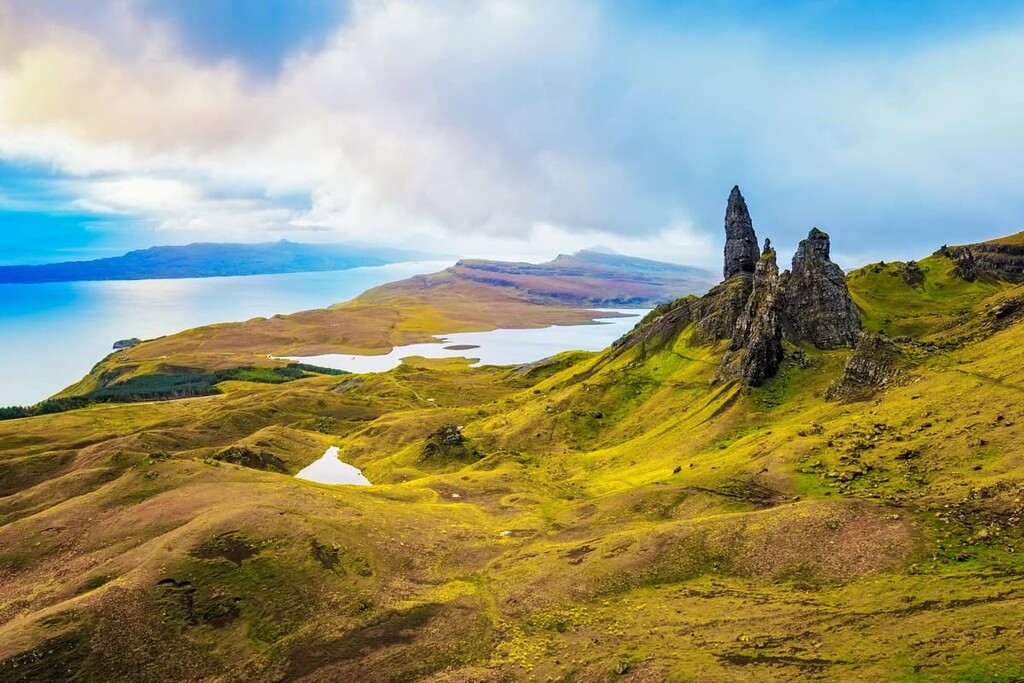
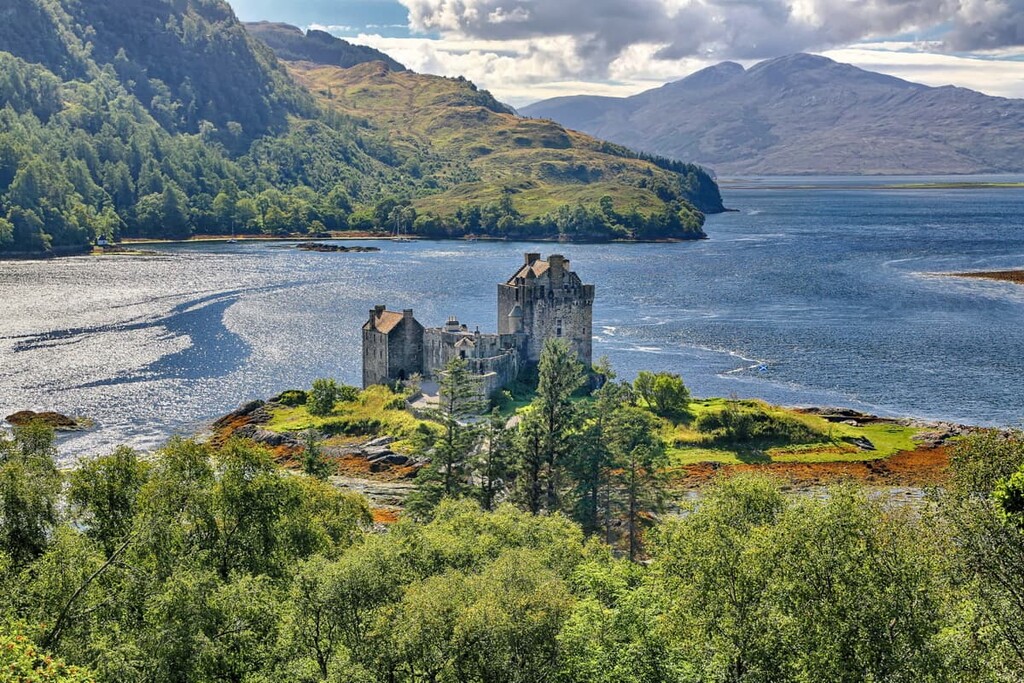
Scotland's second-largest island, the Isle of Skye (An t-Eilean Sgitheanach), is notable for being home to the Cuillin (An Cuiltheann), the largest mountain range not on the Scottish mainland.
The longest river in Scotland is the 120 mi (193 km) long River Tay (Tatha). The UK's seventh-longest river, the River Tay springs from the slopes of Ben Lui (Beinn Laoigh) (1,129 m/3,707 ft) and flows east across the Highlands to the Firth of Tay.
Other significant rivers in Scotland include River Clyde (Abhainn Chluaidh), River Spey (Uisge Spè), River Tweed (Abhainn Thuaidh), and River Dee (Uisge Dhè).
Bodies of freshwater in Scotland are called lochs and lochans. There are thought to be over 31,000 lochs and lochans in Scotland.
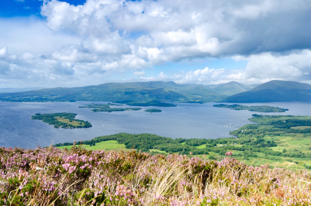
Scotland's largest loch is Loch Lomond (Loch Laomainn), with a surface area of 70 sq km (27 sq mi). Loch Ness (Loch Nis) is the largest lake by volume, with a volume of water nearly double that of all the lakes in England and Wales combined.
Edinburgh (Dùn Èideann) is Scotland's capital, while Glasgow (Glaschu) is the largest city. Other significant cities and towns in Scotland include Aberdeen (Obar Dheathain), Dundee (Dùn Dè), Paisley (Pàislig), and Inverness (Inbhir Nis).
The Highland Boundary Fault significantly influences the geology of Scotland. The Highlands and islands to the north and west of the fault line are composed of rocks uplifted during the Caledonian orogeny roughly 490 to 390 million years ago.
The Caledonian orogeny occurred due to the closure of the Iapetus Ocean and the collision of the continents of Laurentia, Baltica, and Avalonia.
The Highlands and islands are mainly Cambrian and Precambrian ancient rocks over 500 million years old.
The Grampian Mountains, which cover around a third of Scotland, are formed from metamorphic and igneous rocks, including granite, gneiss, quartzite, and marble. Lewisian gneiss, the oldest rock in Scotland, is over 1.7 billion years old. Igneous intrusions are also found in the Skye Cuillins.
South of the Highlands and islands is the Central Lowlands, a rift valley. A rift valley is a type of linear lowland that occurs between highland areas due to a geological rift.
Most of the formations of the Central Lowlands are Paleozoic, with large iron and coal deposits that fuelled Scottish industrialization.
The Central Lowlands were also subjected to intense volcanic activity, with Arthur's Seat (Suidhe Artair) (251 m/823 ft) in Edinburgh the remnants of a large volcano. Despite their name, the Central Lowlands aren't flat and feature several hill ranges, including the Pentland Hills, Ochils, and Campsie Fells.
Scotland's southernmost geographical region, the Southern Uplands, is a 120 mi (200 km) range of hills that sit south of a second fault line between Ballantrae and Dunbar.
They're composed of Silurian sedimentary deposits from the 420-million-year-old Iapetus Ocean and formed due to the collision of Laurentia, Baltica, and Avalonia. The Southern Uplands contain several hill ranges, like the Galloway Hills, Cheviot Hills, and Manor Hills.
Much of Scotland's modern landscape was shaped by Pleistocene glaciations eroding the country's mountains, hills, and glens into their current form.
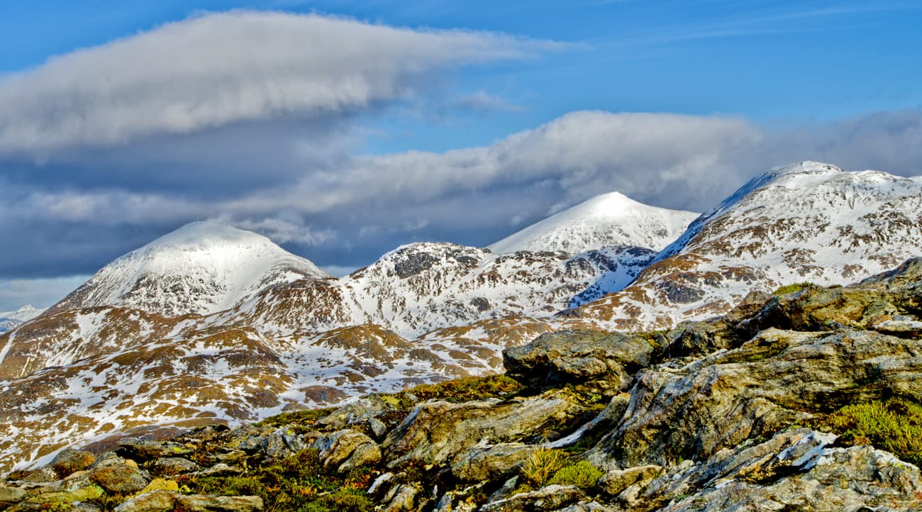
Today, Scotland is by far the most mountainous country in the UK. It's home to many of Great Britain's highest summits like Ben Macdui (Beinn MacDuibh) (1,309 m/4,295 ft), Braeriach (Am Bràigh Riabhach) (1,296 m/4,252 ft), and Ben Lawers (Beinn Labhair) (1,214 m/3,982 ft).
Boasting some of the wildest areas of the UK, Scotland is the perfect place to reconnect with nature. Read on to learn about Scotland’s wildlife.
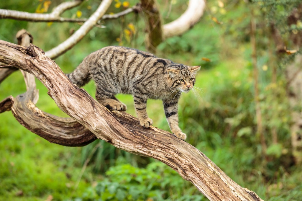
Scotland is home to 62 mammal species, including the critically endangered Scottish wildcat and native domesticated mammals like Highland cattle and Shetland ponies.
Thirteen of Scotland's 62 mammal species are aquatic, including gray seals, harbor porpoises, and the world's most northerly colony of bottlenose dolphins.
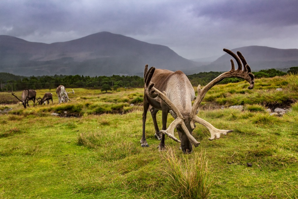
Other notable mammals in Scotland include red deer, red squirrels, pine martens, and mountain hares.
Over 250 bird species live in Scotland. The Scottish crossbill is Britain's only endemic bird and, with only 300 breeding pairs, is one of the rarest birds in Europe.
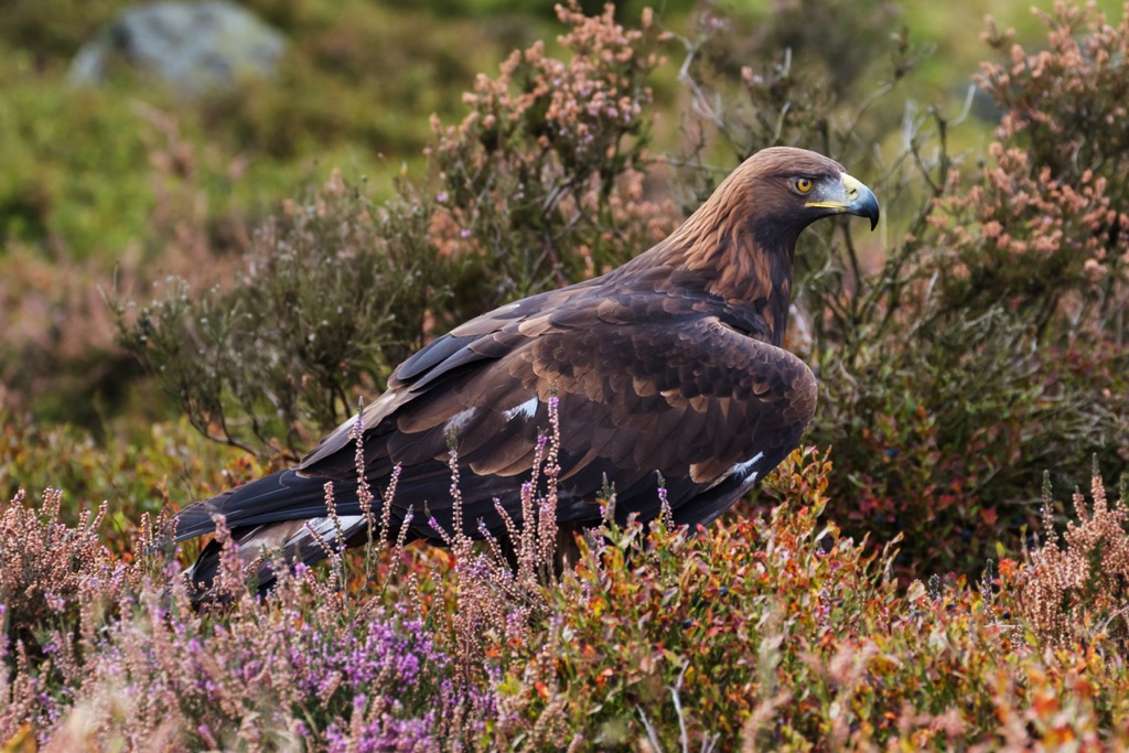
Many raptor species are found in Scotland, including almost the entirety of Britain's golden eagle and peregrine falcon populations. Grouses and game birds like western capercaillies and ptarmigans breed in Scotland and aren't found anywhere else in Great Britain.
Internationally significant populations of several seabird species live in the coastal areas of Scotland. Around half of the world's northern gannets and a third of all Manx shearwaters nest in Scotland.
Other notable bird species in Scotland include hooded crows, red grouse, ospreys, great skuas, and corncrakes.
Scotland's temperate climate means only a handful of reptile and amphibian species inhabit the country. Scotland has four land reptile species: adders, grass snakes, slowworms, and common lizards. Six amphibian species call Scotland home, most notably the great crested newt, of which there are only around 1,000 individuals.
An estimated 14,000 insect species inhabit Scotland, including several rare species like the Scottish ant and the Pardosa lugubris wolf spider. While rare in other parts of the UK, neither of these species are truly endemic to Scotland.
Scotland's most infamous insect is the highland midge, a biting gnat that plagues visitors in late spring and late summer. Other notable insects in Scotland include pine weevils, pearl-bordered fritillaries, Blaeberry bumblebees, and long-horned beetles.
Scotland has an abundance of freshwater fish, with 42 recorded species, such as Atlantic salmon, brown trout, allis shad, Haddy charr, and northern pike.
Around 1,600 vascular plant species grow in Scotland, which is considered low compared to countries worldwide.
A few endemic plant species can be found in Scotland, like the Shetland mouse-ear, Young's helleborine, and the Scottish primrose. Additionally, there are also several rare species like the mountain bearberry, creeping lady's tresses, and twinflowers.
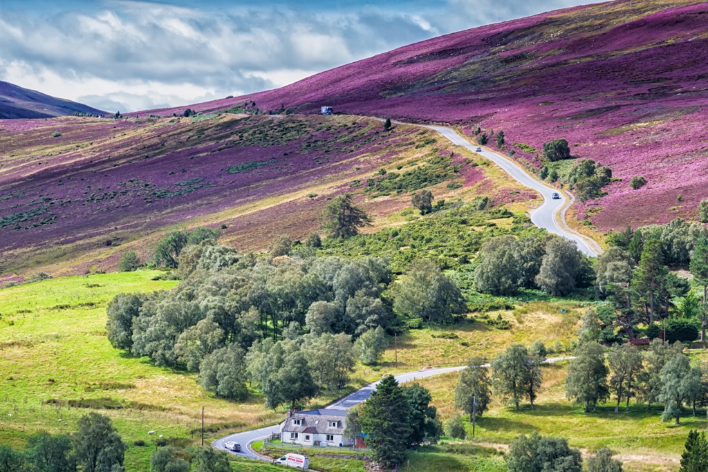
Scotland's extensive heather moorlands boast an array of plant species, such as bell heather, ling, and bog myrtle. Meanwhile, mountain aven, Alpine pearlwort, and mossy cyphel are prevalent on the cliffs and mountain sides.
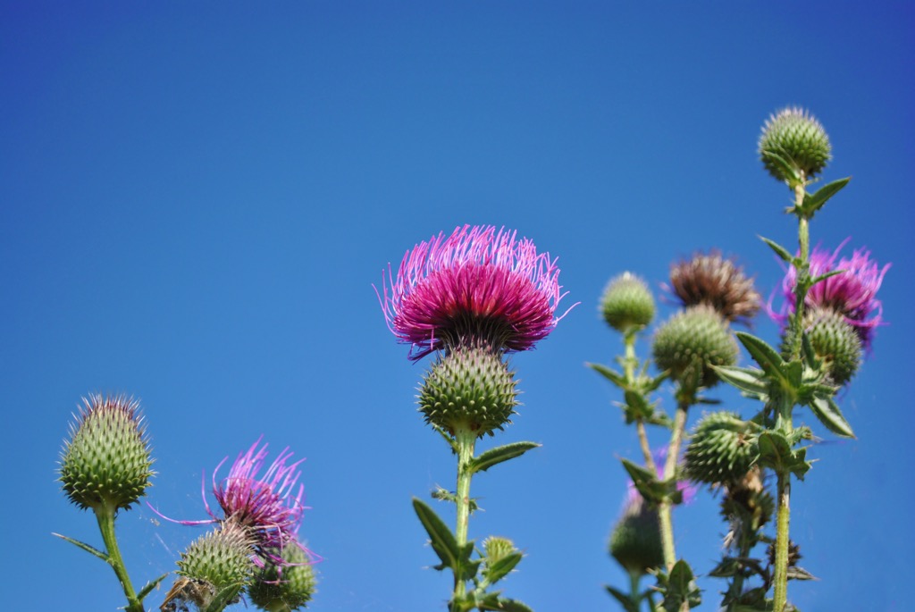
The thistle is the national flower of Scotland. Other common flowering plants in Scotland include bluebells, cuckoo flowers, dwarf cornels, and moss campions.
Approximately 18 percent of Scotland is forested. Thirty-one deciduous trees and conifers grow across Scotland, the most common of which are Scots pines, birches, alders, oaks, and ashes.
It's believed Scotland is home to the oldest tree in the UK. The Fortingall Yew in Perthshire is estimated to be between 2,000 and 3,000 years old.
Humans have inhabited Scotland since around 12,000 BCE, with possible evidence of pre-Ice Age axes found on the island of Orkney. Read on to learn about the history of Scotland.
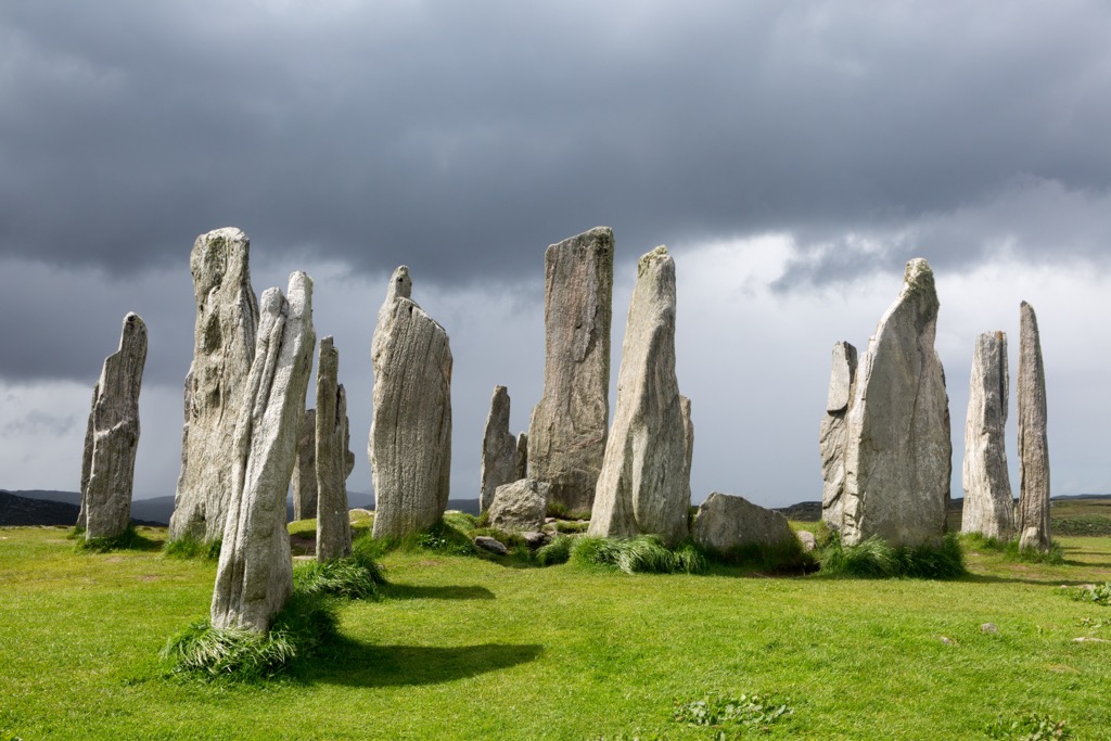
The earliest Neolithic farmsteads in Scotland date back around 5,500 years. The most common archeological sites from the Bronze Age are cairns and the remnants of megalithic structures. By 2,000 BCE, the first hillforts in Scotland were erected. Archeologists have identified over 1,000 hill forts across Scotland dating back to the Iron Age.
The Roman Empire invaded Scotland in the 1st century CE, extending the province of Britannia from Hadrian's Wall to the turf-built Antonine Wall, which stretches across Scotland's Central Belt from the Firth of Clyde to the Firth of Forth.
The area north of Antonine Wall called Caledonia was inhabited by the Picts, a formation of tribes descended from the Caledonii. A Picts uprising and subsequent battles eventually forced the Romans back to Hadrian's Wall.
Following the Roman withdrawal from Britain, the Gaels began colonizing and raiding the western coast of Scotland. The Latin name for Gaels, Scoti, is where modern Scotland gets its name. They formed the Gaelic kingdom of Dál Riata in the sixth century.
In the seventh century, Irish-Scots missionaries visited the Pictish Kingdom of Fortriu on the east coast, converting them from paganism to Celtic Christianity.
Over the following centuries, the Pictish and Gaels slowly merged, with the Picts adopting the Gaelic language and customs. This was partly due to the start of Viking invasions in the eighth century, which caused the two crowns to put aside their differences and unite as the Kingdom of Alba under the House of Alpin.
The House of Alpin ruled Scotland from the ninth to the eleventh centuries, ending with Malcolm II dying in 1034 without a male heir. Control of Scotland passed to the House of Dunkeld, which also collapsed due to a lack of heir in 1286.
England took advantage of Scottish succession problems, resulting in the Wars of Scottish Independence. Scotland's eventual victory cemented its sovereignty.
From the fourteenth to the seventeenth century, the House of Stuarts ruled Scotland. The House of Stuarts’ King James VI, inherited the English crown in 1603 due to being the great-great-grandson of Henry VII.
Becoming James I of England, subsequent Stuart kings and queens ruled both England and Scotland independently until the establishment of the Kingdom of Great Britain under the Acts of Union in 1707. The House of Stuart ruled until 1714, following the death of Queen Anne.
The establishment of Great Britain and the crowning of Hanoverian King George I of Great Britain led to the rise of Jacobitism, an attempt to restore the House of Stuart to the monarchy. However, several failed uprisings by Charles Edward Stuart and the death of his brother Henry, Cardinal of York ended Jacobitism.
The collapse of the Scottish clan system in the mid-eighteenth century was followed by the Scottish Enlightenment and the start of industrialization. The rise of academics like David Hume and Adam Smith led to the development of modern Scottish economics and philosophy.
By the start of the nineteenth century, Scotland had developed into an industrial powerhouse, with its population quickly growing by nearly 3 million in under 100 years. However, due to insufficient jobs, over 2.7 million Scots emigrated either to Canada, Australia, or England between 1840 and 1930.
Scotland was instrumental in the First World War, manufacturing everything from artillery shells to horseshoes. Over 650,000 Scots fought in the First World War. Scotland was also important in the second World War, with a vital naval base on Orkney.
The rise in Scottish nationalism since the Second World War and the formation of the Scottish National party (SNP) in the 1970s culminated in Scottish devolution in 1998. However, Scotland voted against independence in a 2014 referendum by 55 percent to 45 percent.
Today, Scotland is an economically and culturally diverse country famed for its rugged landscape, historic cities, and well-preserved traditions.
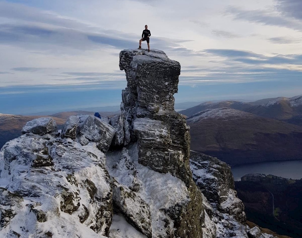
Scotland is one of the best hill bagging locations in the UK. It's famous for its Munros — Scottish mountains with a height of over 914.4 m (3000 ft). They take their name from Sir Hugh Munro, 4th Baronet, who compiled a list of hills entitled Munro's Tables in 1891.
As of December 2020, the Scottish Mountaineering Club (SMC) lists 282 Munros and 226 Munro Tops. Munro bagging is an activity unique to Scotland that involves scaling every Munro. Only around 7,400 people have completed this feat.
There are several other names for peaks of different heights:
Hiking in Scotland is potentially dangerous — many mountains and hills, especially in the Northwest Highlands, are very isolated.
When hiking in Scotland, ensure you bring topographic maps, appropriate hiking gear, and plenty of food and water. Check weather forecasts and route closures. Map out your route carefully and inform others of your itinerary.
Read on to learn about some of the best hikes in Scotland.
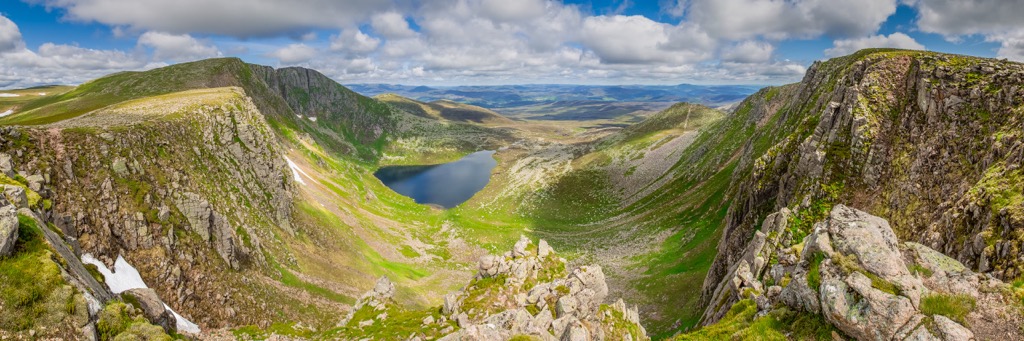
Cairngorms National Park is the largest national park in the UK, encompassing an area of 4,528 sq km (1,748 sq mi). It's located approximately 127 mi (204 km) north of Edinburgh.
Cairngorms National Park centers around the Cairngorms (Am Monadh Ruadh) range within the Grampian Mountains. The range takes its name from Cairn Gorm (1,245 m/4,084 ft), the sixth-highest mountain in the UK.
The park boasts many of Britain's highest mountains — one-third of land in the UK above 600 m (1,968 ft) is within the Cairngorms. In addition, roughly a quarter of Scotland's native forest is within Cairngorms National Park. There are 55 Munros in Cairngorms National Park.
Due to low temperatures and high wind speeds, hikers should take care when exploring Cairngorms National Park, especially on the Cairngorms Plateau.
One of the best Munro bagging hikes in Cairngorms is the circular route across the summits of Ben Macdui (1,309 m/4,295 ft) and Cairn Gorm. The trail starts and ends at the Cairngorms Ski Centre car park.
You'll start by climbing one of Scotland's most famous summits, Cairn Gorm, before scaling the UK's second-highest mountain, Ben Macdui.
Along the way, you'll have stunning views of Cairn Toul (1,291 m/4,236 ft) and Braeriach (1,296 m/4,252 ft) from the Lairig Ghru (Làirig Dhrù) mountain pass and panoramas of Rothiemurchus Forest from Ben Macdui. This looped trail is roughly 11 mi (17.5 km).
Or, walk in the footsteps of legendary poet Lord Byron by bagging Lochnagar (Beinn Chìochan) (1,156 m/3,793 ft). Described in the poem Lachin y Gair, Lochnagar is famed for its dramatic north-facing corrie. Lochnagar is also a mountain fit for royalty — it was once climbed by Queen Victoria.
The most common ascent of Lochnagar is from the car park at Spittal in Glen Muick. Lochnagar's true summit, Cac Càrn Beag, affords amazing views of Deeside and the Cairngorms. The best descent is via Glas Allt glen and the Royal Lodge of Glas-allt-Shiel. The walk is approximately 11.75 (19 mi) in length.
Other popular mountains worth bagging in Cairngorms National Park include Bynack More (1,090 m/3,576 ft), The Cairnwell (932 m/3,061 ft, Braeriach (1,296 m/4,252 ft), and Sgor Gaoith (1,118 m/3,668 ft).
Loch Lomond and the Trossachs National Park was the first of Scotland's two national parks. The park is located just north of the Central Belt, with roughly 50 percent of Scotland's population living within 60 mi (96 km) of the park. It covers an area of approximately 720 sq mi (1,865 sq km) and is the UK's fourth-largest national park.
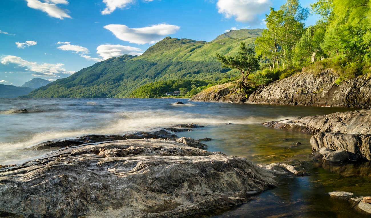
The park's main feature is Loch Lomond, the largest loch in Scotland by surface area. To the east of Loch Lomond is a collection of woodland glens and lochs called the Trossachs. The park also contains the Highlands mountains of the Breadalbane region, including 21 Munros and 19 Corbetts.
One of the best ways to see Scotland's largest loch is from its most southerly Munro, Ben Lomond (974 m/3,196 ft). Due to the view it provides of Loch Lomond and its remarkable eastern corrie, Ben Lomond is one of the most popular Munros.
The easiest way to climb Ben Lomond is from the Rowardennan car park. The walk starts in oak woodlands before weaving gradually uphill, with Ben Lomond's summit cone coming into view on the mountain's shoulder.
The views of the islands in Loch Lomond grow ever more impressive the higher your climb. You'll also see the Arrochar Alps to the west of the loch. This walk is approximately 7.5 mi (12 km).
You should also consider climbing the highest mountain in Loch Lomond and the Trossachs National Park, Ben More (Beinn Mhòr) (1,174 m/3,851 ft). With its conical summit and steep slopes, Ben More is a strenuous but rewarding climb. It's usually climbed along with its neighbor, Stob Binnein (1,174 m/3,822 ft).
You can bag these two Munros by following the path from Ben More Farm on the A85 road. You can park safely along the road or in the layby at the west end of Loch Iubhair. You'll find a wooden sign for 'Ben More' along the A85, which signifies the start of the path.
Pay close attention when hiking around the dangerous Sloc Curraidh corrie, which is prone to avalanches. From the summit cairn, you'll be able to spot Ben Lawers (1,214 m/3,982 ft) beyond Loch Tay and Ben Lui (Beinn Laoigh) (1,129 m/3,707 ft) to the west.
Finally you'll climb south across a bealach to Stob Binnein. There are a few ways to descend, but returning the way you came over Ben More is the easiest. This walk is approximately 7.5 mi (12 km) in length.
Other popular mountains worth bagging in Loch Lomond and the Trossachs National Park include The Cobbler (Beinn Artair) (884 m/2,900 ft), Ben Lui, and Ben Vorlich (Beinn Mhùrlaig) (943 m/3,094 ft).
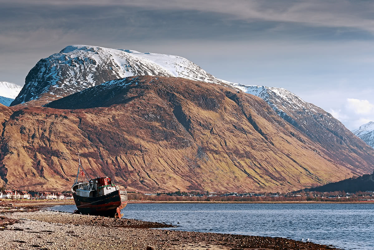
Ben Nevis is located at the western end of the Grampian Mountains near the town of Fort Williams. As well as being the highest mountain in Great Britain, "The Ben" is the highest summit in any direction for 459 mi (739 km). The next closest point higher than Ben Nevis is in Norway’s Scandinavian Mountains.
Ben Nevis is the most iconic Scottish mountain, with over 125,000 people bagging Britain's highest summit annually. Plus, Ben Nevis is home to some of the highest cliffs in the UK with its 600 m (2,000 ft) high north face. It's one of the best scrambling and ice-climbing locations in the country.
Most hikers that scale Ben Nevis follow the Mountain Track (Pony Track). Despite being referred to as the tourist path, the Mountain Track is an arduous trek. Ensure you bring the correct equipment and carefully map your route when climbing Ben Nevis.
You can pick up the Mountain Track from the Glen Nevis Visitor Centre. Along the path, you'll pass over the plateau containing Lochan Meall an t-Suidhe at around the halfway point.
An old meteorological observatory, a trig point, and several cairns mark the summit of Ben Nevis. The views from atop Ben Nevis stretch across most of the Highlands, with Northern Ireland visible in the distance.
You descend the way you came, taking great care around Gardyloo Gully and Five Finger Gully, which have been the sites of many fatalities. The Mountain Track is approximately 10.5 mi (17 km) in length.
The finest but most challenging way to experience Ben Nevis is along the Càrn Mòr Dearg Arête. This route is only suitable for experienced hikers with a head for heights. The path starts from the North Face car park near Torlundy.
This route involves traversing Càrn Mòr Dearg (1,220 m/4,006 ft), the ninth-highest mountain in Great Britain.
Càrn Mòr Dearg's knife-edge arête that leads to Ben Nevis is tricky to navigate and requires some scrambling. But, it affords the best views of Ben Nevis' sublime north face. The Càrn Mòr Dearg Arête walk is approximately 11 mi (17.5 km) in length.
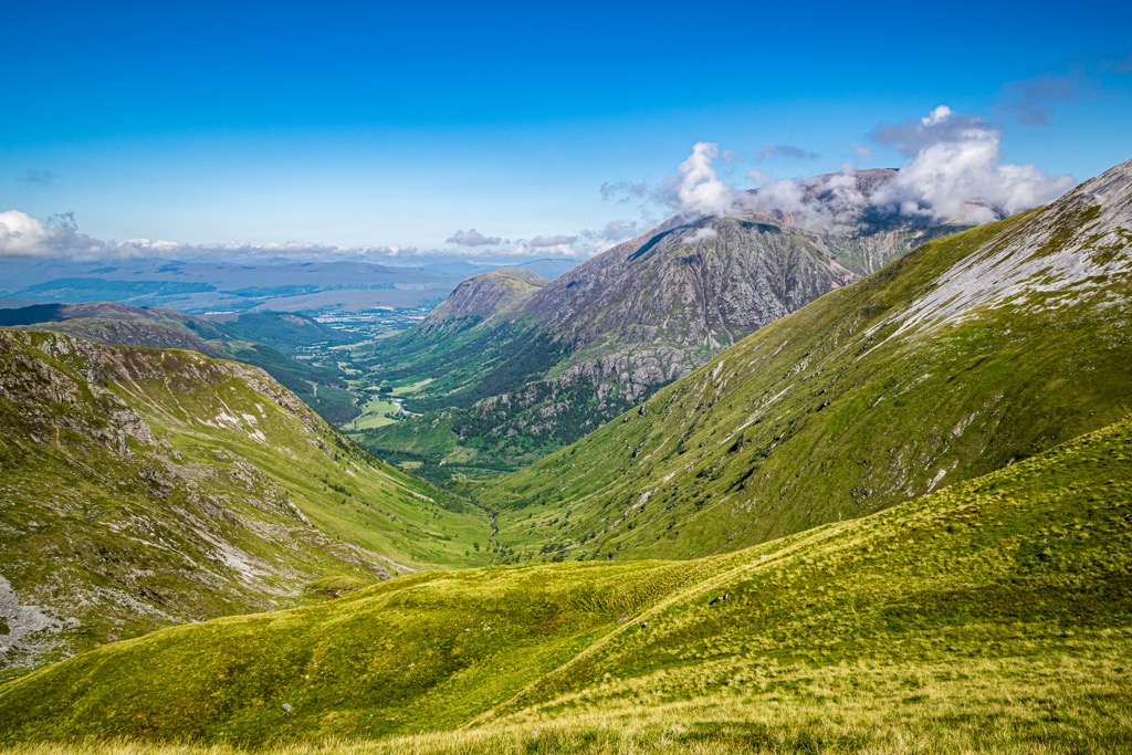
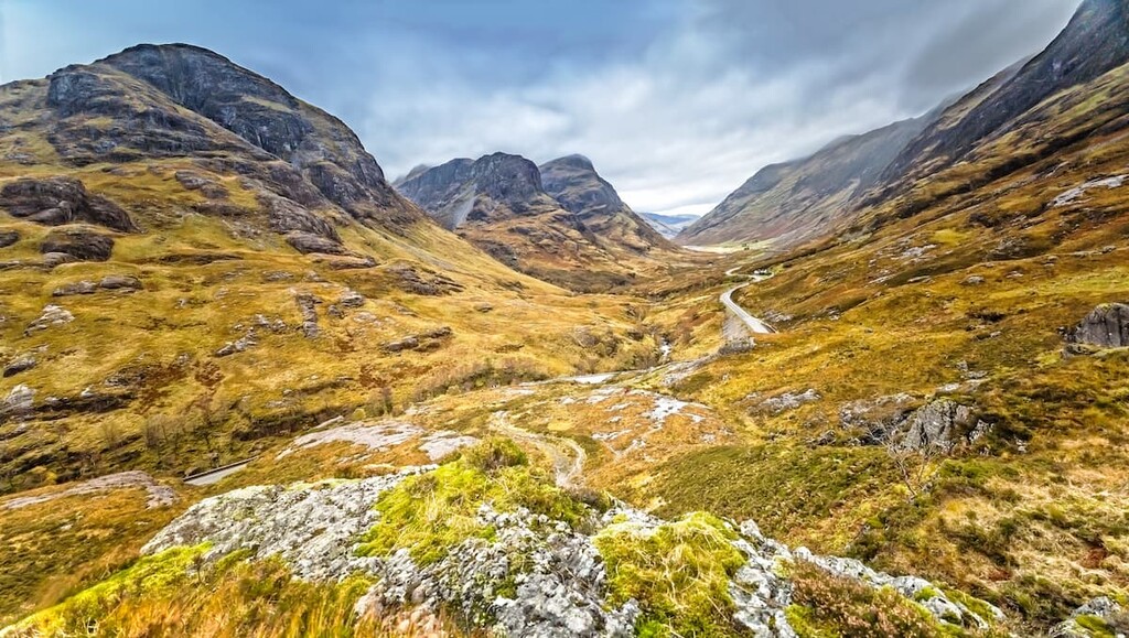
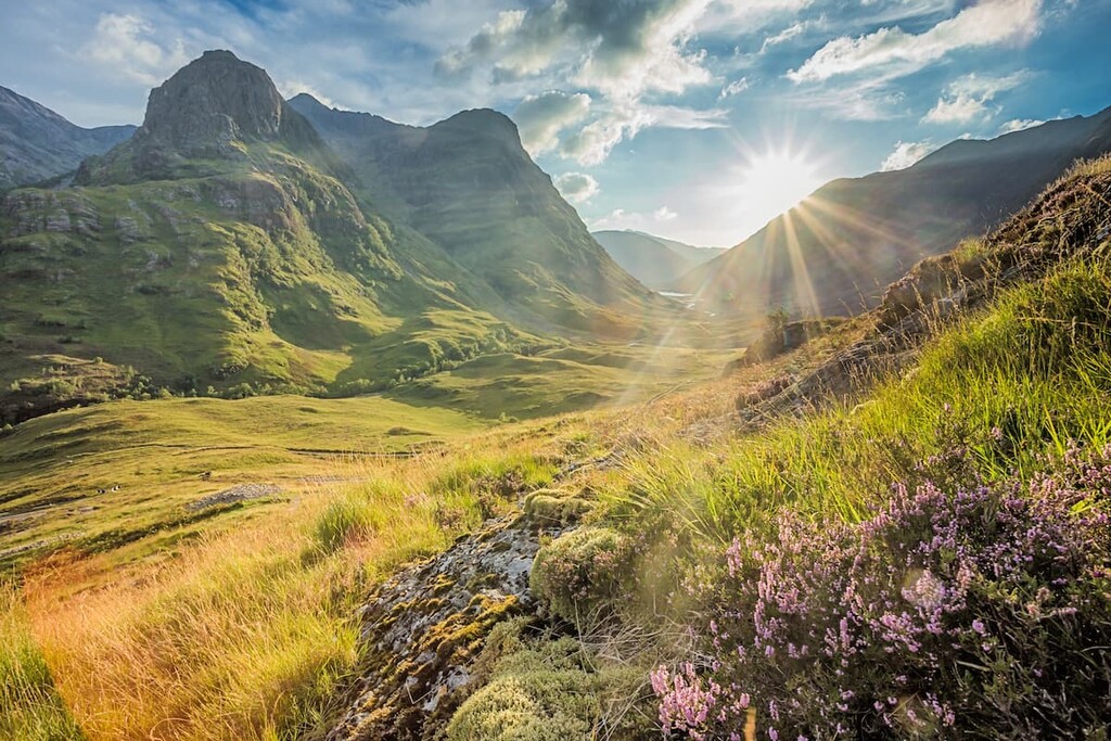
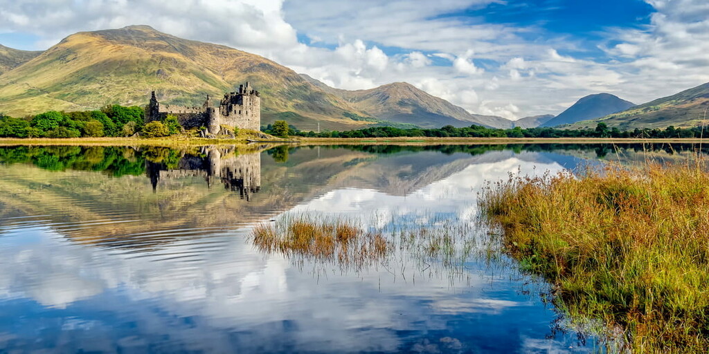
Glen Coe (Gleann Comhann) is considered the birthplace of Scottish hillwalking and mountaineering. It's one of the most picturesque areas of the Scottish Highlands, with its U-shaped valley and sublime mountains. Glen Coe is also hugely historic and was the site of the Massacre of Glencoe in 1692.
Glencoe National Nature Reserve is home to several of Scotland's most famous mountains, like Buachaille Etive Mòr (1,021 m/3,349 ft).
Sitting on the eastern edge of Glen Etive, Buachaille Etive Mòr is famous as it often features on tourism brochures and postcards due to its distinctive pyramidal shape. Buachaille Etive Mòr comprises four main peaks, the highest of which is Stob Dearg.
The best way to scale this iconic mountain is from the large layby at Altnafeadh. During the ascent up Coire na Tulaich, you'll be treated to excellent views of Buachaille Etive Mòr's sister, Buachaille Etive Beag (958 m/3,143 ft).
The summit of Stob Dearg is marked with a cairn. Panoramas from atop Buachaille Etive Mòr are among the best in Glen Coe, with the mountain's rugged cliffs towering over the barren Rannoch Moor.
The trail then continues onto Buachaille Etive Mòr's other summits in this order: Stob na Doire (1,010 m/3,313 ft), Stob Coire Altruim (941 m/3,087 ft), and Stob na Broige (956 m/3,136 ft).
To descend, return to the bealach before Stob na Doire and follow the path through Lairig Gartain. This walk is approximately 8 mi (13 km) in length.
Another unmissable walk in Glencoe National Nature Reserve is up Bidean nam Bian (1,150 m/3,773 ft). Bidean nam Bian is the highest mountain in Glen Coe and consists of three ridges known as The Three Sisters: Beinn Fhada (1,032 m/3,385 ft), Geàrr Aonach (755 m/2,477ft), and Aonach Dubh (888 m/2,913 ft).
One of the best ways to scale Bidean nam Bian is from the Three Sisters car park midway up Glen Coe. The trail leads over several subsidiary peaks starting with Stob Coire nan Lochan (1,115 m/3,658 ft).
From atop Bidean nam Bian, you'll be able to spot Ben Nevis beyond Aonach Eagach (991 m/3,251 ft) and the Isle of Mull. The trail then continues onto Stob Coire Sgreamhach (1,072 m/3,517 ft), which is classified as a Munro in its own right. From here, there are exquisite views of Buachaille Etive Beag and Buachaille Etive Mòr.
The descent from Bidean nam Bian heads north into Coire Gabhail and through the "Lost Valley." This walk is approximately 6.75 mi (10 km) in length.
Other popular mountains worth scaling in Glencoe National Nature Reserve include The Pap of Glencoe (Sgorr na Cìche) (741 m/2,434 ft) and Aonach Eagach.
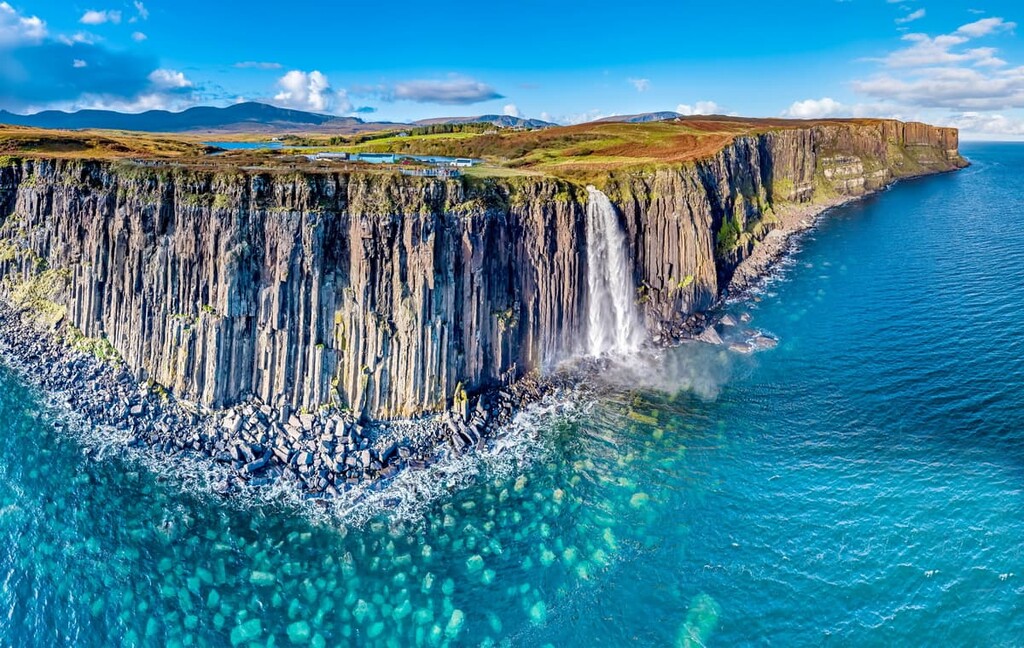
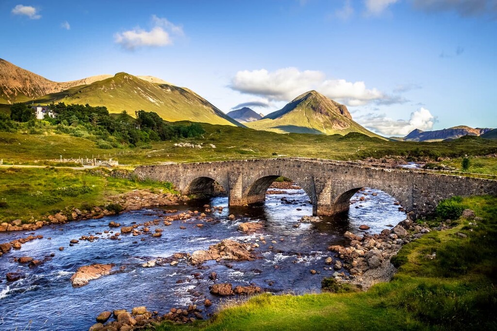
The Isle of Skye's Cuillin range is the best mountain hiking destination on any Scottish island and one of the most popular areas of the Northwest Highlands. The Cuillin is split into Red Cuillin and Black Cuillin by Glen Sligachan.
This rough gabbro range is famed for its unique coloration and jagged ridges. There are 20 Munros in the Cuillin, 11 of which belong to the Black Cuillin ridge. The Black Cuillin contains the highest mountain on any UK island, Sgùrr Alasdair (992 m/3,254 ft).
Sgùrr Alasdair is a challenging hike that includes a long trek up a scree slope. The easiest way to climb Sgùrr Alasdair is via the Great Stone Chute. You can pick up this trail from near the campsite at the end of Glen Brittle road.
As you gain height, you'll be treated to views of the Isle of Rùm and then the Isle of Eigg (Eige). You should take great care on the Great Stone Chute; helmets are advisable as dislodged stones can fall on climbers.
The views from atop Sgùrr Alasdair are impressive, with The Inaccessible Pinnacle ( (986 m/3,234 ft) visible across Coire Lagan. The easiest descent is back the way you came down the Great Stone Chute. This walk is approximately 6 mi (9.5 km) in length.
You'll find no shortage of sublime mountains in the Cuillin, but one that shouldn't be missed is Blà Bheinn (929 m/3,048 ft). Also known as Blaven, Blà Bheinn is an outlier of the Cuillin ridge. It's one of Scotland's most magnificent mountains, with its breathtaking cauldron of jagged summits.
One of the best routes up Blà Bheinn is from the Blà Bheinn Car Park near Loch Slapin. This tough trek follows a stream before ascending Coire Uaigneich and zigzagging up scree slopes.
The panoramas from Blà Bheinn are among the best in Scotland, with the sea, islands, and mountains visible in all directions. One of the best views from Blà Bheinn is of Glen Sligachan flanked by Sgùrr nan Gillean (964 m/3162 ft) and Marsco (736 m/2,415ft). Blà Bheinn also affords one of the best views of the Cuillin ridge
The best way to descend from Blà Bheinn is to return the way you came. This walk is approximately 5 mi (8 km) in length.
Other popular mountains in the Cuillin include Bruach na Frithe (958 m/3,143 ft), Sgùrr Mhic Choinnich (948 m/3,110 ft), and Sgùrr Dearg (985 m/3,234 ft).
Steeped in history and Gaelic tradition, Scottish cities and towns offer everything from ancient castles to quaint pubs to stunning scenery. Read on to learn about Scotland's main cities in towns.
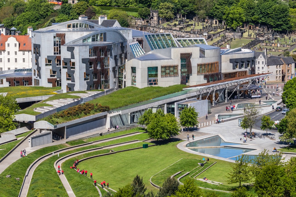
Edinburgh is the compact capital of Scotland, famed for its architectural marvels, world-famous festivals, and vibrant nightlife. It's easy to see why many people consider Edinburgh one of Europe's most beautiful cities as you wander along the cobbled streets of its medieval Old Town.
During your stay in Edinburgh, ensure you climb Arthur's Seat (250 m/823 ft), an impressive hill that overlooks the city. Other popular attractions to check out during your stay in Edinburgh include Edinburgh Castle, the National Museum of Scotland, and the Palace of Holyroodhouse.
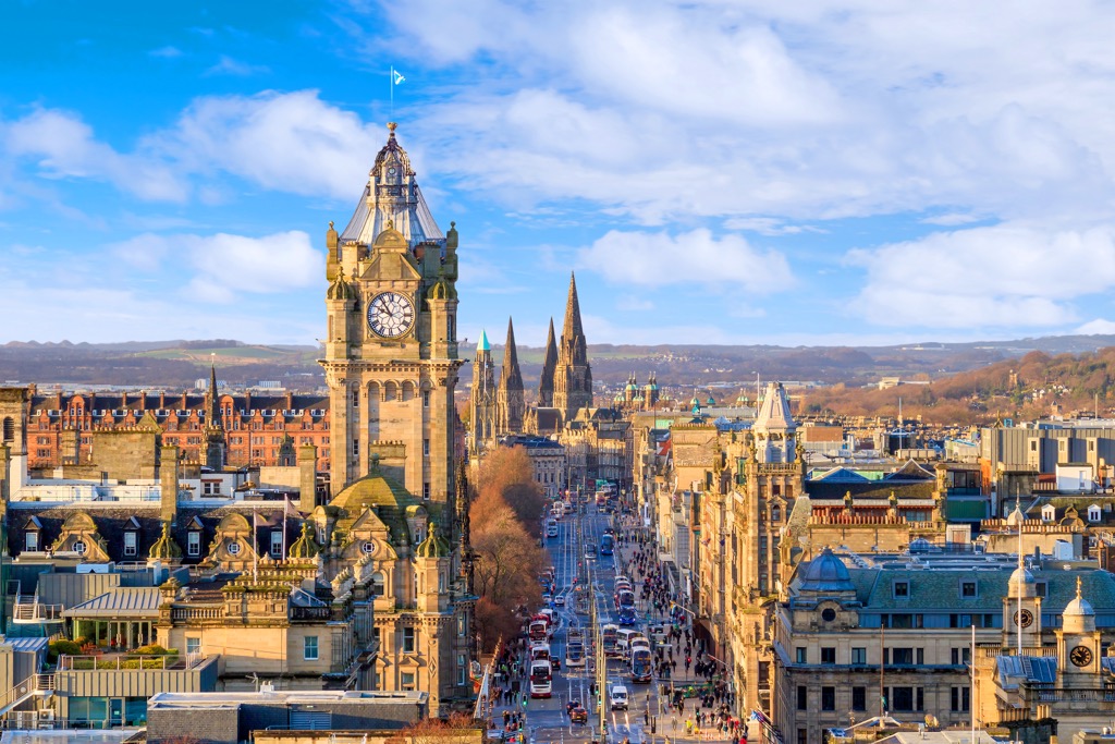
Edinburgh is located 60 mi (96 km) from Loch Lomond and The Trossachs National Park and 80 mi (128 km) from Cairngorms National Park.
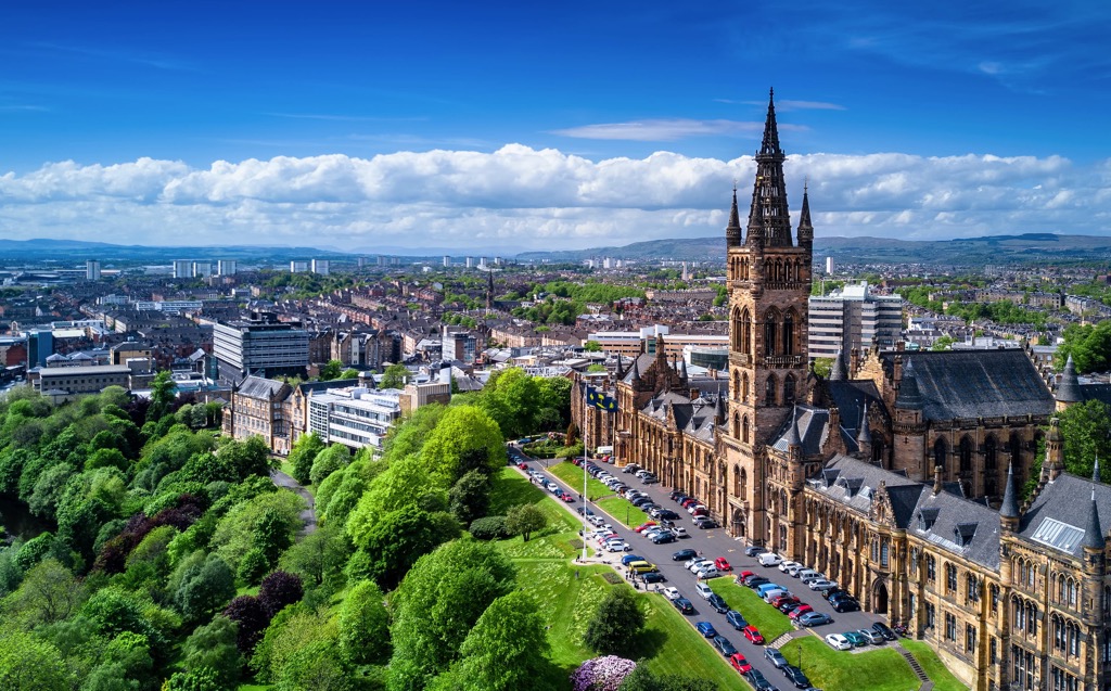
Glasgow is Scotland's largest city and the UK's fourth most populous city. Glasgow is known for its friendly locals, whisky tours, and historic shipbuilding industry.
Like Edinburgh, Glasgow is home to many beautiful buildings, like the twelfth-century Glasgow Cathedral (Cathair-eaglais Ghlaschu) and the Hunterian Art Gallery. Art and history lovers won't miss touring Kelvingrove Art Gallery and Museum, Scotland's most popular free attraction.
Glasgow is located less than 25 mi (40 km) from Loch Lomond and The Trossachs National Park and 20 mi (32 km) from Clyde Muirshiel Regional Park.
Aberdeen is the largest city in Scotland outside of the Central Belt region. Scotland's third city, Aberdeen boasts unique granite architecture and a long sandy coastline.
Often overlooked in favor of Glasgow and Edinburgh, Aberdeen has plenty to offer tourists, including the ninth-century St Machar's Cathedral (Cathair-eaglais Naomh Machar) and the Aberdeen Maritime Museum.
Aberdeen is on the west coast of Scotland, less than 35 mi (56 km) from Cairngorms National Park.
Perched on the eastern shore of Loch Linnhe at the western end of the Great Glen is Fort William (An Gearasdan). Fort William is a major tourist hotspot due to its position near many of Scotland's best hiking destinations.
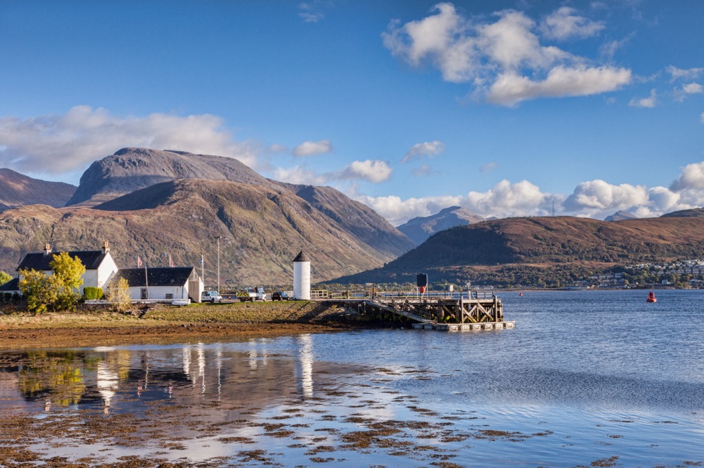
Fort William is within walking distance of Ben Nevis and is less than 20 mi (32 km) from the Glencoe National Nature Reserve. The "Road to the Isles" connects Fort William to the port of Mallaig, which provides ferry services to Skye, Eigg, Mull, and Rùm.
Aside from the local natural beauty, Fort William has some interesting cultural attractions, like the West Highland Museum and the thirteenth-century ruins of Old Inverlochy Castle.
Consider staying in Portree (Port Rìgh) if you're planning a hiking adventure in the Cuillin. Portree is the largest town and capital of the Isle of Skye. It's also the largest settlement on the Inner Hebrides.
Portree is famous for its high percentage of Gaelic speakers — roughly 37 percent of the population speak Gaelic. It's the perfect place to immerse yourself in Gaelic heritage. Portree is located approximately 10 mi (16 km) north of the Cuillin.
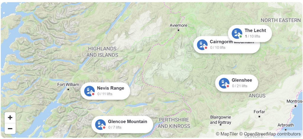
For skiing and snowboarding enthusiasts, there are 5 large ski resorts in Scotland, which are located throughout its territory. On the administrative map of the UK, it is also the country's major ski region.
The largest ski resort in Scotland is Glenshee Ski Resort with more than 40 km (25 mi) of slopes and more than 20 ski lifts in total. Other four major areas for skiing in Scotland with more than 15 km (9 mi) of slopes and more than 10 ski lifts each include the following in descending order of size: Cairngorm Mountain, Glencoe Mountain, Nevis Range, and Lecht.
Given the relatively small size of the region, these are also the main ski resorts to Edinburgh and Glasgow, the two largest cities in Scotland.
Check the Scotland ski resorts map on the larger UK ski resorts map in the World Mountain Lifts section of the site. It includes information about open ski lifts/slopes in Scotland in real-time with opening dates and hours. There are also year-round cable cars, funiculars, cog railways, aerial tramways, and all other types of mountain lifts.


Yes. Scotland has 18,464 named mountains. The highest is Ben Nevis at 1,345 m.
The highest mountain in Scotland is Ben Nevis, at 1,345 m.
Scotland has 18,464 named mountains.


