Scan the QR code and open PeakVisor on your phone
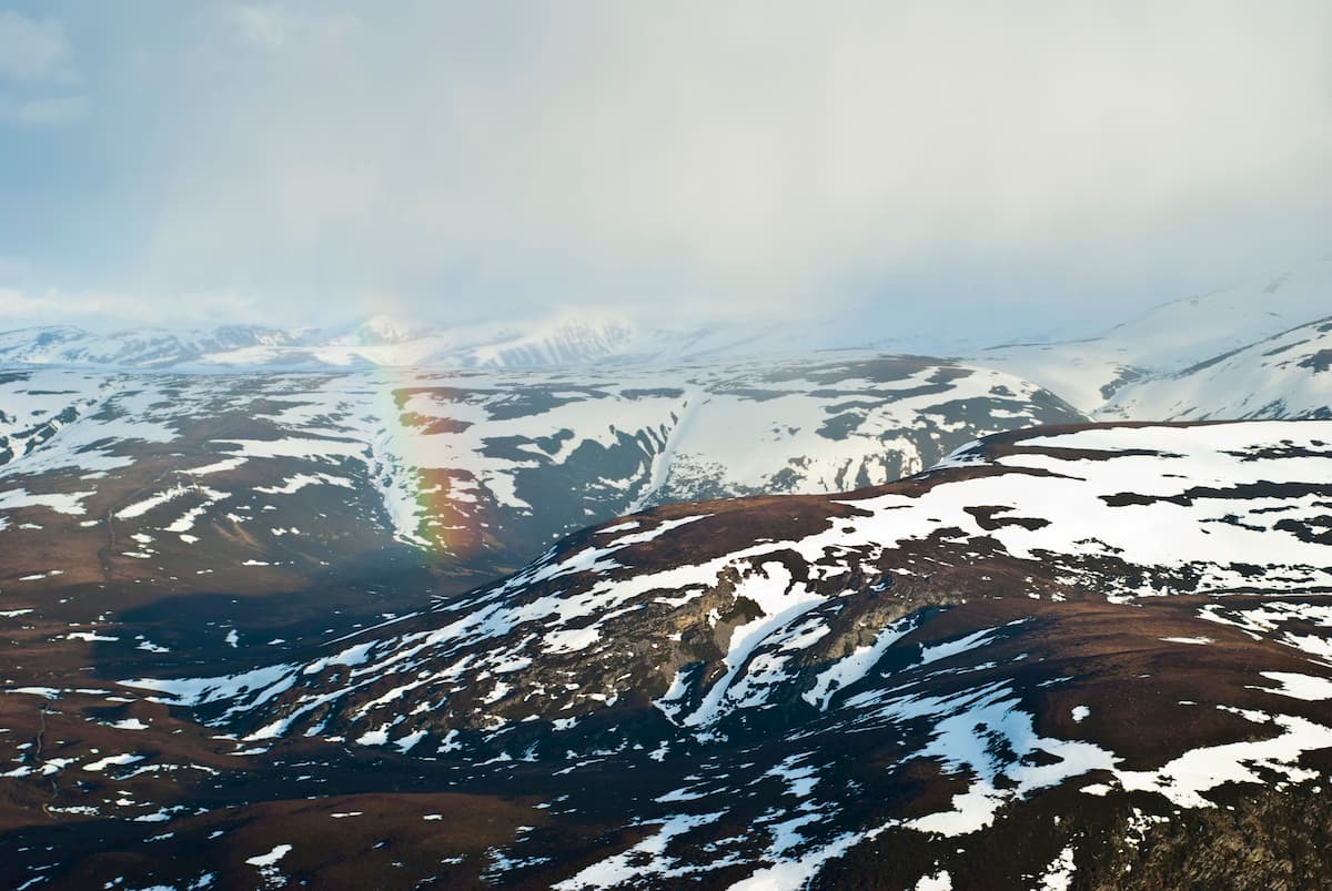
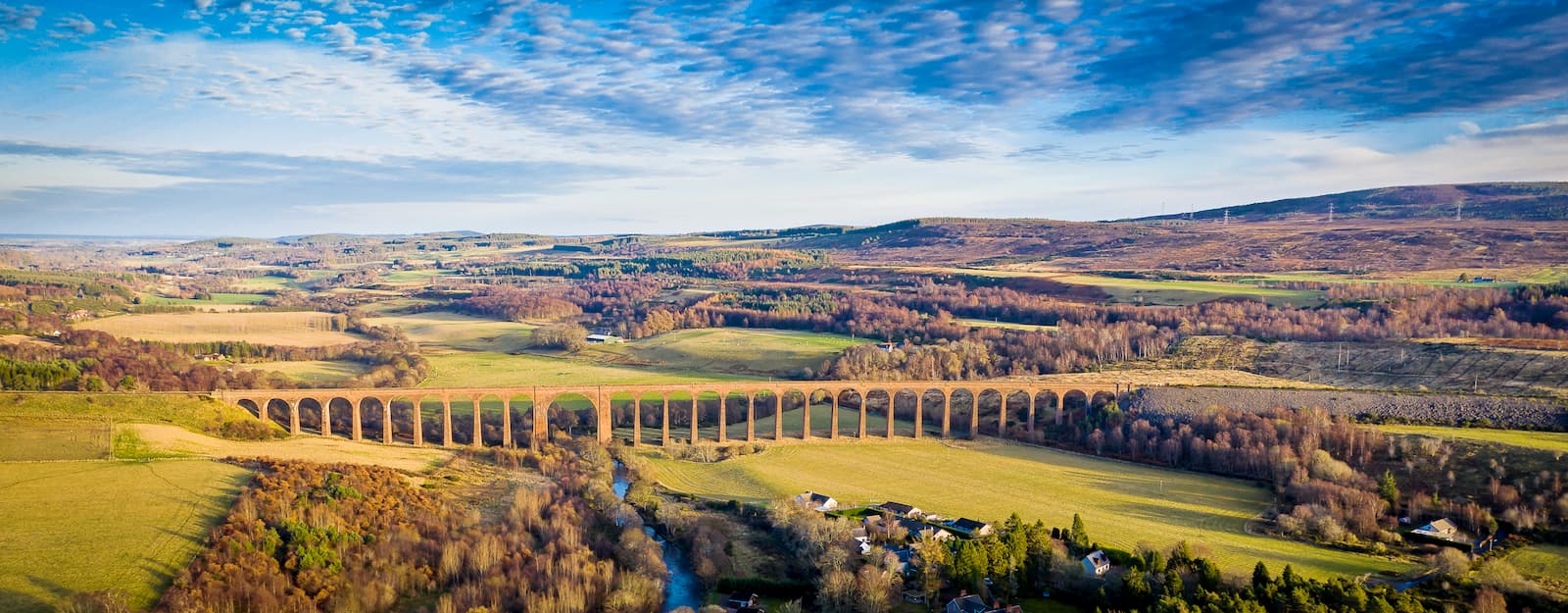
Cairngorms National Park is the largest national park in the UK, covering 1,748 square miles of snow-capped mountains, vast lochs, and dense forests. Located in the northeast of Scotland, Cairngorms National Park spreads through the counties of Aberdeenshire, Angus, Highland, Moray, and Perth and Kinross. It's one of two national parks in Scotland, along with Loch Lomond and The Trossachs National Park.
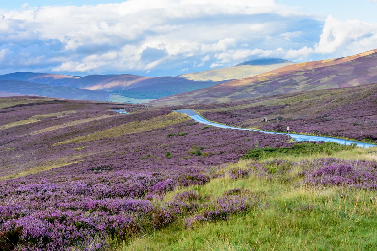
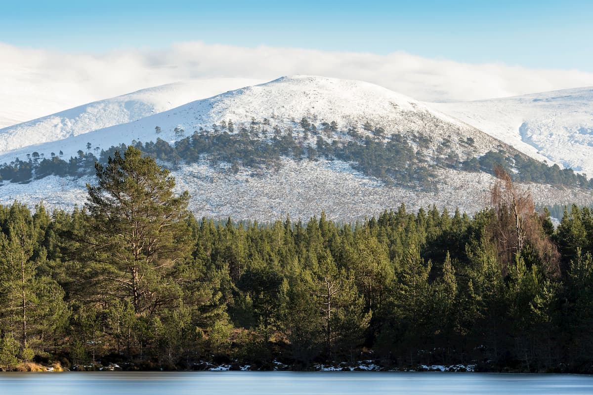
Cairngorms National Park centers around the Cairngorms mountains but also features several other upland areas, including the Monadhliath Mountains and the Five Glens of Angus. The Cairngorms range takes its name from Cairn Gorm (1,244 m), one of Scotland's 282 Munros, and the seventh-highest summit in the UK. It's part of the immense Grampian Mountains, which stretch across the majority of the Scottish Highlands. Cairngorms or Am Monadh Ruadhin Gaelic translates to "red mountains," which originates from the pink and red granite that would've been visible on the mountains following the last Ice Age.
The highest mountain in the Cairngorms National Park is Ben Macdui (1,309 m), which is also the second tallest peak in the UK. Other notable Munros within the Cairngorms mountains include Braeriach (1,296 m) and Cairn Toul (1291 m), the third and fourth-highest mountains in the UK respectively. Due to the Cairngorms range containing many of the highest peaks in Britain, the national park is a hotbed for mountain climbers looking to test their skills on precipitous cliff tops and high-grade scrambles. 55 of Scotland's 282 Munros are located within Cairngorms National Park.
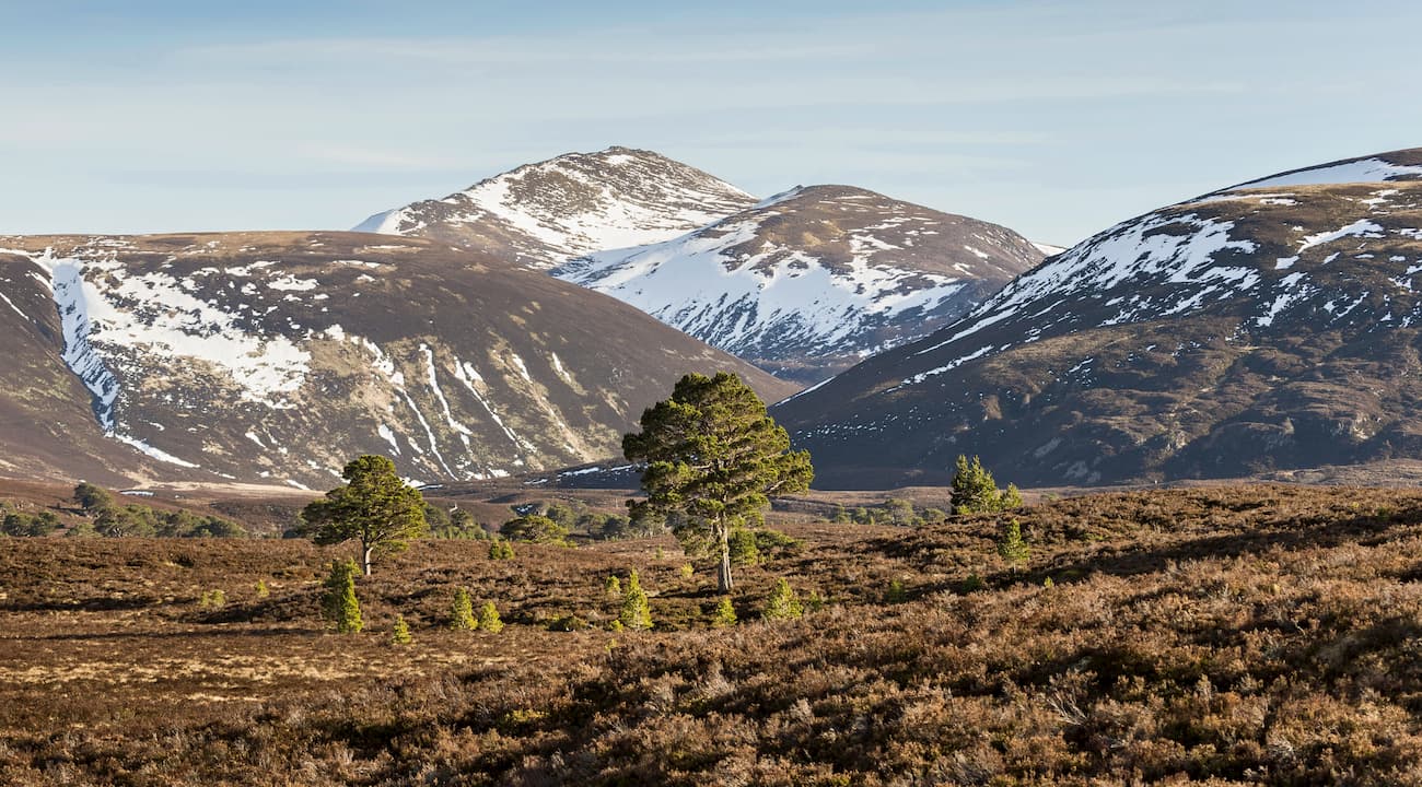
Another significant upland area that skirts the western fringes of Cairngorms National Park is the Monadhliath Mountains. This range differs greatly from the surrounding Scottish Highlands, as the Monadhliath Mountains consist of continuous uplands areas with few prominent peaks. The range features four Munros: Carn Dearg (945 m), A'Chailleach (930 m), Geal Charn (927 m), and Carn Sgulain (918m). These four mountains form an area known as the Spey rim. While these mountains are occasionally visited by hikers, the range's interior is rarely explored.
Read on to find out about some of the best mountain treks and hiking areas in Cairngorms National Park.
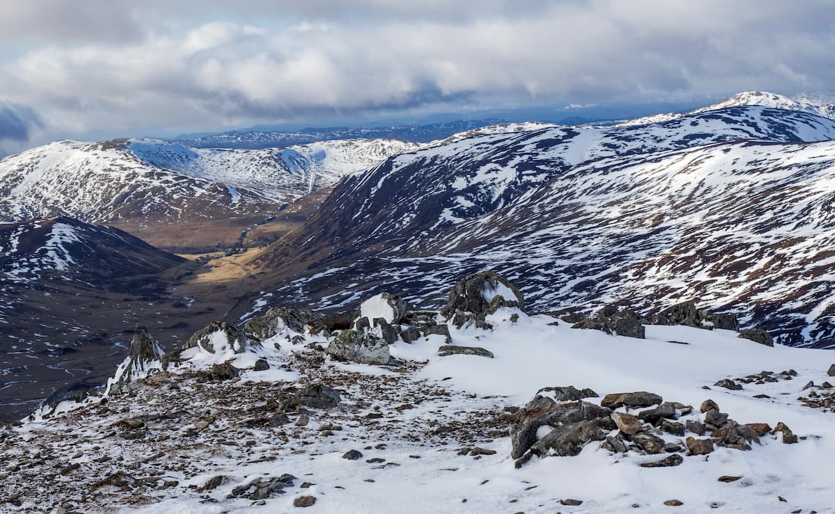
As the second-highest mountain in the UK, Ben Macdui draws climbers from around the world looking to bag the highest peaks of the Scottish Munros. The journey to the summit of Ben Macdui is strenuous and is only suitable for highly experienced hikers. Before setting off, ensure you have all the necessary equipment and thoroughly map out your route. The hike up Ben Macdui is around 11 miles, ascends 932 m, and takes approximately 7 hours.
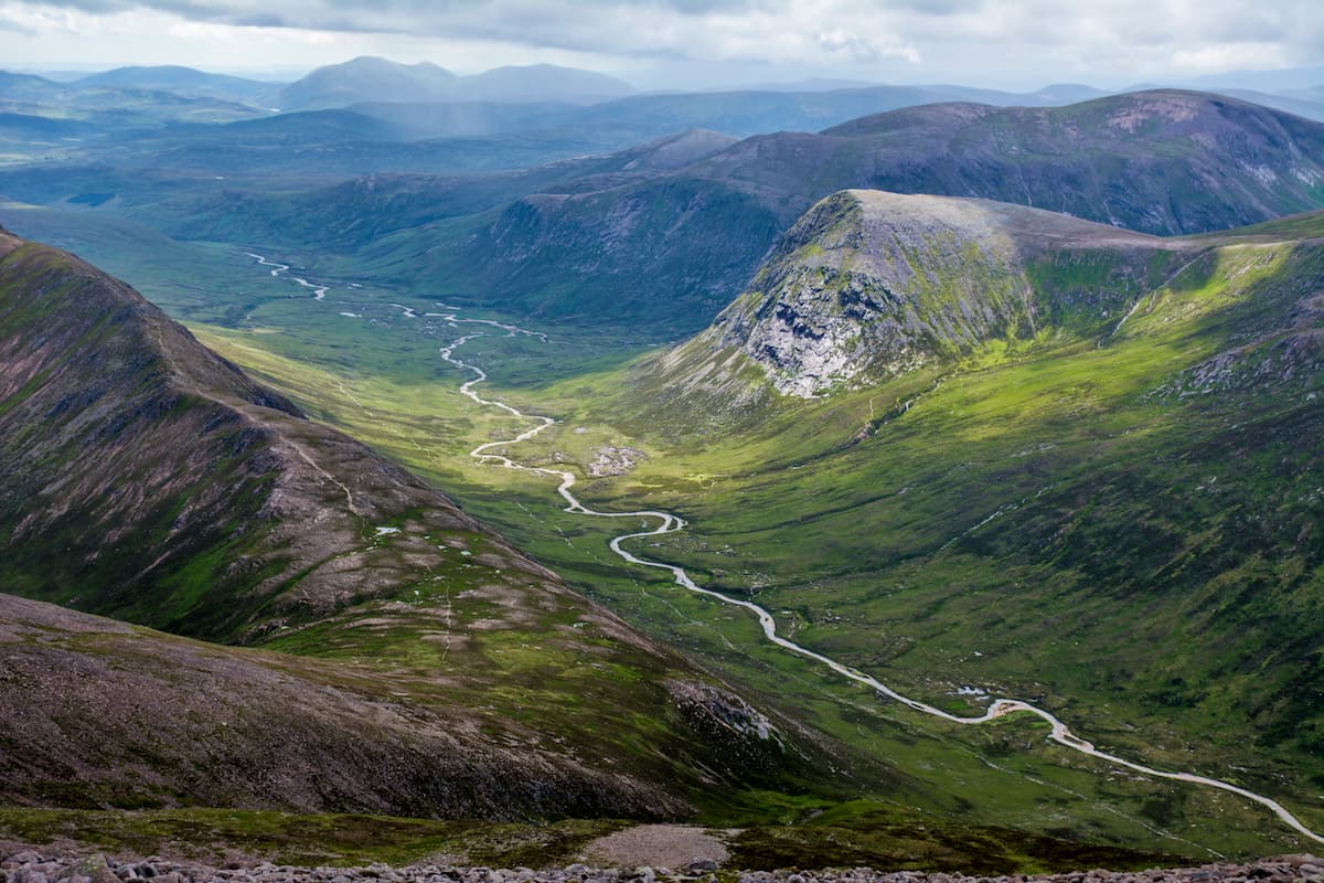
A popular place to start this trek is from the Cairngorm Ski Centre car park. The paths up and down Ben Macdui are easy to navigate; however, the mountain plateau is difficult to cross even in good conditions and can be especially hazardous during heavy snow. If you want to take in the area's sublime corries on the way up Ben Macdui, head west towards Coire an t-Sneachda to begin your ascent. This path will lead you onto the western ridge of Creag an Leth-choin (1,046 m), which provides beautiful views of the lochs and corries below.
From here the path continues through boglands onto the plateau of Cairn Gorm. You'll approach the summit of Ben Macdui from the northern flank. The summit is marked with a large cairn and trig point. From atop Ben Macdui, you'll have stunning views of the surrounding mountain peaks, but not expansive views due to the plateau. A stone indicator points out the direction of viewable mountains. The quickest way to descend Ben Macdui is via the Fiacaill a'Choire Chais ridge towards the Ptarmigan restaurant to the north.
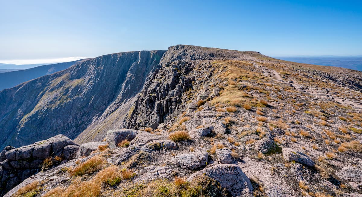
Braeriach is the second highest peak in the Cairngorms and is the highest point in the western massif. Along with Ben Macdui, it was included in the Great Outdoors Britain's 40 Finest Mountains. As with any Munro, you should come with appropriate hiking equipment and carefully plan out your route. As Braeriach is a popular hike, there are a few different trails up the mountain. Like Ben Macdui, the descent down Braeriach becomes much harder after snowfall. The hike up Braeriach is approximately 12 miles there and back, ascends 1,326 meters, and takes 6 to 7 hours.
The most common way of ascending Braeriach is from the Cairngorms Ski Center car park. Head south and cross the bridge over the river and follow the trail to Chalamain Gap. The boulder field in Chalamain Gap is tough to navigate and the ascent becomes very steep from here, so proceed with caution. Descend onto the Lairig Ghru hill pass, before heading in a southerly direction to the summit of Sron na Lairige (1,180 m).
Once you summit Sron na Lairige, you'll be able to spot the peak of Braeriach to the southwest. You'll approach the summit of Braeriach from the west. Braeriach's top offers stunning views of nearby Cairn Toul, as well as the park's serene corries and lochs. This is a there and back trail, so retrace your steps to descend the mountain.
The Cairnwell (935 m) is regarded as one of the easiest Munros to climb and is an excellent way to bag a Munro without exerting yourself. The main reason The Cairnwell is considered the easiest of the Cairngorm Munros is the main trail up the mountain starts at Glenshee Ski Centre, which is 650 meters up the eastern side of the mountain. You'll also get to bag a couple of other Munros during this walk, Carn Aosda (917 m) and Carn a' Gheoidh (975 m). Despite being a relatively leisurely trek, take caution and map out your route, as some trails are badly eroded and hard to follow. The hike up The Cairnwell is 8 miles, ascends 595 meters, and takes approximately 6 hours.
Start by following the trail which leads by Glenshee Ski Centre's ski lift and winter cafe. The tail will fork several times steeply uphill. You'll be aiming for the western ridge of Carn Aosda to begin with, which is marked with a signpost. From the ridge, head directly to the summit of Carn Aosda, which has a cairn as a marker. Retrace your steps along the ridge and head onto the bealach (mountain pass) overlooking Loch Vrotachan. Follow the path up the mountain, before passing by two lochans and onto the summit of Carn nan Sac (919 m). Next, you'll reach the highest point on the walk, Carn a' Gheoidh (975 m), which boasts sublime views of Glas Tulaichean (1,051 m) to the west.
Head back to the bealach, take the opposite direction onto the ridge. You'll know you're on the right track when you pass the top of the chairlift. Soon you'll reach the final summit, The Cairnwell, which is marked with a shelter and satellites. You can descend the mountain by retracing your steps or take a quicker route down the bealach into the corrie, which reconnects with the main trail back to the ski lift and cafe.
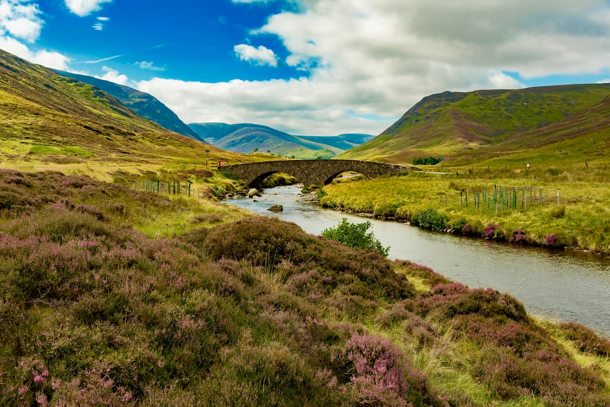
Made famous by Lord Byron, Lochnagar (1,155 m) has become one of the most popular Munros in Cairngorms National Park. The summit of Lochnagar provides some of the best views of corries and lochs in Cairngorms National Park. You can scale Lochnagar from Glenmuick to the east. Summiting Lochnagar is a 12-mile hike, ascends 930 meters, and takes around 7 hours.
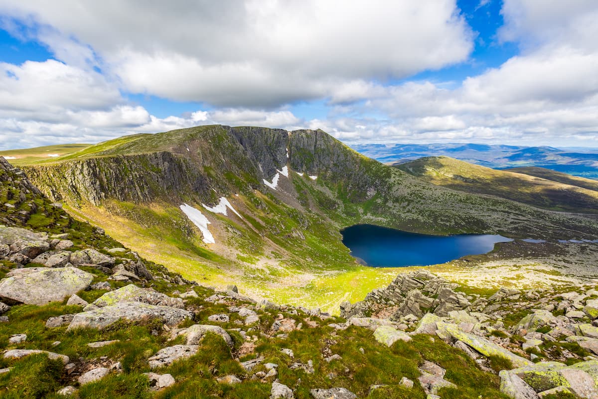
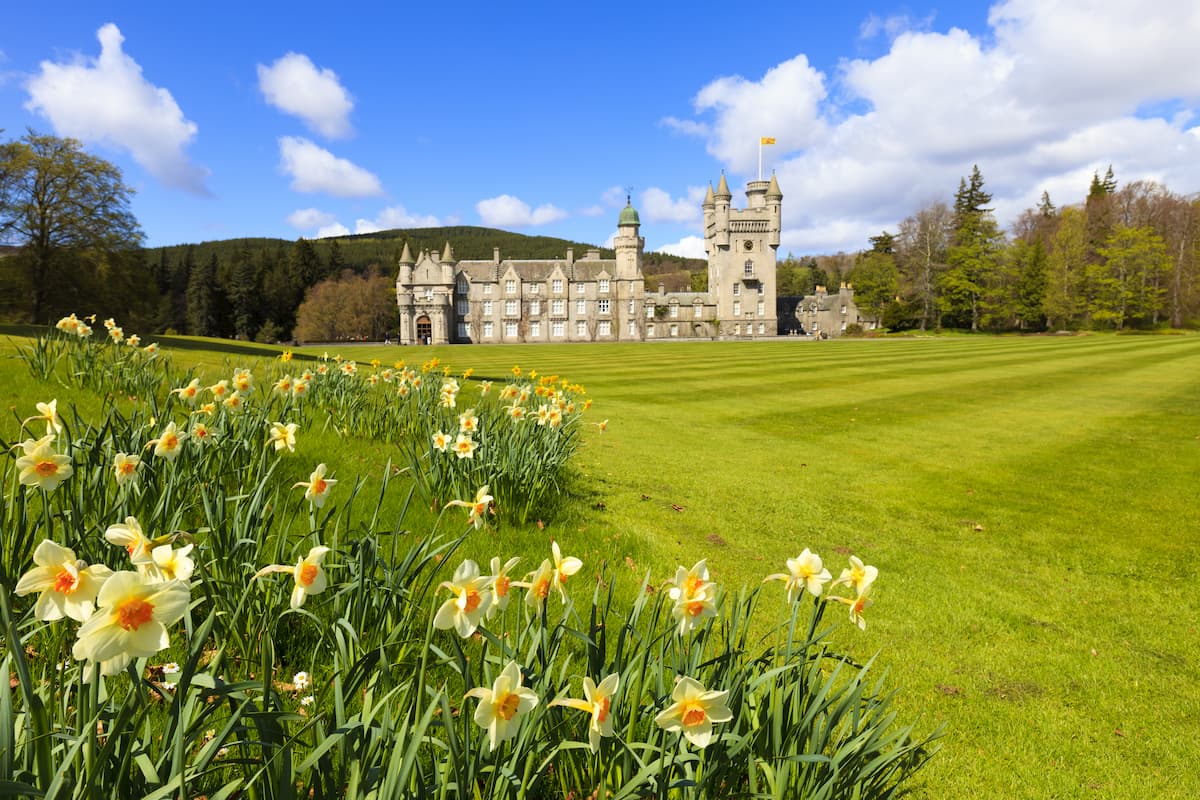
Start from the Spittal of Glenmuick car park. Follow the well-defined track to the west. The trail up to Lochnagar is clear and easy to follow and passes by the Royal Balmoral Estate. At one point you'll need to follow a fork in the road left, with Lochnagar and Meikle Pap (974 m) visible in the distance. Ascending the mountain, you'll have a choice to ascend directly up Lochnagar to the left, or head down the bealach for views of Lochnagar's stunning northern corrie, one of the best corrie views in the Cairngorms. You'll also have the opportunity to bag the summit of Meikle Pap.
If you decide to take the scenic route you can either walk back to the fork in the road or head directly up The Ladder. The Ladder is faster but much more challenging and is prone to avalanches during winter. On the mountain plateau, ascend to Cac Carn Mor (1,150 m) being mindful of the rugged cliffs. The summit of Lochnagar is marked with a viewpoint indicator and affords panoramic views of the Cairngorms on a clear day. Descend the mountains by returning the Cac Carn Mor, before following the path down Glas Allt glen passing Glas-allt-Shiel lodge.
Complete with trails overlooking towering crags, Sgor Gaoith (1,111 m) is not for the faint-hearted. Located on the western edge of the Cairngorms, Sgor Gaoith provides panoramic views of the park's highest peaks, as well as stunning views of the tranquil Loch Einich in the valley below. One popular route up Sgor Gaoith is from Glen Feshie to the southwest. The walk is 9 miles, ascends 913 meters, and takes around 6 hours.
From the Achlean road, cross the Allt Ruadh bridge and park at the parking area. Walk east along the track through the woodlands, ascending the left fork in the road. Continue straight following the Sgor Gaoith trail, crossing a stream and walking through the woodlands and heathlands. At around 810 meters, the path will disappear; however, the ascent is fairly direct up to Sgor Gaoith's plateau.
Sgor Gaoith far-reaching plateau stretches several miles south to Mullach Clach a' Bhlàir (1,019 m). Head north to the summit of Sgor Gaoith, admiring the dizzying views across to the slopes of Braeriach above Loch Einich. To descend Sgor Gaoith, you can either retrace your steps or take the scenic route from the Meall Buidhe- Geal Charn ridge into the minor peaks of Sgoran Dubh Mor (1,116 m) and then Geal Charn, before picking up the near Allt Coire na Cloiche.
Situated in the northeastern corner of the Cairngorms, Bynack More (1,090 m) is a favorite among hikers thanks to its conical peak and granite tors. You can start the hike up Bynack More from the Allt Mor car park just south of Glenmore. The climb up Bynack More is 14 miles, ascends 756 meters, and takes 7 hours.
Follow the path with the purple waymarker, through the pine woodlands. Cross the stream, and turn right towards Ryvoan Pass. Keep right on the trail after passing the gorgeous Lochan Uaine. The path will eventually join onto the ancient Lairig an Laoigh, before heading on the right-hand path onto the plateau of Bynack More. Head right again to tackle the mountain's summit. Atop Bynack More, you'll get some of the best-uninterrupted views of the Cairngorms.
The quickest way to descend Bynack More is by going back the way you came. If you have some extra time/energy, consider swinging by the Barns of Bynack, Bynack More's formidable granite tors. From the Little Barns viewable from the summit, head east, before returning to the summit to descend.
The Speyside Way is one of Scotland's four Long Distance Routes and is ideal for hikers looking to explore one of the longest rivers in Scotland. This lengthy trek runs for 65 miles along the River Spey, ascends 1,245 meters, and takes most hikers between 5 days and a week to complete. Generally, the Speyside Way runs from Aviemore on the edge of the Cairngorm mountains up to the seaside fishing town of Buckie.
The Speyside Way is well marked, and generally follows the course of the River Spey, Scotland's third-longest river. This beautiful hike passes by the Glenlivet distillery, the WDC Scottish Dolphin Centre, and the Strathspey Steam Railway making it an exciting route for tourists. Along your journey watch out for local wildlife, including roe deer, capercaillie, and the elusive Scottish wildcat. If you don't fancy hiking the entire 65 miles along the Speyside Way, the journey can easily be split up into shorter sections, by stopping at one of the landmarks or villages along the route. Popular shorter walks include from Buckie to Spey Bay (5 miles) and from Nethy Bridge to Boat of Garten (5 miles).
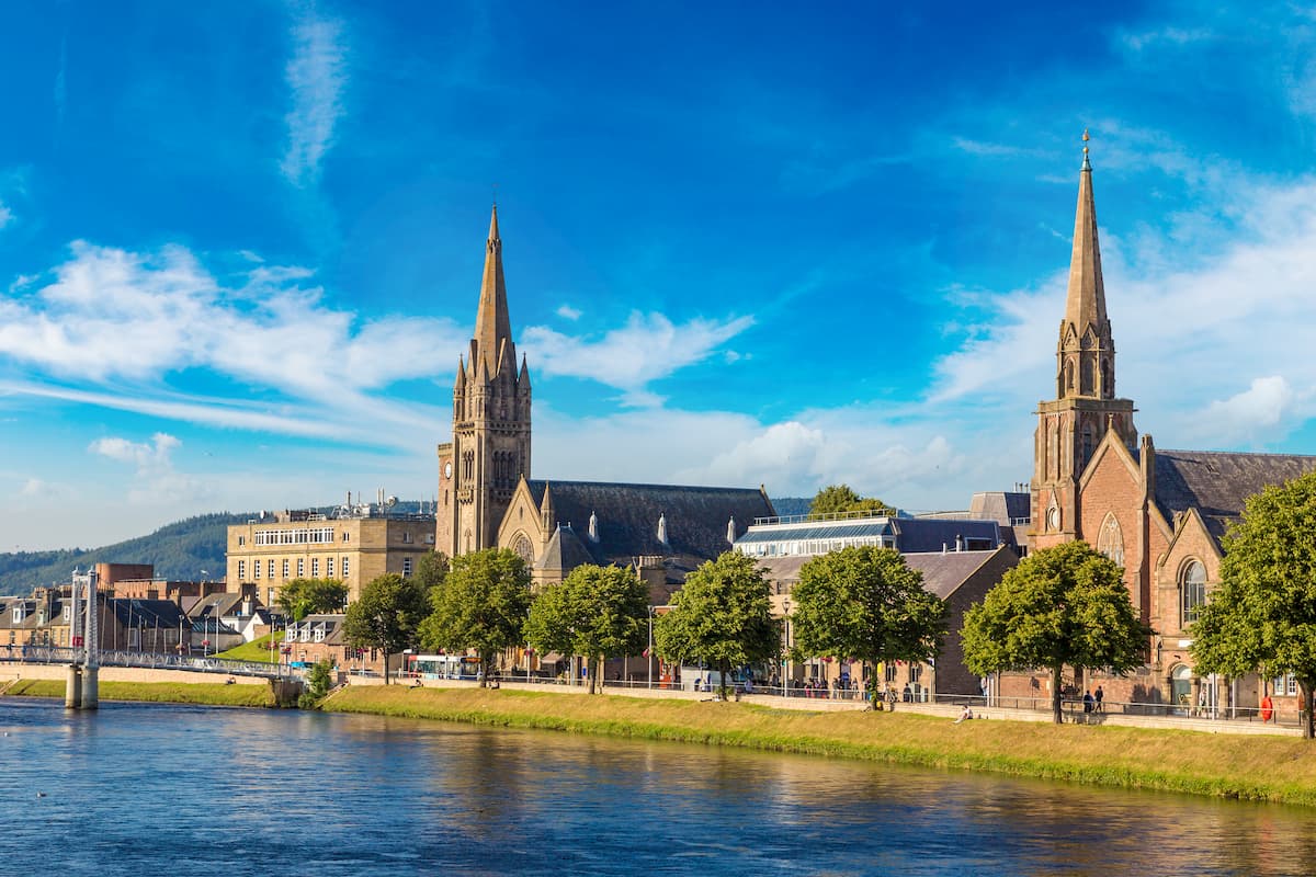
Considered the capital of the Highlands, Inverness is the biggest city within touching distance of Cairngorms National Park. Perched at the mouth of the River Ness, Inverness offers plenty of activities and attractions for visitors. Take a tour of the stately Inverness Castle, make the short 14-mile journey south to the legendary Loch Ness. Inverness is home to loads of hotels making it a great palace to visit if you’re planning a last-minute getaway to the Scottish Highlands. Popular hotels include the Ness Walk Hotel, Inverness Palace Hotel, and Columba Hotel. To reach Cairngorms National Park from Inverness take the A9 road southwest for 30 miles.
Aviemore is one of the most convenient places to stay in Cairngorms National Park. Sat upon the eastern banks of the River Spey, Aviemore is about ten miles from the Cairngorm Mountain ski area, which is a starting point for trails that lead up Ben Macdui, Braeriach, Cairn Gorm, Bynack More, and others. Aviemore is also superb for watersports with Loch an Eilein and Loch Morlich nearby. It is also the start of the Speyside Way. Aviemore has a range of guest houses, hotels, and self-catered accommodation, ideal for escaping civilization. Some of the best in town include the Ravenscraig Guest House, Eriskay, and Cairngorm Hotel.
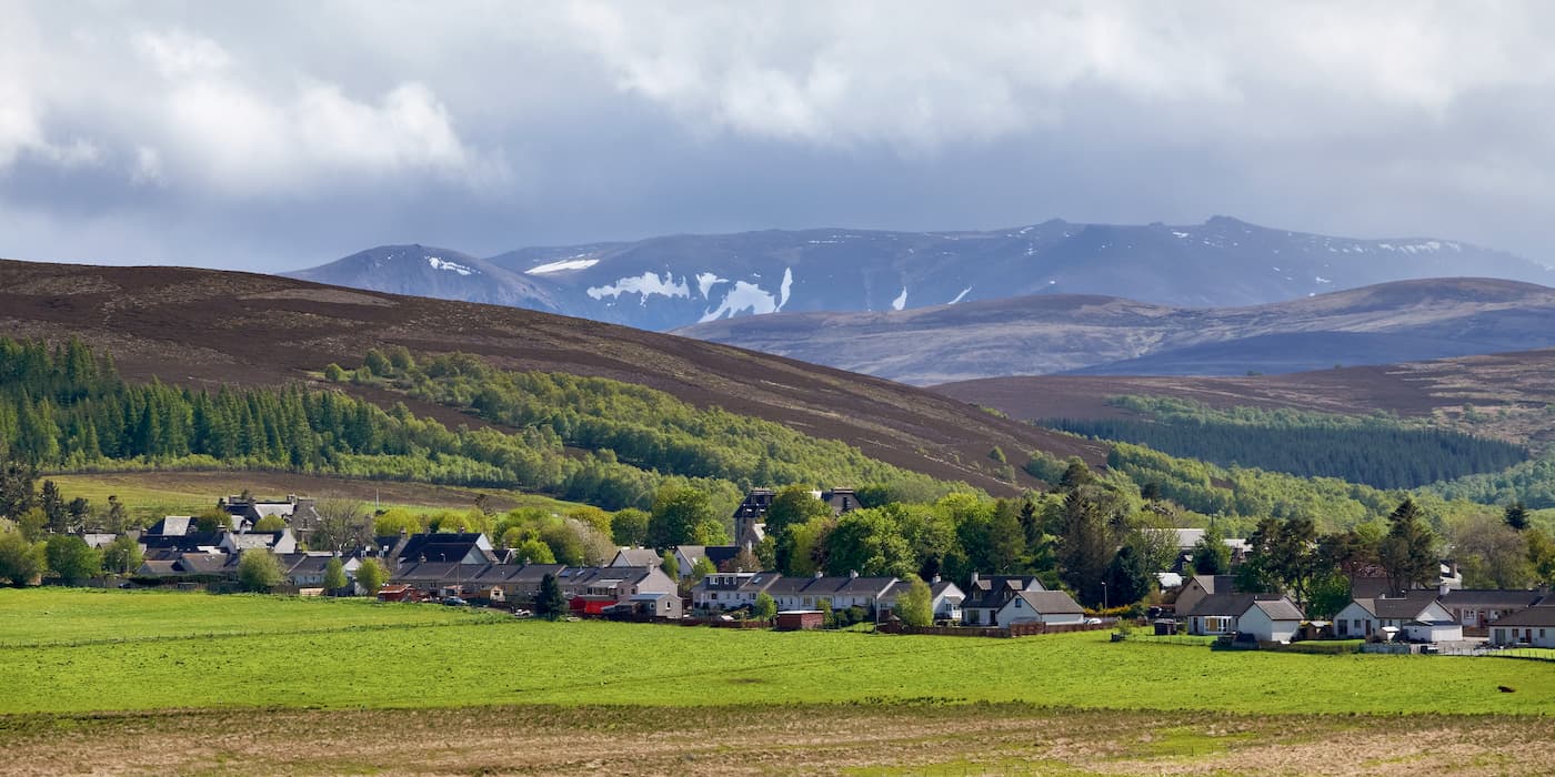
The quaint village of Nethy Bridge is the perfect setting for a secluded getaway. Nethy Bridge is located at the edge of the lush Abernethy Forest, which is protected as part of the Abernethy National Nature Reserve. While there isn't much to do around Nethy Bridge, you'll find the Cairngorm mountains just a stone's throw from the village. The Speyside Way also passes through Nethy Bridge, in case you fancy hiking a section of this 65-mile trek. This favorite vacation destination is home to some excellent accommodation, including the Nethybridge Hotel, The Lazy Duck, and Mountain Bear Lodge.
Located in Aberdeenshire is the settlement of Ballater. With a population of around 1,500, Ballater is one of the largest settlements on the eastern side of Cairngorms National Park. The settlement affords superior access to some of the peaks in the south of the park, including Lochnagar. While in Ballater, climb up Craigendarroch (403 m) for views of the town, and explore the ruins of Knock Castle. There are some picturesque hotels in Ballater which overlook the River Dee, like the Deeside Inn, Alexandra Hotel, and the Hilton Craigendarroch Suites.
Tomintoul is the highest settlement in the Scottish Highlands at 345 meters, making it a mountain climber's paradise. The small town is also home to the Glenlivet Distillery Visitors Centre, in case you fancy sampling one of Scotland's most popular exports. The most popular hotels in Tomintoul are Hotel Square, The Glenavon, and the Richmond Arms.