
Scan the QR code and open PeakVisor on your phone
Highland is home to 4,977 named mountains. The highest is Ben Nevis at 1,345 m.
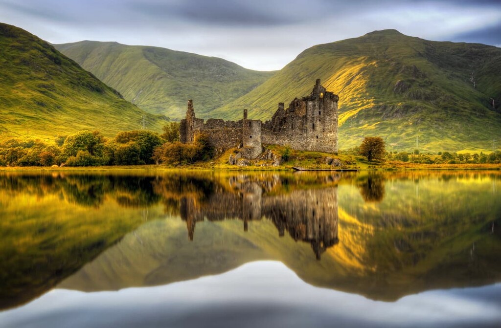
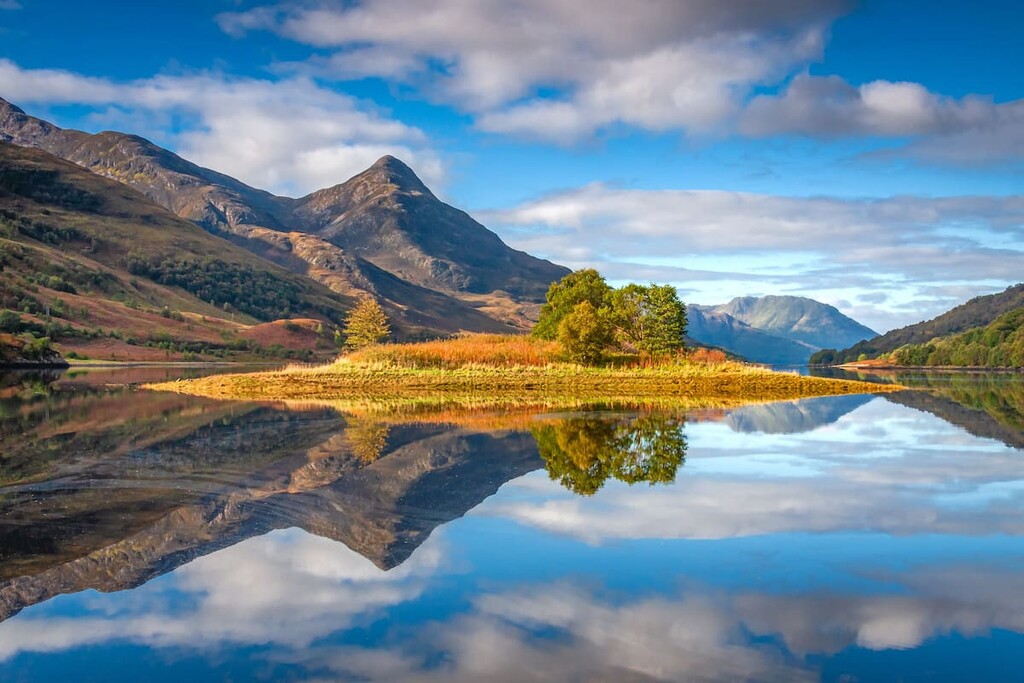
Mythical lochs, sublime glens, and the highest summits on the British Isles await visitors to the Highland council area in northwestern Scotland. There are 4977 named peaks in Highland. The highest and the most prominent mountain is Ben Nevis (1,345 m/4,412 ft).
Highland is one of 32 council areas in Scotland, covering most of the northwestern half of the country. At 9,906 square miles (25,657 square km) in area, it is the largest council area in Scotland and the seventh most populated. It shares its borders with Aberdeenshire, Moray, Argyll and Bute, and Perth and Kinross.
While called Highland, the council area doesn't cover the entirety of the Scottish Highlands. In fact, some of Highland’s neighboring council areas, as well as Angus and Stirling, also contain parts of the historic area known as the Highlands.
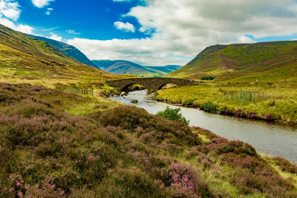
The Highland council area encompasses the entirety of the Northwest Highlands and the northwestern sections of the Grampian Mountains as far south as Càrn an Fhidhleir (994 m/3,261 ft). The two ranges are separated by the Great Glen, which stretches for 62 miles (100 km) from Fort William northwest to Inverness.
Notable parks in the region include the Small Isles National Scenic Area, Cuillin Hills National Scenic Area, and Glencoe National Nature Reserve.
Inverness is the largest city in the Highland council area. It's generally considered the capital of the Highlands region and the official Highland council area. The boundary of Highland is located approximately 85 miles (136 km) north of Glasgow and 100 miles (160 km) north of the capital, Edinburgh.
The Grampian Mountains lie on the southeastern edge of Highland, spilling over into the neighboring counties as far south as Ben Lomond (974 m/3.195 ft) in Stirling. It's among the most popular Highland areas due to the fact that it contains Ben Nevis, the highest mountain on the British Isles, which sits on the western edge of the Grampian Mountains.
You'll also find several small groups of hills in the Grampians, including the Lochaber Hills to the west. Several of Scotland's major rivers spring from high in the Grampian Mountains, including the River Tay, the longest river in Scotland, and the River Spey, which is home to one of the world’s most famous whisky-producing regions.
The sparsely populated Northwest Highlands encompass the northern third of the Scottish mainland. It's separated from the rest of Scotland by the Caledonian Canal, which runs from Loch Linnhe in the southeast up to the Moray Firth.
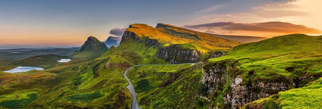
The Northwest Highlands features the starkest landscape in Scotland, with steep hillsides that plunge into untouched glens. Furthermore, the Northwest Highlands also include some of the islands off the west coast of Scotland, including the Isle of Skye—the largest of the Inner Hebrides archipelago.
Many people come to the Northwest Highlands to visit the legendary Loch Ness, scale the highest mountain north of the Great Glen, Càrn Eige (1,183 m/ 3,881 ft), or to visit the magical Isle of Skye.
Scotland boasts 282 Munros, most of which are contained within the Highlands, including several of the United Kingdom's highest mountains. “Munro” is a local term for mountains that have an elevation of at least 3,000 feet (914.4 m), though there is no official topographic prominence requirement for a peak to be considered a munro.
The Cairngorms range, which dominates the landscape of the Grampian Mountains, contains five of the six highest mountains on the British Isles: Ben Macdui (1,309 m/4,294 ft), Braeriach (1,296 m/4,251 ft), Cairn Toul (1,291 m/4,235 ft), Sgòr an Lochain Uaine (1,258 m/4,127 ft), and Cairn Gorm (1,244 m/4,081 ft). The Grampians are also home to Ben Nevis, the highest mountain on the British Isles. Of these, only Ben Nevis, Braeriach, and Cairn Gorm sit within the Highland council area.
While the Northwest Highlands don't contain the highest mountains in Britain, there are still approximately 100 Munros in this mountainous area. The most notable peaks in this region include Càrn Eige, Mam Sodhail (1,181 m/ 3,874 ft), and Sgùrr Alasdair (992 m/ 3,254 ft).
The Highland council area covers nearly a third of Scotland, meaning the area's mountains, glens, and lochs have formed differently over millions of years. Indeed, much of the Scottish Highlands has a long and complex geological history.
Between 500 to 800 million years ago, the Grampian Mountains and the Northwest Highlands sat 60 miles (100 km) apart on the fringes of the Iapetus Ocean, forming part of the continent of Laurentia. Upon the closure of the Iapetus Ocean, a series of continental collisions occurred during an event that’s now known as the Caledonian Orogeny.
During the Caledonian Orogeny, a string of islands that formed in the Iapetus Ocean collided with the Grampian Mountains, creating the range's central belt. This event, known as Grampian Event, happened around 460 million years ago.
The Caledonian Orogeny brought together the geology of Scotland and much of Europe, creating the Caledonian Mountains, the remnants of which are still visible across Europe and North America.
Most of the mountains in Highland are made of rocks from the Dalradian Supergroup, which include granites, limestones, quartzites, sandstones, and shale. Most of the highest peaks and deepest valleys in the Scottish Highlands were formed in the last 40 million years by erosion. Additionally, ice present during the last glacial maximum helped wear away the softer sandstone and limestone rock, leaving behind rugged granite peaks.
The land within the Highland council area is home to a wide variety of flora and fauna, including many rare and endangered species.
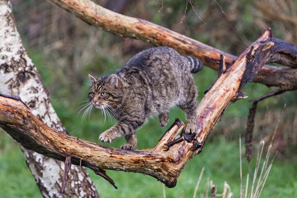
One of the most famous examples of Highland wildlife is the Scottish wildcat, the UK's last remaining native wildcat species. The Scottish wildcat is also endangered, mainly due to interbreeding with domestic species.
While trekking through the region's moorlands and woodlands, you might get lucky and spot some of Highland's elusive mammals, including pine martens and red squirrels. Two of the largest mammals you'll encounter in the Scottish Highlands are red deer and Highland cattle.
Birdwatchers will also love the Highland council area. High up in the mountains, you may spot golden eagles and ospreys soaring overhead. Meanwhile, across the moorlands, you may get to observe the bizarre mating rituals of western capercaillie.
The coastal areas of Highland are also great for spotting rare wildlife. Guillemots, Manx shearwaters, and puffins all nest on the cliff tops and across the islands. You should also keep an eye on the ocean below, as sightings of humpback whales and bottlenose dolphins have become more common over the past decades.
There are thought to be around 4,000 plant species native to the Scottish Highlands. The Highlands are noted for having a vast array of lichen and bryophytes, which account for approximately 2,500 species. However, the number of vascular species is low compared to world averages.
The heathlands of Highland feature an abundance of plant species. Bog myrtle, ling, and gorse are widespread across the council area, transforming the region into a tapestry of pink and yellow.
You'll also find several iconic and rare flora species across the area. Scottish bluebells are commonly seen in the fall across boggy areas, while Scottish thistles can grow up to 5 feet (1.5 m) high and are a rare sight along the region's roads and trails.
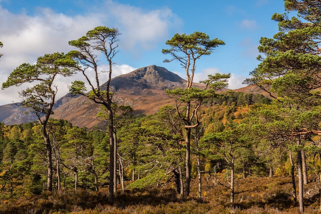
Remnants of the 12,000-year-old Caledonian Forest are visible across the Scottish Highlands. These forests are descended from the pinewoods that arrived in Scotland after the last glacial maximum. The forests consist mainly of pine, birch, rowan, and oak. Many consider these remnants to be one of the few remaining true wilderness areas in the UK.
There are several famous trees in the Scottish Highlands. In Inverness-shire, a Douglas fir measured over 66 m (216 ft), making it the tallest verified tree in Scotland. There's also the Fortingall Yew in Perthshire, which is said to be one of the oldest trees in the UK, at around 2,500 years old.
The history of the Scottish Highlands predates written records, with evidence of hunter-gatherers in the region during the Paleolithic period over 12,000 years ago.
Highlanders were nomadic throughout much of early history, with the first evidence of permanent farms dating back to around 3,000 BCE. Most Highlanders spoke Scottish Gaelic language, while the people of the Lowlands predominantly spoke Scots.
Following the arrival of the Vikings and the Roman Empire, Scotland was ruled by a series of kings. One of the most famous is Macbeth, who ruled during the eleventh century as King of Alba and famous for being the titular character in the Shakespearean play Macbeth.
One of the most important moments in Highland history happened in the mid-eighteenth century. After the end of clan warfare and various battles with the English, landowners across the Highlands realized they could make more money renting the land as sheep walks.
As a result, many Highlanders were displaced from their homes and forced to emigrate during a period known as the Highland Clearances. The Highland Clearances are one of the chief reasons for the loss of Highland culture and history. They also in part caused the Scottish diaspora, with the majority of modern-day Highland descendants living outside of Scotland in places like Canada, the United States, Australia, New Zealand, Argentina, and Chile.
Today, the Highlands are managed by the Highland Council. Inverness is the region's administrative center and it is considered the capital of the historic region of the Highlands.
These days, the region is fairly sparsely populated as the current population of the Highlands is approximately 235,000 people. Settlements are most common along the coast, especially in the Northwest Highlands, where one of the largest inland settlements is Lairg with only 800 residents.
Here's an overlook at the best hiking areas and trails in Highland so you can plan the perfect Scottish adventure.
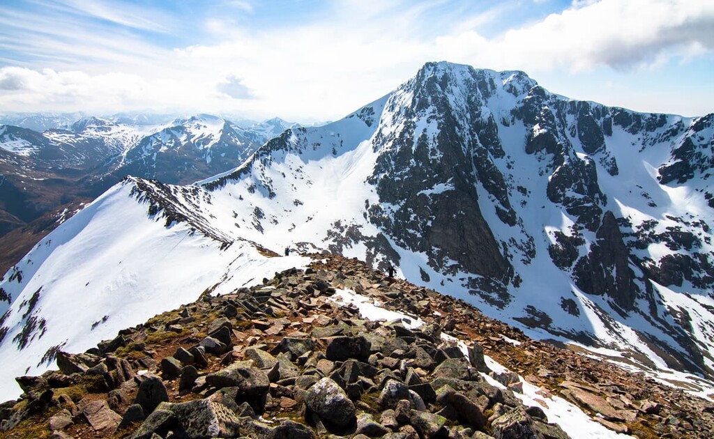
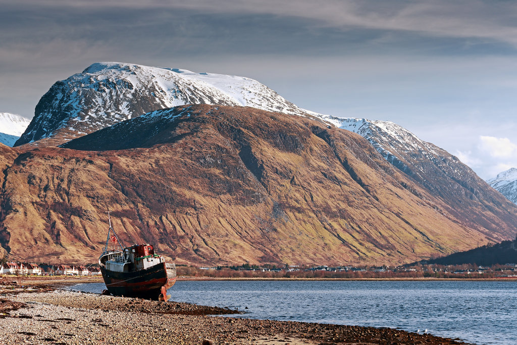
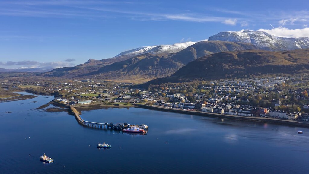
Home to the highest mountain in Britain, Ben Nevis, the Ben Nevis Group is one of the best ranges in Scotland for experienced hikers to test their abilities. This mountain group is part of the Lochaber region of Highland, near the town of Fort William.
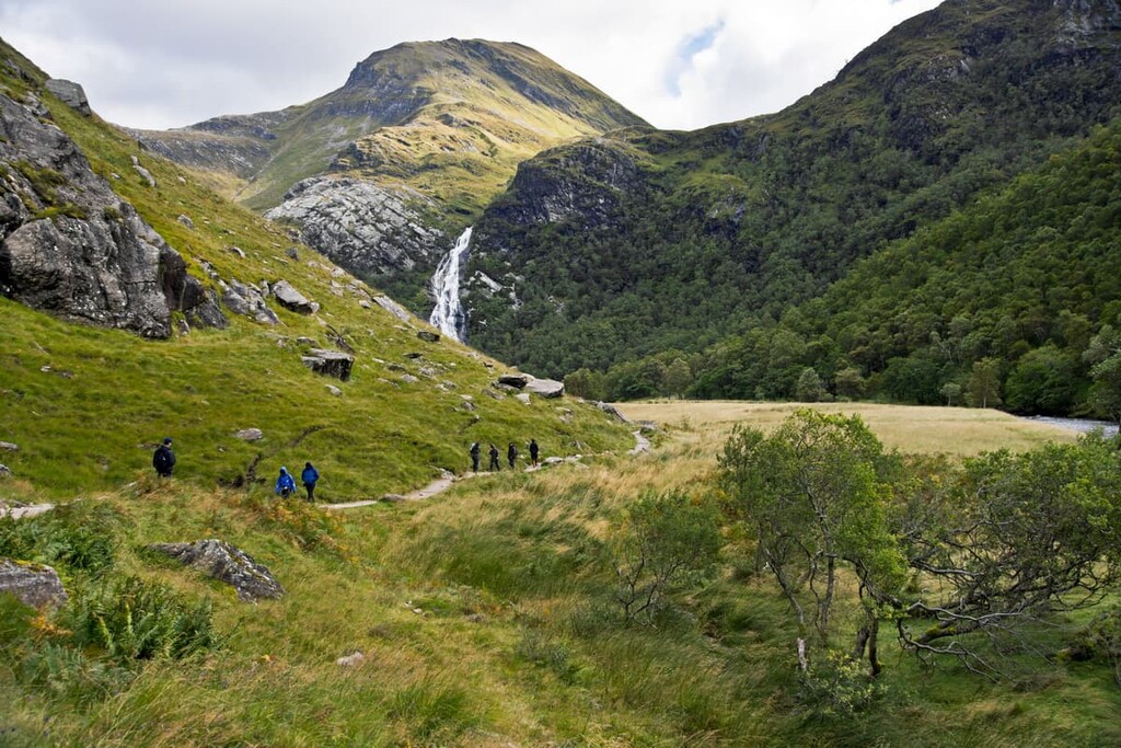
Below Ben Nevis is Glen Nevis, a popular hiking area notable for containing the second-highest waterfall in Scotland, Steall Falls.
To the northwest of Ben Nevis is Càrn Mòr Dearg (1,220 m/4,002 ft), the ninth highest mountain in the UK. The two mountains are linked via the knife-edge Càrn Mòr Dearg Arête. The arête is considered one of the finest ridge walks on the British Isles.
There are two other significant summits within the Ben Nevis Massif: Aonach Beag (1,234 m/4,048 ft) and Aonach Mòr (1,221 m/4,005 ft). All four of these peaks are Munros that are among the 11 tallest mountains on the British Isles. Aonach Beag is 3 miles (5 km) east of Fort William, while Aonach Mòr is around 2 miles (3 km) northeast of Ben Nevis.
While Ben Nevis is a popular mountain with around 150,000 ascents annually, it isn't to be underestimated.
You should only attempt Ben Nevis during the summer unless you're an experienced climber that’s prepared for the harsh conditions typical of the Scottish winter. You should bring navigational equipment, warm clothing, and plenty of food and water on any trip up Ben Nevis.
The most popular and easiest way of climbing Ben Nevis is via the Pony Track, which was established in the late nineteenth century. You can pick up this trail from the visitor's center in Glen Nevis. The hike up Ben Nevis via the Pony Track is 10 miles (17 km) long and it ascends 1,352 m (4,435 ft). Most people take around 8 hours to complete the round trip hike.
Another popular route is along the Càrn Mòr Dearg Arête. This route starts at the North Face car park at Torlundy and takes hikers up Càrn Mòr Dearg, along the mountain's namesake arête, and to the summit of Ben Nevis. The route requires some scrambling and a head for heights but is an arguably more enjoyable hike for experienced adventurers.
Hikers looking for a remote hillwalk should consider trekking up Aonach Beag and Aonach Mòr from Glen Nevis. This rugged walk leads over a large summit plateau, where good navigational skills are required.
You can pick up this trail from the car park at the end of Glen Nevis road. The hike is around 10 miles (16 km) long, ascends 1,376 m (4,514 ft), and takes around 8 hours.
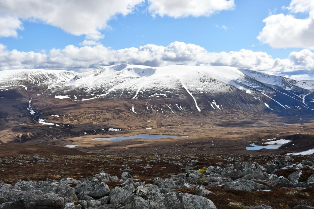
Located in the southeastern corner of the Highlands, Cairngorms National Park encompasses 1,748 square miles (4,528 sq km), including five of the six highest peaks in the UK and roughly a quarter of all of Scotland's forests. The Highland council area only covers the northern half of the park, including peaks like Cairn Gorm, but excluding the likes of Ben Macdui.
Cairngorms National Park is among the most popular areas in Highland, with approximately 1.9 million visitors annually. One of the most prominent man-made landmarks in the Cairngorms is the Royal Balmoral Estate, one of the official residences of the British Royal Family, though it is privately owned by the Royal Family, not by the Crown.
There are approximately 50 Munros within Cairngorms National Park and 1,071 named peaks. Remarkably, the Cairngorms National Park contains over one-third of all land in the UK over 600 m (1,968 ft) in elevation.
The western massif of the Cairngorms is dominated by Braeriach and Carn Toul (1,291 m/4,235 ft), with Ben Macdui in the center, and Lochnagar (1,155 m/3,789 ft) to the east. Other notable peaks within the Cairngorms include: Càrn nan Gabhar (1,121 m/3,677 ft), Cairn Gorm (1,244 m/4,081 ft), and Bynack More (1,090 m/3,576 ft).
Within Cairngorms National Park are 9 national nature reserves:
Cairngorms National Park is home to Ben Macdui, the second-highest mountain on the British Isles. While Ben Macdui isn't within the Highland council area, the popular neighboring peak, Cairn Gorm, is, and the two mountains are sometimes climbed together over the course of a very long day hike.
Cairn Gorm is among the most famous mountains in Highland and the Cairngorms thanks to its high elevation car park and popular ski center. It's also the sixth-highest mountain in the UK, so it’s a worthy goal in its own right.
The paths here are generally good, but the exposed mountain plateau can be difficult to navigate, especially in snowy or windy weather. You can pick up this trail from the Cairngorm Ski Center. The walk is around 17 miles (27 km), ascends 932 m (3,057 ft), and takes approximately 7 hours.
Cairngorms National Park is also home to Britain's third-highest mountain, Braeriach. While still a popular Munro to bag, Braeriach's isolated location means it's much less popular than the likes of Ben Macdui or Lochnagar (1,155 m/3,789 ft).
One of the most common ways of scaling Braeriach is on the Whitewell circuit. The ascent is fairly straightforward; however, descending can be tricky, especially in snow.
It's also possible to climb Braeriach on a linear path via Chalamain Gap, but the circular route from Whitewell will take you on a more scenic walk through Cairgorm's Caledonian pinewoods. The hike up Braeriach is around 16 miles (26 km), ascends 1,217 m (3,992 ft), and takes about 9 hours.
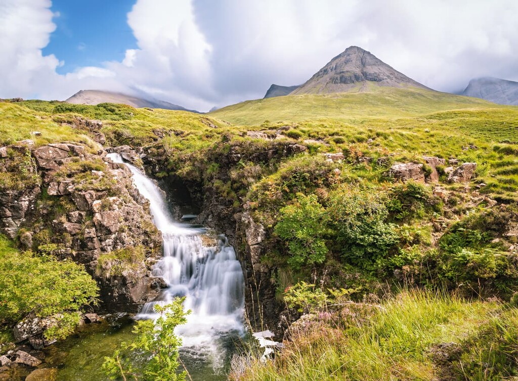
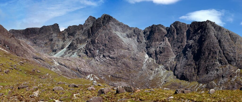
Located on the largest of the Inner Hebrides, the Isle of Skye, the Cuillins are among the most challenging mountains in Britain. The range can be split into two regions: the Red Cuillins to the east of Glen Sligachan and the Black Cuillins, which dominate the central ridge. The area is managed by NatureScot.
There are 11 official Munros within the Black Cuillins. Many of the island's mountains are precipitous, requiring a good head for heights and scrambling ability. The highest mountain is Sgùrr Alasdair (992 m/3,254 ft).
Another famous feature of the Black Cuillins is Sgùrr Dearg (986 m/3,234 ft), also known as The Inaccessible Pinnacle. Sgùrr Dearg's peak is only accessible via rock climbing and is considered one of the biggest obstacles for anybody attempting to bag every Scottish Munro.
Sgùrr Alasdair is the highest mountain on the Isle of Skye and the highest mountain on any British island away from the mainland. The summit provides stunning views across the Cuillins and towards the Small Isles. Due to the mountain's complexity, you should bring navigational equipment and a head for heights.
The best way to climb Sgùrr Alasdair is from the end of the road at Glen Brittle. The walk is hazardous, with an extremely steep climb up loose scree at the Great Stone Chute. You'll also have to scramble to reach the true summit. The hike up Sgùrr Alasdair is 6 miles (9 km), ascends 992 m (3,254 ft), and takes around 6 hours.
Blà Bheinn (928 m/3,044 ft), also known as Blaven, is the 13th highest mountain in Britain and one of the most popular hikes on the Isle of Skye. The hike is straightforward compared to the island's other peaks, but it is still a rugged and challenging trek.
The best place to start this hike is east of the mountain itself. From Broadford, cross the bridge over the Allt na Dunaiche to locate the path towards the Blà Bheinn. It's worth noting that the path is good to begin with before turning to loose scree. Some simple scrambling is required in certain areas. This hike is around 5 miles (8 km) long, ascends 990 m (3,248 ft) of elevation, and takes roughly 5 hours.
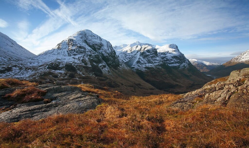
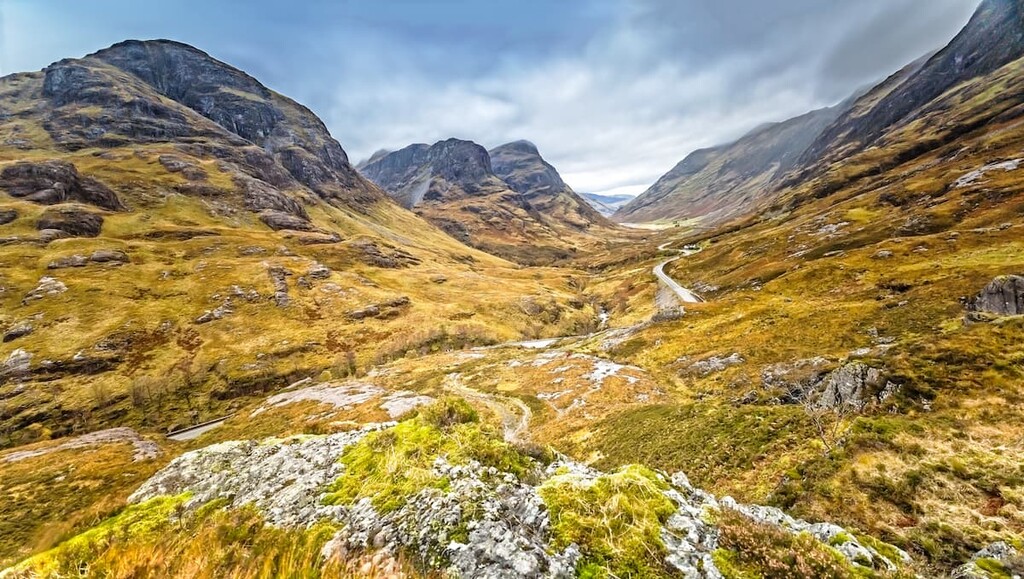
Of Scotland's 43 national nature reserves, Glencoe is among the most popular and the most beautiful.
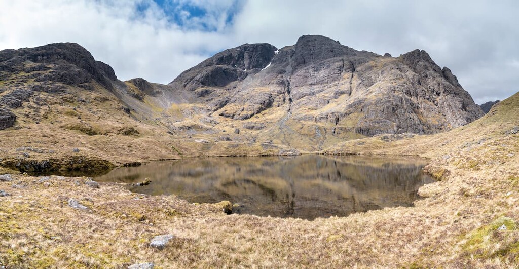
As well as featuring the dramatic Glen Coe, this national nature reserve is also home to some of Scotland's most iconic mountains, including the Pap of Glencoe (742 m/2,434 ft) and Buachaille Etive Mór (1,021 m/3,351 ft). The highest mountain in the reserve is Bidean nam Bian (1,150 m/3,772 ft).
Glencoe National Nature Reserve is often considered the home of Scottish mountaineering, with the Aonach Eagach ridge and the famed 'Three Sisters" of Bidean nam Bian providing abseiling and scrambling opportunities for generations. Glen Coe also has some historical significance, as the 1692 Massacre of Glencoe took place here following the Jacobite Uprising.
Situated in the southeastern corner of the Highlands, Glencoe is just south of Ben Nevis, making it a great place to visit after scaling the UK's tallest mountain. The reserve encompasses an area of 21 square miles (56 square km).
With its 5-mile (9 km) long ridge and pyramidal summit, Buachaille Etive Mór is one of the most instantly recognizable Munros in Scotland. Buachaille Etive Mór sits overlooking the A82, meaning it's often photographed and commonly appears on Scottish postcards and calendars. Around 30,000 hikers attempt Buachaille Etive Mór each year.
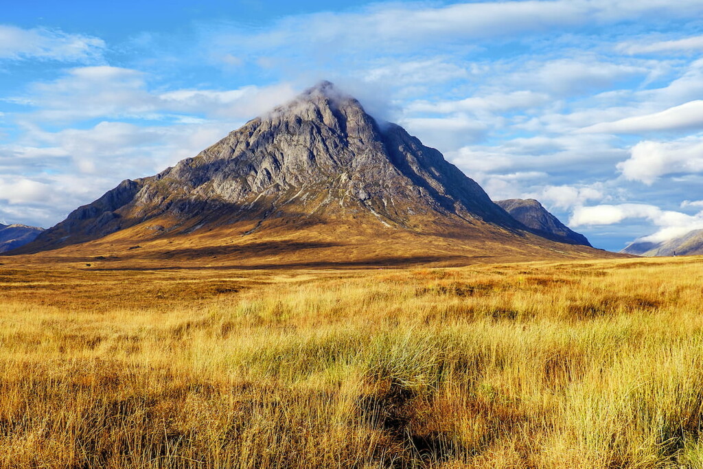
The route up Buachaille Etive Mór is steep, and the mountain's ridge is bouldery and difficult to traverse. Scrambling is necessary in a couple of areas during the descent. You'll also need to scale two of the Munros that constitute Buachaille Etive Mór: Stob Dearg (1,021 m/3,349 ft) and Stob na Bròige (956 m/3,136 ft).
You can pick up the trail from the Buachaille Etive Mor Car Park on the A82. The walk is 8 miles (13 km), ascends 1,110 m (3,641 ft), and takes around 8 hours.
The Pap of Glencoe, also known as Sgòrr na Cìche, sits at the western edge of the Aonach Eagach ridge overlooking where the River Coe meets Loch Leven. While by no means the highest mountain in the region, it's popular due to its iconic shape and the uninterrupted views it provides of the surrounding countryside.
One of Scotland's finest Grahams (a mountain between 2,000 and 2,500 ft/609.6 to 762 m in elevation), the Pap of Glencoe is a short yet rugged walk. While there is a path up the Pap, it's very eroded, and the summit is very rocky and may require some simple scrambling. You can pick the trail from the Glencoe village. The walk is 4 miles (7 km) long, ascends 716 m (2,349 ft), and takes about 4 hours.
Looking for a place to stay during your next trip to the Highland council area? Here are some of the best places to check out during your visit:
Dubbed the "Capital of the Highlands", Inverness is one of the best places to stay if you're looking to soak up some Highlander culture. Pay a visit to the nineteenth century Inverness Castle or tour the Inverness Museum and Art Gallery.
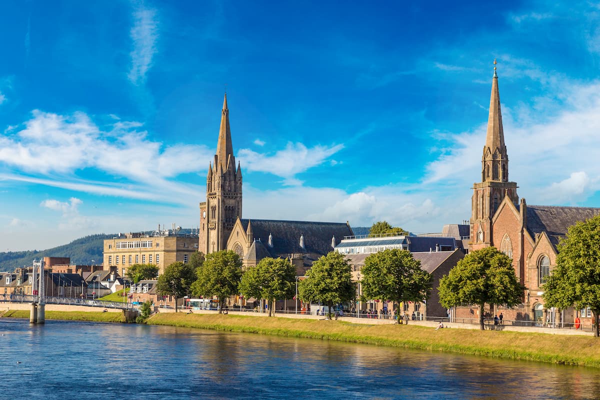
You won't be short of opportunities to get outdoors in Inverness. The city is less than 30 miles (48 km) from Cairngorms National Park and around 10 miles (16 km) from the legendary Loch Ness. If you're staying in Inverness, spend a night at the Royal Highland Hotel or the Glen Mhor Hotel.
Overshadowed by Britain's highest mountain, Fort William is the best place to stay if you're looking to hike up Ben Nevis. You'll also find the stunning Glencoe National Nature Reserve just south of the town.
Learn more about Highland history at the West Highland Museum and then experience it for yourself at the thirteenth century Inverlochy Castle ruins. There are several hotels in Fort William, including the Ben Nevis Hotel and the Alexandra Hotel.
Aviemore is one of the best places to stay in Cairngorms National Park. Various points across this quaint town provide sweeping vistas of the nearby mountains, with the likes of Càrn Dearg Mòr (857 m/2,811 ft) and Meall a' Bhuachaille (810 m/2,657 ft) within 10 miles (16 km) of town.
While visiting Aviemore, ensure you also visit the nearby Craigellachie National Nature Reserve or Rothiemurchus Forest. There are also few better places for skiing and winter sports in the Cairngorms than Aviemore. If you're planning to stay in Aviemore, consider booking a room at the Macdonald Morlich Hotel or the Coylumbridge Hotel.
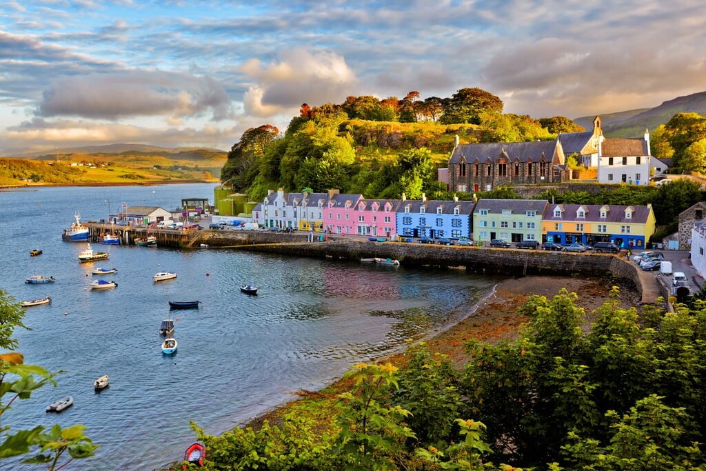
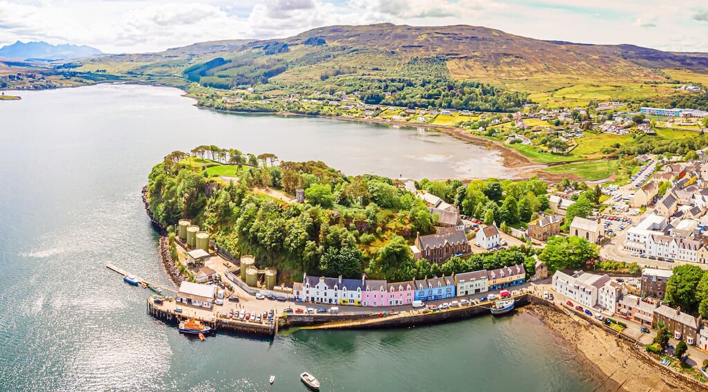
Anybody looking to leave the mainland and explore the majestic Cuillins of Skye will want to stay in Portree. Sat on the edge of Loch Portree on Skye's east coast, Portree is both the largest town and capital of the island. Despite being the capital, Portree is a picturesque town, often considered one of the most beautiful in the UK.
During your stay, ensure you sign in at the visitor's center before walking up nearby Ben Tianavaig (413 m/1,354 ft) for panoramas of Portree. Popular hotels in Portree include the Portree Hotel and the Cuillin Hills Hotel.


Yes. Highland has 4,977 named mountains. The highest is Ben Nevis at 1,345 m.
The highest mountain in Highland is Ben Nevis, at 1,345 m.
Highland has 4,977 named mountains.


