
Scan the QR code and open PeakVisor on your phone
New Zealand is home to 8,316 named mountains. The highest is Mount Cook at 3,724 m.
New Zealand is an island country in the South Pacific Ocean. It’s the southwesternmost point of Polynesia and is one of the largest island nations in the world. Despite its remoteness, New Zealand is home to over 5 million inhabitants. A country of dramatic contrasts and outstanding natural landscapes, New Zealand is a popular hiking and skiing destination in the Southern Hemisphere. There are 8316 named mountains in New Zealand, the highest and most prominent being Aoraki/Mount Cook at 3,724 m / 12,218 ft.
New Zealand, or Aotearoa, lies in the southwest Pacific Ocean. It comprises two main islands, the North Island and South Island, separated by the Cook Strait. The nation also includes many smaller satellite islands, some hundreds of miles from the main islands.
New Zealand is about 1,600 km (1,000 mi) long and 450 km (280 mi) across at its widest point, with a total land area of 268,710 sq km (103,750 sq mi). Slightly more extensive than the United Kingdom, it’s one of the largest island nations in the world. It’s part of Australasia, which includes Australia, Papua New Guinea, and neighboring Pacific Island nations. However, New Zealand lies more than 1,600 km (1,000 mi) southeast of Australia, its closest neighbor.
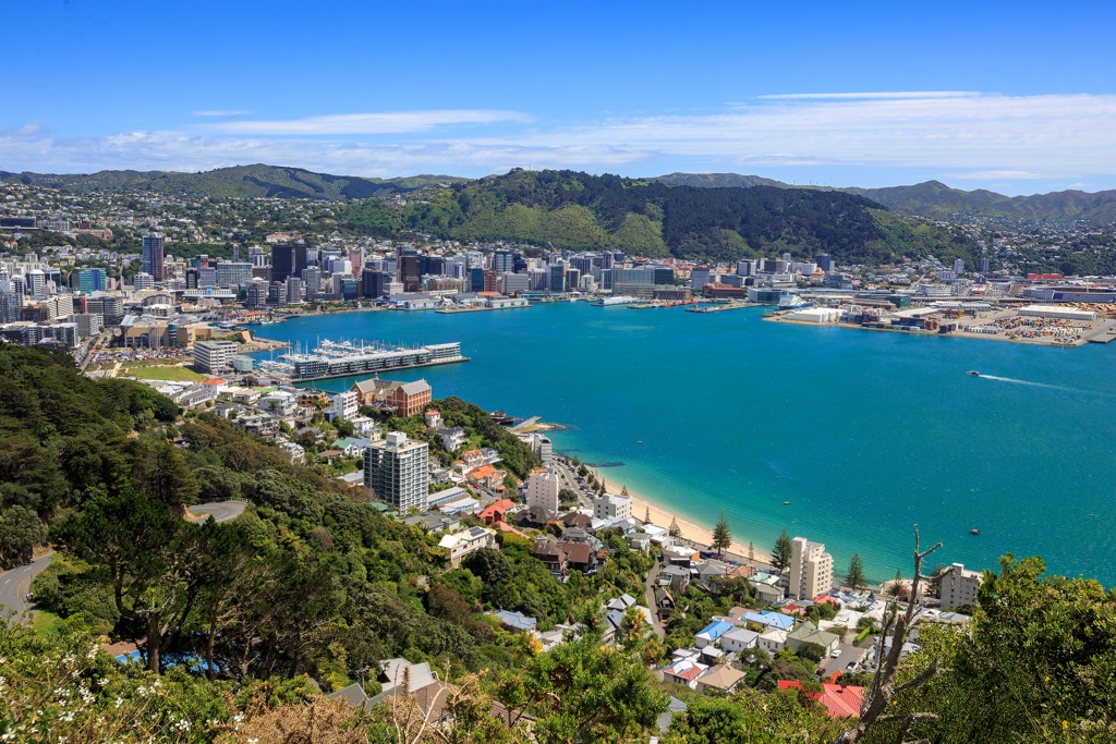
The capital city is Wellington, while the largest urban area is Auckland, both situated on the North Island.
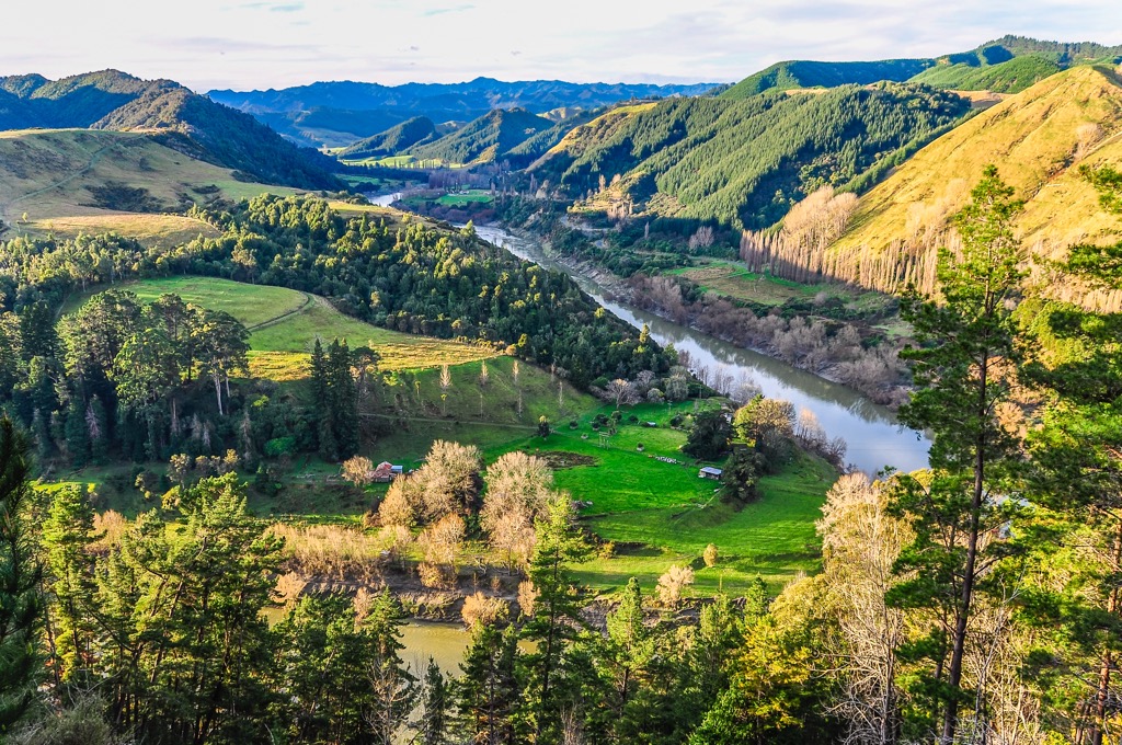
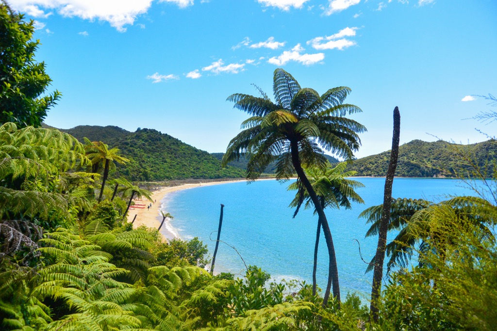
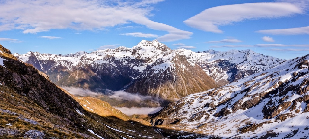
The country is highly mountainous, with various snow-capped ranges, volcanic regions, deep glacial lakes, and fjords. Long sandy beaches and vast plains and farmland contrast the grand peaks. There are 13 national parks in New Zealand protecting these precious landscapes and natural ecosystems.
The North Island of New Zealand is the most populated of the two main islands. It’s separated from the South Island by the Cook Strait, with the shortest distance between the two islands at about 23 km (14 mi).
A series of mountain ranges form the backbone of the North Island from East Cape to Cook Strait, including the Raukūmara, Huiarau, Kaimanawa, Kaweka, Ruahine, Tararua, Remutaka, and Aorangi, often considered the northern continuation of the Southern Alps. However, these ranges rarely exceed 1,500 m (4,921 ft).
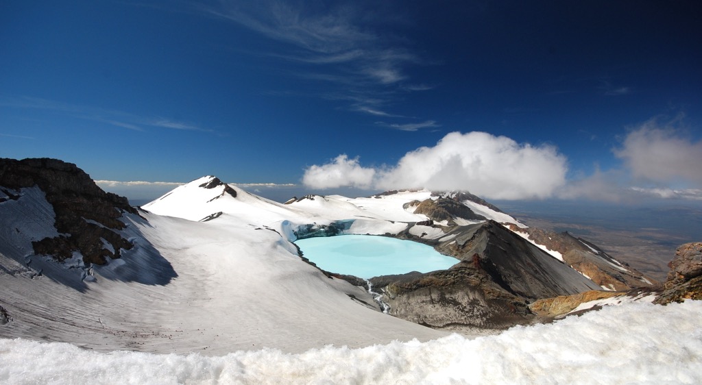
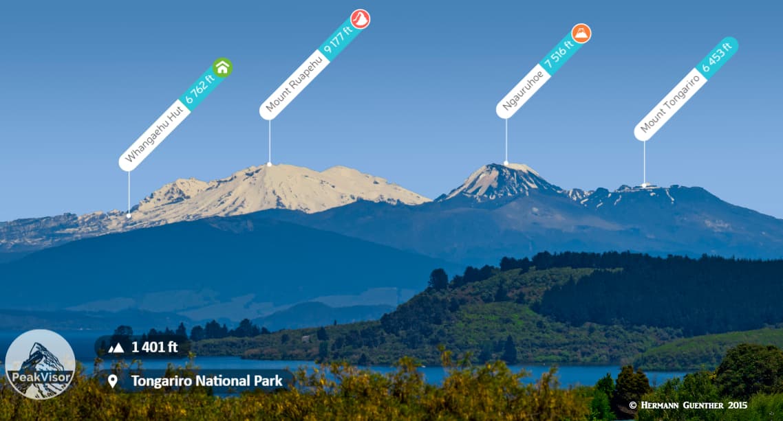
The Volcanic Plateau is one of the regions characterizing the North Island, with active volcanoes, large lakes, and steaming geothermal areas. The Tongariro National Park protects the southernmost part of the volcanic region. Three large cone volcanoes crown the park, including the tallest mountain on the North Island, Mount Ruapehu (2,797 m / 9,177 ft).
The North Island is home to three national parks, including:
The South Island is the larger of the two main islands but less populated. Ranges with high peaks over 3000 meters (10,000 ft) cover about 60% of the South Island.
The Southern Alps is the central mountain range running the length of the South Island for approximately 500 km (310 mi) from Nelson in the northeast to Milford Sound in the southwest. The Southern Alps create a division of the South Island both climatically and geographically. To the east of the Southern Alps is the rolling farmland of Otago and Southland and the vast Canterbury Plains, while the West Coast is known for its remote coastline and thick forest.
The Southern Alps are the highest range in Australasia and contain most of New Zealand’s highest peaks, with the highest mountain being Mount Cook/Aoraki (3,724 m / 12,218 ft). The Alps are also the most popular destinations in the country for hiking and skiing.
The South Island is home to 9 national parks, including:
Besides the North and South Islands, New Zealand has other smaller islands. The next largest island is Stewart Island/Rakiura, about 30 km (19 mi) south of the South Island and separated by the Foveaux Strait.
Most of the island is covered by wilderness areas, with its only settlement located at the entrance of Paterson Inlet (Whaka a Te Wera). The population of Stewart Island is estimated to be around 400. Rakiura National Park covers approximately 85% of the island. Mt. Anglem (Hananui), on the island’s north coast, is its highest peak at 980 m (3,215 ft).
New Zealand's territory also includes three remote groups of offshore islands: the Kermadec Islands in the north, the Chatham Islands to the east, and the subantarctic islands in the south.
New Zealand has a long and complex geological history. Land has existed in the vicinity of New Zealand for most of the past 500 million years. The oldest rocks originated as sedimentary deposits and were once part of the supercontinent of Gondwana.
Continental drift created a distinct island arc and oceanic trench about 300 million years ago. The deposition of sedimentary rock (mostly greywacke) into the trenches began to build up over millions of years, with the movements of the sea floor carrying them upwards. Today, greywacke still forms most mountain ranges on the North and South islands.
However, erosion immediately began to take its toll on the mountain-building period. By the middle of the Cretaceous period, the mountains had become extensive lowlands.
At the same time erosion was wearing down the land, circulation patterns below the earth’s crust were shifting. Hot rock began to well up beneath Gondwana and move outward, pulling the continent apart.
Around 85 million years ago, a large section of Gondwana moved off into the Pacific Ocean, known as Zealandia. Tectonic plate pressure between the Pacific and Indo-Australian Plates eventually uplifted this crust to form the New Zealand islands. The new ocean region separating New Zealand from Gondwana became the Tasman Sea.
There are seven major tectonic plates on the Earth’s mantle. Sections of the Pacific Plate's ocean floor began to sink beneath the Australian Plate's continental rocks. This pressure caused major cracks to develop, eventually joining New Zealand’s great Alpine Fault and splitting the continental mass. Since then, New Zealand has laid across two separate plates; the Pacific and the Australian. The North Island and some parts of the South Island sit on the Australian Plate; the rest is on the Pacific Plate.
These plates are constantly moving, colliding, and grinding against each other. This compressional movement has created the Southern Alps and other ranges in New Zealand over millions of years.
The mountains continue to be raised even today by this tectonic pressure. The Southern Alps are some of the fastest-growing mountains in the world, estimated to be uplifted at approximately 7 millimeters per year.
However, this tectonic plate movement also creates violent seismic activity along fault lines. New Zealand is part of the Ring of Fire, marked by frequent earthquakes and volcanic activity. Countless tremors occur annually, with several devastating earthquakes over the last few hundred years.
The oldest volcanic remnants in New Zealand formed on the Gondwana supercontinent. However, most violent volcanic activity occurred in the last two million years of the Quarternary Period.
Most of New Zealand’s most prominent volcanoes are basin-shaped volcanic depressions known as calderas rather than cone-shaped mountains. Many of New Zealand’s geothermal areas, such as Rotorua and Waimangu, lie within these calderas. Lakes, such as Taupō and Rotorua, now occupy some calderas subject to repeated eruptions.
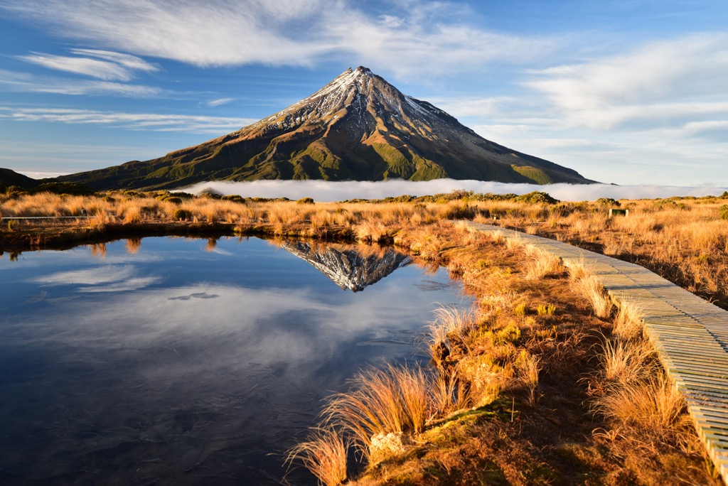
The North Island is the site of most of today’s volcanic activity. Currently, none of the South Island’s volcanoes are active. The primary active volcanoes of the North Island include Mt Taranaki (2,518 m / 8,261 ft), the peaks of Tongariro National Park (Tongariro, Ngāuruhoe, Ruapehu), and White Island.
About 2.6 million years ago, before the start of the Quaternary period, the earth plunged into cycles of repeated climate cooling known as ice ages. Over time, accumulated snow hardened into ice, forming massive glaciers that moved downhill into lower regions. Glaciers predominantly formed in the South Island and, to a lesser extent, in the North Island’s Tararua and Ruahine ranges.
Glaciers and ice caps formed and retreated many times during the ice ages. Their flow has left ice-sculpted landforms most visible in the Southern Alps. As ice has retreated, depressions left behind have been filled with water, creating the many glacial lakes across New Zealand, such as Wakatipu, Tekapo, and Pūkaki.
Today, many of New Zealand’s glaciers are receding at rapid rates. On the North Island, only Mount Ruapehu (2,797 m / 9,177 ft) has glaciers remaining. However, most of New Zealand’s largest glaciers exist in the Southern Alps. Most notably, the Tasman Glacier is the largest in New Zealand at 23 km (14.3 mi) long and between 1 and 2 km (0.6 and 1.2 mi) wide at different points.
New Zealand is a global hotspot for biodiversity. The country is home to an estimated 80,000 endemic species, likely due to long isolation from other land masses.
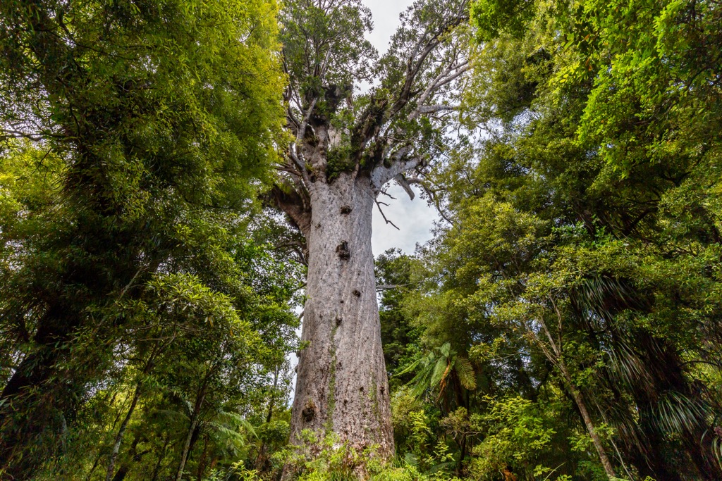
The native vegetation of New Zealand consisted of evergreen forests that covered the majority of the total land area. However, since European settlement, this has reduced significantly to only about 10-15% of the land. Native flora includes tall kauri and kohekohe forests to rainforests dominated by rimu, beech, tawa, matai, and rata. Parts of the higher alpine regions are home to tussock, scrub, and spinifex.
Unlike most countries, New Zealand has been home to few mammals. Before European colonization, only a few bat species and marine mammals like dolphins existed on the islands. Conversely, birds and insects dominate the region’s fauna. For this reason, birds became the predators, the scavengers, the herbivores, and the insectivores. They can be found everywhere, from the highest mountains to the sea. Some even lost their ability to fly due to the lack of other predators.
Some prominent flightless bird species in New Zealand include the Kiwi, Weka, and Takahe, with the latter highly endangered.
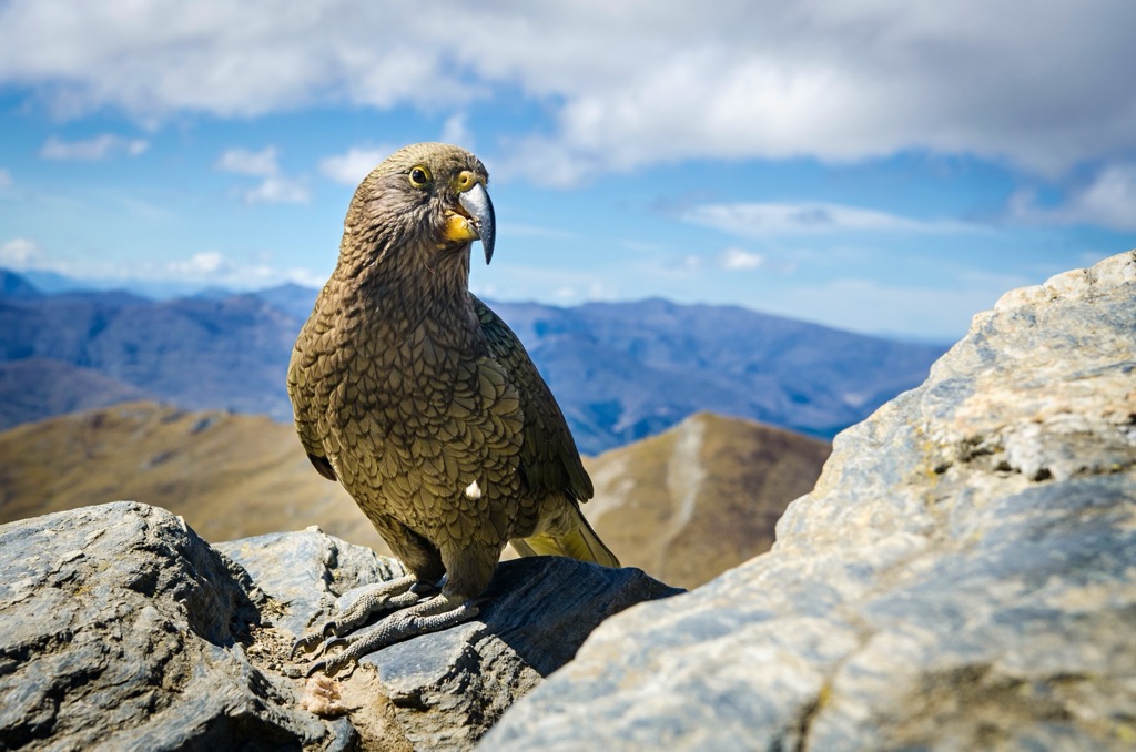
One of the most well-known native birds, the Kea, is the world’s only alpine parrot. The forested foothills and higher elevations of the South Island compose this fascinating bird’s habitat. It’s often considered one of the most intelligent birds in the world.
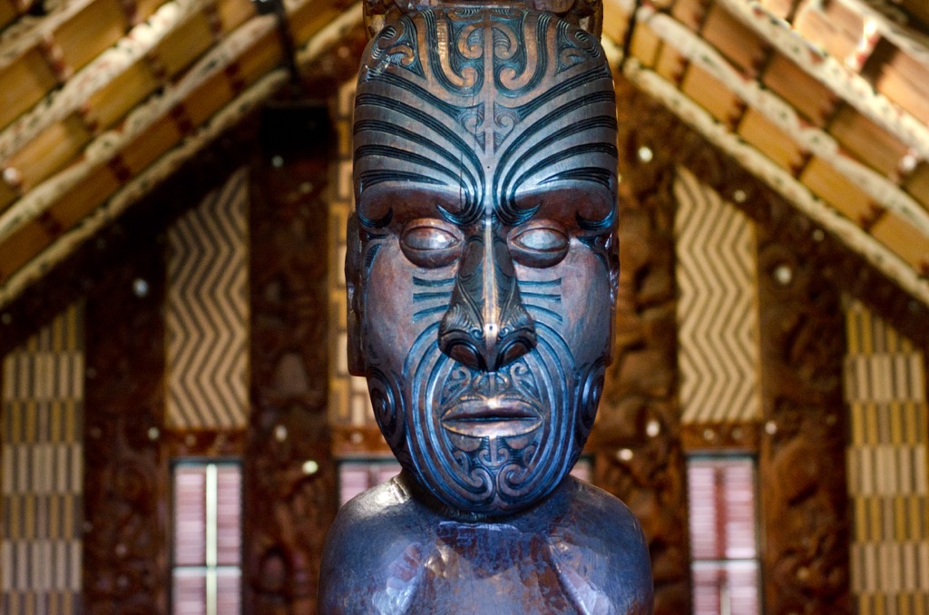
Due to its isolation, New Zealand was likely the last prominent and liveable place in the world to be inhabited. The first settlers were Polynesians, who likely traveled from what is now French Polynesia as they explored the Pacific. The term Maori did not exist until the arrival of Europeans; the Indigenous people adopted it to distinguish themselves from the new arrivals.
The Dutch navigator Abel Tasman was the first European to sight New Zealand in 1642. The name New Zealand came from the Dutch ‘Nieuw Zeeland,’ first given by a Dutch mapmaker.
Englishman James Cook arrived in New Zealand in 1769 on the first of three voyages, after which European whalers and traders began to visit more regularly.
By the 1830s, the pressure was mounting for the British government to settle the land before the French, who also considered New Zealand a potential colony. In 1840 at Waitangi, William Hobson, New Zealand’s first Governor, invited Māori chiefs to sign a treaty with the British Crown. Local chiefs from every corner of the country signed the treaty; more than 500 leaders eventually signed what is now known as the Treaty of Waitangi (Te Tiriti o Waitangi).
The Europeans brought an array of diseases to which the Māori had no resistance. As a result, the Māori population declined rapidly to less than half of their original numbers. By the late 1850s, settlers outnumbered the Māori people.
By the 1860s, war broke out in the North Island as the Māori came under increasing pressure from European settlers to sell their land for settlement. On the South Island, settlers established sheep farms and discovered gold in Otago in 1861.
Throughout the 1870s, the British government encouraged citizens to start a new life in New Zealand. They built railways, and towns sprang up and continued to expand. Agriculture formed the backbone of the economy, with much of the forest that originally covered New Zealand rapidly cleared for farmland.
Independence was a slow process that unfolded throughout the late 1800s and early 1900s. As early as 1840, New Zealand was recognized as the independent Colony of New Zealand, separate from Australia. In 1901, New Zealand rejected the idea of joining the Federation of Australia, preferring to take its own route towards independence. In 1907, the country was then granted Dominion status by the British, meaning self-governing and politically independent.
At the request of Canada, South Africa, and Ireland, the 1926 Balfour Declaration provided formal and international recognition of the independence of former colonies as members of the British Commonwealth of Nations. While New Zealanders did not initially embrace these developments, the country began to operate more independently and make its own decisions.
At the turn of the 21st century, New Zealand’s executive, legislative, and judicial branches all stood separate from the UK. Similar to Australia, only the monarch remains as the shared head of state.
New Zealand is home to 13 national parks across the main islands, encompassing a variety of landscapes from snow-capped mountain peaks to rugged coastlines. Here are some of the best places to go hiking in the country:
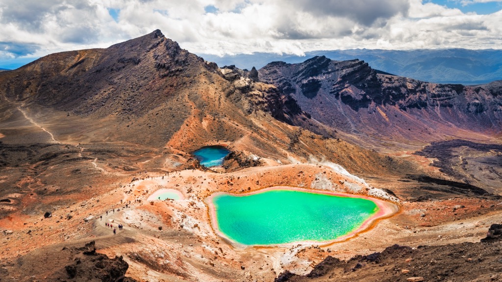
Tongariro National Park is New Zealand's oldest national park and a World Heritage area. It’s in the central North Island region and features a stark volcanic landscape. The park is home to the highest mountain on the North Island, Mount Ruapehu (2,797 m / 9,177 ft), one of the world’s most active stratovolcanoes.
The park is undoubtedly one of the top attractions on the North Island and one of the country's best places to go hiking. The Tongariro Alpine Crossing is an incredibly popular hiking trail within the park. The 19 km (11.8 mi) day hike is usually done one–way from the southwest to the northeast. Most hikers take a shuttle bus from one of several locations to the trailhead at the end of Mangatepopo Road. The challenging trail immerses hikers in the South Crater, Red Crater, and Emerald Lakes scenery.
Otherwise, there are also options for longer multi-day hikes in the park. The six-day Round-the-Mountain Track is one of New Zealand’s Great Walks and leads hikers right around Mount Ruapehu over 66 km (41 mi) of trail. There is also the four-day Northern Circuit, which encircles Mount Ngauruhoe (2,291 m / 7,516 ft) and includes views of the Emerald Lakes.
Nelson Lakes National Park is in the far north of the South Island and is considered the northernmost extension of the Southern Alps. It’s named after the two glacier-carved alpine lakes in the region, Lake Rotoiti and Lake Rotoroa. Nelson Lakes contains 39 named peaks, the highest of which is Mount Travers (2,341m/7,680 ft). The gateway to the park is St Arnaud, a 1-2 hour drive from Nelson or Blenheim.
The national park is home to some incredible hiking trails introducing people to the spectacular alpine landscapes of the South Island. The most popular day hike is the 9 km (6 mi) loop track across the northern slopes of Mount Robert (1,421 m / 4,662 ft), offering stunning views across Lake Rotoiti.
For longer trails, the Travers Sabine Circuit is an 80 km (50 mi) loop starting and ending in St. Arnaud. It takes hikers through beech forests, fields of tussock grasses, towering peaks, and cold mountain streams. It takes 4-7 days to complete this track, with huts along the way, although Mount Cupola (2,260 m/7,414 ft) is worth climbing as a side trip.
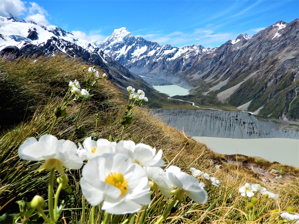
Aoraki/Mount Cook National Park is the pinnacle of mountain regions in New Zealand. Located deep in the Southern Alps of the South Island, it’s home to the highest mountain in New Zealand, Mount Cook/Aoraki (3,724 m / 12,218 ft). However, it encompasses 23 peaks over 3000 meters (10,000 ft), making it the loftiest of the South Island’s park areas.
The park is accessible through the Aoraki/Mt Cook Village providing a comfortable base for alpine activities. Hiking and mountaineering are popular in the park, considered the best training ground for high-altitude climbing in Australasia.
The park is home to two of the best hikes in the country. The Hooker Valley Track is a 10 km (6.2 mi) return hike up the Hooker Valley. It ends at the glacial lake with fabulous views of Mount Cook/Aoraki on a clear day. However, this is a rainforest, and clouds often obscure the highest peaks.
The other is the Mueller Hut Route, best done as an overnight hike. The more challenging 10 km (6.2 mi) return trail takes up to 8 hours, so spending the night at the hut is ideal. The trail climbs to a mountain pass on the Sealy Range and includes spectacular views of Mount Cook/Aoraki.
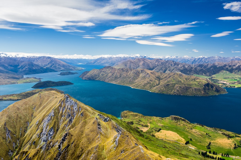
Mount Aspiring National Park is one of the four national parks of the Te Wahipounamu – the Southwest New Zealand World Heritage Area. It’s home to 326 named peaks, the highest of which is Mount Aspiring (3,033 m / 9,951 ft), known to the Māori as Tititea, meaning ‘sparkling white peak.’ The park is easily accessible from Wanaka, a quaint town on the southern end of its namesake lake.
It’s one of the most popular destinations in the country for hiking, with plenty of day hikes and longer overnight trails, including one of the country’s Great Walks.
The 10 km (6.2 mi) day hike to Rob Roy Glacier includes the best alpine landscapes within a few hours, including a spectacular glacier view. Otherwise, to delve a little deeper, head off on the famous Routeburn Track, which is one of the most popular multi-day trails in New Zealand. The track is 32 km (19.9 miles) long and provides beautiful views as it links Mount Aspiring National Park with Fiordland National Park. Hikers have the option of booking multiple huts through the Department of Conservation.
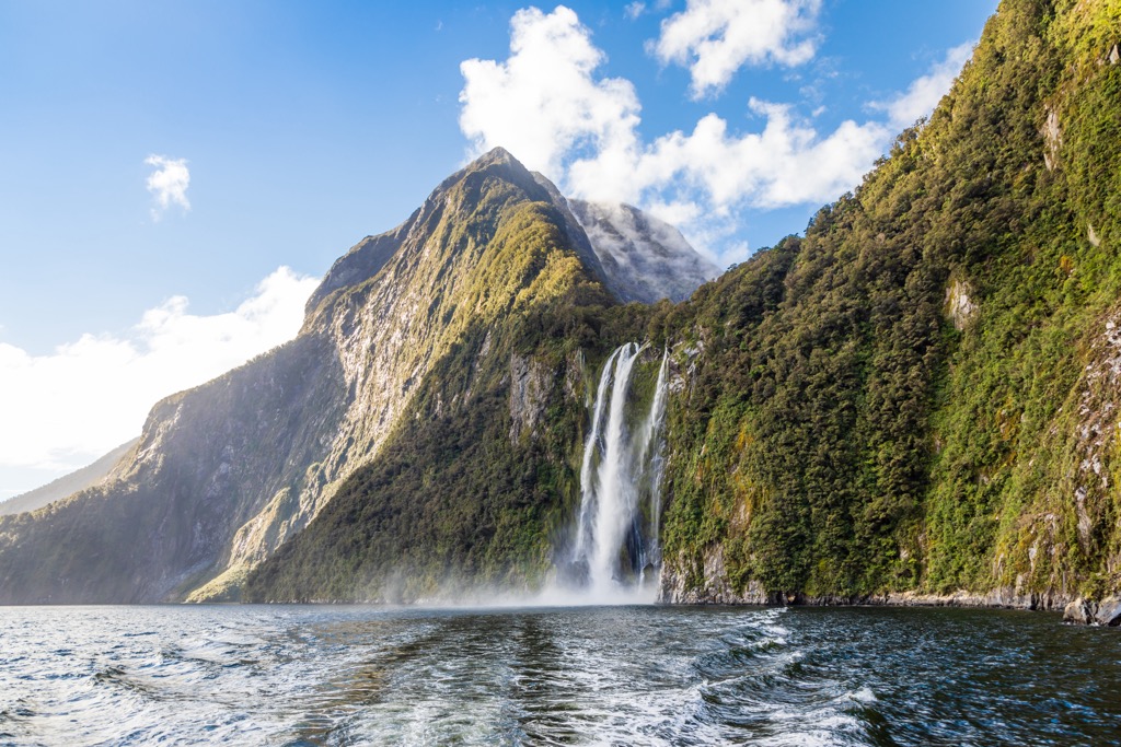
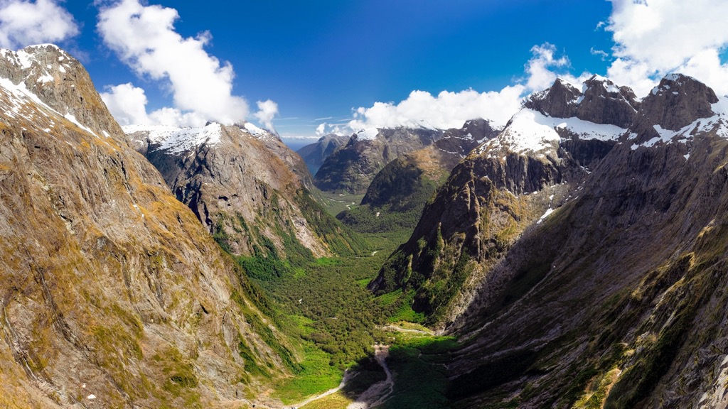
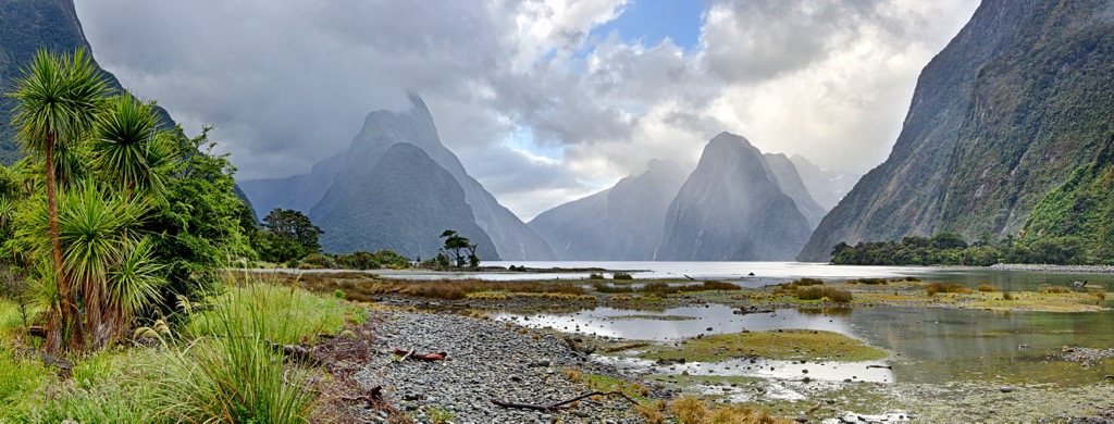
Fiordland National Park is in the southwest corner of New Zealand’s South Island. It’s the largest national park in the country, covering a staggering 1.2 million hectares (2.9 million acres), and is undoubtedly one of the country’s most famous natural attractions.
While the northeast of the park is home to the famous Milford Sound, wild and dramatic landscapes of soaring mountains, fiords, dense rainforest, and alpine lakes and meadows dominate the entire area.
Three of New Zealand's Great Walks are in Fiordland: Kepler Track, Milford Track, and Routeburn Track. These are easily the most popular multi-day hikes in the country, with advanced bookings required for the campsites and huts through the Department of Conservation.
For shorter day hike options, you can take the 6 km (3.7 mi) return hike to Lake Marian in the Hanging Valley or the 8 km (5 mi) out-and-back Gertrude Saddle Route for a far more challenging option.
There are plenty of ski fields across New Zealand’s two main islands for skiing and snowboarding enthusiasts. While most ski resorts lie in the Southern Alps on the South Island, the North Island is also home to two of the largest ski areas in the country. Here are some of the best places to go for skiing on your next visit:
Mount Ruapehu (2,797 m / 9,177 ft) is the center of winter skiing in the North Island. Located in Tongariro National Park, the active volcano is home to two skiing areas: Whakapapa and Tūroa. State-of-the-art lifts access some of the country’s longest ski runs with vast views.
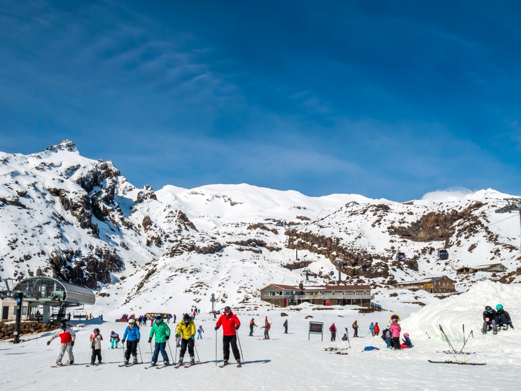
The solidified lava and volcanic landscape make for fun and challenging terrain for experienced boarders and skiers. However, there's also more beginner-friendly terrain at Happy Valley.
Rainbow Ski Area, nestled in the Nelson Lakes region, is the northernmost ski field in the South Island and the only one in the Nelson region.
It has wide slopes that are often uncrowded compared to other resorts in the South Island. There are well-groomed trails for beginner and intermediate skiers and jumps and drops for snowboarders of all levels.
The Remarkables is one of the most popular skiing areas in the country. Located near Queenstown in the Otago area of the South Island, The Remarkables has north-facing slopes, various terrain parks, and dedicated freestyle areas, with over 380 hectares (939 acres) of terrain in total.
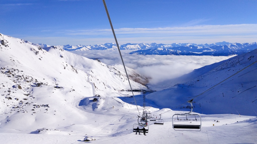
It’s home to six mountain lifts, including a couple of high-speed chairs (not a given in New Zealand). Plus, it’s not far from Coronet Peak, offering the benefit of using both ski areas with the same multi-day or season pass. It’s usually open from June until October.
The North Island is home to the largest cities in New Zealand, but the South Island is still easily accessible with great towns to base yourself in for a trip. Looking for a place to stay during your trip to New Zealand? Here are some of the best cities to check out:
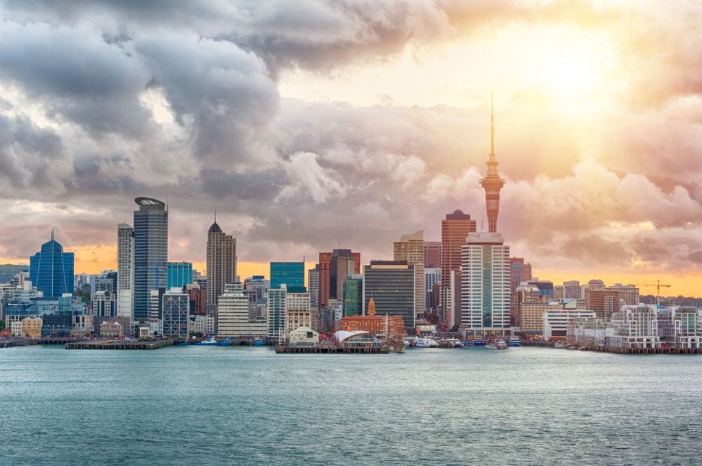
Auckland, or Tāmaki Makaurau, is by far the most significant urban center in New Zealand. It’s home to about one-third of the country’s total population. Based around two large harbors in the island's northern part, it’s a vibrant multi-cultural center surrounded by beaches and bushland.
The most iconic landmark is the Sky Tower, which has views of Viaduct Harbour. Otherwise, the inner city also has waterfront shopping precincts, restaurants, and bars. As the primary international gateway to the country, Auckland is home to a large airport and is a central transport hub for the rest of the country.
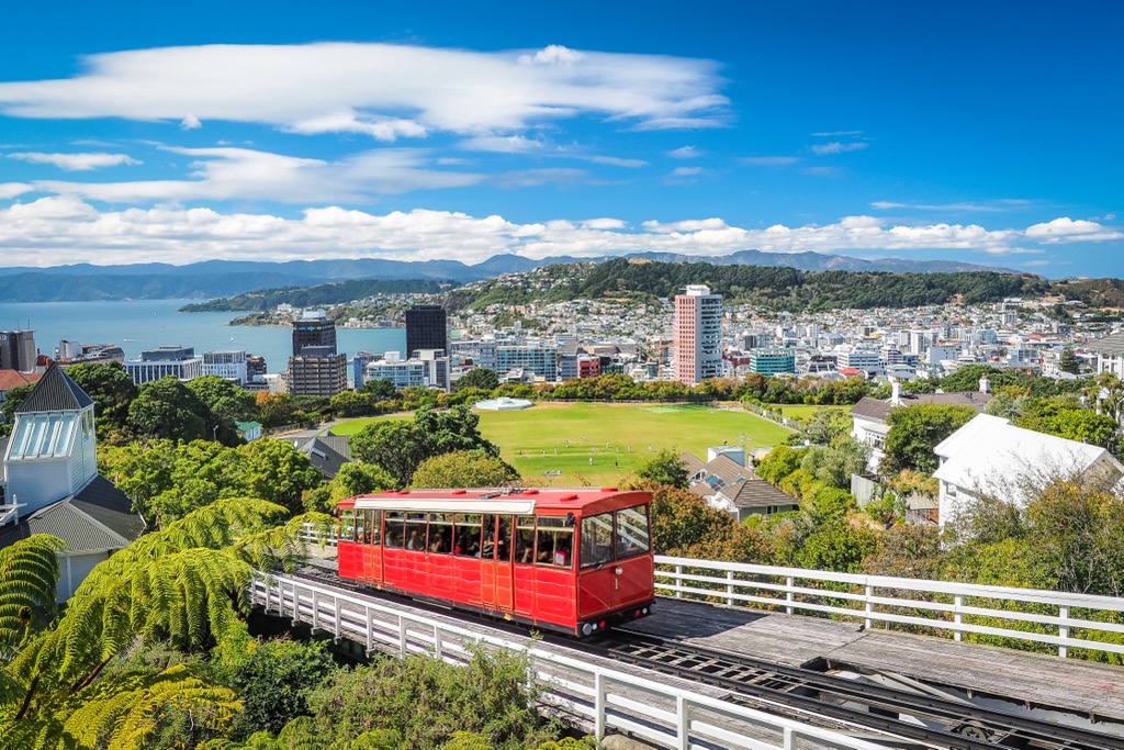
Wellington, or Te Whanganui-a-Tara, is the capital city of New Zealand. It sits at the very southern tip of the North Island on the Cook Strait. It’s home to some of the country's most important historical and cultural sites, including the National Museum, National Library, and Parliament buildings.
Wellington has become a foodie epicenter, with craft breweries, cocktail bars, and delicious restaurants. You’ll also find a range of quirky and unique boutiques and shops in the urban center.
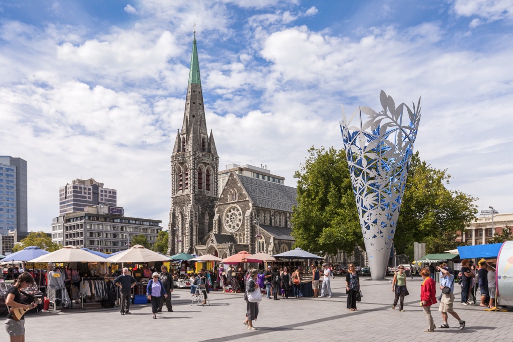
Christchurch is the largest city on the South Island, home to around 400,000 people. It’s well-known for its English heritage and old buildings, along with a revitalized center that has been rebuilt after the 2010-11 earthquakes.
The Avon River flows through the city, and plenty of green spaces exist, including the expansive Hagley Park and Christchurch Botanic Gardens. West of the Canterbury Plains from the city, Arthur’s Pass National Park is only about a two-hour drive away.
As the main gateway to the South Island, the city has a large airport and plenty of transport connections to other areas of the country.
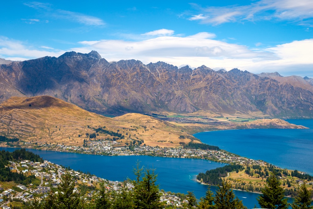
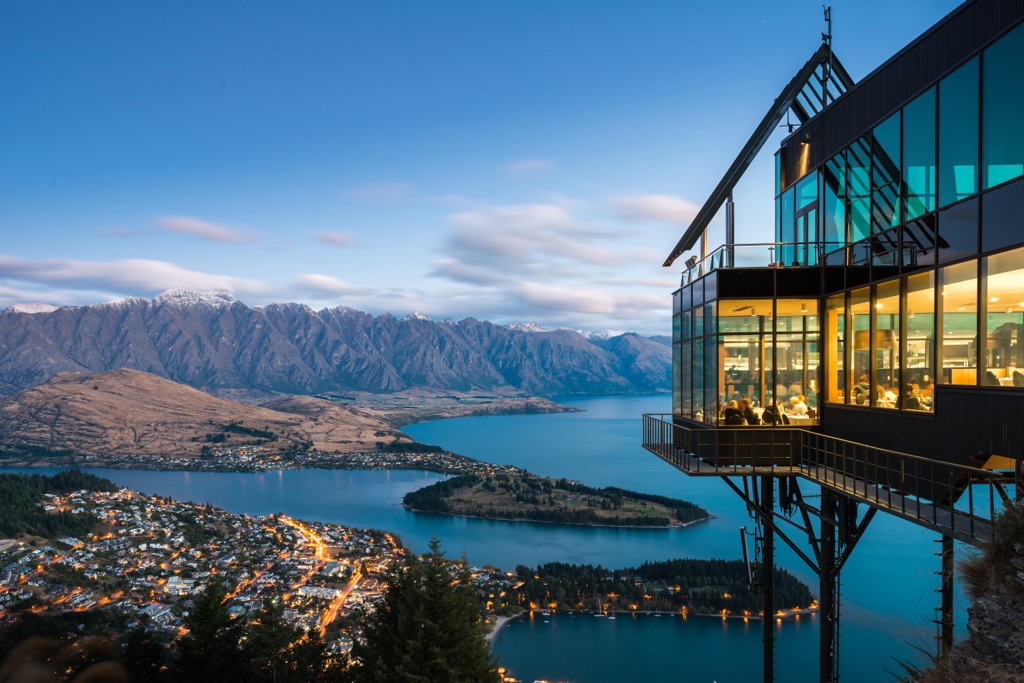
Despite being a small town, Queenstown is the bustling hub of the adventure scene on the South Island. Located on the shores of Lake Wakatipu and against the dramatic backdrop of the Southern Alps, Queenstown is often considered the adventure capital of the world.
Within the town, the Skyline Gondola shuttles visitors high above Queenstown for mountain biking, paragliding, and hiking. The Gondola is receiving an upgrade from the old 4-seater to a 10-seat Doppylmeyr, which should reduce summer congestion. Skyline is due to reopen to the public in July 2023.
Otherwise, on the town's doorstep are Mount Aspiring and Fiordland National Parks, as well as the ski fields of The Remarkables and Coronet Peak.
Being a buzzing hub all year round, Queenstown is well-serviced, with regular domestic and international flights to and from the airport. As one of the most visited places in New Zealand, it has plenty of amenities for travelers.


Yes. New Zealand has 8,316 named mountains. The highest is Mount Cook at 3,724 m.
The highest mountain in New Zealand is Mount Cook, at 3,724 m.
New Zealand has 8,316 named mountains.


