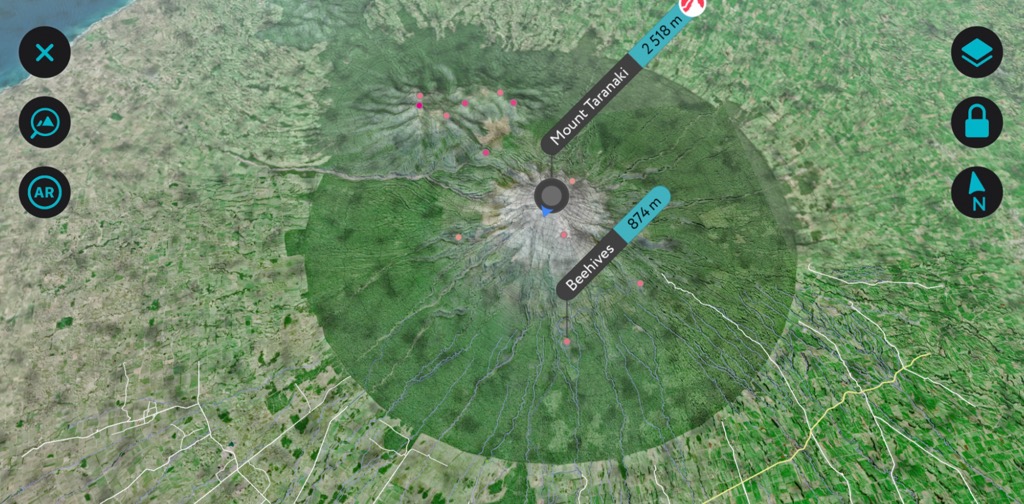
Scan the QR code and open PeakVisor on your phone
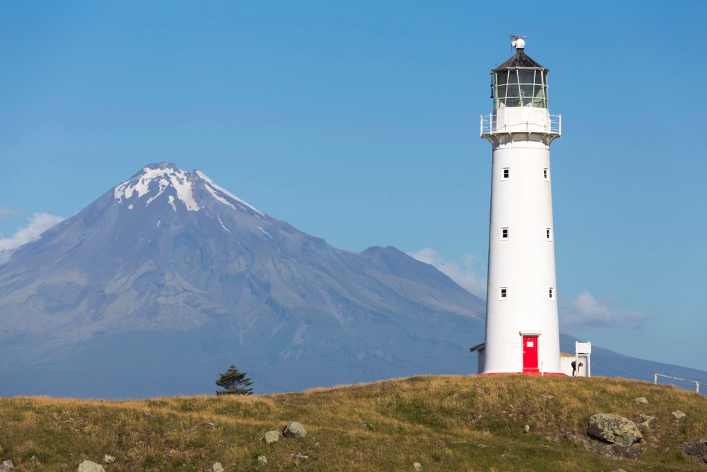
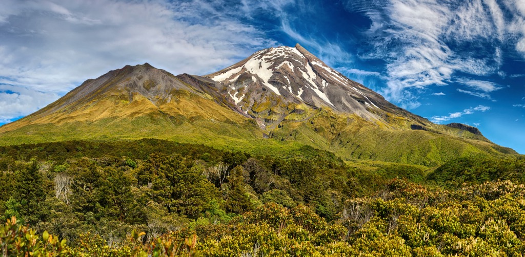
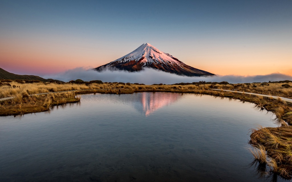
Egmont National Park lies on the west coast of New Zealand’s North Island. It encompasses 34,170 ha (84,436 acres) of lush and diverse plant communities and 34 named peaks. The park is best known for the dormant stratovolcano Mount Taranaki, sometimes called Mount Egmont, the park’s highest peak at 2,518 m (8,261 ft). Taranaki is an ultra-prominent peak, with 2,309 m (7,575 ft) elevation gain from the foothills around it.
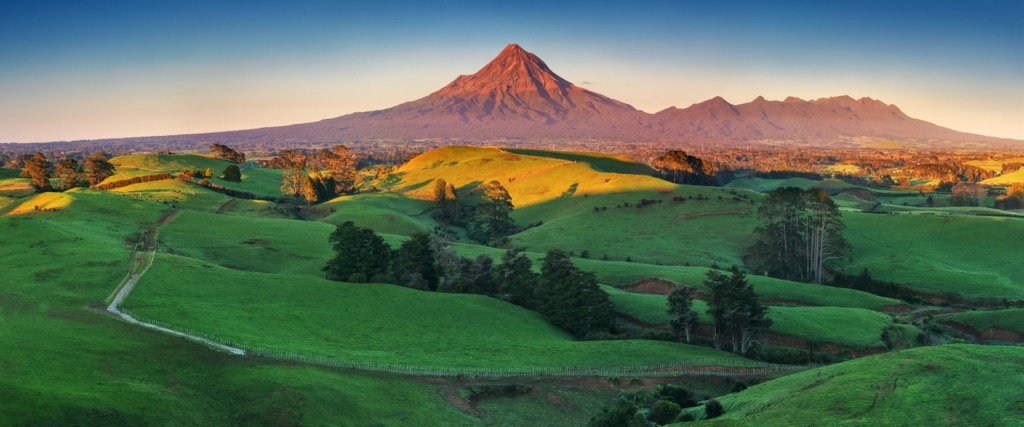
Egmont National Park in New Zealand, located on the North Island’s west coast, protects 34,170 ha (84,436 acres) around Mount Taranaki (2,518 m / 8,261 ft), a dormant stratovolcano and the tallest peak in the park. The two other volcanic cones in the area are extinct, forming the base of the mountains Pouakai and Kaitake in the park's northwest corner.
Egmont National Park forms a circle around Mount Taranaki, incorporating Pouakai and Kaitake. Fertile farmlands surround the mountain, and the park boundaries appear as an alien crop circle-esque forested ring around the peak.
Egmont National Park is home to a stunning array of lush vegetation, lava flows, alpine meadows, thick forests, and swamps. Multiple habitats, along with the area’s volatile volcanic history – Mount Taranaki last erupted in 1775 – have created diverse forest communities.
The main areas of access to the park are through the Dawson Falls area, North Egmont area, and East Egmont area. The park boasts several trails ranging from easy half-hour walks to multi-day circuits.
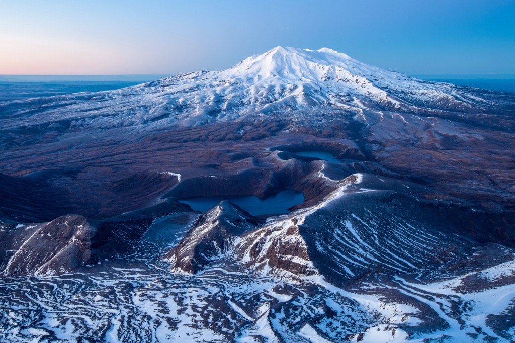
Mount Taranaki is about 129 km (80 mi) west of its more famous and slightly taller brethren, Mount Ruapehu. Taranaki hosts one tiny glacier hidden within its summit crater, while Ruapehu is host to as many as 18 distinct glaciers (although this number is steadily declining). The two mountains are clearly visible from each others slopes on cloudless days.
New Zealand’s geologic history dates back to the supercontinent Gondwana. Around 540 million years ago, New Zealand formed along the supercontinent’s perimeter. Rivers carried sediment, and underwater eruptions generated ash that hardened into the rocks underlying most of the country today.
New Zealand sits near the boundary between the Australian and Pacific plates. Around 100 million years ago, magma welled up and caused volcanic eruptions and splits along faults. By 85 million years ago, the Zealandia land mass separated from Gondwana and the Australian mainland, and began to drift across the Pacific Ocean.
Twenty-five million years ago, Zealandia split, and sections of the continent were uplifted. There has been further uplift in the last 1.8 million years, such as the Southern Alps on the South Island and volcanic eruptions, which continue in the present. During the Ice Age, glaciers carved out valleys and shifted rocks and sediment. Massive ice flows, such as the Tasman and Fox glaciers, continue to alter the landscape today.
In comparison to the geological deep time that defines continental drift, Egmont National Park’s geological formation was incredibly recent. The park is home to three volcanic cones, and the landscape is the product of their turbulent effects. Mount Taranaki formed around 125,000 years ago and last erupted around 1775. The secondary cone, Fanthams Peak, formed on Taranaki’s south side.
Ash showers, lava, and debris flows carried volcanic materials from the slopes. Some preserved ancient lava flows remain while others have been whittled away by erosion. The eroded lava created formations such as Humphries Castle, Lion Rock, and Warwick Castle (Tahuna a Tutawa).
Egmont National Park houses a robust array of vegetation communities and wildlife. These ecosystems range from semi-coastal to montane forests to grassland and alpine meadows, and don’t occur predictably along altitudinal lines.
Microclimates (including rain shadows), base rock and soil type, slope, and drainage influence variations in growth patterns. Natural disasters such as volcanic eruptions, landslides, and cyclones have historically disrupted ecosystems and altered forest composition. Needless to say, human civilization is the primary disrupter today.
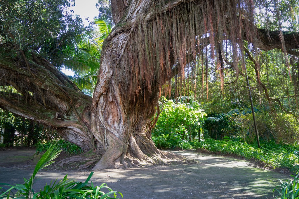
The park’s trees are both native conifer and broad-leaf. One distinct feature of the forest is the lack of beech trees, otherwise common in many New Zealand forests. There are many northern rata trees and an extensive kahikatea-rimu-kāmahi semi-swamp forest.
Along the coast, high rainfall and a mild climate support lush rainforests. Tall rimu and kamahi grow at lower elevations and transition to thick shrubs, then alpine meadows.
There is a unique forest composition along the lowland coast forest of the Kaitake mountains. Trees here include nikau, titoke, kohekohe, and puriri. One grove of California redwoods, planted in the 1930s, remains while other exotic trees are facing removal in an extensive native plant restoration project.
A third of all the park’s plant species grow in Ahukawakawa, a swampland between Mount Taranaki and the Pouakai Range. The wetlands make up the headwaters of the Stony River (Hangatahua). Flora here is well adapted to cool temperatures and acidic soil.
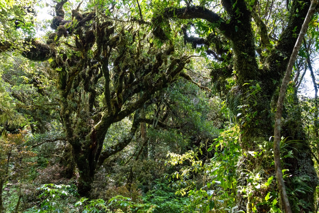
The high elevation kāmahi forest is an example of a landscape shaped by natural disasters. About 400 years ago, a volcanic eruption wiped out portions of the rimu forest. Kāmahi grew up in its place, mainly as epiphytes rooting on the remnants of tōtara and rata trees. The trees have distinct gnarled and twisted trunks that formed over the skeletons of dead trees, herlding the nickname ‘Goblin Forest.’
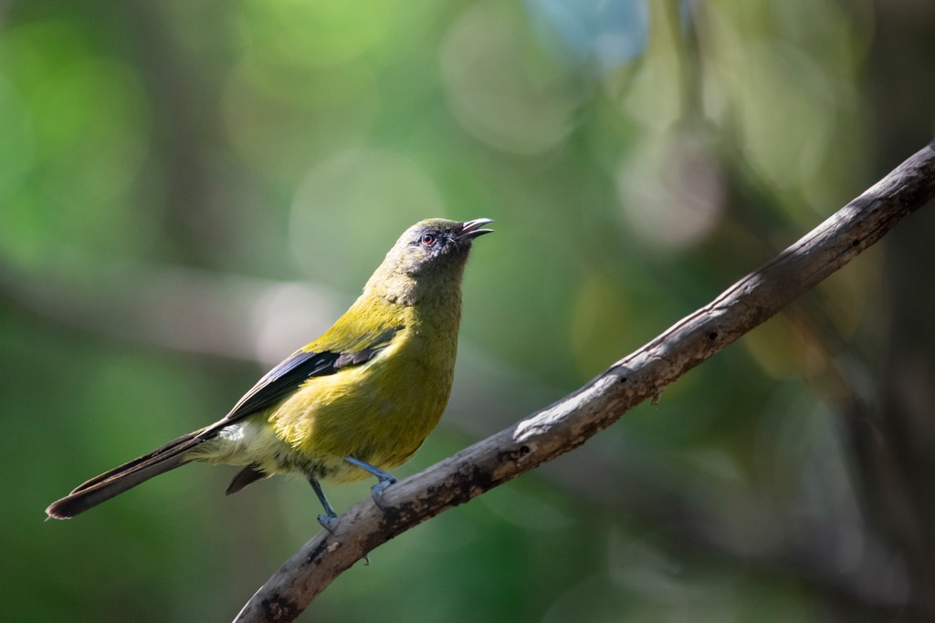
Egmont National Park has 20 native bird species and 15 introduced species. Common birds are tomtits (miromiro), tui, bellbirds (korimako), and woodpigeon (kererū), while threatened species include the North Island brown kiwi, fernbird, and blue duck.
Nearly half of the country’s native fish species exist in or around the park. The giant kokopu, short-jawed kokopu, banded kokopu, and koaro are threatened species living in the area. The giant land snail Powelliphanta, its shell up to 10 cm (3.9 in) in diameter, is also found in the park.
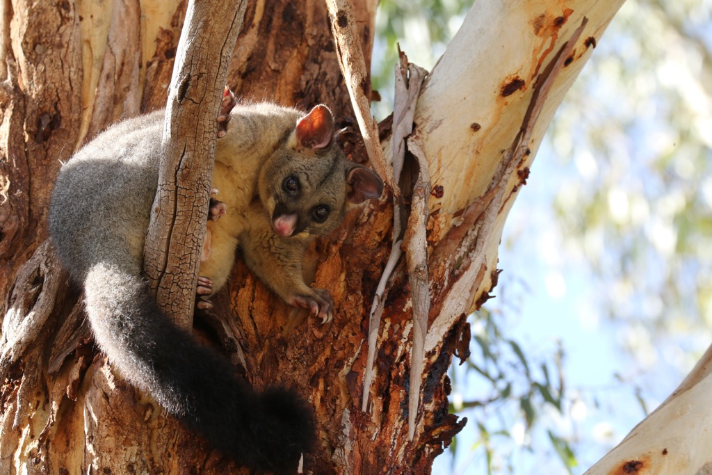
As in many places in New Zealand, introduced species pose problems in the park. Mammals damage native habitats and wildlife populations. Possums are a major culprit, destroying tree canopies and preying on bird eggs, chicks, and large invertebrates. Plants such as asparagus scandens, old man’s beard, and hawkhead compete with native vegetation.
The Māori arrived in New Zealand from the Polynesian Islands in a series of canoe migrations between 1320 and 1350 CE.
Māori legend swirls around Mount Taranaki. As the story goes, Taranaki was once part of the island’s larger central mountains. In a tragic departure from the central mountains, Taranaki gouged out the path of the Whanganui River as it headed west. The mountain remains a sacred site today for the Tangata Whenua of the area, and visitors are asked to be respectful.
The area first came under formal protection in 1881 when the slopes of Taranaki became a forest reserve. Next came the development of huts and roads; boundaries were extended, and the area achieved national park status in 1900. It is New Zealand’s second-oldest national park.
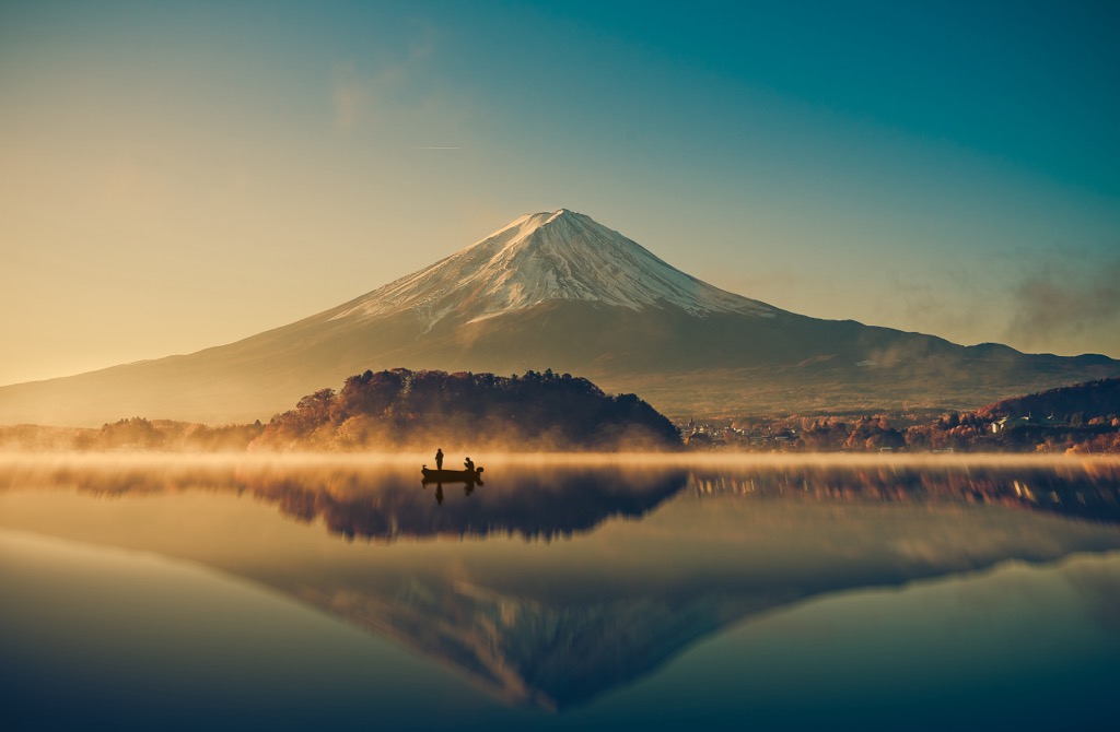
Mount Taranaki resembles Mount Fuji and was used as the backdrop for the film The Last Samurai.
Egmont National Park has several trails that explore features like waterfalls and the gnarled Goblin Forest, as well as challenging routes to summit Taranaki and complete multi-day treks. In addition to huts in the park, there are two private tourist lodges and three club lodges. Arrangements can be made with clubs ahead of time. All huts require advance booking for overnight stays.
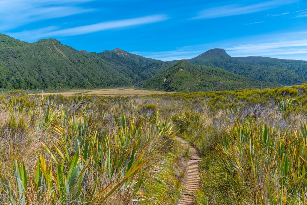
The Pouakai Circuit is one of Egmont National Park’s most popular multi-day treks. The circuit offers a two to three-day loop, with incredible views of Mount Taranaki and geologic features along the way. The trail is 25 km (15.5 mi) long and passes two huts. Hikers should note that there are multiple river crossings, and the river may be high or impassable after heavy rains.
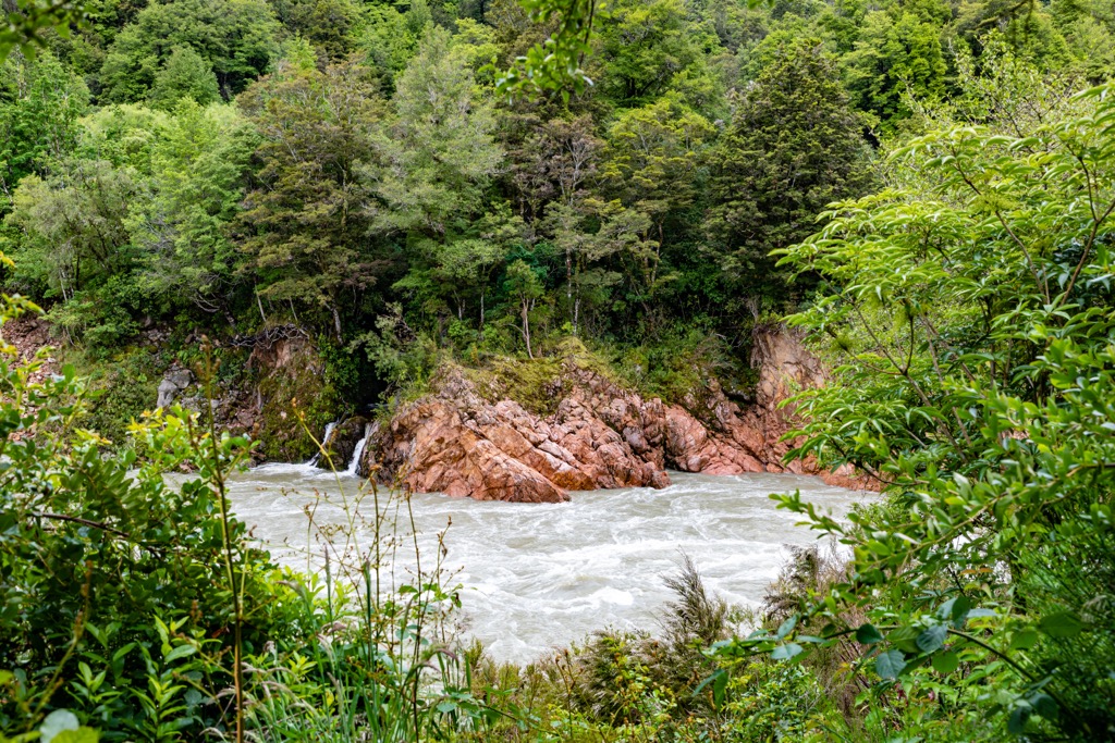
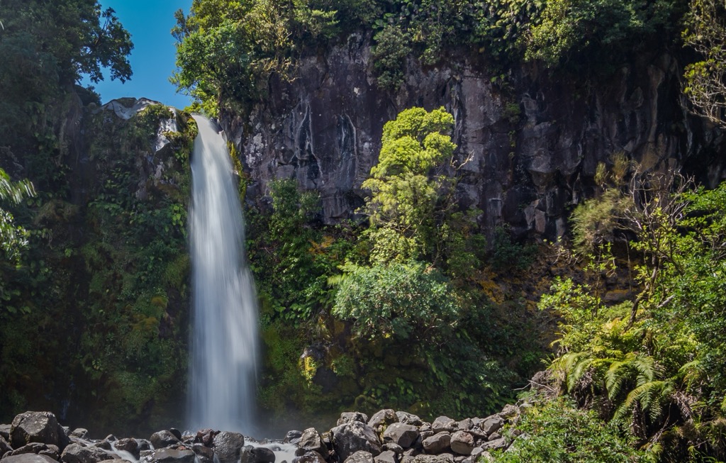
Highlights of the trail include the looming lava columns of the Dieffenbach Cliffs, the Kokowai Stream running red with manganese oxide, the ecologically diverse Ahukawakawa Swamp, and the short detour to Bells Falls, a waterfall pouring over an ancient lava flow.
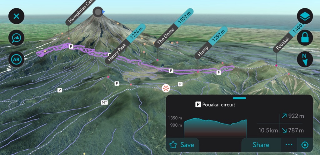
The first section of the trail runs from North Egmont to Holly Hut, spanning 7.5 km (4.7 mi), taking an average of three to four hours. This segment cuts through forest, alpine shrubs, and beneath the lava columns of the Dieffenbach Cliffs. From the Ahukawakawa trail junction, it is a five-minute walk to Holly Hut and another 30 minutes to Bells Falls.
The second section runs 4.5 km (2.8 mi) from Holly Hut to Pouakai Hut. After returning to Ahukawakawa junction, the trail crosses the headwaters before winding through mountain cedar. There are a couple of options for other trails along the way if you want to see the Pouakai Trig or leave the circuit if there is bad weather.
The final stretch leaves Pouakai Hut and returns to North Egmont. It is 13 km (8 mi) and takes five to seven hours. The path cuts along tussock grassland and alpine lakes before climbing Henry Peak. Finally, the trail crosses the Kai Auahi stream and the swing bridge across the Waiwhakaiho River before reconnecting to the road.
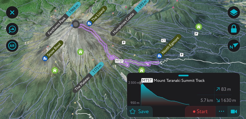
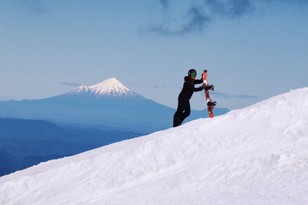
The Mount Taranaki summit climb takes eight to ten hours round trip and is 12.6 km (7.8 mi) out and back. Winter summits are possible - the mountain is a frequent ski touring destination - but the ascent requires more knowledge and gear than in the summer. Hikers will have the best conditions from December through April. The trail crosses through forest, alpine grassland, and slopes of scoria. There is no water along the way.
The first section runs from North Egmont to Tahurangi Lodge, taking an average of four hours and gaining about 545 m (1,788 ft) in elevation. A steep climb follows from the lodge to the summit; 1,026 m (3,366 ft) elevation gain in 2.3 km (1.4 mi). The route runs through rocky valleys, gravel slopes, and along a rocky ridge before crossing the ice of the tiny glacier in the crater on the final ascent.
Mount Taranaki is a sacred place to local Māori, and visitors are asked not to stand directly on the summit, as well as camp or cook near the summit.
Trails around Dawson Falls offer easy but scenic day hikes typically taking between thirty minutes and 1.5 hours. Destinations include a beautiful 18 m (59 ft) waterfall (the namesake Dawson Falls), the Goblin forest, and lava-formed pools perfect for a quick dip. The national park has a brochure outlining all the trails in this area.
Manganui Ski Area operates on the northern slopes of Mount Taranaki, typically from July to September.
The ski area offers a few T-bars and rope tows to provide access to the terrain. As a New Zealand “clubbie” ski field, the facilities are relatively basic compared to larger commercial ski resorts; the Stratford Mountain Club operates the ski area. A lodge at the base of the ski field provides accommodation and amenities for club members and visitors. You must hike to the base, adding 30 minutes of strenuous exercise to your ski day here. There are no lessons for beginners and not much beginner terrain. In short, this may not be the place for the faint of heart.
Snow conditions can vary year to year, month to month, day to day, and even hour to hour. The point is that the snow here is variable. Due to the ski area's relatively low elevation and extremely high precipitation, the quality and quantity of snow can be inconsistent, and rain events are common.
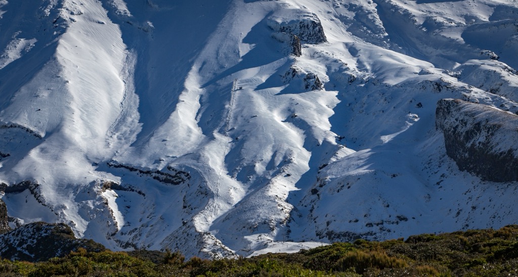
The drag lift to the top of the mountain is not always open, but it is legendary when it’s going off. You just have to be ready to catch it when it’s good. The terrain is steep and alpine, offering a European off-piste skiing experience. There are also touring and ski mountaineering opportunities if conditions are right. Moreover, ice climbing abounds on Taranaki, with significant ice flows building due to the heavy precipitation.
More information is available at the area’s website, skitaranaki.co.nz.
The nearest towns to Egmont National Park are New Plymouth, Inglewood, Stratford, and Opunake. Auckland, New Zealand’s largest city, is just under five hours to the north, and Wellington, the capital, is four hours away by car on the southern tip of the North Island.
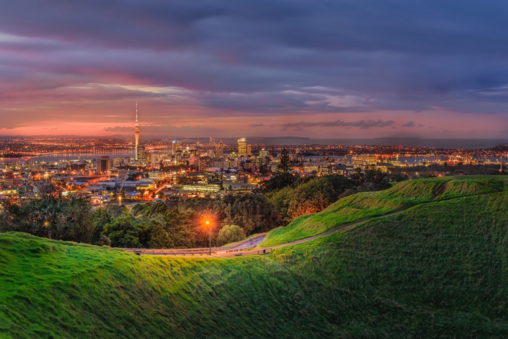
Auckland is the largest city in New Zealand, with a population of 1.66 million. Home to the country’s international airport, visitors can easily spend a day or two in the city while passing through. Many people skip the big city to travel to more scenic destinations, but there is plenty to do around Auckland.
Wandering along the waterfront will take you past harbors, restaurants, and bars, offering a feel for the city. A handful of museums – the Auckland Art Gallery, the Auckland War Memorial Museum, and the New Zealand Maritime Museum – are well worth a visit.
Out of the city center, the trendy cafes and boutiques of Ponsonby or the beaches of Mission Bay are worth a visit. You can also opt for a half or full-day excursion to Waiheke or Rangitoto Island, both accessible by ferry.
Dining and accommodation options are varied throughout the city. Visitors will have no problem finding spots to sample traditional Māori dishes and Polynesian-influenced cuisine. Hostels are available for those on a budget.
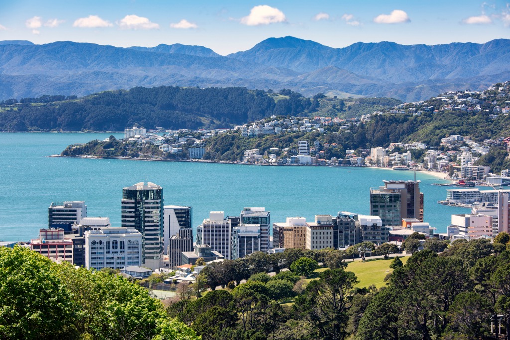
The picturesque capital of New Zealand, Wellington, sits on a harbor and is home to just under 215,000 people. The Welly Walks app offers several city tours, such as the City to Sea Walkway and the Foodie Trail. The Museum of New Zealand Te Papa Tongarewa is free and filled with natural history, history, and cultural exhibits.
A cable car climbs the hills surrounding Wellington. At the top, you can visit the Botanic Gardens and the Carter Observatory. The Mount Victoria lookout also offers excellent views of the wharf and city and can be accessed by hiking or car. A visit to the wildlife reserve, Zealandia, offers trails with the chance to spot iconic and endangered species.
Not only is Wellington the political capital, but it is also considered New Zealand’s culinary capital. A wide range of cuisines is available, including plenty of fresh seafood and culturally-inspired dishes. There are campsites outside the city, and hostels and hotels closer to the city center.