Scan the QR code and open PeakVisor on your phone
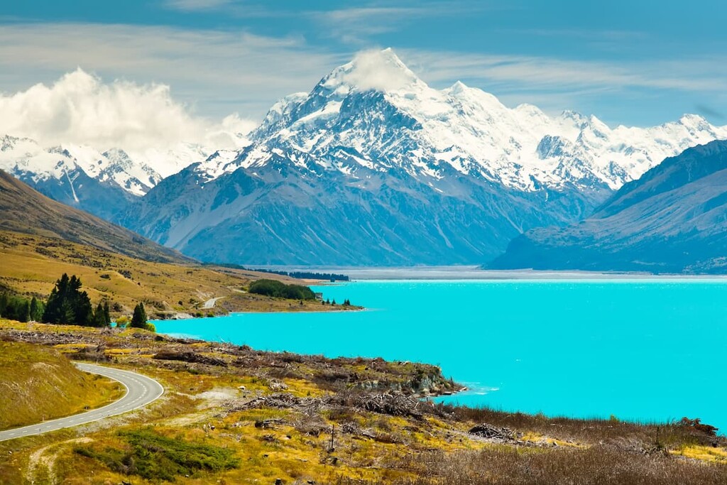
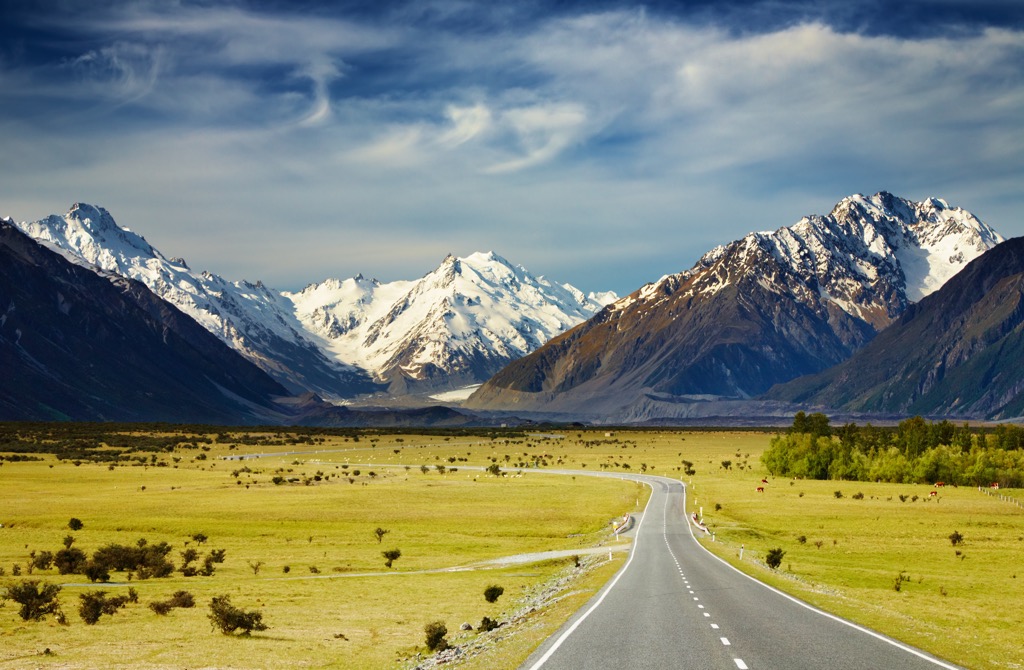
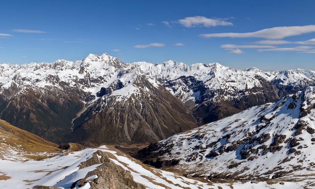
The Southern Alps are a mountain range extending nearly the length of New Zealand’s South Island. The range varies in elevation from 900 meters (3,000 ft) to multiple peaks over 3000 meters (10,000 ft). Mount Cook/Aoraki, at 3,724 m / 12,218 ft, is the highest and most prominent mountain in the Southern Alps. A total of 2122 named peaks comprise the Southern Alps.
The Southern Alps is a collection of smaller ranges running the length of New Zealand’s South Island. Together they stretch for approximately 500 km (310 mi) from Nelson in the northeast to Milford Sound in the southwest.
The Southern Alps are the highest range in Australasia and contain most of New Zealand’s highest peaks, with the highest mountain being Mount Cook/Aoraki (3,724 m / 12,218 ft). The range also includes over 20 peaks exceeding 3,000 meters (9,800 ft).
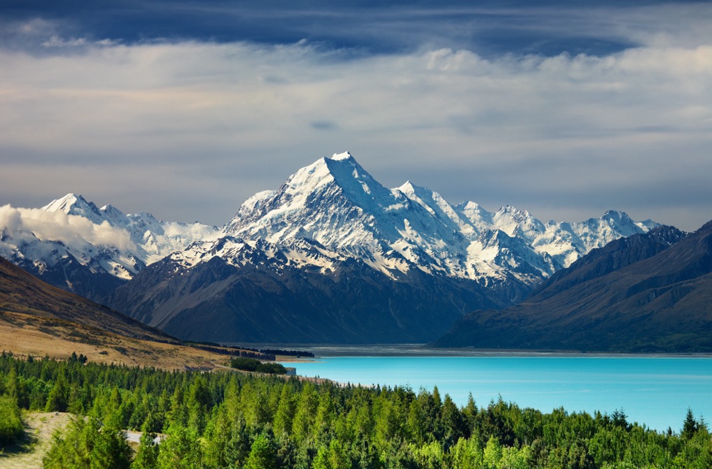
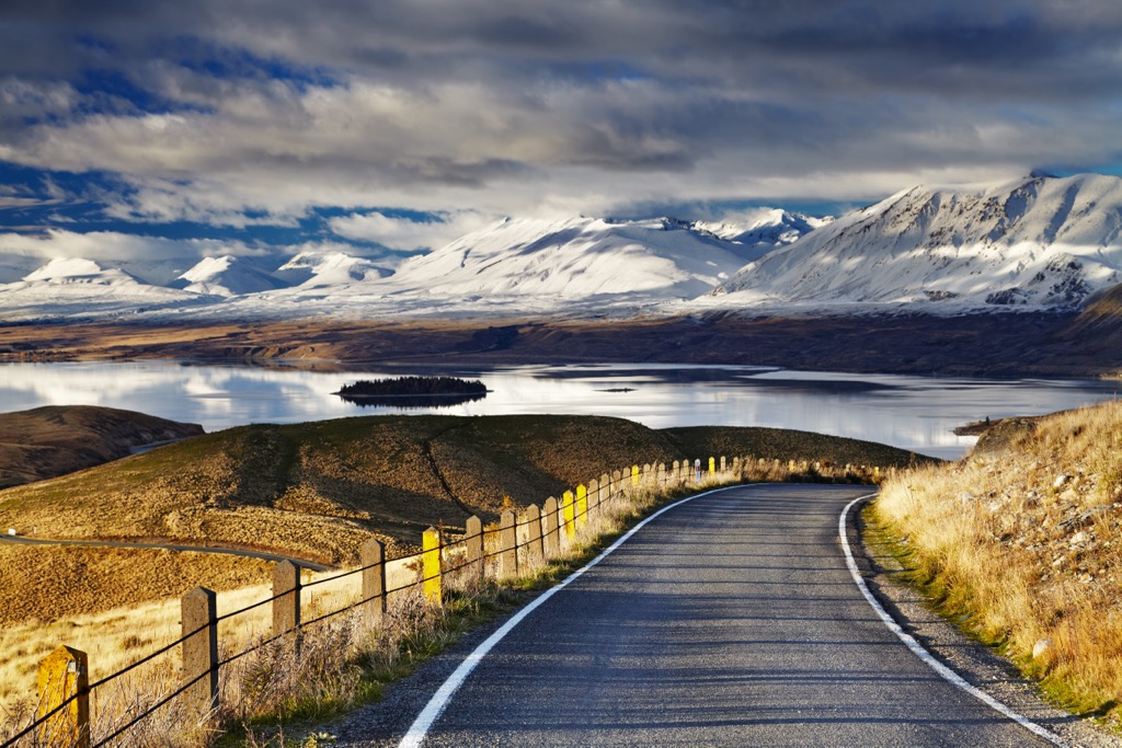
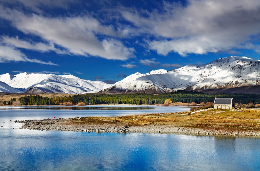
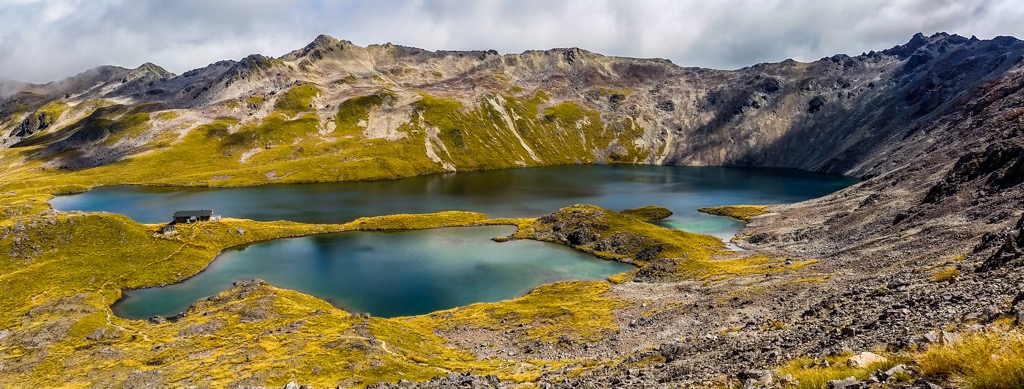
The mountain range is bisected by glacial valleys and filled with glacial lakes, including Lake Tekapo, Lake Wanaka, and Lake Te Anau. The glaciers also feed into major rivers, including the Rakaia, Rangitata, and Waitaki. Most notably, the Southern Alps are home to the Tasman Glacier, the largest in New Zealand at 23 km (14.3 mi) long and between 1 and 2 km (0.6 and 1.2 mi) wide at different points.
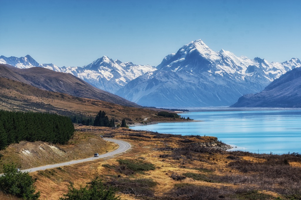
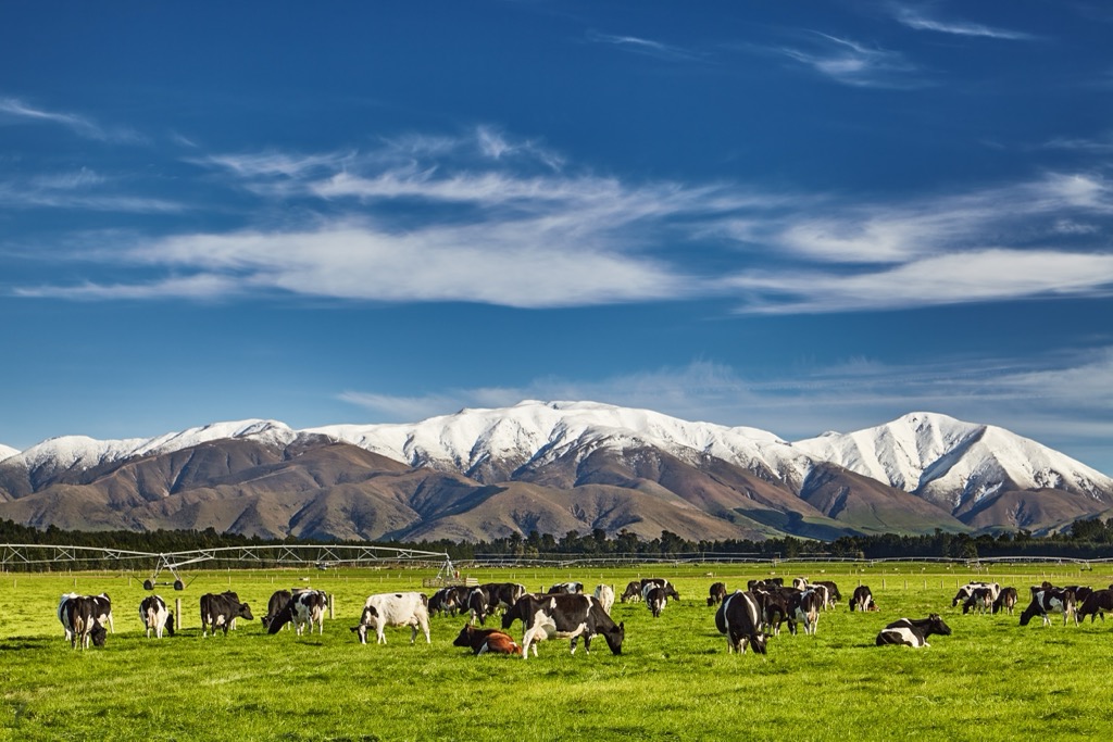
The Southern Alps are the key dividing factor within the South Island climatically and geographically. The forested western slopes and coastal plains are wetter and sparsely populated. Meanwhile, the eastern slopes and vast Canterbury Plains are drier and have more significant population centers.
Different parts of the ranges are protected under national park status. These parks are also the top destinations on the South Island for various outdoor activities, including hiking, skiing, camping, and mountain biking. These parks include:
The Southern Alps mark a geological plate boundary within the Pacific Ring of Fire. The Pacific Plate lies in the southeast and collides with the northwards-moving Indo-Australian Plate. This plate margin is marked by what is referred to as the Alpine Fault, where the plates rub past each other horizontally.
However, these plates are simultaneously slipping past and toward each other. This compressional movement is how the Alps have been created over millions of years; as rock layers have been pushed upwards and eroded to form rugged mountain peaks, they’ve molded a high mountain range parallel to the Alpine Fault.
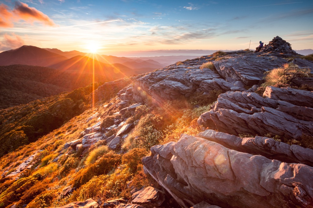
The mountains continue to be raised even today by this tectonic pressure. The Southern Alps are some of the fastest-growing mountains in the world, estimated to be uplifted at approximately 7 millimeters per year.
Despite their growth, the Alps also see very rapid rates of weathering and erosion. The stresses of rapid uplift, drastic changes in temperature, and frequent precipitation split the rock. This rapid erosion is apparent in the expanses of boulder and gravel that make up river beds.
Much of the Southern Alps is characterized by 100–300 million-year-old sedimentary rock. This is predominantly greywacke (a type of sandstone) containing narrow siltstone bands in the east, grading into schist in the west.
However, further south in Fiordland, the Alps are made of harder crystalline rocks (such as granite, gneiss, and diorite), which are far more resistant to erosion than the greywacke ranges. This has resulted in a sharper topography of steep valleys, fiords, and rugged peaks.
Granite and gneiss also feature in the ranges in the far northern reaches of the Alps near Nelson. This landscape is more diverse, with ridges, crests, and sizable alpine karst (limestone and marble) terrain.
The highest peaks of the Southern Alps are permanently snow-covered, with glaciers sweeping down through the highest passes and slopes. For much of the previous two million years, these glaciers dominated the valleys of the Southern Alps as far as 100 km (62 mi) east of the main divide. However, in recent times, the ice has rapidly receded, leaving behind sheer valleys, fjords, and deep glacial lakes within the ranges' rock and gravel deposits.
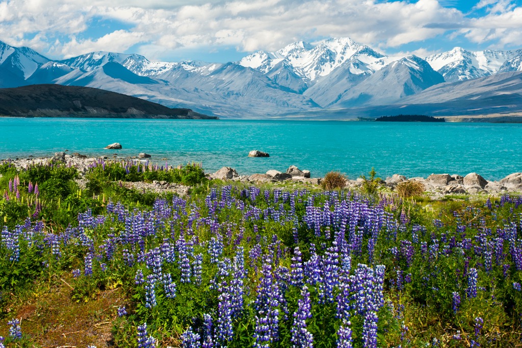
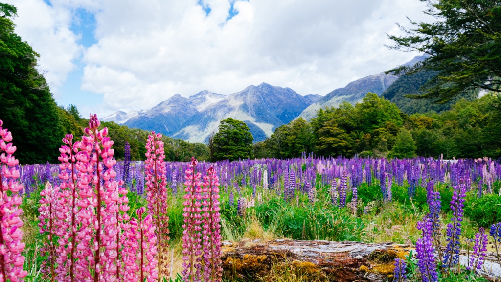
The Southern Alps are home to a wide variety of flora and fauna. Alpine plants and animals must cope with extreme cold, wind, and dry conditions, making them highly adaptable and resilient. It’s estimated that about 25% of the country’s plant species can be found above the treeline in alpine habitats, concentrated around the Southern Alps of the South Island.
The mountain ranges are home to abundant grassland and mountain beech forest. The wetland vegetation includes mosses, rushes, low-lying shrubs such as hebes, and other flowering plants such as mountain daisies and buttercups.
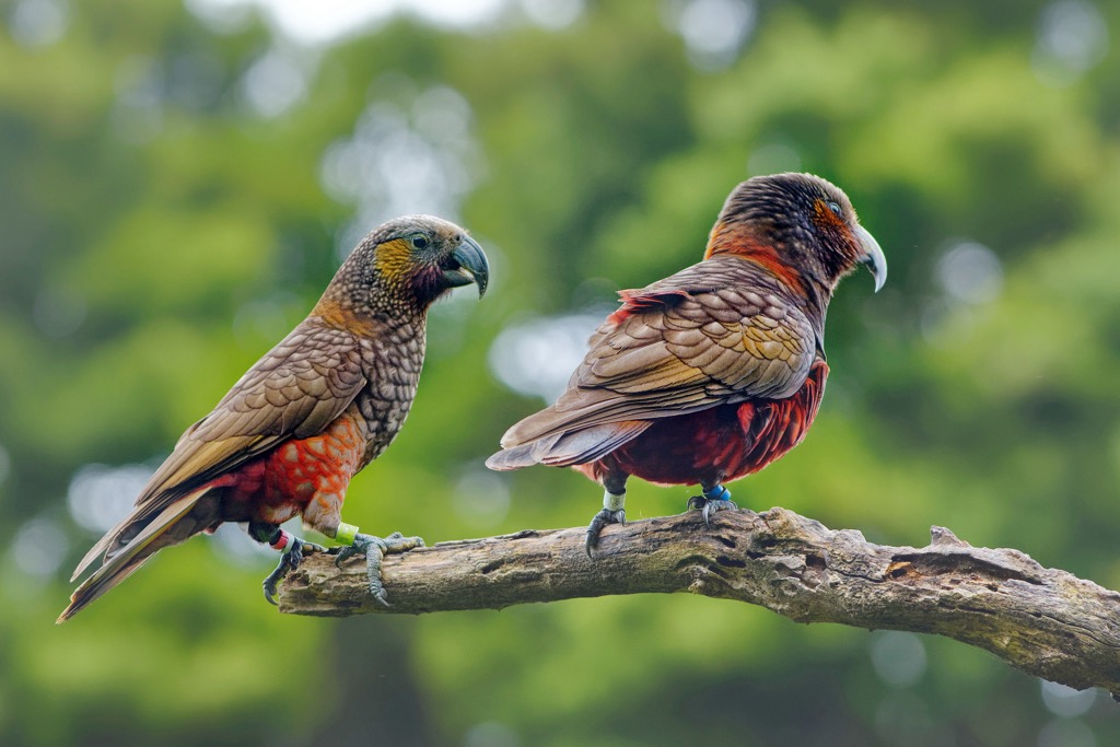
Wildlife of the Southern Alps includes many insects and lizards, including geckos, giant snails, grasshoppers, butterflies, and spiders. The beech forests in the lower elevations are an essential habitat for two birds specifically: the Great Spotted Kiwi and the South Island Kaka. The Kea, the world’s only alpine parrot, can also be found in the forested foothills and higher elevations. Other birds include the Rock Wren, Pipit, and Takahe.
The Southern Alps are known to the Maori as Kā Tiritiri o te Moana, meaning the “Mirage of the Ocean.” Mount Cook (3,724 m / 12,218 ft) is known as Aoraki, meaning “cloud piercer” or “cloud in the sky.” The Maori legend goes that the mountain range was formed when the four sons of Raki, the sky father, Ao-raki (Cloud in the Sky), Raki-ora (Long Raki), Raki-rua (Raki the Second), and Raraki-roa (Long Unbroken Line) went out in a canoe and got stuck on a reef. When they weren’t rescued, they were frozen and turned into stone. Their canoe, or ‘waka,' formed the South Island, and the four brothers formed the Southern Alps.
The Southern Alps were first sighted by Europeans when the Dutch navigator, Abel Tasman, arrived off the coast on a voyage in 1642. However, the English explorer, James Cook, bestowed the name ‘Southern Alps’ and ‘Mt. Cook’ in March 1770 after landing at Poverty Bay in 1769. Since 1998, the range has been known as the Southern Alps/Kā Tiritiri o te Moana in recognition of Maori culture.
It’s believed that the first crossing of the Southern Alps was made by a Maori woman, Ruareka, around 1700. She was a chieftainess of the Ngati-Wairangi tribe on the coast of Westland and crossed the Main Divide to meet with tribes on the east. Her trailblazing mission opened a corridor for traders and war parties between Maori tribes.
The Southern Alps were first traversed by a European in 1857 by British-born explorer Leonard Harper, who later became the first president of the New Zealand Alpine Club. Over the following decades, a gold rush reshaped the landscape of New Zealand. The boom peaked in the late 1800s, and mines and villages were suddenly abandoned.
In 1882, a group of Europeans unsuccessfully attempted to climb Mount Cook/Aoraki for the first time. The first successful ascent was in 1894 by Tom Fyfe, George Graham, and Jack Clarke.
Arthur’s Pass National Park was the first area of the Southern Alps to be officially declared a national park in 1929. Today, there are around eight national parks within the Alps area. In 1990, Te Wāhipounamu (the place of Greenstone) was declared a UNESCO World Heritage Site. This includes the four national parks that comprise the Southern Alps southwest: Aoraki/Mount Cook National Park, Fiordland National Park, Mount Aspiring National Park, and Westland Tai Poutini National Park.
The Southern Alps includes eight national parks of the South Island in New Zealand. The region is home to the best outdoor recreation opportunities in the country, with abundant hiking trails. Here are some of the most popular places to check out in the region for hiking:
Kahurangi National Park is in the far northwest of the South Island. It’s the second-largest national park in New Zealand, home to wild rivers, alpine fields, coastal forests, and rugged mountains. It’s considered the northernmost point of the Southern Alps, along with nearby Nelson Lakes National Park. There are 146 named mountains in Kahurangi National Park, the highest and most prominent of which is Mount Owen (1,875 m / 6,151 ft).
The park is home to both day and multi-day hikes, enabling adventure seekers to explore deeper in the otherwise inaccessible wild region. The most popular day hike is to Mount Arthur (1,798 m / 5,899 ft). This 17km (10.5 mi) return trail from the Flora car park is a moderate hike to an exposed peak with a panoramic view over the national park and Tasman Bay.
Otherwise, Kahurangi National Park is also where you’ll find the Heaphy Track, the longest of the Great Walks of New Zealand. This 80 km (50 mi) trail takes hikers 4-6 days to complete, with campsites and huts along the route for overnight stays. This trail requires advanced booking through the Department of Conservation.
Nelson Lakes National Park is in the far north of the South Island and is considered the beginning of the Southern Alps. The park's name refers to its two glacier-carved alpine lakes, Lake Rotoiti and Lake Rotoroa, which comprise the heart of the 102,000 hectares (252,050 acres) of parkland. Nelson Lakes contains 39 named peaks, the highest of which is Mount Travers (2,341m/7,680 ft).
The park is home to spectacular alpine hikes for all levels. The most popular day hike is the 9 km (6 mi) loop track across scree-filled gullies dotting the northern ramparts of Mount Robert (1,421 m / 4,662 ft) and offering stunning views across Lake Rotoiti.
For those seeking a more extended adventure, the Travers Sabine Circuit is an 80 km (50 mi) loop starting and ending in St. Arnaud. It takes hikers through beech forests, fields of tussock grasses, towering peaks, and stunning waterways. It takes 4-7 days to complete this track, although Mount Cupola (2,260 m/7,414 ft) can also be climbed as a worthy side trip.
Tucked in the middle of the Southern Alps, Arthur’s Pass National Park is in the heart of the South Island. The park is a rugged mountainous region with many peaks over 2,000 m (6,562ft), the highest being Mount Murchison (2,400m). On top of that, rough backcountry hiking trails and around 28 mountain huts are scattered across the park for overnight hikes.
One of the most popular short hikes in the park is the Devil’s Punchbowl track. This easy 1.8 km (1.1 mi) return hike should take less than an hour. However, it includes a stunning view of a waterfall that plunges 131 m (430 ft) into the canyon.
For something more challenging, the hike to Avalanche Peak (1,834 m / 6,017 ft) is ideal for experienced backcountry hikers. This sometimes treacherous trail can be completed as an 8 km (5 mi) loop via Avalanche Peak Track and Scott’s Route. The mission should only be attempted when the weather is clear, but you’ll be rewarded with panoramic views of spectacular mountains.
Paparoa National Park is a coastal park on the west coast of the South Island. It’s not as lofty as other parts of the Southern Alps but still contains 13 named mountains, with the highest and most prominent mountain being Mount Lodge (1,447m / 4,747 ft). It’s characterized by limestone landforms, including sculptured mountain ridges, river canyons, delicate caves, and pancake-like coastal formations.
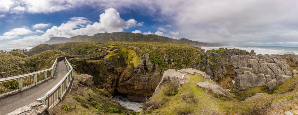
Head off on the 1.1 km (0.7 mi) loop known as the Punakaiki Pancake Rocks and Blowholes Walk for a short but beautiful hike that crosses these exciting limestone formations. It’s a well-paved walk, perfect for families and wheelchairs.
As one of the newest of the ten Great Walks of New Zealand, the Paparoa Track is a multiday hike in Paparoa National Park. The 56 km (34.8 mi) walk through alpine ridges, limestone karst landscapes, and thriving rainforests takes 2-3 days to complete. The track is a shared-use Great Walk, meaning you can hike or mountain bike. Mountain huts along the route are bookable through the Department of Conservation.
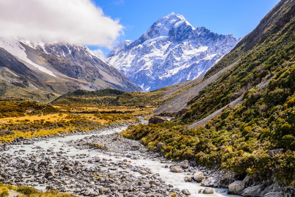
Aoraki/Mount Cook National Park is deep in the Southern Alps of the South Island. It’s most well-known for being home to the highest mountain in New Zealand, Mount Cook/Aoraki (3,724 m / 12,218 ft). Although it encompasses 23 peaks over 3000 meters (10,000 ft), the park is accessible with the Aoraki/Mt Cook Village providing a comfortable base for alpine activities.
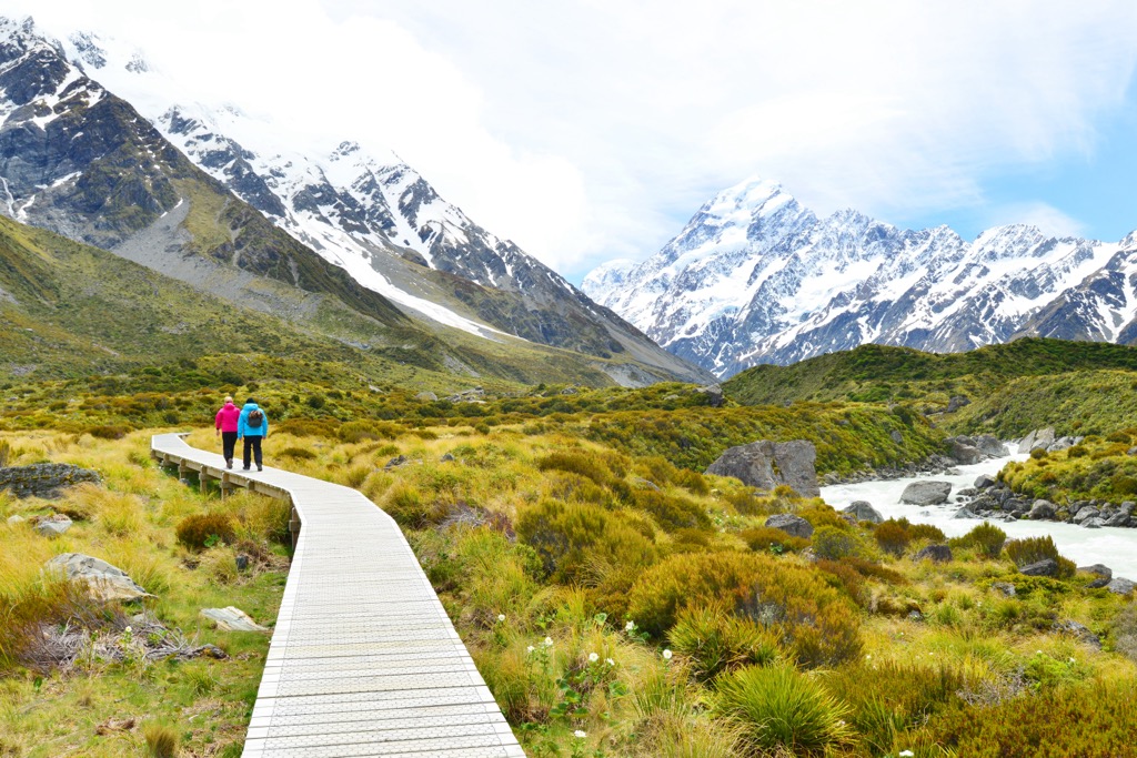
The national park is considered a hikers’ and mountaineers’ dream, home to some of Australasia's best trails and climbing routes. By far, the most popular hike in the park (and perhaps even the whole country) is the Hooker Valley Track. This 10 km (6.2 mi) return hike leads up the Hooker Valley and along the Hooker River, ending at the glacial lake with fabulous views of Mount Cook/Aoraki on a clear day.
Otherwise, there is also the Mueller Hut Route, best done as an overnight hike. The more challenging 10 km (6.2 mi) return trail takes up to 8 hours, so spending the night at the hut is ideal. The trail climbs to a mountain pass on the Sealy Range and includes spectacular views of Mount Cook/Aoraki.
Mount Aspiring National Park is one of the four national parks of the Te Wahipounamu – the Southwest New Zealand World Heritage Area. Located on the outskirts of the quaint town of Wanaka, the park is dominated by snow-capped peaks and braided rivers. It’s home to 326 named peaks, the highest of which is Mount Aspiring (3,033 m / 9,951 ft), known to the Māori as Tititea, meaning ‘sparkling white peak.’
It’s one of the most popular destinations in the country for hiking, with plenty of shorter day hikes and longer overnight trails. For a day hike, the 10 km (6.2 mi) hike to Rob Roy Glacier includes all of the best alpine landscapes within a few hours, including a spectacular view of the glacier.
The national park is also home to the famous Routeburn Track, one of the most popular alpine multi-day trails in New Zealand. The track is 32 km (19.9 miles) long and provides beautiful views as it links Mount Aspiring National Park with Fiordland National Park. Multiple huts can be booked through the Department of Conservation. Outside of walking, this route also serves as an access point for climbing, mountaineering, and backcountry skiing.
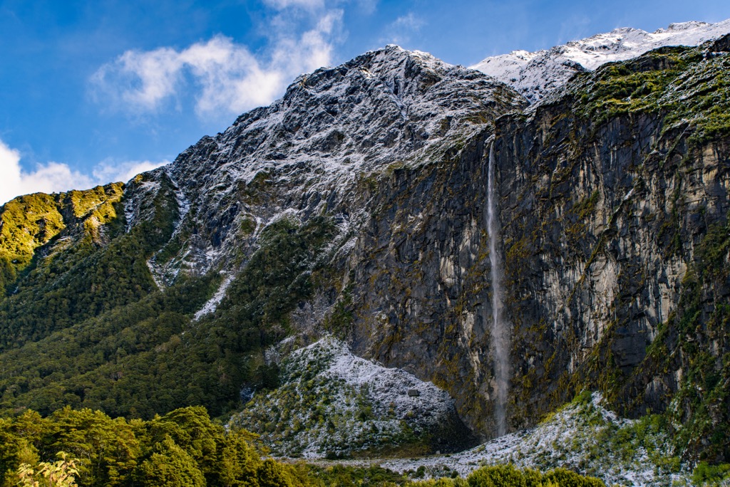
Westland Tai Poutini National Park is glacier country. It extends from the Tasman Sea to the crest of the Southern Alps' main divide, separating it from Aoraki/Mount Cook National Park. The park is home to a wide range of alpine landscapes, including long glaciers, towering 3,000 m (10,000 ft) peaks, lowland rainforests, tussock grasslands, and rivers running all the way to the west coast of the South Island.
The park's main attractions are the Fox Glacier and Franz Josef Glacier, with most of the hiking trails offering close viewpoints of these dramatic tongues of ice. The Franz Josef Glacier Walk is a popular 5 km (3.1 mi) out-and-back. It takes hikers through a forest before reaching a rocky riverbed. A short climb accesses the main viewing area of the glacier. Check before heading out, as the river can sometimes impede access.

For a more extended day hike, the Robert’s Point Track is an 11 km (6.7 m) round trip hike that follows the east side of the valley. The trail gradually gains 548 meters (1,797 feet) to a stellar viewpoint, encompassing the Franz Josef Glacier and the surrounding peaks of the Alps.
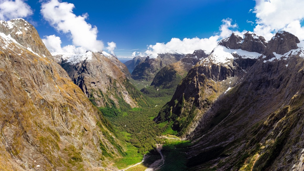
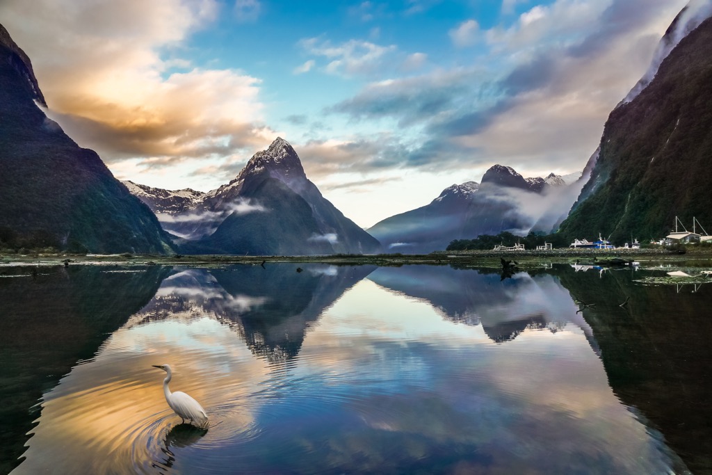
Fiordland National Park is in the southwest corner of New Zealand’s South Island. It’s the largest national park in the country, covering a staggering 1.2 million hectares (2.9 million acres). Wild landscapes of soaring mountains, fiords, dense rainforest, and alpine lakes and meadows characterize the park. Most visitors confine themselves to the northeastern part of the park, home to Milford Sound, a spectacular and famous fiord. However, there are plenty of hiking trails to discover in other corners of the park.
Three of New Zealand's Great Walks are found in Fiordland: Kepler Track, Milford Track, and Routeburn Track. These are easily the most beloved (and crowded) multi-day hikes in the country, with advanced bookings required for the campsites and huts through the Department of Conservation.
The 6 km (3.7 mi) return hike to Lake Marian in the Hanging Valley is well-liked as a shorter day hike. Gertrude Saddle Route is a far more challenging option. This 8 km (5 mi) out-and-back is for experienced alpine hikers seeking jaw-dropping views.
New Zealanders passionately celebrate on the ski slopes each winter, and there’s nowhere better to make turns than within the Southern Alps.
The ski fields here tend to be much smaller and less corporate than their North American and European counterparts. After all, New Zealand is home to the ‘club field:’
“The Clubbies are ski clubs (though most definitely open to the public) run by passionate locals who, rather than see soaring profits, would rather feel the rush of the wind in their hair and white stuff sliding beneath their planks.”
However, even commercial resorts are much cozier. The Alps boast ten charming ski areas for all abilities; here are some of the region’s most popular.
Rainbow Ski Area, nestled in the Nelson Lakes region, consistently captures winter snow. It’s the northernmost ski field in the South Island and the only one in the Nelson region.
It has wide slopes that are often uncrowded compared to other resorts further south. There are well-groomed trails for beginner and intermediate skiers and jumps and drops for snowboarders of all levels.
Not far from Christchurch, Mount Hutt Ski Area is a cherished ski field of the Canterbury region of the South Island. With views over the plains extending all the way to the east coast, Mount Hutt (2,186 m / 7,172 ft) is one of the country's highest and most extensive ski areas.
The resort is usually open for the snow season from June until October. It’s a great family-friendly resort with runs for skiers and snowboarders. It’s home to a high-speed eight-seater (New Zealand's first), a high-speed six-seater, and a triple chair.
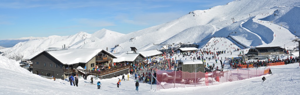
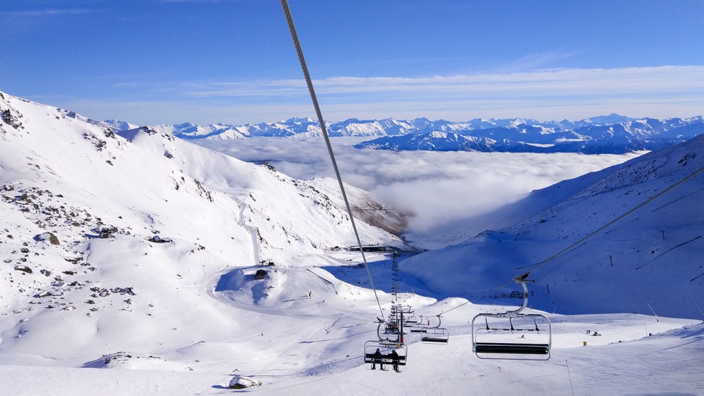
As one of the most well-known ski areas in New Zealand, The Remarkables is bustling all winter long. Located near Queenstown in the Otago area, The Remarkables has north-facing slopes, various terrain parks, and dedicated freestyle areas, with over 380 hectares (939 acres) of terrain in total.
It’s home to six mountain lifts, including a couple of high-speed chairs (not a given in New Zealand). As it’s not far from Coronet Peak, both ski areas can be accessed with the same multi-day or season pass. It’s usually open from June until October.
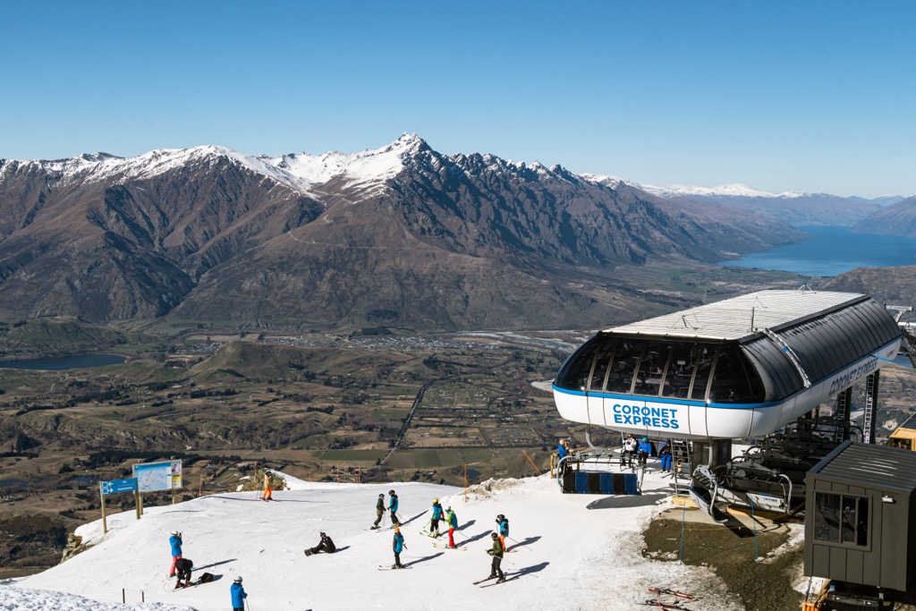
Coronet Peak is the oldest commercial ski field in New Zealand. It’s just under a 30-minute drive from Queenstown. It hosts many of the national championship and FIS events and is home to some of the best ski racers in the country.
It features alpine terrain with plenty of bowls, served by high-speed chairlifts. With plenty of facilities, it’s a local favorite in New Zealand.
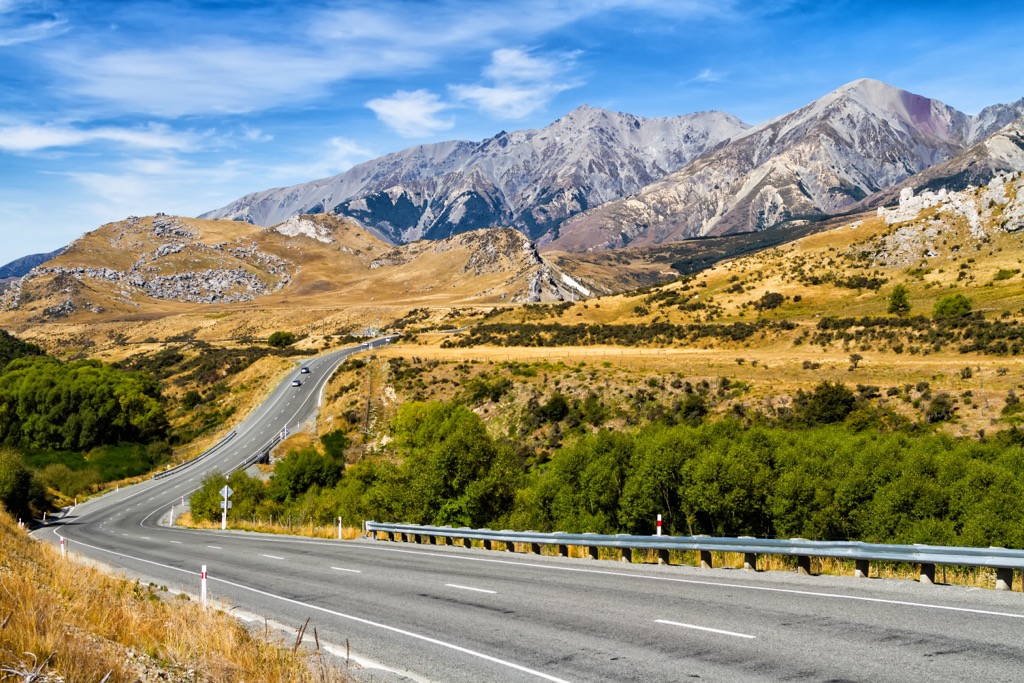
Despite being home to some incredibly rugged terrain and remote landscapes, the Southern Alps are relatively accessible, particularly from the eastern side. Here are some of the best places to stay if you’re planning a trip:
Nelson is a city on the eastern shores of Tasman Bay on the South Island. It’s one of the oldest cities in New Zealand and is known for its golden beaches and beautiful national parks on its doorstep.
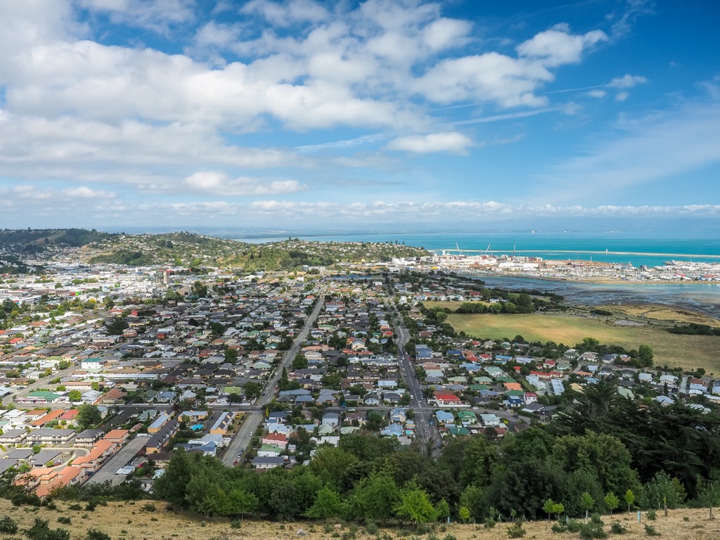
As the gateway to Nelson Lakes National Park and Kahurangi National Park, Nelson makes for an excellent base for exploring the northern reaches of the Southern Alps. It has an airport so you can easily reach the town from the North Island or elsewhere.
Christchurch is the largest city on the South Island of New Zealand. Located on the east coast and the banks of the Avon River, it’s known for its English heritage with many historic stone-built buildings. The city is about two hours east of Arthur’s Pass National Park.
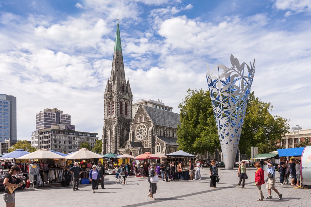
While not as close to the Southern Alps as some other towns, the city is a convenient place to begin a South Island trip. It’s home to an international airport servicing overseas destinations like Australia, China, and Singapore.
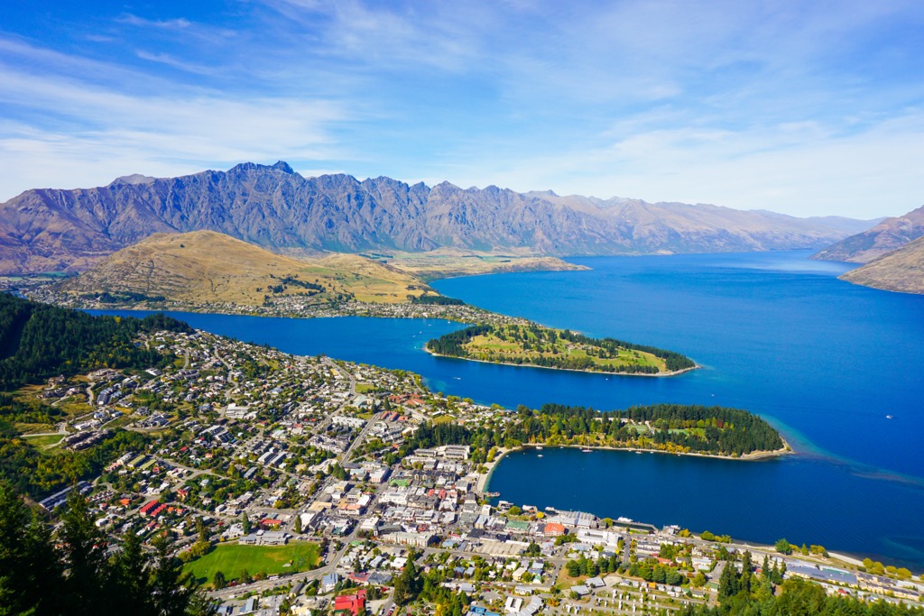
By far the most famous city in the South Island, Queenstown is the hub of outdoor activities in New Zealand. Known as the world's adventure capital, Queenstown sits on Lake Wakatipu's shores against the Southern Alps' backdrop.
It’s home to various adventure activities, including mountain biking, bungee jumping, jet-boating, skiing, hiking, and rafting. It’s by far the most frequent - and convenient - base for exploring the southern half of the South Island and its national parks. On its doorstep, you’ll find Mount Aspiring National Park and Fiordland National Park.
Within the town, the Skyline Gondola shuttles visitors high above Queenstown for mountain biking, paragliding, and hiking. The Gondola is receiving an upgrade from the old 4-seater to a 10-seat Doppylmeyr, which should reduce summer congestion. Skyline is due to reopen to the public in July 2023.
The town is well serviced with regular domestic and international flights to and from the Queenstown Airport. As one of the most visited places in New Zealand, it has plenty of amenities for travelers.