Scan the QR code and open PeakVisor on your phone
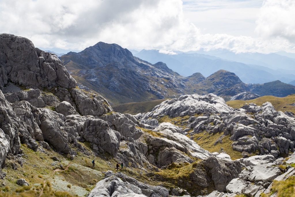
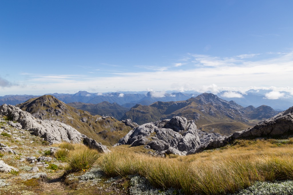
Kahurangi National Park is a lush and wild enclave in the northwestern corner of New Zealand’s South Island. At 452,002 ha (1,116,921 acres), it is the country’s second-largest national park and is home to vast tracts of forest, beautifully carved caves and bluffs, and biodiverse estuaries. There are 146 named mountains in the park; Mount Owen (1,877 m / 6,158 ft) is the tallest and most prominent, rising 1,399 m (4,590 ft) from the surrounding foothills to the summit.
Kahurangi National Park, located on the northwestern corner of the South Island in New Zealand, is the country’s second-largest national park. It spans 452,002 ha (1,116,921 acres) of wilderness, glacier-carved valleys, coastal estuaries and tide pools, and extensive cave systems.
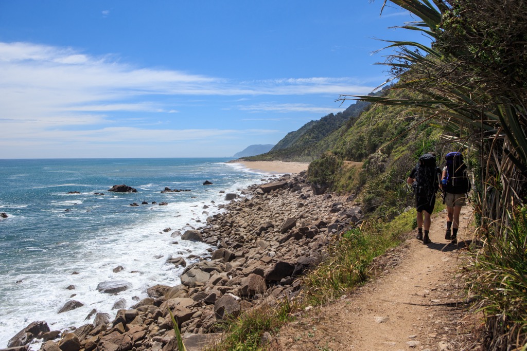
Kahurangi was designated in 1996 and contains a wealth of ecological diversity across its varied and rugged topography. The park protects a wide range of delicate flora and fauna, from endemic flowers to enormous cave spiders. While there are many day and multi-day trails, one of the best known is the Heaphy Track, a multi-day trek that follows historical Māori and European trading routes along the coast and inland.
New Zealand’s geologic history dates back to the supercontinent Gondwana. Around 540 million years ago, New Zealand formed along the supercontinent’s perimeter. Rivers carried sediment, and underwater eruptions generated ash that hardened into the rocks underlying most of the country today.
New Zealand sits near the boundary between the Australian and Pacific plates. Around 100 million years ago, magma welled up and caused volcanic eruptions and splits along faults. By 85 million years ago, the Zealandia land mass separated from Gondwana and the Australian mainland, and began to drift across the Pacific Ocean.
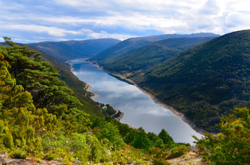
Twenty-five million years ago, Zealandia split, and sections of the continent were uplifted. There has been further uplift in the last 1.8 million years, such as the Southern Alps on the South Island and volcanic eruptions, which continue in the present. During the Ice Age, glaciers carved out valleys and shifted rocks and sediment. Massive ice flows, such as the Tasman and Fox glaciers, continue to alter the landscape today.
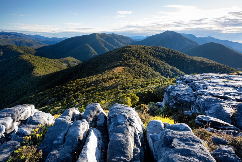
The mountains in Kahurangi National Park are part of the Marino Mountains. A majority of the rocks are sedimentary, formed from river sediment and ash that compacted on the seafloor hundreds of millions of years ago. Subsequent uplift and faulting occurred as the New Zealand land mass separated from the supercontinent Gondwana and drifted towards the boundary between the Australian and Pacific plates.
During the Ice Age, glaciers carved out distinct valleys and left behind moraine ridges. Cobb Valley was home to the largest glacier in what is now Kahurangi National Park. The gouged-out valleys expose ancient rocks, including sandstone, schists, shales, quartzites, and undersea fan deposits. They also contain ancient trilobite and graptolite fossils. The oldest known fossil in New Zealand was discovered in Kahurangi National Park and dates back 540 million years.
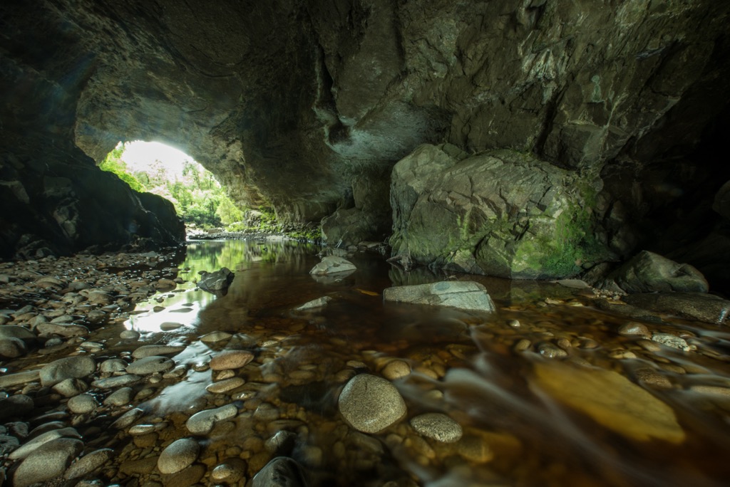
Another distinct feature of the park’s geology is the limestone and marble karst caves, arches, and impressive outcrops along the coast. The Bulmer Cavern stretches through the park, New Zealand’s longest cave system at 64 km (40 mi) long.

Kahurangi National Park houses breathtakingly biodiverse flora and fauna. In addition to its varied habitat and geologic features ranging from coastline to cave systems to alpine zones, the area also escaped the worst of the Ice Age. Alpine communities survived the onset of glaciers and later recolonized the mountaintops quickly after the ice receded.
As a result, Kahurangi National Park is home to more than half of New Zealand’s 2,400 native plants and more than 80 percent of the country’s alpine species. It features 67 endemic plant species and contains the most diverse flora of New Zealand’s national parks.
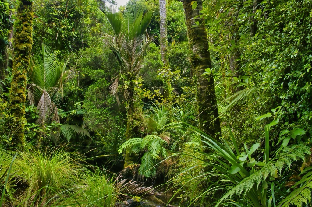
The eastern side of the park is drier and commonly covered in beech forest, while the western side has podocarp forest and an understory bursting with ferns, vines, and shrubs. Along the coast, stands of nikau palms create a tropical beach atmosphere.
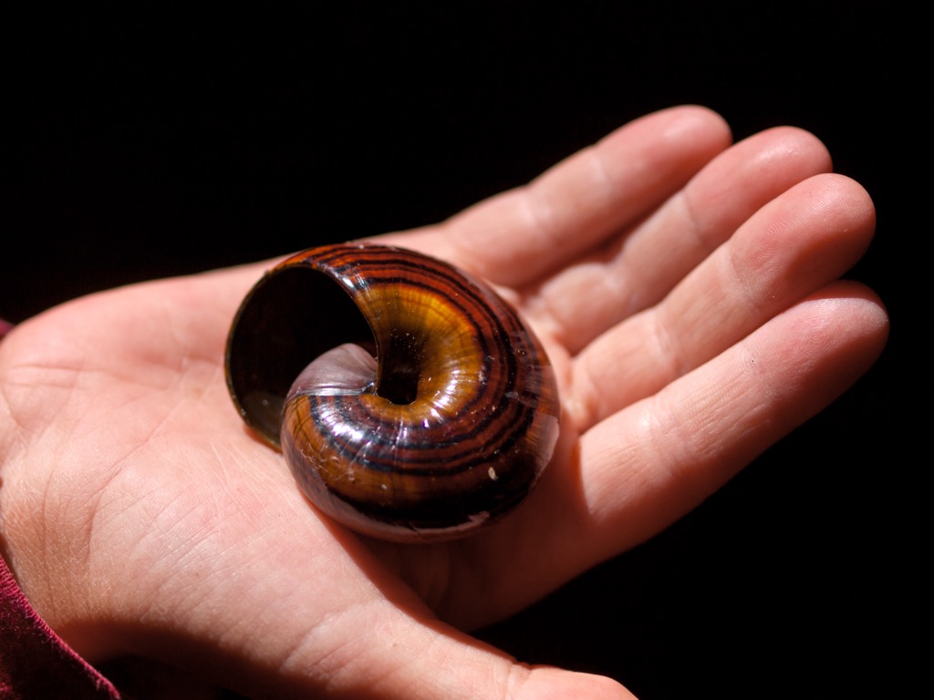
Eighteen native bird species live in Kahurangi National Park, including blue ducks, falcons, rock wrens, and the great-spotted kiwi. The park is also home to New Zealand’s largest cave spider, the smallest species of giant weta (a grasshopper-like insect), and healthy populations of powelliphanta. This carnivorous snail grows up to 10 cm (4 in) in diameter.
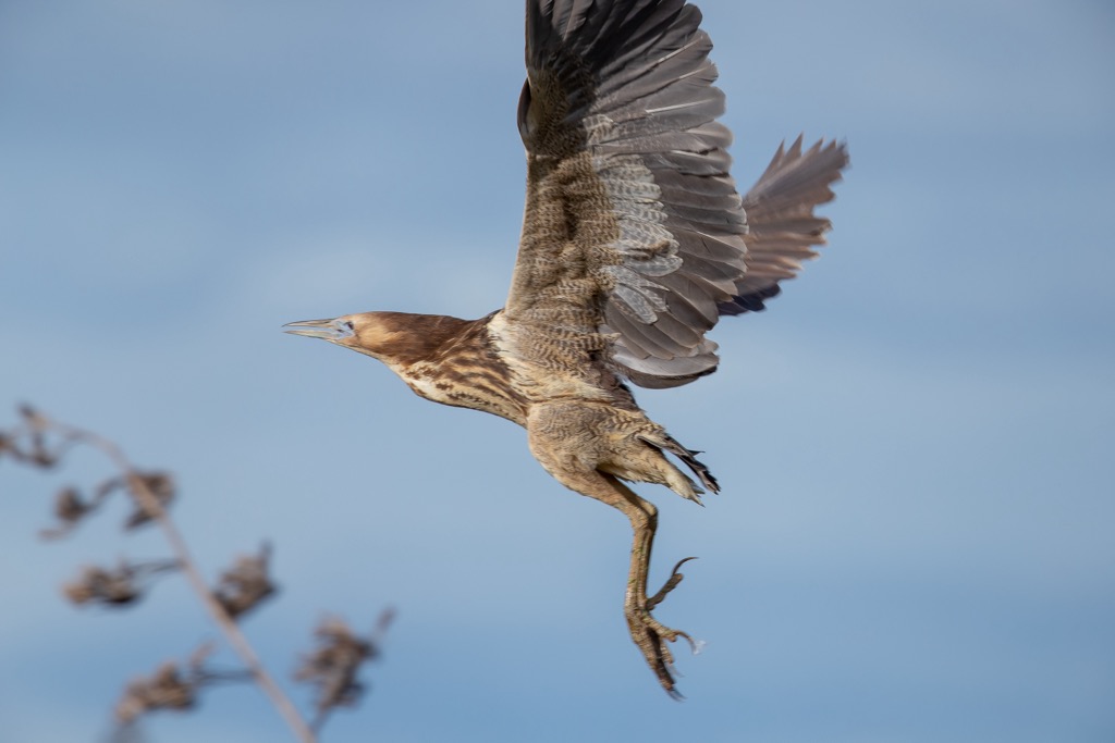
The Mangarakau Swamp is one of New Zealand’s largest relatively intact estuaries. The swamp is nestled between tidal bays and limestone bluffs to the west and the national park’s forest to the east. The swamp is a haven for wetland birds like fernbirds and Australasian bitterns. The area was protected in 1994 by Westhaven (Te Tai Tapu) Marine Reserve and Westhaven (Whanganui Inlet) Wildlife Management Reserve.
Another unique ecosystem in the park is the Ōpārara Basin. Ferns and algae grow around cave entrances, and the basin is home to the rare short-tailed bat, the cave spider, and the whio/blue duck. It is also a sanctuary for the great spotted kiwi and the world’s only known habitat for the rare Ngakawau Gorge Daisy that flowers on steep rock faces in December and January.
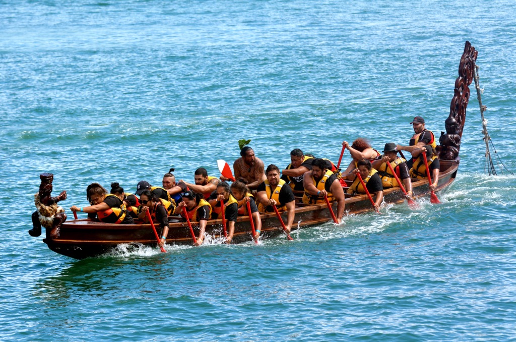
The Māori arrived in New Zealand from the Polynesian Islands in a series of canoe migrations between 1320 and 1350 CE. Parts of the modern-day Kahurangi National Park have been home to the Māori since the 14th century; they would cross this section of the coast looking for pounamu, or greenstone.
In 1846, Charles Heaphy and Thomas Brunner were the first Europeans to traverse sections of the coastline. Later, settlers built tracks inland to access the Aoerer goldfield, the country’s first gazetted goldfield. Adams Flat Hut, constructed in 1882 and currently in a semi-ruined state, is the last hut remaining from mining days along Fenian Goldfield.
Engineers implemented a hydroelectric power station in Cobb Valley around 1940. For three decades prior to its designation as a national park, the area was part of a forest park. In 1987, the Department of Conservation formed and subsequently allowed the land to be reassessed for further protection.
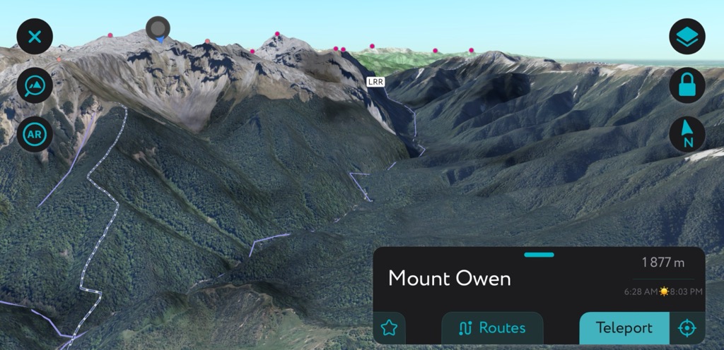
The dramatic landscape of Kahurangi National Park was featured in Lord of the Rings as the location for Dimrill Dale and the outcrop south of Rivendell.
Shelters and huts are scattered throughout the park; most require a pass to use them. In addition to day hikes and multi-day treks, visitors can fish, hunt, mountain bike, hire walking guides, tour the Honeycomb Caves at Karamea, and take multi-day raft trips down the Karamea River.
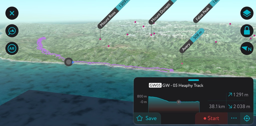
The Heaphy Track is Kahurangi National Park's best-known and oldest route. This multi-day trek is 78.4 km (48.7 mi) one way and takes four to six days. It is open to mountain bikers between May and November and classified as advanced grade 4. Those looking for shorter routes can do sections of the trail. The park website has a breakdown of trail sections, accommodation, and features.
The Heaphy Track gets its name from one of the area’s first European explorers. Charles Heaphy and Thomas Brunner followed the coast with a Māori guide. Generations of Golden Bay Māori followed inland tracks. Miners, too, began to cut through the interior forests around the mid-1800s. These paths grew over around the turn of the century and were cleared and re-established in the 1960s.
Remnants of a 14th-century village remain near the Heaphy River. Stones at the site were sourced from across the whole island – obsidian from Mayor Island, argillite from D’Urville Island, chert from central Otago, and West Coast greenstone and heaphyite.
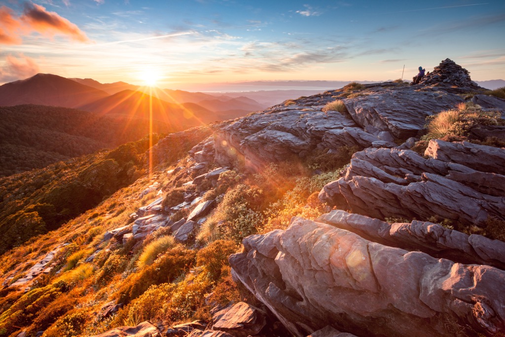
The trail to Mount Owen crosses over Granity Pass, and an overnight at Granity Pass Hut can break up the two-day trek. Although an ascent is possible in winter, snow will hide sinkholes, and hikers should use caution.
Two routes wind their way to the summit of Mount Owen. Northern access is more accessible. From Granity Pass, the route to the summit is unmarked. It typically takes seven hours from hut to summit and back. The path keeps east of Sentinel Hill before crossing a saddle and heading towards the summit.
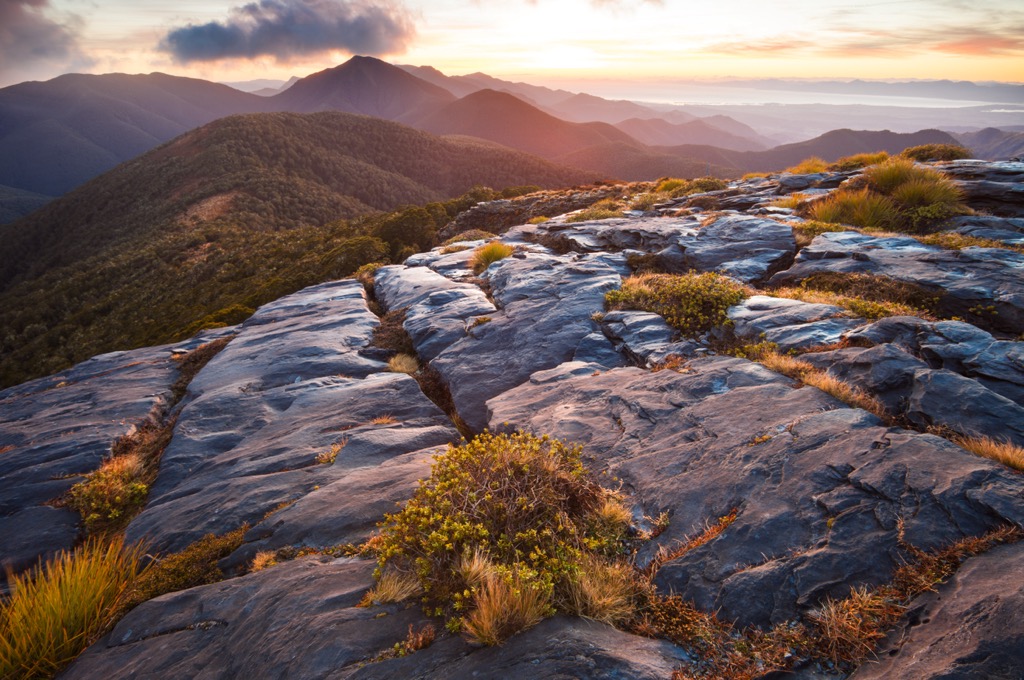
Approaching from the south along the Sunrise Peak is more challenging and takes around seven hours. The trail begins in farmland for 2 km (1.2 mi), crosses the river a few times, and then climbs Sunrise Ridge to the bushline.
Above the treeline, it’s a steep scramble up to the ridgeline below Sunrise Peak. From there, hikers should head north towards Mount Owen. From the treeline to the summit takes approximately three hours.
Mount Arthur is another peak in the park with spectacular summit views and options for both moderate and challenging hikes. The easier option goes from the Flora car park to the Mount Arthur Hut. It is 4.2 km (2.6 mi) one way and takes an hour and a half. The trail passes beech forest and mountain neinei. The hut is near the treeline; just beyond, visitors can soak in views of Mount Arthur and the Tablelands.
Those wanting to summit Mount Arthur can continue for another 5 km (3.1 km) through an exposed alpine landscape. Along the way, the route climbs past several basins and ultimately wraps around the back of Winter Peak. After a steep and rocky ascent to the summit of Mount Arthur, the reward is sweeping panoramic views. There is over 915 m (3,000 ft) of elevation gain from the Flora car park to the summit.
Motueka, Murchison, Karamea, and Takaka are the gateway towns to Kahurangi National Park. Public transport and roadways lead from these towns into the park. Larger cities nearby are Wellington, across the Cook Strait on the North Island, and Christchurch on the South Island.
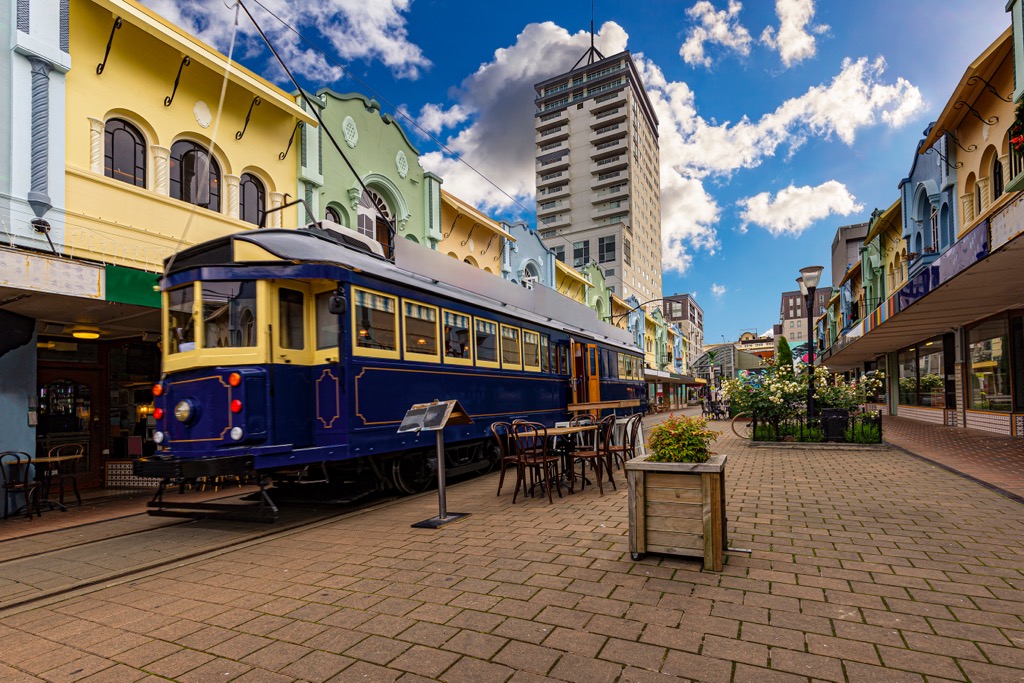
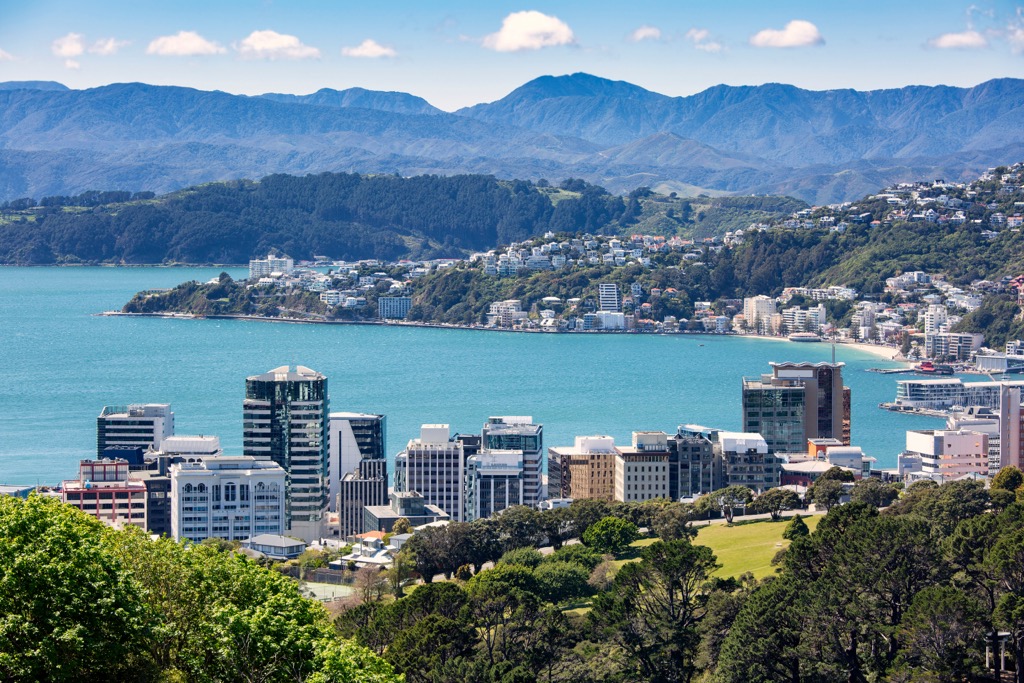
Wellington is a small city of just over 200,000 people nestled onto a harbor on the southern tip of New Zealand’s North Island. Become acquainted with Māori culture, New Zealand history, and the country’s natural environment at the Museum of New Zealand Te Papa Tongarewa. A visit to the Zealandia eco-sanctuary lets visitors wander, guided and unguided, among a refuge for rare, native animals. An excellent half-day activity in the city is a cable car ride to a lookout point with botanic gardens and panoramic views above the city.
The city itself boasts a vibrant food and coffee scene. Explore Māori and Polynesian flavors and fresh seafood when you visit. Accommodation ranges from budget-friendly hostels to luxurious waterfront hotels.
Christchurch is New Zealand’s second-largest city and home to over 380,000 people. A newer city, Christchurch is known for its innovative architecture, funky street art, and abundant green spaces. A fantastic way to explore is by taking a cultural food tour that dives into Māori culture and the region's culinary heritage. Spend a day visiting one of the city’s museums and botanical gardens or take a ferry to Quail Island, previously used as a leprosy colony and the quarantine site for dogs and ponies on Antarctica expeditions.
Outside the city are the Hanmer hot springs and wildlife viewing at Kaikōura. Christchurch is an excellent spot on the South Island to pass through on the way to other areas like the Banks Peninsula, the Southern Alps, and the Canterbury Plains.