
Scan the QR code and open PeakVisor on your phone
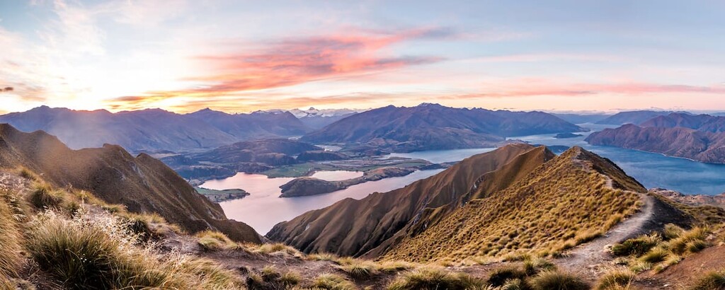
Harboring a sprawling network of summits along the western coast of the South Island of New Zealand, Mount Aspiring National Park is part of Te Wahipounamu – the Southwest New Zealand World Heritage Area. The park contains 326 named peaks, the highest of which is Mount Aspiring (3,033m/9,951ft), a peak that is also known to the Māori as Tititea, a ‘steep peak of sparkling white.’
Mount Aspiring National Park can be accessed through nearby Wanaka, Makarora, and Glenorchy.
With a total land area of 3,562 square kilometers (1,375 sq. mi), Mount Aspiring National Park is New Zealand’s third-largest national park. Only Fiordland National Park (12,607 sq. km / 3,900 sq. mi), and Kahurangi National Park (4,529 sq. km / 1,749 sq. mi) are larger.
Covering a substantial area of the Southern Alps, Mount Aspiring National Park is bound by the Olivine and Haast ranges to the west, the Mataketake and Thomas Ranges to the north, the Young Range to the east, and the Richardson and Harris mountains to the southeast. Its northern boundary is the Haast river, and it is southbound by Fiordland National Park.
The park’s landscape is varied and complex, and the peaks within it are predominantly part of the Southern Alps.
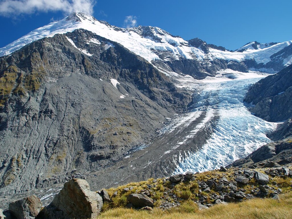
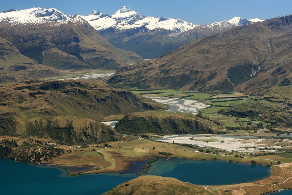
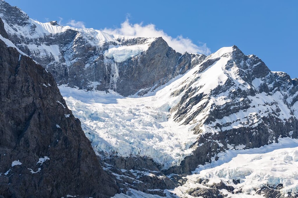
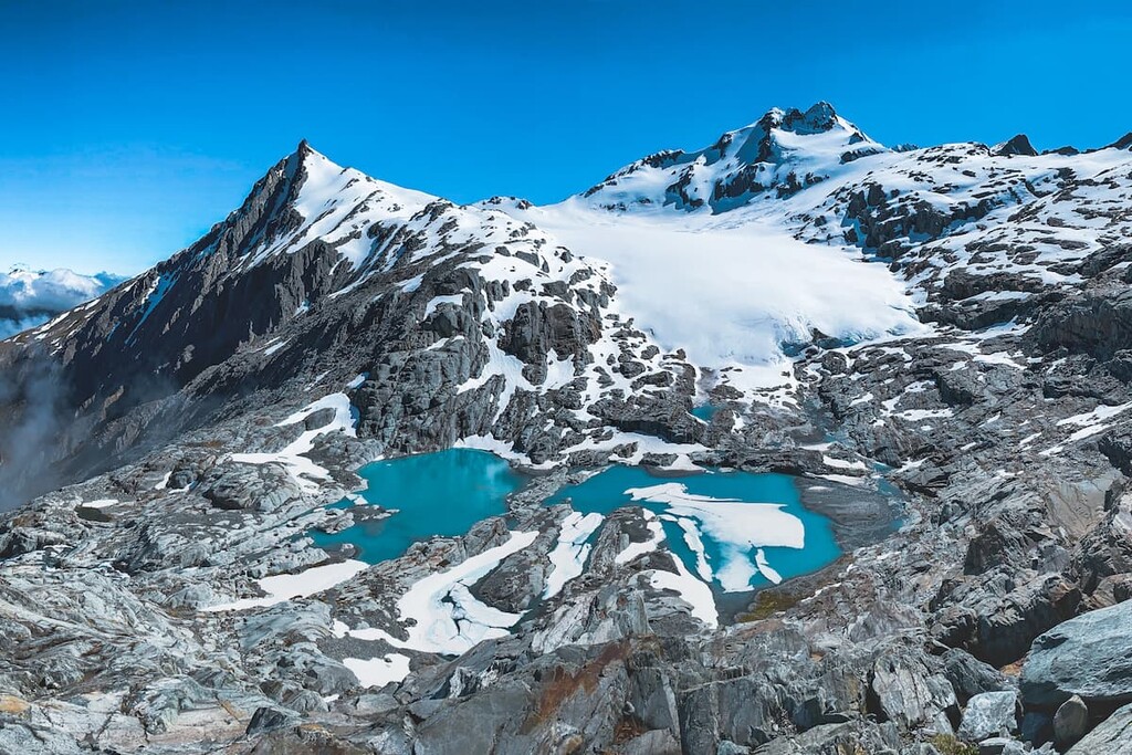
Aspiring’s landscape is characterized by high peaks, cirques and glaciers fed by permanent snowfields. Hanging valleys descend to steep-sided, flat-floored, U-shaped valleys. The valleys’ walls are forested, while the wider valley floors feature meandering rivers flowing through expansive grasslands.
Over 100 glaciers cut the range, segregating the peaks, and leaving deep gorges behind. The Bonar, Therma and Volta are the largest glaciers in the park. Mt Aspiring was molded by these glaciers, giving the peak its unique pyramid-like shape.
The park’s peaks are formed predominantly from Haast schist, which contains both Alpine and Otago schist. Pounamu, volcanic rock, and greywacke remnants can be found along the park’s edges.
One of the park’s most distinctive features is its ultramafic belt, wedged between Otago’s schists and Fiordland’s harder rocks, which extends over 150 kilometers (93.2 mi) between northwest Fiordland and southwest Westland.
The ultramafic rocks at Red Mountain and in the Red Hills range have very high amounts of magnesium, iron and other heavy metals, helping in the creation of a stark and dramatic landscape of red rocks and sparse vegetation, which contrast the well-vegetated slopes of the other mountains in the park.
Major peaks in the park include Mt Aspiring, Mt Pollux (2,542 m/8,340 ft), and Mt Brewster (2,519 m/8,264 ft).
Like New Zealand as a whole, Mount Aspiring National Park is renowned for its biodiversity.
Plant communities within the park range from lowland rainforests to beech (tawhai) forest slopes, tussock grasslands, subalpine and alpine plant communities and the sparse vegetation found in the ultramafic area.
The park is mostly populated with beech/tawhai forest, with silver beech (tahina) being the most common species. Red beech (tawhero) and mountain beech (tamauka) are found solely in the southern depths of the park. While lowland forest and wetland ecosystems are not well represented within the confines of the park, they can be found in conservation land nearby.
There are almost 600 unique plant species to be found within the park, including over 70 ferns and members of the fern family.

A wide range of wildlife can be found in Mount Aspiring National Park, including native birds, bats, lizards, invertebrates, and fish.
Birds significantly populate the alpine and forest areas of the park. One endangered, endemic species, the Haast tokoeka brown kiwi, can be found partially in the alpine zone of the park.
Three ‘biodiversity hotspots’ of the park are especially significant for indigenous birds. These are the Dart catchment, Makarora and Young Valleys and the Haast Tokoeka Kiwi Sanctuary.
The Dart catchment is the richest wildlife area within the park, where lucky visitors can sometimes spy South Island riflemen (titipounamu), grey warbler (riorio), brown creeper (pīpipi) and South Island tomtit (miromiro). Kaka, blue duck (who), kea and yellow-crowned parakeet (kakariki) can also be found in this area.
Bats (pekapeka) are found predominantly in the lower Dart catchment, while skinks can be found at high altitudes.

Mount Aspiring National Park was established in 1964. The country’s first national park, Tongariro, was established much earlier, in 1887, through the generosity and foresight of the Ngāti Tuwharetoa people, who declared the mountainous area sacrosanct; and whose Araki (chief), Horonuku te Heuheu Tukino IV, enacted a tuku (act of customary lore) over the volcanic peaks to protect and preserve the mountains for Ngāti Tuwharetoa, other iwi (tribes) and all New Zealanders.
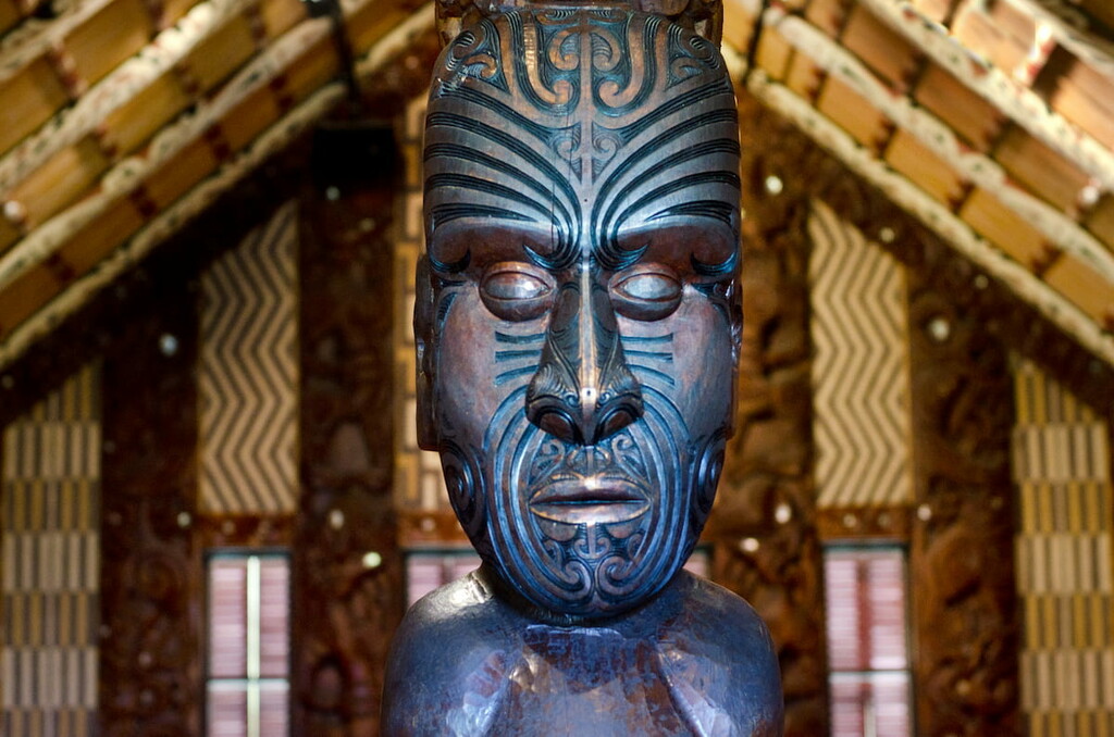
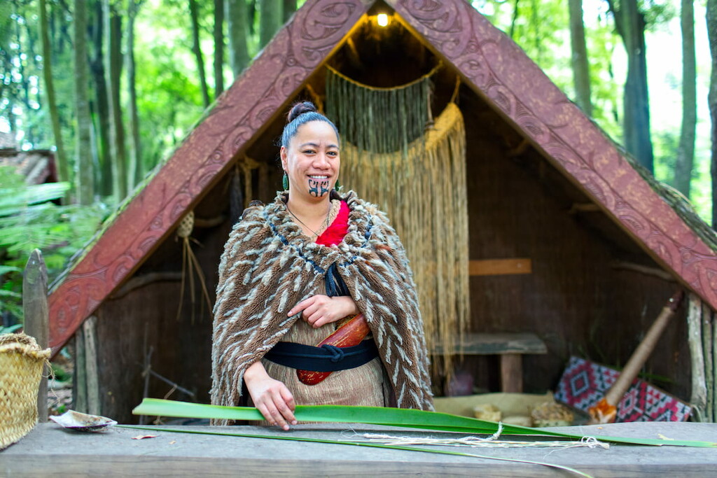
Mount Aspiring National Park’s history is rich and inherently linked to the heritage of the Waitaha, Kāti Mamoe and Ngāi Tahu people. Prior to European settlement and exploration, the rivers and valleys of the park were traveled by Māori during hunting, fishing, and gathering expeditions. Pounamu (greenstone) was the park’s primary attraction to Māori.
The Māori names for the park’s features are rich in visual imagery and reflect the status in which the land is held.
The Otago gold rushes in the 1860s brought an influx of surveyors and explorers into the area. However, no large quantities of gold were found among the park’s mountains.
In the late 19th century, surveyor Charlie Douglas mapped most of the peaks of the park and wrote detailed accounts that are still read widely today.
The park has a long mountaineering and backpacking history. The first confirmed ascent of Mount Aspiring was in 1909 by Englishman Bernard Head and alpine guides Alec Graham and Jack Clarke. The east face of Mount Earnslaw (Pikirakatahi) was climbed in 1890 by a Glenorchy local named Harry Birley.
Despite the traditional use of the park as a path between the Main Divide by Māori, early explorers and mountaineers, there are few physical historic remains. However, there are many places of spiritual and cultural significance to the native Māori within the park.
Mount Aspiring National Park offers an unparalleled range of outdoor activities. Here are some of the best places to check out in the area:
The Routeburn Track is New Zealand’s most popular trans-alpine trail. The track is 32 km (19.9 miles) long and provides beautiful views across the Hollyford and Routeburn Valleys. There are multiple public-use huts along the track which can be booked through the Department of Conservation. Outside of walking, this track serves as access to opportunities for climbing, mountaineering and backcountry skiing.
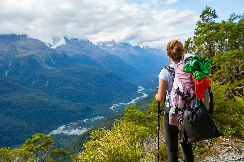
The West Matukituki Valley is the gateway to some of the best mountaineering in the country. From Aspiring Hut, challenging trips can be made to Cascade Saddle, Liverpool Hut, and French Ridge Hut. The easy walks throughout the valley floor contrast the steep climbs up the valley walls beyond the bushline. Mount Aspiring is accessible through this valley.
While the trail is only 6 km (3.7 mi) long, the climb to Mount Brewster is deceptively difficult. The trail is a steep vertical, that boasts superb views of Mount Brewster, the Brewster glacier, Makarora Valley, Mount Aspiring and the West Coast.
Hiking and mountaineering expeditions in New Zealand are often much more rugged than in other developed nations, and weather conditions reflect the harsh and changing nature of the natural landscape. People are always advised to pack for the weather conditions and carry a personal locator beacon.
Here are some of the best places to stay if you’re visiting Mount Aspiring National Park from further afield:
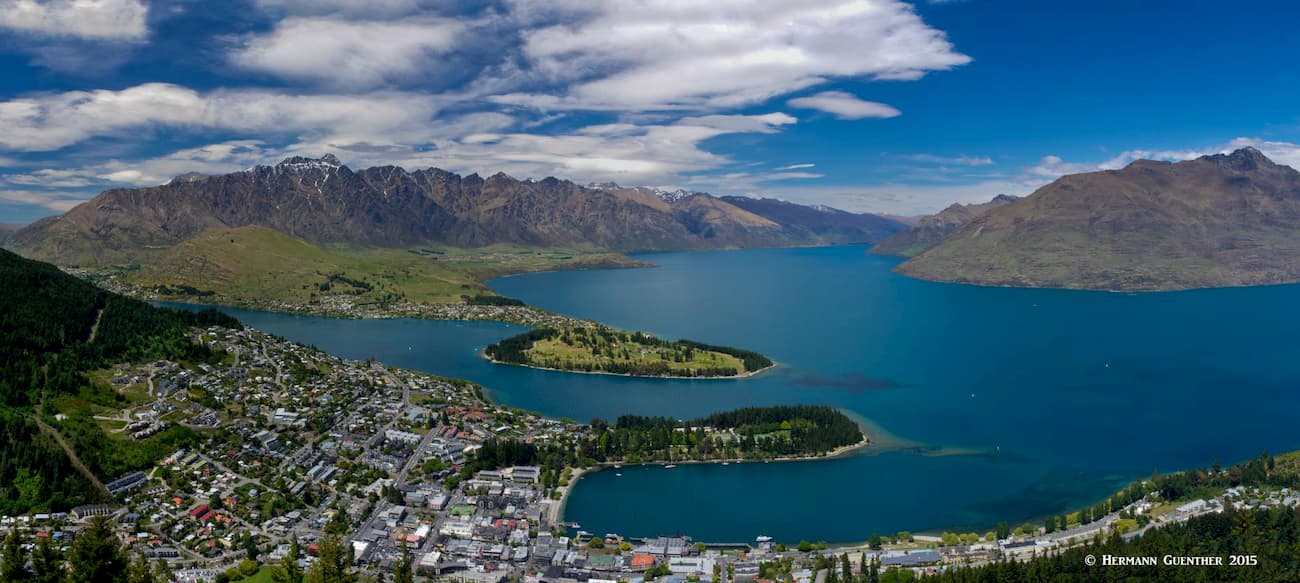
Queenstown is a resort town in Otago in the southwest of New Zealand’s South Island with an urban population of 16,000 people. The town is best known for its adventure and ski tourism. Queenstown is the gateway to nearby Arrowtown, Glenorchy, Kingston, Alexandra, and Cromwell. It is serviced by an international airport that has direct connections to nearby Australia.
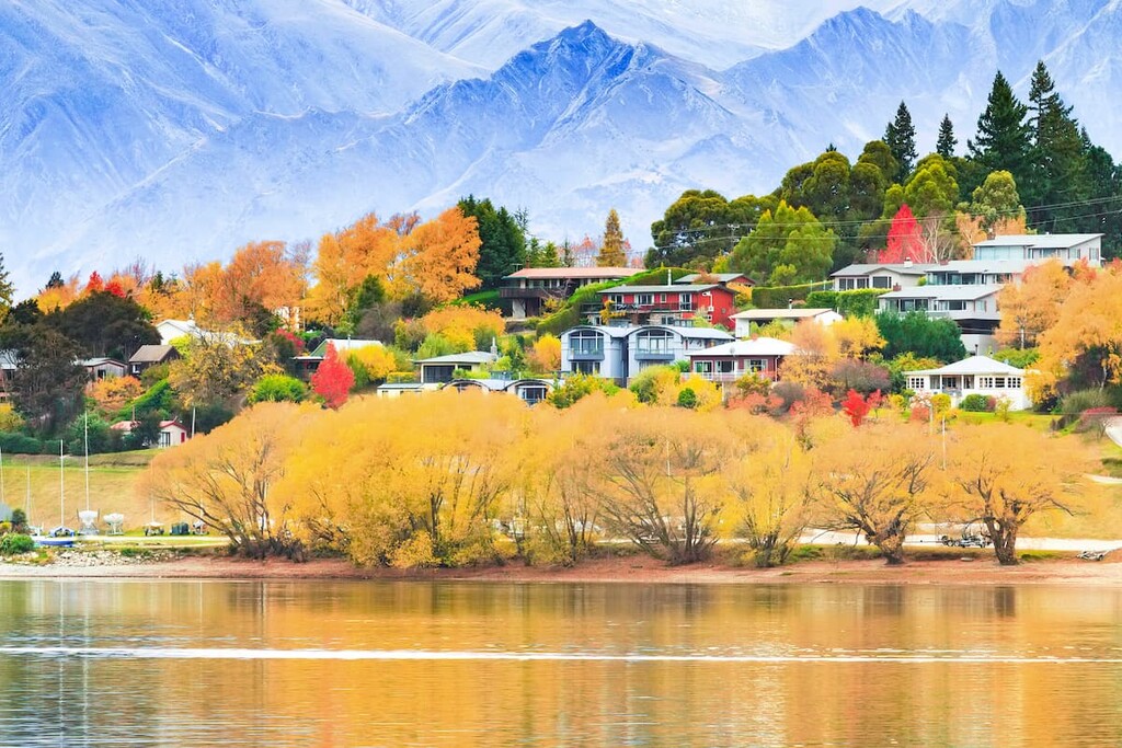
Wanaka is located an hour’s drive north of Queenstown, located within the stunning Southern Alps of New Zealand, and surrounded by the beauty of mountains, lakes and forest. A popular ski and summer destination, the town has a population of 11,550.
Wanaka is one of the few areas in New Zealand to have a semi-continental climate, with four distinct seasons. Winter can be extreme by New Zealand standards with temperatures mostly in the single digits during the day, followed by cold nights and frequent snowfalls.
New Zealand’s Department of Conservation manages a network of over 950 public-access huts of all shapes and sizes. They provide unique places to stay, a refuge from poor weather, or the opportunity to rest and recover while exploring the outdoors.
There are multiple huts located within Mount Aspiring National Park available for use at a small fee.
Camping is also permitted within the park, and hikers are required to leave no trace.


