
Scan the QR code and open PeakVisor on your phone
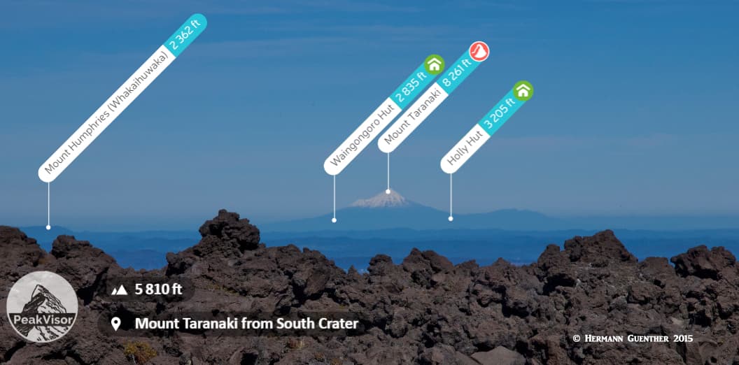
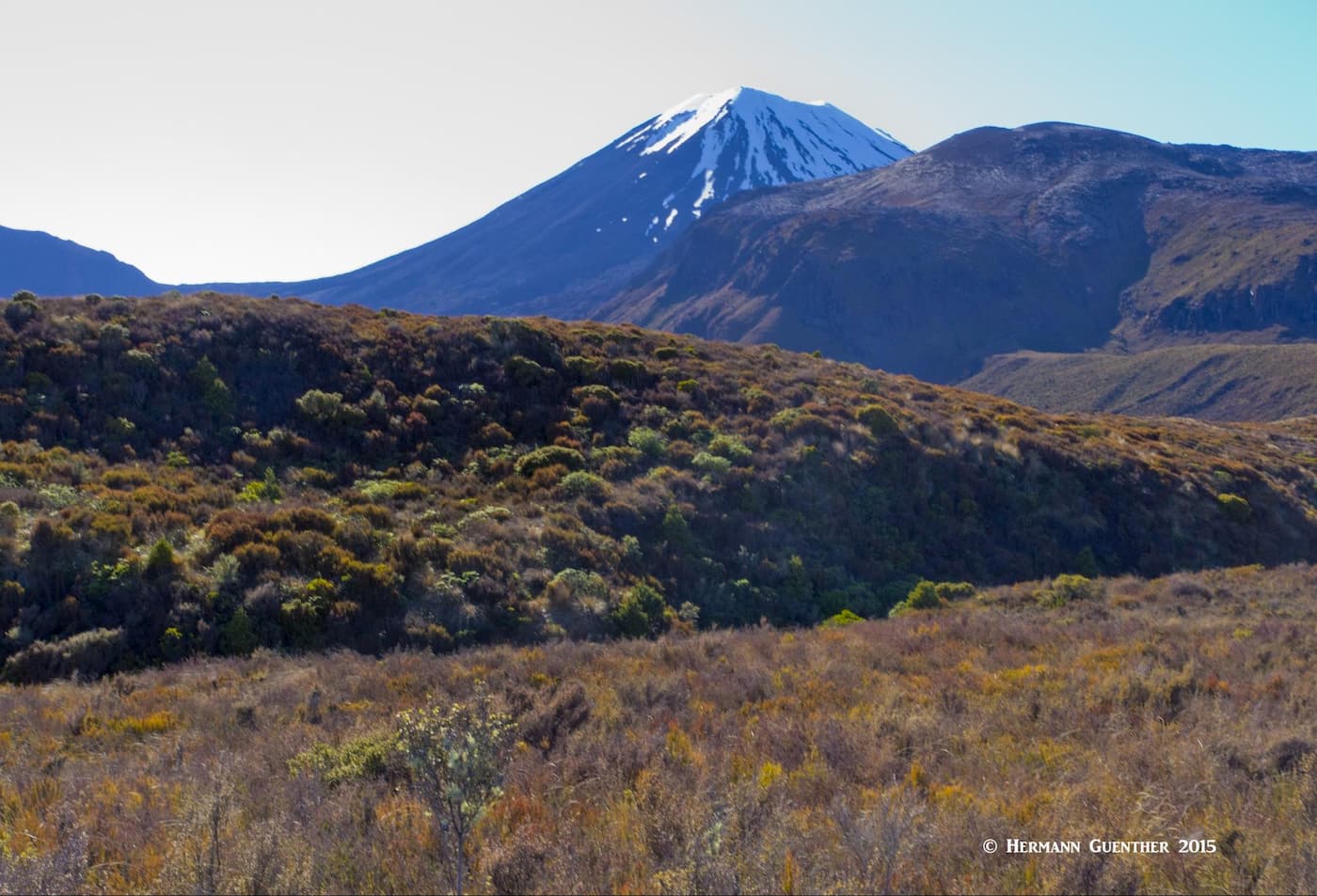
Close to the geographic center of New Zealand’s North Island is Tongariro National Park. This stunning park is a visitor’s delight and is home to the highest mountain on the North Island – Mount Ruapehu. It is an ultra-prominent mountain with an elevation and prominence of 9,177 feet (2,797 meters). It is also an active stratovolcano at the south end of the Taupō Volcanic Zone. It is one of the world’s most active volcanoes and the largest active volcano in New Zealand. The mountain is actually a massif comprised of several summits, the highest of which is Tahurangi. Therefore, it is technically correct to also call Tahurangi the highest point on the North Island, though Ruapehu remains the commonly used name. It is indeed an impressive sight when driving to the park no matter from which direction you are coming. However, it is not the only volcano in the park. The photo below was taken from the town of Taupō 50 miles away.
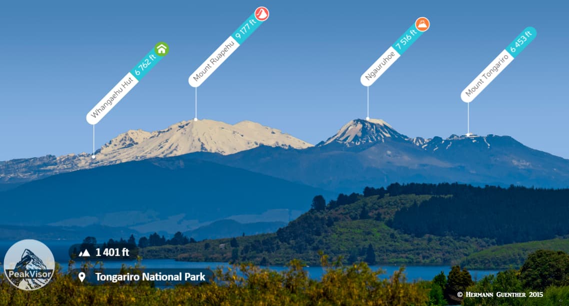
The park is centered about 25 miles south of Lake Taupō, and is equi-distant from Auckland, the country’s largest city, and Wellington, the nation’s capital. It can be reached by road in about 4½ to 5 hours from each. The visitor centre in Whakapapa Village is the place to go for all the information you will ever need about this magnificent park. The village is located just northwest of the base of Mount Ruapehu, and the ski area. The view from the village toward Mount Ruapehu, and especially Mount Ngauruhoe (referred to as Mount Doom in the Lord of the Rings movies), is stunning. When you arrive here, you will immediately want to put on your hiking boots and backpack and head out on a hike.
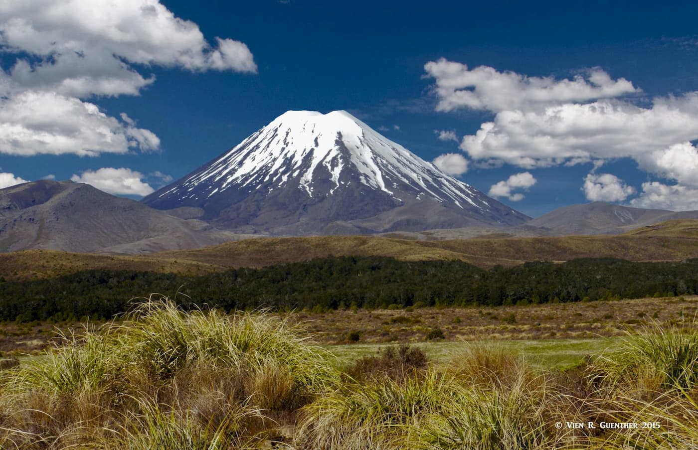
Mount Ngauruhoe (“Mount Doom”)
Tongariro National Park is New Zealand’s first national park and is designated a dual UNESCO World Heritage Site. The “dual” means that it is recognized under both cultural and natural criteria. The mountains in the park have cultural and religious significance to the Māori people – the original native peoples of the country. The mountains symbolize the spiritual links between the people and the environment. And it goes without saying that the park has some spectacular landscapes of the numerous active and extinct volcanoes along with a diverse range of ecosystems.
We came to this place in November of 2015 and stayed at a Holiday Park (campground) in Whakapapa Village since we had a rental campervan. There are other means of accommodation in the village, including the swanky Chateau Tongariro and a number of private lodges near the ski area higher up the mountain. Our mission was to accomplish the “finest one-day hike” in New Zealand - the Tongariro Alpine Crossing (more on this one later). With the village being the focal point for activities in the park, it goes without saying that there is plenty to do here. While most activities do involve some hiking, there are other outdoor treats to be found here as well.
Mount Ruapehu is home to the two largest ski areas (called ski fields here) in the country. And in the summer, for tourists who want to “climb” the leisurely way, there is the Sky Waka gondola that takes you over unbelievable terrain on its way high up on Mount Ruapehu. It is the largest gondola in the country, traveling more than a mile up the mountain’s slopes, for mind-bending views. Then there are opportunities to enjoy river rafting and kayaking nearby, even for less adventurous family groups. Prefer some mountain biking? Yup, it’s there for you to enjoy as well. Fishing anyone? Nearby Lake Taupō is reputed to have some of the best trout fishing in the world.
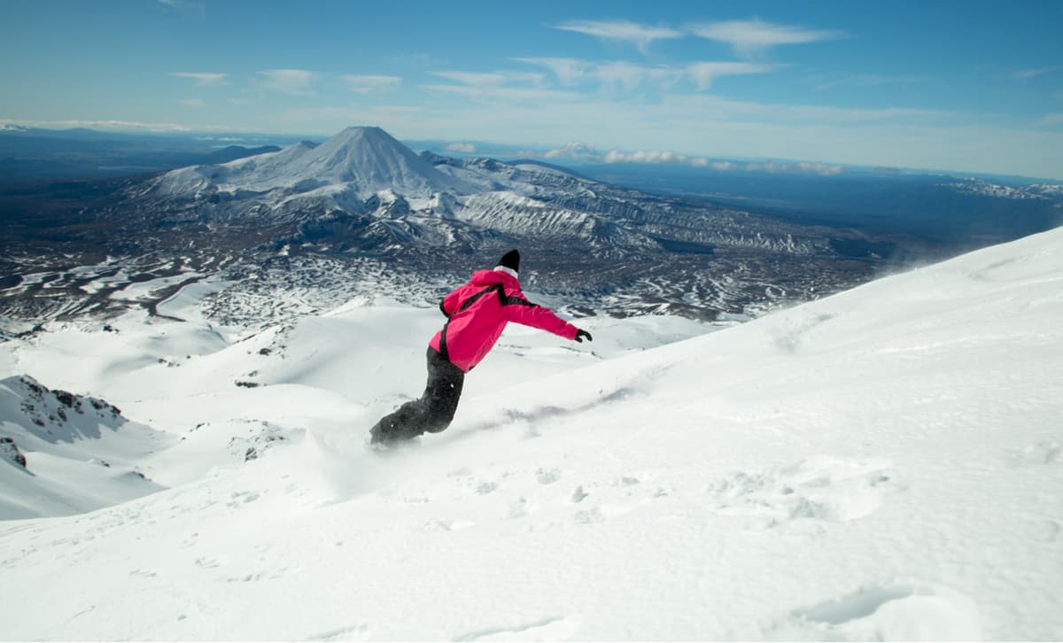
Snowboarding on Mount Ruapehu, view toward Mount Ngauruhoe
But it is hiking (tramping to the Kiwis) the magnificent terrain and and enjoying the natural features that make this place special. And there is no shortage of hiking trails (tracks as they call them here). Some start right from Whakapapa Village and for others you may have to drive a short way or take a shuttle service which is handily available right in the village. Trails come in all levels of difficulty and length – from as little as a half mile (1 km) to as long as 45 miles (72 km) and can involve multiple days on the trail. With many of the trails starting right in the village, you don’t even have to drive to get to the trailhead. In fact, if you are really into long-distance trekking, you can pretty well hike to anywhere in the park from here if you are equipped to spend multiple nights on the trail. Let’s look at some examples.
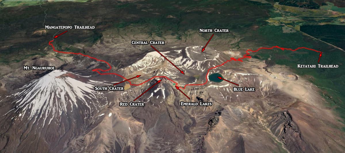
We’ll start with the obvious and most popular of them all – the Tongariro Alpine Crossing (TAC). We will discuss this in some detail because it is so grand. This hike over stunning volcanic terrain is variably called the “finest one-day hike” in New Zealand. My wife and I were fortunate enough to make this hike – and we did it on an unusually fine day without a cloud in the sky the whole way. (See here for a more detailed trail description and photos of our hike.) This hike of 12.5 miles (20 km - we took a slight detour) must not be taken lightly. First is the weather, which can change for the worse without warning. Hikers are advised to bring warm clothing even for summer days whether they think they need it or not. This is called an “alpine” crossing for a reason. Then there is the volcanic risk – this is something you cannot plan for but need to be prepared to deal with. The trail is at times closed when monitoring indicates that the risk is elevated to dangerous levels.
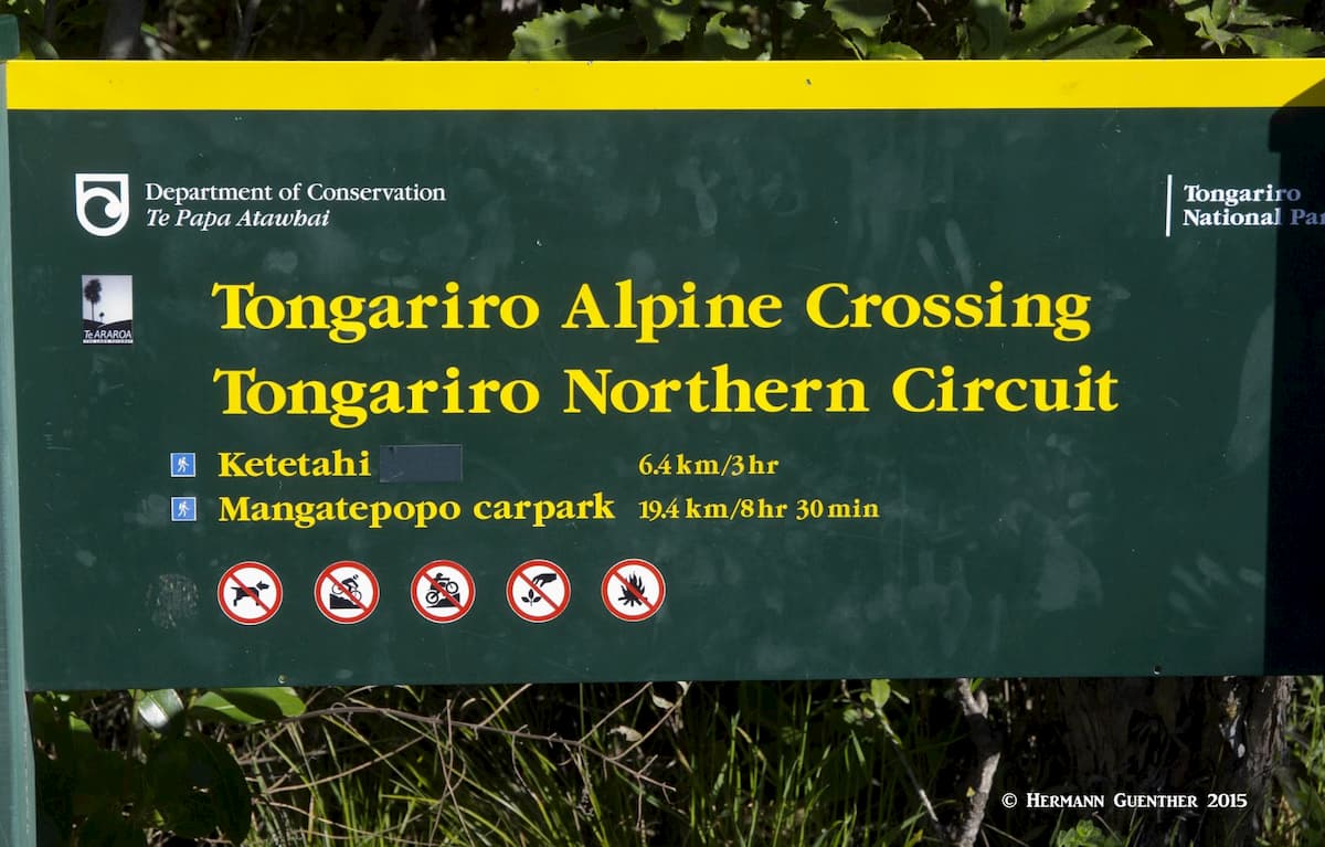
This hike is usually done one–way from the southwest to the northeast. Most hikers will take a shuttle bus from one of several locations to the trailhead at the end of the Mangatepopo Road, which is only a short drive from the village. They will then be picked up at the northern trail-end parking area on the Ketatahi Road off the State Highway 46. While this hike reaches a high elevation of only 6,128 feet (1,868 meters), it involves a total elevation gain of 3,443 feet (1,050 meters) including intermediate ups and downs. The total elevation loss to the endpoint is 4,328 feet (1,320 meters). This alone is a good reason to make the hike in a northbound direction – it would be much more strenuous going the other way.
The hike starts gently enough as it gradually works its way up the Mangatepopo Valley, eventually to climb steeply up into South Crater on a long series of stairs called the Devil’s Stairway. Here you will be as close as you will get to the steep slopes of Mount Ngauruhoe, which you will see almost constantly for the first half of the hike. It is a stunning thing to look at while imagining what that would look like when it blows its top, as it is known to do. On a really clear day, you will get a view that is rarely seen from here according to the locals we met there – an unobstructed view of Mount Taranaki 85 miles (137 km) to the west. That is how clear it was on that day.
Mount Taranaki
Once you cross South Crater, which is pretty level walking, you get to the ridge that connects Ngauruhoe with Mount Tongariro. This is where the track climbs steeply to the saddle between Red Crater and Mount Tongariro. Here you are almost at the highest elevation of the hike. You really want to stay up here for a while and enjoy the marvelous views in all directions. Of course if the weather is awful, you will really want to get down off this point as quickly as possible. We lingered up here, even contemplating a side trip to the summit of Mount Tongariro, but that would have added two miles and at least another hour to our hike. We passed on this one.
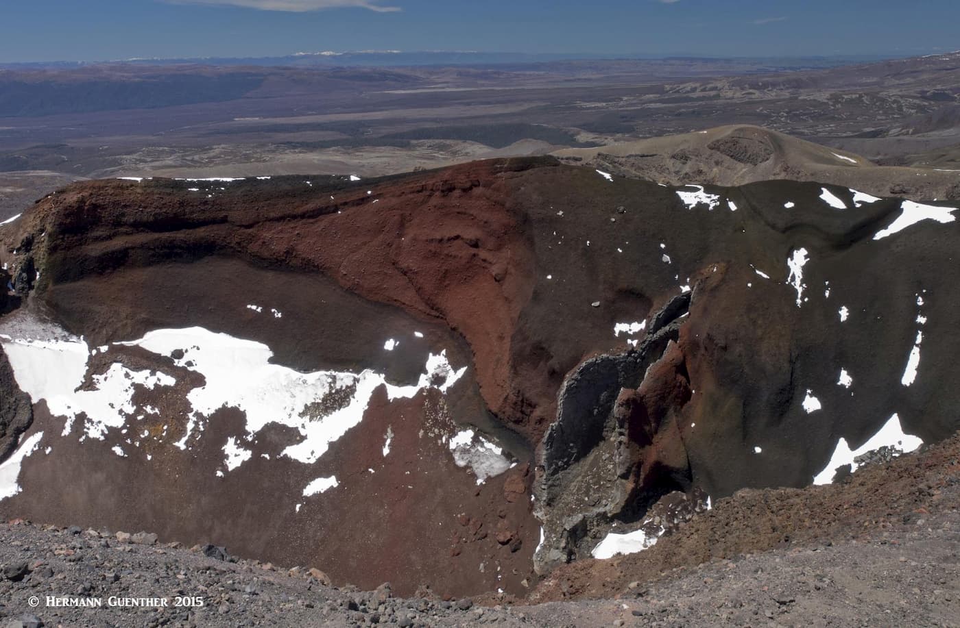
Red Crater
A short distance further and you will reach the highest point of the hike on the rim of Red Crater and the awesome view down into it and of course toward the focal point, perhaps, of the entire hike – the Emerald Lakes. From here, it is a very steep descent to those lakes on very loose gravel and other volcanic debris. We were sure thankful to have our hiking sticks with us for this segment. The view toward the north as far as Lake Taupō and the mountains even beyond was simply stunning. The Emerald Lakes are a fine place to stop for lunch before continuing on to the next destination.
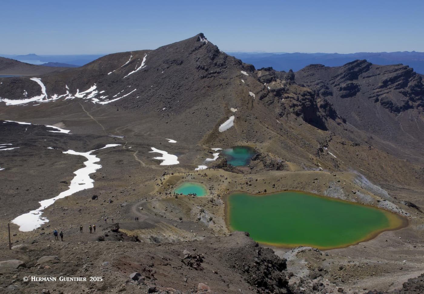
Emerald Lakes from Red Crater
From the Emerald Lakes, which are at the edge of Central Crater, it is a relatively easy hike to Blue Lake, although a steady climb of about 300 feet (91 m) is necessary to get you to this appropriately-named lake, which is sacred to the Māori. Touching the water or even sitting and eating beside the lake is considered disrespectful because the lake is sacred. After Blue Lake, you will enter one of the major volcanic hazard zones of the hike. Here you are at the halfway point of the hike and the six-mile (10 km) descent begins; but fear not, there is no end to the terrific scenery along the way. (It also seems like there is no end to the trail!) About two miles down you will pass the Ketatahi Hut where you can take a rest break, since your knees will still be subject to four more miles of abuse on the downhill trek to the end. But before you are finished you will have to cross a half-mile lahar hazard zone – a sign warns you to move quickly and not to stop here. A few more minutes to the end and you can sit and relax until your shuttle picks you up and returns you to lodging.
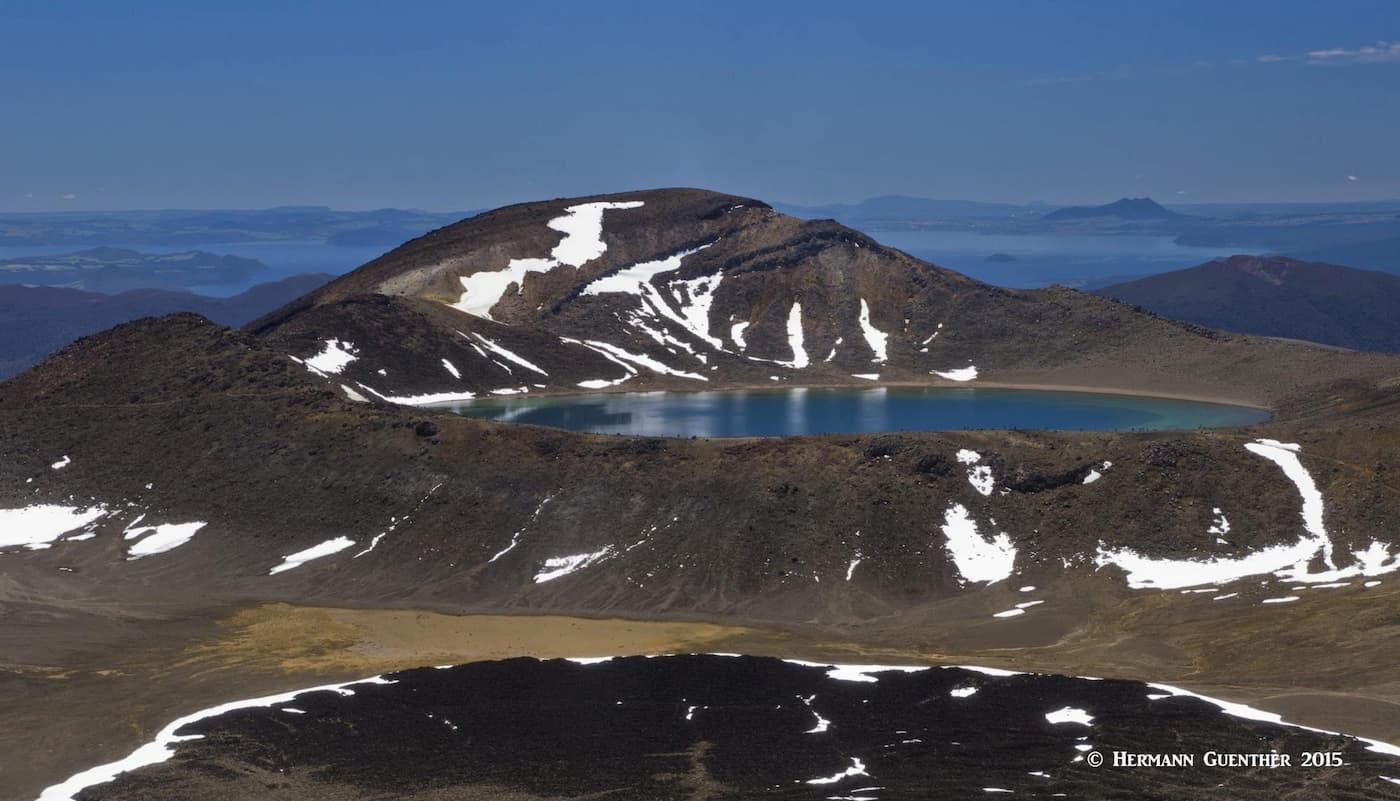
Blue Lake and Lake Taupō
Since I usually carry a GPS unit when we hike, I was able to record our actual track and then import it into Google Earth. The image below is a screenshot showing the result, with labels I created in Photoshop.
Yes, there are other great hikes in Tongariro National Park. And if the weather is really bad on the TAC (people have spent days here waiting for decent weather to do the TAC, only to have to return home and go back to work), then you will want to opt for one of these. Since we had limited time in the area, we were not able to do any of the other hikes, but I’m sure any of them would be very worthwhile, and would be guaranteed not to be crowded. The day we did the TAC, we heard that 600 people made the hike, and that was on a weekday. It did not seem crowded, but locals told us that on holiday weekends the crowds can be overwhelming. That is another reason you need to know about alternatives.
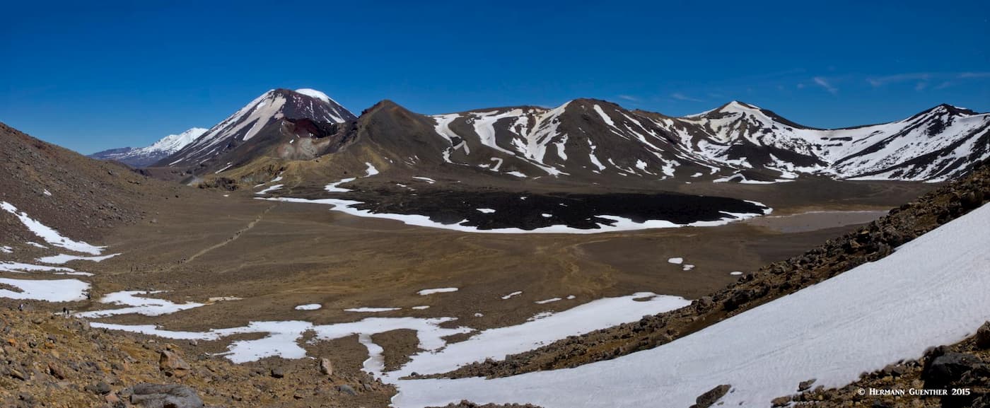
Tongariro National Park panorama
Taranaki Falls Loop – This 70 foot waterfall can be reached on an easy 3.6-mile loop hike starting practically at the doorstep of the Skotel Alpine Resort (just behind the Chateau Tongariro). It is of course possible to walk this track in either direction as the falls are located just about at the midpoint of the loop. The left (lower) track is more sheltered on windy days and also passes Cascade Falls. The upper track is more exposed and crosses a series of eroded gullies, thus affording better views.
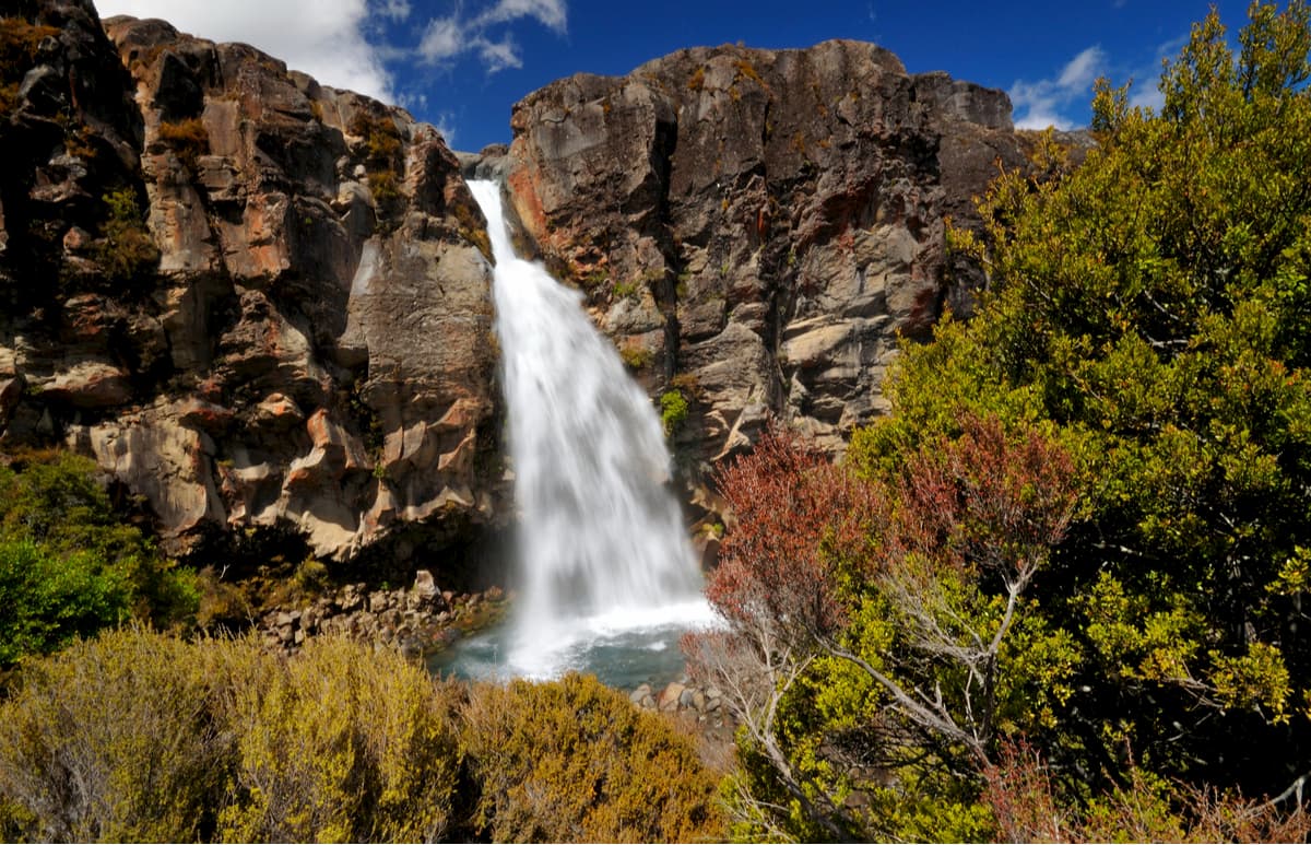
Taranaki Falls
Tama Lakes – This 10.5-mile round trip hike is an extension of the Taranaki Falls hike. After the falls, the track crosses open tussock country before it reaches the Lower Tama Lake, where a track goes clearly around the lake but not to its shore. Hiking steeply a short distance further along the track you will emerge at an overlook of the Upper Tama Lake. It is not advisable to try to go down to the lake since the way is made up of loose and uneven rock. Since these are pristine alpine lakes, it is important to keep away from the water to prevent the introduction of weeds and other invasive matter from entering the water. The lakes are located about midway between Whakapapa Village and Mount Ngauruhoe. The views of it and Mount Ruapehu are stunning.
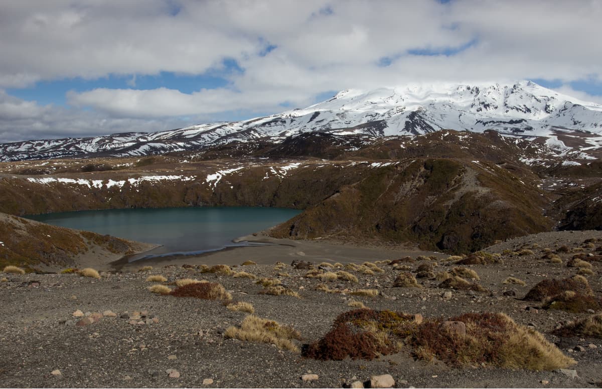
Lower Tama Lake with Mount Ruapehu
Tongariro Northern Circuit – This gigantic hike is not a stroll in the park. It is 27 miles (43 km) long and partly follows the TAC, so it is subject to weather conditions that can be severe. Even so, it is considered intermediate in terms of difficulty, though it will take three to four days to complete. Of course, you don’t have to do the whole thing in one go; you can make it as short or long as you want. There are easy family hikes that can be planned on different parts of the circuit, which has four different trailheads, the main one being at Whakapapa Village (same trailhead as for Taranaki Falls and Tama Lakes). The other major trailhead is at the northern end of the TAC. This of course adds considerable mileage since you would have to go in all the way to the Emerald Lakes just to get to the point where the TAC intersects the Circuit, and then you would do the entire Circuit before you get back to where you started. Ouch! I think I would skip this one, but surely the experience and scenery would be hard to beat.
Tongariro Northern Circuit
Round the Mountain Track – OK, this one is for the hard-core hikers. Completely around Mount Ruapehu in only 42 miles (68 km) and taking four to six days. Of course you can do just parts of it, for instance between Whakapapa Village and the Ohakune Mountain Road near the south entrance to the park. This could take you around either the western or eastern side of the mountain and would only take two to three days. Shuttle services are available to take you back to where you started. There are six huts with campsites available along the track, which require advance reservations during peak periods, although camping outside designated campsites is allowed with certain restrictions. This hike also has many side-trip options so that you will never get bored.
Climbing the Volcanoes – Naturally, since this is mountain terrain, people will want to climb them – and people do. There are no official trails to the summits of Ruapehu or Ngauruhoe. But there are routes that people commonly use. The crater lake near the summit of Ruapehu is particularly enticing, as is the inner crater at the top of Ngauruhoe. But these are tough climbs on unforgiving (and at times dangerous) terrain. Proper equipment and conditioning are mandatory. Reports I have read clearly tell me that these climbs are intimidating and even terrifying. When we took our shuttle ride to the TAC trailhead, we were strongly advised not to even think about doing such climbs. So we didn’t and wouldn’t. I have since read that climbing of Mount Ngauruhoe is not allowed anymore and that whatever trail markings were there have been removed. Of course, that doesn’t necessarily mean people won’t try to climb it.
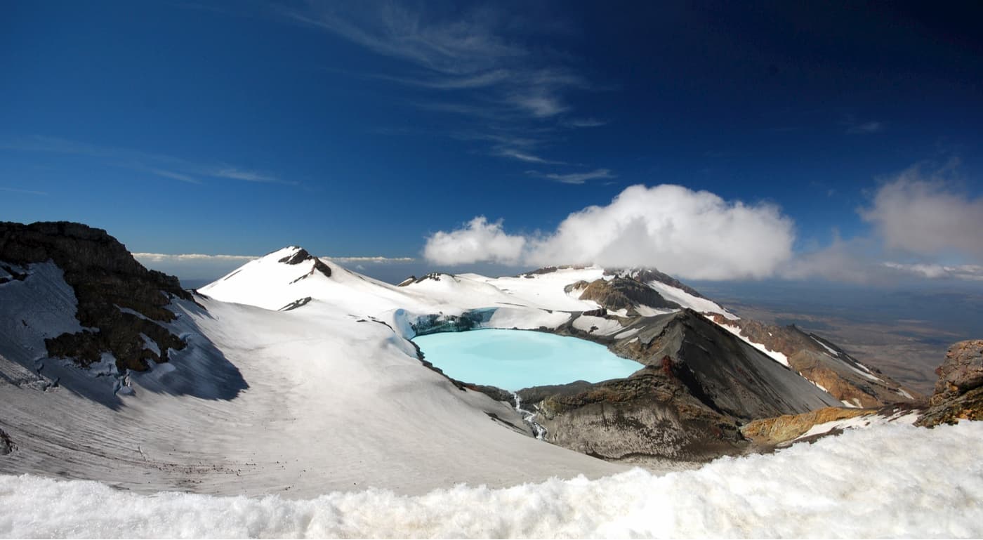
Mount Ruapehu Crater Lake
If you plan to spend a few days in Tongariro National Park, you can’t do much better than the wonderful town of Taupō, although staying right in the park itself in Whakapapa Village, as we did, is very handy and enjoyable. But if you have several days to spend here, you may also do well to stay in one of the many small and charming nearby towns. Let’s look into a few of them.
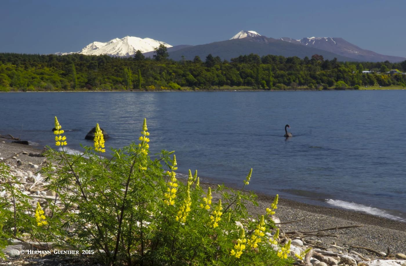
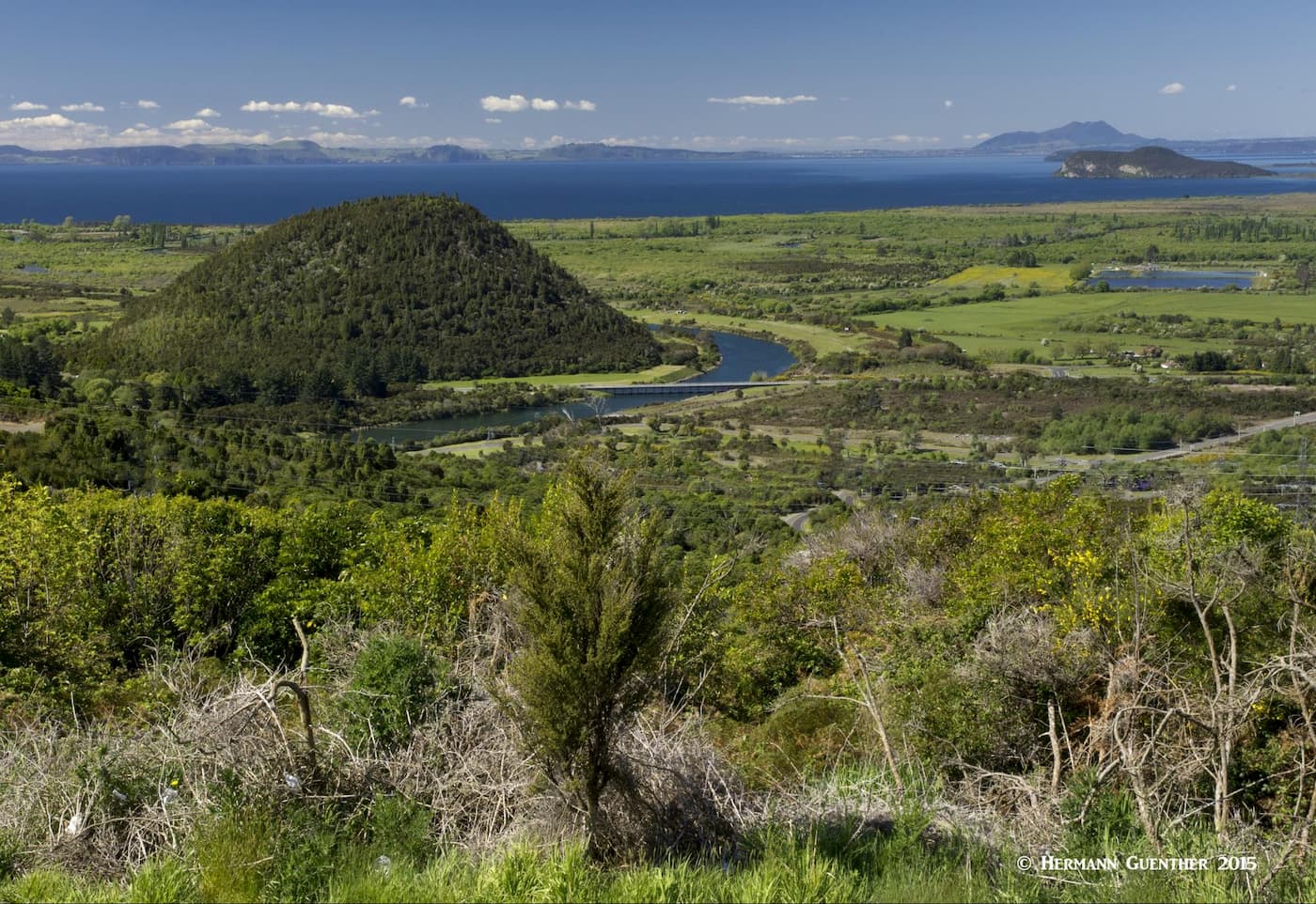
This is simply an ideal town to choose as a base for exploring the entire central part of the North Island, not just the National Park. Perched beside the northeast shore of the lake of the same name, this town of about 25,000 inhabitants is a fantastic place to make your base and will give you opportunities to take on an endless variety of recreation options. There is no shortage of accommodations ranging from Holiday Parks (campgrounds) to five-star hotels here. Many of them, including most of the best, are concentrated along the beautiful waterfront of Tupuaeharuru Bay, the largest inlet on this great lake. It is a real pleasure even to just stroll along Lake Terrace and gaze at the stupendous views toward the mountains of Tongariro National Park.
Taupō waterfront park
Besides having such a fantastic hiking world just a few miles away, there are so many other amenities to be found in and near Taupō. The mighty Waikato River starts its journey here and it doesn’t end until it flows into the Tasman Sea south of Auckland, 265 miles (425 km) later – the longest river in New Zealand. This river itself is a playground of activities. Within town and downstream, it is flanked by beautiful parkland and walking/biking tracks that pass the awesome Huka Falls, beyond which there are opportunities for kayaking and jet-boating. Do you want to try skydiving or paragliding or bungy jumping? It can all be found here. If you prefer more benign activities, you can try boating or fishing on the lake.
Of course you can just stroll around the town, do some shopping or see some of the sights. If hunger gets the best of you, there are plenty of places to eat to satisfy everyone's tastes, most of them clustered around the town centre near the lake outlet. One that you should go out of the way to see, and even eat there if you choose, is the McDonald’s just a block from the waterfront. While the food will probably be familiar, the restaurant is unique. They even have seating inside the old DC-3 airplane permanently parked on its property. Not far from Taupō is Rotorua, a vacation destination of its own, featuring lakes and thermal features. So just chill out and thoroughly enjoy this fine town.
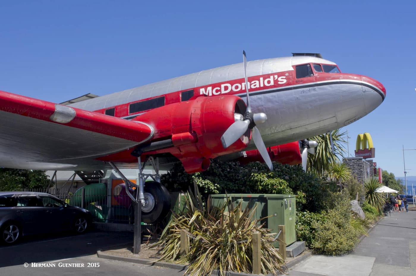
Taupō eating establishment
While this is truly just a small village, this is the place to stay if you want to go tramping right from your doorstep. You could spend days following different tracks and never have to drive your car. Of course, accommodations are limited here as are choices for eating. Many hikers will opt to stay in the Holiday Park, a fully serviced campground set among beautiful native trees and handy to walking tracks. It offers tent sites, powered camper sites, cabins, unlimited wifi and hot water showers at no additional charge. Flowing right beside the campground is the Whakapapanui River. This is a rustic and delightful place to stay if you are equipped to do so. If not, you can always opt for the high-end Chateau Tongariro – the name should speak for itself. This place may not be for the backpacking crowd, but it does have several restaurants and bars just in case you get tired of your camp food or need something relaxing to drink. Nearby is the park’s visitor centre operated by the Department of Conservation. We were perfectly happy staying in our campervan parked under the trees with the soothing sounds of the river nearby, and our home-cooked food wasn’t bad either. We would stay here again.
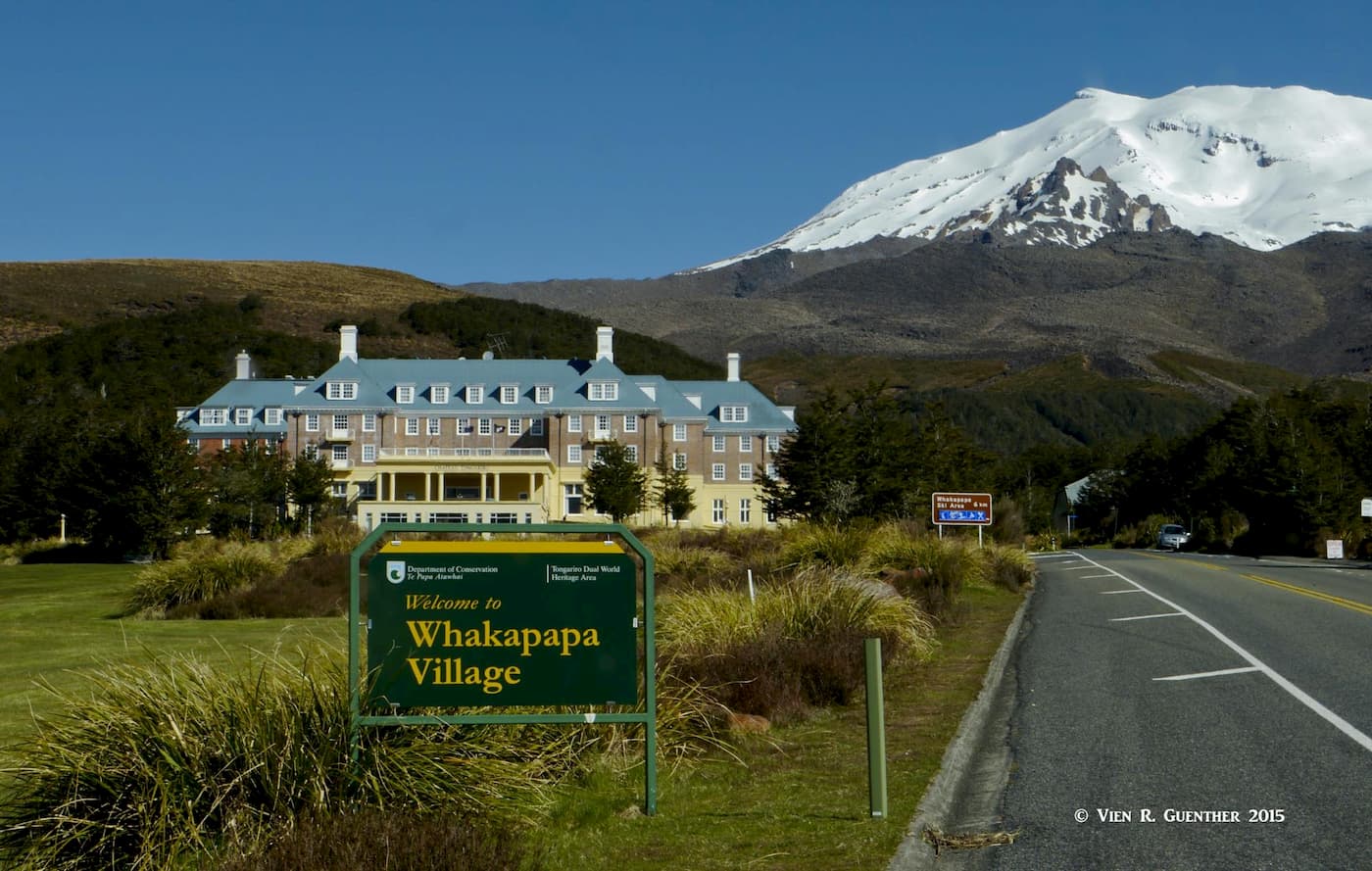
Whakapapa Village, Chateau Tongariro and Mount Ruapehu
Turangi is a small town at the crossroads of State Highway 1 and State Highway 41 near the southern end of Lake Taupō. It is just 30 miles (48 km) from the center of the Tongariro National Park at Whakapapa Village. With a population of 3,300, it calls itself “the trout fishing capital of the world”. Built on the banks of the Tongariro River, Turangi and its surrounding countryside offer challenging hunting, fishing, mountain biking, tramping or leisurely bushwalking, white water rafting, kayaking and sightseeing. The town has a decent selection of accommodations, restaurants and shopping venues. Its location is midway between the much larger Taupō and Whakapapa Village in the park. The scenery around town is primo.
Viewpoint above Turangi, Lake Taupō
This small town of less than 1,200 inhabitants is located just to the south of Tongariro National Park. It is considered the southern gateway to the park and is mostly associated with skiing since it is home to the ski resort of Turoa which is 11 miles (18 km) to the north on the southern slopes of Mount Ruapehu via the Okahune Mountain Road. This road also serves a number of hiking tracks including the Round the Mountain Track. Ohakune is a charming little town that offers somewhat limited but adequate tourist amenities, including several lodges, inns and a Holiday Park. It is the site of the world’s first commercial bungy jumping operation and is served by a state highway and the North Island Main Trunk Railway.
Okahune Main Street (Wikipedia)


