Scan the QR code and open PeakVisor on your phone
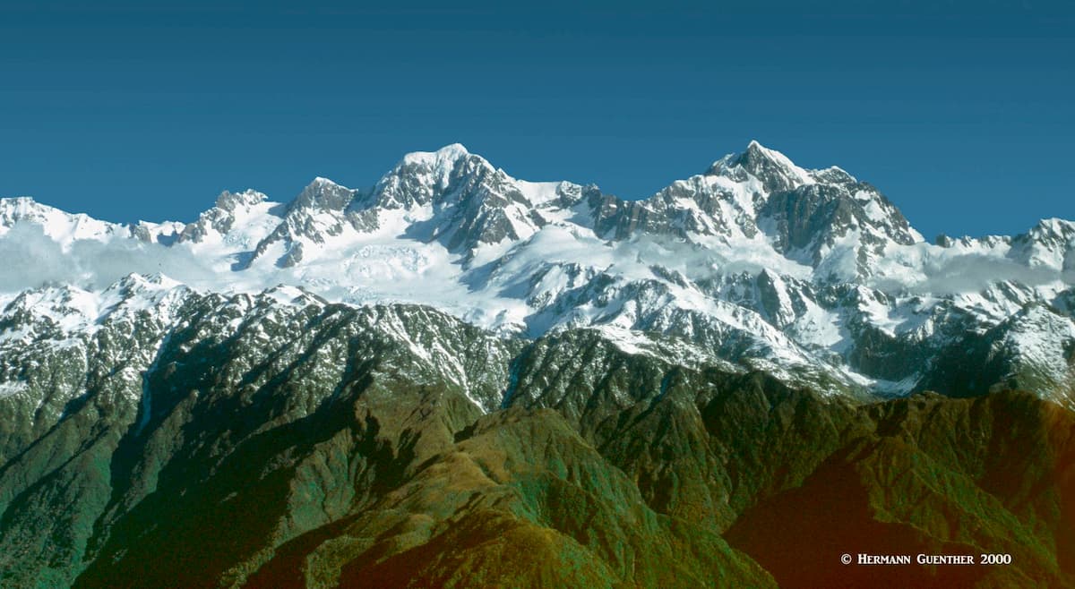
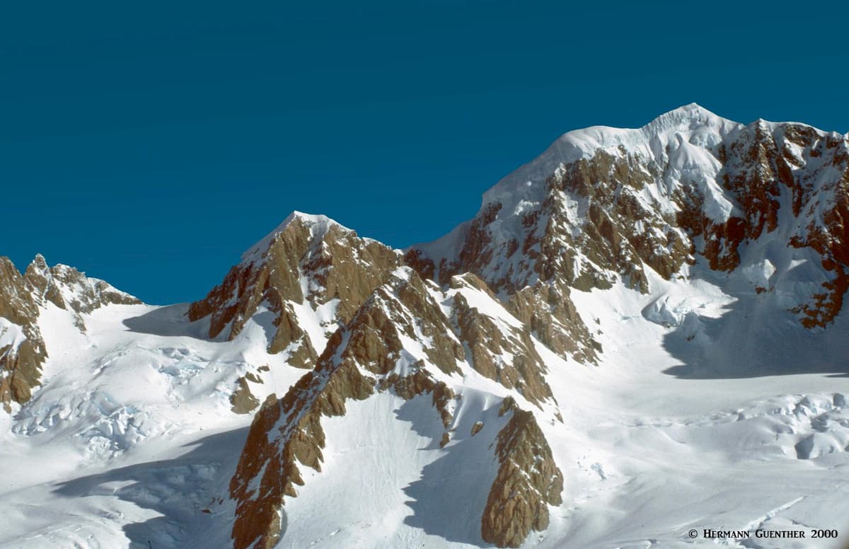
Westland Tai Poutini National Park is located on the central west coast of New Zealand’s South Island. It extends from the Tasman Sea to the crest of the main divide of the Southern Alps, which separates it from Aoraki/Mount Cook National Park. As with so many natural features in the country, the name was appended to include the native Maori name in deference to the native heritage of the land. The highest and most prominent mountain is Mount Tasman, which sits squarely on the divide – thus it is also the second highest mountain in Aoraki/Mount Cook National Park (as well as the second highest in the entire country).
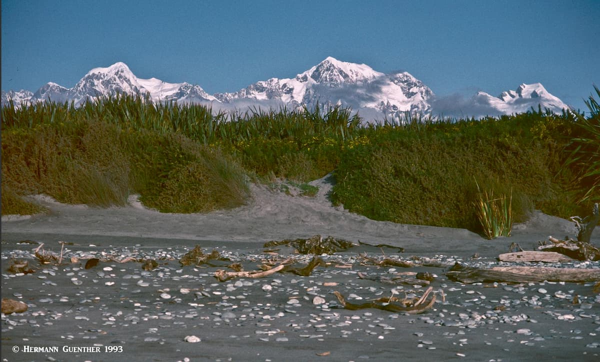
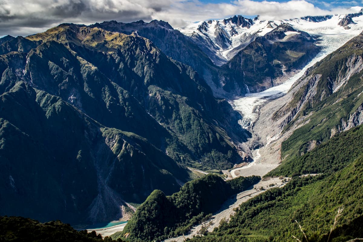
With the highest peaks no more than 16 kilometers (10 miles) from the coast, this is truly impressive topography. On clear days, which are not abundant, the views here are mind-blowing. There are 143 named mountains in the park, and although Aoraki/Mount Cook is not within the park boundaries, it dominates the view at some locations just as it does on the east side of the divide.
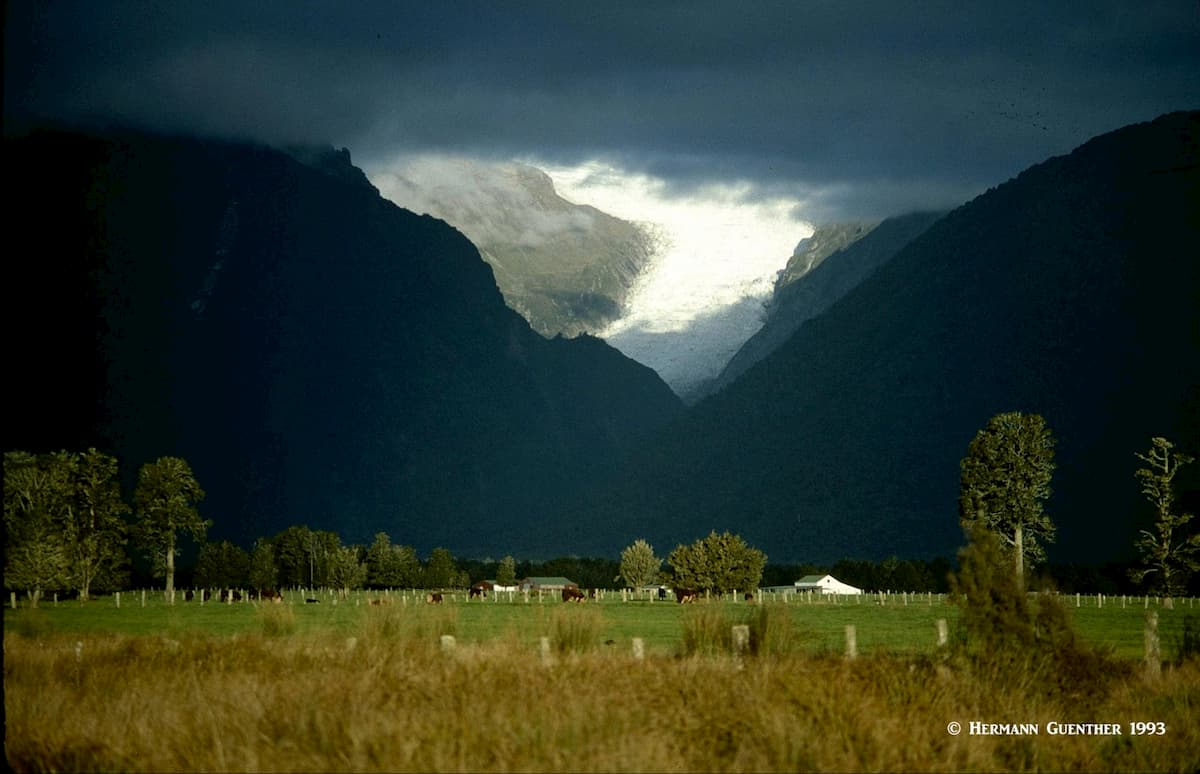
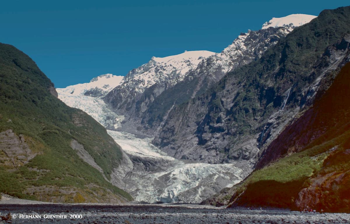
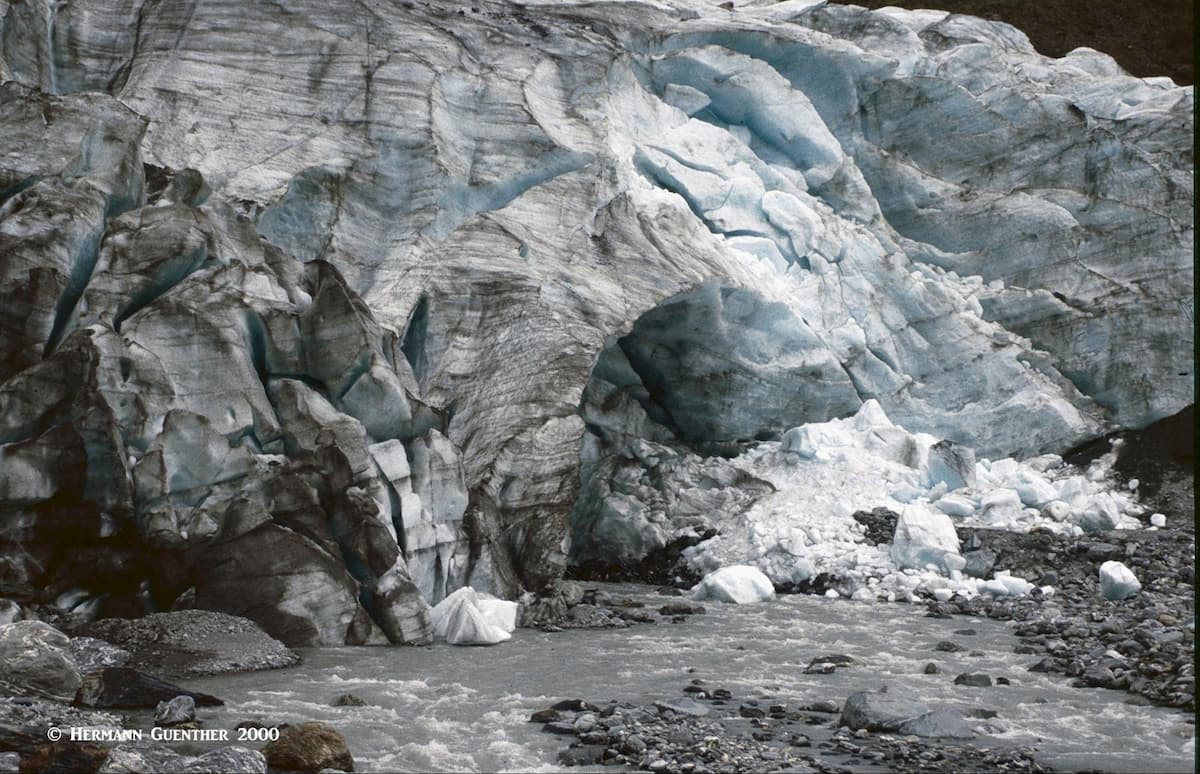
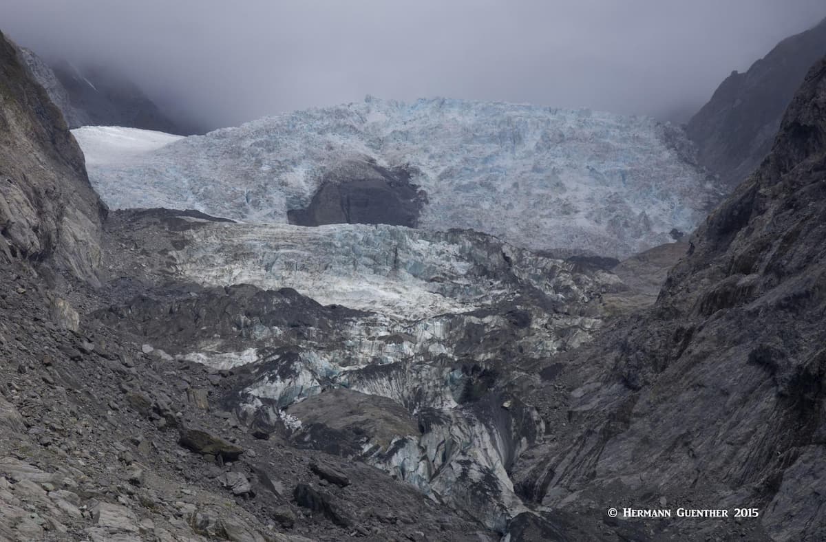
The National Park is also home to two world-famous glaciers – Fox Glacier and Franz Josef Glacier – at the foot of each of which are the only towns of any significance, with names coincident with the names of the glaciers. These glaciers are the only ones in the world that flow into a temperate rainforest. At least they used to, before they receded so far uphill that they pretty much end before they get down to the tree line (or the bush line as the locals sometimes call it).
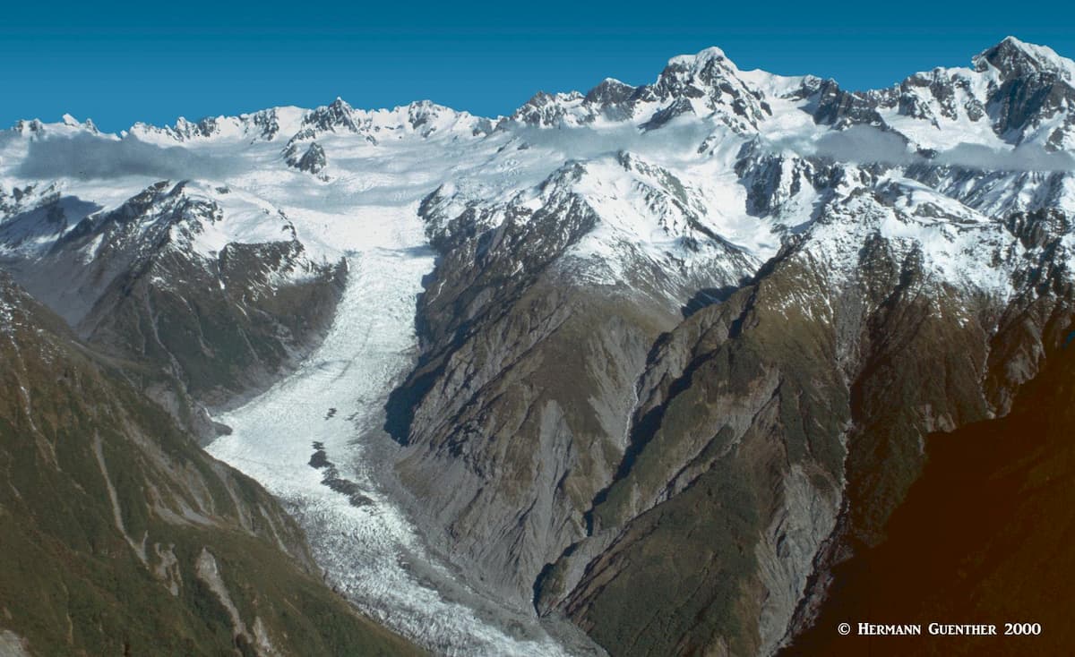
The first two times that I came to this place, the glaciers had reached all the way down to the valley floor, and you could hike right up almost to the face of each glacier, and even beside it. Now you can only get to within at best several hundred meters of them. Unlike the glaciers on the east side of the divide, these two have not formed a terminal lake. But they are impressive enough even so, and they are among the most accessible rivers of ice in the world.
Naturally, being predominantly a mountain environment, hiking and climbing are going to take the front seat in the recreation domain. Given that Westland Tai Poutini National Park lies in the heart of the Southern Alps, it goes without saying that hiking and mountaineering are among the main recreational attractions here. The diversity of environments means that visitors of all abilities and experience will find something enjoyable to undertake. At the “high” end, there is the lure to reach the highest summits – but let’s be realistic about that. These mountains are serious business and should only be attempted by highly experienced and suitably equipped parties. Even in summer, the higher routes are not meant for casual hikers.
Glaciers are of course of highest interest to visitors, especially because they are so easily accessible. Everyone wants to walk on a glacier. But these glaciers are not friendly and to try to walk on them is putting one’s life in jeopardy. Yes, it is possible to walk on them, but is only advisable if one is properly equipped, experienced and guided by professionals. Not only is there the danger of falling into a crevasse, there is the ever present threat of icefalls and rockfalls in the narrow valleys that these glaciers traverse. The safest way for casual visitors to experience walking on a glacier is to book a tour with one of the many flight-seeing services. There are many operators offering landings on the glaciers, for those who want to see the mountains and glaciers up close without exerting too much energy. They know where they can safely land high up on a glacier and can control where visitors can walk while being assured of their safety.
Besides glaciers and stunning mountains, Westland Tai Poutini National Park also has some very interesting lowland attractions between the mountains and the sea. These include a number of fine lakes nestled within the rain forest as well as deserted (well, almost deserted) beaches, such as Gillespie’s Beach, which offers rudimentary camping, stunning sunsets and amazing views back toward the mountains. There are some wonderful “bush walks” where entire families can experience the lush rainforest and the fascinating flora and wildlife that make it home.
Most of the popular hiking trails (tracks to Kiwis) in Westland Tai Poutini National Park start in or near the two major townships of Franz Josef Glacier and Fox Glacier. Some of these, especially those starting in the villages, also serve as cycleways such that you can ride a bike as far as the parking areas for the main attractions and trailheads. Here we will only discuss some of the main trails, including some that require a good level of fitness, while others are quite suitable for families with children. It goes without saying that any hike, or even simple walks, will mandate that you are suitably equipped for the type of hike you will do. Warm clothing and raingear are an absolute must since the weather can change drastically in just minutes – any time of year. Good footwear (hiking boots) is essential for the more advanced tracks. And don’t forget insect repellant – those sand flies are brutal. It’s best to get it locally – the locals know what works best.
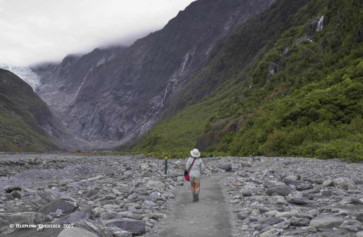
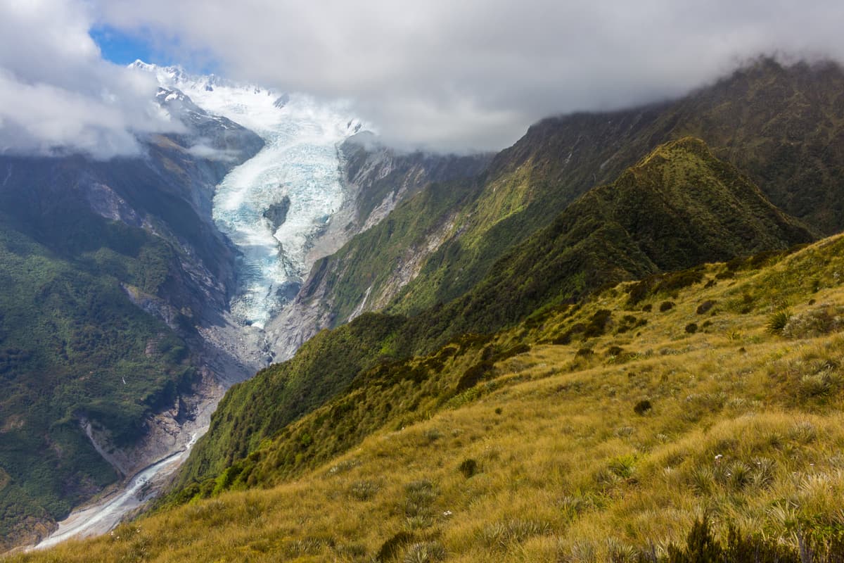
Franz Josef Glacier Walk – It is safe to say that pretty much anyone who visits here will do this 5.4 kilometer (3 miles) round trip hike to get as close as is safely possible to the glacier viewpoint. Only 4 kilometers (2.5 miles) from the township to the trailhead parking area, this easy hike starts as a forest walk to an initial viewpoint of the glacier. It then continues as a route over the shingle and rock of the riverbed, which is quite rough so that suitable footwear is advised. It is generally level with only a slight incline to the actual viewing area. Along the way it passes the lovely Trident Falls.

One peculiarity we observed in this area was the many boulders covered with what appeared to be bright red lichens. You can’t miss them. At the end of the track are information boards and barriers beyond which you must not go. This is a beautiful but volatile place, which is why you are not allowed to get closer than 500 meters from the actual face of the glacier. During periods of even moderate rainfall, this track can easily rise in just minutes at which times it might be closed. Allow at least two hours for this hike.
Alex Knob Track – This 17.2 kilometer (11 miles) round trip hike to some fantastic lookouts is not for casual or inexperienced trampers (Kiwi-talk for hikers). The hike begins beside the Glacier Access Road just over two kilometers (one mile) from the township of Franz Josef Glacier, at the same point where the very easy Wombat Lake hike begins. After passing the turnoff to that lake, the Alex Knob Track gets serious and is definitely not a family walk in the park. The total elevation gain for this hike is 1,080 meters (3,546 feet) which will result in a fairly strenuous 8-hour day. So you want to keep an eye on the weather. But the views from the top will be well worth the effort. For those who don’t want to do the entire route to the top, there are two intermediate viewpoints (Rata Lookout and Christmas Lookout) that offer stunning views as well for a bit less effort. If there is snow above the tree-line, these may be good places to turn around.
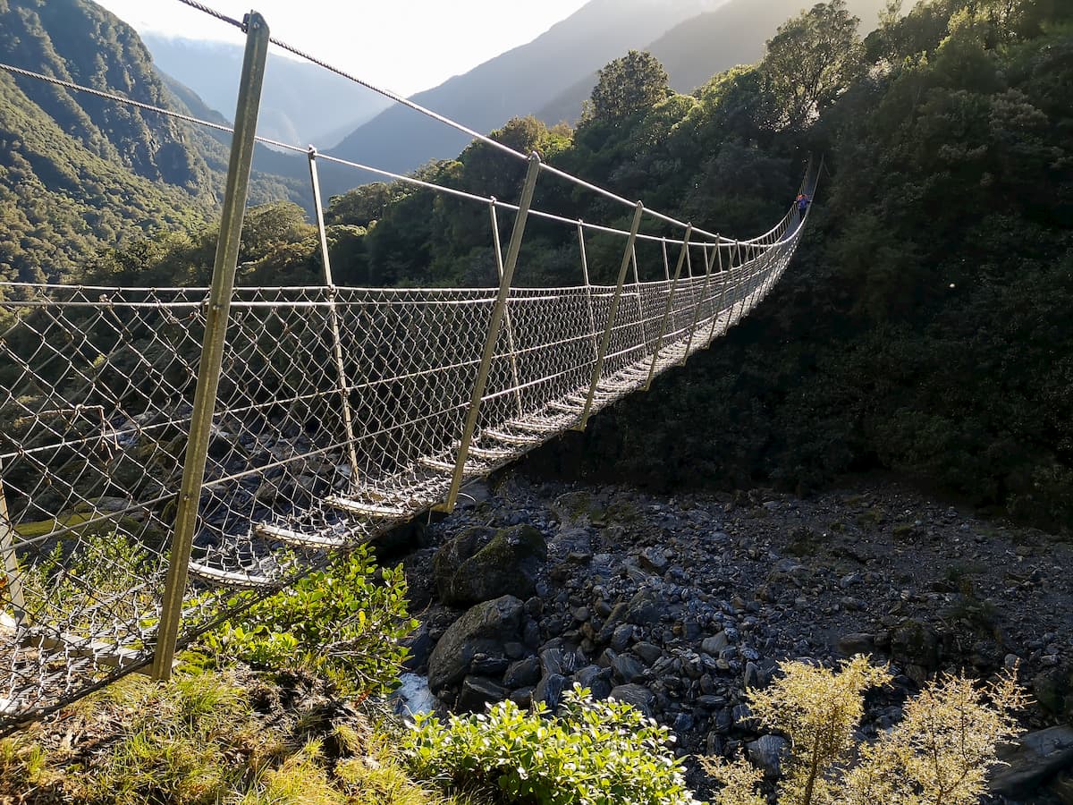
Robert’s Point Track – This 11 kilometer (6.7 miles) round trip hike starts at the same parking area as the Alex Knob Track, but can also be started at the Glacier Walk parking area in which case it is slightly longer. In either case, an approach trail will take you to a swing bridge (Douglas Bridge) across the Waiho River where the actual Robert’s Point Track begins. From this point the track generally follows the east side of the valley while gradually gaining 548 meters (1,797 feet) of elevation to a viewpoint high above the valley floor. There are many creek crossings and waterfalls and several swing bridges until it reaches its end at Robert’s Point. The view encompasses the Franz Josef Glacier, sheer rock walls, waterfalls and the mountain peaks of the main divide. A truly challenging and worthwhile hike that requires a good level of fitness. Good boots are essential for this hike, since it is very wet and slippery.
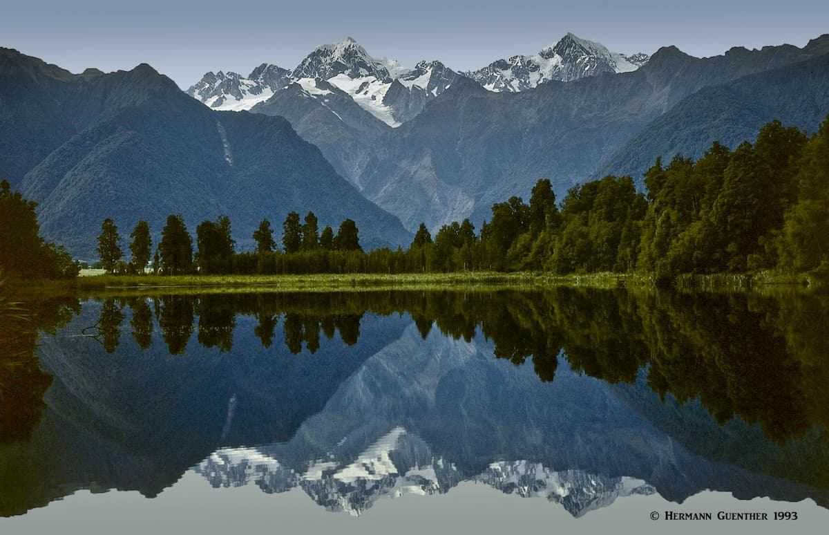
Lake Matheson Walk – This is not so much a hiking trail as it is a simple loop walk through the forest and around a small lake. But, wow, has this walk ever become popular! Why? Because at the right time of day (morning, usually) and with the right weather (no clouds or wind) this walk defines the idea of a postcard. The length of the loop is only about 2.6 kilometers (1.6 miles) long, but the reason everyone comes here (that includes tour bus crowds) is to witness one phenomenon – to see the reflection of Mounts Cook and Tasman in the calm waters of the lake. Yes, but that is only if the aforementioned conditions are met. I’ve come here three times. The first time was just perfect, the second time, marginal, and the third time it was raining so hard that we never even got out of the car. But if you get lucky (the odds in favor of that are slim, since the west coast is one of the rainiest places on the planet), you will be amply rewarded, as I was back then, when tourism was not the madness it is now. The problem will be to find a place where you can get that perfect shot without the selfie-addicts blocking your view or knocking over your tripod.
Lake Gault Track – As an alternative to the Lake Matheson Walk, you can hike the Lake Gault Track, starting at the same trailhead parking lot. This will be a longer hike, about 8 kilometers (5 miles) and involves an elevation gain of 244 meters (800 feet), which ends at a lake that offers a fine lookout point. From here you will get an incredible panoramic view of the Southern Alps including Mounts Cook and Tasman. Like Lake Matheson, early morning is the time to be here, when the lake is calm and before clouds obscure the mountains. You will be rewarded with a perfect reflection. Since this round-trip hike will take between three and five hours, you will not be burdened with the tour bus crowds, who don’t have that much time. Of course, you could combine this hike with a walk around Lake Matheson, which would add about 1.6 kilometers (one mile) to the overall length of the hike. You can expect mud, wet feet and steep, rough terrain on this track, which is not recommended in heavy rain.
Mount Fox Route – For the benefit of those wanting a more intense workout, while avoiding the crowds, the route to the top of Mount Fox is for you. But be forewarned; only well-equipped and experienced hikers should attempt this one, as the route is steep and rough. In a mere 3.5 kilometers (2.2 miles), the route attains the summit with an elevation gain of 1,170 meters (3,839 feet). The trailhead for this hike is 3 kilometers (2 miles) south of the township of Fox Glacier, right beside the Haast Highway (State Highway 6) – the only highway along the west coast. At the top, the views to the Southern Alps and the Fox Glacier in one direction compete with those across the coastal forest and farmland to the coast in the other. This climb should be started early in order to be on the mountain’s top before the clouds obscure the view. Though the route above the bushline is marked, it can be easily lost if clouds descend or if it is misty or foggy. Even in the forest, the trail can be easily lost. Constant awareness of your location is mandatory.
Copland Valley Track – This very popular hiking trail starts at a parking area 26 kilometers (16 miles) south of the township of Fox Glacier on the Haast Highway (State Highway 6). The track is 18 kilometers (11 miles) one way, taking about 8 hours, to what is called Welcome Flat, where you will find the Welcome Flat Hut, although you will find a very small hut about halfway up the track as well. Needless to say, this is an overnight trip affording great glimpses of Westland’s spectacular forest, river and mountain scenery, with natural hot pools at Welcome Flat where you can soak your weary bones. Because of the terrain and wilderness conditions, this hike is for well-equipped and experienced backcountry hikers only. In addition to the hut, there are designated campsites as well. Bookings must be made year-round for any overnight stay. It is possible to continue into the Upper Copeland Valley, but that is only advised for more highly hikers and mountaineers.
Because of the remoteness of the west coast of the South Island, there are really no major towns or resorts near Westland Tai Poutini National Park. Even so, there are plenty of accommodations available to the visitor right within the limits of the park. For those wanting something a bit more cosmopolitan, that would require a fairly lengthy drive north to the town of Greymouth, about 175 kilometers (110 miles) from Franz Josef Glacier township and over two hours away. In fact, those who are coming from the north and are planning on staying in Holiday Parks or other camping facilities, Greymouth would be the logical place to stock up on supplies, since it has a good selection of supermarkets and other shopping venues. If, on the other hand, you are coming here from the south, your last town of any significance is Wanaka, 262 kilometers (163 miles) and 3½ hours away. But the two dominant towns in the park are of course Fox Glacier and Franz Josef Glacier Townships, only 24 kilometers (15 miles) and a half hour apart. You will find that here is most likely where you want to spend a night or more.
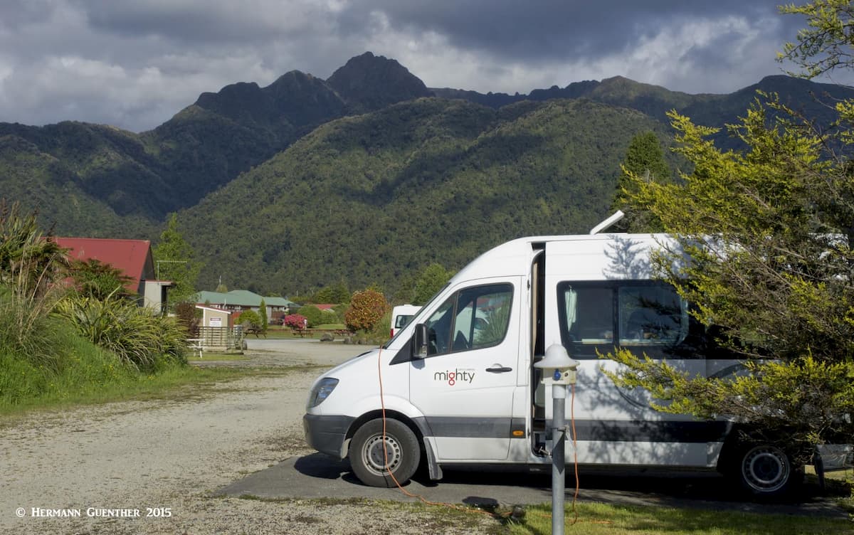
Franz Josef Glacier – This small and pleasant town is the gateway to its namesake glacier. The town has several hotels, motels, hostels, retreats, cabins and a very nice Holiday Park with a good view of the mountains. Remember that Holiday Parks are not just campgrounds – they offer comfortable motel rooms as well as simple bunk room cabins. While there are restaurants and food stores, the selection is not overwhelming - just adequate. And of course there are abundant touring services, including several helicopter services and at least one fixed-wing airplane service. The town actually has an airport, from which I have taken a scenic flight, pictures from which are included here. The popular walk to the glaciers as well as many other hikes start just a very short drive from town; some start right in town.
Fox Glacier – This small town has pretty much the same amenities as does Franz Josef – it even has a very short landing strip though I wouldn’t exactly call it an airport. Like Franz Josef, this town also has a very nice Holiday Park as well as plenty of other accommodations. Access to the various hiking trails is a very short drive out of town, and a little further out is the trailhead to the famous Lake Matheson. Gillespies Beach and the adjacent campground can also be easily reached in a half hour, a distance of 20 kilometers (12 miles) from town. The last half of this drive is on an unpaved road which is not suitable for towing vehicles. The view toward the Fox Glacier and the mountains from the road as well as from the beach is quite amazing.