Scan the QR code and open PeakVisor on your phone
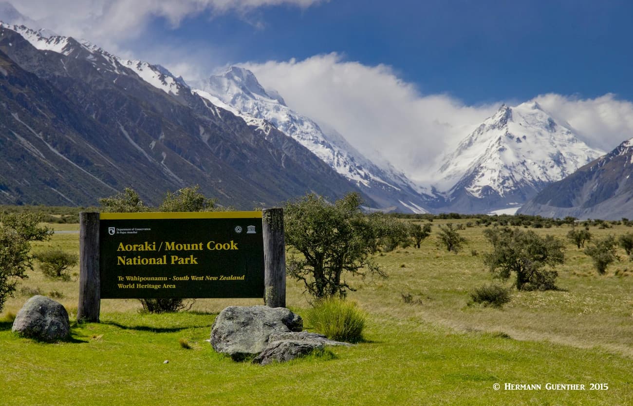
Let’s start with being politically correct – while this park is commonly referred to as Mount Cook National Park, in deference to the native Māori of New Zealand, the name has been appended as have so many others in the country to honor the native heritage. So while we call it Mount Cook National Park, we will keep this important distinction in mind. The park is located in the central part of the South Island, deep in the heart of the Southern Alps. The only settlement, Aoraki/Mount Cook Village, lies within the park, while the nearest actual town outside the park is Twizel, 63 kilometers (40 miles) to the south. For brevity, we will likewise call it Mount Cook Village, keeping in mind its full name.
There are 108 named mountains in the park – Aoraki/Mount Cook itself is its highest and most prominent mountain - also the highest in all of New Zealand. The park has 19 peaks over 3,000 meters (9,842 feet). A number of these mountains lie directly on the main divide of the South Island and are thus in both Westland Tai Poutini and Aoraki/Mount Cook National Parks, the divide serving as the boundary between them. But since Mount Cook itself does not lie directly on the divide, it resides solely in Mount Cook NP. Although Mount Cook has two other named summits that might be considered the second and third highest mountains in the country, it is Mount Tasman that is generally recognized as the second highest mountain in New Zealand. The former two peaks are part of Cook’s summit ridge.
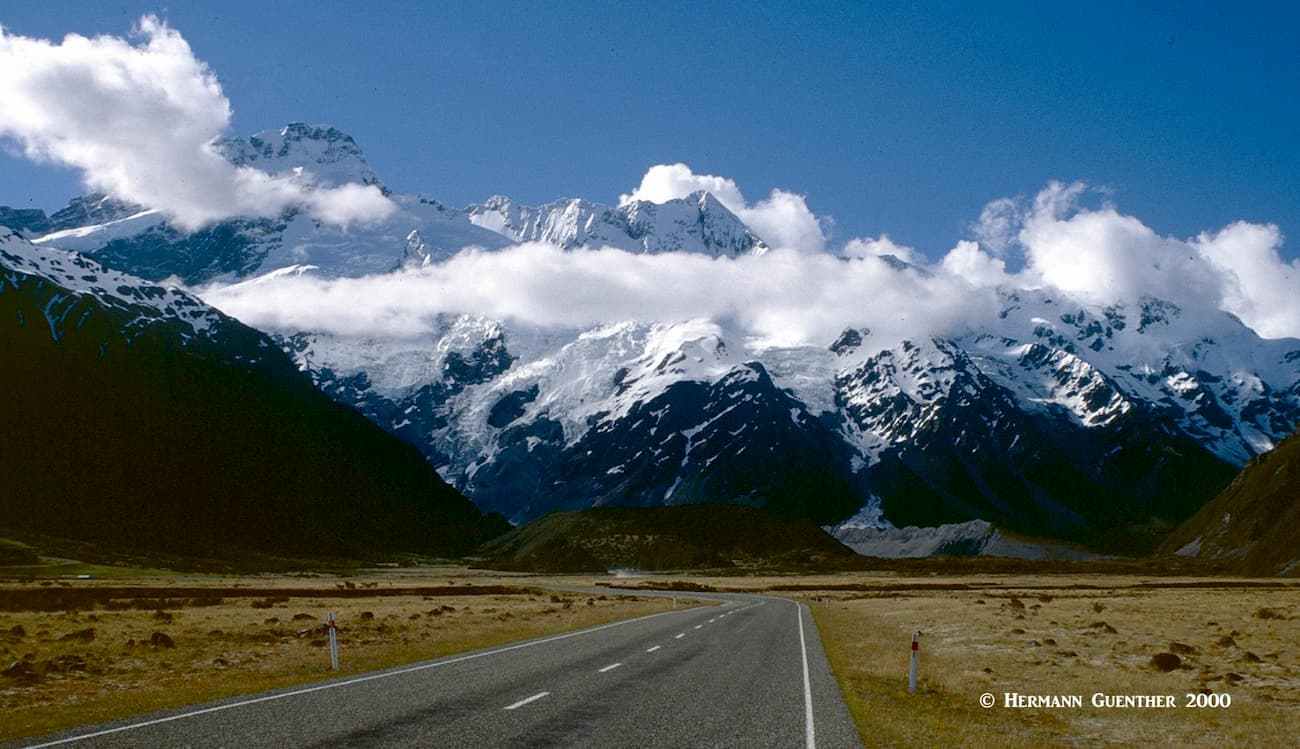
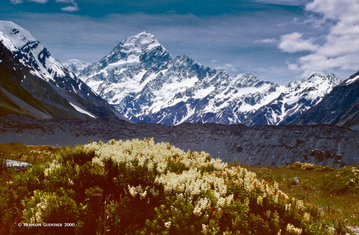
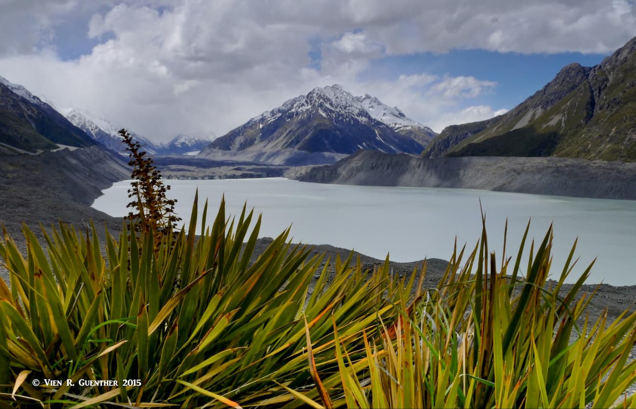
Mount Cook National Park is part of the Te Wāhipounamu - South West New Zealand World Heritage Area, which includes three additional national parks – Fiordland, Mount Aspiring and Westland, essentially most of the Southern Alps. Mount Cook NP is a wonderland of ice and rock, with high, forbidding peaks almost always covered in snow and ice, supplemented by massive glaciers carving their way down through deep valleys. Glaciers cover 40% of the park. The longest glacier is the Tasman at 27 kilometers (17 miles) long. Despite the fact that it has been receding since the 1990’s, this glacier still sports some impressive statistics – up to 4 km (2.5 miles) wide, 600 meters (2,000 feet) thick, and covers an area of 101 square kilometers (35 square miles). This glacier has a terminal lake formed as a result of glacial melting – something it did not have in 1973. Now the lake is at least 7 km (4.3 miles) long, two km (1.2 miles) wide and 245 meters (804 feet) deep.

Tasman Glacier, Mount Cook (c) and Mount Tasman (r)
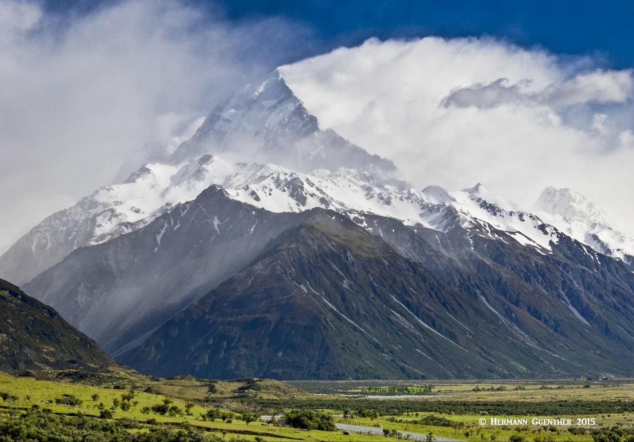
There is only one way to drive into Mount Cook National Park. If you are driving on State Highway 8, which you will be, and coming from the towns of Twizel or Lake Tekapo, you will get to a turnoff to State Highway 80 at the lower end of the spectacular Lake Pukaki. This road follows the west shore of that huge lake for about 30 km (19 miles) to its northern end. At that point you will be just past the halfway point to Mount Cook Village. But, on your way there, do not miss stopping at the scenic overlook known as Peter’s Lookout, about 12 km (7.5 miles) from the turnoff. You can’t miss it on the right side. If you are lucky, Mount Cook will appear in its immense bulk beyond the lake. I have been there three times and experienced that view twice – the third time, the top two-thirds of the mountain was in the clouds, but the view was still impressive. If you are fortunate enough to get that iconic view, it would be really good if you have a powerful lens on your camera as I did.
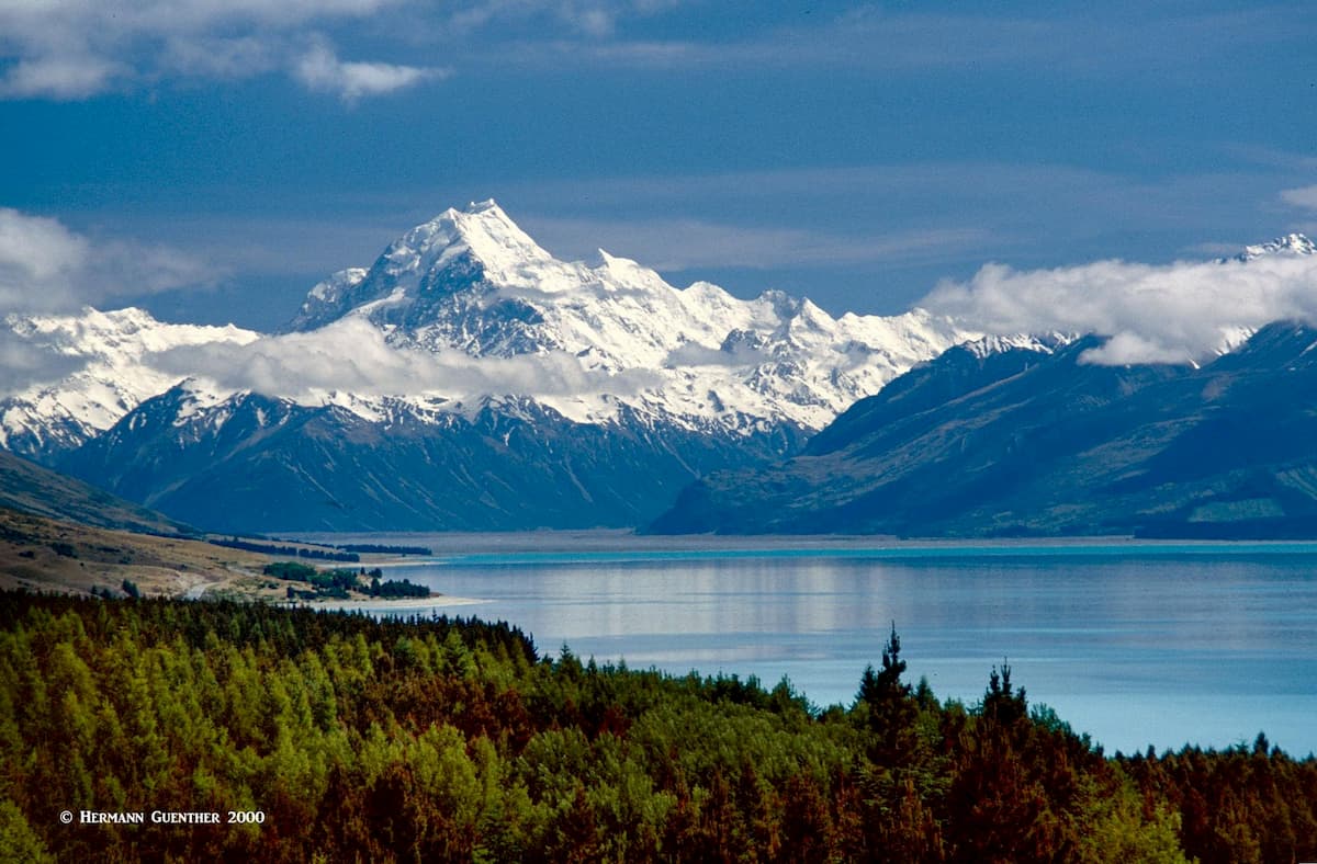
Mount Cook and Lake Pukaki
Just a short distance past the end of the lake is Glentanner Park, which has a Holiday Park with accommodations and a shop and cafe. Since we had a campervan, this is where we stayed for a couple of nights. There is no other place to stay for the night except right in Mount Cook Village. Now, there is another attraction in Glentanner Park – an airport (or a gravel landing strip would be more appropriate) from where you can get scenic flights over, through and between the Southern Alps. If the weather is cooperating, by all means do this – it is well worth the money. One local operator has a 50-minute flight that departs from here (as well as from nearby Lake Tekapo and Franz Josef on the West Coast) called the Grand Traverse. It takes in both Mount Cook and Westland Tai Poutini National Parks. I’ve done it twice – once from here and once from Franz Josef. There are also helicopter tours from here – you can even land on a glacier!
Once you continue past Glentanner, it is another 22 km (14 miles) to the Village. Just before the Village is the “official” Mount Cook Airport – it even has a paved runway. Once you get to the Village, the adventure begins. And there is much to choose from, keeping in mind that this place is all about mountains. So hopefully you are prepared for the great outdoors, which can throw some nasty weather your way. The Village itself is small, but has several inns and lodges, as well as restaurants. Just nearby is the DOC Visitor Centre – this is a must-see place and is also the best source of information regarding recreation, as well as useful information about important matters regarding safety, weather, avalanche conditions, etc.
Approach to Mount Cook Village - Mount Sefton
Given that Mount Cook National Park is right in the middle of the Southern Alps, it goes without saying that mountaineering is “high” on the list of things to do here. But these mountains are serious business and climbing in them is necessarily only the domain for experienced and well-equipped mountaineers. Climbing here involves calculated risks such as icefall, rockfall and avalanches, not to mention crevasses while crossing glaciers. So clearly, venturing into these mountains beyond maintained trails or tracks is not a family affair.
For example, Mount Cook is considered New Zealand’s most dangerous mountain, with hardly any climbing season going by without at least one fatality – more than 80 people have died since the early 20th century attempting the mountain. In 1991, an avalanche of 10 million cubic meters (353 million cubic feet) of rock and ice, followed by 20 years of erosion of the ice cap, caused the mountain’s elevation to drop by 40 meters (131 feet). And that’s just one mountain – many of the others don’t offer much friendlier terrain.
Despite this ominous introduction, there is plenty to do here for casual hikers, bikers, and even skiers, although there is no lift-serviced terrain here. A number of fine trails (tracks) are totally suitable for families and most of these start right in the Village or very close by. Let’s look at some nice options.
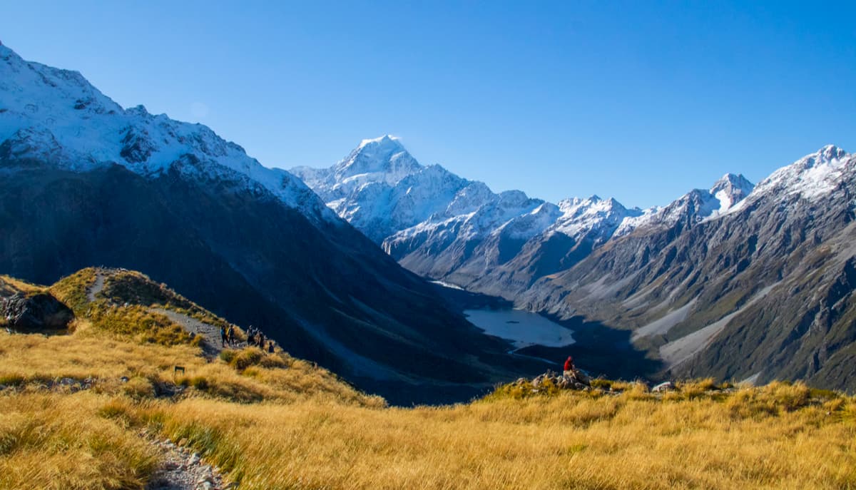
There are a number of short walks that can be undertaken right from the center of the village or from the White Horse Hill Campground, involving round-trip hikes of two hours or less, in some cases having almost no discernible elevation gain. These are naturally well-suited for families and inexperienced casual hikers. A very popular one is the Kea Point Track which is 4 km (2.5 miles) one way starting from the village and takes about two hours round trip. For those starting at the campground the walk takes only about one hour. It has a total elevation gain of 180 meters (590 feet) and ends at a viewing deck on the Mueller Glacier’s moraine wall. This gives stunning views of Mount Sefton, Hooker Valley, Mueller Glacier Lake and Mount Cook.
Mount Cook from Kea Point
There are a few “bush walks” starting right in the Village and all are under one hour in duration. They are mainly nature walks demonstrating some of the flora and fauna (mainly birdlife) of the lower elevations. Very suitable for families with little children.
Red Tarns and Mount Cook
The Red Tarns Track, starting in the village, takes about two hours round trip and involves 300 meters (985 feet) of elevation gain. Though classified as easy, it is steep, mostly involving stairs, and leads to breathtaking views of the village below and up the Hooker Valley toward Mount Cook and Mount Sefton. The hike can be extended even further up which can involve 150 meters or more additional elevation gain for even better views.
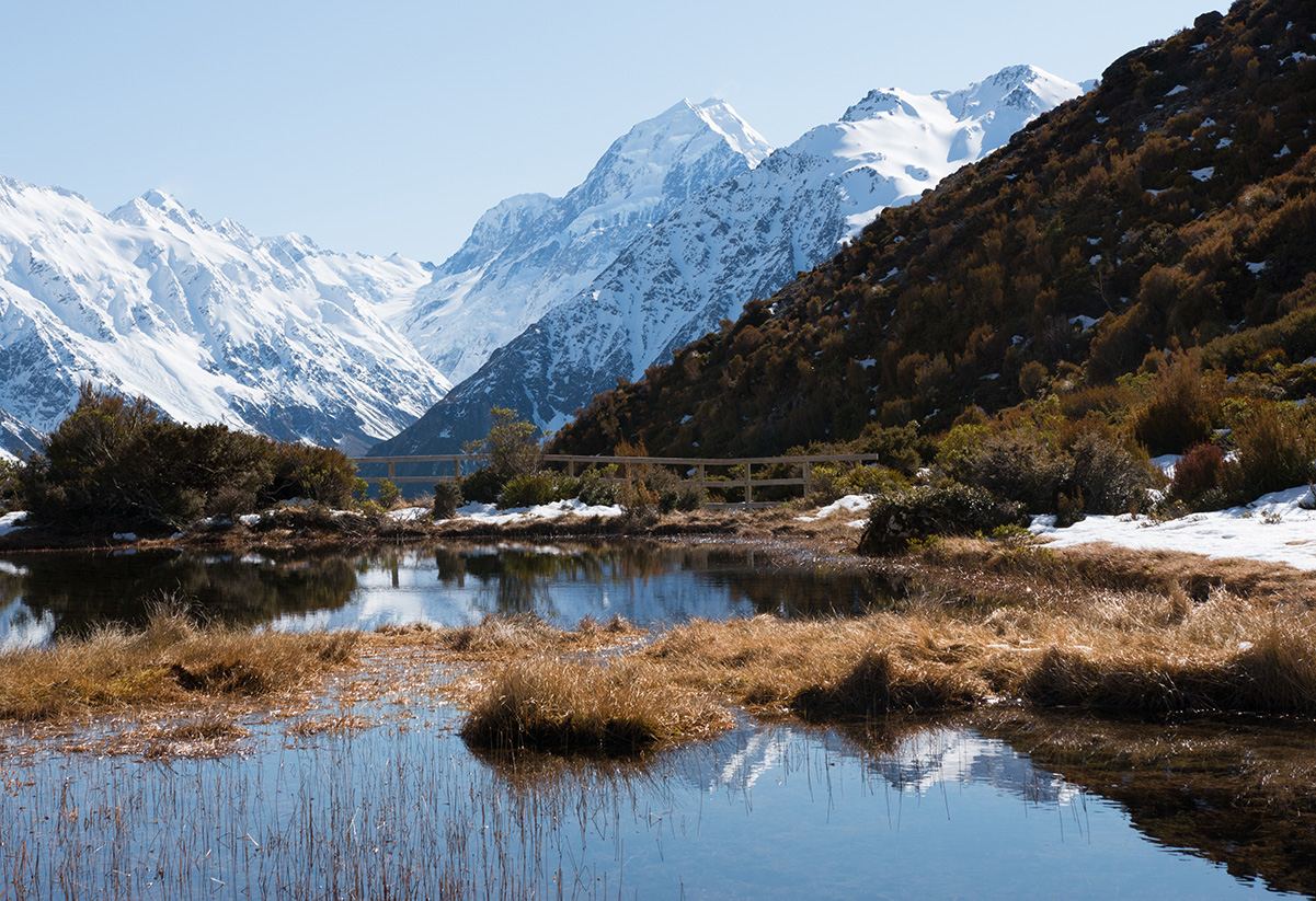
Hooker Valley Track and Swing Bridge
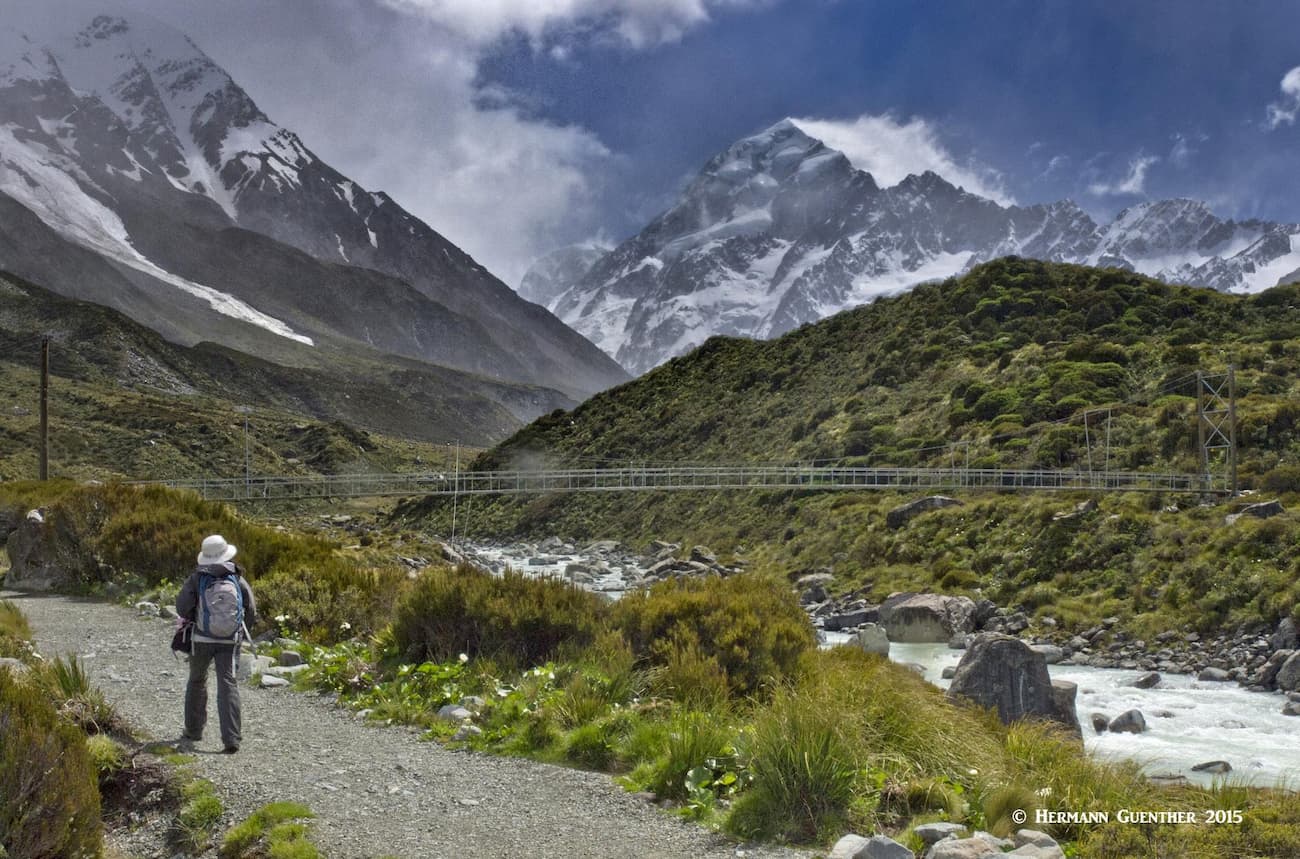
This very popular and awesome hike (see this link for more information and photos) starts at the White Horse Hill Campground and car park at the end of the Hooker Valley Road above the village. It is worth describing it in some detail. The round trip is only 10 km (6 miles) and involves no more than 80 meters (262 feet) of elevation gain – in other words, this hike is basically level. If you don’t do any other hike while in the park, do this one. I have done it twice and would love to do it again. The track ends at the Hooker Glacier Lake after winding its way through the sacred Tōpuni area of the Hooker Valley. On the way, you will cross three swing bridges across the Hooker River (and they do swing, especially on a windy day as we experienced the second time). The bridges are nevertheless very well constructed and perfectly safe – but you may lose your hat if you don’t secure it. At the first swing bridge, you will get a stunning view across Mueller Lake toward Mount Sefton. Listen carefully – you may hear the rumbling of avalanches.
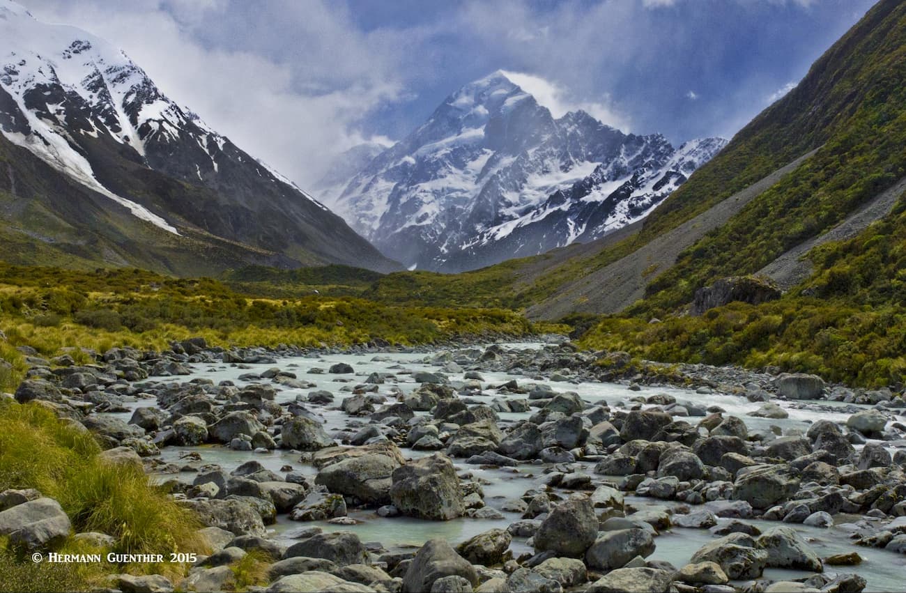
Mount Cook and Hooker River
After you cross the second swing bridge, you will come around a bend in the trail and will get your first glimpse of the mighty Mount Cook. For the rest of your hike to the Hooker Glacier Lake, the mountain will be perfectly framed in the middle of the valley. That is, if it is not hidden in the clouds. I was lucky both times, although the clouds did come and go with passing rain and sleet squalls. Eventually, you will reach the third swing bridge, after which crossing and a slight incline, you will be standing right above the lower end of the lake, with the mighty mountain as a backdrop. Do stay here and savor this view – there are few like it in the world. If you are lucky, you will see icebergs floating in the lake that have calved from the foot of the glacier at the far end of the lake.
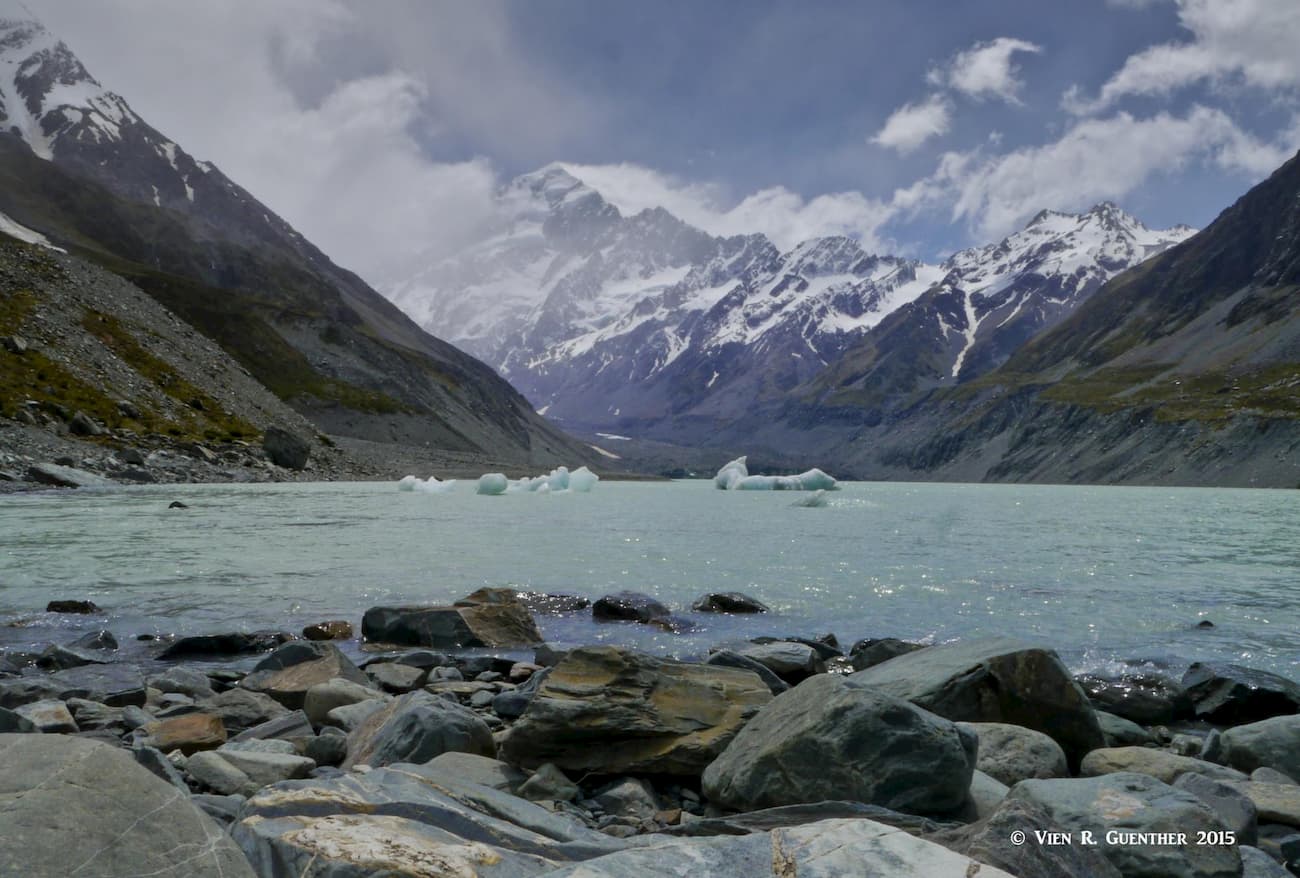
Hooker Glacier Lake and Mount Cook
As you return to your starting point, observe how well constructed this trail is. Parts of it are on stretches of boardwalk in order to protect the fragile environment. If you are there in the springtime, look closely at the vegetation. You should see clusters of Mount Cook Buttercups, the world’s biggest buttercup. Sometimes you may hear the call of the endangered kea, the only alpine parrot in the world. If you are really lucky, you will see one – they are mischievous and not very shy.
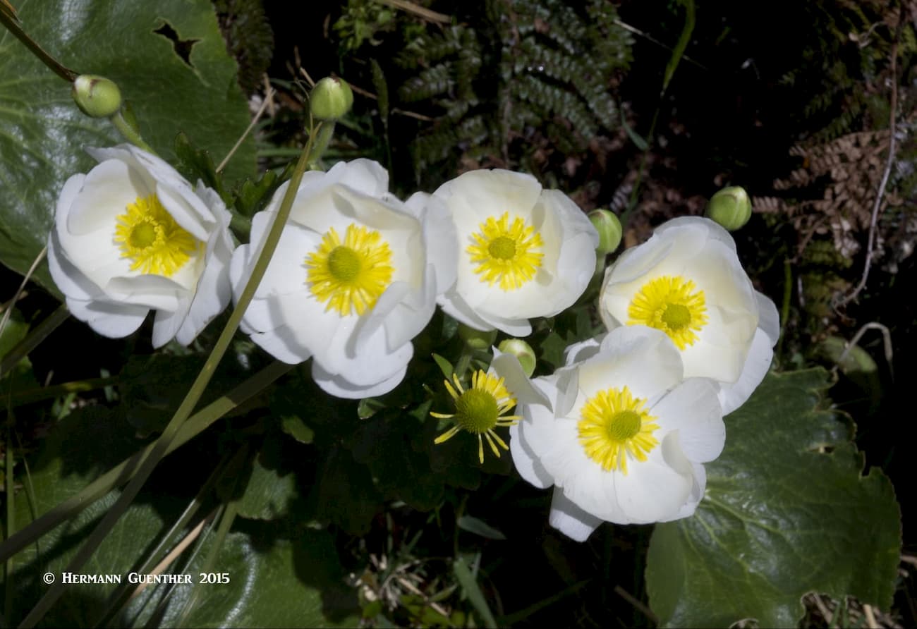
Mount Cook Buttercups
This track, which branches off the Kea Point Track is called the “stairway to heaven”, as there are 2,200 steps that take you straight up to the small freshwater lakes known as the Sealy Tarns. Summer is the time to do this hike, when the steep slopes display an abundance of wildflowers. The elevation gain to the tarns is 600 meters (1,970 feet) but is well worth the effort for the spectacular views you will be rewarded with. While this is considered an easy walking track, some level of conditioning is certainly called for given its steepness – a round trip can be accomplished in three to four hours. Keep in mind, however, in winter this track can be extremely icy, possibly requiring crampons and an ice axe, and avalanche risk may exist. The visitor centre can provide information and advice on conditions. The views of the surrounding mountains are epic.
View from Sealy Tarns
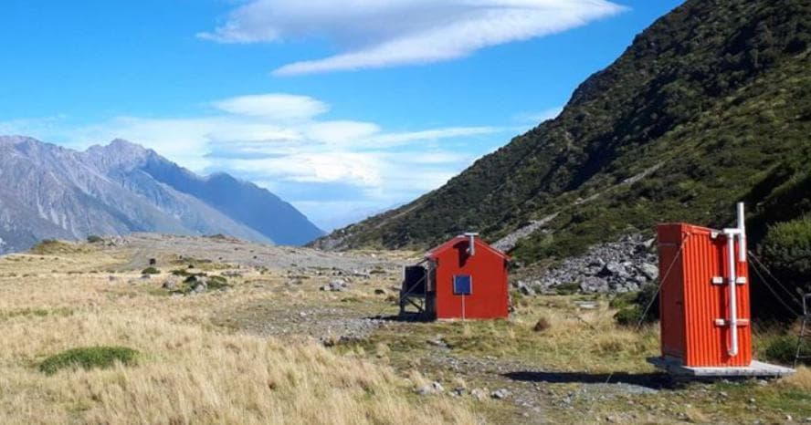
Following the same track as to Sealy Tarns, this route then continues to the top of the Sealy Range. It is called a route because, after the Sealy Tarns, it is no longer a maintained track but instead an alpine route. It will take you two hours to reach the hut from the tarns. With an overall elevation gain of 1,000 meters (3,280 feet), this is definitely not a casual hiker’s route, although at the right time of year (i.e. summer), this can be done by anyone with moderate tramping experience and some common sense. It is a 10-km (6 miles) round trip hike. In the winter months, of course, this requires major mountaineering experience and preparation. The hut itself is serviced and provides 28 bunk beds, cooking facilities, lighting, mattresses, toilets and untreated tap water. Bookings are required to stay there, although in the summer, this hike can be easily accomplished as a day hike by seasoned hikers. The 360-degree views will be astonishing – on a clear day. If you are ambitious, an additional 30-minute hike along the ridge will take you to Mount Ollivier, which is the first peak that Sir Edmund Hillary ever climbed, thus beginning a climbing career culminating in the first ascent of Mount Everest (notwithstanding the story of George Mallory).

Mueller Hut
As you drive to Mount Cook Village, just about one kilometer from the Village you will come to the intersection of the Tasman Valley Road. Follow this road 7 km (4.3 miles) to its end at the Tasman Glacier car park. This is the trailhead for several short but highly rewarding hikes, mostly easy with moderate steps to the top of the Tasman Glacier moraine wall. (See this link for more about these hikes).This short climb is well worth the effort for the views of the 7 km (4.3 mile) long Tasman Lake which started its formation as some small ponds in 1974 and has grown steadily ever since. It is now large enough to provide commercial boat and kayak tours among the icebergs on the lake, which has become a popular tourist activity. They are not allowed to take you closer than 1.5 km (0.9 mile) to the terminal face of the glacier, which is 50 meters (160 feet) high.
Tasman Lake Viewpoint
Just past the beginning of the trail after the Blue Lakes shelter is a branch trail that leads to the glacier lake itself, with a further branch that leads right to the source of the Tasman River, which flows into Lake Pukaki. This easy trail can be completed in under an hour. It leads through old terminal moraines from before the time the lake was formed. Some very interesting vegetation can be found in this area.
Another popular side trail is the one that diverts left from the main trail about halfway up to the viewpoint on the moraine wall. It goes to the three Blue Lakes, which are actually green. There is a reason for that, and a trailside information kiosk tells us why. In the mid-1800s, when the Blue Lakes were named, they were fed by glacial meltwater filtering through the moraine. Today, because the glacier has receded, the water no longer flows from the glacier into the lakes. Therefore, the warmer rainwater that now feeds the lakes supports green algae, making the water green. The track to these lakes is somewhat more primitive, but very easy to follow. In summer, the lakes offer good swimming (but probably pretty cold!).
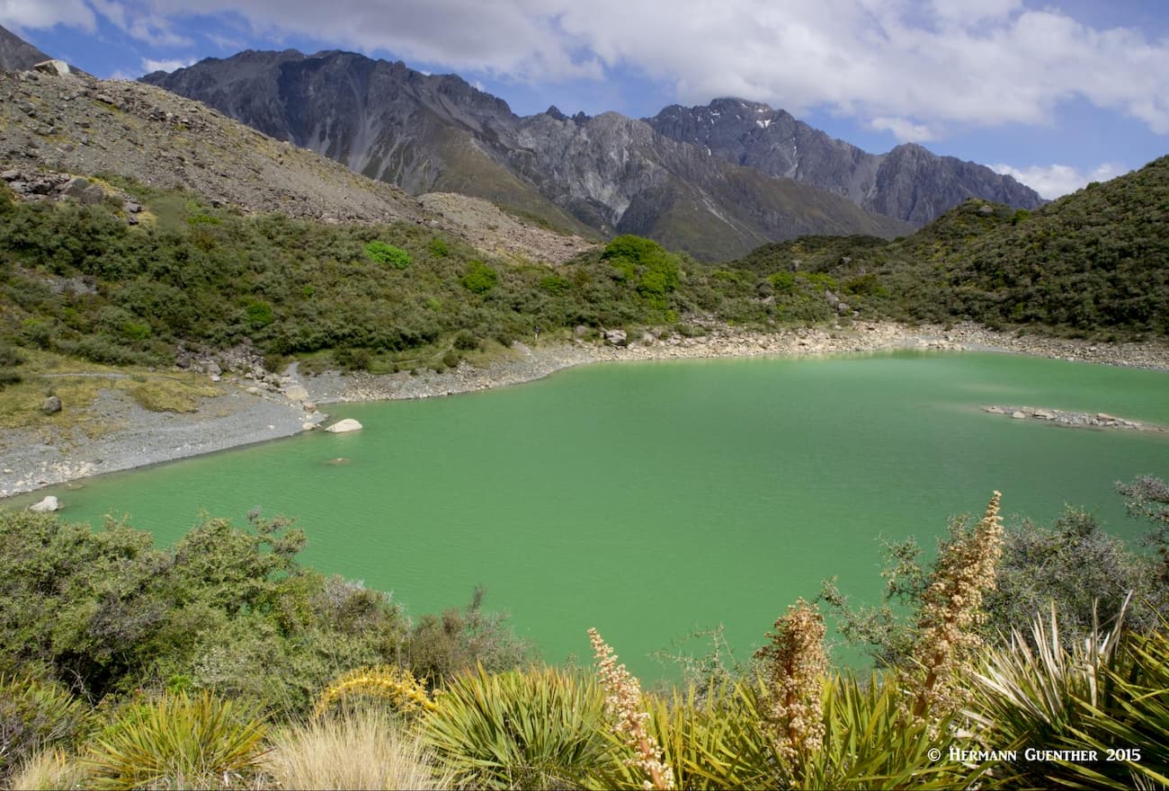
One of the “Blue Lakes”
A longer hike also starts at this same trailhead – it is called the Ball Hut Route. It follows an old road that has become a four-wheel drive track for its first 5 km (3 miles) until it reaches the small Ball Hut (yes, I mean small – it has three bunks and mattresses). The overall length of the trail to the hut is about 9 km (5.6 miles) and it rises about 300 meters (985 feet). After the end of the 4WD track, the route opens up to spectacular views but becomes more difficult and very unstable as it follows along collapsed parts of the moraine. This advanced route should be negotiated with caution (and at the time of this writing, the upper part is closed due to collapses caused by a major storm in December 2019). Normally, this is used by mountaineers who want to cross the ridge that separates the Tasman and Hooker Valleys via Ball Pass.
Ball Hut (Department of Conservation)
In case I have not mentioned it, there really are no major towns or significant resorts near Mount Cook National Park, other than what is available in the Village itself, and a few other not-so-close small towns. But visitors do, of course, find places to stay and make a base for exploring this wonderful part of the South Island of New Zealand. Here are a few choices to examine.
Naturally, the closer you can stay to the action, the better, and Mount Cook Village could not be better positioned to provide visitor amenities, though limited in number they might be. The four-star Hermitage Hotel or Mount Cook Lodge and Motel are reasonably priced for these somewhat high-end hotels. There are a few other lodges and restaurants in the Village, all within a short walk of course. The Glentanner Park Centre (see above) is a Holiday Park and activity center. Just a short drive of less than 20 minutes from the Village, it offers affordable accommodation options from self-contained cabins to dormitory rooms, as well as sites for campervans. While it has a café, it is only open for breakfast and lunch – so you either bring your own or drive somewhere for dinner.
Glentanner Holiday Park
This little town of only 1,280 permanent inhabitants is strategically positioned beside the beautiful Lake Ruatanihwa, with the Ohau Mountains as a backdrop. It is the closest town to the Park and has a surprisingly large selection of accommodations, some of them quite pricey as would be consistent with its proximity to a national park. But fear not, there are dozens of reasonably priced motels, lodges, vacation homes, apartments, bed-and-breakfasts, and Holiday Parks for those with campervans. I should mention that most Holiday Parks don’t just have camping sites – they have cabins, and even motel units, so that they can accommodate all kinds of travelers. The town and nearby area also has a selection of restaurants, shops, a supermarket and even a golf course.
Twizel - Lake Ruataniwha
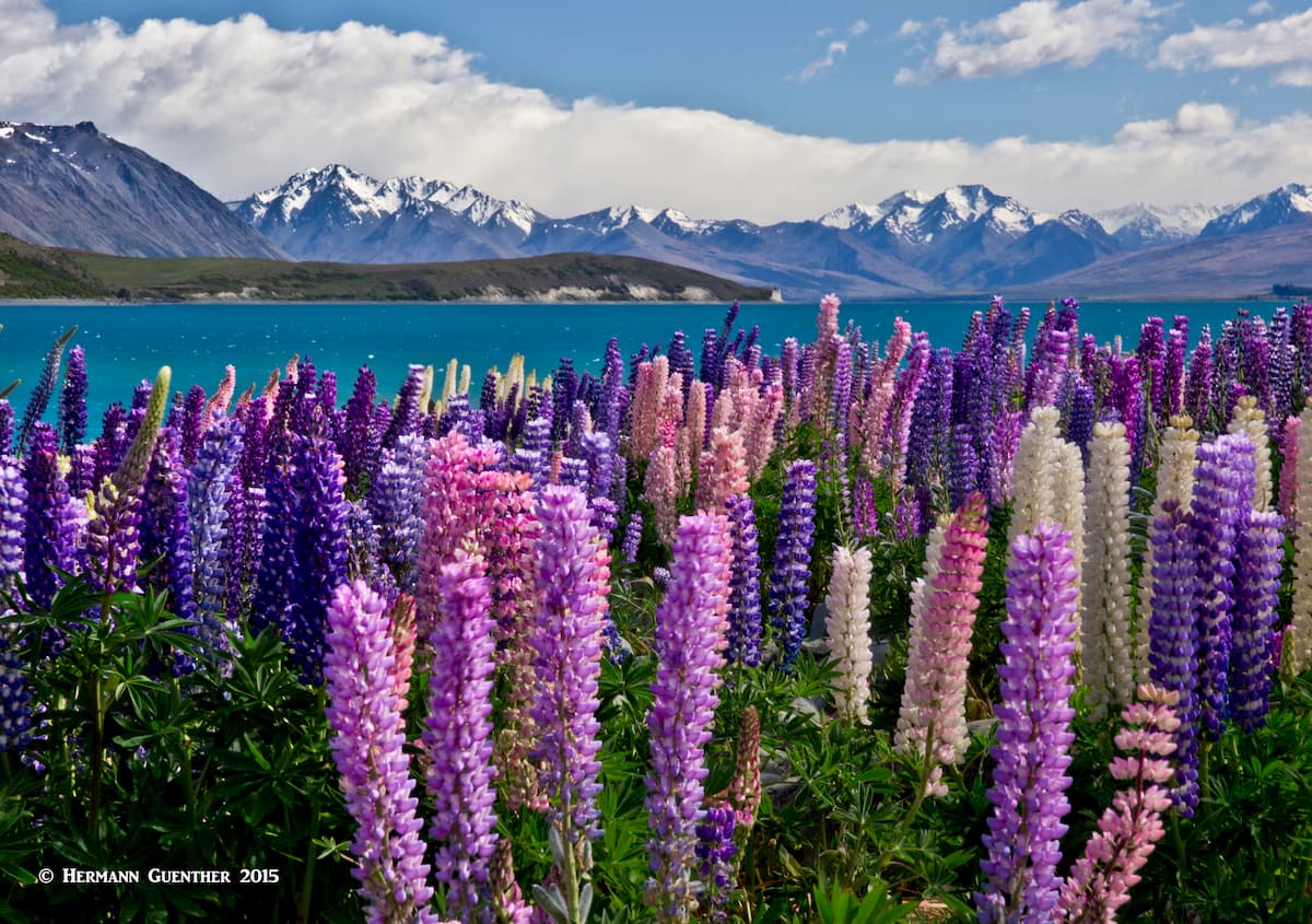
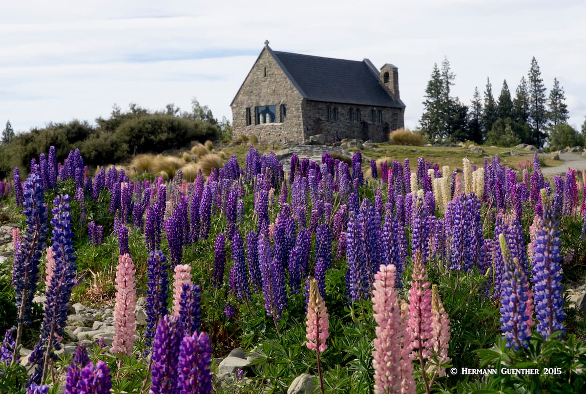
This very small town at the south end of the lake of the same name, has a population of less than 500 but it sure has its share of accommodations. You will find a variety of good places to stay in this scenic place and a fine selection of restaurants will ensure that you will not go hungry. A side benefit is the famous and charming historic Church of the Good Shepherd. Just make sure you get there before the tour buses do. Its setting by the shore of the lake is iconic. There is a stunning view of the high Southern Alps at the far end of the lake, and if you are there in the spring, you will be awed by the huge field of (almost) wild lupines displaying all colors of the rainbow. The downside of staying here, if Mount Cook National Park is your primary destination, is that it is a fairly long drive away – about 105 km (65 miles) and well over one hour. But do try to see this place.