Scan the QR code and open PeakVisor on your phone
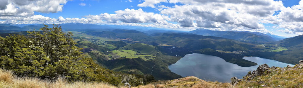
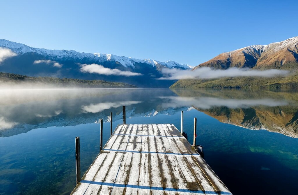
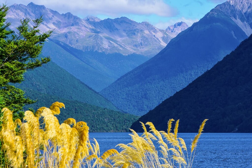
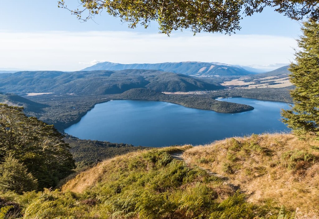
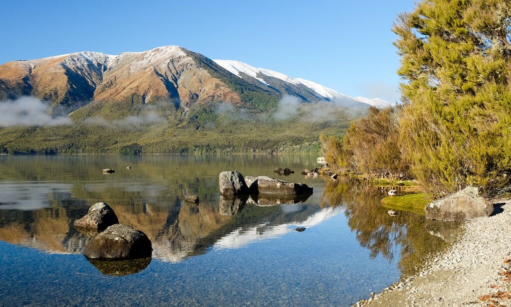
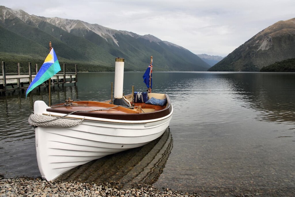
Nelson Lakes National Park is a rugged landscape of towering peaks and glistening alpine lakes nestled in the north of New Zealand's South Island. The park is located at the northern limits of the Southern Alps (Kā Tiritiri o Te Moana) and contains 39 named peaks, the highest of which is Mount Travers (2,341m/7,680 ft). It also contains 16 picturesque lakes, including the world-famous glacial lakes Rotoroa (long lake) and Rotoiti (little lake).
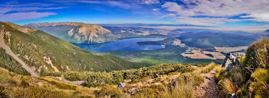
Located in the Tasman District in the northern part of the South Island of New Zealand, Nelson Lakes National Park is a federally-protected area that’s known for its stunning mountain landscapes. The park contains 1,019 square kilometers (393 sq. mi) of land and it is named for its beautiful views over a series of lakes (of which Rotoiti and Rotoroa are the most well-known).
Nelson Lakes National Park can be accessed through Saint Arnaud, which is one to two hours by car from nearby Blenheim or Nelson. There are shuttle services that operate between Saint Arnaud, Nelson, Blenheim, and Picton to help transport visitors to the park.
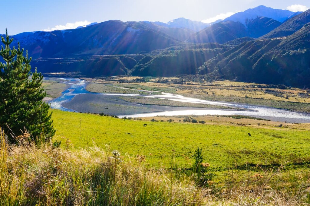
Three rivers flow through the rough, mountainous park: the Travers, the Sabine, and the D’Urville. The park is ringed by the Mount Robert (Porangahau) range to the north, the Braeburn and Muntz ranges to the northwest, the St. Arnaud Range to the east, and the Ella Range to the west.
Furthermore, the park is situated within close proximity to a number of other protected areas. This includes Kahurangi National Park to the northwest, Paparoa National Park to the west, and Arthur’s Pass National Park to the south.
Like much of New Zealand, the landscape in Nelson Lakes National Park is rugged and varied. The peaks within its boundaries are mostly part of the Southern Alps, and in particular, the Kaikōura Ranges.
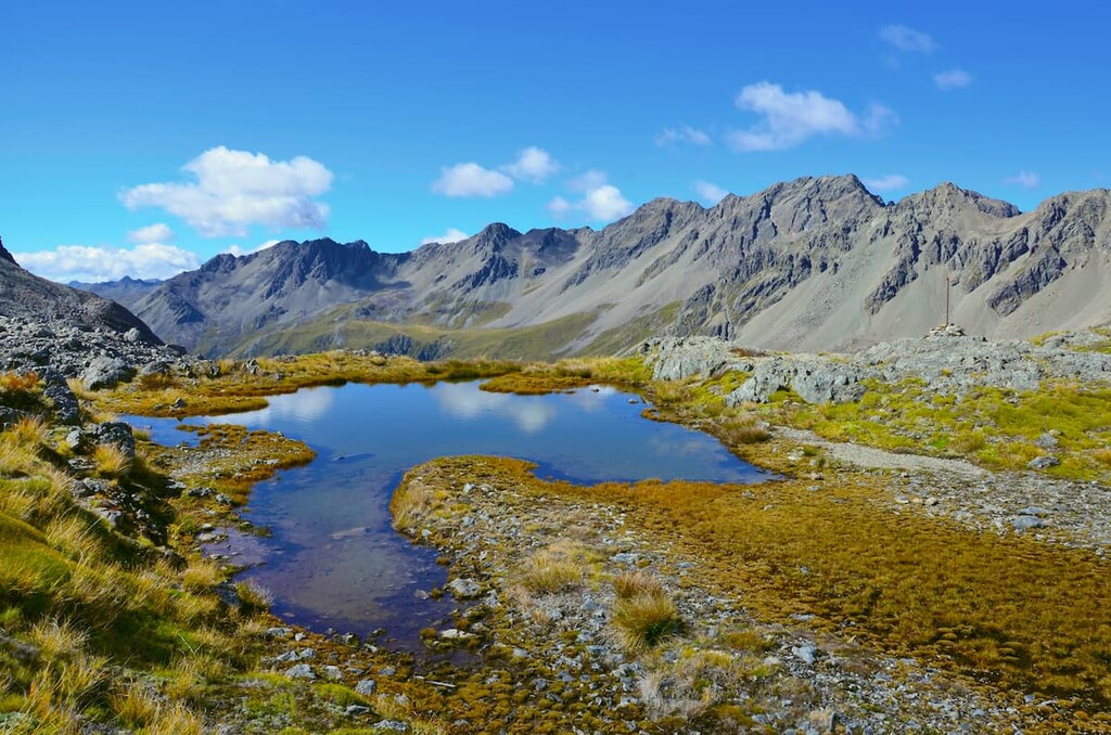
The park’s landscape was shaped by glaciers, which left behind scree slopes, tarns, and hanging U-shaped valleys in their wake. There are several mountain ranges within the confines of the park, in addition to five valley systems and 16 lakes.
The northern boundary of the park is bisected by the Alpine Fault, which runs almost the entire length of New Zealand’s South Island (Te Waipounamu) and forms the boundary between the Pacific and the Indo-Australian tectonic plates. The Alpine Fault zigzags through the park and across the heads of Lakes Rotoroa and Rotoiti.
The rocks in this area contain high volumes of iron and magnesium. Poor soil in the region has contributed to the presence of these ultramafic rocks, and as a result, only sparse vegetation is found in this area.
Major peaks in the park include Mount Travers, Mount Franklin, Mount Una, Mount McKay, Mount Hutton, and Mount Hopeless.
Much of the park is forested with different species of native beech. Its higher slopes are home to mountain beech (tawhai rauriki), while silver (tahina), and red beech (tawhai raunui) thrive at lower altitudes. The forest’s understory consists of a rich variety of plants, such as broadleaf (kāpuka), wineberry (makomako), coprosmas (karamu), fern, and moss varieties.
Nelson Lakes National Park is also home to the Rotoiti Nature Recovery Project, one of New Zealand’s six ambitious “Mainland Island” initiatives. The Mainland Island at Rotoiti in particular consists of over 5,000 hectares (12,350 acres) of red, silver, and mountain beech forest where the New Zealand Department of Conservation (DOC) is implementing an extensive predator trapping campaign to return the native beech forest to its pre-human state.
The forest is alive with the songs of bellbirds, and both bellbird (korimako) and South Island robin (kakaruwai) populations are increasing thanks to conservation efforts in this region. Additionally, kākā populations are growing within the park—thanks to a rapidly declining pest population.
Lakes Rotoroa and Rotoiti were used as food gathering places by Māori, who traveled along New Zealand’s West Coast to trade and collect pounamu (greenstone). Lake Rotoiti serves as the Buller River’s source, and the river and its tributaries offer fantastic opportunities for brown trout fishing. Māori tell the story of Rākaihautū, a great chief who created the park’s lakes with his ko (digging stick).
These holes grew into what we now know as Lake Rotorua and Lake Rotoiti. Lake Rotomairewhenua (Blue Lake), which also sits within the park, has been named the clearest lake in the world.
The first Europeans to see these lakes were Charles Heaphy, William Fox, and Thomas Brunner who traveled as a group from Nelson to as far as Murchison with the aid of Kehu, a Māori guide, in 1846.
Camping at the water's edge in Lake Rotoiti became popular from the early 1900s, and cottages were built in the mid-1920s. The national park itself was not established until 1956, though it has since become a popular spot for outdoor recreation, thanks to the park’s proximity to the city of Nelson.
Nelson Lakes National Park is a hiker’s dream. There are a plethora of opportunities for hiking, mountaineering, and sightseeing, in addition to activities like mountain biking, fishing, and boating. Hiking trails, or “tracks,” in New Zealand are often described in terms of time, instead of distance, due to the difficult and rugged nature of the terrain.
Hiking and mountaineering expeditions in New Zealand are often much more treacherous than in other developed nations, and weather conditions reflect the harsh and changing nature of the natural landscape. People are always advised to pack for adverse weather conditions and carry a personal locator beacon. Check out some suggestions below:
Waiau Pass is a technical alpine crossing suitable for experienced hikers only, and an ice axe is required for this route. It links the nearby Lewis Pass with Nelson Lakes National Park. On the trail, hikers will be rewarded with spectacular alpine and lake views, stays in historic huts like the Christopher (Ada) Cullers Hut, and a crossing of the rocky Cannibal Gorge via a swing bridge.
Weather conditions can deteriorate rapidly here, and icy snow is possible year-round. It takes hikers an average of 8–10 days to complete the full 59.5 km (36 mi) track, and the terrain is notoriously difficult to navigate.
This circuit features tranquil beech forests, fields of tussock grasses, towering peaks, and stunning waterways—all located in the heart of the ramparts of Nelson Lakes National Park’s main mountain cirque. Weather and snow conditions are best between October and May, so plan on visiting then if you have some wiggle room in your travel schedule.
The Travers Saddle (Poukirikiri) portion of this route is susceptible to freezing conditions year-round. It takes 4–7 days to complete this 80-kilometer (50-mile) track. Mount Cupola (2,260 m/7,414 ft) can also be accessed from this track.
This gorgeous 9 km (6 mi) loop track winds across scree-filled gullies dotting the northern ramparts of the 1,421-meter (4,662-foot) Mount Robert and offers stunning views across Lake Rotoiti to the town of Saint Arnaud.
The Mt Robert Track is one of the most beginner-friendly and accessible trails in Nelson Lakes National Park, and it works well as either a day or an overnight hike. Hikers will travel through beautiful beech forests before emerging into the subalpine zone. This is an easier route but is still an alpine hike, so use proper precautions and pack for inclement weather.
Here are some of the best places to stay if you’re visiting Nelson Lakes National Park from further afield:
Saint Arnaud, formerly known as Rotoiti, is a small alpine village that sits at the doorstep of Nelson Lakes National Park, just to the north of Rotoiti Lake. It supports a small permanent population of 111 people and covers a tiny 6.29 square kilometers (2.43 sq mi).
The western part of the township has a Department of Conservation (DOC) Visitor Centre, which contains extensive information about the national park. Hikers venturing into Nelson Lakes are advised to leave their trip intentions with DOC staff at this location for safety reasons.
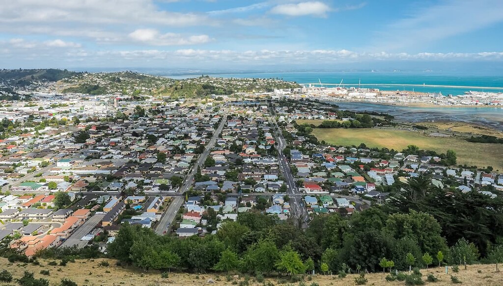
Nelson, also known as Whakatū in Māori, is a city on the eastern shores of Tasman Bay (Te Tai-o-Aorere). It is the oldest city in New Zealand’s South Island, and it was established in 1841. Nowadays, Nelson is home to a population of about 51,100 people and it boasts a balmy, coastal climate.
Nelson is known throughout the country for its friendly, artistic communities and beautiful beaches. It also serves as the gateway to the Abel Tasman Great Walk, which attracts thousands of tourists to the island nation each year.
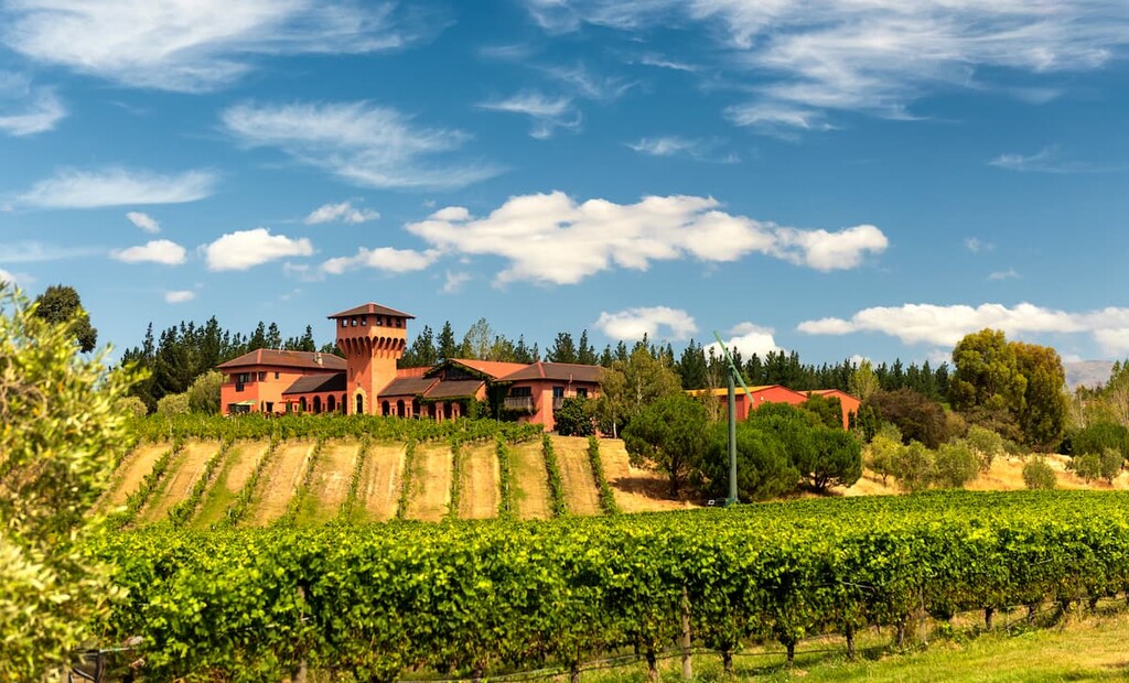
Blenheim is a bustling town in the northeast of the South Island. It has a population of 28,200 people and it’s situated in the Marlborough wine region, known to many as the center of New Zealand’s bustling wine industry.
Blenheim holds one of New Zealand’s sunniest climates, including rosy summers, and crisp, clear winters. The town is named after the Battle of Blenheim (1704), a major battle fought in Germany during the War of the Spanish Succession.
New Zealand’s Department of Conservation (DOC) manages a network of over 950 public-access huts of all shapes and sizes. They provide unique places to stay while on an overnight trip, a refuge from poor weather, and the opportunity to rest and recover while exploring the outdoors.
There are multiple huts located within Nelson Lakes National Park available for use at a small fee. Hut tickets can be purchased from any DOC Visitor Centre. Backcountry camping is also permitted within the park, and hikers are required to adhere to Leave No Trace practices while in Nelson Lakes.