
Scan the QR code and open PeakVisor on your phone
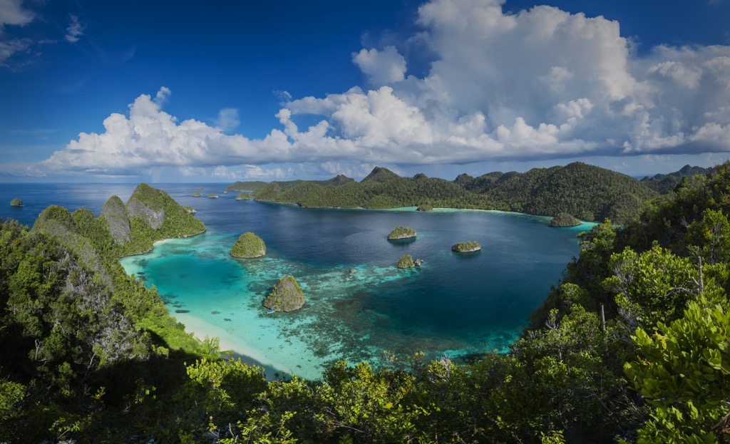
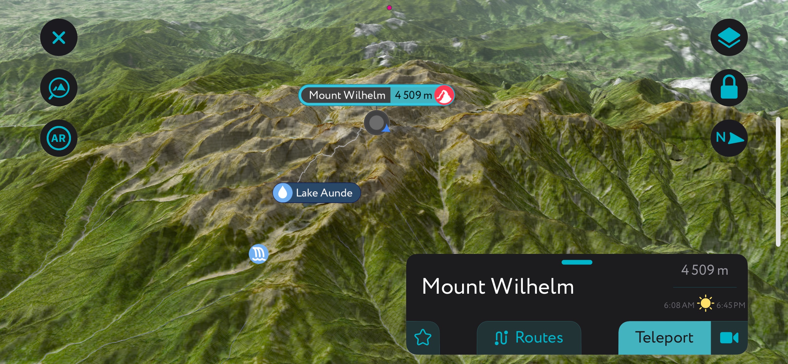
Papua New Guinea is an island nation in Oceania comprising the eastern half of the island of New Guinea and an array of offshore islands. The county spans 178,700 square miles (462,840 sq. km) and is home to 17 million people. Predominantly rugged, dense jungle, Papua New Guinea is spectacularly mountainous. There are 978 named peaks in the country. The highest is Mount Wilhelm (4,509 m / 14,793 ft), while the most topographically prominent is Boising (4,150 m / 13,615 ft). Boising boasts over 3,600 meters (11,800 feet) of prominence and was not climbed until 2014.
After Indonesia and Madagascar, Papua New Guinea is the largest island nation in the world, with an area of 178,700 square miles (462,840 sq. km). (For reference, this is slightly larger than the U.S. state of California.)
Papua New Guinea is one of two nations on New Guinea island, the other being Indonesia, the only nation with which Papua New Guinea shares a land border. As a result, the western half of New Guinea is usually called “Indonesian Papua.” New Guinea is the world’s second-largest island after Greenland.
The nation is mountainous, with 24 ultras (peaks with over 1,500 meters [4,921 ft] of topographic prominence), many of which are volcanic. Papua New Guinea’s highest mountain, Wilhelm (4,509 m / 14,793 ft), is surpassed by several others on the Indonesian half of the island, notably Puncak Jaya (4,884 m / 16,024 ft), which is usually recognized as the tallest peak in Oceania. Wilhelm and the most topographically prominent peak on the island, Boising (4,150 m / 13,615 ft), are in Madang province.
NOTE: Some “Seven Summits” lists include Mount Wilhelm instead of Puncak Jaya because Indonesia is partially located in Asia, which has many far higher peaks.
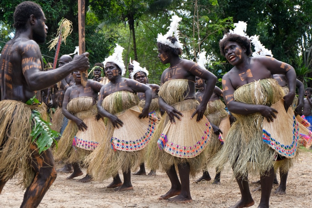
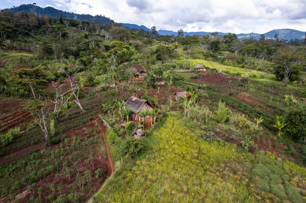
Papua New Guinea is divided into four regions: the Highlands, the Niugini Islands, Momase, and the Southern Region. These four regions contain 22 administrative districts. Twenty of these are traditional provinces, and the other two are the Autonomous Region of Bougainville (an island group off the coast that has recently lobbied for independence) and the National Capital District of Port Moresby, the nation’s capital city. Papua New Guinea is the world’s most linguistically diverse country, home to 839 distinct languages. It is also notable as one of the world’s most rural nations; as of 2019, only 13% of its population lived in urban centers.
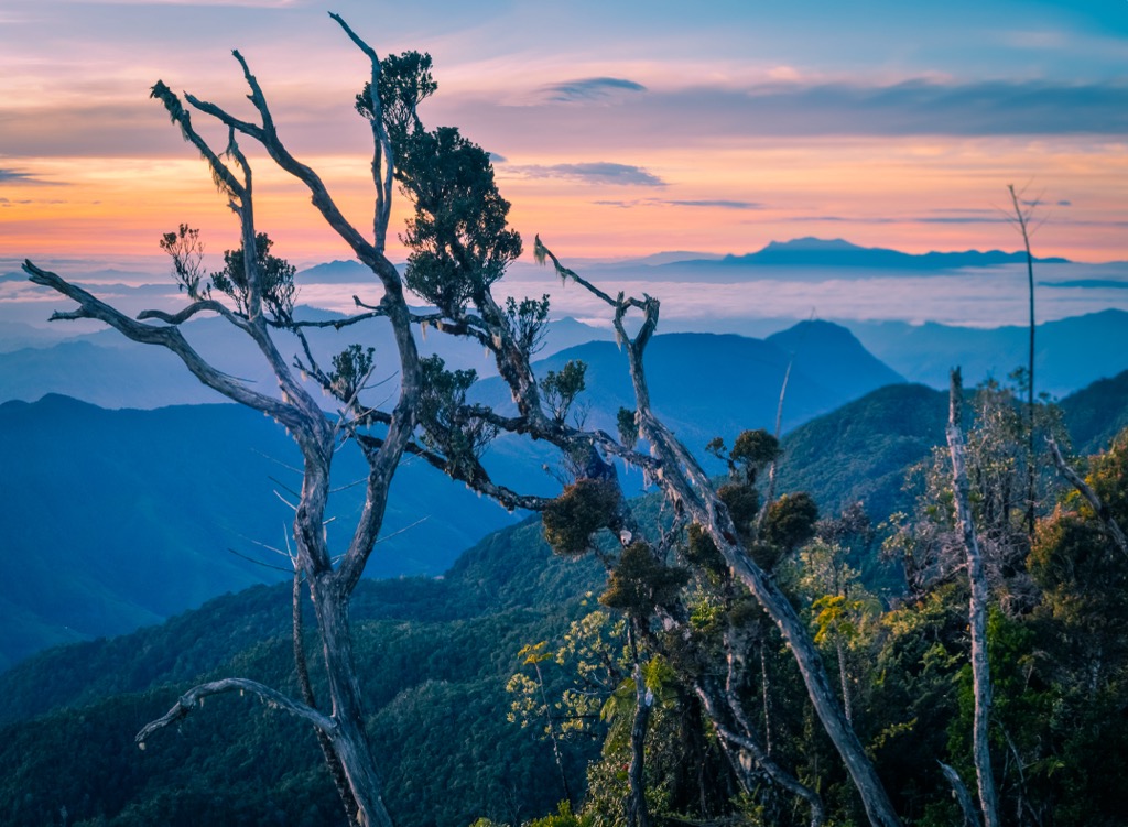
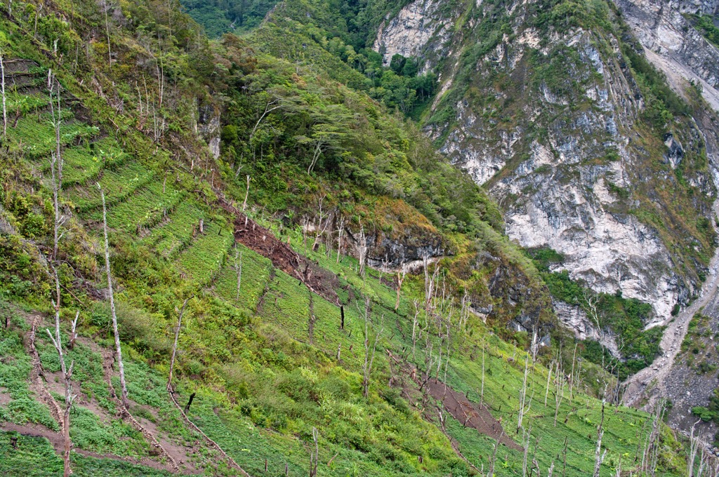
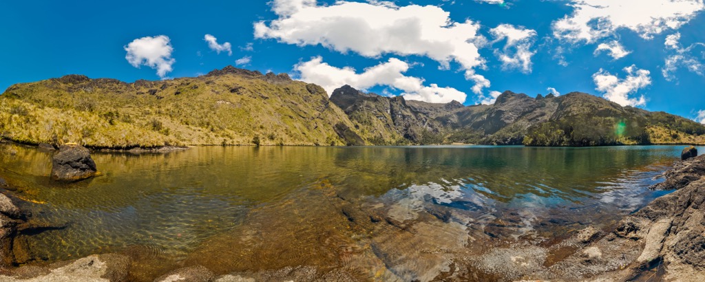
A mountainous spine, the New Guinea Highlands, dominates the nation’s central part, running west to east. These mountains contain numerous peaks over 4,000 meters, creating a formidable barrier that has historically limited interaction between communities on either side.
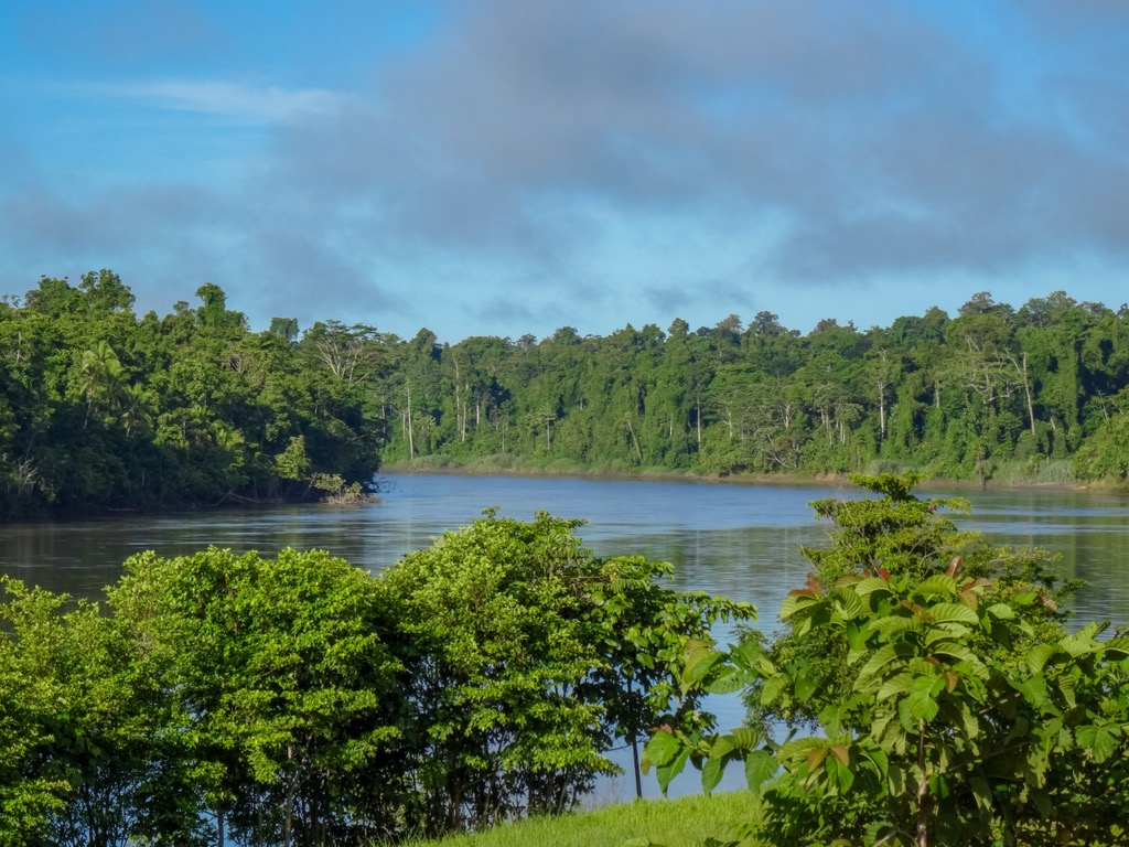
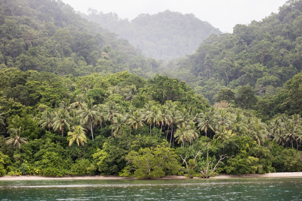
The New Guinea Highlands transition into lowland rainforests, extensive swampy areas, and coastal plains. Large river systems, such as the Sepik and Fly rivers, drain these lowlands, playing a crucial role in transportation and ecology.
The nation’s geographical diversity extends to its numerous islands, ranging from large, mountainous islands like Bougainville and New Britain (West and East) to small atolls and coral reefs. The country is part of the Australasia ecozone, which includes several endemic species of plants and animals.
Papua New Guinea experiences a tropical monsoon climate. The highlands have a cooler climate, whereas the lowlands and coastal areas are hot and humid. The country has two distinct seasons: a wet season from December to March and a dry season from May to October. However, these seasons vary depending on the region.
Rainfall is generally abundant throughout the country, supporting dense tropical rainforests, particularly in the lowland and highland areas. The highlands, however, can experience cooler temperatures and different precipitation patterns.
Papua New Guinea is one of the few equatorial regions that experience snowfall. Along with Indonesia, the few other nations with equatorial snow include Ecuador, Colombia, Uganda, the DRC, Kenya, the Philippines, Tanzania, and Hawaii.
Papua New Guinea's geological history is closely tied to the dynamics of plate tectonics. The region's formation and evolution began around 250 million years ago as part of the supercontinent Gondwana.
Gondwana comprised around two-thirds of Earth’s modern-day continental area, including South America, Africa, Antarctica, Australia, New Zealand, the Arabian Peninsula, and the Indian subcontinent. With Gondwana’s breakup around 180 million years ago, Papua New Guinea began its own geological journey.
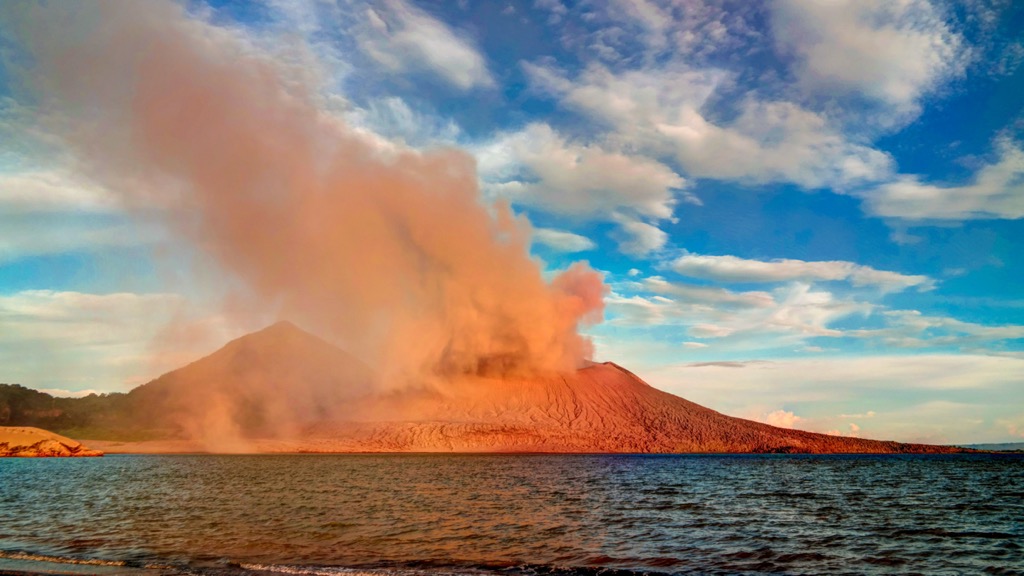
Papua New Guinea is nestled on the Pacific “Ring of Fire” (a region of spectacular volcanic activity) at a collision point for several tectonic plates: the Philippine Plate, Pacific Plate, Eurasian Plate, and Indo-Australian Plate. Papua New Guinea lies on the northern reaches of the latter, which includes the landmasses of India, Australia, and the floor of the Indian Ocean.
Along with Australia, Papua New Guinea forms a single mass known as Australia-New Guinea or Meganesia. It is connected to Australia by a continental shelf across the modern-day Torres Strait, which in past millennia was a land bridge.
The Indo-Australian Plate's collision with the Pacific Plate, starting about 66 million years ago, was crucial in shaping Papua New Guinea’s landscape. This process led to the uplift of the New Guinea Highlands—the central spine of mountains mentioned above—and heavily influenced the region's topography.
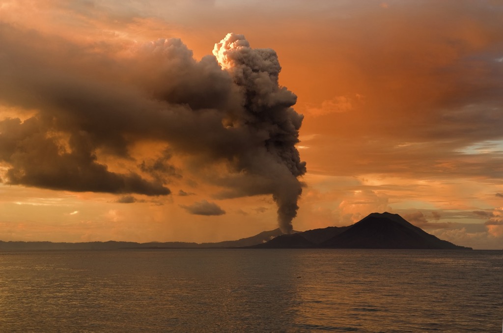
The subsequent subduction of the Pacific Plate beneath the Indo-Australian Plate has been a primary driver of the region's significant volcanic activity. This tectonic interaction contributed to the formation of numerous volcanic islands, such as those in the Bismarck Archipelago, by lava and other volcanic debris over extended periods, similar to the islands of Hawaii.
Additionally, sedimentary geologic processes have also shaped Papua New Guinea’s landscape. The deposition of sediments by major river systems, such as the Sepik, Ramu, and Fly, has formed extensive valleys and verdant delta regions, shaping the lowland and coastal plains.
Like many mountainous island nations, Papua New Guinea’s varied topography, geographic isolation, and accompanying archipelago of islands separate from mainland New Guinea has resulted in a vast array of biological diversity, both in flora and fauna, many endemic to the nation.
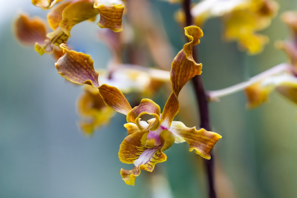
Long-tubed rothmannia (Ridsdalea papuana) is an endemic plant commonly found in lowland rainforests, distinguished by its striking white flowers and long tubular shape. The Lasianthera orchid (Dendrobium lasianthera) is another endemic plant celebrated for its vibrant colors and intricate patterns.
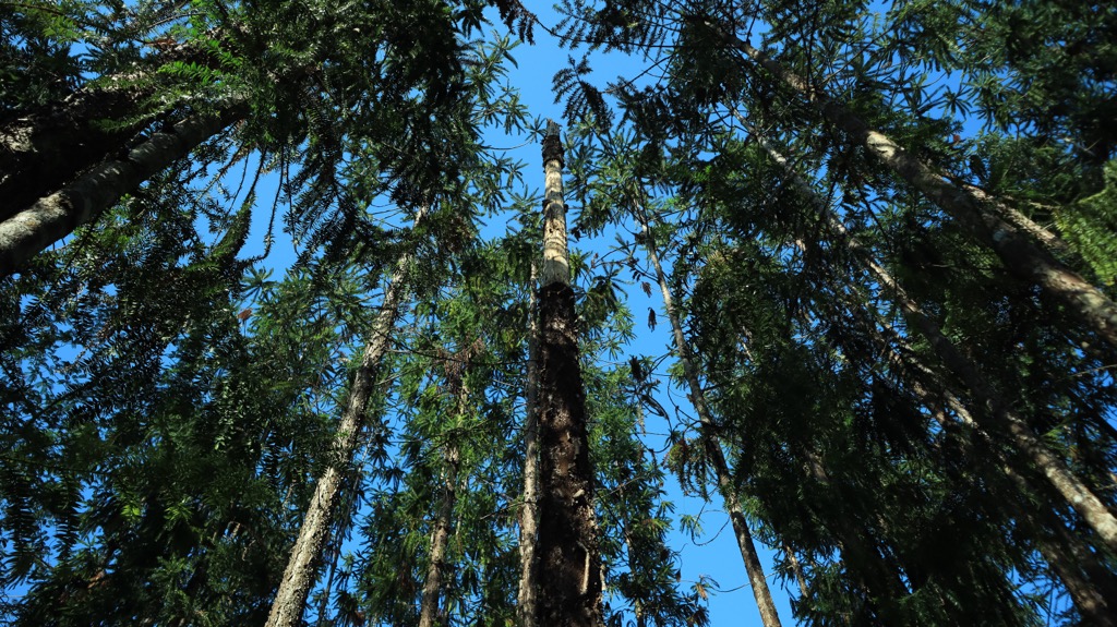
Larger instances of flora include Papuacedrus papuana (informally known as New Guinea cedar), a native coniferous tree of the highlands renowned for its durable timber. New Guinea cedar is only found in Papua New Guinea and the Indonesian province of Maluku.
The Klinki pine (Araucaria hunsteinii) is a towering tree species native to New Guinean rainforests, known for its significant height (up to 90 meters / 295 ft). Like New Guinea cedar, Klinki pines are also often used for timber.
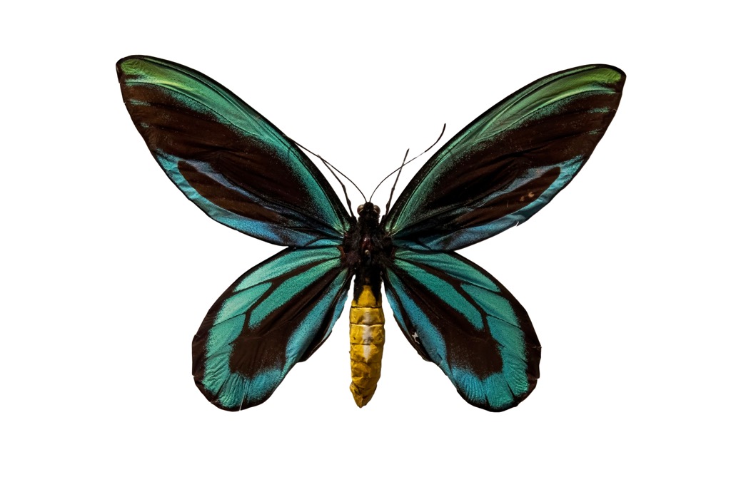
No list of important Papua New Guinea flora would be complete without mention of Pararistolochia dielsiana, sometimes called Queen Alexandra's Birdwing Butterfly Vine. This vine is critical for the survival of the endangered Queen Alexandra's birdwing, the world's largest butterfly, which is endemic to Papua New Guinea and only found in the eastern province of Oro. Queen Alexandra’s birdwings can reach a wingspan of 0.3 meters (one foot). The eponymous vine serves as the primary food source for the butterfly's larvae.
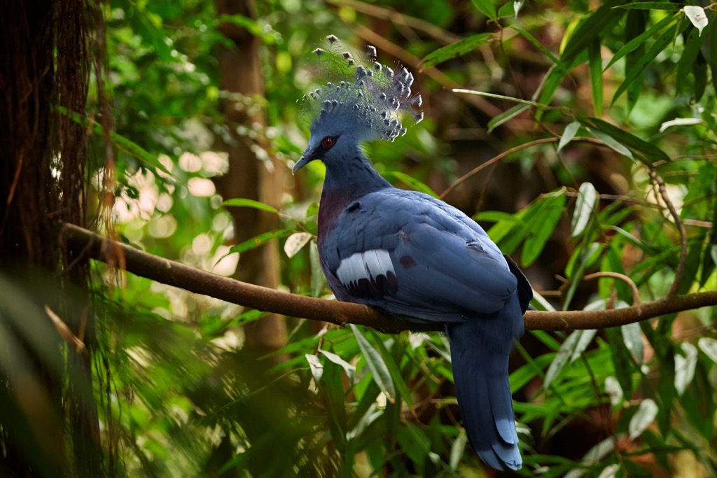
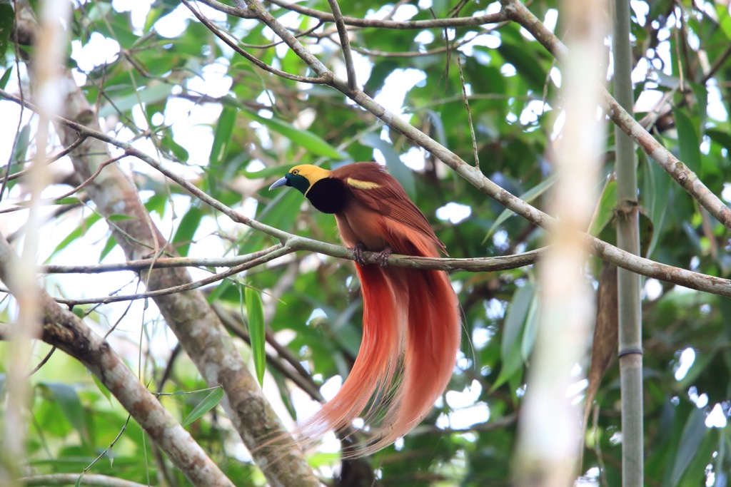
Notable fauna include the Raggiana bird-of-paradise (Paradisaea raggiana), Papua New Guinea’s national bird known for its males’ striking red and yellow plumage and elaborate courtship dances. Matschie's tree kangaroo (Dendrolagus matschiei), known as the “boongarry,” is a small arboreal marsupial endemic to the country’s northeastern rainforests.
In the skies, look for the Papuan (Blyth's) hornbill (Rhyticeros plicatus), a large bird characterized by its prominent yellow and black casqued beak, golden or orange-buff head, white throat, and a sharp white tail.
The New Guinea singing dog (Canis lupus dingo) is another unique species. As its name suggests, this is one of the few “barkless” dogs in the world, instead known for a melodious, almost yodel-like call. This wild dog is native to the highlands and is considered one of Earth’s oldest canine breeds.
Human presence in Papua New Guinea dates back at least 40,000 years, with the first settlers likely arriving from Southeast Asia during the last Ice Age, traversing land bridges and shallow sea crossings These early inhabitants adapted to a variety of local environments, from coastal regions to highland valleys, leading to the development of distinct cultural and linguistic groups.
Migration and adaptation profoundly impacted the development of the modern-day nation. As mentioned above, today, Papua New Guinea is the world’s most linguistically diverse country, with over 800 distinct languages (840, by most accounts). It is followed by Indonesia (711), Nigeria (517), India (456), and the United States (328)).
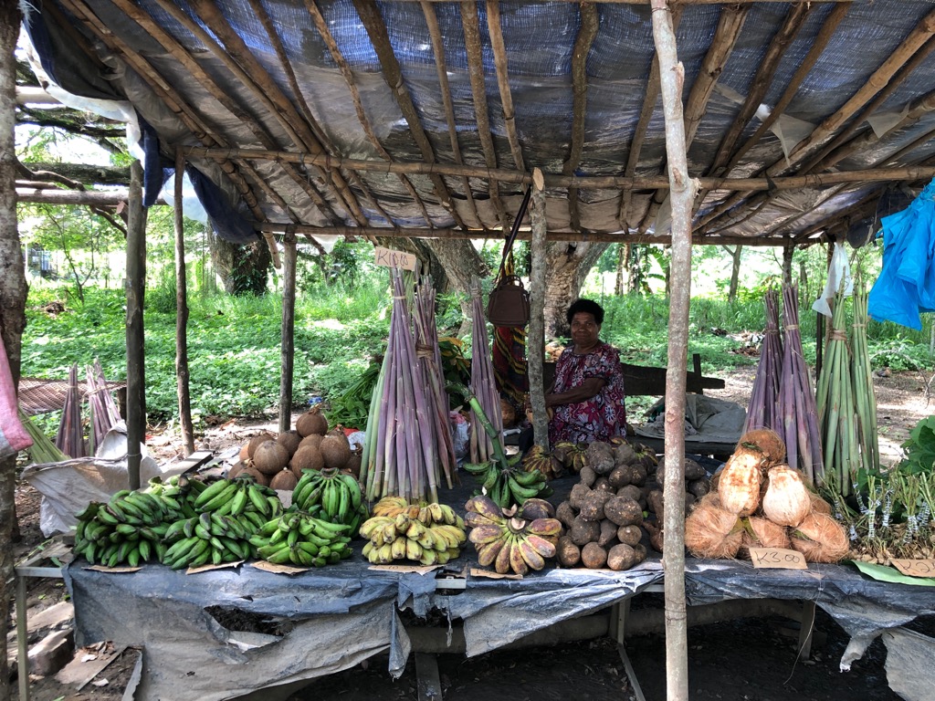
Agriculture emerged in the highlands around 9,000 years ago. Notably, this is one of the few places in the world where agriculture developed independently. Tribes cultivated staple crops like taro, banana, and sugarcane, supporting growing populations and complex societies. Due to the advent of agriculture, the highland regions became a hub of cultural and economic activity.
The first European contact with New Guinea occurred in the 16th century with Portuguese and Spanish explorers, but extensive exploration didn't begin until the 19th century. Europeans brought significant changes, including the establishment of German and British colonies in the latter part of the century. These two colonial territories were united under an Australian administration after World War I.
The 20th century was a period of significant change for Papua New Guinea. World War II saw major Pacific Theatre battles fought on its territory—primarily between Japanese and Australian-Papuan forces—notably the Kokoda Track campaign, fought throughout the Owen-Stanley mountain range. Post-war efforts towards self-governance gained momentum, leading to independence in 1975.
Since independence, Papua New Guinea has faced numerous challenges, such as political instability and sluggish economic development. The country is known as one of the more dangerous in the world, with a high level of violent crime in large urban areas like Port Moresby, Lae, and Mount Hagen. These cities have significant criminal gang presence. These gangs, known as “Raskols,” are particularly notorious for sexual violence. Traversing Port Moresby by foot is not recommended due to the continual lack of fundamental law and order.
Some regions, like the Hela and Southern Highlands provinces, are also dangerous due to tribal conflicts. In 2024, Papua New Guinea’s crime index sat at 80.40, just shy of Venezuela (83.76), the world’s most crime-ridden nation. Visitors must be vigilant, avoid displaying wealth, and stay informed about local conditions.
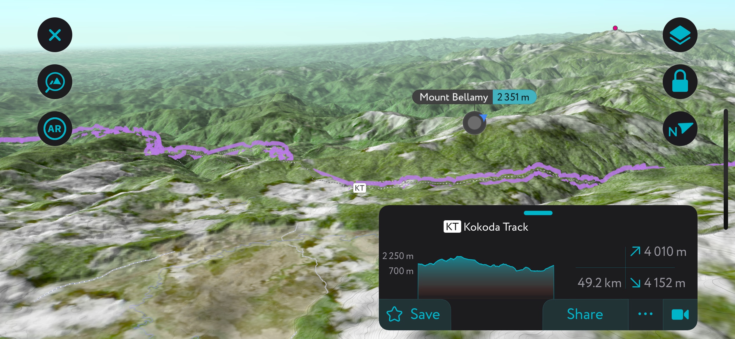
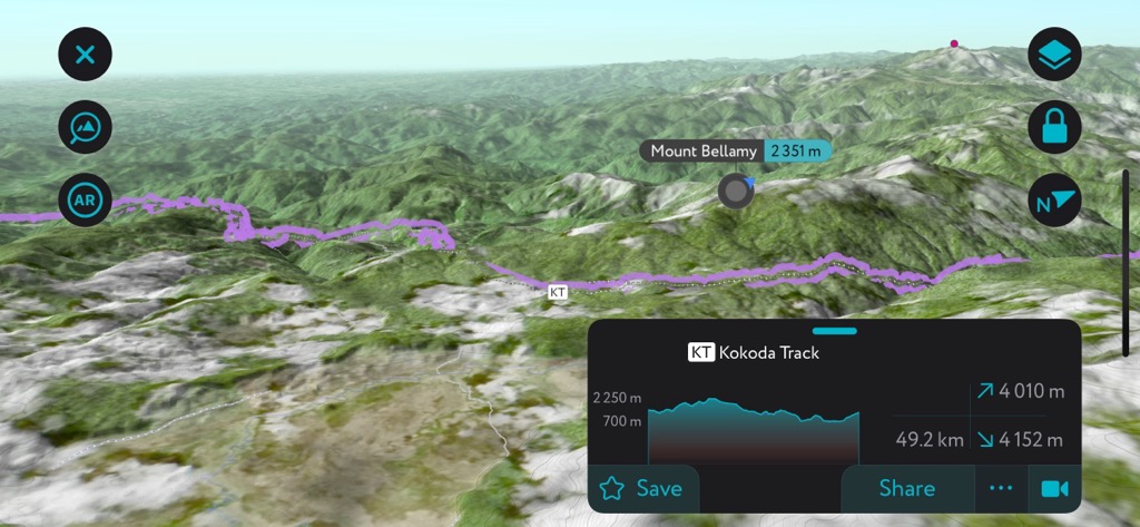
The Kokoda Trail is the most famous hiking trail in Papua New Guinea. Spanning approximately 96 kilometers (about 60 miles) from the Central to Oro provinces in the island's southeast, this route takes hikers across the Owen-Stanley Range and the high point of Mount Bellamy (2,351 m / 7,713 ft).
The Kokoda Trail isn’t just a physical challenge due to its mountainous terrain and dense rainforests but also a journey through history, marking the site of an eponymous military campaign (mentioned above) between the Japanese and the Allies during World War II. Completing the trail typically takes four to 12 days, depending on the pace and physical condition of the hiker; runners have finished in under 17 hours.
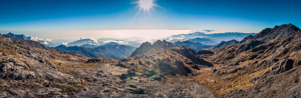
As the highest peak in the nation (and sometimes considered the highest in Oceania), Mount Wilhelm (4,509 m / 14,793 ft) makes for an extremely rewarding hike. The ascent is non-technical but typically takes three to four days.
Even for experienced trekkers, guides are recommended for safety and navigation. Trekking on Wilhelm is increasingly gaining popularity, partly due to targeted campaigns by the government’s tourism agency, but it’s a worthy adventure for any visitor to Papua New Guinea.
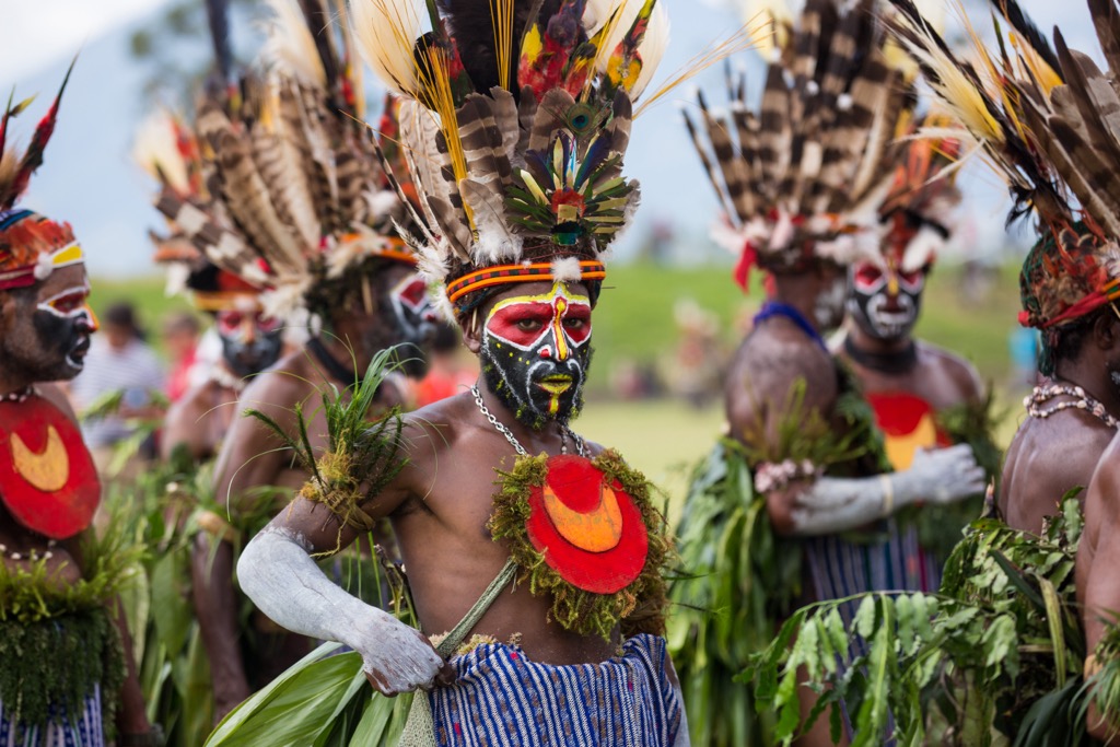
Goroka, the capital of the Eastern Highlands, serves as a base for many hikes ranging from half-day to multi-day outings. Notable objectives nearby include Mt. Michael (3,624 m / 11,890 ft), the highest peak in the province, and Mt. Gisauka (2,539 m / 8,330 ft). Timing your hike to coincide with the annual Goroka Show (in September) allows for an enriched cultural experience, as over 100 groups and tribes gather for this festival, displaying music, dance, and culture.
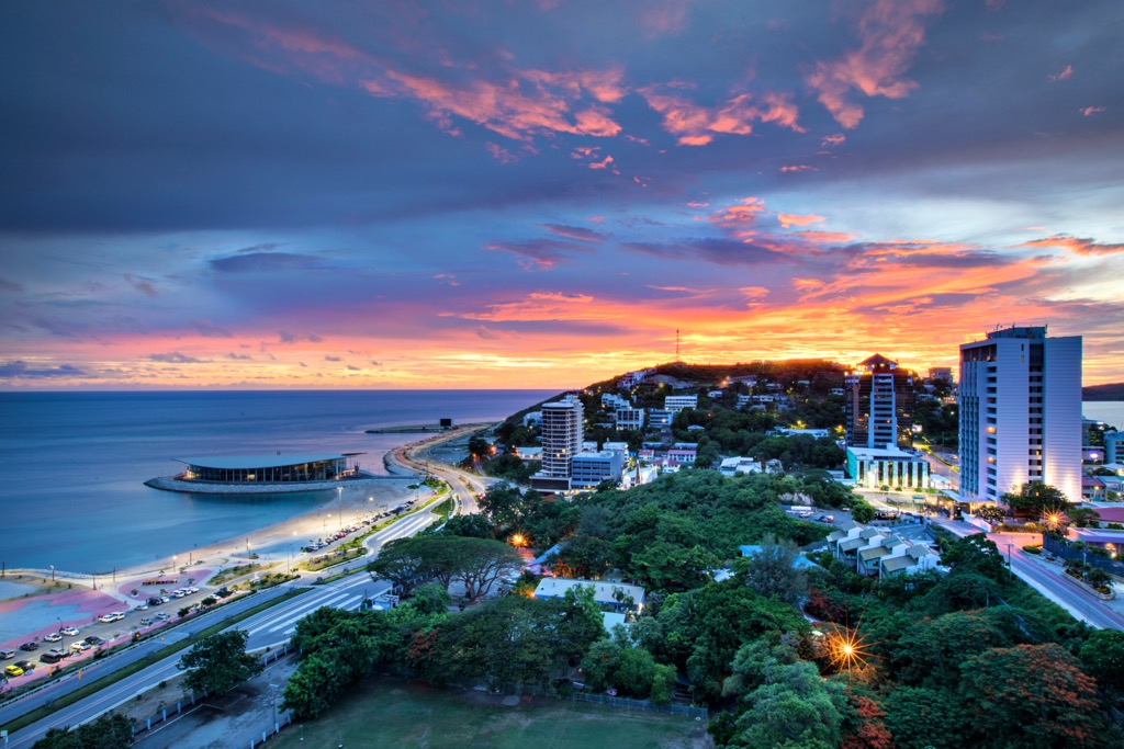
As the capital and largest city of Papua New Guinea, Port Moresby is the administrative and commercial heart of the country. It sits on the shores of the Gulf of Papua and features a mix of modern buildings and traditional stilt houses. Despite its urban development, the city faces high crime rates and limited urban infrastructure. It's home to the National Parliament, the University of Papua New Guinea, and the National Museum and Art Gallery.
NOTE: Population estimates in Papua New Guinea are notoriously imprecise. A recent study by the UN Population Fund estimated the nation’s population at 17 million. Previously, the official government figure was nearly half that, a mere 9.4 million. A 2020 estimate of Port Moresby put the city’s population around 380,000.
The capital of Morobe province, Lae (population estimated to be 76,000), is the second-largest city in Papua New Guinea. Known as the country's industrial hub, Lae is the gateway to the highlands, with its port playing a vital role in the nation's export economy, particularly in coffee, cocoa, and copra trading. The city is home to the Papua New Guinea University of Technology and is surrounded by lush rainforest.
Mount Hagen (pop. estimated 47,000) is the third-largest city in Papua New Guinea and the capital of the Western Highlands province. Known for its vibrant cultural festivals, especially the Mount Hagen Show, held each year for two days during late August, Mount Hagen is a center of coffee production and trade. The town is named for Mount Hagen (2,017 m / 6,617 ft), a peak that looms over the city.
Mount Hagen blends traditional and modern culture and is a crucial hub for rural highland communities. The city’s cool climate - the result of its elevation - contrasts with the tropical conditions prevalent in much of the country.


