
Scan the QR code and open PeakVisor on your phone
Philippines is home to 3,142 named mountains. The highest is Mount Apo at 2,954 m.
With unmatched biodiversity, breathtaking volcanoes, and bustling metropolises, the Philippines is one of the gems of the western Pacific Ocean. There are 3142 named summits in the Philippines. The highest and most prominent mountain is Mount Apo (2,954 m/9,692 ft).
The Philippines (Pilipinas), or the Republic of the Philippines (Republika ng Pilipinas), is an Asian country and archipelago consisting of 7,641 islands. The Philippines covers an area of roughly 300,000 sq km (120,000 sq mi), making it the seventy-second largest country in the world.

The Philippines lie around 500 mi (804 km) off the west coast of Vietnam. It has no land borders but shares maritime borders with seven countries, notably China to the northwest, Japan to the northeast, and Indonesia to the south. Four seas encircle the Philippines: the Philippine Sea to the east, the Celebes Sea to the south, the Sulu Sea to the southwest, and the South China Sea to the north.
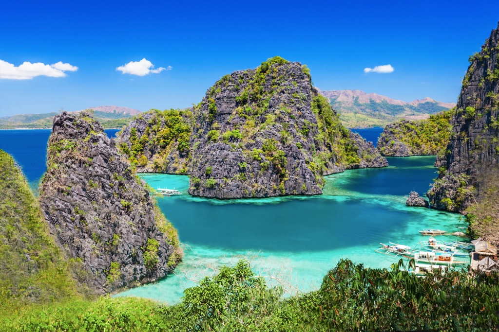
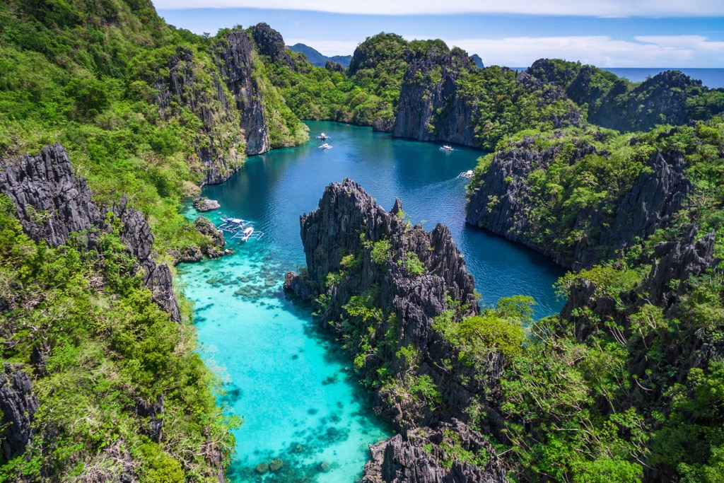
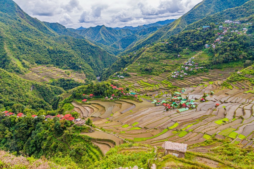
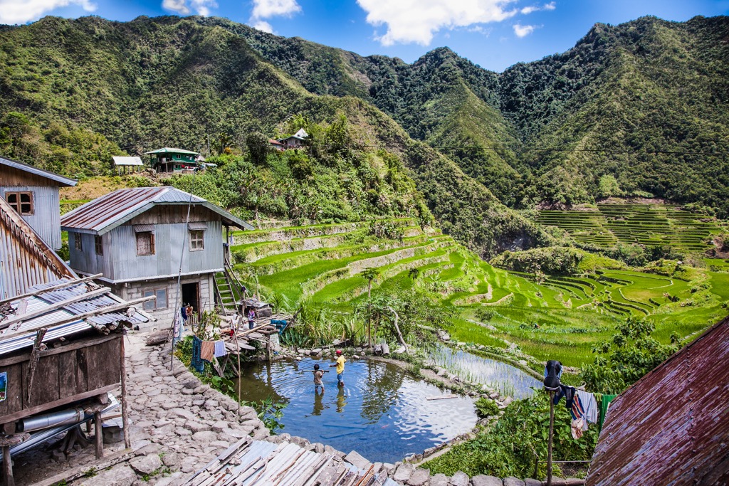
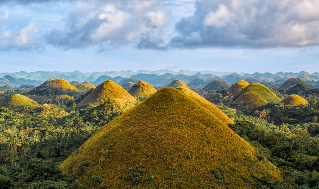
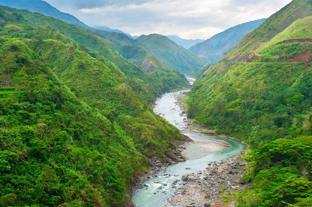
The Philippines is a mountainous country with numerous summits nearing 3,000 m (9,842 ft) in elevation. Most of the archipelago's mountains are inland, with verdant grasslands and rolling hills in coastal areas. The Philippines' has a partly tropical climate and around 25 percent of the country is rainforested.
There are 240 protected areas in the Philippines, 35 of which are national parks. These protected areas account for approximately 15 percent of the Philippines' total area.
The sheer scope of the Philippines archipelago means it has the fifth longest coastline of any country in the world at 36,289 km (22,549 mi). The country is generally divided into three loose island groups in a north-to-south trend: Luzon, the Visayas, and Mindanao.
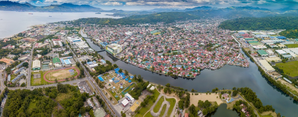
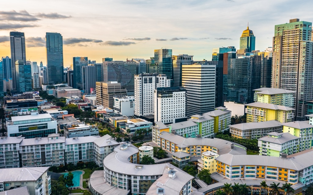
The Philippines has a population of over 109 million people, making it the thirteenth most populated country in the world. Manila, on the island of Luzon, is the capital, while neighboring Quezon City is the most populated city. Other notable cities include Davao City, Caloocan, Zamboanga City, and Cebu City.
The Luzon region takes its name from the Philippines' largest and most populous island. The northernmost island in the archipelago, Luzon is home to over 52 percent of the Philippines' population. It's the fourth most populated and fifteenth largest island globally.
The two other major islands in the Luzon region are Mindoro and Palawan. Several other island groups, including the Batanes, Babuyan, and Polillo Islands, form part of Luzon.
The central plains of the Luzon mainland are primarily low-lying, with isolated mountains and volcanoes in the south. Northern Luzon is the island's most mountainous area, home to the Sierra Madre, the Caraballo Mountains, and the Cordillera Central.
The Sierra Madre extends for over 540 km (340 mi) from Cagayan to Quezon in eastern Luzon and is the Philippines' longest mountain range. Mount Pulag (2,928 m/9,606 ft), a dormant volcano in the Cordillera Central, is Luzon's highest peak.
Located in northern Luzon, the Cagayan River (Río Grande de Cagayán) is the Philippines' longest river, measuring approximately 520 km (320 mi). Laguna de Bay, southeast of Manila on Luzon, is the country's largest lake, with a minimum surface area of 911 sq km (352 sq mi).
The Luzon island group contains 23 of the Philippines' 35 national parks, including:
The Northern Sierra Madre Natural Park is the largest protected area in the Philippines, with an area of 3595 sq km (1388 sq mi).
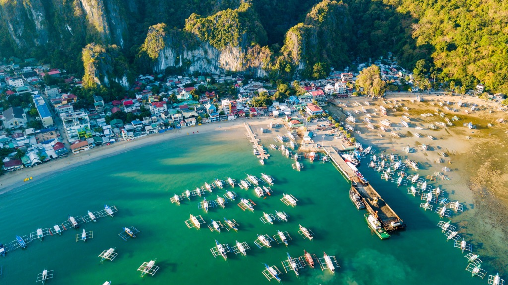
The Visayas is a cluster of hundreds of smaller central islands, 25 of which have significant populations. Major islands include Panay, Negros, Cebu, Bohol, Leyte, and Samar. Samar is the Philippines' third largest island, while Negros is the most populated in the Visayas, with a population of around 4.6 million people.
Most of the Visayas' main islands, except Samar and Bohol, are mountainous. Panay and Negros are especially mountainous with several summits exceeding 1,800 m (6,000 ft). Mount Kanlaon (2,465 m/8,087 ft), an active stratovolcano in north-central Negros, is the highest summit in the Visayas.
Four of the Philippines' 35 national parks in the the Visayas: Bulabog Putian National Park, Guadalupe Mabugnao Mainit Hot Spring National Park, Kuapnit Balinsasayao National Park, and MacArthur Landing Memorial National Park.
The Philippines' southernmost region is Mindanao, which takes its name from the Philippines' second-largest island. Despite Mindanao Island's size, it's only the seventh most populated in the country.
There are several notable mountain ranges in Mindanao. The Diuata (Diwata) Mountains stretch along the eastern coastline and is the island's most prominent range. To the north, the Butig Mountains trend toward the northwest from the Moro Gulf. Mount Apo, a stratovolcano and the Philippines' highest mountain, is on the south-central coast.
Eight of the Philippines' 35 national parks are in Mindanao, six of which are in the Lanao del Sur province. These parks are:

The primary geological feature of the Philippines is the Philippine Mobile Belt, a tectonic boundary between the Eurasian and Philippine Sea Plates that form the archipelago.
To the east of the Philippine Mobile Belt is the 1,320 km (820 mi) long Philippine Trench, which is the result of tectonic subduction. This submarine trench reaches depths of roughly 10,540 m (34,580 ft). This depth makes the Philippine Trench the third-deepest point on the planet.
To the west of the Philippines, off the islands of Luzon and Mindoro, is another submarine trench, the Manila Trench. The Eurasian Plate subducting under the Philippine Sea Plate formed this trench. It has a maximum depth of around 5,400 m (17,700 ft).
The archipelago itself didn't form due to the breakup of Pangaea but rather due to a series of complex geological events. The Philippines originated from the Indo-Australian Plate drifting towards the Eurasian Plate, creating tectonic pressure on the Pacific seafloor.
This tectonic pressure made the seafloor uplift, causing volcanoes to erupt and creating the basis of the Philippines. By around 30 million years ago, the modern Philippines had begun to take shape. Due to this high volcanic activity on the seafloor, the Philippines is composed primarily of volcanic rock and coral.
There are roughly 300 volcanoes in the Philippines, 24 of which are active. There is relatively low volcanic activity in the Philippines, despite the large number of volcanoes. That said, Mount Pinatubo (1,486 m/4,875 ft) on Luzon, once considered extinct, was the site of the second-largest volcanic eruptions of the 20th century after the 1912 eruption of Novarupta (2,759 ft/841 m) in Alaska.
The Philippines' position on the Pacific Ring of Fire's edge means it's subject to frequent seismic activity. There are thought to be around 20 earthquakes a day, but most are too minor to be felt. The 1990 Luzon earthquake, which had a maximum magnitude of 7.7, was the Philippines' last major earthquake.
The Philippines is one of the world's most biodiverse countries, with the highest rate of highest percentages of endemic species globally. Read on to learn about the Philippines' wildlife.
Over 52,000 animal species inhabit the Philippines, with the most marine biodiversity of any country. There are roughly 200 mammal species in the Philippines, 50 of which are bats. Notable mammals include water buffalo, pangolins, chevrotains, mongooses, civet cats, red deer, and Philippine tarsiers.
Around 714 bird species have been documented across the Philippines, including 243 endemic species. The critically-endangered Philippine eagle is the Philippines' national bird. Sixty-seven of the Philippines' bird species are threatened or endangered, including celestial monarchs, rufous hornbills, Calayan rails, blue-winged racket-tails, and red-vented cockatoos.

The Philippines has a very high rate of endemism among amphibians and reptiles. Approximately 70 percent of reptiles and 80 percent of amphibians are endemic. There are believed to be as many as 60 endemic ground frog species, making it by far the most common amphibian genus in the Philippines.
Of the Philippines' 270 reptile species, 111 are snakes, 14 of which are venomous. Notable venomous snakes include Philippine cobras, yellow-lipped sea kraits, coral snakes, and lance-headed pit vipers. The endemic Philippine crocodile is considered the most threatened crocodile species globally.
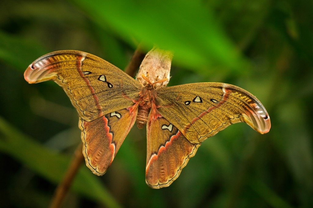
Of the Philippines' 21,000 insect species, around 70 percent are found only on the archipelago. There are approximately 915 butterfly species, including one of the world's largest species, the Magellan birdwing. One of the world's largest moths, the Atlas moth, also inhabits the Philippines.
The marine diversity of the Philippines is almost unmatched, with its waters home to the world's largest and smallest fish, the whale shark and the dwarf pygmy goby. The world's largest clam, the giant clam, also lives in the Philippines. Other significant fish species include parrot fish, blue marlin, manta ray, and yellow-fin tuna.
The Philippines' flora is unique, with around 33 percent of its over 9,250 plants native to the archipelago. There are no endemic plant families in the Philippines, but hundreds of endemic plants. For example, around 100 of the Philippines' 150 palm species are endemic.
The Dipterocarpaceae tree family dominates the Philippines' tropical forests, constituting roughly 75 percent of their area. Some other common plant families include begonias, pandans, gingers, and gesneriads.
Giant fig trees are essential to the Philippines' ecosystem, providing food for fruit bats, monkeys, and parrots. Other interesting tree species in the Philippines include ylang-ylang, rainbow eucalyptus, Indian beeches, and kapoks.
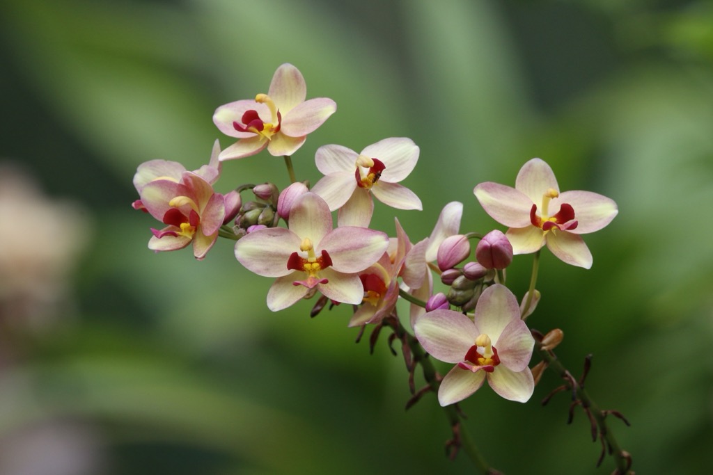
The Philippines has around 8,000 flowering plant species, including 998 orchids and 1,000 ferns. Sampaguita, also known as Arabian jasmine, is the national flower of the Philippines.
Common and interesting flowering plants found in the Philippines include jade vines, moth orchids, Heart of Jesus plants, snake plants, golden pothos, and waling-waling.
The Philippines has a long human history, with evidence of archaic Homo luzonensis inhabiting the islands over 65,000 years ago. Archeologists identified the earliest evidence of modern humans in the Tabon Caves in Palawan, dating back around 47,000 years ago.
Negritos, the term used for the Philippines' indigenous population, were the first humans to settle on the archipelago.
Around 5,000 years ago, Austronesians migrating south from Taiwan arrived in the Philippines. Today, Austronesians form the majority of the Philippines' population. They are believed to have first settled on the Batanes Islands and northern Luzon.

A 2021 study of indigenous communities discovered that the Philippines were subjected to at least five independent waves of ancient migration, including from Thailand, Laos, and New Guinea.
By around 1,000 BCE, four distinct tribal groups inhabited the Philippines: the Aetas, Hanunoo, Ilongots, and the Mangyan. There were also more advanced warrior societies, such as the Isneg and Kalinga, and the plutocratic Ifugao of the Cordillera Highlands.
Between 300–700 CE, seafaring in barangays became common in the Philippines, with Filipinos trading with mainland Southeast Asia and Malaysia. This trade corridor, known as the Maritime Jade Road, became one of the largest prehistoric maritime trade networks of geological material.
The Philippines' early history saw the archipelago split into complex societies, with some scholars believing they were akin to early states. During this period, many of the most populated areas were precursors to modern cities, including Manila, Cebu City, and San Carlos City.
Trade and naval expeditions meant the Philippines were increasingly influenced by Arabia, China, and India, with some of the population adopting Hinduism, Buddhism, and Islam. One notable expedition that affected Filipino culture was the Southeast Asian campaign of Rajendra Chola I in 1025 CE.
Portuguese explorer Ferdinand Magellan and his contingent were the first Europeans to visit the Philippines. Ferdinand Magellan was subsequently killed following defeat in the Battle of Mactan with local chief (datu) Lapulapu.
One of the most pivotal moments in the Philippines' human history was the arrival of Miguel López de Legazpi and the expansion of New Spain in 1565. After establishing the first permanent settlement in Cebu, Spain gradually took control of most of the archipelago.
During Spanish colonialism, the Philippines saw the introduction of Catholicism, a legal code, and the founding of Asia's oldest university, the University of Santo Tomas. The Philippines takes its name from the sixteenth-century King of Spain, Philip II.
Spanish colonialism of the Philippines lasted for 333 years until Spain's rule finally ended in 1898 following its defeat to the US in the Spanish–American War.
Following the conflict, the Philippines came under the possession of the US, which lasted for 48 years. The Tydings–McDuffie Act of 1934 promised the Philippines full independence within ten years. Establishing the Philippine Commonwealth in 1935 was the first step towards complete independence.
The establishment of the Philippine Commonwealth started a ten-year interim period prior to independence, which stalled when Japan occupied the Philippines during the Second World War. The 1946 Treaty of Manila saw the Philippines gain full autonomy.
The Philippines experienced a tumultuous twentieth century, enduring a decade of authoritarian government under Ferdinand Marcos. This period of dictatorship included a declaration of martial law, numerous extrajudicial killings, and countless cases of human rights abuse. The peaceful People Power Revolution in 1986 ended the dictatorship, forcing Marcos into exile.
Due to colonization and US influence, the Philippines is one of the most westernized Asian countries. The Philippines and East Timor are Asia's only largely Roman Catholic countries. It's also one of only two Asian countries where English is an official language, alongside India.
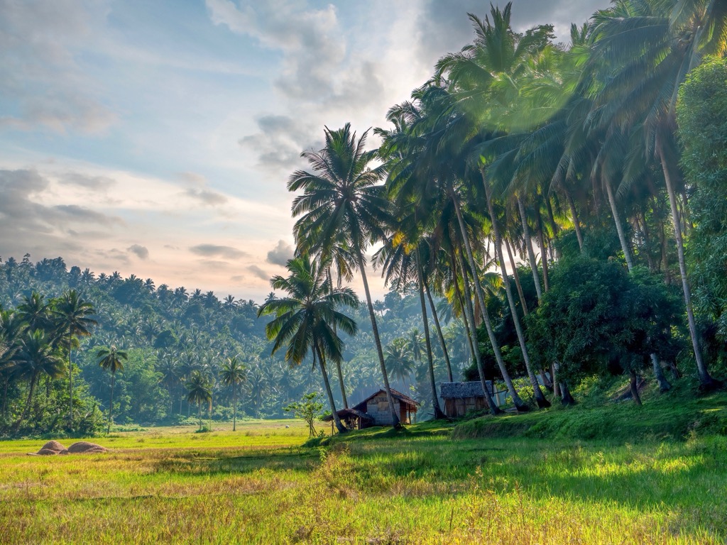
Today, the Philippines is a country of extreme wealth and poverty. Agriculture is still the primary industry despite having the resources to build a robust industrial economy.
The Philippines is a unique hiking destination with its breathtaking biodiversity and numerous volcanoes.
Bring plenty of water and appropriate hiking gear when hiking in the Philippines. Many of the best hikes in the Philippines are isolated, so inform others of your itinerary and map your route carefully. Registration fees and local guides are necessary in many hiking areas, so plan ahead.
Read on to learn about some of the best hikes in the Philippines.
Mount Apo Natural Park is located in southwestern Mindanao, the Philippines' second-largest island after Luzon. It forms part of the Davao Region, on the outskirts of Davao City.
Mount Apo Natural Park contains 22 named mountains, including the highest mountain in the Philippines, Mount Apo. The park covers an area of approximately 549.7 sq km (212.2 sq mi).
While the main draw of Mount Apo Natural Park is scaling the archipelago's highest summit, there are some other popular natural attractions, like Lake Venado, the second-highest lake in the Philippines.
You'll need a permit to hike Mount Apo, which can be acquired from the Tourism Office in Santa Cruz. Mount Apo is not a particularly strenuous hike, but a local guide is recommended to help with permits and navigation.
One of the most popular routes up Mount Apo is from Upper Culan, following the Santa Cruz Trail. This out-and-back trail is approximately 14.3 km (8.8 mi) in length. The best time to climb Mount Apo is from November to May during the dry season.
Mount Pulag National Park covers an area of 115.5 sq km (44.5 sq mi) on the spine of the Cordillera Central. It's located in central Luzon on the border of the Cordillera Administrative Region and the Cagayan Valley. The park takes its name from Mount Pulag, the highest mountain in Luzon and the third-highest mountain in the Philippines.
The slopes of Mount Pulag are carpeted in mossy forests that are home to many threatened species, including Philippine brown deer, Luzon pygmy fruit bats, and northern Luzon giant cloud rats. The main summit of Mount Pulag is grassy, with views of Mount Singakalsa (2,719 m/8,921 ft) to the northwest and Mount Tabayoc (2,498 m/8,195 ft) to the north.
You must obtain a permit from the Mount Pulag National Park Protected Area Office to climb Mount Pulag. Visitors must also undergo an orientation class to enter the park. The hike up Mount Pulag is relatively straightforward and suitable for beginners.

Four primary trails ascend Mount Pulag, the easiest of which is the Ambangeg Trail from Babadak in Benguet. This out-and-back trail is approximately 17 km (10.5 mi) in length. The best time to climb Mount Pulag is from November to March during the dry season.
Mount Arayat National Park is a small national park encompassing an area of 37.2 sq km (23.1 sq mi) in the Pampanga province of Central Luzon, approximately 16 km (10 mi) west of Angeles City.
The park centers around Mount Arayat (1,026 m/3,366 ft), a dome-shaped stratovolcano with a breached crater. Mount Arayat may still be active, and while there are no records of recent eruptions, there's evidence the volcano has erupted in the last 2,000 years.
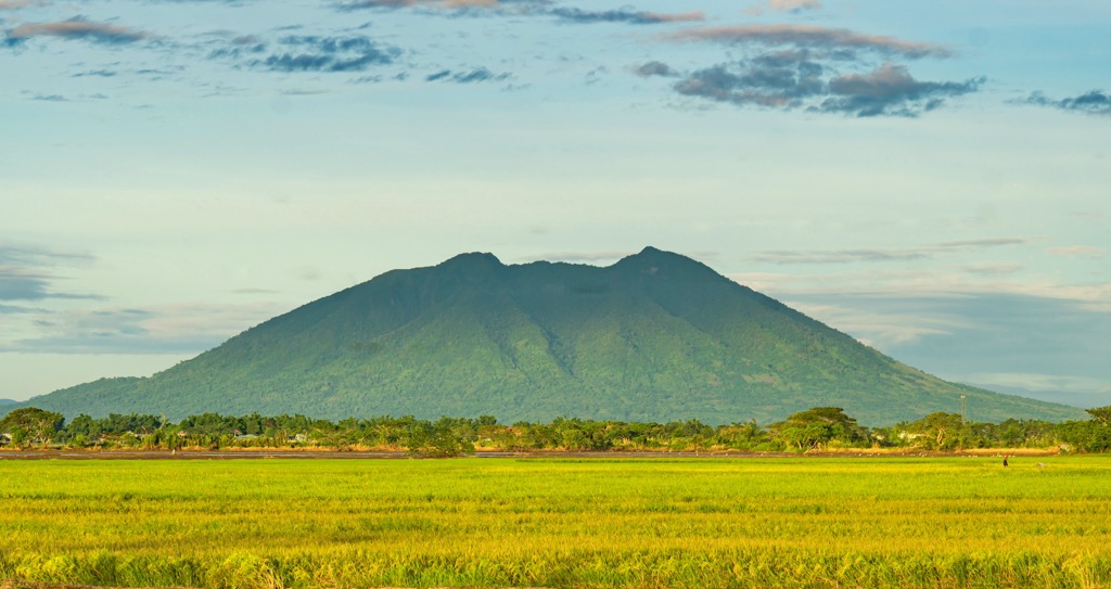
The mountain is steeped in folklore and history. It's said to be the legendary home to Apung/Aring Sinukuan, a powerful ancestral spirit called a diwata. Locals say the current widespread deforestation of the mountain is angering the spirit. Additionally, Mount Arayat served as a hiding place for Filipino guerillas during the Second World War.
One of the best ways to climb Mount Arayat is from Magalang and finishing in Barangay Juan Bano, Arayat. This route traverses Mount Arayat's North Peak and South Peak (993m/3 258ft).
The mountain affords idyllic views of the Central Luzon plain, the surrounding rice paddies, and the Pampanga River. This out-and-back trail is approximately 20 km (12.4 mi) in length.
Mount Kitanglad Range Natural Park covers an area of 472.7 sq km (293.7 sq mi) and is located in the Bukidnon province of Mindanao. Approximately 93 percent of the park is forested with over 600 rare and endemic species.
Mount Kitanglad Range Natural Park contains 11 named mountains, including Mount Dulang-dulang (2,941 m/9,649 ft), the second-highest mountain in the Philippines. The highest summit in the Kitanglad Mountain Range, Mount Dulang-dulang is nicknamed 'D2" by local mountaineers.
Mount Dulang-dulang is culturally significant as it's the ancestral land of the Talaandig tribe of Lantapan and is considered a sacred site. It's also the home of several other indigenous peoples, including the Bukidnon and Higaonon.
Rainforests cover the slopes of Mount Dulang-dulang, with slippery mossy slopes adding to the mountain's difficulty. The mountain is biodiverse, with 58 mammal species recorded in the area, including monkeys, flying lemurs, and wild boar. You might even be lucky enough to spot Philippine eagles soaring over the mountainside.
You must coordinate with the local branch of the Department of Environment and Natural Resources (DENR) to climb Mount Dulang-dulang. You must also perform a ceremony with the Datu Makapukaw, which involves a ritual sacrifice. There's a fee for the ceremony.
Mount Dulang-dulang is a challenging mountain, and a guide is recommended for inexperienced hikers. One popular trail to Mount Dulang-dulang is from Lantapan, Bukidnon to the south of the mountain. On a clear day, you can spot Mount Apo 128 km (80 mi) away to the southeast from Mount Dulang-dulang's summit.
This out-and-back trail is approximately 16 km (9.9 mi) in length. The best time of year to climb Mount Dulang-dulang is from November to March during the dry season.
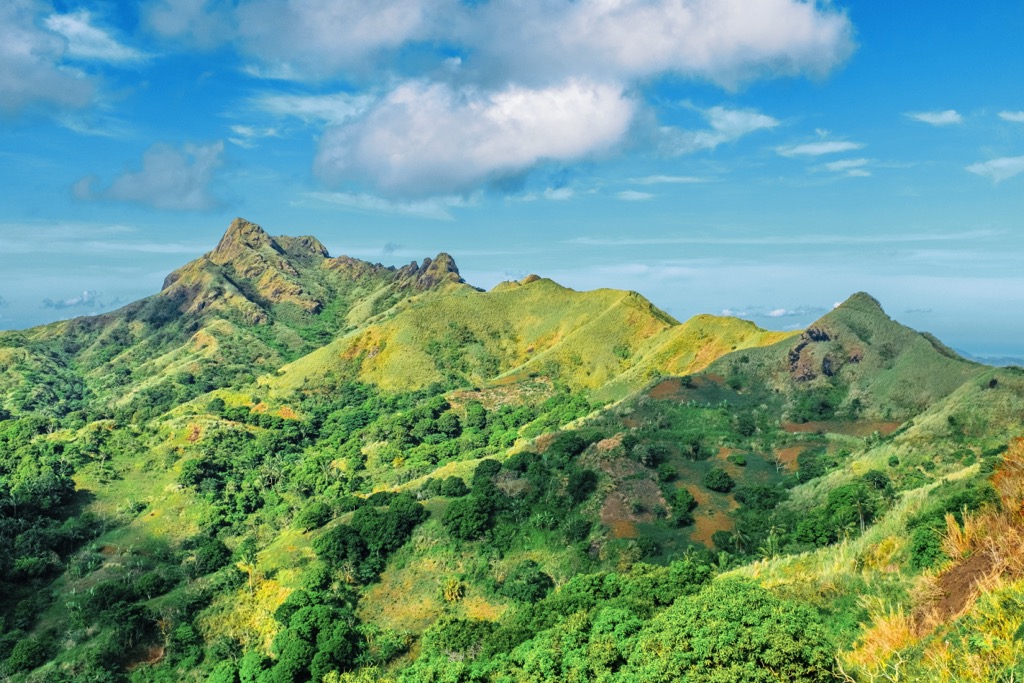
Mount Palay-Palay National Park, also known as Mounts Palay-Palay–Mataas-na-Gulod Protected Landscape, covers an area of 39.9 sq km (24.7 sq mi) across the Cavite and Batangas provinces of Calabarzon in Luzon.
Part of the Palay-Palay Mountain Range, Mount Palay National Park contains the last remaining areas of lowland rainforest in Cavite, as well as the famous Mount Pico de Loro (688 m/2,257 ft).

Also known as Mount Palay-Palay, Mount Pico de Loro is a dormant volcano and the highest point in Cavite. Its Spanish name means "Parrot's Beak" due to the distinct shape of its summit.
Mount Pico de Loro’s summit pillar offers a different challenge to many other mountains in the Philippines, with bouldering and rappelling required to reach the true summit. It's well worth the extra effort, with the top of the “Parrot's Beak” providing sublime views of the South China Sea.
You can pick up the trail to Mount Pico de Loro from the DENR Station in Ternate. This out-and-back walk is approximately 9.7 km (6 mi) in length.
Mount Batulao (2,661 m/8,730 ft) is an inactive stratovolcano located in the Batangas province of the Calabarzon region of Luzon. Mount Batulao is one of the Philippines' most popular day hikes, due partly to its proximity to Manila, which is located just 85 km (53 mi) to the north.
Mount Batulao is an excellent escape from the bustling streets of Manila, with over 300 sq km (115.8 sq mi) of lush forests encircling the mountain. Numerous bird species have been documented on the mountain, including barn swallows, collared kingfishers, Philippine hanging parrots, and Philippine fairy-bluebirds.
There are two recognized trails on Mount Batulao: the New Trail from the west and the Old Trail from the east. There's a small registration fee for both trails.
The Old Trail is a relatively challenging route that can be picked up from near the Mount Batulao jump-off near the KC Hillcrest Hotel and Golf Club. This out-and-back trail is approximately 10.3 km (6.4 mi) in length.
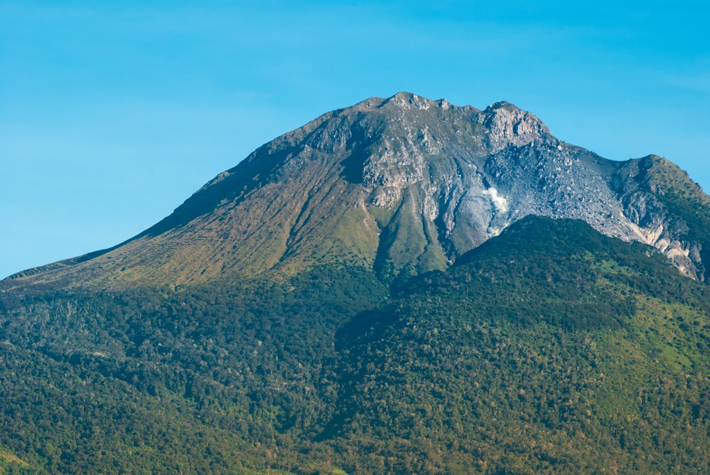
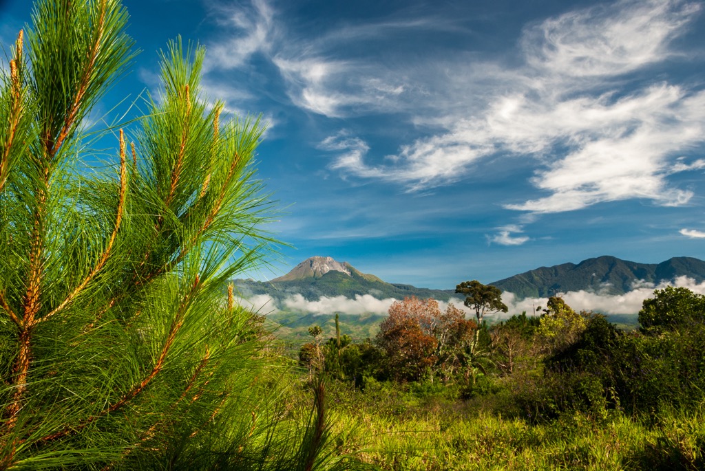
Mount Pinatubo is the Philippines' most famous stratovolcano. It's located in the Zambales Mountains in Central Luzon on the tripoint between the Zambales, Tarlac, and Pampanga provinces.
Mount Pinatubo gained international attention following its powerful 1991 eruption, which was the second-largest terrestrial eruption in the twentieth century. Mount Pinatubo's previous eruption was around 1,500 CE. The mountain is the ancestral land of the Aetas indigenous people, who have owned the area since 2009.
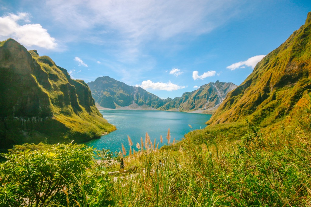
Lake Pinatubo, a summit crater lake formed by the 1991 eruption, has become a major tourist destination. The walk to the crater lake is relatively straightforward, with the starting point to the north reached by 4x4. A tour guide is recommended.
The lake's dazzling turquoise-green waters and the surrounding landscape are well worth the walk. You'll pick up the trail from the parking lot to the north of the lake. This walk is approximately 5.5 km (3.4 mi) in length.
Lively cities, welcoming locals, and cultural wonders await travelers to the Philippines. Read on to learn about the Philippines' main cities and towns.
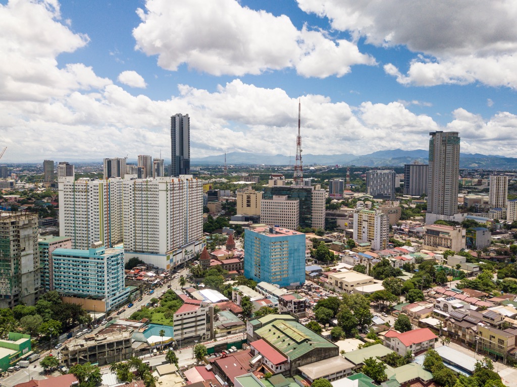
Manila is the capital city of the Philippines, located on the eastern shore of Luzon overlooking Manila Bay. Nicknamed the "Pearl of the Orient," the Philippines' second-largest city boasts a wealth of historical attractions, shopping opportunities, and world-class eateries.
Step back into the Spanish Era by visiting Manila's oldest district, Intramuros, or escape the city with a stroll through Rizal Park, the country's largest urban park. There's no shortage of things to do in Manila, with dozens of historic churches, fascinating museums, and a vibrant nightlife scene.

Manila is well-connected and serves as a starting point for many visitors to the Philippines. The Philippines’ largest airport, Ninoy Aquino International Airport, is in Manila. Manila is less than 90 km (55 mi) from Mount Palay-Palay National Park, Mount Arayat National Park, Mount Pinatubo, and Mount Batulao.
Quezon City is the largest city in the Philippines. Located just north of Manila, it forms a part of Metropolitan Manila. It has a population of over 2.9 million people.
Despite its proximity to Manila, Quezon City has many attractions unique to the city, including the biggest 3D art museum in Asia, Art in Island. There’s also Quezon Memorial Circle, a national park with hiking trails, an amusement park, and several restaurants.
Quezon City is less than 15 km (9.3 mi) from the center of Manila, with Ninoy Aquino International Airport 35 km (21.7 mi) away. Quezon City is a similar distance to Manila from many of the Philippines' best hiking destinations, including Mount Pinatubo, Mount Batulao, and Mount Arayat National Park.
Davao City is the largest city in Mindanao and the third most populous city in the Philippines. It's located in the Davao Region on Mindanao's southern shoreline overlooking the Davao Gulf.
With a population of over 1.7 million people, Davao is a multicultural city home to 11 indigenous groups and small communities from across Asia. Davao City is great for families, with many attractions for all ages, like Abreeza Mall, the Philippine Eagle Center, and Malagos Garden Resort.
It's the perfect place to stay if you're planning to climb Mount Apo, which is located less than 30 km (18.6 mi) southwest of the city. Mindanao's busiest airport, Francisco Bangoy International Airport, is located in Davao City.
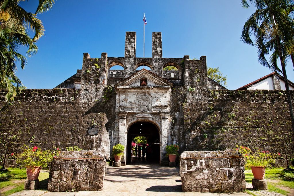
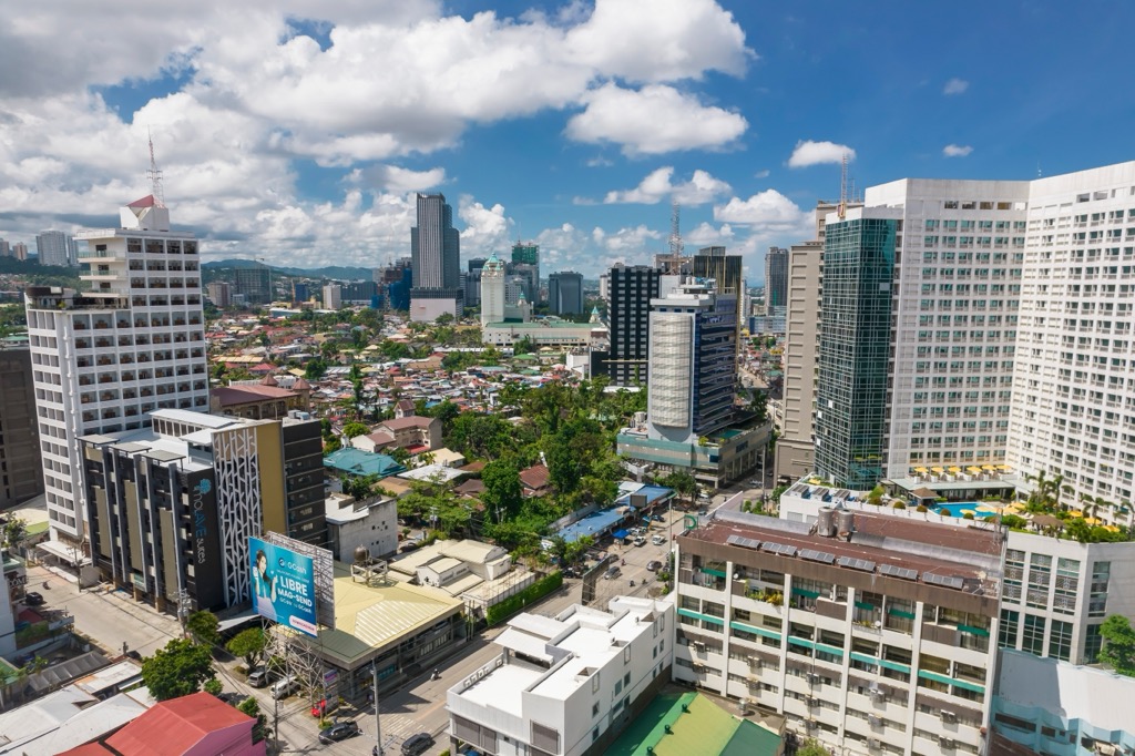
Cebu City is the capital of the island of Cebu and the largest city in the Visayas. Located on Cebu's eastern coastline, Cebu City offers pristine beaches, Filipino-Spanish architecture, and eco-friendly adventures.
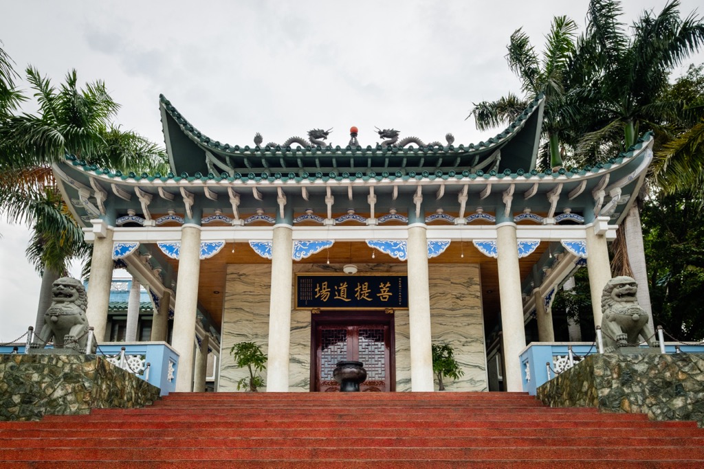
You'll find several exciting excursions in and around Cebu City, including canyoneering at Kawasan Falls and trips to Sumilon Island. The city itself has some fantastic cultural attractions like Fort San Pedro, the Cebu Taoist Temple, and the Basilica del Santo Niño. Ensure you visit Tops Lookout for the best view of Cebu City's impressive skyline.
The Philippines' second-busiest airport, Mactan–Cebu International Airport, is located in Lapu-Lapu just outside Cebu City.


Yes. Philippines has 3,142 named mountains. The highest is Mount Apo at 2,954 m.
The highest mountain in Philippines is Mount Apo, at 2,954 m.
Philippines has 3,142 named mountains.


