
Scan the QR code and open PeakVisor on your phone
Vietnam is home to 4,563 named mountains. The highest is Phan Xi Păng at 3,143 m.
A land of stunning beaches, rugged mountains, rich culture, and amazing cuisine, Vietnam is a gorgeous country located in southeastern Asia. Vietnam contains 4,561 named mountains, the highest of which is Phan Xi Păng (3,143 m/10,312 ft), and the most prominent of which is Ngọc Linh (2,600 m/8,530 ft).
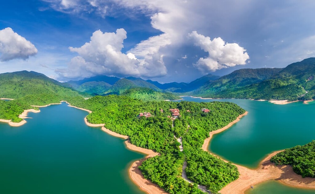
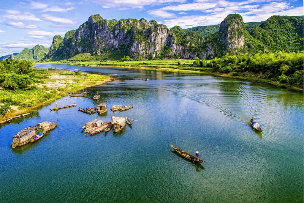
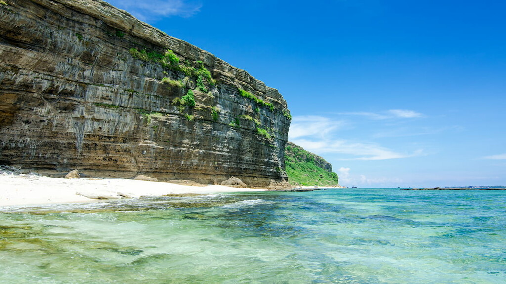
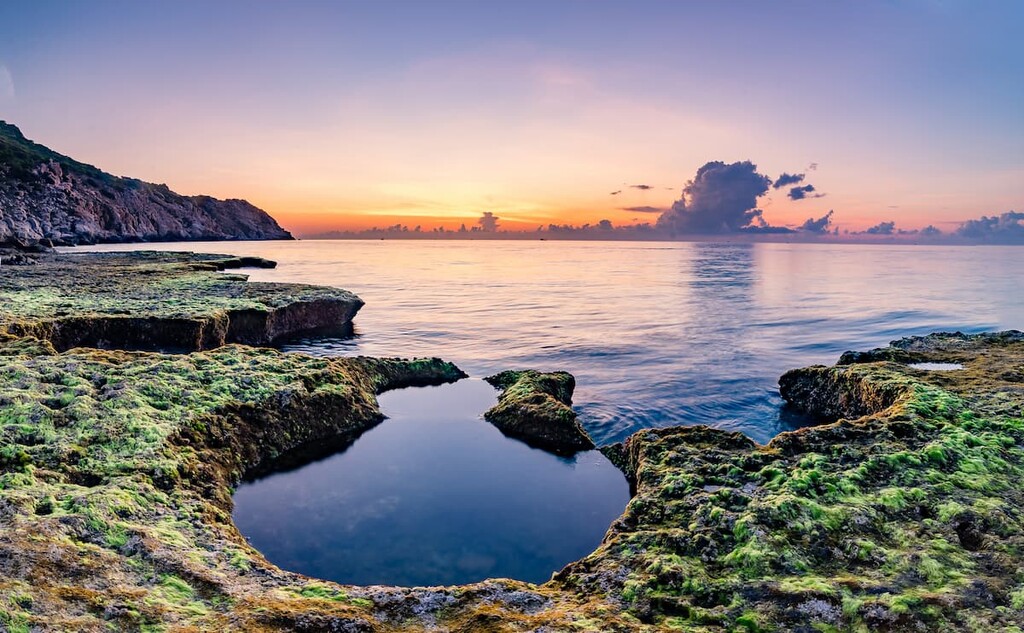
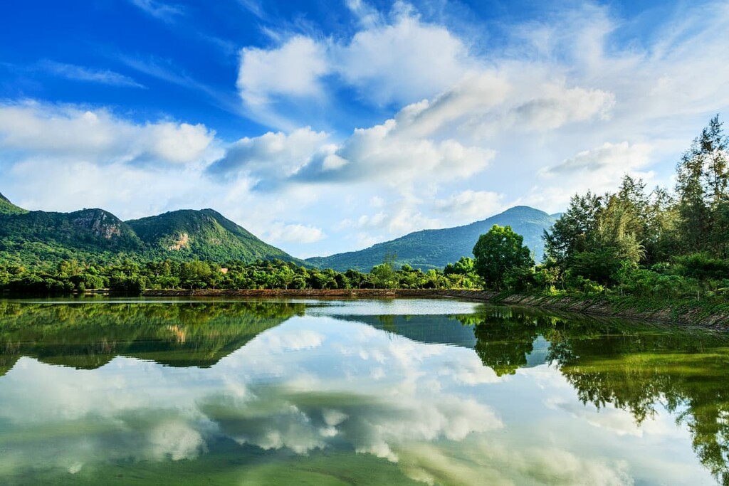
The country of Vietnam is located in southeastern Asia on the edge of the Indochinese Peninsula. It is a land dominated by beautiful coastlines, tropical rainforests, and jagged cliffs.
With a total area of some 331,699 square kilometers (128,070 sq. mi), Vietnam is the world’s 66th largest country. This makes it slightly smaller than Japan, Germany, the Republic of the Congo, and Finland, but slightly larger than Malaysia, Norway, Côte d'Ivoire, and Poland.
Interestingly, despite being a relatively small country in terms of total land area, Vietnam is one of the most populous countries on Earth. Indeed, it has a population of nearly 100 million people as of 2021, which ranks it as the 15th most populous country in the world after Ethiopia, Philippines, and Egypt, though it is slightly larger than the Democratic Republic of the Congo, Iran, Turkey, and Germany.
Due to its location on the edge of the Indochinese Peninsula, Vietnam shares its land borders with China to the north and both Laos and Cambodia to the west. It also has maritime borders with Malaysia, Indonesia, Thailand, and the Philippines.
These days, Vietnam is officially divided up into 58 provinces and 5 independent municipalities. These provinces and municipalities are also organized into 3 geographic regions, which are subdivided into a total of 8 administrative regions. However, these regions don’t serve an official purpose, so you may hear people use alternative definitions for them. These regions include:
Aptly named, the Northwest (Tây Bắc Bộ) region of Vietnam is located in the northwestern part of the country. It typically includes the provinces of Yên Bái, Sơn La, Lào Cai, Lai Châu, Hòa Bình, and Điện Biên.
This region is highly mountainous with a number of minor ranges and large valleys traversing the landscape. However, this region is also one of the most seismically active parts of Vietnam and it is generally regarded as having one of the highest risks of earthquakes in the country.
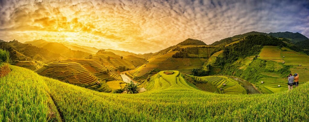
Furthermore, the Northwest is also highly agricultural, particularly in the lower elevations. Rice cultivation and cattle raising are two of the main economic activities in the region thanks to its mostly pleasant climate and relatively small population of about 4.5 million people.
The region also contains a number of excellent national parks and nature reserves, such as:
Situated along Vietnam's northern border with China, the Northeast (Đông Bắc Bộ) region is a humid, tropical area that contains everything from mountains to beautiful coastline. It is generally regarded as containing the provinces and municipalities of:
Like its neighbor to the west, the Northeast region is fairly rugged. It features large limestone and granite cliffs, though these are mostly found in the northernmost part of the region.
In addition to its many inland rice fields, the coastal areas of the Northeast region also contain a large number of islands. Indeed, some of the country’s most notable sea islands are located in this part of Vietnam. Additionally, there are two primary parks in this region: Ba Bể National Park and Tây Yên Tử Nature Reserve.
A collection of small, but highly populated provinces, the Red River Delta (Đồng Bằng Sông Hồng) region is located along the northern coast of Vietnam. It is generally regarded as containing the provinces and municipalities of:
With a total population of more than 23 million people, the Red River Delta is one of the most densely populated parts of Vietnam. It also is home to the country’s capital, Hanoi, which itself is home to some 8 million people.
The Red River Delta is one of the most important economic areas in Vietnam. It is a vital part of the country’s fishing, forestry, and rice-producing economies. But, despite being both economically important and highly populated, there are a number of national parks in this region, including:

Encompassing the bulk of central Vietnam, the North Central (Bắc Trung Bộ) region stretches from the Vietnamese coast all the way westward to the country’s border with Laos. This region contains the provinces of Thừa Thiên–Huế, Thanh Hóa, Quảng Trị, Quảng Bình, Nghệ An, and Hà Tĩnh.
Vietnam’s North Central region is very rich in natural resources. It contains a high concentration of valuable minerals, including limestone, so mining is an important part of the regional economy. It is also a highly agricultural region, particularly when it comes to growing rice, sugar cane, and the like.
Additionally, North Central Vietnam contains a decent number of national parks and reserves, including:
The South Central Coast (Duyên hải Nam Trung Bộ) region of Vietnam includes a handful of provinces and municipalities along the country’s southern coastline. This region is generally regarded as including the provinces and municipalities of:
Here, the landscape is rugged and complex. There are a number of minor mountain ranges that stretch throughout this part of the country before terminating in the Central Highlands to the west.
As one of the gateways to the Central Highlands, the South Central Coast is a popular tourist destination. However, it is less industrialized than its southerly neighbor, which includes Ho Chi Minh City. This region also contains a number of parks and reserves, including:
Vietnam’s most rugged region, the Central Highlands (Tây Nguyên) is located in the southwestern part of the country, along its border with Cambodia. This region contains the provinces of Lâm Đồng, Kon Tum, Gia Lai, Đắk Nông, and Đắk Lắk.
The Central Highlands contain a series of contiguous plateaus, each of which provide a unique flair to the landscape. Due to the difficulties in establishing infrastructure in such a rugged region, this part of Vietnam is known to struggle economically.
Nevertheless, the region does contain a large quantity of fertile basalt soil, which has helped bolster the coffee, cocoa, and tea industries. In fact, this region is one of the most important coffee-growing areas in Vietnam.
Despite all of this, the Central Highlands are one of Vietnam's major nature-based tourist attractions. There are a number of important cultural sites in the region, as well as a selection of excellent parks and reserves, such as:

One of the most populous regions in Vietnam, the Southeast (Đông Nam Bộ) is situated just to the south of the South Central Coast. It contains the provinces of Tây Ninh, Đồng Nai, Bình, Phước, Bình Dương, and Bà Rịa–Vũng Tàu, as well as the municipality of Ho Chi Minh City.
The Southeast is one of the most economically important parts of Vietnam. It contributes a substantial amount of financial resources to the country’s annual budget due to the highly urbanized population in the region.
Indeed, this region is home to Ho Chi Minh City, which is the largest city in the country. It also contains the country’s largest airport and some of its most important sea ports.
Although this part of Vietnam is highly urbanized, it does contain a number of national parks and biosphere reserves. These include:
Last but not least, the Mekong River Delta (Đồng Bằng Sông Cửu Long) is the southernmost region of Vietnam. This low-lying region contains the provinces of:

Within this region, the dominant economic activity is easily agriculture. In fact, the Mekong River DElta is the most productive agricultural and aquaculture region in the entire country. IT is an important place for the growing of cereals, including rice.
The Mekong River Delta is considered to be a gem of biodiversity in the region. It is home to thousands of different animal and plant species, though it is vulnerable to climate change. There are many national parks and reserves in the region, such as:
The geology of Vietnam is complex and varied. Within the country, the mountains are part of a larger collection of ranges known as the Southeast Asia Mountains, which include a range that’s known locally as the Annamite Range, and the Yunnan-Guizhou Plateau.
The Yunnan-Guizhou Plateau covers the northernmost part of Vietnam, as well as a large portion of southwestern China. There are 2,040 named mountains on the plateau, though the bulk of them, including the highest—Siguniangshan—are located in China.
Known for its karst topography, the Yunnan-Guizhou Plateau is a region dominated by hills and large gorges. By the time it reaches northern Vietnam, however, the range starts to slowly decrease in size until it reaches the low-lying region of the Red River Delta near Hanoi.
The Southeast Asia Mountains are a large, informal grouping of peaks that stretch across much of southeastern Asia from Myanmar in the west all the way to Thailand, Laos, Cambodia, Malaysia, and Vietnam.
Within this group of ranges, there are 24,952 named mountains, the highest of which is Nikhu Razi in Myanmar, and the most prominent of which is Ngọc Linh, in southern Vietnam.
The most dominant range in Vietnam’s section of the Southeast Asia mountains is the Annamite Range (Dãy núi Trường Sơn), which covers much of the country. This range extends for about 1,100 km (680 mi) from Laos into Vietnam and Cambodia.
The range’s geologic structure is quite complicated, but it contains some various limestones, granites, sandstones, and even some basalts.
Major peaks in the range include Chư Yang Sin, Ngọc Linh, and Phou Xai Lai Leng.
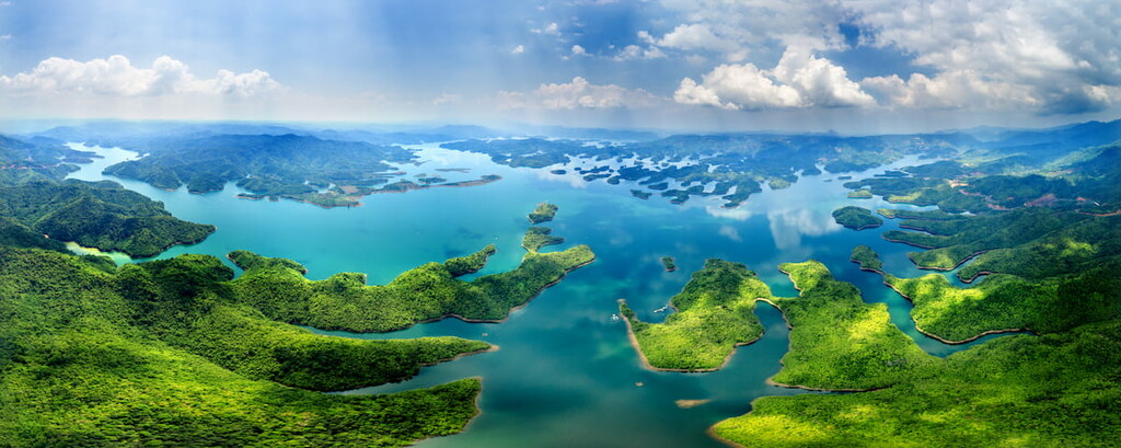
Vietnam is particularly well known for its biological diversity. The country exhibits a high level of endemism, which means that there are a number of plant and animal species that can’t be found anywhere else on Earth.
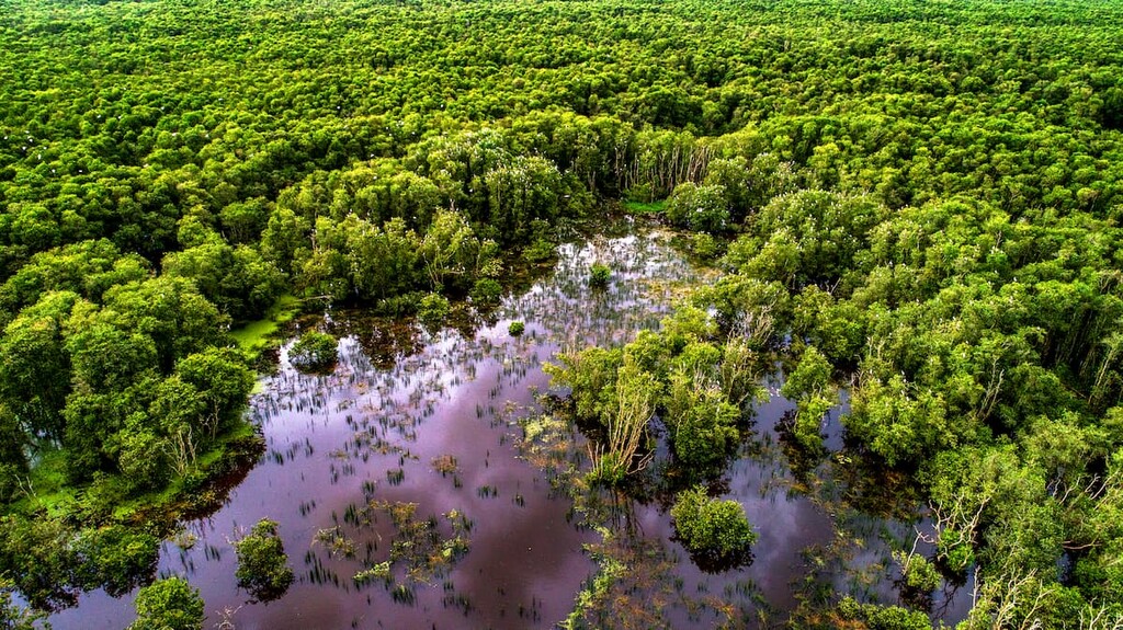
Within Vietnam, which is part of the Indomalayan realm, the landscape is heavily forested. In particular, the country contains a number of tropical rainforests, subtropical and montane forests, swamps, and mangroves. The regions around the country’s major river deltas (the Red River and the Mekong River, are also both noted for their biological diversity.
Wildlife in Vietnam is also particularly abundant. There are a number of notable animal species in the country, which is home to more than 300 species of mammals, nearly 300 species of reptiles, 2,700 species of fish, nearly 900 bird species, and some 160 species of amphibians.
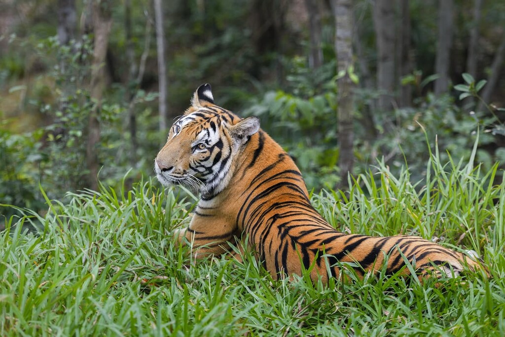
Some of the most notable animal species in the country include the Indian elephant, Bengal slow loris, white-headed langur, sunda pangolin, and the Chinese pangolin. Vietnam also has an impressive array of wild cats, including the Asian golden cat, jungle cat, marbled cat, leopard cat, clouded leopard, and the Indochinese tiger.

Other major land mammals in the country include the dhole, golden jackal, sun bear, Asiatic black bear, Eurasian otter, Malayan tapir, dwarf musk deer, sambar deer, bantaeng, guar, and saola.
The country also contains some fantastic marine mammals in its waterways, including the vulnerable dugong, which is a fully aquatic herbivorous mammal. Other marine mammals in Vietnam’s waters include the western gray whale, orcas, northern blue whale, and th eIrrawaddy dolphin.
The area that is now part of the country of Vietnam has been inhabited by humans for thousands of years, at least as far back as the Paleolithic. Furthermore, archaeological evidence suggests that Homo erectus, an extinct species of archaic humans, likely lived in the region as early as about 500,000 BCE.
Extensive human settlement of the region and the establishment of a dynastic government in what is now Vietnam likely started around 3000 BCE with the Hồng Bàng dynasty.
Over time, by the year 111 BCE, the Han dynasty from China eventually gained control over what is now Vietnam, leading to a period of Chinese rule that lasted nearly 1,000 years. This period of Chinese rule ended in the mid tenth century CE when Vietnamese lord Ngô Quyền defeated the Chinese.
This then led to the establishment of a long succession of Vietnamese dynasties that were briefly interrupted by a period of control by the Ming dynasty from China. However, this period mostly saw the expansion of these Vietnamese dynasties throughout most of the eastern Indochinese Peninsula.
By the sixteenth century, sailors from Portugal had arrived off the coast of what is now Vietnam. They attempted to settle in what is now Vietnam, but repeatedly failed in their attempts, focusing their efforts on Macau and the city of Nagasaki in what is now Japan, instead.
During the seventeenth century, French, Dutch, Spanish, and English traders frequented Vietnam. During the nineteenth century, France eroded away at the sovereignty of Vietnam through a number of sieges which eventually led to the establishment of the colony of French Indochina.
French rule over Vietnam more or less continued until World War II, at which point Japan invaded French Indochina, precipitating the decline of French colonial activity in eastern Asia.
At the same time, the Vietnemese were fighting their own war, the First Indochina War, against the French as the Việt Minh sought liberation from French rule. This eventually led to the Geneva Conference which attempted to settle remaining issues resulting from both the First Indochina War and the Korean War.
After the Geneva Conference, Vietnam was partitioned into the Democratic Republic of Vietnam to the north and the State of Vietnam to the south. Interestingly, this partition wasn’t originally intended to be permanent, but, after Ngô Đình Diệm proclaimed himself president of the new Republic of Vietnam in the southern part of the country, tensions started to rise in the region.
Eventually, the North Vietnamese government, which was backed by the Soviet Union, North Korea, China, Khmer Rouge, and GRUNK, and the South Vietnamese government, which was backed by the United States, South Korea, Australia, New Zealand, Laos, Cambodia, Khmer Republic, Philippines, Thailand, and others, were at war.
The Vietnam War continued for over 19 years from 1955 to 1975, ending eventually with the fall of Saigon.

In 1976, the former North and South Vietnam merged to create the Socialist Republic of Vietnam, which exists to this day. The country has undergone a number of reforms since its establishment under the Communist Party of Vietnam.
Since then, Vietnam has seen substantial growth in its economic, particularly in terms of its agricultural and economic outputs. It has established itself as a major player in southeastern Asia thanks to its growing economic prospects.
Vietnam is home to a superb collection of national parks. Here are some of the best hiking and outdoor recreation destinations to check out during your next visit to the country:
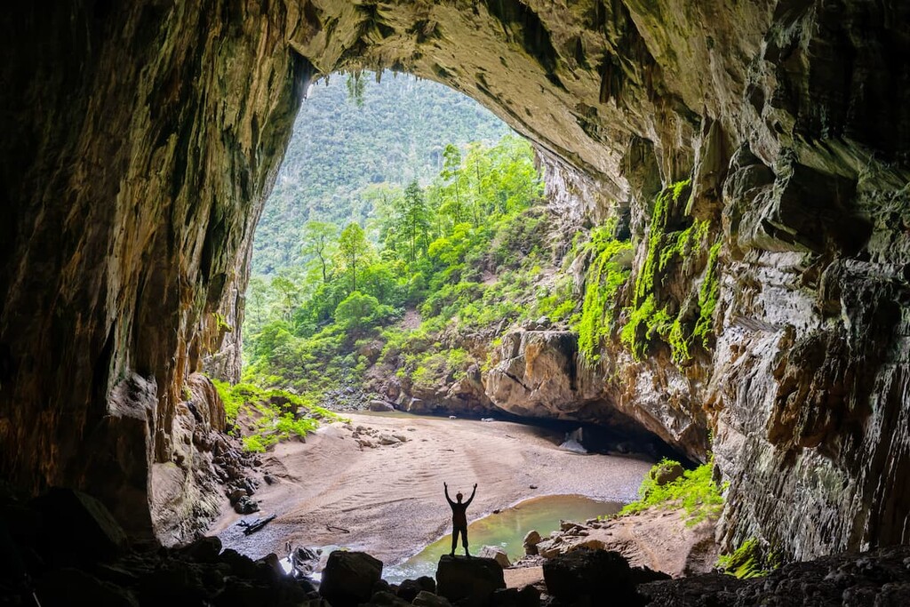
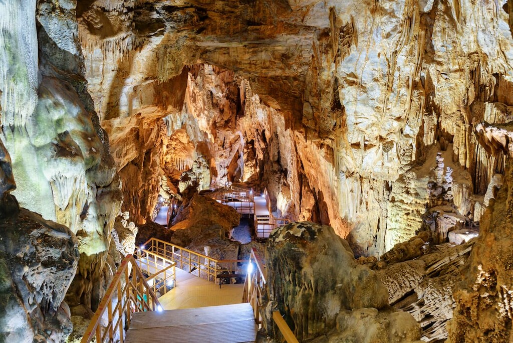
Located in central Vietnam, Phong Nha-Kẻ Bàng National Park is a stunning natural area and a UNESCO World Heritage Site. It contains 12 named mountains, the highest of which is Phu Pha Dan, and the most prominent of which is Co Khu.
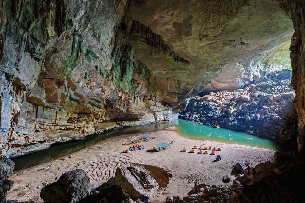
Phong Nha-Kẻ Bàng was initially created in order to protect some of Vietnam’s most iconic karst topography. The park contains hundreds of caves and smaller grottoes as well as a unique limestone forest ecosystem. In fact, one of the world’s largest known caves, Sơn Đoòng Cave, is located within the park.
Visitors to the park can enjoy caving, hiking, paddling, and other similar activities. There are plenty of tour guides in the region, too, for visitors who would like some guidance throughout the park. One of the most popular activities in the park is to take a boat tour up the Chay River, which offers a chance to see some of the region’s best waterfalls.
Situated on Phú Quốc Island off the coast of Vietnam, Phú Quốc National Park is a popular tourist attraction. The park is very low-lying, so it’s better known for its beaches than for its mountainscapes.
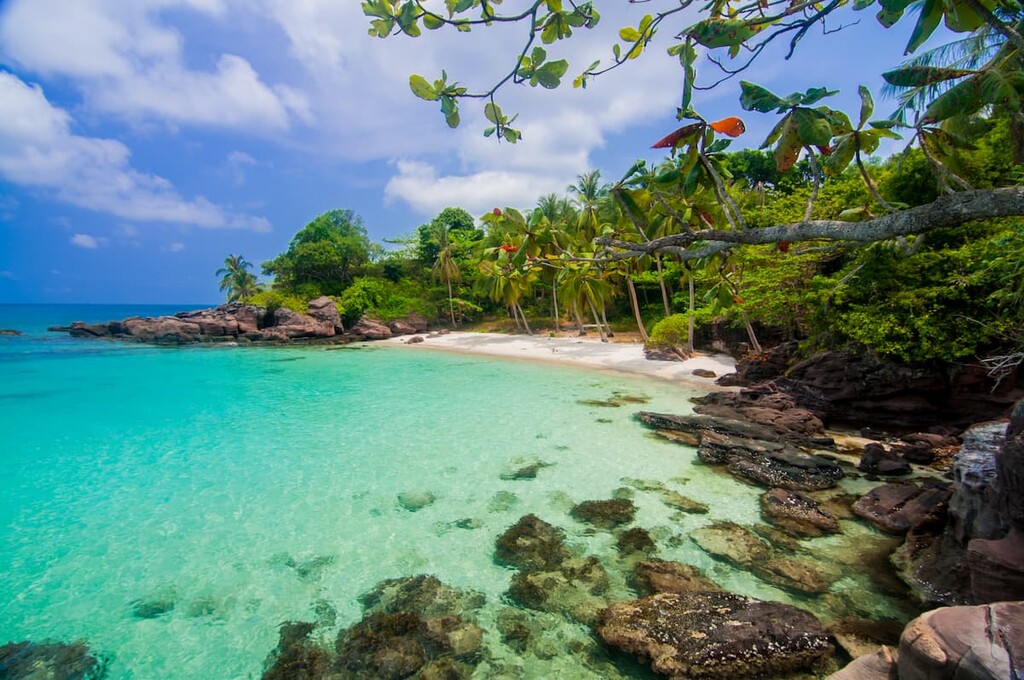
The primary attraction of Phú Quốc National Park, however, is the park’s resident dugong population. It is a popular tourist destination among visitors who want to experience the region’s beautiful beaches and there are plans underway to help develop a more sustainable ecotourism industry within the park.
Cát Bà National Park is a UNESCO World Heritage Site and federally protected area located in the northern part of Vietnam. Aptly named, it is located on Cát Bà Island, where it covers the bulk of the island’s total land area.
The park is best known for its population of white-headed langur (Trachypithecus poliocephalus), which is listed by the IUCN as critically endangered. Although sightings of the langur are now, unfortunately, quite rare, visitors to the park can see plenty of other fantastic wildlife and enjoy some fantastic hiking opportunities.

One of the most biodiverse parks in Vietnam, Yok Đôn National Park is a federally protected area located in the southern part of the country. It is home to one of the largest contiguous forests left in the country as well as some of its rarest species.
Within the park, visitors can see hundreds of animal species, including the Indochinese leopard, Indochinese tiger, Indian elephant, kouprey, guar, and the black-shanked douc. Therefore, it’s a great place to visit for people looking to learn more about the wildlife of the region.
Looking for a place to stay during your visit to Vietnam? Here are some of the best cities and communities to check out:
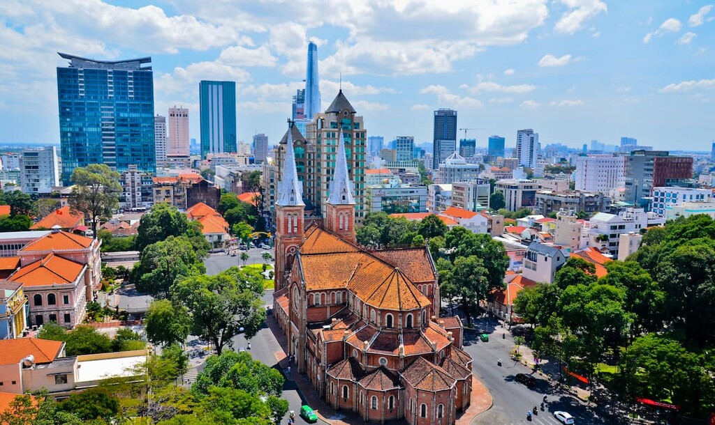
Vietnam’s largest city, Ho Chi Minh City (Thành phố Hồ Chí Minh) is a community of around 9 million people located in the southeastern part of the country. Formerly known as Saigon (Sài Gòn), Ho Chi Minh City is the cultural and economic capital of the country.
Ho Chi Minh City has long played an important role in the region. It rapidly urbanized during French colonization and it has since become an international tourist destination. The city retains many of the old colonial architecture from the period of French colonization and it also contains some important cultural sites and museums.
Furthermore, Ho Chi Minh City is home to the country’s largest international airport (Tân Sơn Nhất International Airport), though it is scheduled to be replaced by a new facility (Long Thành International Airport) by 2025.
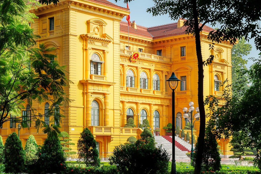
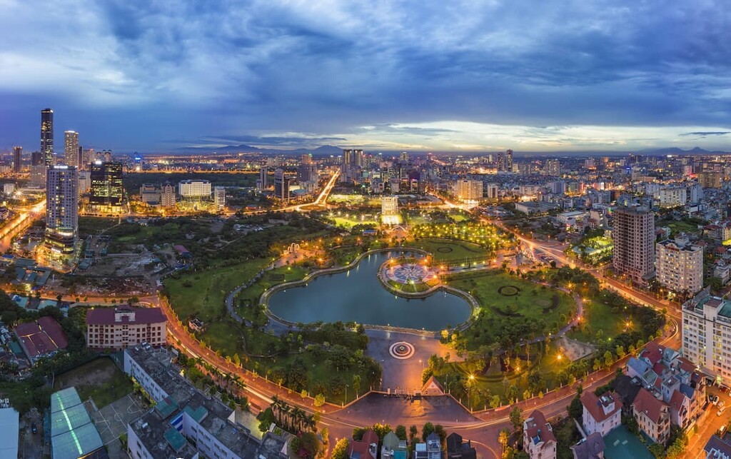
The capital of Vietnam, Hanoi (Hà Nội) is a city of some 8 million people located in the northern part of the country along the Red River Delta. It is the second-largest city in Vietnam after Ho Chi Minh City and it is the economic and cultural center of the northern part of the country.
Hanoi has long played an important role in the history of Southeastern Asia. The region has been continuously inhabited for nearly two thousands years, having served as the political center of multiple Vientamese dynasties and, later, that of French Indochina.
These days, Hanoi is an important hub for commerce, culture, and education in the country. It contains a number of important educational institutions, as well as a UNESCO World Heritage Site.
Located in the northern part of the country, Hai Phong (Thành phố Hải Phòng) is the third-largest city in Vietnam. With a population of about 2 million people, it is commonly referred to as the country’s technological hub.
Hai Phong was originally established as a port city by the French during the period of French colonial rule. During that time, it quickly became the most important city for maritime commerce in the northern part of the country.
During the twenty-first century, Hai Phong has become a particularly important center for technological advancement within the country, though it is also a major hub for manufacturing and trade.
Central Vietnam’s largest city, Da Nang (Thành phố Đà Nẵng) is a vital port city. Home to approximately 1.2 million people who live at the mouth of the Hàn River (Sông Hàn), Da Nang is one of the most urbanized areas in the country.
Da Nang is Vietnam’s leading industrial center, particularly when it comes to the production of textiles, handicrafts, footwear, and agricultural products, like rice and coffee. It is also rapidly becoming an important tourist center due to its proximity to a number of UNESCO World Heritage Sites.
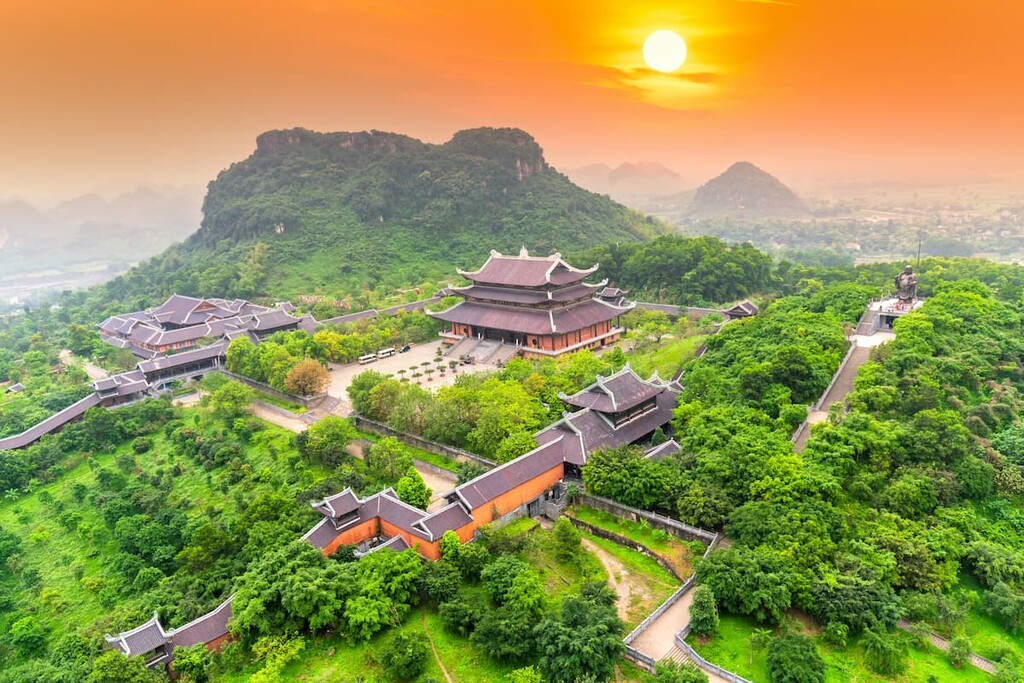
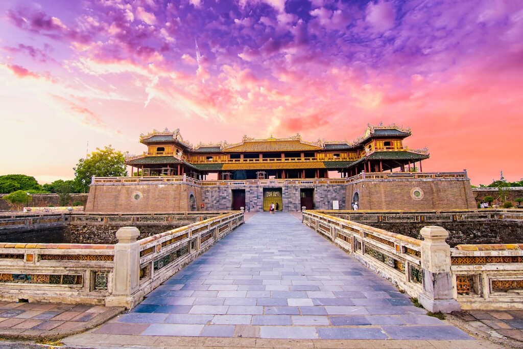
In particular, Da Nang is located close to the Imperial City of Huế (Hoàng thành Huế), which was the former imperial capital of the country. There are also some stunning rocky limestone cliffs just outside of the city that extend upward from the beautiful beach below, making Da Nang a great place for outdoor enthusiasts and history buffs, alike.


Yes. Vietnam has 4,563 named mountains. The highest is Phan Xi Păng at 3,143 m.
The highest mountain in Vietnam is Phan Xi Păng, at 3,143 m.
Vietnam has 4,563 named mountains.


