Scan the QR code and open PeakVisor on your phone
Egypt (مصر), or the Arab Republic of Egypt, is a country in the northeastern corner of Africa, covering a total area of 1,001,450 sq km (386,662 sq mi). Egypt is a transcontinental nation, with the Sinai Peninsula bridging the gap between Africa and southwestern Asia. It’s the 30th largest country globally and the 13th largest in Africa.
Egypt borders the Gaza Strip and Israel to the east, Sudan to the south, and Libya to the west. Egypt features approximately 1,000 km (620 miles) of Mediterranean coastline to the north and about 1,900 km (1,200 mi) of Red Sea coastline to the east.
The Nile Valley and Delta are Egypt’s most important geographical features. They form the largest oasis on Earth along the longest river in Africa, the Nile. The Nile stretches 1,496 km (930 mi) from Sudan through northeast Egypt and is one of the few major rivers in the world which flows from south to north.

The fertility of the delta and valley compared to the rest of Egypt's arid landscape sustains its high population. Approximately 98 percent of Egypt's population lives on 3.3 percent of the country's total landmass along the Nile River. Almost all of Egypt's major cities and settlements occupy the Nile Valley and Nile Delta, including the capital Cairo (القاهرة), Alexandria (الإسكندرية), and Giza (الجيزة).
The Nile’s Aswan High Dam created Lake Nasser (بحيرة ناصر), one of the world's largest artificial lakes with a surface area of 5,250 square km (2,030 square mi).
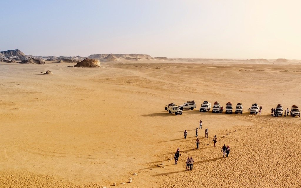
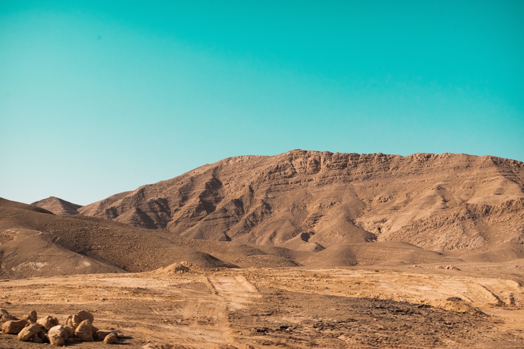
The Western Desert encompasses roughly two-thirds of Egypt, with an area of over 700,000 sq km (270,271 sq mi). Stretching from the Mediterranean Sea to the Sudanese border, the Western Desert comprises four parts: the Giza Plateau, the Great Sand Sea, the Black Desert, and the White Desert.
The Western Desert is home to depressions and plateaus. The Gilf Kebir (جلف كبير) is a sandstone plateau encompassing an area of 7,770 sq km (3,000 sq mi) with a mean elevation of 1,000 m (3,280 ft).
Another significant feature of the Western Desert is the Qattara Depression (منخفض القطارة), home to Africa's second-lowest point, at 133 m (436 ft) below sea level. The Qattara Depression encompasses an area of 19,605 sq km (7,570 sq mi), mainly consisting of dry lake beds, badlands, and salt marshes.
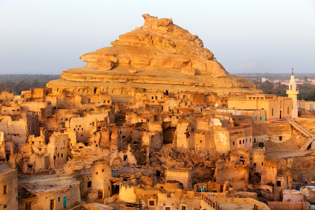
Aside from Quattara, the Western Desert features six depressions considered oases. These oases contain the largest settlements in western Egypt, including El-Bawiti (الباويطي) in the Bahariya Oasis (الواحات البحرية) and the Siwa Oasis ( واحة سيوة).
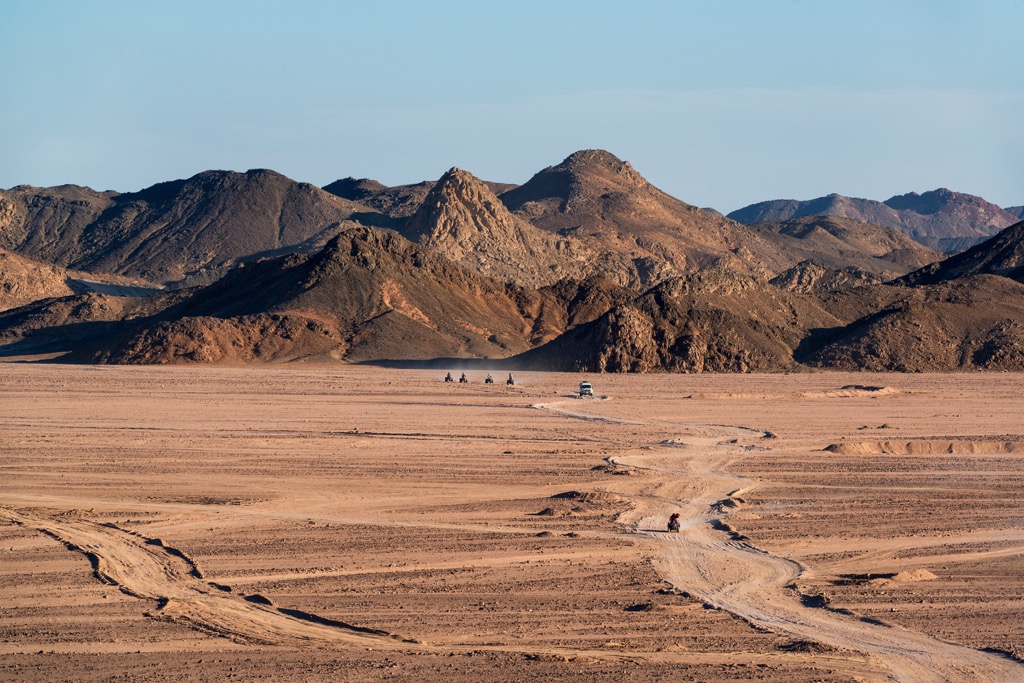
The Eastern Desert is the smaller of Egypt's two desert regions. Located east of the Nile, the Eastern Desert covers an area of around 223,000 sq km (86,000 sq mi). The Eastern Desert forms part of the Sahara Desert, the largest hot desert in the world.
The Eastern Desert is surprisingly mountainous. A portion of the Itbāy (اطبيه) region of Egypt and Sudan, the Eastern Desert contains the Red Sea Hills, which separate the desert landscape from the Red Sea. The mountains of the Eastern Desert run for a maximum length of 137 km (80 mi), with many summits over 1,500 m (4,921 ft) in elevation. Gabal Sha'ib El Banat (2,187 m/7,175 ft) is the highest mountain in the Eastern Desert.
Most of the Eastern Desert's settlements sit on the Red Sea's coastline. Major settlements include Suez (السويس) and Hurghada (الغردقة).
The Sinai Peninsula is the portion of Egypt on the Asian continent. It is a land bridge between Africa and Asia and covers around 60,000 sq km (23,000 sq mi).
The triangular plateau is encircled by the Red Sea to the south, with the Gulf of Aqaba to the west and the Gulf of Suez to the east.
The southern half of the Sinai Peninsula is mountainous due to an extension of the Red Sea Hills from the west. The Sinai Peninsula is home to many of Egypt's tallest and most celebrated mountains, like Mount Catherine and Mount Sinai (2,285 m/7,497 ft).
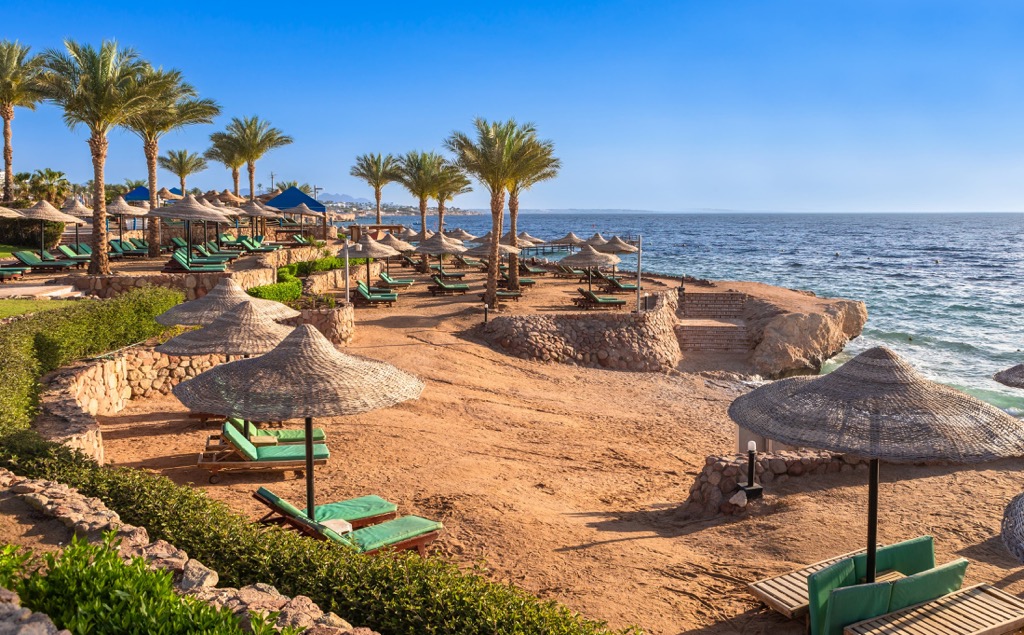
The Sinai Peninsula is a popular tourist destination with famous resort towns like Sharm El Sheikh (شرم الشيخ) and Dahab (دهب).
Egypt can be split geologically into three layers. The oldest rocks across Egypt are igneous and metamorphic and are outliers in the Western Desert.
The majority of modern Egypt is covered in a layer of limestone. Beneath this limestone is a layer of sandstone. This older sandstone is the surface rock in Nubia and upper southern Egypt, spreading as far north as Luxor and Edfu.
Most rock in Egypt formed during the Proterozoic and Archaean eras between 4,000 and 1,600 million years ago. Parts of Egypt took shape during the Pan-African Orogeny during the Neoproterozoic, a series of mountain-building events around 600 million years ago.
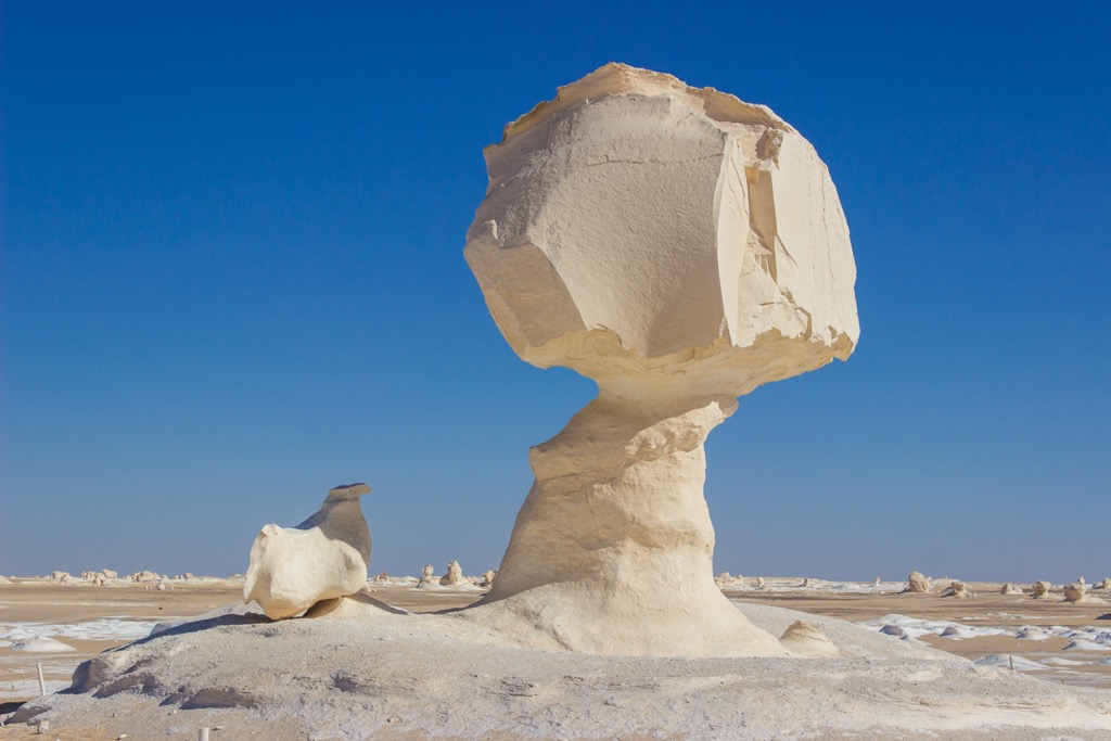
Several areas of Egypt developed their unique geological composition much later than the Pan-African Orogeny. The White Desert, one of Egypt's most striking natural landscapes, consists of 66-million-year-old chalk and limestone from the Cretaceous period when the region lay underneath a shallow, ancient sea.
Today, Egypt is a relatively flat country composed mostly of desert, with most highland areas in the Red Sea Hills and the Sinai Peninsula.
However, several summits in eastern Egypt still exceed 2,500 m (8,202 ft), including Jabal Abū Rūmayl (2,623 m/8,606 ft), Jabal Umm Shūmar (2,588 m/8,491 ft), and Jabal al Khalā (2,549 m/8,363 ft).
Egypt's flora and fauna are varied due to the variance between the fertile Nile Delta, lush oases, and arid deserts.
At one time, Egypt was home to many mammal species. But, as the climate warmed, mammalian biodiversity reduced; hippos, giraffes, and ostriches are now extinct in Egypt. Today, notable mammals include camels, rhim gazelles, aoudads, wild donkeys, and Egyptian mongooses.
The highlands of the Sinai Peninsula are home to Nubian Ibex, striped hyenas, aardwolves, and striped polecats. Some of these animals inhabit the Gebel Elba Mountains in Egypt's southeastern corner. Egypt has a few endemic mammals, such as the Egyptian weasel, pallid gerbil, and Flower's shrew.
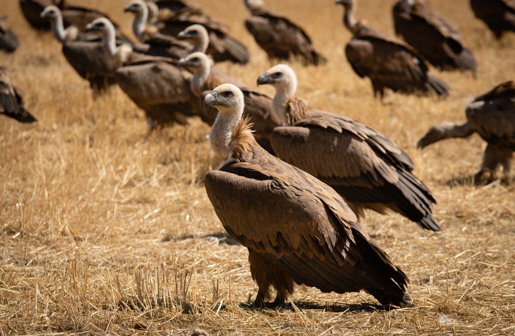
Around 480 bird species have been documented in Egypt, mostly in and around the Nile Valley and Delta. Egypt is also a major migratory route between Eurasia and East Africa. Common birds include vultures, eagles, hawks, flamingoes, storks, sunbirds, and quail.
Several globally endangered bird species have been observed, including Egyptian vultures, red-breasted geese, saker falcons, slender-billed curlews, and Balearic shearwaters. The steppe eagle is the national bird of Egypt.
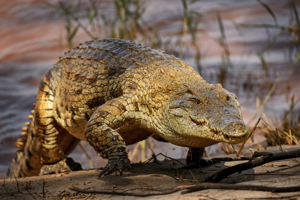
There are thirty documented snake species in Egypt. The 15 venomous species include Egyptian cobras, horned vipers, and false smooth snakes. Nile crocodiles rank as one of Egypt's most dangerous animals.
Insects are abundant in Egypt, with more than 10,000 species, including scarab beetles, Sinai baton blue butterflies, locusts, and click beetles.
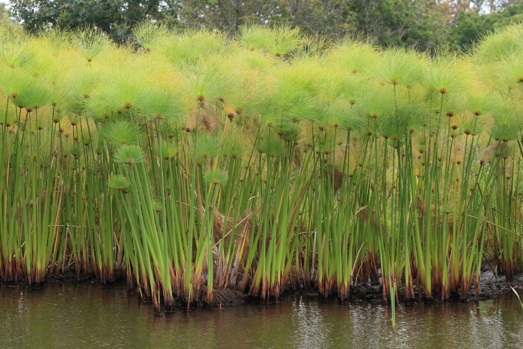
The Nile Delta is Egypt's most fertile region, home to most of its plant life and agriculture. In contrast, the Western Desert lacks almost any plant life. There are over 2,400 plant species in Egypt, including 100 types of grass, such as bamboo, esparto, papyrus reeds, and Spanish reeds.
Common crops grown in the Nile Delta include beans, peanuts, sugarcane, and cereal. Date palms are one of Egypt's most widespread and cultivated plants in the Nile Delta and across oases. Doum palms are ubiquitous across oases and the southern Nile Valley in northern Egypt.
There are few native trees in Egypt, with Phoenician juniper the only native conifer. Several Casuarina genera imported during the nineteenth century were Egypt's most crucial timber source.
The lotus is the national flower of Egypt. Common flowers growing in Egypt include birds of paradise, chrysanthemums, cornflowers, jasmine, irises, and delphiniums.
Ancient Egypt was one of humanity’s first literate urban civilizations. Along with nearby Mesopotamia, it was one of the most important ancient civilizations in the Middle East.
Ancient Egypt’s history and culture were largely a mystery until the discovery of the Rosetta Stone in 1799, which helped scholars decipher hieroglyphics.
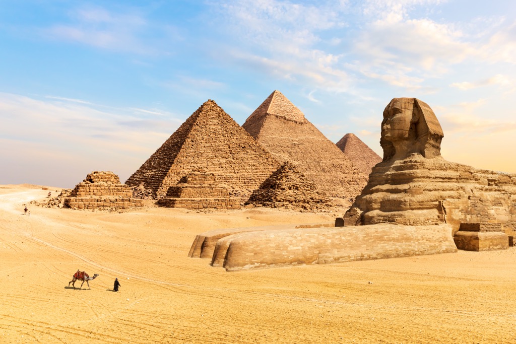
Ancient Egypt became a single empire around 3,150 BCE when Upper and Lower Egypt united under Narmer, King of the First Dynasty. Many of Egypt's enduring ancient historic sites were built by the Old Kingdom during the Third and Fourth Dynasties between 2700 and 2200 BCE, including the Pyramid of Djoser and the Four Giza Pyramids.
Pharaonic Egypt lasted around 3,000 years until the Achaemenid Empire conquered it in the sixth century BCE. By 330 BCE, Alexander the Great had conquered the Achaemenid Empire, and Egypt became part of the Macedonian Empire.
The Macedonian Empire lasted less than 30 years, with the Ptolemaic Kingdom, led by one of Alexander the Great's generals, Ptolemy I Soter, seizing control. Constant foreign and domestic wars caused the Ptolemaic Kingdom's collapse, resulting in Egypt's annexation by the Roman Empire.
Cleopatra's death in 30 BCE ended independence, with Egypt becoming a province of the Roman Empire. Egypt remained a part of the Roman Empire and the subsequent Byzantine Empire for nearly 700 years until the Arab conquest of Egypt in 641 CE.
Following the Arab conquest, different caliphates and the Mamluk sultans split Egypt into provinces. Egypt remained divided until the Ottoman Empire absorbed it after conquering Cairo in 1517 CE under Ottoman sultan Selim I. The whole of Egypt remained part of the Ottoman Empire until 1805.
France briefly occupied Egypt between 1798 and 1801 under Napoleon I, marking the first time a European power controlled the country. Ottoman, British, and Mamluk forces expelled the French, starting a power struggle between the Ottomans and Mamluks due to Egypt's advantageous position for trading at the crossroads of Asia, Europe, and Africa. In 1867, Egypt became the Khedivate of Egypt, a tributary state of the Ottoman Empire.
Egypt's trade importance grew even more significant following the opening of the Suez Canal in 1867, which connected the Red Sea and the Mediterranean Sea. The Canal eliminated the need for ships to sail around Africa to facilitate trade between Europe and Asia. Following the Anglo-Egyptian War in 1882, Egypt became a part of the British Empire.
The Egyptian Revolution of 1919, following the First World War, led to the establishment of the Kingdom of Egypt, with the British recognizing the state in 1922. However, Britain retained a high degree of control and refused to withdraw troops from the Suez Canal Zone until the 1952 Egyptian Revolution and the Suez Crisis.
The Republic of Egypt was established in 1953. Under President Gamal Abdel Nasser, Egypt was briefly in political union with Syria as the United Arab Republic between 1958 and 1961. Following the Six-Day War, Israel occupied the Sinai Peninsula between 1967 and 1973 until the Fourth Arab-Israeli War and the Egypt–Israel peace treaty.
From 1981 to 2011, Hosni Mubarak presided over Egypt until the 2011 Egyptian Revolution, which ended in the election of Mohamed Morsi. Morsi's reign was short-lived, with a 2013 military coup d'état ending his presidency. Abdel Fattah al-Sisi was elected president in 2014.
Present-day Egypt is increasingly urbanized, with over 99 percent of the population occupying 5.5 percent of the country. Manufacturing and trade have overtaken agriculture as the country's primary industries. Tourism was once of substantial economic importance but has been impacted by political and civil unrest.
Egypt is a diverse and fascinating hiking destination home to sacred mountains, beautiful coastlines, and seemingly endless deserts.
Due to the unforgiving, arid nature of Egypt's landscape, hikers should come well prepared. Bring plenty of food and water, appropriate clothing, and hiking boots. Almost all hiking areas in Egypt require a guide by law, so make arrangements before traveling.
You should take extra care when visiting certain regions of Egypt. For example, the Sinai Peninsula is currently on the U.S. government's "Do Not Travel" list due to the risk of terrorist activity. Check with your government whether they advise traveling to certain areas of Egypt.
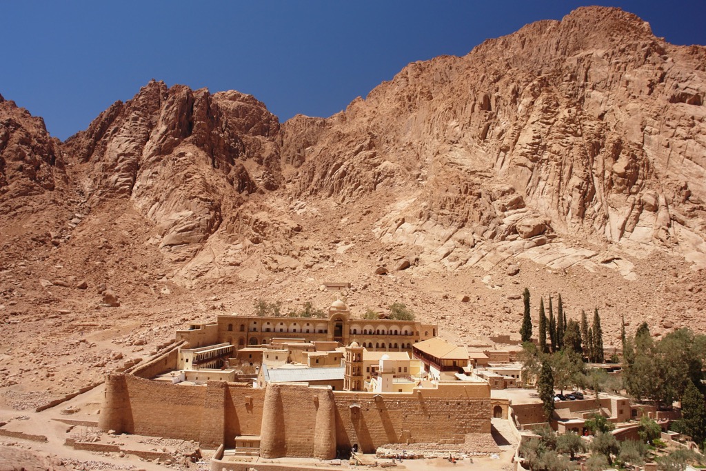
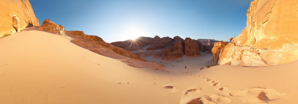
The St. Katherine Protectorate, also known as St. Katherine National Park, is a national park in the southern Sinai Peninsula. The park encompasses over 5,750 sq km (2,220 sq mi) in south central Sinai's most mountainous area, which includes Egypt's highest mountain, Mount Catherine, and Mount Sinai.
The St. Katherine Protectorate is Egypt's central hiking hub. Mount Sinai, known locally as Jabal Musa, is renowned for its religious significance. Many believe it to be the biblical Mount Sinai, where Moses received the Ten Commandments.
Mount Sinai is a popular spot to watch the sunrise and is encircled by higher summits, including Mount Catherine to the southwest. Note that a guide is required by law when climbing Mount Sinai.
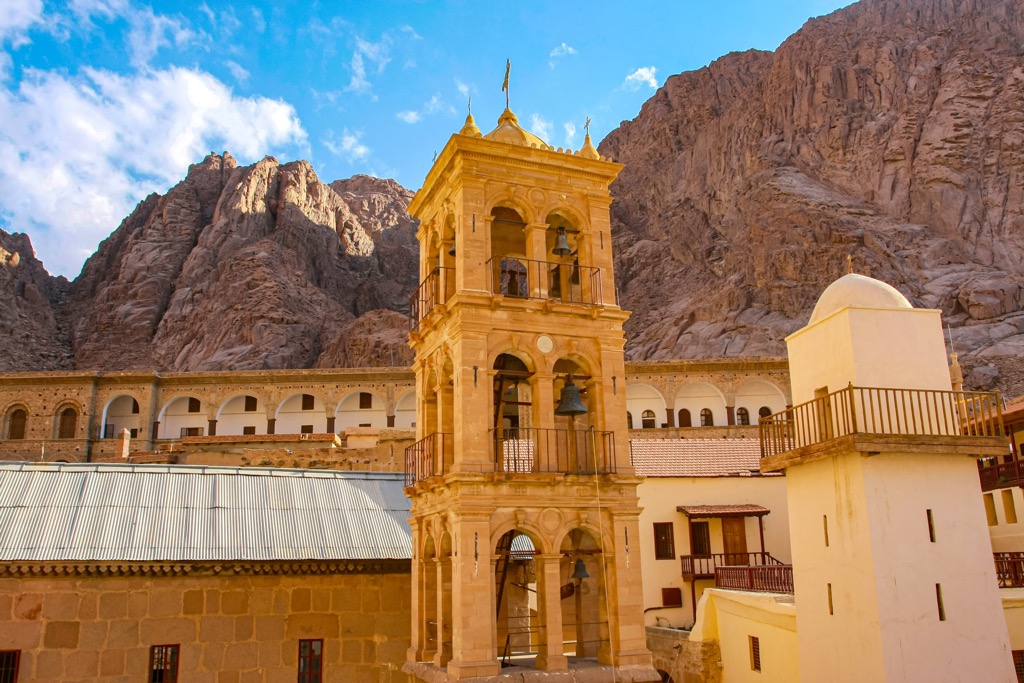
You can hire a guide in nearby Sharm el-Sheikh or Dahab. Tours always include the St. Catherine Monastery, the world’s longest continuous Christian monastery, built between 548 and 565 CE.
Mount Sinai is an easy and rewarding hike. The two routes are the Camel Path and the Steps of Repentance. Tourists usually take the more accessible Camel Path. The hike starts at the St. Catherine Monastery, with several tents near the summit offering refreshments. The final push to the summit follows 750 steps carved into the mountain. The route is 11.5 km (7.1 mi) round-trip.
Mount Catherine is often overlooked in favor of Mount Sinai. It's a more challenging hike than Mount Sinai but worth visiting to scale Egypt's highest summit. A local guide is required by law to climb Mount Catherine.
The most popular route up Mount Catherine is via the Wadi Matar, with the town of St Catherine serving as the starting point. The route is longer than the direct ascent via Shag Musa but offers better views and insights into Bedouin culture. The walk takes around 7 hours, depending on the exact route taken.
Other prominent mountains in the St. Katherine Protectorate include Gebel Serbal (2,073 m/6,801 ft), Jabal Abū Rūmayl (2,623 m/8,606 ft), and Jabal Umm Shūmar (2 588m/8 491ft).
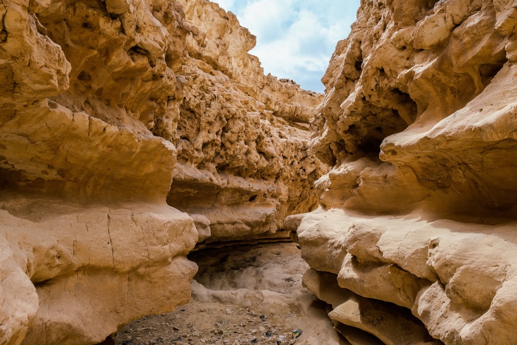
The Wadi Degla Protectorate is the perfect place to escape bustling Cairo. Located on the edge of Cairo's Maadi suburb, the Wadi Degla Protectorate contains 60 sq km (23 sq mi) of winding canyons and sublime limestone cliffs.
The park features several well-groomed trails and picnic areas, making it a popular spot for biking, hiking, and camping. One of the most exciting trails in the Wadi Degla Protectorate is the Wadi Degla Loop, which leads up onto the clifftops for spectacular views of the canyon below. This trail is approximately 13 km (8 mi) in length.
You can extend your walk by adding the Wadi Degla Deep Loop to your itinerary. The trail takes you further into the Wadi Degla Protectorate, with an easy ramble across the valley floor. The trail is approximately 4 km (2.5 mi) in length.
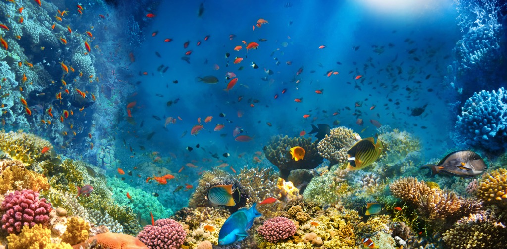
Wadi El Gemal National Park is a 4,770 sq km (1,840 sq mi) protected area on Egypt's Red Sea coastline. It's a popular area for snorkeling and scuba-diving, with 450 coral reefs to explore. The park features several islands, including Wadi El Gemal, the park's namesake. You'll need a tour guide to visit Wadi El Gemal National Park.
As well as a wealth of marine diversity, Wadi El Gemal National Park is home to part of the Red Sea Hills that separate the Eastern Desert from the Red Sea. The highest mountain in Wadi El Gemal National Park is Jebel Wadi Lehama (1,977 m/6,486 ft).
Also known as Hamata Mountain, Jebel Wadi Lehama is the second-highest summit in the Red Sea Hills. One of the park's most popular trails is the Hamata Trail, which leads to the foot of Jebel Wadi Lehama. The walk starts from Marsa Allam and continues through the Talhk quarries. The trail is approximately 12 km (7.5 mi) in length.
The Ras Abu Galum Protectorate encompasses 400 sq km (154 sq mi) of the Red Sea coastline from Dahab to Nuweiba. Like Wadi El Gemal National Park, it's a popular snorkeling area but also contains beautiful valleys and a section of the Red Sea Hills. The park's highest summit is Gebel al Risasa (999 m/3,278 ft)
Ras Abu Galum Protectorate features one of the best coastal hikes in Egypt, from Dahab to the Blue Hole. This submarine sinkhole is on the Red Sea’s coastline and is among Egypt's most popular freediving locations.
There's no marked trail to the Blue Hole, but you'll just need to follow the shoreline from Dahab north to reach it. The walk from Dahab to the Blue Hole is approximately 5 mi (8 km).
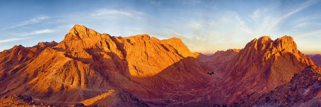
The Red Sea Mountain Trail is the sister trail of the Sinai Trail and is one of Egypt's best long-distance treks.
The entire route is 170 km (105 mi) and takes 14 days. However, six separate hiking hubs contain dozens of excellent day hikes. These hiking circuits add another 600 km (372 mi) of trails to the Red Sea Mountain vicinity. The local Maaza Bedouin tribes are mandatory Red Sea Mountain Trail guides.
The Red Sea Mountain Trail centers around the Red Sea Hills, roughly 50 km (31 mi) west of Hurghada. The region includes Gabal Sha'ib El Banat (Jabal Shayib) (2,186 m/7,175 ft), the highest mountain in Egypt outside the Sinai Peninsula.
One Red Sea Mountain Trail circuit leads to Gabal Sha'ib El Banat's summit. Gabal Sha'ib El Banat is a challenging hike due to steep elevation gain and areas that require scrambling. It can be climbed from all aspects, but its classic route is from Wadi Abu Abid to the south.
Gabal Sha'ib El Banat's summit provides one of Egypt's finest panoramas. The Sinai Peninsula is visible across the Red Sea to the east, and Jebel Um Anab (5,466 ft), with its three pyramidal peaks, is directly to the south. This walk is a 12-hour round trip and can be completed in a long day.
One of the world's oldest and most celebrated ancient civilizations, Egypt has many historic and culturally significant cities to discover.
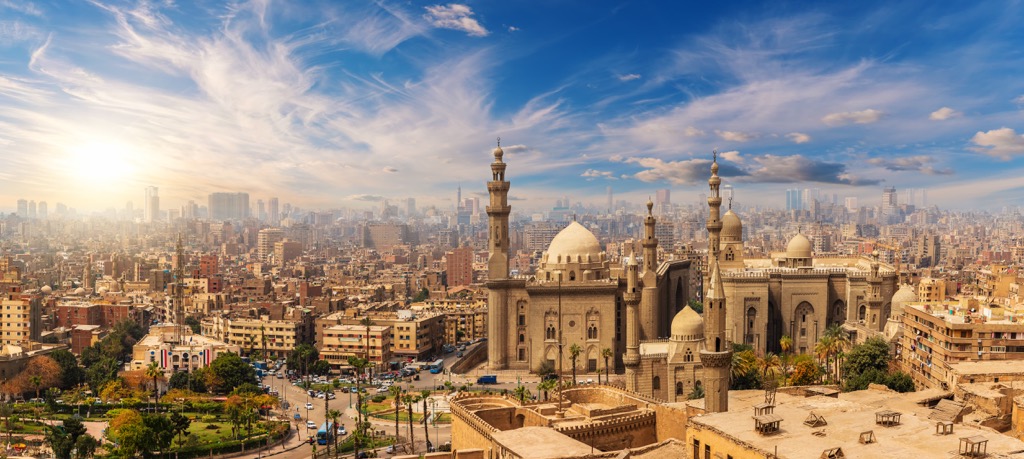
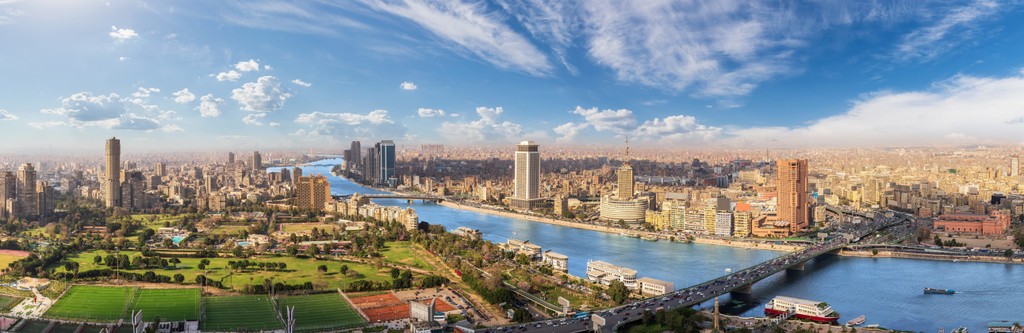
Cairo is Egypt's capital and largest city, with a population of over 10 million people. It’s over 1,400 years old, founded as Fustat in 641 CE. Today it's one of the world's unique capital cities, with its globally-famous ancient Egyptian landmarks, lavish mosques, and blend of Middle Eastern and African cultures.
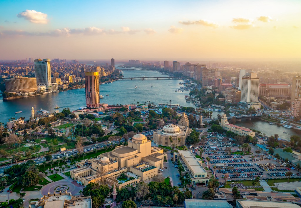
One trip to Cairo is complete without visiting the 4,500-year-old The Great Pyramid of Giza, one of the Seven Wonders of the Ancient World. There's no shortage of ancient attractions in Cairo, from the City of the Dead to the Great Sphinx. Other interests include the Egyptian Museum of Egypt, Khan el-Khalili Bazaar, and the Citadel of Cairo.
Cairo is Egypt's best-connected city, making it an ideal base for planning excursions further afield. If you're planning a quick hiking excursion, the Wadi Degla Protectorate is just 19 km (12 mi) southwest of downtown Cairo. Egypt's busiest airport, Cairo International Airport, is 20 km (12.5 mi) northeast of downtown Cairo.
Egypt's second city, Alexandria, was founded in 331 BCE by Alexander the Great. The largest city on the Mediterranean Coast, Alexandria is a must-visit destination for history buffs, with sites like the new Library of Alexandria, the Catacombs of Kom el Shoqafa, and the Citadel of Qaitbay.
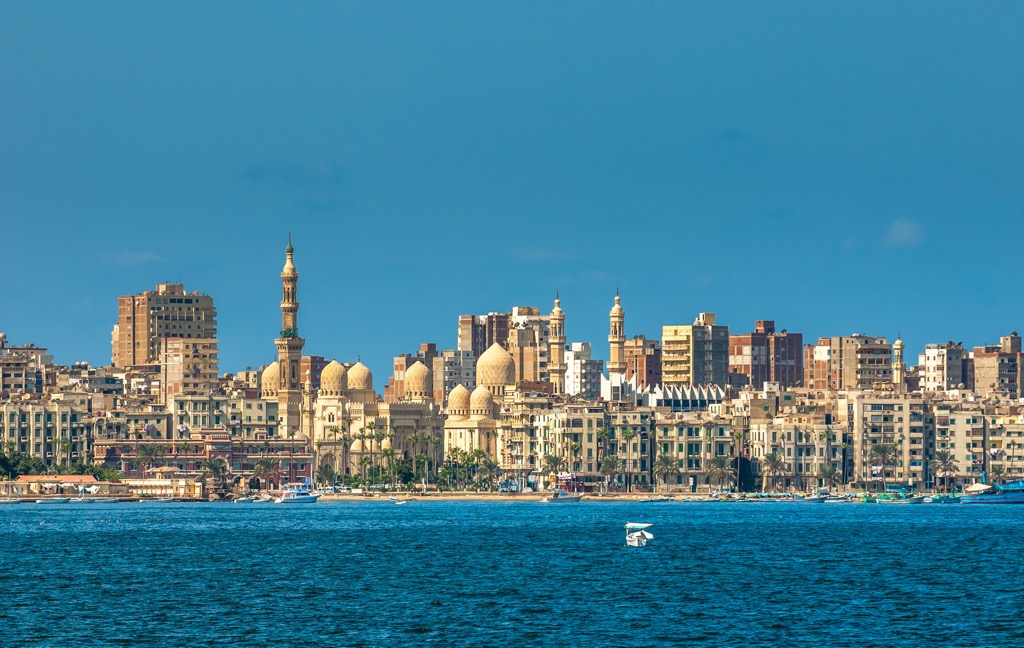
Alexandria is a quieter destination than Cairo if you want to avoid crowds of tourists. Plus, the city's beautiful port helps provide a romantic setting for your Egyptian adventure. During your stay, take advantage of Alexandria's exquisite cuisine, which includes fresh seafood and Mediterranean-inspired dishes.
Borg El Arab International Airport is less than 50 km (31 mi) from downtown Alexandria.
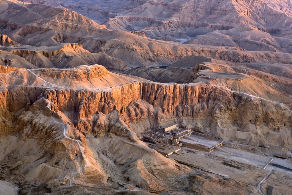
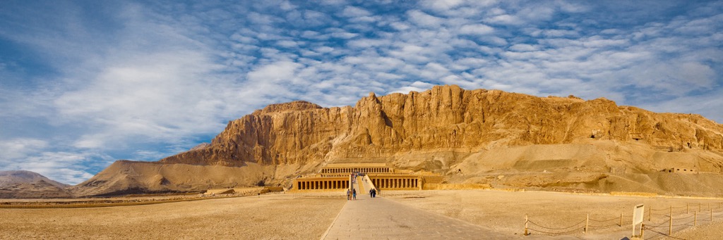
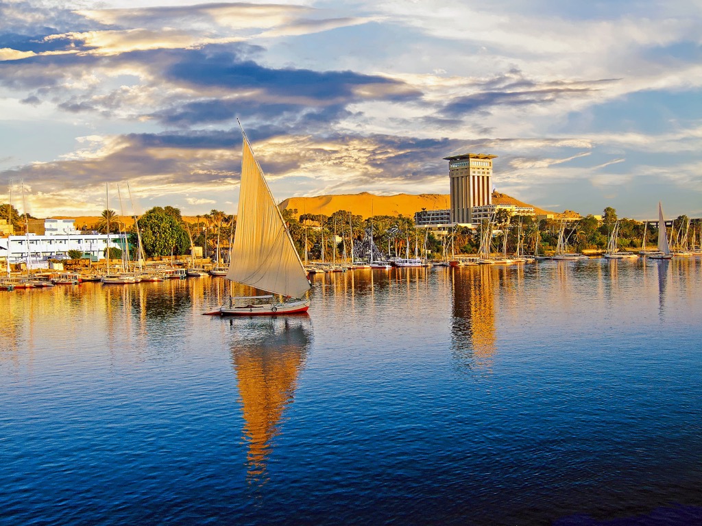
Luxor rests on the eastern banks of the Nile in Upper Egypt, approximately 660 km (410 mi) south of Cairo. Founded as Thebes in 2150 BCE, Luxor is one of the world's oldest continuously inhabited cities.
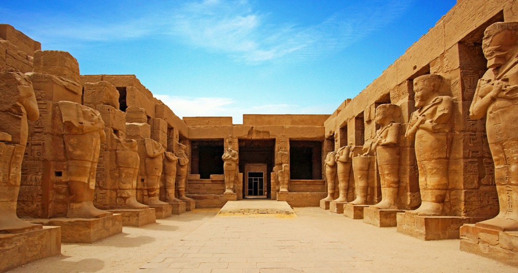
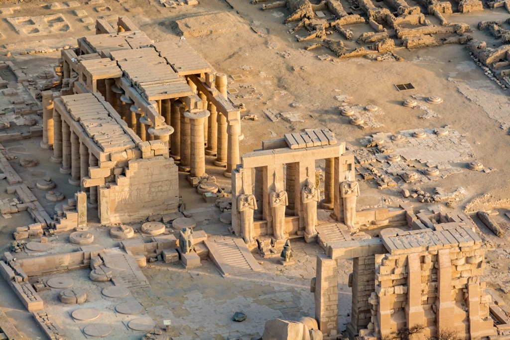
Luxor is nicknamed the 'world's greatest open-air museum' due to the city’s numerous ancient Egyptian ruins, including the temples of Karnak and Luxor. You'll find a wealth of historical sites in Luxor, from the Colossi of Memnon to the Valley of the Kings.
Luxor's position in southern Egypt means it's an excellent base if you're planning excursions to the Red Sea Hills. Egypt's third-largest airport, Luxor International Airport, is located 6 km (3.5 mi) east of the city.
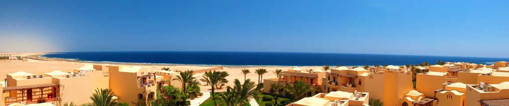
Hurghada is one of Egypt's most popular tourist destinations on the Red Sea's coastline. Pristine beaches, unmatched watersport opportunities, and nearby hiking destinations make it a top destination for lovers of the great outdoors.
Hurghada is an excellent city for all ages, with family-friendly attractions like Mini Egypt Park, Sindbad Aqua Park, and Hurghada Grand Aquarium.
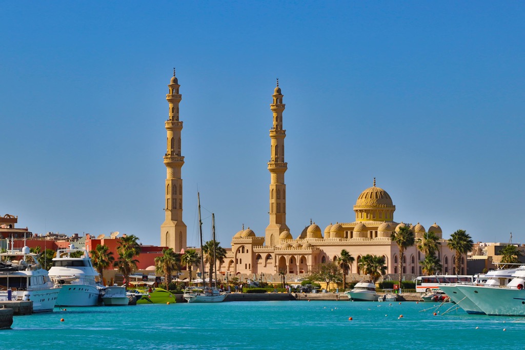
Hurghada is the best place to stay if you're planning to hike the Red Sea Mountain Trail, just 50 km (31 mi) west of the city. Egypt's second-busiest airport, Hurghada International Airport, is 12 km (7.5 km) south of the city center.
Sharm El Sheikh is one of the busiest tourist destinations in the Sinai Peninsula. Perched on Sinai's southern tip, Sharm El Sheikh attracts tourists from across the globe due to its endless sunshine, beautiful beaches, and spectacular coral reefs.
The many luxury beachside accommodation options make Sharm ideal for a restful getaway. Sharm el Sheikh and Dahab are the best places to stay if you visit the St. Katherine Protectorate, a 200 km (124 mi) drive from Sharm el Sheikh.
Egypt's third busiest airport, Sharm El Sheikh International Airport, is less than 5 km (3 mi) from the city center.