
Scan the QR code and open PeakVisor on your phone
Libya is home to 2,013 named mountains. The highest is Bikku Bitti at 2,267 m.
Libya is a country in North Africa’s Maghreb, along the shores of the Mediterranean Sea. Covering 1,759,541 square kilometers (434,792,050 acres), it is the fourth largest country in Africa (after Algeria, the Democratic Republic of the Congo, and Sudan) and the 16th largest in the world. Clockwise from the east, Libya has land borders with Egypt, Sudan, Chad, Niger, Algeria, and Tunisia. Libya has 2013 named summits, of which Bikku Bitti (2,266 m/7,434 ft) is the highest. The most prominent mountain in Libya is Gebel el Uwaynat (1,934 m/6,345 ft), near the triple border between Libya, Egypt, and Sudan. Gebel el Uwaynat sports over 1,200 meters (4,200 feet) of prominence.
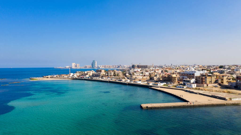
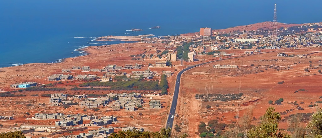
The Libyan coastline stretches 1,770 kilometers (1,100 mi) along the Mediterranean. Flat, low-lying terrain with sandy beaches and shallow bays characterize the landscape. Here the climate is typical of the Mediterranean, with hot, arid summers and mild, relatively rainy winters.
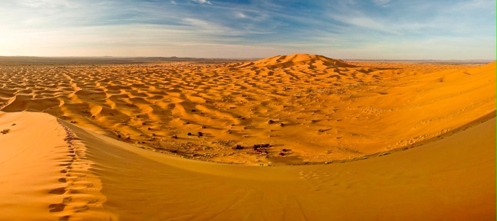
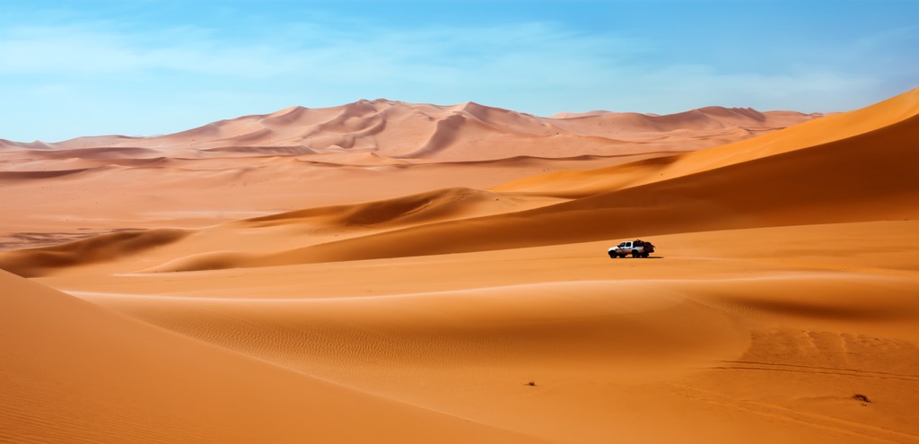
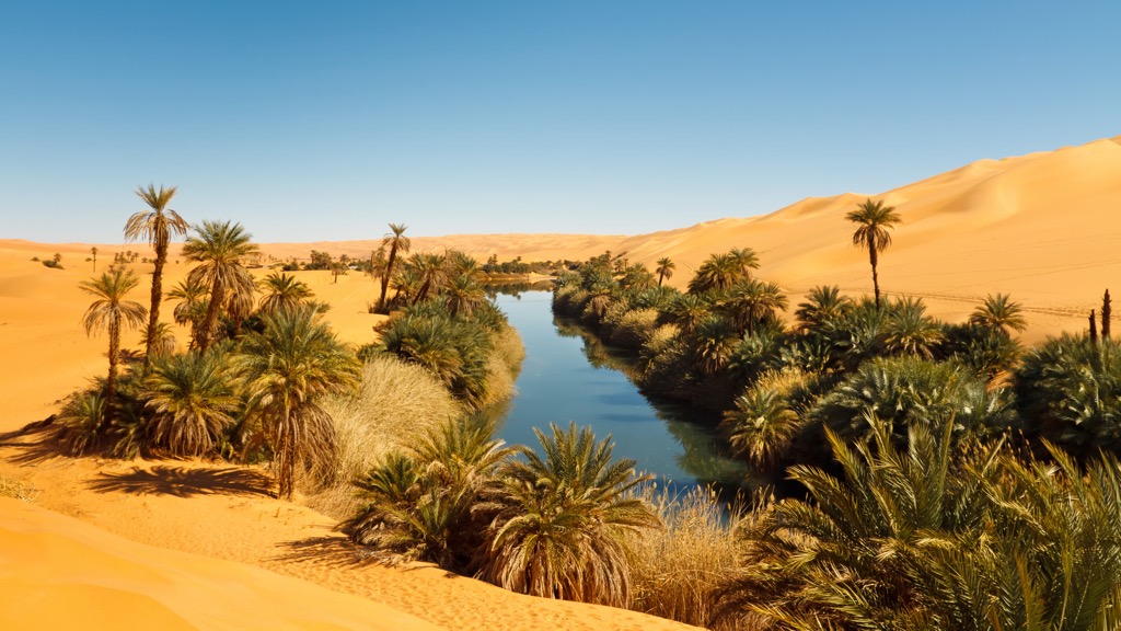
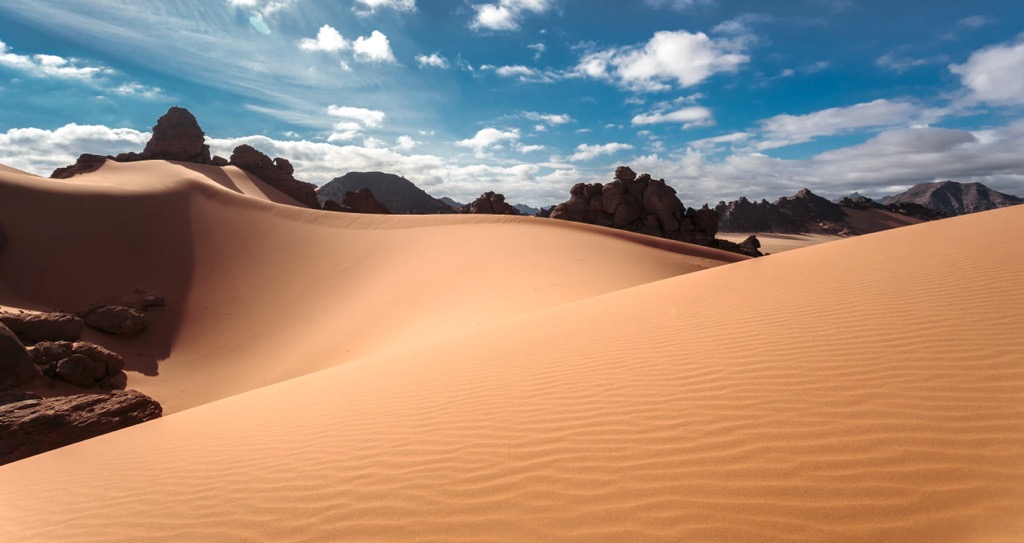
However, most of Libya's landmass consists of the Libyan Desert, an arid, barren, and inhospitable expanse spanning the eastern and southern parts of the country. This vast desert, part of the larger Sahara, is characterized by rolling dunes, stony plateaus, and gravel plains. The desert is sparsely populated and experiences extreme temperature variations, with scorching hot days and cold nights.
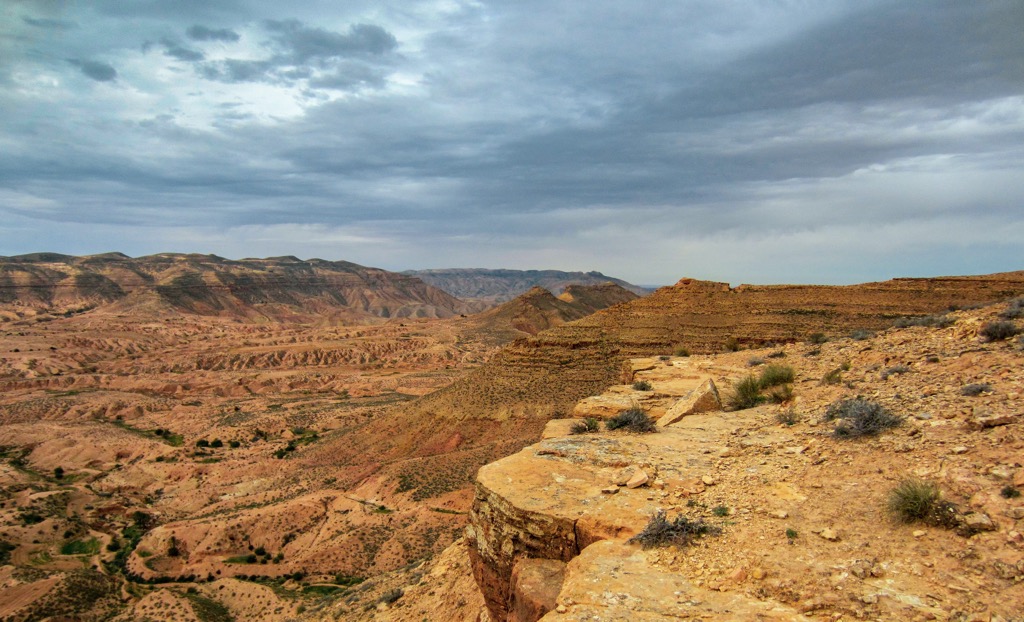
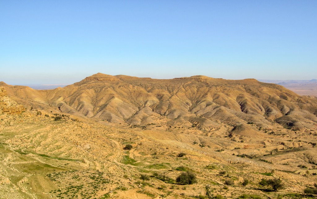
In the northwest, the coastal plains rise to meet the Jebel Akhdar mountain range. Also known as the Green Mountains, this small range is an extension of the larger Atlas Mountains, which stretches across the Maghreb from Morocco to the Libyan border. The highest and most prominent peak in the Jebel Akhdar (also known as the Jabal al Akhdar) is Ra’s at Tubayl (872 m/2,861 ft).
These mountains receive higher rainfall than the surrounding areas, resulting in a more moderate climate and fertile valleys. As a result, it’s become synonymous with agriculture, particularly olive and fruit orchards.
In Libya’s southwest, the landscape is dominated by the Tibesti mountain range, home of the nation’s highest peaks, including Bikku Bitti (2,266 m/7,434 ft), as well as the Uwaynat massif, crowned by Libya’s most prominent summit.
The Tibesti is primarily located in Chad but stretches into Libya as well. At 480 kilometers (300 mi) long and over 350 kilometers (220 mi) wide, it is the most extensive mountain range in the Sahara Desert. Steep escarpments and deep canyons formed by volcanic activity guard these rugged and remote peaks.
The climate in this region is extremely arid, with limited vegetation, so human habitation is sparse. In fact, despite its low elevation, Bikku Bitti did not even receive a documented summit until 2005 (although cairns on the summit indicated that this team was certainly not the first).
Most of Libya is underlain by sedimentary rock, primarily dating to the Mesozoic and Cenozoic eras. These formations include limestone, sandstone, shale, and conglomerates deposited in ancient seas, lakes, and river systems. Today, the coastal plains and the Libyan Desert comprise these deposits.
Northern Libya is part of the Mediterranean Maghreb Fold Belt, an extension of the Atlas Mountains. This area is characterized by folded and faulted rock layers resulting from the collision between the African and Eurasian tectonic plates. The Jebel Akhdar in the country’s northwest, in particular, exhibits prominent anticlines, synclines, and faulted structures.
Libya has significant reserves of hydrocarbons, such as oil and natural gas. In fact, Libya has the tenth-largest proven oil reserves in the world. These resources are mainly located in sedimentary basins, such as the Sirte and Murzuq. The country's oil and gas industry plays a crucial role in its economy and has driven much of Libya’s development (and arguably, upheaval) in recent decades.
Volcanic activity has also influenced Libya's geology, particularly in the southwest. The Tibesti Mountains are volcanic, and the rocks here contain valuable minerals, such as uranium. Earthquakes remain a concern in Libya today, as the nation lies in a seismically active zone with several fault lines.
Although Libya’s deserts dominate much of its landscape, it’s home to diverse flora and fauna.
In the mountainous Jebel Akhdar, a moderate climate and higher rainfall provide for a variety of vegetation. The area boasts cypress and Aleppo pine forests, along with shrubs such as juniper and oleander. Along the coast, the flora includes many halophytic plants (which can tolerate high salinity levels), such as saltworts and glassworts. In the desert, plant species include desert thorns and dates.
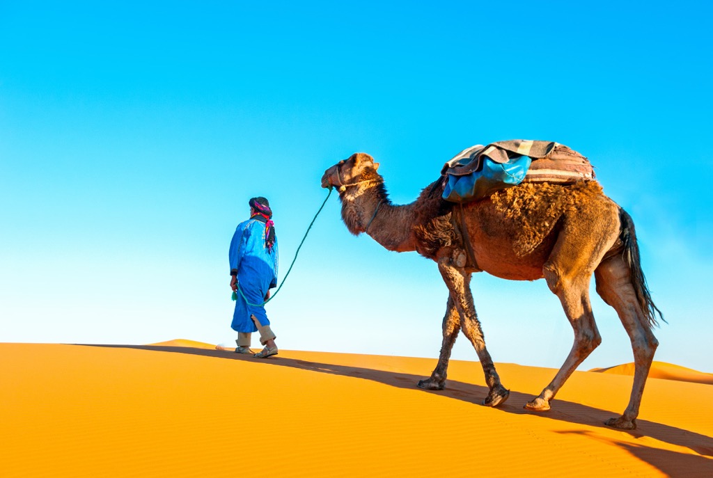
One prominent animal endemic to Libya is the dromedary camel, which is well-suited to the harsh desert conditions and an integral part of the local culture and economy. Other notable fauna include the sand fox, sand gazelle, and desert hedgehog.
Libya features exceptional avian diversity, as many migratory birds pass through the nation each year, stopping in Libya’s coastal regions and wetlands. Common birds include flamingos, herons, and various waterfowl. Along the coast, fish species include grouper, sea bream, and mullet; the waters are also home to large mammals like the Risso’s dolphin.
Like other countries in the Maghreb, Libya's human history is characterized by a complex tapestry of civilizations, migrations, and cultural exchanges. Its strategic location at the crossroads of Africa, Europe, and the Middle East has made it a historically significant (if volatile) nation throughout the centuries.
The earliest evidence of human presence in Libya dates back to the Paleolithic era, with archaeological sites featuring stone tools and cave paintings. From around 6,000 BCE, the region housed Neolithic settlements characterized by plants and animal domestication. From approximately 1,000 BCE to 600 CE, Libya was home to an elaborate (and prosperous) trading network across the Sahara, established by the Garamantes, an ancient Berber civilization.
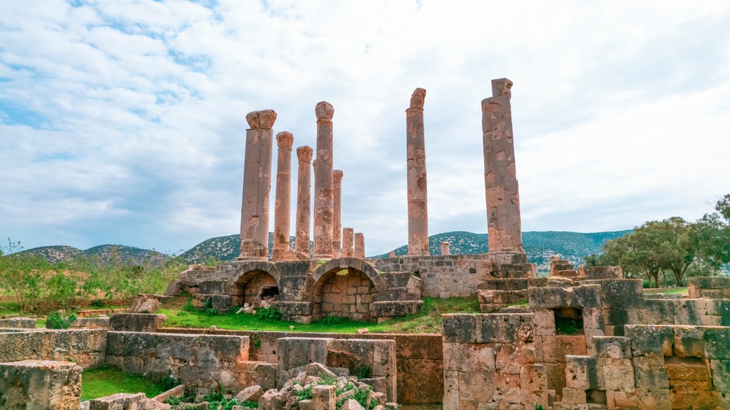
Like Tunisia and Algeria, Libya was part of the ancient Phoenician and Carthaginian spheres of influence. The Phoenicians established trading posts along the coast, contributing to the development of coastal cities such as Sabratha, Leptis Magna, and modern-day Tripoli (then called Oea). In Circa 600 BCE, the Carthaginians controlled much of Libya and most of the western Mediterranean.
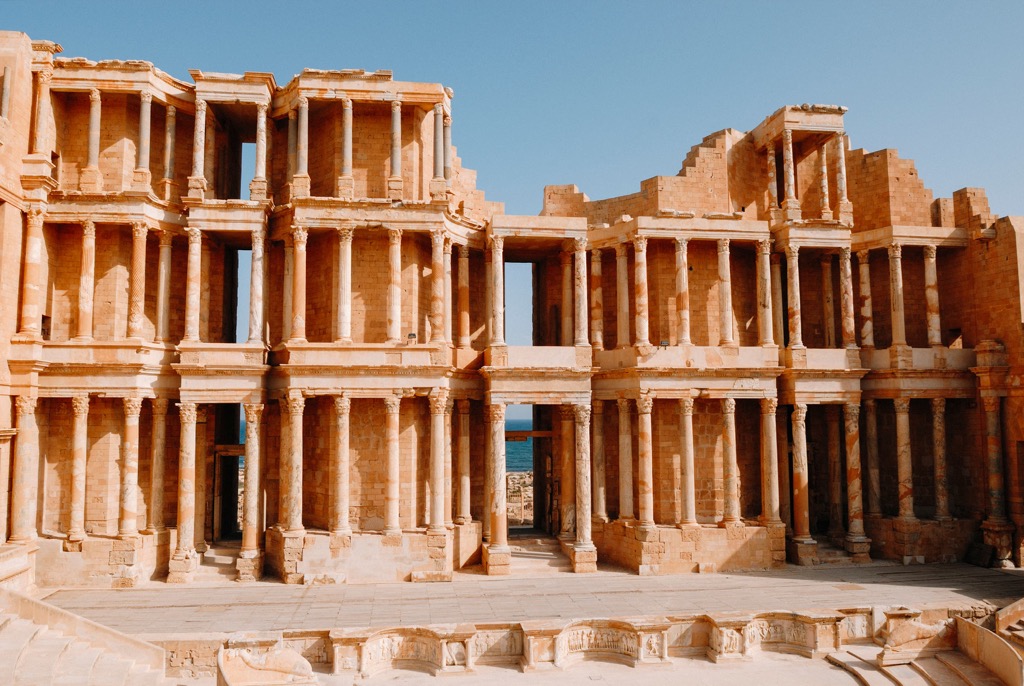
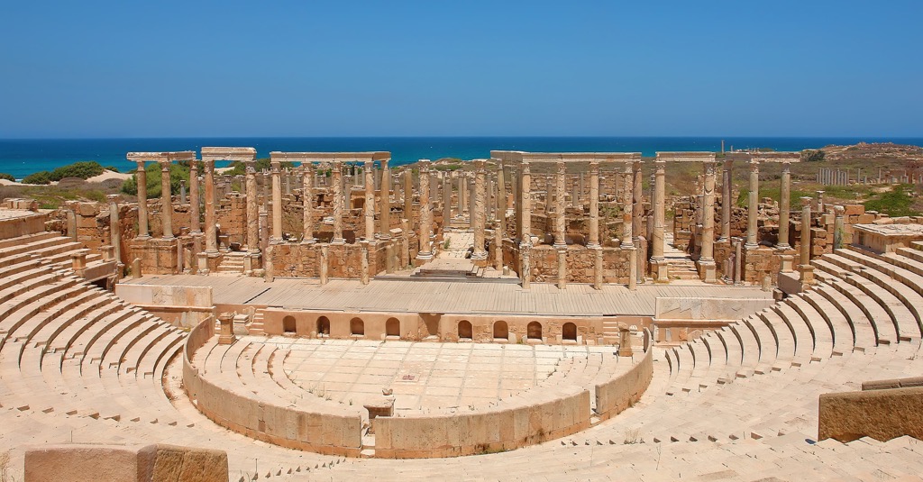
The region came under Roman rule after the Punic Wars, leading to significant urban development and prosperity. Prominent coastal cities flourished as major centers of trade and culture. Leptis Magna, in particular, became renowned for its grand architecture, including the well-preserved Roman Theater and Arch of Septimius Severus.
In the 7th century CE, Arab conquests brought Islam to the nation, marking a significant cultural and religious shift. The region swapped hands between Islamic empires, including the Umayyads, Abbasids, and Fatimids. Berber and Arab tribes settled across the country during this period, and a distinct Arab-Berber cultural blend emerged.
In recent history, Italy colonized Libya from 1911 to 1943. Italian influence is still evident in architecture and urban planning, particularly in major coastal cities like Tripoli and Benghazi. Libya gained independence in 1951 (as part of Italy’s post-war demilitarization) and experienced a period of monarchy under King Idris. However, in 1969, Muammar Gaddafi led a military coup, establishing a socialist government that lasted until 2011.
The Libyan revolution in 2011, fueled by widespread discontent, led to the overthrow of Gaddafi's regime. From this point, the country faced a tumultuous period marked by political instability and armed conflicts among various factions. In 2012, it was famously the site of an attack by Islamist militants on two U.S. government facilities in Benghazi, resulting in the murder of the U.S. ambassador to Libya and three others.
A second civil war began in Libya in 2014, lasting until the signing of a ceasefire in October 2020, but conflict continues to simmer even today. Libya is perhaps the most dangerous country in the Maghreb, and tourists should visit with caution.
As noted above, Libya is not a safe destination for Western tourists, especially when traveling in remote wilderness regions. Due to the unstable political situation and occasionally violent conflict in certain areas, staying updated on travel advisories and seeking guidance from local authorities or tour operators is crucial. If you choose to visit wilderness regions in Libya, only hike with a guide, and do extensive research beforehand.
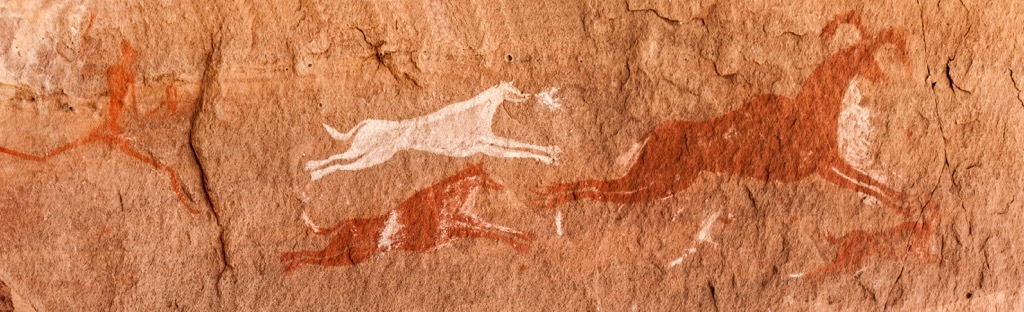
That said, the aforementioned Jebel Akhdar range in northwestern Libya is a popular destination for locals, with a more moderate climate (compared to the inhospitable desert) and lush valleys filled width olive and juniper groves. Another excellent hiking destination in the far desert southwest is the Acacus Mountains. These dramatic sandstone formations are rife with slot canyons and an extensive collection of prehistoric rock art.
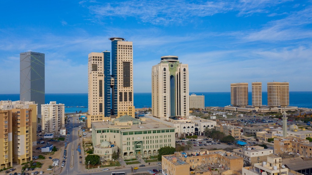
Tripoli (pop. three million) is Libya's capital and largest city, located on the country's northwestern coast. Its rich history dates to antiquity, and it boasts a blend of architectural styles influenced by its diverse cultural heritage, from Roman to Arab to Berber to Italian. The city is known for its bustling markets, such as the Old City's Medina, which offers a vibrant atmosphere and a variety of goods. Prominent landmarks include the Arch of Marcus Aurelius, the Assaraya al-Hamra, and the Gurgi Mosque.
The ruins of Leptis Magna (present-day Khoms, approximately 130 km/80 mi from Tripoli) are an essential addition to any tourist’s itinerary. Founded by the Phoenicians and later expanded under Roman rule, this port town thrived as a prosperous trading center. The city boasts many impressive ruins, including the Arch of Septimius Severus, the Severan Basilica, a sprawling amphitheater and forum, and the intricately decorated Hadrianic Baths. Today, the well-preserved ruins are a UNESCO World Heritage site.
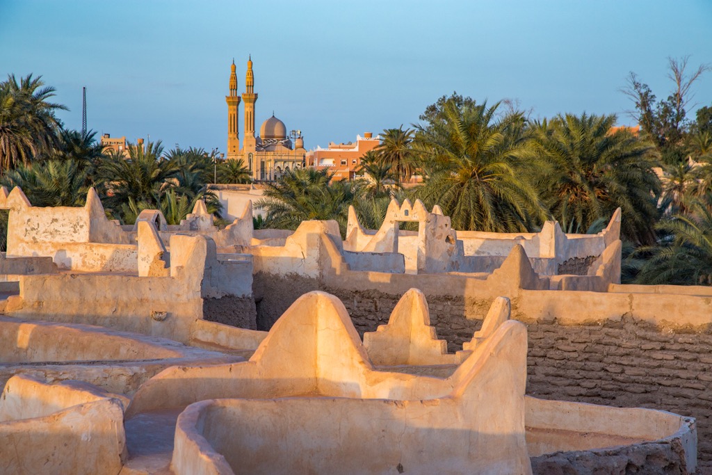
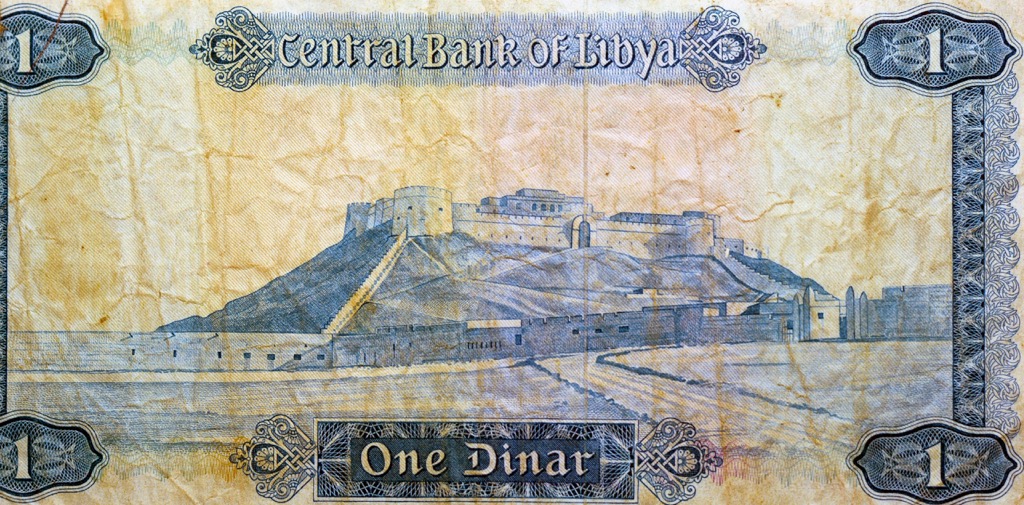
The lakeside city of Sabha is in the country’s southwest and is known for its distinctive architectural style, which reflects traditional desert settlements. Sabha has served as a trading post for nomadic Saharan tribes for centuries. The city's ethnic medley includes Tuareg, Arab, and Berber communities. Be sure to check out the Italian stronghold Fort Elena, a dramatic fortress that appears on Libyan currency!


Yes. Libya has 2,013 named mountains. The highest is Bikku Bitti at 2,267 m.
The highest mountain in Libya is Bikku Bitti, at 2,267 m.
Libya has 2,013 named mountains.


