Scan the QR code and open PeakVisor on your phone
Morocco is a country in the Maghreb of North Africa. Excluding the disputed territory of Western Sahara, Morocco spans 446,300 square kilometers (110,283,132 acres) and is home to 37 million people. It is a maritime neighbor of Spain to the north via the Strait of Gibraltar and bordered to the east/southeast and south by Algeria and Western Sahara.
Morocco is also one of the most mountainous countries in Africa. To trekkers, it is best known for the mighty Atlas Mountains, which stretch across the Maghreb through Algeria and Tunisia. In total, there are 23581 named summits in Morocco.
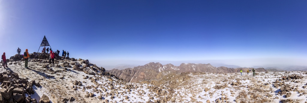
The country’s highest and most prominent peak, Toubkal (4,167 m/13,671 ft), is the highest in North Africa and the 22 nations that make up the Arab world. With a whopping 3,757 meters (12,326 ft) of prominence, Toubkal is Africa's sixth most prominent peak. There is not a higher mountain for over 2,000 km (1,200 mi).
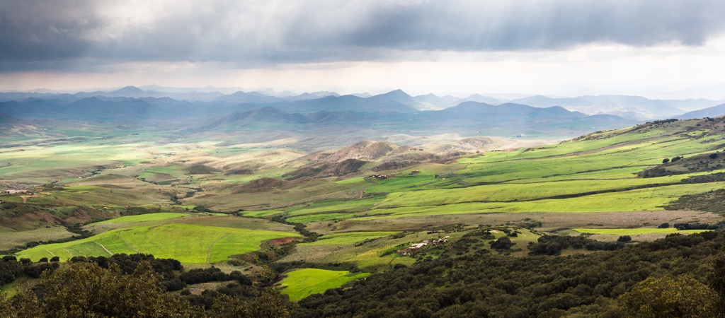
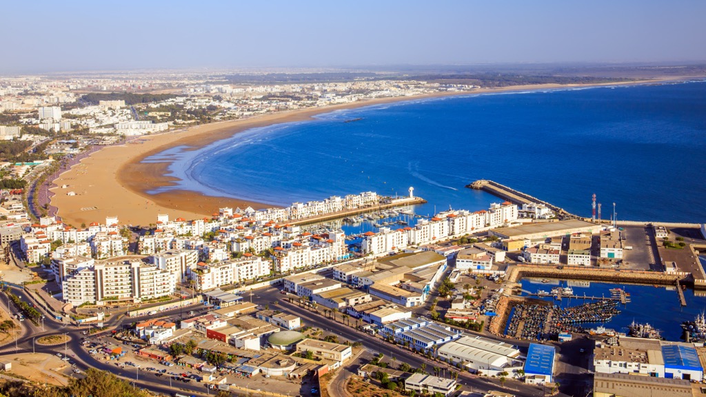
Like much of North Africa, Morocco's geography showcases a blend of coastal plains, mountain ranges, and vast desert expanses. Depending on how you define its borders, the country boasts a coastline of around 2,500 kilometers (1,500 miles), with numerous beaches and picturesque, traditional coastal fishing villages. (Thanks to this vast coastline and Atlantic swells, Morocco also has the best surfing in North Africa.)
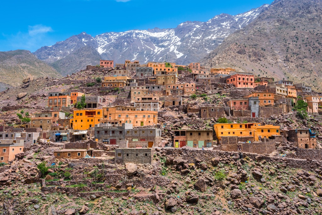
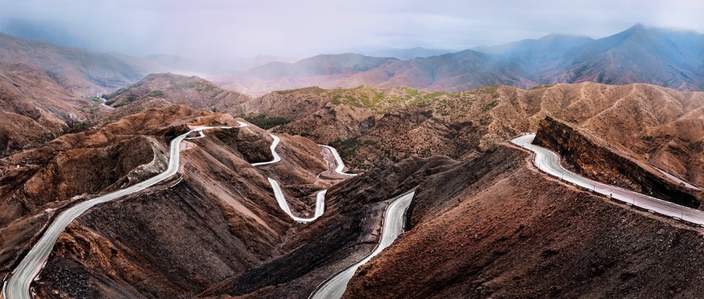
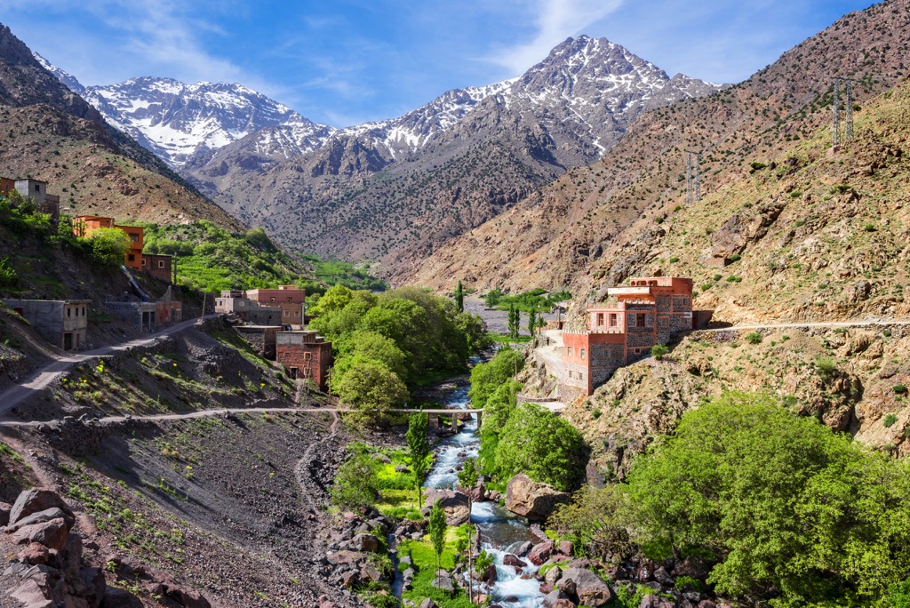
The landscape rises into the Atlas Mountains, traversing the country's north and center and moving laterally into neighboring Algeria. As noted above, the range is crowned by Jebel Toubkal (4,167 m/13,671 ft), the highest point in North Africa. The Atlas Mountains offer a wide array of outdoor activities, from hiking and climbing to skiing. They are also home to fertile valleys and the cultivation of a variety of crops, particularly olive and the world-famous argan.
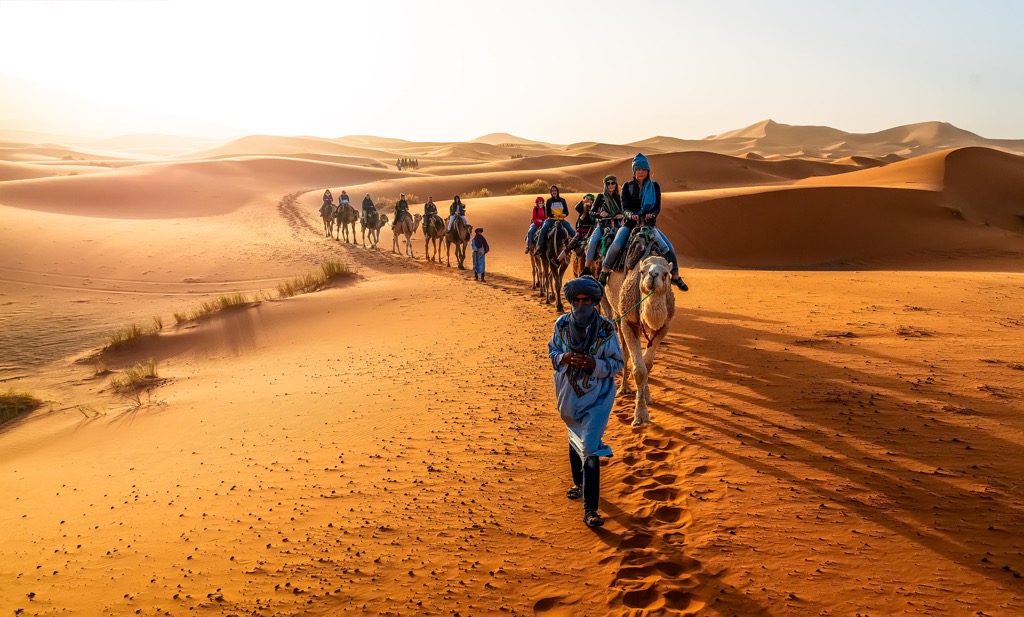
Beyond the Atlas lies the vast expanse of the Sahara Desert, sprawling across a significant portion of southern Morocco. The desert landscape is characterized by undulating sand dunes, rocky plateaus, and arid plains. These reaches are destinations for camel trekking, desert camping under starlit skies, and exploring ancient caravan routes.
Though the inhospitable Sahara dominates much of the country’s south, Morocco is also home to several significant rivers, such as the Sebou, Moulouya, and Draa—the nation’s longest, at 1,100 kilometers (680 mi). These waterways contribute to the country's agricultural productivity, supporting fertile valleys and oases throughout the region.
The Atlas provides a natural barrier between Morocco’s arid Sahara and the temperate Mediterranean coastline. As a result, the climate of the country varies widely. A Mediterranean climate with warm summers and mild, wet winters is typical in the north. The interior has a semi-arid climate, while further south, the Sahara Desert generates scorching days and cold nights.
The average overall temperature in Morocco is 18℃ (64℉). The hottest month is July, with an average temperature of 32℃ (90℉). The coldest month is January, with an average temperature of 10℃ (50℉). Morocco’s rainy season stretches from October to April, with an average annual rainfall of 300 millimeters (12 in). The driest region in Morocco is the Sahara, which gets less than 100 millimeters (4 in).
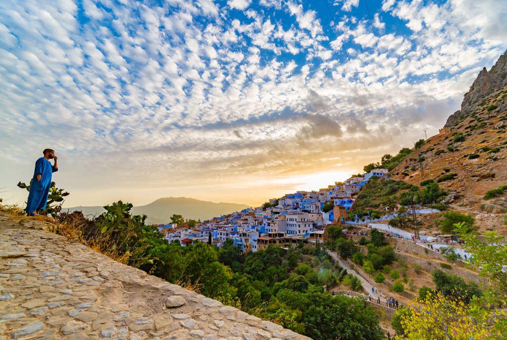
By far, the wettest region of Morocco is the Rif Mountains (popular for hash growing and the famed “Blue City” of Chefchaouen) in the far northeast, along the Mediterranean Coast.
The Rif, crowned by Jebel Tidirhine (2,456 m/8,058 ft), is a geologically unique range. It’s actually an extension of the mountains of Spain and the southern Iberian Peninsula, not the Atlas. The Rif receives an average of 1,000 millimeters (40 in) of yearly precipitation.
The Atlas Mountains are primarily composed of folded and faulted sedimentary rocks. These rocks originated from the accumulation of marine sediments such as limestone, sandstone, and shale over millions of years.
The folding and faulting of these rock layers resulted from tectonic forces, particularly the collision between the African and Eurasian plates, which have a fault line along Morocco’s northern vestiges. The Atlas also has volcanic rocks associated with ancient seismic activity. These formations, such as basalt and rhyolite, offer evidence of past volcanic eruptions and lava flows.
Moving southward into the Sahara, the landscape naturally transforms into vast stretches of sand dunes and underlying sedimentary basins. These basins contain sandstone, siltstone, and shale layers deposited by ancient rivers and shallow marine environments. Fossilized remains of ancient plants and animals are often found in these sedimentary rocks.
Geologically, the eastern parts of Morocco—bordering Algeria—are known for their rich mineral deposits. Extensive mining operations exist in this region, extracting valuable resources such as phosphates, lead, zinc, and copper.
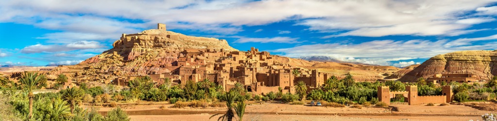
Morocco also features several unique geological sites like caves, canyons, and natural arches. The fortified hilltown of Aït Benhaddou, a UNESCO World Heritage site, showcases the region’s impressive traditional earthen clay architecture, illustrating the integration of human activity with the geological landscape. This site is a must-visit in Morocco and has been fortified in some form since circa 1000 AD.
Morocco’s diverse climate, with a blend of the Mediterranean and Atlantic coasts, High Altas, and the Sahara, is home to diverse flora and fauna. Morocco's most unique species of flora include the argan tree, the Barbary fig, and the Moroccan fir.
The argan is sacred in Morocco, and its oil is used for many purposes, including cooking, cosmetics, and traditional medicine. It is one of Morocco's most iconic and ecologically important plant species and is endemic to the country’s southwest. The Barbary fig (or prickly pear), a cactus known for its sweet fruits, is native to this region of North Africa, hence the name. The Moroccan fir is found in the High Atlas Mountains and is the only fir native to Morocco.
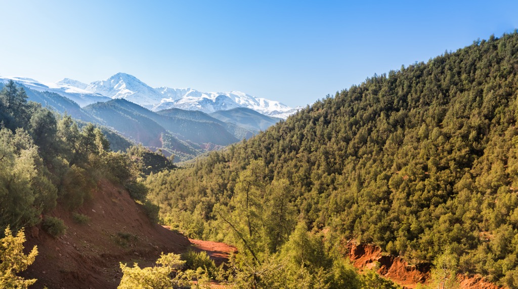
Other notable fauna include the towering Atlas cedar, the thuya or arar tree, and the Moroccan Bluebell, which blankets the forest floor during the spring months.
Morocco's unique fauna includes the Atlas mountain viper, desert hedgehog, Barbary stag, bald ibis, and Moroccan spiny-tailed lizard. The Barbary macaque, found throughout the High Atlas, is the only species of monkey native to North Africa and perhaps the most culturally important animal in the nation.
Early human presence in Morocco dates to the Paleolithic era. Like much of the Maghreb, Morocco has changed hands many times over the millennia, and various ancient civilizations, such as the Phoenicians, Carthaginians, and Romans, have left their mark through trade and colonization. Nestled at the mouth of the Mediterranean, Morocco has long served as a strategic location for trade routes between Africa, Europe, and the Middle East.
In the 7th century, Arab armies led by Uqba ibn Nafi conquered Morocco and the rest of the Mahgreb, bringing Islam to the region. The Arab influence profoundly impacted Moroccan culture, language, and architecture.
The later Idrisid dynasty established the first Muslim state in Morocco in the 8th century, centered in modern-day Fez. By the 11th century, a succession of Berber dynasties replaced the Idrisids. Morocco (along with the Iberian) was the scene of much fighting between Christians and Moors in the High Middle Ages.
The 15th and 16th centuries saw the rise of the Saadi Sultanate, which united much of Morocco and expanded its influence beyond North Africa, establishing the nexus of the modern-day Moroccan state.
In the early 1900s, Morocco came under French and Spanish colonial rule, seeing an influx of tens of thousands of European settlers. The country experienced several subsequent resistance movements, such as the Rif Rebellion—which led to the brief establishment of an eponymous nation-state in the Rif in the early 1920s. By 1956, Morocco gained independence from France and Spain, and Sultan Mohammed V became the first king of modern Morocco.
In subsequent years, his son, King Hassan II, and grandson, King Mohammed VI (the current monarch), played significant roles in shaping Morocco's modern history, introducing social and political reforms, promoting economic development, and strengthening international relations.
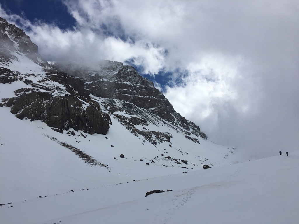
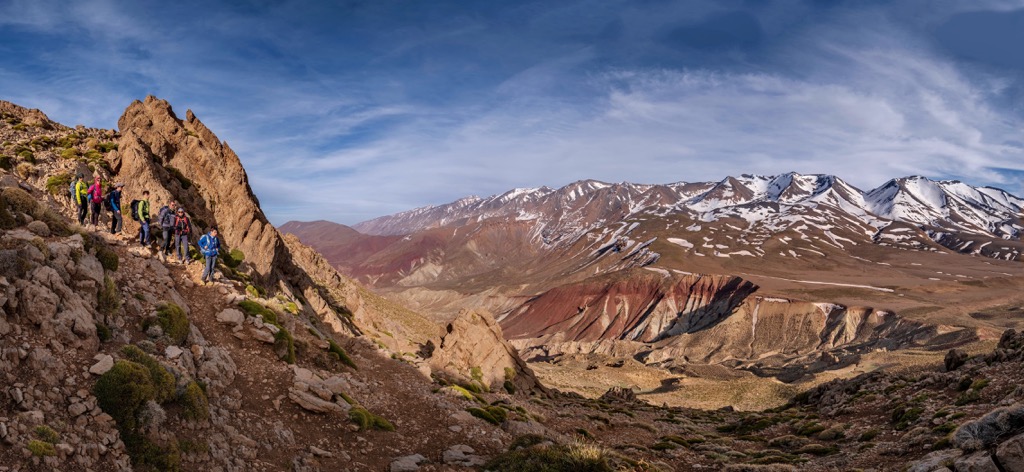
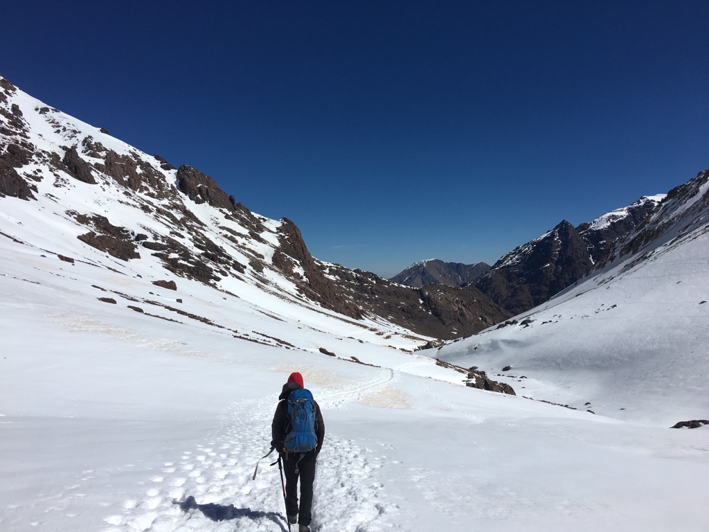
As Morocco’s highest peak, the highest in North Africa, and the highest in the 22 nations of the Arab world, Toubkal (4,167 m/13,671 ft) is a worthy goal for any trekker. In winter, it is a technical climb, with crampons and ice axes needed, but in the summer months, the ascent is a one or two-day hike, with scree and elevation as the only obstacle.
The most popular route begins in the village of Imlil. It ascends through a succession of alpine valleys, passing the smaller Berber settlement of Sidi Chamharouch—home to a famed Muslim shrine—and into Toubkal National Park. Climbers, skiers, and hikers can stay the night at one of two stone refuges at the apex of the Isougouane Valley at 3,207 meters (10,522 ft).
Most parties take five to seven hours to reach the refuge on the first day. On the second day, expect five to seven hours up and back to the summit the following morning and another three to five hours back to Imil.
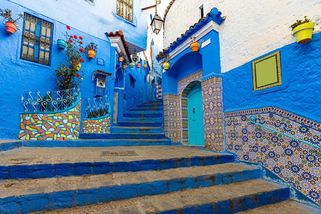
Morocco’s “Blue City” in the Rif Mountains is one of its most popular tourist destinations. There are dozens of hikes in the hills around “Chaouen,” but a one-mile jaunt up to the Spanish mosque south of town is the best place to start, providing spectacular views of the azure city and the surrounding mountains. Nearby peaks to hike include el-Kelaâ (1,616 m/5,302 ft) and its larger neighbors Chaoun (2,036 m/6,680 ft) and Tisouka (2,118 m/6,949 ft).
Morocco’s classic “desert town,” Merzouga is the gateway to the mighty Erg Chebbi dunes, a worthy taste of the Sahara and the most extensive dune sea in Morocco. These dunes rise over 150 meters (500 ft) from the surrounding rocky plateaus and are crowned by the spectacular Grande Dune de Merzouga (822 m/2,697 ft). Camel treks and desert camping expeditions leave daily from Merzouga.
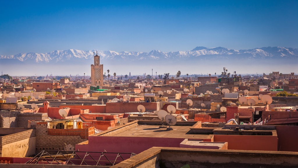
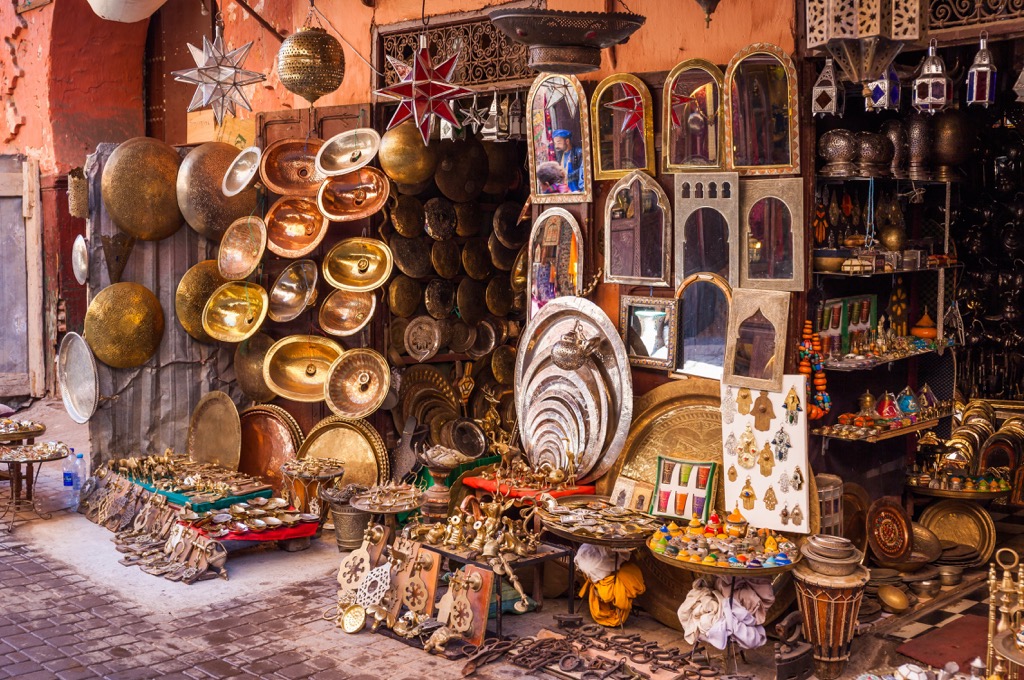
Marrakech (pop. 1.2 million) may not be Morocco’s largest city (Casablanca) or the capital (Rabat), but it is undoubtedly the cultural and tourist hub. The city boasts a rich history, evident in its mesmerizing architecture, bustling souks, and enchanting palaces like the Bahia Palace and Koutoubia (Kutubiyya) Mosque.
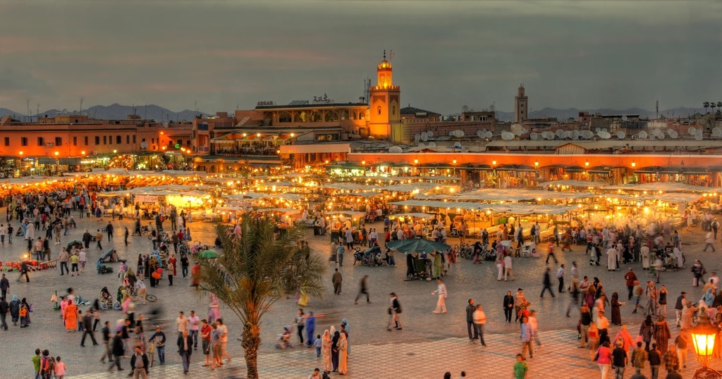
Jemaa el-Fnaa, the medina’s central square, captivates visitors with its lively atmosphere, bustling markets, and street performances. Visitors can also explore the serene Majorelle Garden and experience the traditional hammams.
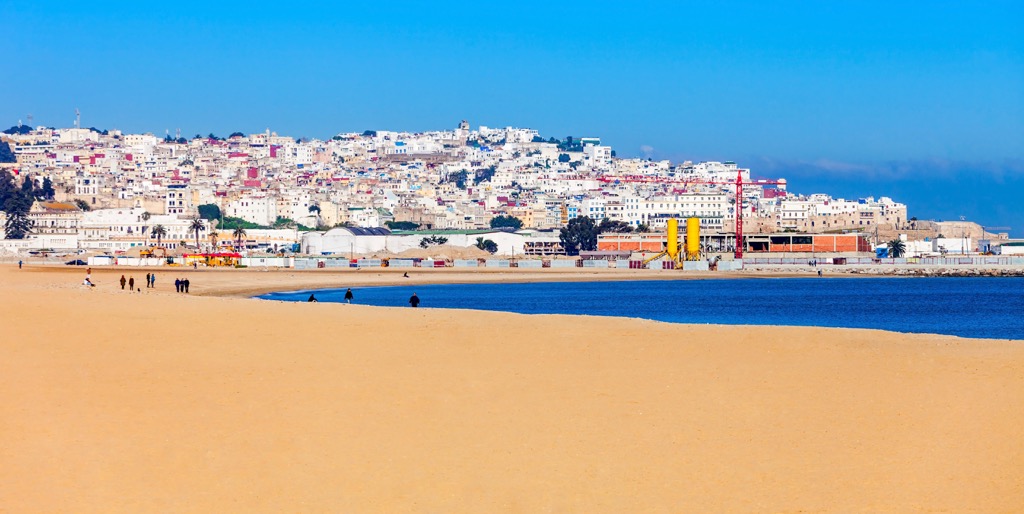
Tangier (pop. 950,000), on the northern coast just across from Spain, offers a unique blend of history and modernity. With a population of around one million, it is a vital economic and cultural gateway between Africa and Europe. Tangier's strategic location on the Strait of Gibraltar has shaped its fascinating history, reflected in its diverse architecture and vibrant neighborhoods.
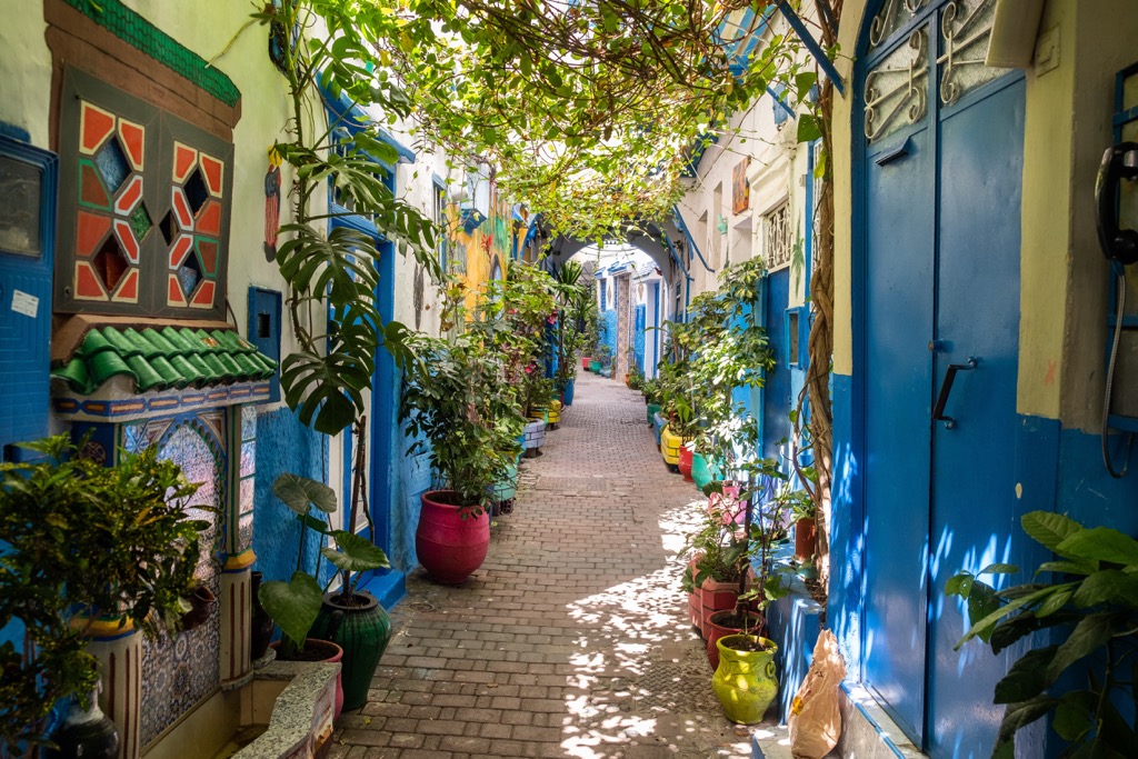
The city’s notable landmarks include the historic Kasbah, the Grand Socco Square, and the breathtaking Caves of Hercules, an archaeological site said to be where Hercules stayed and slept before his 11th labor (stealing golden apples from the Hesperides Garden). The cave’s mouth was said to have been created by the Phoenicians. Visitors can explore bustling markets, taste delicious Moroccan cuisine, and enjoy stunning views of the Mediterranean and Atlantic.