Scan the QR code and open PeakVisor on your phone
Tunisia is Africa’s northernmost nation, situated in the Maghreb along the southern shores of the Mediterranean Sea. It sits between Algeria (to the west) and Libya (to the east and south). Much smaller than its neighbors, Tunisia spans 163,610 sq. km (40,428,911 acres) and sustains a population of 12.1 million. 2.7 million of these live in the capital, Tunis, making it one of the largest cities in the Arab World.
Tunisia is well known as a vacation destination due to its pristine coastline and numerous beach resorts. But it is also the eastern terminus of the mighty Atlas Mountains, with 2936 named mountains in the country. Djebel Chambi (1,544 m/5,066 ft) is the highest peak. The most prominent is Djebel Zaghouan (1,293 m/4,242 ft), which boasts over 915 meters (3,000 ft) of prominence)
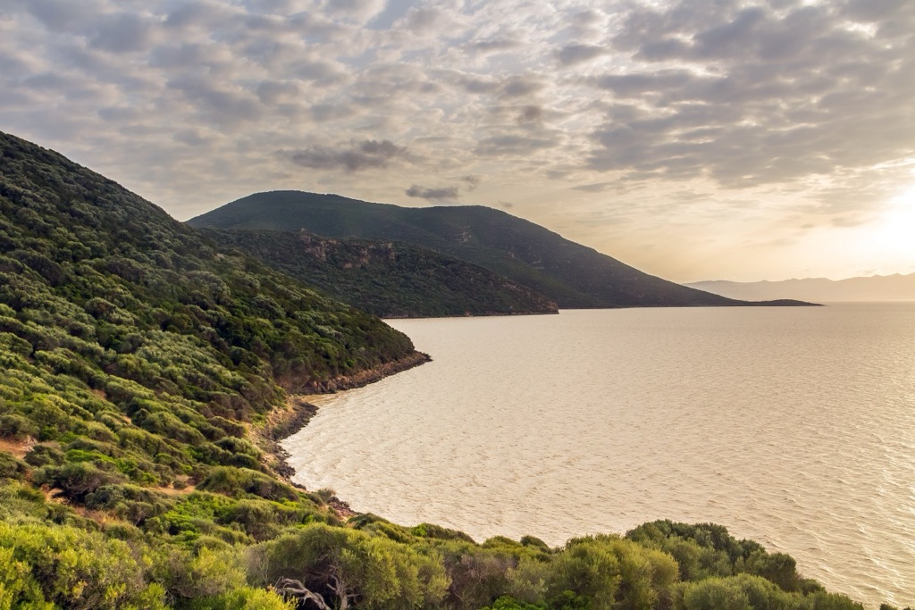
Tunisia’s geography is characterized by over 1,300 kilometers (810 mi) of coastline, as well as the end of the Atlas Mountains (in the west) and the northern reaches of the Sahara Desert (in the south). In the north, Tunisia’s land is temperate and arable thanks to the humid climes of the Mediterranean, making it suitable for crops such as olive, grape, and citrus.
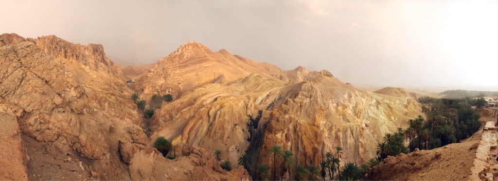
As mentioned above, Tunisia holds the eastern vestiges of the Atlas, known as the “Tell Atlas.” While far lower than the range’s loftier heights in Morocco, like Djebel Toubkal (4,167m/13,671 ft), the Tell still displays rugged terrain. The range features deep valleys and rocky peaks, although it’s subject to a more temperate climate and more rolling hills and fertile plains.
Further south, these temperate lands change into the arid Saharan (here Dorsale) Atlas, home to the nation’s highest peak Djebel Chambi (1,544 m/5,066 ft). It is situated inside Chambi National Park, near the Algerian border.
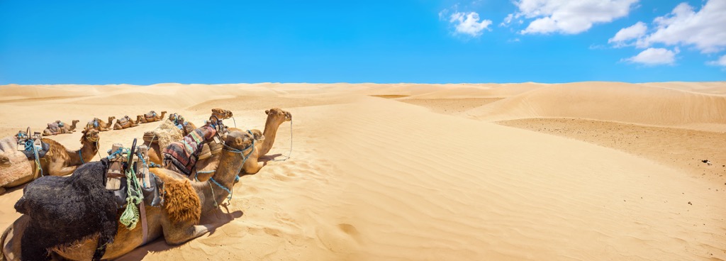
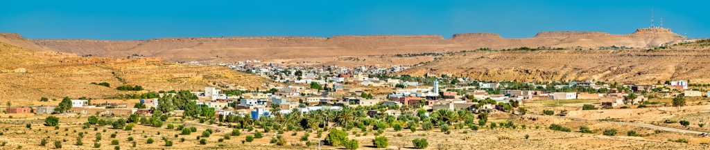
In southern Tunisia, the climate is that of the Sahara Desert, which covers most of Tunisia’s southern half. This region is characterized by towering sand dunes, with vast stretches of barren, arid desert interspersed with rocky plateaus. Tunisia's diverse geography is enriched by its other natural features, including the massive salt lake Chott el Djerid (7,000 sq. km/1,729,738 acres), a filming location for Star Wars, and coastal lagoons in the Gulf of Gabès.
In the north, the Tell Atlas mainly comprises crystalline metamorphic rocks from the Miocene epoch. The range is also home to reserves of several important minerals, such as phosphates, iron ore, and salt. The Tell—along with the Saharan Atlas further south—forms a natural barrier between the moist air of the Mediterranean and the inhospitable Saharan Desert, making Tunisia’s fertile land possible.
Central Tunisia is characterized by the Dorsale (an eastern extension of the Saharan Atlas). Like the Tell, these peaks are also crystalline metamorphic. The Dorsale is home to many sedimentary basins, like the Jeffara, holding significant hydrocarbon reserves. Like the Tell, the region is rich in mineral resources, such as lead, zinc, and copper.
The Saharan Platform, primarily composed of sedimentary rocks overlaid by vast shifting dunes, makes up the southernmost region of Tunisia. The Saharan Platform is known for its vast oil and gas reserves and the Nubian Sandstone Aquifer System, the world's largest known fossil water aquifer system.
Due to its position as a “crossroads” between the Mediterranean Sea, the Sahara Desert, and the Atlas Mountains, Tunisia sports diverse ecosystems, including coastal areas, forests, wetlands, steppe grasslands, and desert landscapes. The country’s mountainous forests are home to cork oak, evergreen oak, and Aleppo pine and provide habitat for a range of wildlife, including wild boars, foxes, and the famous Barbary macaque.
Tunisia’s coast is home to plants and animals like seagrass, marine algae, dolphins, and sea turtles. Wetland habitats, like the coastal lagoons in Gabès, like the Ghannouch Lagoon and Kerkennah, are crucial for migratory birds, and pink flamingos can be found throughout these wetlands. Between 20,000 and 40,000 storks, cranes, geese, and raptors follow migratory flight paths through Tunisia each year.
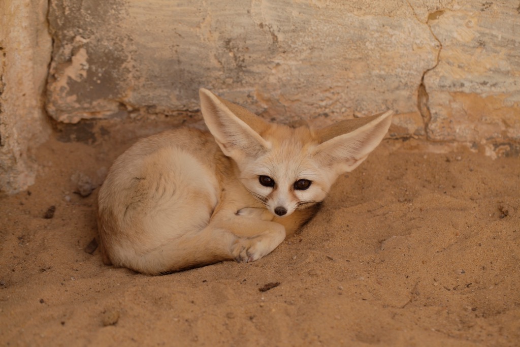
The steppe grasslands in the central and southern reaches are characterized by low vegetation like grasses, shrubs, and succulents. These grasslands offer habitats for small mammals, reptiles, and various bird species. Further south, as the land morphs into the Sahara, you’ll find acacia trees, desert foxes, fennec foxes, jerboas, and dozens of desert reptiles.
Perhaps above all else, Tunisia is known for its rich human history. The country houses an array of important archeological sites dating to antiquity, including notable ruins from the Carthaginian and Roman empires.
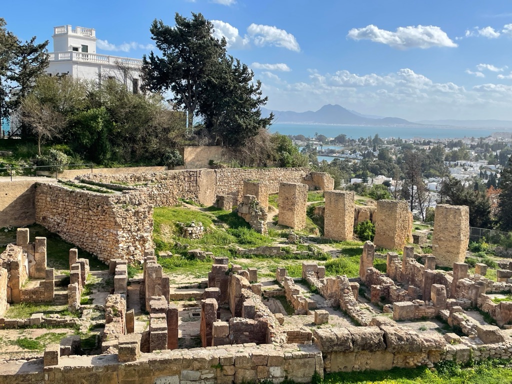
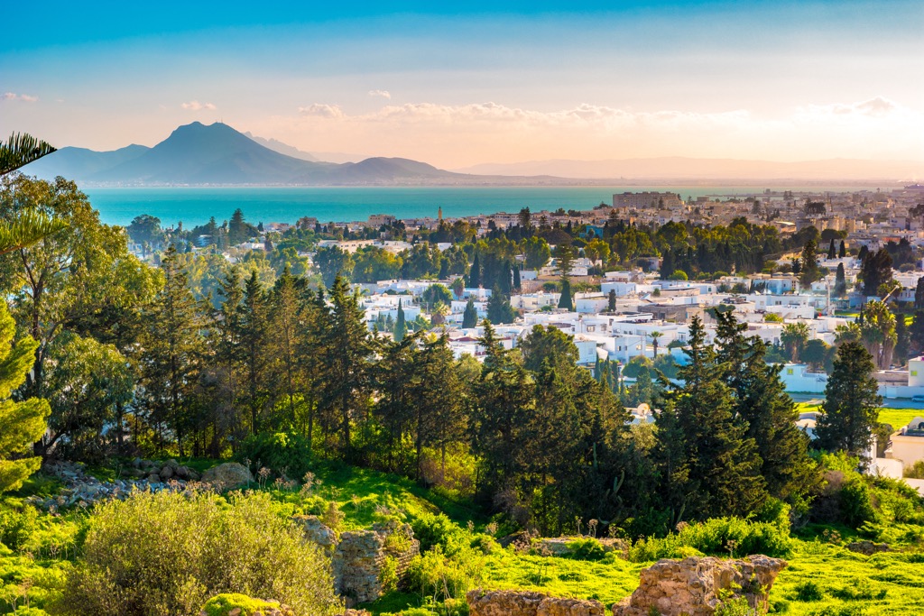
Originally, Tunisia was inhabited by Berber tribes before its coast was settled by the Phonecians (circa 12th century BCE). In the 9th century BCE, the Phoenicians founded Carthage—which lies due east of modern-day Tunis. This bustling port city, situated at a chokepoint in the Mediterranean, would grow into one of the most powerful empires of the era and eventually face off against Rome in the Punic Wars.
These legendary conflicts lasted for nearly 80 years, beginning in 264 BCE, and included 43 years of pitched warfare across the Iberian Peninsula, Italy, and North Africa. Hannibal led the Carthaginians, who famously crossed the Alps during the Second Punic War and ravaged Italy for nearly 15 years. The wars ended with the Romans' ransacking and utter destruction of Carthage in 146 BCE, after which the region became a Roman province.
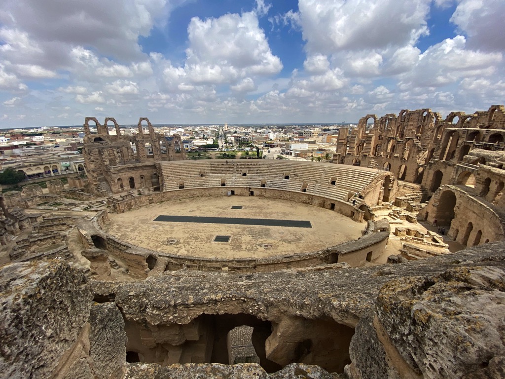
During this period, Tunisia became a primary producer of the valuable commodity olive oil. The Romans also left many architectural legacies, like the arena at El Jem. This mighty Roman amphitheater still stands today and is the second-largest remaining in the world (after the Roman Colosseum). After the fall of Rome, Tunisia switched hands between Arab Muslims, Europeans, and Ottoman Turks for much of the following two thousand years.
The Ottomans held Tunisia from 1546 until a French conquest in 1881. It remained under French rule until 1956 when it gained independence under Habib Bourguiba and became known as the Republic of Tunisia.
The nation’s most recent significant development was a revolution in 2011, which overthrew the 24-year rule of President Zine El Abidine Ben Ali. It was also the catalyst for the “Arab Spring,” a series of revolts and widespread protests throughout the Arab World.
There are dozens of world-class hiking destinations in a variety of climes, from mountains to deserts to coasts, throughout Tunisia. There are occasional security threats in Tunisia due to terrorist activity; the area around Chambi National Park and the border regions near Algeria and Libya are the most dangerous. However, in general, the country is quite safe.
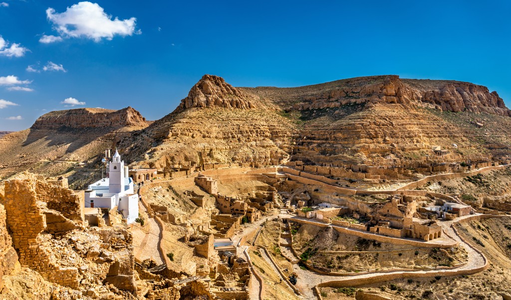
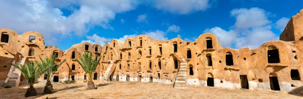
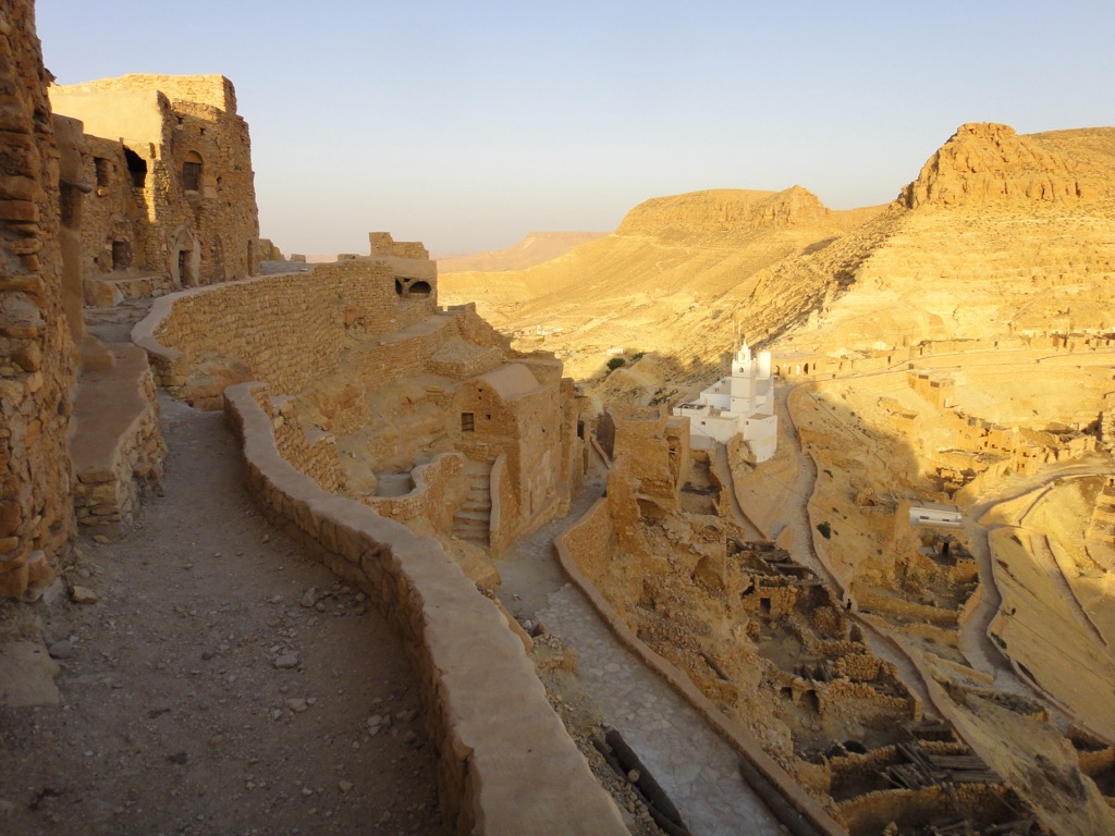
Below are a few worthy hiking destinations presented in lieu of specific trails. Others not mentioned include the Berber village of Chenini, the oasis at Mides, the emerald blue waters and coastal cliffs of El Haouaria, and the densely forested mountains near Ain Draham.
Zaghouan, a village in northern Tunisia, is home to the country’s best rock climbing and is a mere 55 km (35 mi) south of Tunis. The ancient Roman Water Temple, which provided water to ancient Carthage over 100 kilometers (60 mi) away via aqueducts, is a must-see.

Ichkeul National Park is a UNESCO World Heritage Site. The eponymous lake and wetlands are nothing short of sublime. It is a crucial midpoint for hundreds of thousands of migrating birds, including numerous species of ducks, storks, pink flamingos, and geese. On the slopes of the park’s highest peak (Djebel Ichkeul [511 m/1,677 ft]), you’ll find perfect vistas for birdwatching and many winding trails with gorgeous views of the lake below.
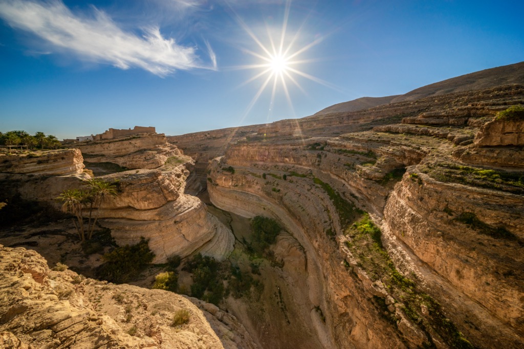
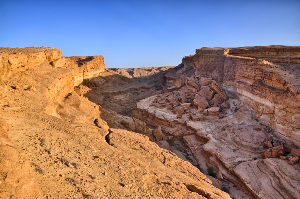
Just a few kilometers outside the town of Tozeur, the ravine of Sidi Bouhlel is both the site of a Muslim saint’s grave and was a filming locale for numerous world-famous productions, from Star Wars: A New Hope to Raiders of the Lost Ark to The English Patient. Hiking through the jagged ravine is a right of passage for any film buff.
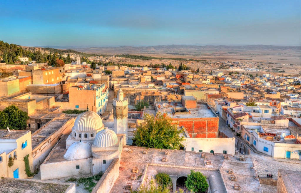
Tunis, the country’s capital and largest city, claims over 600,000 people inside its city limits and a whopping 2.7 million in its greater metropolitan area. Tunis is home to the Bardo National Museum, among many other sites, such as thriving souks (bazaars) and a historic medina. The Bardo is one of Africa’s leading archeological galleries and harbors one of the world's largest collections of Roman mosaics.
Other noteworthy sights in Tunis include the Al-Zaytuna Mosque, which dates to the late 7th century and once held one of Islam’s first universities. Also, don’t miss the ruins of the Baths of Antoninus at nearby Carthage. These are the most extensive Roman thermal baths in Africa and one of the three largest in the former Roman Empire.
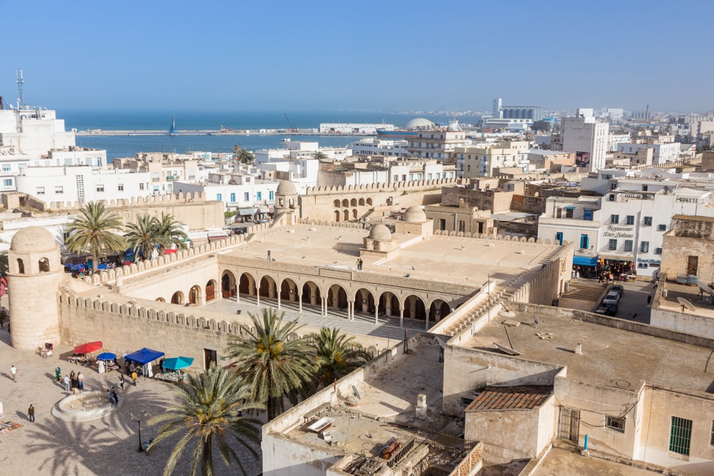
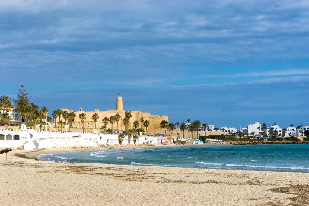
The coastal Sousse, Tunisia’s third-largest city, is known primarily for its beaches. Sousse is one of Tunisia’s most touristed and Westernized cities, with a slew of modern bars, restaurants, and beach resorts, especially in the Port El Kantaoui suburb north of the city proper.
However, Sousse also has a wealth of historical sites, including an ancient medina—declared a UNESCO World Heritage Site in 1988—kasbah, traditional ribat (fortress), Carthaginian catacombs, and the ruins of Hadrumetum, a Phoenician colony predating even Carthage.