Scan the QR code and open PeakVisor on your phone
Algeria is a country in the Maghreb of North Africa. It spans 2,381,741 square kilometers (588,541,018 acres) and is home to 44 million people. Following the 2011 splintering of Sudan and South Sudan, Algeria became the largest nation in Africa and the tenth largest in the world. There are 9854 named summits in Algeria. Mount Tahat (2,918 m/9,573 ft), in the country's far south, is the highest and most prominent. Tahat is perched amidst the Ahaggar (Hoggar) Mountains and boasts over 2,300 meters (7,500 ft) of prominence.
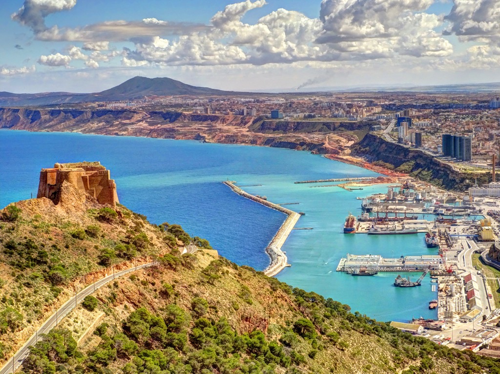
As noted above, Algeria is the largest country in Africa by land area, and over 80% of this land is desert. In clockwise fashion, beginning in the northeast, Algeria is bordered by Tunisia, Libya, Niger, Mali, Mauritania, and finally, to the west, Morocco and the disputed region of Western Sahara. Algeria’s northern border is the Mediterranean Sea. The country has approximately 1,622 km (1,008 mi) of coastline.
Geographically, Algeria is into four primary zones running from north to south: the Tell and Tell Atlas, the High Plateau, the Saharan Atlas, and the Sahara Desert. The fertile Tell contains the vast majority of Algeria’s population and major cities.
The Tell is characterized by rolling hills and vast plains used for agriculture, such as the Mitidja and the Bejaia Plains. It is also home to a lower-elevation mountain range, the Tell Atlas, a subsidiary of the large Atlas Range, which runs across the Maghreb from Morocco to Tunisia.
The High Plateaus are south of the Tell region and consist of dry steppes and high plains rising to the Saharan Atlas further south. The elevation of these arid plateaus varies between 1,300 meters (4,300 ft) and 400 meters (1,300 ft).
South of this steppe country is the Saharan Atlas. This range comprises three distinct massifs, the Ksour near the Moroccan border, the Amour in the center, and the Ouled-Naïl in the east, just south of Algiers. Unlike the desert further south, the alpine slopes receive decent rainfall, and runoff from these heights supplies many oases throughout the northern Sahara.
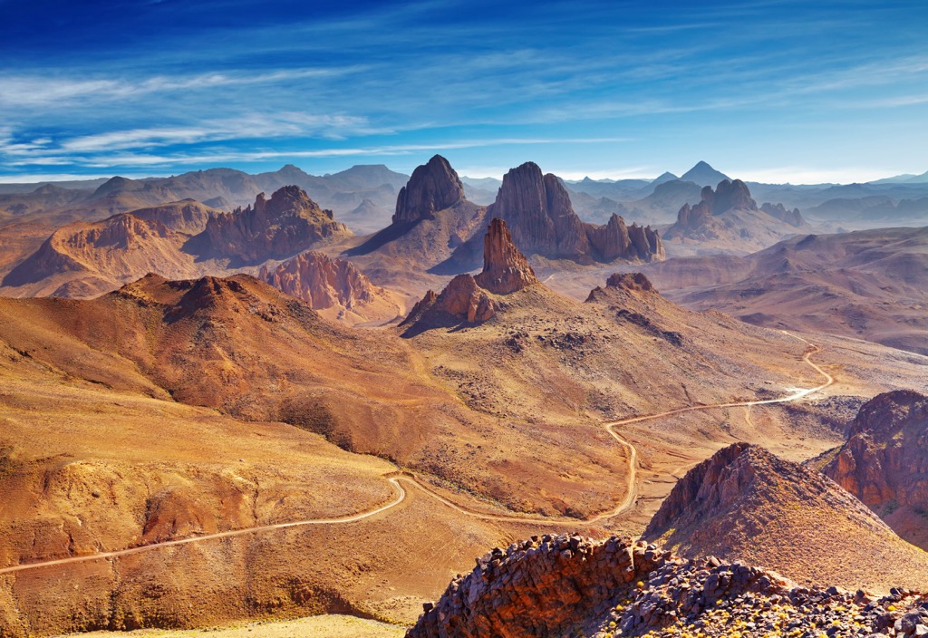
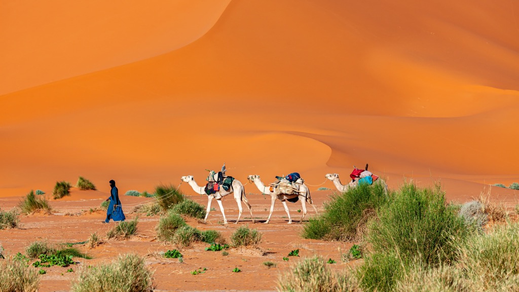
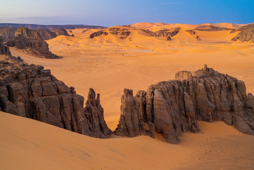
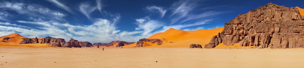
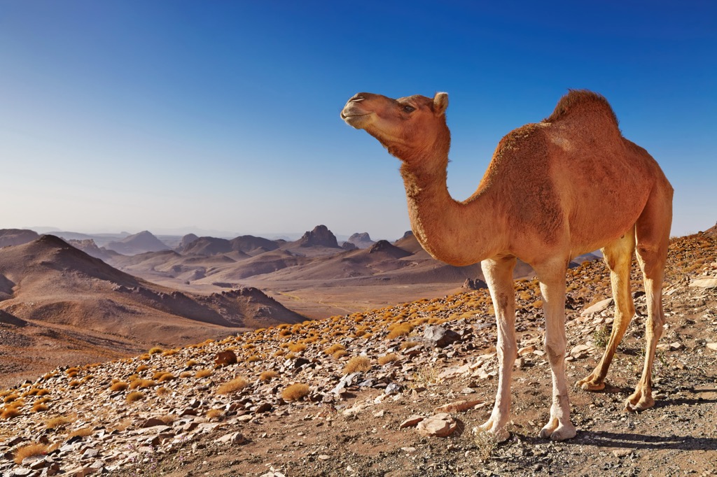
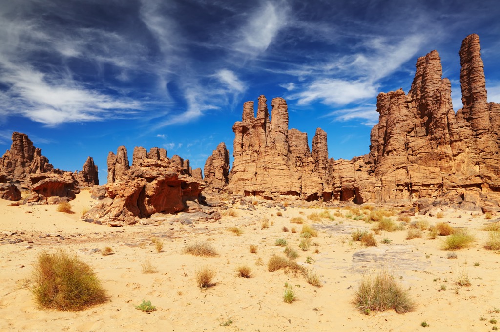
The Algerian Sahara runs along the Saharan Atlas for over 1,500 kilometers (930 mi) to the nation’s border with Niger and Mali. The desert consists of vast sand dunes, such as the Great Eastern and Western Ergs, and stretches of rocky plateau. In the far south and southeast, the rugged Ahaggar Mountains are home to Algeria’s tallest peaks, crowned by Mount Tahat (2,918 m/9,573 ft).
Another notable peak in the range is Assekrem (2,780 m/9,121 ft), the country’s second-highest summit. Its name means “end of the world” in the local Tuareg dialect; indeed, traditional Taureg culture considers it as such.
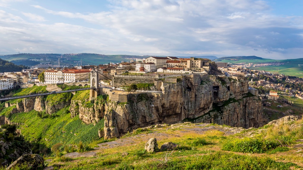
The massif of east and northeastern Algeria has its own distinct geography, with several rugged mountainous stretches along the coast. Ranges here include the Aurès Mountains and the Petite and Grande Kabylie.
The climate of Algeria varies based on its proximity to the Mediterranean. Northern Algeria straddles the coastal temperate zone and has a similar climate to Southern California. Summer temperatures in this region average between 30 and 43°C (86 and 109°F), and winter temperatures hover in the relatively mild range of 10 to 12°C (50 to 54°F).
Temperatures drop as one moves East and South, particularly in the High Plateaus, where winter temperatures are regularly below freezing. Communities in the Sahara Desert, meanwhile, see summer temperatures soaring above 45°C (113°F), while winters remain quite cold, often around 4 to 7°C (40 to 44°F).
Rainfall is abundant along the coastal Tell (400 to 670 mm/15.7 to 26.4 in) annually and almost nonexistent further south. Deep in the Sahara, total annual precipitation is frequently no more than 14 mm (0.5 in).
Algeria’s northern mountain ranges, the Tell and Saharan Atlas, are most notable as a natural barrier. These peaks separate the temperate Mediterranean climate of northern Algeria, the High Plateau, and the Tell Plains from the inhospitable Saharan Desert to the south. Both receive significant rainfall compared to their neighboring plateau and desert climes.
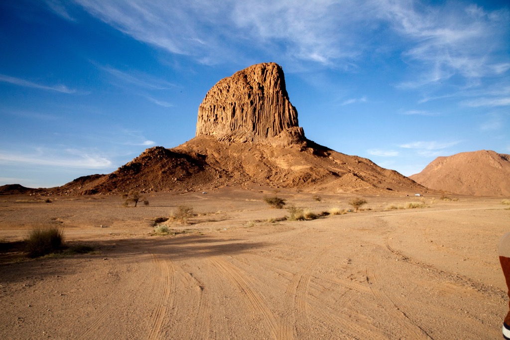
The geological history of the Ahaggar, Algeria’s tallest range, is more interesting. Its geological origins date to 300 million years ago, when earthquakes uplifted the central massif of the Sahara, which lay on the “African shield,” a thick crystalline base. Subsequent volcanic eruptions resulted in the deposition of basaltic lava across the entire region.
This seismic and volcanic activity pushed the Ahaggar region thousands of feet above the neighboring Sahara, resulting in jagged gorges and soaring cliff faces. The plateau is approximately 2,012 meters (6,600 ft) above sea level. In the deepest reaches of the range, volcanic eruptions left behind basaltic pumice and lava beds, and volcanic rock spires soar over 300 meters (984 ft).
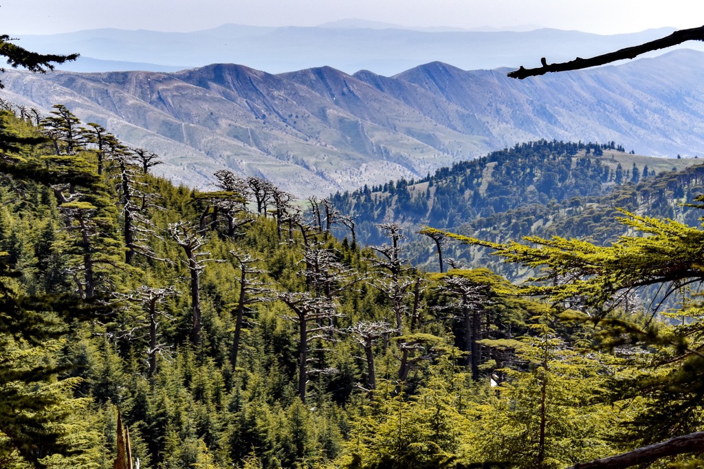
Algeria contains a variety of ecological regions, primarily delineated north to south by the Atlas sub-ranges that run west-east across the country, rimmed by the Mediterranean coastline in the north, and the Saharan Desert that dominates the landscape in the south. In the north, due to the milder climate, we find mixed and conifer forests, home to Algerian oak, Atlas cedar, and Aleppo pine, as well as yew, willow, junipers, and a variety of other conifers and oaks, while in the coastal lowlands grapevine is indigenous.
Further south, in the dry woodlands and steppe, brushwood and scrub dominate the landscape. As we move into the Saharan Atlas, the slopes are covered with Atlas cedar (although forest fires and clearcutting have dramatically reduced their ranks). In the Saharan region, date palms are common, as are acacia.
Throughout Algeria, some of the most well-known fauna are wild boars, gazelles, and jackals, as well as fennecs and jerboas. Other large mammals include the Barbary macaque, wild sheep, African golden wolf, and leopard.
Of Algeria’s 120+ mammal species, three are critically endangered and two endangered. The former are the North Atlantic right whale, Northwest African cheetah, and Dama gazelle. The latter include the Rhim gazelle and the European rabbit. Several prominent larger fauna, like the lion, brown bear, hippopotamus, North African elephant, and Scimitar oryx, are now extinct in the wild.
Indigenous reptiles include the Algerian sand racer and Egyptian sand boa. Amphibians comprise the Mediterranean tree frog and North African fire salamander, while the Atlantic white marlin and velvet belly lantern shark are two of the numerous fish species. Many bird species also make the country an excellent destination for birdwatchers.
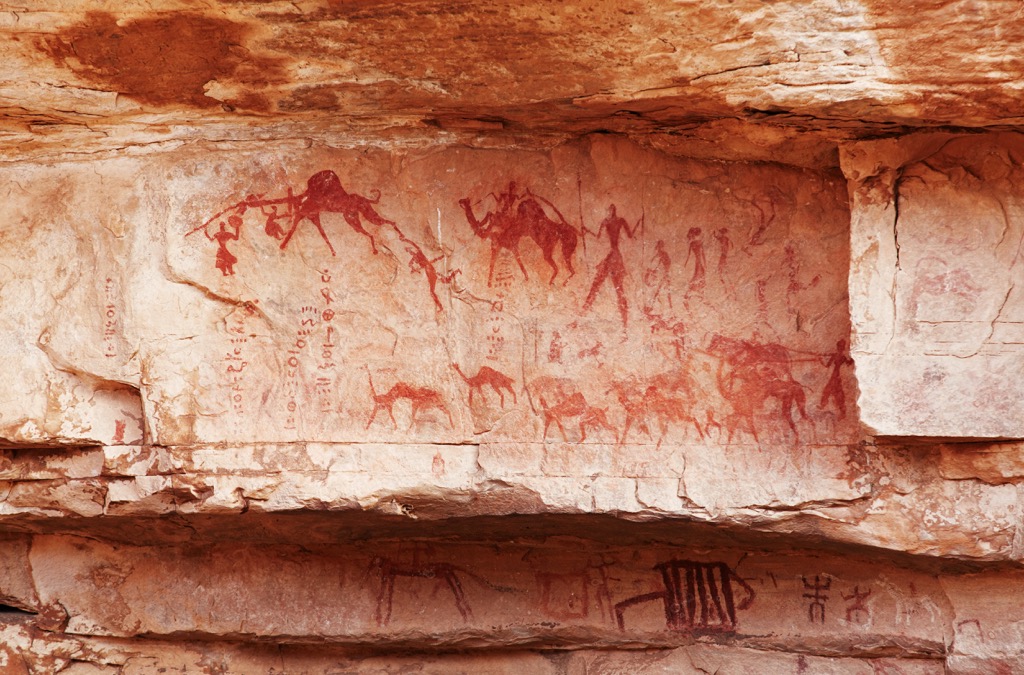
Evidence of human presence dates back to the Paleolithic era in Algeria. Like Tunisia, the country’s “hub” location nestled between Africa, Europe, and the Middle East has long made it a font of cultural exchange and a coveted territory. Prehistoric Algeria witnessed the emergence of early human settlements, as evidenced by cave paintings and artifacts found in Tassili n'Ajjer and other sites. These early inhabitants were hunter-gatherers who later adopted agriculture and animal husbandry.
The Phoenicians established trading posts along the Algerian coastline around 1,000 BCE. Their presence marked the beginning of external influences on the region, including the eventual integration of Algeria into the famed Carthaginian Empire.
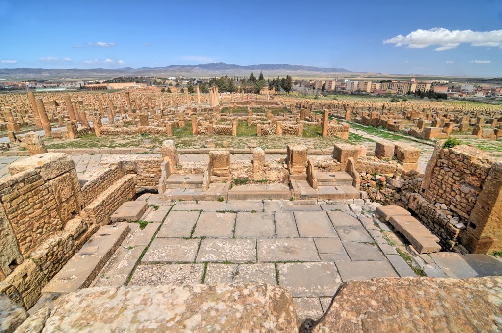
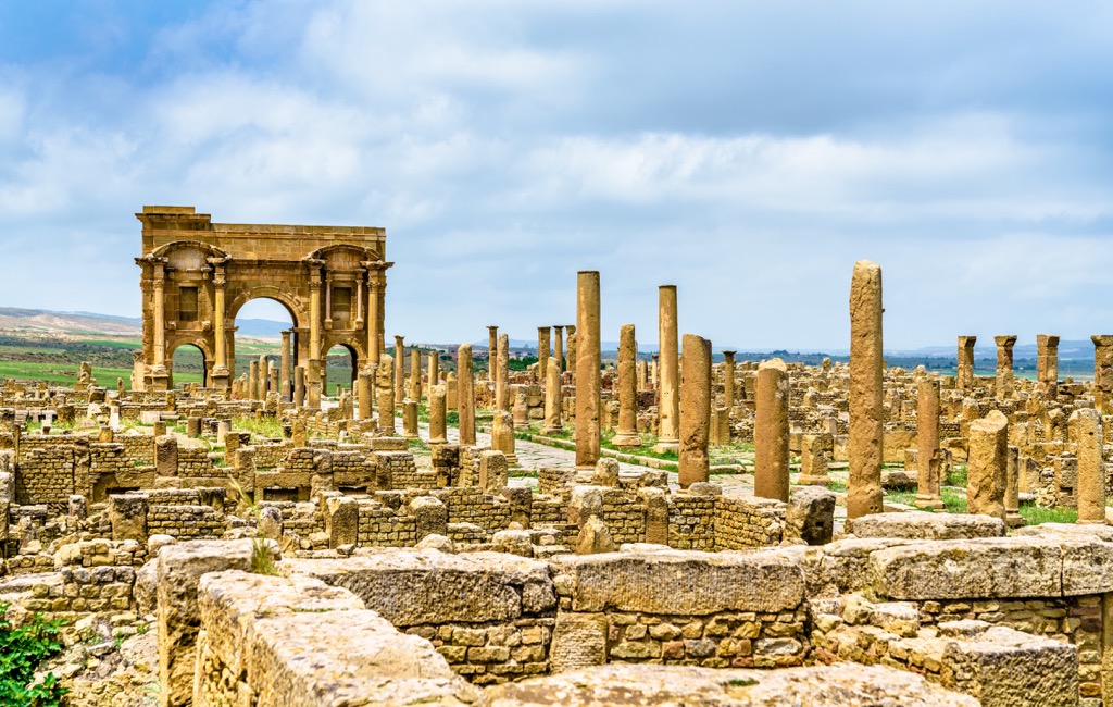
With the fall of Carthage after the Punic Wars, Algeria slipped under Roman control circa 150 BCE. The Romans established prosperous cities such as Hippo Regius and Timgad, leaving behind well-preserved ruins. Christianity also spread across the region during the later years of this period.
In 600 CE, armies led by Uqba ibn Nafi conquered the nation, introducing Islam and Arab culture. The area became part of the Umayyad and Abbasid Caliphates, followed by various Berber dynasties in the subsequent years.
From 1516, Algeria served as a base for Ottoman pirates, who raided European ships in the Mediterranean. These in-discretions led to several conflicts with European powers, particularly France.
As a result, France invaded Algeria in the early 1800s and gradually colonized the entire territory, incorporating it as an integral part of France. Algeria's struggle for independence began in the mid-1900s, culminating in a lengthy war against French colonial rule. After a brutal conflict, the National Liberation Front (FLN) played a pivotal role in achieving independence in 1962.
Post-independence Algeria faced numerous challenges, including political instability, economic disparities, and the rise of armed Islamist groups in the 1990s. The country experienced a devastating civil war from 1991 to 2002 due to a coup following an Islamist election victory. However, it is a relatively peaceful, if impoverished, destination today.
Algeria has around a dozen national parks and many smaller parks in the metropolitan hub of Algiers, like the Bainem and Ben Aknoun forests. The two listed below are top choices for hiking, but several others, notably Chréa and Théniet El Had, are equally sublime. Remember that Algeria is a developing nation, and the potential for violent crime exists in remote wilderness areas. Hiring a guide is recommended in such locations.
The Ahaggar Mountains, home to Algeria’s tallest peaks, are the ultimate trekking destination in the country. Rife with soaring volcanic spires and jagged gorges, this massive park covers 450,000 sq. km (111,197,422 acres), nearly ¼ of the entire country.
Visitors can best access the park from Tamanrasset. In addition to high mountains like Mount Tahat (2,918 m/9,573 ft), the country’s tallest summit, the park has high biodiversity. It is home to several animal species that have died off elsewhere in the Sahara.
Tassili N’Ajjer, located on a broad plateau in the Sahara Desert, has been a UNESCO World Heritage Site since 1982 and is one of Algeria’s most-visited national parks. Its highest and most prominent peak is Adrar Afao (2,158 m/7,080 ft).
The park is also home to one of the world's largest groupings of prehistoric cave art, dating back over 12,000 years, and accompanying pottery relics dating back 9,000. Notably, the caves at Tassili are also home to fungoid-like cave paintings, used by some researchers as proof of humanity’s long-standing relationship with psychedelics. The nearest major city is the oasis town of Djanet.
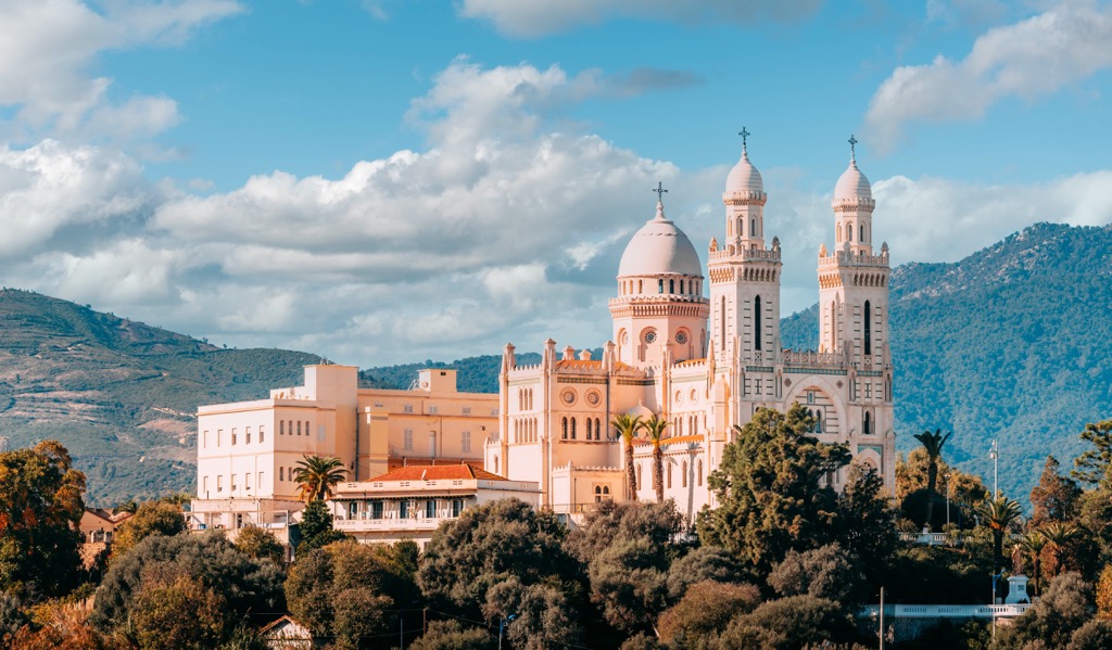
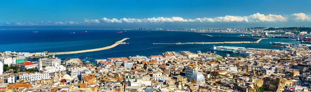
Algiers, the nation’s capital, is home to nearly three million people. On the shores of the Mediterranean, Algiers is not only the most populous but one of the most beautiful cities in the county. Thanks to its heritage as both a French and Islamic territory, Algiers offers a unique architectural fusion, with sprawling, elegant villas and French colonial boulevards married to historical, traditional Islamic architecture (including one of the finest Kasbahs and two of the most pristine mosques in North Africa).
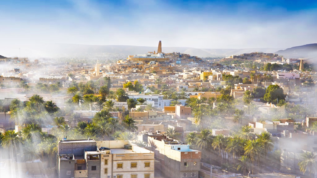
The oasis city of Tamanrasset (pop. ~100,000) is the best city to access the Ahaggar Mountains. Originally built as a military outpost to oversee trans-Saharan trade routes, it is now a tourist destination. The city is only desirable in winter, as the summer temperatures are brutal for tourists.
Despite the harsh climate, local crops include citrus, dates, apricots, figs, and almonds. In addition to the natural splendor of the surrounding wilderness, tourists often visit the Museum of the Hoggar, exploring exhibits on the indigenous Tuareg peoples and their culture.