
Scan the QR code and open PeakVisor on your phone
Ethiopia is home to 1,948 named mountains. The highest is Ras Dashen at 4,553 m.
Ethiopia is a landlocked country in the Horn of Africa. Home to 132 million people, it spans 1,104,300 square kilometers (426,400 sq mi), making it the most populous landlocked country in the world (and one of the most populous outright). It is also the oldest independent country in Africa.
Often called “The Roof of Africa” due to its rugged, mountainous topography, Ethiopia contains 1948 named summits, the highest of them in the Semien (Simien) Range in the country’s north. The highest and most prominent peak in Ethiopia is Ras Dashen (4,553 m / 14,937 ft).
Ethiopia is located in East Africa, in a region known as “the Horn of Africa,” which also consists of Eritrea (to the north), Djibouti (northeast), and Somalia (southeast). These countries separate Ethiopia from the Red Sea, Gulf of Aden, and Arabian Sea. Clockwise from the south, Ethiopia also shares land borders with Kenya, South Sudan, and Sudan. It is the world’s 26th-largest country and one of the most heavily-populated (10th).
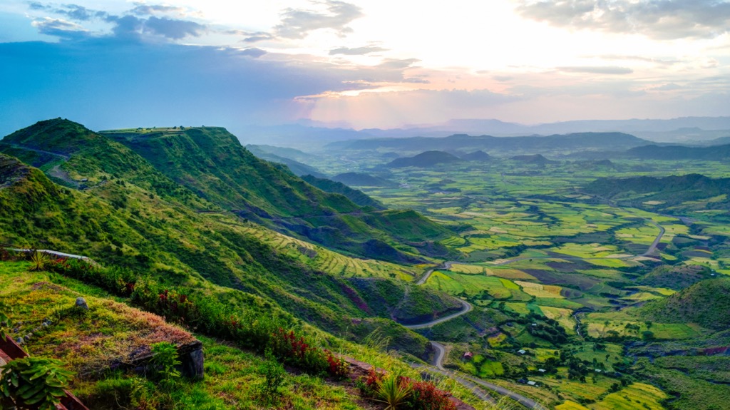
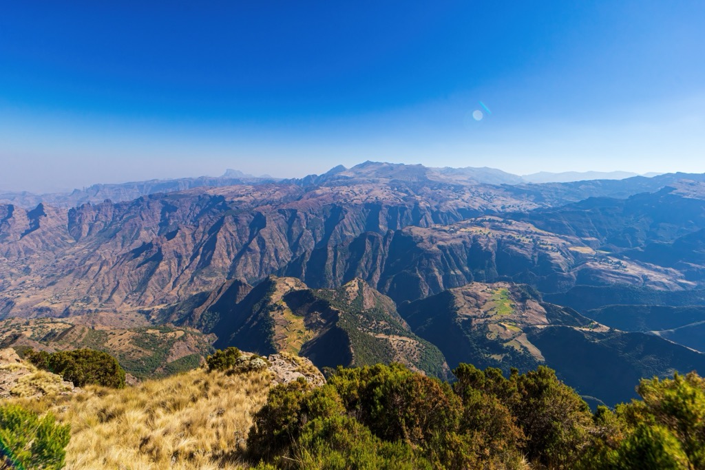
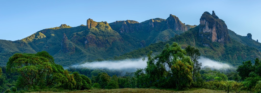
Compared to other countries in the Horn, Ethiopia is very mountainous (1,948 named summits) and dominated by a vast central plateau known as the Ethiopian (Abyssinian) Highlands, or the Ethiopian Plateau. These highlands run for over 1,000 kilometers (620 mi) north to south and about 500 kilometers (310 mi) east-west, making them the most extensive continuous mountain range in Africa.
Here, elevation varies from 1,300 to 3,000 meters (4,265 ft to 9,843 ft), and this region contains all of the country's major summits. Over a dozen peaks are over 4,000 meters (13,123 ft), culminating in the country’s high point, Ras Dashen (4,553 m / 14,937 ft).
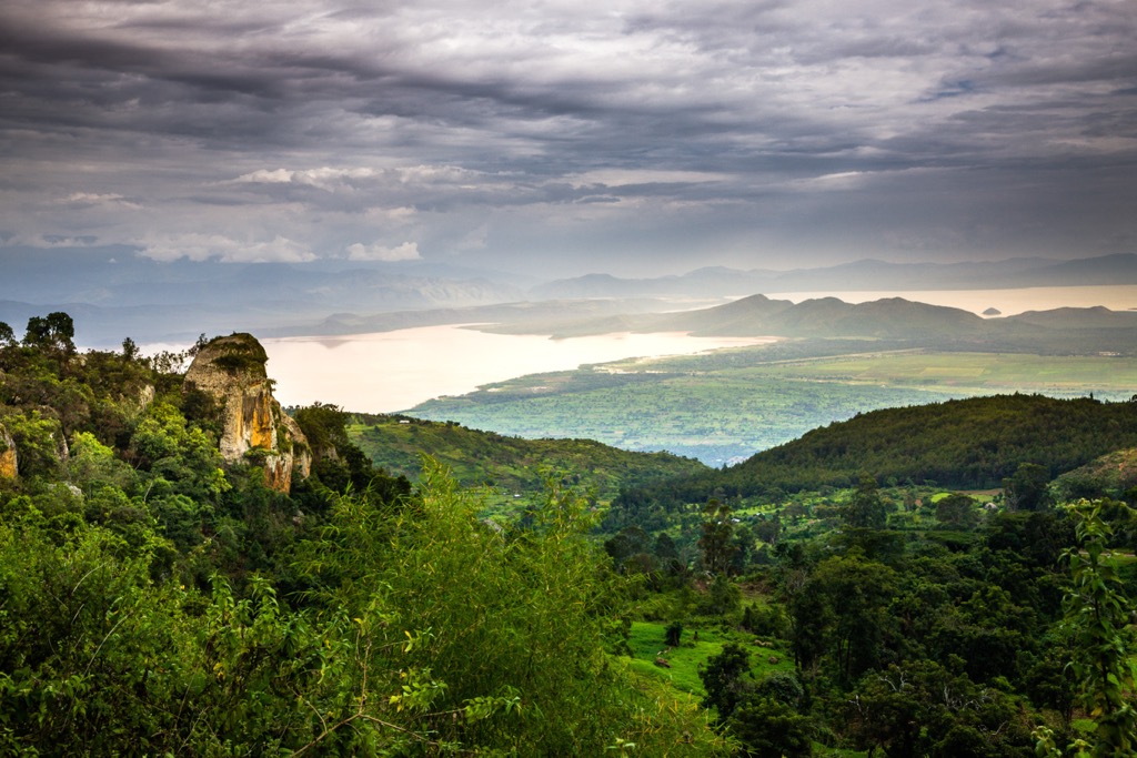
The Ethiopian Highlands are bisected into two sections, northwest and southeast, by the Great Rift Valley (For more on this, see “Geology” below.) The northern half, sometimes called the Abyssinian Massif, contains the country's three highest peaks and largest range, the Semien Mountains.
This region is also home to Lake Tana, a UNESCO Biosphere Reserve and the largest lake in Ethiopia. Tana is the source of the 1,450-kilometer (900 mi) Blue Nile River (one of the two tributaries, along with the White Nile, of the main Nile). It provides roughly 85% of the water to the Nile during the rainy season.
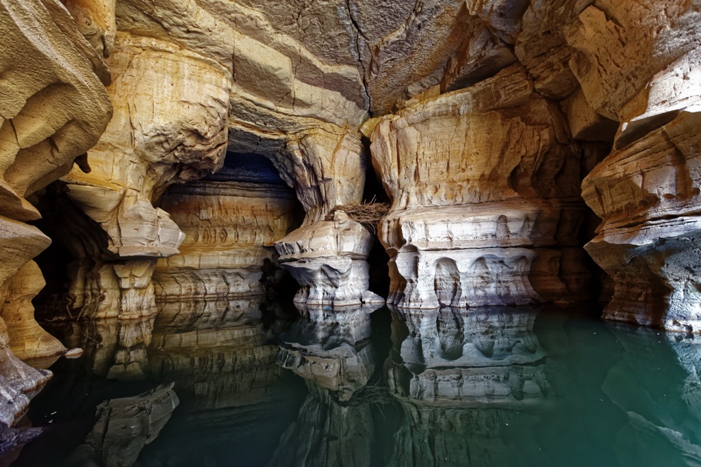
The southern half of the highlands, known as the Harar Massif, also contains many high peaks, predominantly the Bale Mountains. These include the fourth-highest peak in the country, Tullu Demtu (4,337 m / 14,360 ft), which is also the second most prominent after Ras Dashen. The Harar region is also the headwaters of the Shebelle and Jubba rivers, which provide most of the water to neighboring Somalia. This region also contains the caves at Sof Omar, one of Africa's longest cave systems, which are historically sacred to Islam and the indigenous Oromo people.
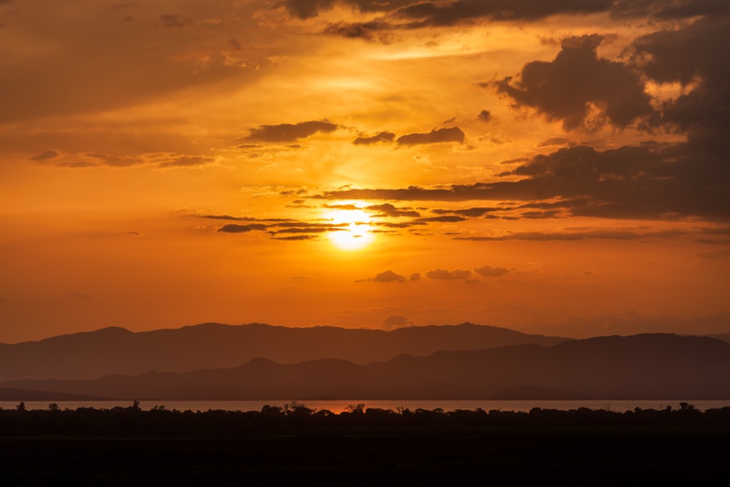
West of the Ethiopian Highlands, the land drops down into the grasslands of Sudan. To the east, the highlands plummet into the Afar Desert, one of the lowest, hottest regions on the planet and home to the most active rift system in the world. In the south of Ethiopia, the land is dominated by the Rift Valley Lakes, a staggering spread of lakes that include some of the oldest, deepest, and largest in the world.
Notable lakes in this region include Lake Abaya, Lake Chamo, Lake Zway, Lake Shala, Lake Langano, Lake Abijatta, and Lake Awasa. These lakes are predominantly alkaline (soda lakes), meaning they have a very high pH level (~9 to 12) and are extremely saline, with high concentrations of carbonate salts.
Alkaline lakes are highly productive ecosystems (meaning a high rate of organic matter is produced through photosynthesis by plants and algae) and harbor many unique species that cannot survive in traditional freshwater lakes.
Though climate varies by region, most of Ethiopia experiences two main seasons: a dry period from October to May (with brief rains in March) and a wet period from June through September. Although Ethiopia is near the equator, most of the country experiences a temperate, mild climate due to the high altitude of the Ethiopian Highlands.
Above 2,000 meters (6,562 ft), temperatures seldom exceed 25°C (77°F), but in the lower areas near the Eritrean, Djiboutian, and Somalian borders, a hotter, more desert-like climate prevails.
Most of Ethiopia sits on the African (Nubian) tectonic plate, bordered by the Arabian plate to the northeast and the Somali plate to the southeast. Ethiopia’s rock is diverse but principally consists of geologics from the Neoproterozoic East African Orogeny, Jurassic marine sediments, and Quaternary rift-related volcanics.
The country’s two main geological features are the Ethiopian Highlands and the Great Rift Valley. The former began to form roughly 75 million years ago, during the Late Cretaceous period, when magma from Earth’s mantle uplifted a dome of the Arabian-Nubian Shield, an exposure of Precambrian crystalline rocks (mostly Neoproterozoic).
As two aforementioned tectonic plates (Africa and Arabia) split roughly 30 to 25 million years ago, they created the Red Sea and the Gulf of Aden, separating Africa in the west from Arabia in the east. Later, the Somali plate began to break away as well, forming the Great Rift Valley, which today splits the Ethiopian Highlands into the two parts mentioned above, the Abyssinian and Harar massifs.
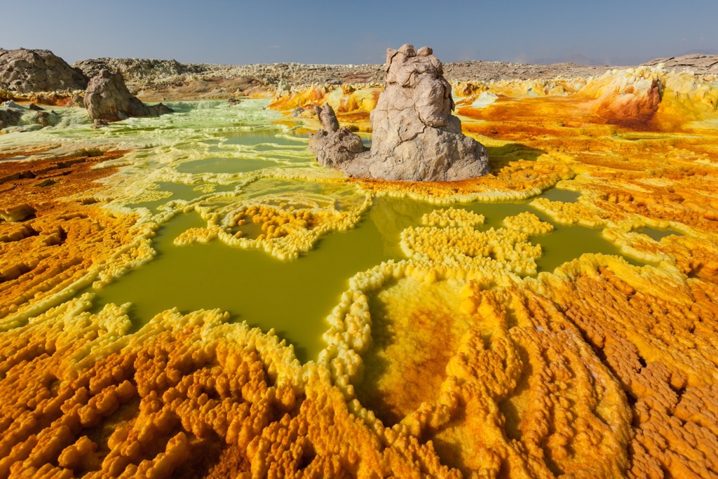
A branch of the larger East African Rift, the Great Rift Valley runs southwest from the Eritrea, Djibouti, and Ethiopia border region towards Kenya. It is roughly 80 kilometers (50 mi) wide and remains exceptionally volcanically active, with a high number of alkaline basalt shield volcanoes (and resulting alkaline lakes, mentioned above in “Geography”).
The northernmost point of the Great Rift Valley, and its most notable feature, is the Afar Triangle (or Afar Depression), the triple junction between the Africa, Arabian, and Somali plates. All three plates are pulling apart (diverging) at this depression, which is currently 155 meters (509 ft) below sea level and the lowest point in Africa.
The Afar has housed some of the oldest known hominini fossils and is believed by many to be the cradle of human evolution. Among other fossils, the Afar was where the famous “Lucy” skeleton was found, a 3.2-million-year-old hominid (Australopithecus afarensis) that was for many years the earliest known member of the human family.
Ethiopia's ecological diversity is remarkable, driven by its wide range of altitudes, climatic variations, and geological history. The country encompasses diverse biomes, from arid lowlands to afro-alpine highlands, each supporting its own unique array of flora and fauna.
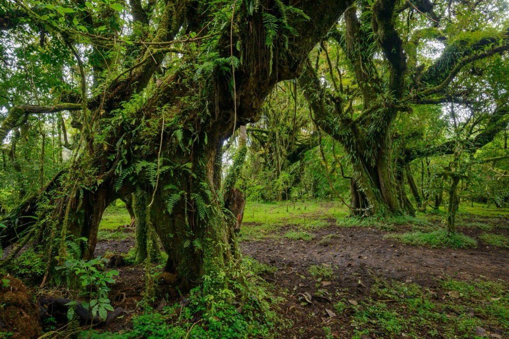
The Ethiopian Highlands, the mountainous region dominating the central and northern parts of the country, exhibit a distinct altitudinal zonation of ecosystems. Acacia-Commiphora woodland and bushland prevail at lower elevations, characterized by drought-resistant trees and shrubs.
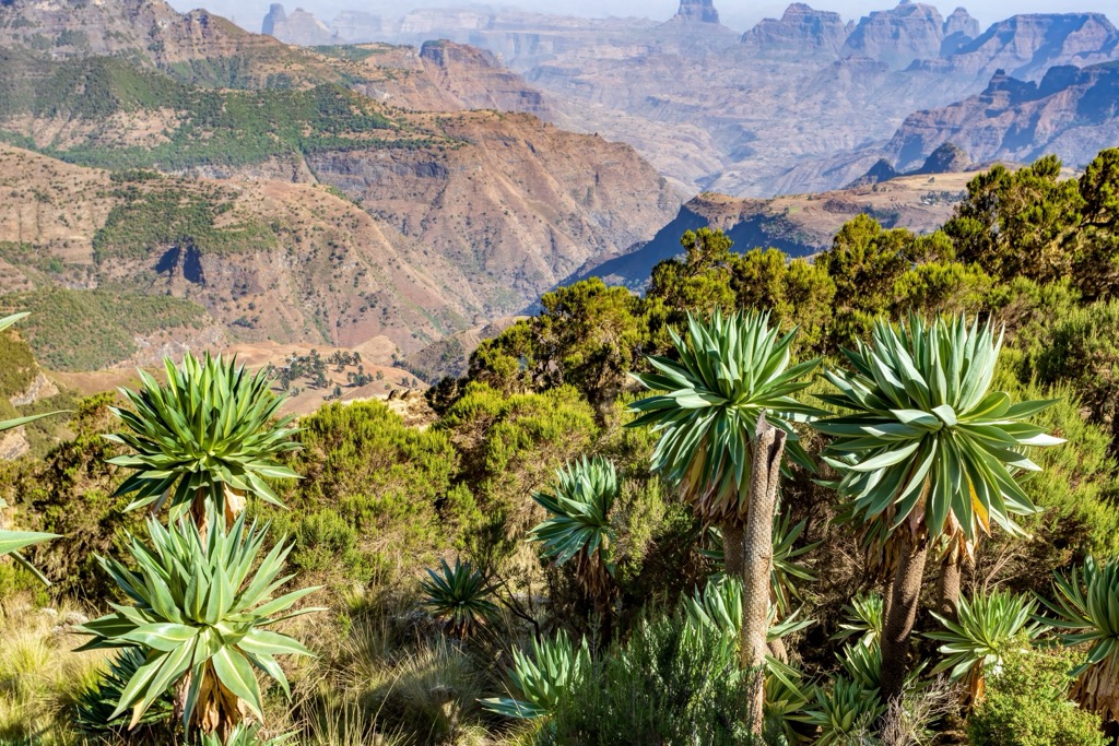
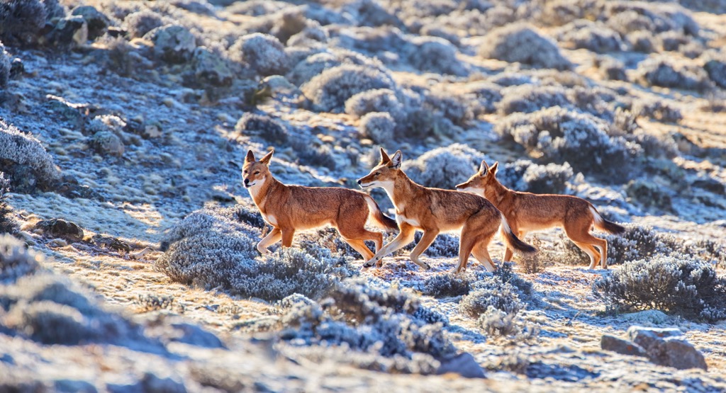
As altitude increases, this transitions into montane forests, with species like the African olive (Olea europaea cuspidata) and the juniper (Juniperus procera). Above 3,000 meters (9,900 ft), the afro-alpine zone is characterized by grasslands, moorlands, giant lobelias (Lobelia rhynchopetalum), and giant groundsels (Dendrosenecio). This high-altitude environment is home to several iconic endemic species, including the Simien jackal or Ethiopian wolf (Canis simensis), the world's rarest canid, which specializes in hunting rodents in the grasslands.
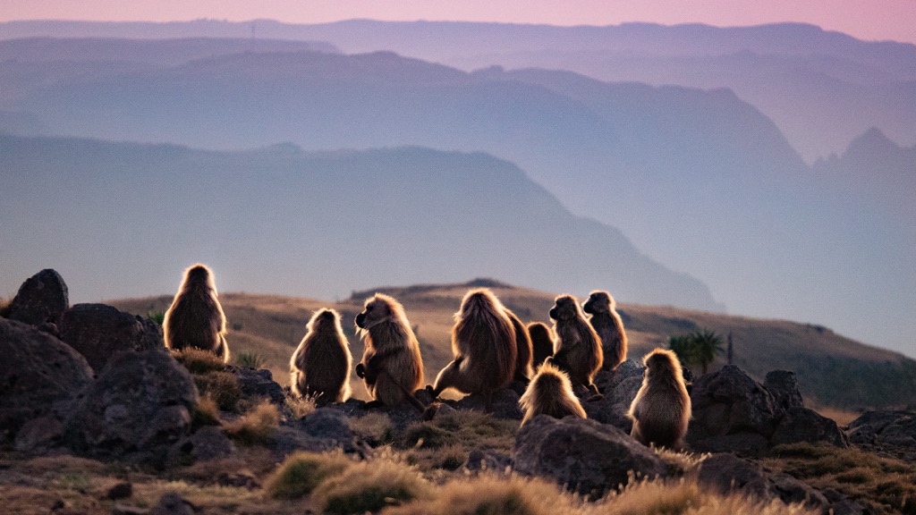
The gelada (Theropithecus gelada), another endemic primate sometimes called the “bleeding-heart monkey,” is found in large troops grazing on grasses in the highlands. The Walia ibex (Capra walie), a critically endangered wild goat, inhabits the steep cliffs and rocky slopes of the Simien Mountains.
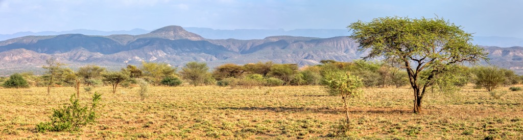
The Rift Valley, bisecting the highlands, presents a very different landscape. Lower elevations, higher temperatures, and lower rainfall characterize this area. Savanna grasslands, acacia woodlands, and dry shrublands dominate the vegetation.
This region supports a diverse array of large mammals, including the African elephant (Loxodonta africana), though populations have been severely reduced due to habitat loss and poaching. The East African oryx (Oryx beisa) and Soemmerring's gazelle (Nanger soemmerringii) are adapted to the arid conditions. Numerous bird species, including various raptors, are found in the Rift Valley's diverse habitats, as are reptilian aquatics such as the Nile crocodile (Crocodylus niloticus).
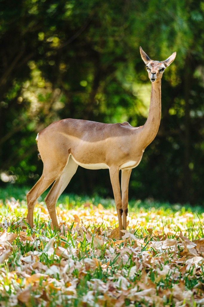
The southeastern lowlands, encompassing the Ogaden region, are characterized by arid and semi-arid conditions. The vegetation consists primarily of Acacia-Commiphora bushland and scrub, adapted to survive with minimal rainfall. This region is home to specialized species such as the dibatag (Ammodorcas clarkei), a slender antelope with a long neck, and the Somali ostrich (Struthio molybdophanes).
Ethiopia's diverse avifauna includes over 800 species, with many endemics. Notable examples include the Abyssinian longclaw (Macronyx flavicollis), found in montane grasslands, and the white-tailed swallow (Hirundo megaensis), restricted to a small area in southern Ethiopia.
Despite its biodiversity, Ethiopia's ecological integrity faces significant challenges. Deforestation, driven by agricultural expansion and fuelwood collection, has led to widespread habitat loss. Overgrazing, soil erosion, and climate change further exacerbate environmental degradation, as do the ongoing human conflicts within the country.
Ethiopia isn’t just home to some of the world’s oldest human fossils. It is the oldest independent nation in Africa and possesses one of the longest and most complex historical trajectories of any country in the world. Save for a brief occupation by fascist Italy during the years preceding the Second World War, it has never succumbed to any colonial power. It is also home to the Ethiopian Orthodox (Tewahedo) Church, one of the only Christian churches in Africa pre-dating European colonization.
Archaeological evidence indicates human presence in Ethiopia dates back millions of years. The oldest known specimen found in the country is the 4.4 million-year-old Ardi (Ardipithecus ramidus).
The pre-Aksumite period, beginning around the first millennium BCE, saw the rise of significant cultural and political entities. The kingdom of Dʿmt, with its capital at Yeha (present-day Eritrea), is the best documented. Dʿmt exhibited evidence of sophisticated irrigation techniques, the use of iron, and cultural influences suggest some contact with South Arabia. (The exact relationship between Dʿmt and South Arabian cultures, such as the kingdom of Saba’/Sheba, remains a topic of ongoing scholarly debate, ranging from hypotheses of colonization to more nuanced models of cultural exchange.)
The Aksumite Kingdom, emerging in the 1st century CE, represents an early pivotal era in Ethiopian history. Centered in the northern highlands, Aksum became a significant power in the Red Sea region. Its strategic location facilitated control over trade routes connecting the Roman Empire, the Indian Ocean, and the African interior.
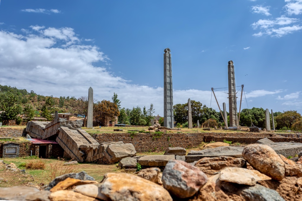
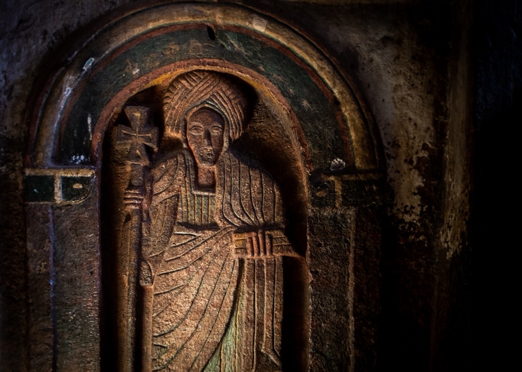
Aksumite power is evidenced by its monumental architecture, including the iconic stelae, which are large monolithic obelisks that likely served funerary or commemorative purposes. The kingdom adopted Christianity in the 4th century CE under King Ezana, making it one of the earliest Christian states in the world. This conversion, documented through inscriptions and coinage, profoundly shaped Ethiopian religious and cultural identity, establishing a distinct Ethiopian Orthodox Tewahedo Church.
Aksum's influence waned by the 7th and 8th centuries CE due to environmental degradation, the rise of Islamic powers controlling Red Sea trade, and internal political struggles.
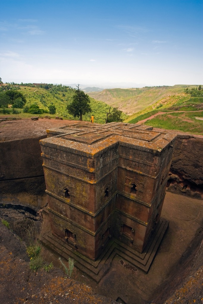
Following the decline of Aksum, political power shifted south. The Zagwe dynasty, originating from the Agaw people, rose to prominence in the 11th century. The Zagwe period is most renowned for the construction of the rock-hewn churches of Lalibela, a UNESCO World Heritage site. These monolithic churches, carved directly into the rock, represent a remarkable feat of engineering and architectural skill.
In 1270 CE, the Zagwe were overthrown by a ruler (Yekuno Amlak) claiming direct descent from the Aksumite kings, establishing what became known as the Solomonic dynasty. This lineage claim was legitimized by the Kebra Nagast (Glory of Kings), a 14th-century text that asserted a direct link between Amlak and the biblical King Solomon and the Queen of Sheba.
The Solomonic dynasty presided over a period of significant territorial expansion and consolidation, and would arguably last for nearly 1,000 years until emperor Haile Selassie was overthrown in 1974. The early Solomonic era also saw increased interaction with European powers, initially through religious connections and later strategic alliances.
The 16th and 17th centuries were the next period marked by significant change and challenge. The Adal Sultanate, a Muslim polity to the east, launched a series of devastating wars led by Imam Ahmad ibn Ibrahim al-Ghazi (also known as Ahmed Gragn).
These conflicts significantly weakened the Ethiopian Empire. Portuguese military assistance, sought by the Ethiopian Emperor, played a crucial role in ultimately defeating the Adal forces. However, they also led to the introduction of Jesuit missionaries seeking to convert the Ethiopian Orthodox Church to Catholicism, which caused further internal religious conflict (and ultimately the expulsion of the Jesuits).
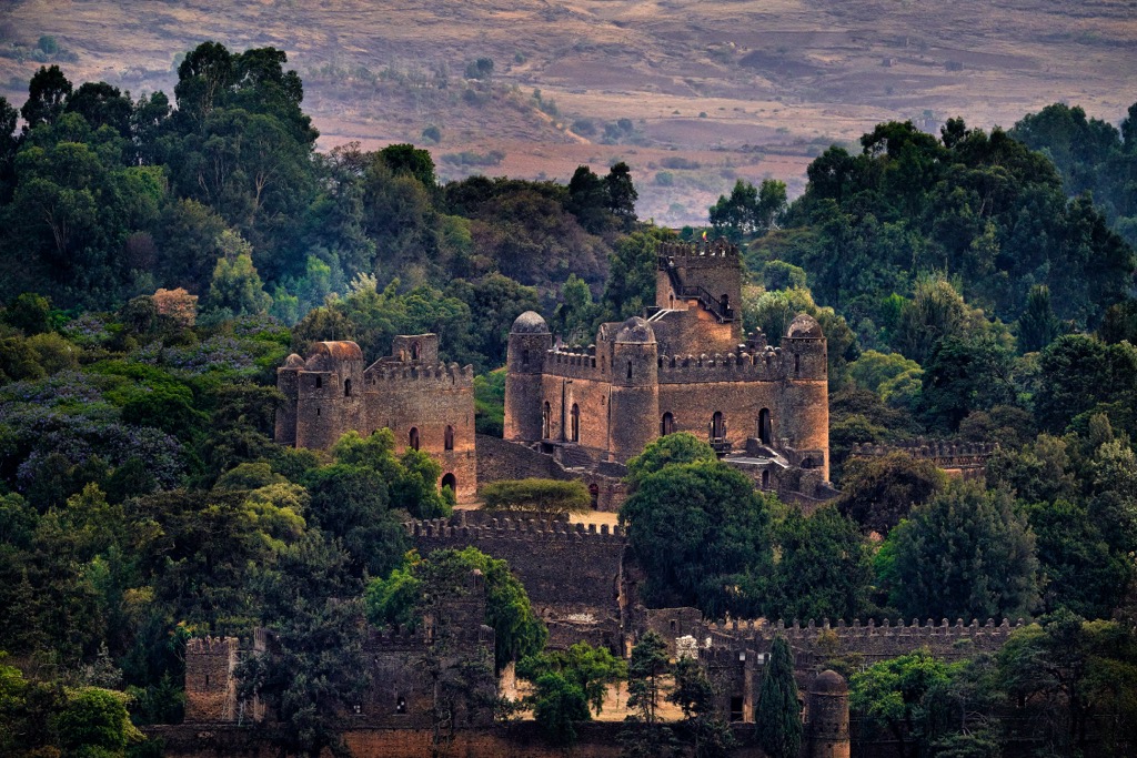
The Gondarine period (17th to 18th centuries), named for the new capital city of Gondar, saw a period of relative stability and cultural flourishing. This period is characterized by the construction of impressive castles and palaces, reflecting a distinctive architectural style. However, the later Gondarine period witnessed a gradual decline in central authority, leading to the Zemene Mesafint (Era of Princes), a period of decentralized rule characterized by regional warlords vying for power.
The mid-19th century marked the beginning of the modern Ethiopian state. Tewodros II, emperor from 1855 until his death in 1868, embarked on a campaign to reunify the fragmented empire and modernize the military. While his reign was marked by internal conflict and ultimately ended in his defeat by a British expeditionary force, Tewodros is credited with laying the groundwork for a unified Ethiopia. Emperor Yohannes IV continued the consolidation process, defending Ethiopia against Egyptian and Mahdist incursions.
Emperor Menelik II (reigning from 1889-1913) is a central figure in modern Ethiopian history. He significantly expanded the empire's territory, most notably by conquering southern regions and incorporating diverse ethnic groups into the Ethiopian state. His victory over Italian forces at the Battle of Adwa in 1896 secured Ethiopian independence during the “Scramble for Africa," making Ethiopia one of only two African nations (along with Liberia) to avoid colonization. Menelik also initiated modernization programs, including constructing infrastructure and introducing modern education (Marcus, 2002).
Haile Selassie I, who reigned from 1930 to 1974 (with a brief period of exile during the Italian occupation of 1936-1941), continued modernization efforts. He oversaw the adoption of Ethiopia's first constitution, promoted Ethiopia's role in international affairs (including the League of Nations and the Organization of African Unity), and implemented social and economic reforms.

However, his reign was also marked by authoritarian rule, growing economic inequality, and unresolved land tenure issues. The Italian occupation, though brief, was brutal and had lasting consequences, exposing vulnerabilities in the Ethiopian state. This period also saw Ethiopia annex neighboring Eritrea, which would result in decades of guerilla warfare and secessionist movements.
In 1974, Selassie was overthrown in a military coup led by the Derg, a committee of military officers. The Derg, under the leadership of Mengistu Haile Mariam, then established a Marxist-Leninist regime. This period was characterized by political repression (“Red Terror”), widespread human rights abuses, and devastating famine, exacerbated by the Derg's policies and the ongoing Eritrean War of Independence. The Derg regime was ultimately overthrown in 1991 by a coalition of rebel forces led by the Ethiopian People's Revolutionary Democratic Front (EPRDF).
The EPRDF, dominated by the Tigray People's Liberation Front (TPLF), established a new government (which saw Eritrea achieve independence in 1993, after a referendum). The EPRDF implemented a system of ethnic federalism, dividing Ethiopia into ethnically based regional states. While this system intended to address historical grievances and promote regional autonomy, it also contributed to ethnic tensions. The EPRDF era saw economic growth and development but also political freedom and human rights concerns.
In 2018, following years of anti-government protests, the EPRDF was dissolved, and chairman Abiy Ahmed became the country’s prime minister, merging three of the EPRDF’s constituent parties into his own new party, the Prosperity Party, excluding the TPLF.
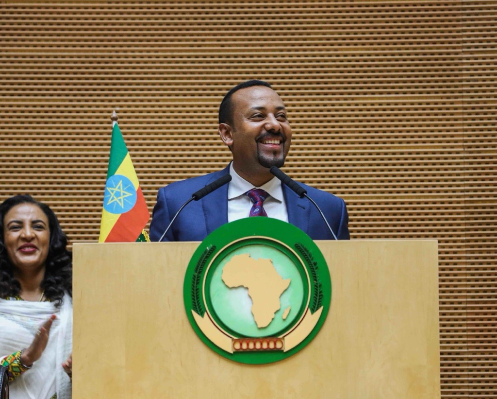
Abiy initiated a series of sweeping reforms, including releasing political prisoners, making peace with Eritrea (for which he was awarded the Nobel Peace Prize), and opening up the political space. However, these reforms also coincided with a rise in ethnic violence and internal displacement.
In November 2020, a conflict erupted in the Tigray Region between the federal government and the TPLF, resulting in a humanitarian crisis and widespread accusations of human rights abuses by all parties. A tenuous ceasefire began in November 2022, but other conflicts have sparked in nearby regions, such as the Amhara War between the government and Fano militia, who had previously backed the Ethiopian government during the Tigray War.
Unfortunately, modern-day Ethiopia is characterized by inter-ethnic clashes and political instability, with significant democratic backsliding. Its capital is Addis Ababa, and the country is divided into a dozen administrative regions: Afar, Amhara, Benishangul-Gumuz, Central Ethiopia, Gambela, Harari, Oromia, Sidama, Somali, South Ethiopia, Southwest Ethiopia, and Tigray.
Ethiopia contains more than 80 ethnic groups, the four largest being the Oromo (35% of the population), Amhara, Somali, and Tigrayans. There are roughly 100 languages spoken in the country, mostly of Afroasiatic origin, and official languages vary by region.
English is the largest spoken foreign language, but tongues corresponding to the four largest ethnic groups (Oromo, Amharic, Somali, and Tigrinya) are the most commonly spoken languages in the country, centered in their respective geographic regions.
Ethiopia is home to 22 national parks, 10 wildlife reserves, and several sanctuaries and controlled hunting areas, in addition to dozens of other protected regions, such as “National Forest Priority Areas.” The country also has five UNESCO-MAB biosphere reserves.
Two of the country’s national parks, Bale Mountains National Park and Simien Mountains National Park, are UNESCO World Heritage Sites. National parks and other protected regions comprise roughly 17% of Ethiopia's total land area (1,104,300 sq km / 426,400 sq mi).
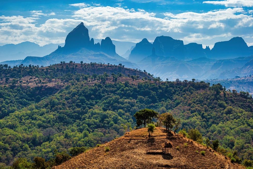
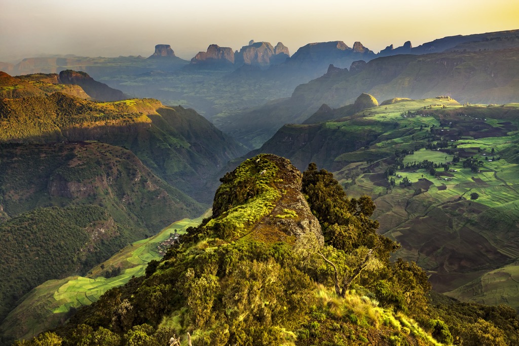
Simien Mountains National Park is Ethiopia's largest national park, located in the far north, in the Amhara Region near the border with Eritrea. A dramatic topography of jagged peaks, deep gorges, and precipitous cliffs marks this UNESCO World Heritage site.
The park’s altitudinal gradient, ranging from around 1,900 meters (6,234 ft) to over 4,500 meters (14,764 ft), creates a variety of distinct habitats, from montane forests to afro-alpine grasslands and moorlands. The park is one of the best places in Ethiopia to see troops of gelada monkeys and is rife with hiking trails.
It is home to 11 named summits, including the three tallest mountains in Ethiopia: Ras Dashen (4,553 m / 14,937 ft), Ancua (4,460 m / 14,633 ft), and Ras Bwahit (4430 m / 14,534 ft). Many peaks here are popular trekking objectives, but Ras Dashen is the most accessible. From a base camp at Ambiko, most parties take roughly 12 hours to ascend and descend.
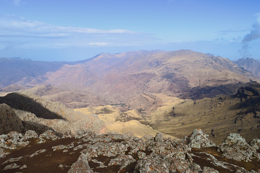
Situated in the Oromia Region of southeastern Ethiopia, Bale Mountains National Park encompasses a vast area of high-altitude plateaus, afro-alpine moorlands, and montane forests in the Bale Mountains. The park is a crucial center of endemism, supporting a remarkable diversity of flora and fauna found nowhere else on Earth. It represents the largest continuous area of afro-alpine habitat on the African continent. The Sanetti Plateau, a vast expanse of high-altitude grassland and moorland, is a key feature.
The national park contains eight named summits. The highest and most prominent is Tullu Demtu (4,337 m / 14,360 ft), which is the fourth highest peak in Ethiopia and the second most prominent, after Ras Dashen. Along with the Simien Mountains National Park, the Bale Mountains are the best place in Ethiopia for trekking and outdoor adventure.
The Bale region is the primary stronghold of the Ethiopian wolf (Canis simensis), with the largest population of this critically endangered canid residing within the park. The mountain nyala (Tragelaphus buxtoni), a large antelope endemic to the Ethiopian highlands, also lives here.
The park's diverse habitats support a range of other mammals, including the Menelik's bushbuck (Tragelaphus scriptus meneliki) and several rodent species endemic to the region. The Bale Mountains are notable for sheltering the only known sub-Saharan breeding populations of Palearctic avian life, like the golden eagle (Aquila chrysaetos), red-billed chough (Pyrrhocorax pyrrhocorax), and ruddy shelduck (Tadorna ferruginea).
Awash National Park is also in the Oromia Region, roughly 233 kilometers (145 mi) north of the Bale Mountains National Park. Located in the Awash River Valley of central Ethiopia, the park is characterized by a drier, savanna landscape, contrasting with the highland parks mentioned above. The Awash River, which stretches some 1,200 kilometers (750 mi) from the highlands northeast to the Djibouti border, flows through the park.
The park's vegetation consists primarily of scrub and woodland, savanna grasslands, and riverine forests along the Awash River. The park is also home to a significant population of Hamadryas Baboons (Papio hamadryas). Awash National Park is an important birding destination, with over 400 species recorded, including various raptors, waterbirds, and dry-country species.
The dormant volcano Mount Fentale (1,554 m / 5,098 ft) is the highest peak in the park and one of only three named summits.
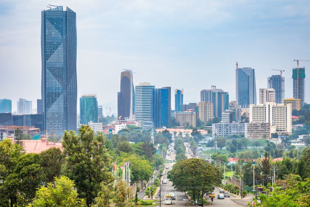
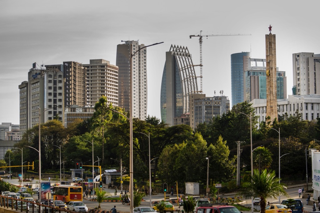
Ethiopia's capital and largest city, Addis Ababa (meaning “New Flower” in Amharic), is a relatively young city, established by Emperor Menelik II in 1886. Situated at the foothills of the Entoto Mountains, it serves as the nation's political, economic, and cultural hub and is home to nearly six million people.
Addis Ababa is also a significant international center, hosting the headquarters of the African Union (AU) and the United Nations Economic Commission for Africa (UNECA). This global presence contributes to its cosmopolitan character. Key landmarks include:
As the Ethiopian Empire's capital during the Gondarine period (17th-18th centuries), Gondar (pop. 450,000) is renowned for its historical significance and architectural heritage. The city's most prominent feature is the Fasil Ghebbi, a 17th-century fortress and UNESCO World Heritage site.
This royal compound encompasses a complex of castles, palaces, and churches built by successive Gondarine emperors. The architectural style uniquely blends Ethiopian, Portuguese, and Indian influences. Debre Birhan Selassie Church, famous for its intricate ceiling paintings depicting biblical scenes and angels, is another important site, showcasing Ethiopian religious art.
Gondar’s setting, nestled within the foothills of the Simien Mountains, also provides a gateway for exploring the dramatic landscapes of the Simien Mountains National Park.
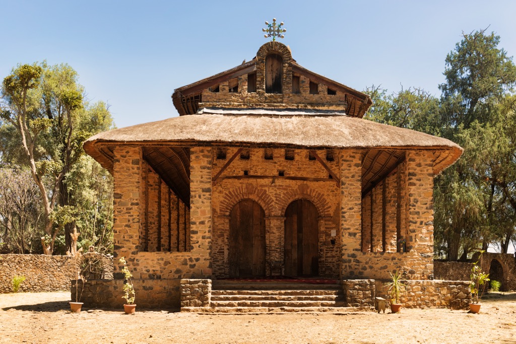
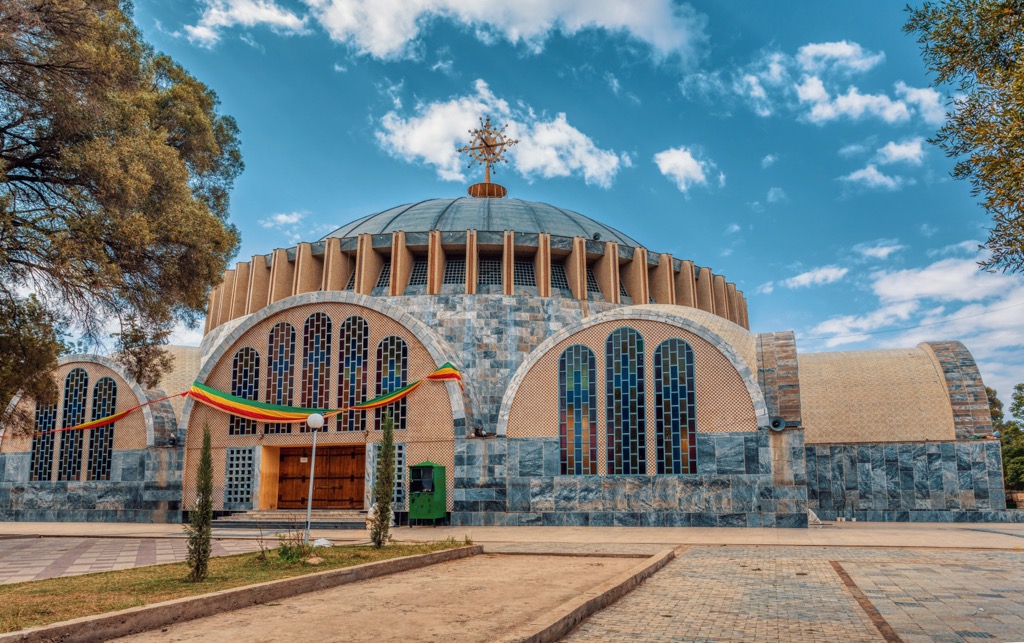
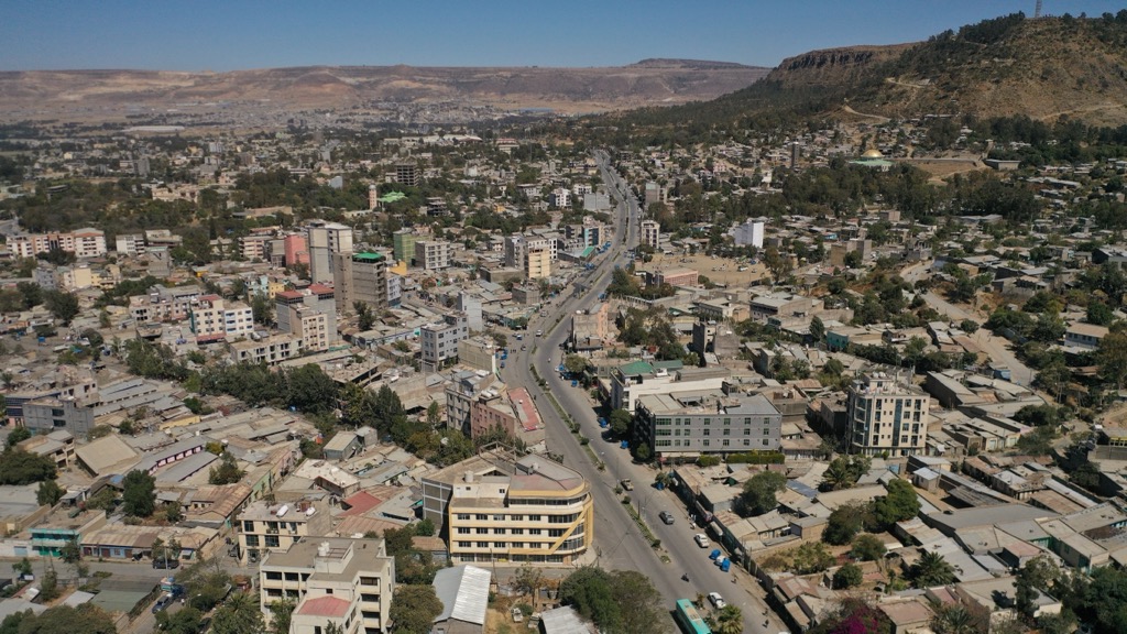
As the ancient capital of the Aksumite Kingdom, Aksum (pop. 100,000) holds immense historical and archaeological importance. It is considered the cradle of Ethiopian civilization and a sacred city for the Ethiopian Orthodox Tewahedo Church.
The most iconic landmarks are the Aksumite stelae, towering monolithic obelisks that mark the tombs of ancient rulers. The largest of these, still standing, reach heights exceeding 20 meters (66 ft). Ethiopian Orthodox Christians believe the Church of Our Lady Mary of Zion houses the Ark of the Covenant, although access is strictly prohibited.
Located in the Lasta region, Lalibela (pop. 20,000) is globally recognized for its eleven monolithic rock-hewn churches, which make up a UNESCO World Heritage site. These churches, carved directly from solid rock during the Zagwe dynasty (primarily in the 12th and 13th centuries), represent a remarkable feat of engineering and artistry.
A network of tunnels and passages interconnects the churches. Each church possesses distinct architectural features and artistic details. Bete Giyorgis (St. George's Church), carved in the shape of a cross, is arguably the most iconic and well-preserved. Lalibela remains an active pilgrimage site for Ethiopian Orthodox Christians, particularly during major religious festivals.
The capital of the Tigray Region, Mekelle (pop. 610,000), has gained prominence as a center of economic and political activity in northern Ethiopia. It served as a key base of operations for the Tigray People's Liberation Front (TPLF) during the struggle against the Derg regime. The city, which sits at over 2,250 meters (7,381 ft) in elevation, houses the Martyrs' Memorial Monument, commemorating those who died in that conflict.
The Emperor Yohannes IV Museum, located in the former palace of Yohannes IV, offers historical insights. Mekelle is also a significant educational center, home to Mekelle University. The recent conflict in Tigray has significantly impacted the city, though most analysis considers it just as safe as Addis Ababa, if not safer.


Yes. Ethiopia has 1,948 named mountains. The highest is Ras Dashen at 4,553 m.
The highest mountain in Ethiopia is Ras Dashen, at 4,553 m.
Ethiopia has 1,948 named mountains.


.jpg)