
Scan the QR code and open PeakVisor on your phone
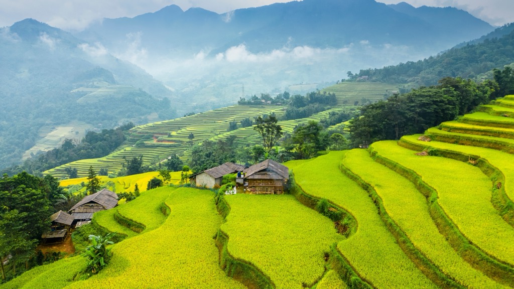
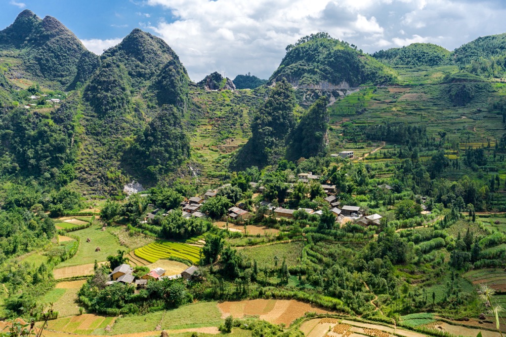
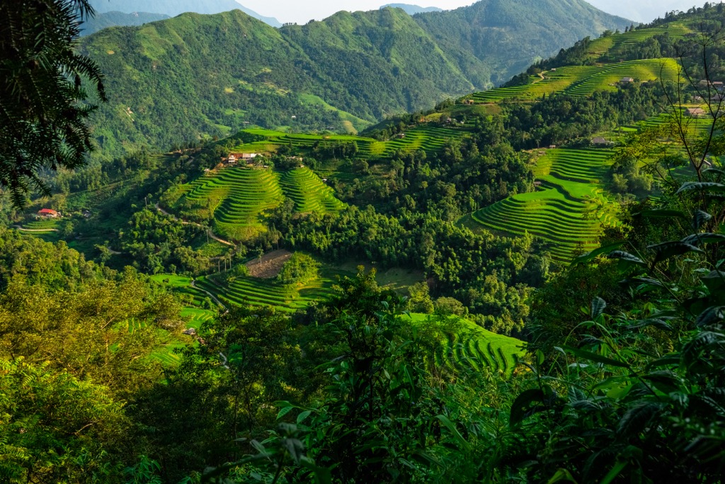
Hà Giang is the northernmost of Vietnam’s 58 provinces. It’s a rural, heavily mountainous region along the border with Yunnan, China. Hà Giang is famous as a tourist destination and is home to an increasingly popular motorcycle loop, as well as hiking, caves, rice paddies, and picturesque alpine passes. The province features 91 named mountains. Tây Côn Lĩnh (2,430 m / 7,972 ft) is the highest, while the most prominent is Núi Pu Tha Ca (2,268 m / 7,441 ft), with over 1,381 meters (4,531 ft) of topographic prominence.
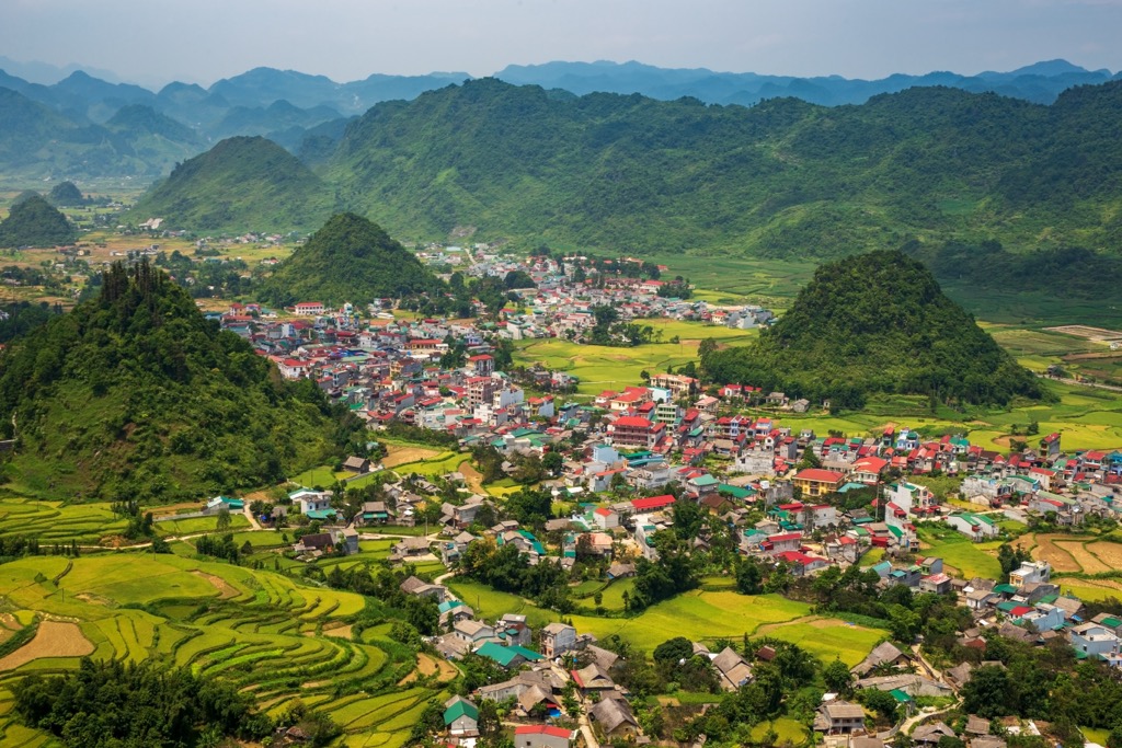
Hà Giang province is in the far north of Vietnam and spans nearly 8,000 square kilometers (3,000 sq mi). Clockwise from east to west, it borders the provinces of Cao Bằng, Tuyên Quang, Yên Bái, and Lào Cai. It also extends for approximately 270 kilometers (168 mi) along the international border with China’s province of Yunnan. The region is home to only one city (Hà Giang) and a number of small villages and towns.
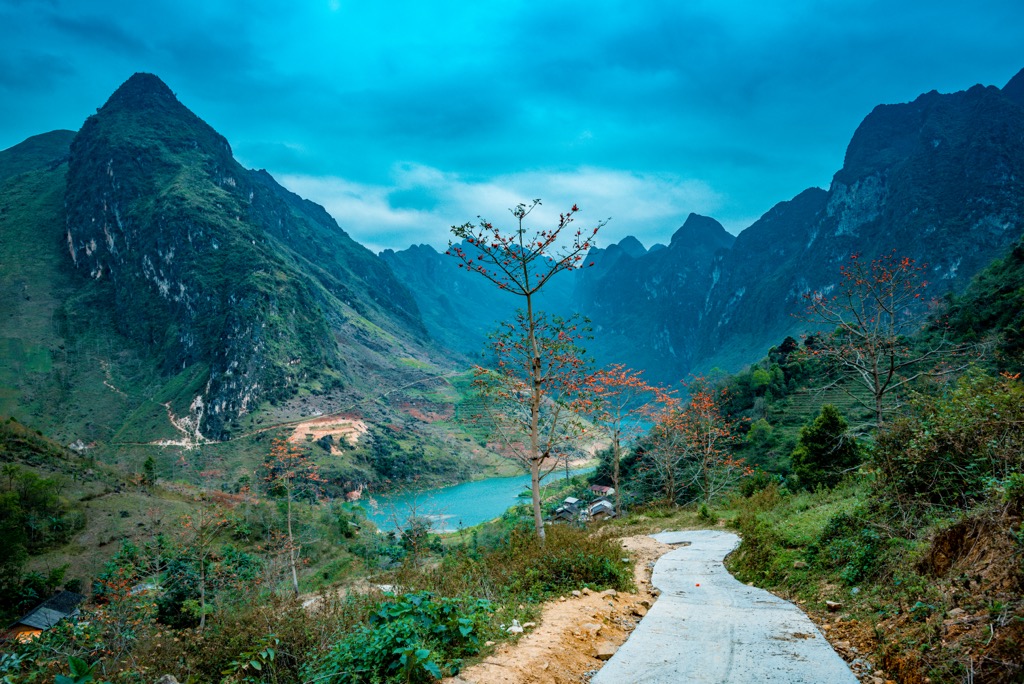
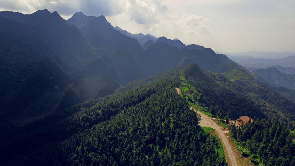
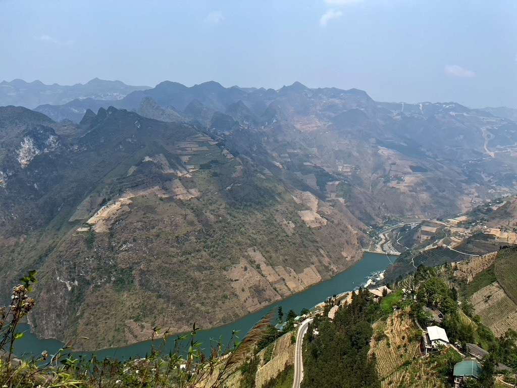
Extremely mountainous and rugged, Hà Giang is one of Vietnam's poorest regions due to its limited agricultural potential. Geographically, Hà Giang is dominated by dramatic topographic relief, with soaring limestone and granite peaks, deep-cut canyons and valleys, and river systems like the Lô and Nho Quế. In the far north, the landscape is predominantly characterized by the karst plateau of Đồng Văn (see “Geology” below).
Hà Giang’s isolated valleys experience distinct microclimates, though overall, the region can be characterized as a subtropical highland climate with distinct wet and dry seasons. The monsoon season brings heavy rainfall from May to September, while October to April is typically dry (though rainfall is possible at any time of year).
The average temperature in the province ranges from 15°C (59°F) to 28°C (82°F). During the summers, temperatures are hot and humid in lower elevations, sometimes exceeding 30°C (86°F). Higher altitudes experience slightly cooler temperatures—though they remain relatively balmy—typically around 24°C (75°F) to 28°C (82°F). Winters are cool across the province, with temperatures ranging from 5°C (41°F) to 16°C (61°F). Higher elevations often drop below freezing, with occasional frost or snow.
The geological history of Hà Giang can be traced to the Cambrian Period, 550 million years ago, when the region was submerged beneath a shallow sea. Over time, layers of sedimentary rock, primarily limestone, were deposited on the seafloor. These layers were later uplifted and subjected to intense tectonic activity, resulting in folding, faulting, and the formation of the mountainous terrain we see today.
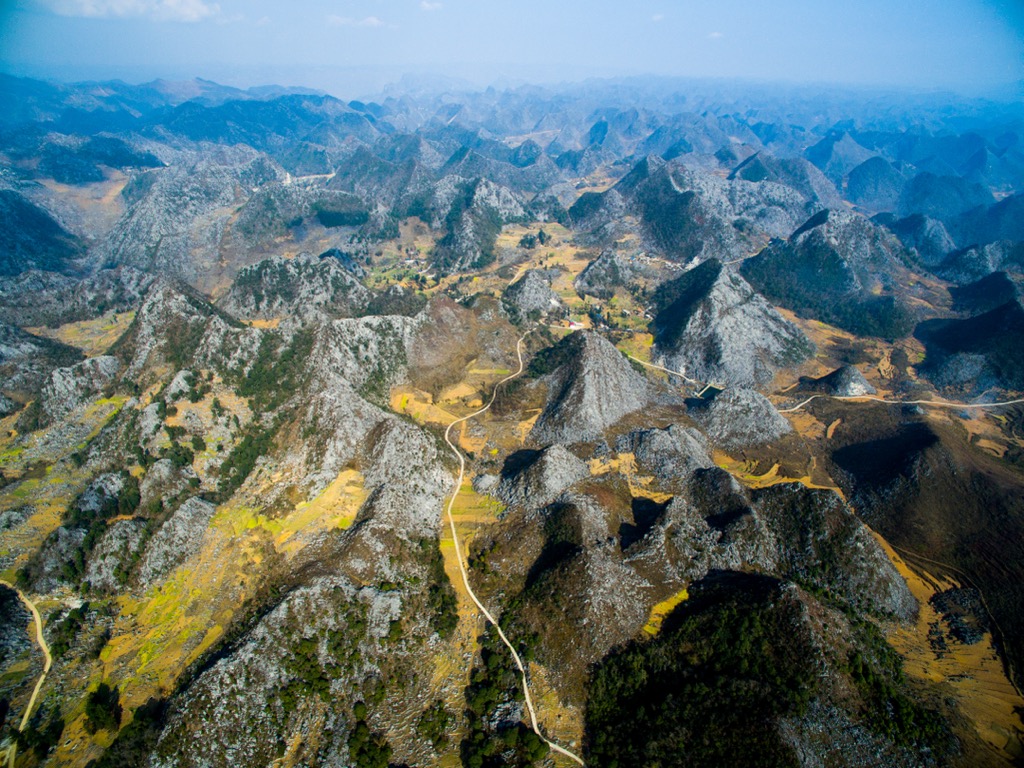
The most notable facet in Hà Giang’s geology, however, is the Đồng Văn Karst Plateau. This UNESCO Global Geopark is recognized for its unique karst landscape. It comprises almost the entirety of northern Hà Giang, in the districts of Đồng Văn, Mèo Vạc, Yên Minh, and Quản Bạ.
During the subsequent millions of years, the limestone formations were subjected to the relentless forces of erosion by water and wind. This process gradually sculpted the landscape, creating the characteristic karst features that define the region. Today, over 80% of the 2,356 square kilometers (910 sq mi) of land that makes up the Đồng Văn—and indeed much of Hà Giang province overall—is rock, not soil.
Karst is a type of landscape formed from the dissolution of soluble rocks such as limestone, dolomite, and gypsum. It is characterized by underground drainage systems with sinkholes, caves, and springs.
A June 2024 study in the International Journal of Geoheritage and Parks found 19 unique fossil groups present in the karst plateau: (1) Chitinozoans; (2) Algae; (3) Paleoflora; (4) Crustaceans; (5) Ostracods; (6) Crinoids; (7) Bryozoans; (8) Cephalopods; (9) Gastropods; (10) Conodonts; (11) Bivalves; (12) Tentaculites; (13) Foraminifera; (14) Paleofish; (15) Trilobite; (16) Stromatoporoid; (17) Rugose coral (Tetracorallia); (18) Tabulate coral; and (19) Brachiopod. The oldest fossils in the region date to over 450 million years ago.
Notable geological marvels include extensive cave systems like Ma Le and Ong, traditional karst canyons, rock deserts, stone forests, and the “Mountain God” group of limestone columns and the “Fairy Bosom” karst cones, both of which are found in Quản Bạ.
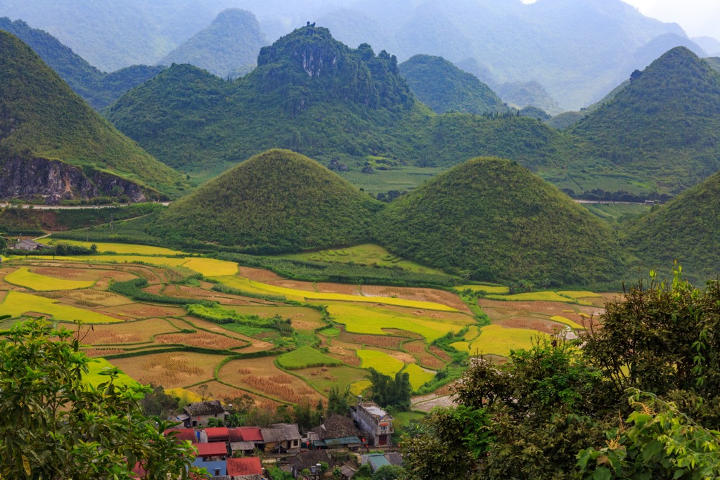
Like many mountainous regions, Hà Giang’s flora varies by elevation. The terrain is predominantly cultivated fields below 800 meters (2,600 ft). Up to 1,000 meters (3,120 ft), the land is covered in low grasses and wood shrubs, with forest cover beginning above 1,000 meters (3,300ft). Above 2,000 meters (6,600 ft), the flora is characterized by montane mixed semi-deciduous and evergreen cloud forests.
Notable species of flora in the region include brown strip conifer chestnut (Amentotaxus hatuyenensis), yellow cypress (Cupressus funebris), short-leaf bamboo pine (Podopcarps pilgri), and the Chinese red pine (Taxus chinensis). There are also many species of orchid, including the threatened Chinese Pholidota (Pholidota chinensis) and Ellen's Paphiopedilum (Paphiopedilum helenae).
Psilocybe cubensis—better known as “magic mushrooms” due to their hallucinogenic properties—also grows in the region.
There are around 50 species of mammals, 90 bird species, 16 reptile species and 36 amphibian species found in Hà Giang. Around 18 of these species are classified as some level of endangered by the International Union for Conservation of Nature (IUCN).
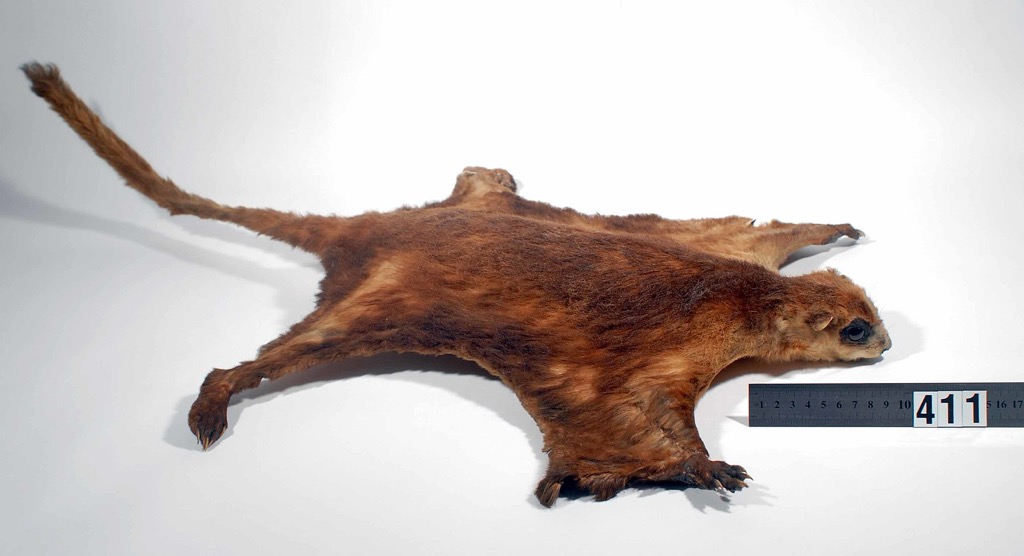
Notable species of mammalian fauna include the leopard Cat (Prionailurus bengalensis), giant flying squirrel (Petaurista petaurista), Asian palm civet (Paradoxurus hermaphroditus), and of course the iconic water buffalo (Bubalus bubalis).
Reptiles such as the king cobra (Ophiophagus hannah), the world’s longest venomous snake, and the iridescent flower snake (Elaphe moellendorffi) can also be found. Perhaps the most unique amphibian is the rare Ziegler's crocodile newt (Tylototriton ziegleri), found only in a couple of Vietnam’s provinces. Phoenix barb (Spinibarbichthys denticulatus) and Amur goby (Rhinogobius similis) can be seen swimming in the province’s rivers.
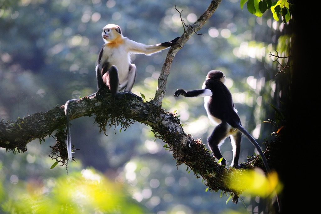
Perhaps the most exciting and rare species in Hà Giang is the Tonkin snub-nosed monkey (Rhinopithecus avunculus). This critically endangered primate has black and white fur, an upturned pink nose, and vibrant blue eye patches and is only found in this province. It is estimated that only around 100 remain due to heavy poaching and habitat destruction.
The earliest inhabitants of Hà Giang were likely hunter-gatherer groups who settled in the region in the Paleolithic era. Archaeological evidence suggests that these early communities engaged in agriculture and animal husbandry, gradually establishing settled villages.
By the Bronze Age (around 2000-1000 BCE), Hà Giang was inhabited by various ethnic groups, including the ancestors of the Hmong, Yao, Tay, and Nùng people (who still inhabit the region today). The Hồng Bàng dynasty (est. 2879 BCE) controlled the region as part of its Văn Lang empire until its fall to warlord Thục Phán—the founder of the short-lived kingdom Âu Lạc—in the 3rd century BCE.
Chinese rule followed in the following century, beginning with the Nanyue dynasty, and lasted in some form for over a thousand years. During this period, Hà Giang was a frontier region, witnessing the ebb and flow of Chinese influence and the resistance of local communities.
After the Vietnamese regained independence from China in 900 CE, Hà Giang became part of the Dai Viet kingdom. The region remained a strategically important border area, playing a role in conflicts with neighboring kingdoms and resisting incursions from the north. The Lé Dynasty (1428-1789 BCE) eventually established administrative control over Hà Giang, further integrating it into the Vietnamese state.
When France colonized the region in the late 1800s, Hà Giang became part of the French protectorate of Tonkin. During this period, the region underwent significant changes, with the introduction of new Western infrastructure, administrative systems, and economic practices. Notably, the French established a military garrison on the east bank of the Lô River, which went on to become one of the four major military establishments in French Indochina. Beginning in 1901, the people of Hà Giang took part in numerous rebellions against the French, including the infamous White Hat Revolt from 1913 to 1915, which ended in the hanging of dozens of rebels.

The Vietnamese continued to struggle for independence in the mid-20th century, with wars perpetuated by France and later the United States also impacting Hà Giang. The Viet Minh, the communist-led independence movement, gained support from local communities, and Hà Giang became a base for resistance against Western powers.
However, the Hmong lords in the northern regions of Đồng Văn and Mèo Vạc were famously heavily supportive of the French. This support lasted until the rule of Vương Chú Sển in 1944, who was the first of the local Vương dynasty to support Ho Chi Minh and independence publicly.
Following the end of French colonial rule in 1954, Hà Giang became part of the Democratic Republic of Vietnam (North Vietnam). Though not a site of active conflict during the Vietnam War, the province was subjected to heavy bombing by the United States due to its proximity to the Chinese border and its importance as a supply route.

After the fall of Saigon (Ho Chi Minh City) and the reunification of Vietnam in 1975, Hà Giang continued to face challenges, including poverty, lack of infrastructure, and limited access to education and healthcare. The region was also a major battleground in the Sino-Vietnamese War (1979).
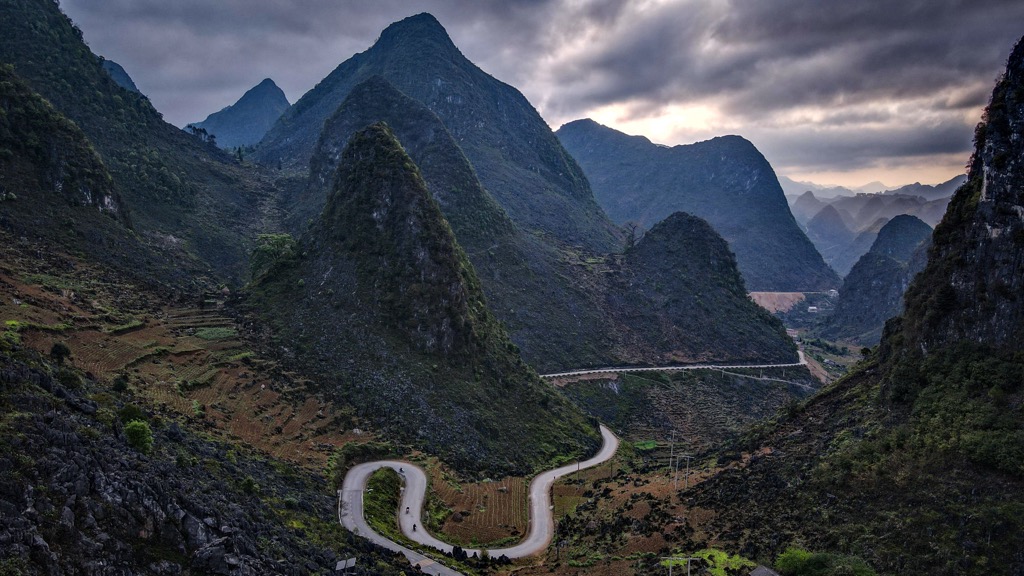
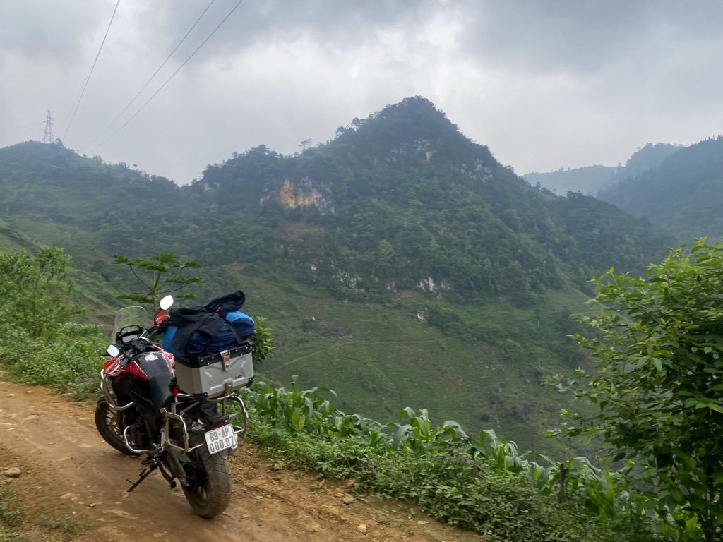
Today, Hà Giang is perhaps most famous for the Hà Giang Motorcycle Loop, a tourist route that travels remote, rugged alpine roads from Hà Giang City up to Đồng Văn and back (exact routes vary). Riding “The Loop” is a mainstay in many Southeast Asian backpackers’ itineraries.
The Hà Giang Motorcycle Loop is the most famous attraction in the region. There is no “set” itinerary for the loop, save for beginning in Hà Giang City and reaching Đồng Văn in the far north, then coming back again.
Riders can start the loop in either direction (clockwise, heading first to Quản Bạ or counterclockwise, heading first to Yên Định and then north to Du Già on DT76) and go as slowly as they like. Some parties go all the way out to Cao Bằng province, following the Gâm River to where it meets the Nho Quế River in Nà Phòng.
On the short end, you need at least three or four nights to make it around without feeling rushed and still having time to explore some of the sights below. However, some parties have longer variations, with trips lasting around ten days or two weeks.
Be sure to book your homestays or other lodgings in advance, as service can be spotty along the loop, and lodging can fill up quickly during the popular seasons!
Do not miss the Ma Pi Leng Skywalk! This 3.5-kilometer (2.1 mi) one-way route is one of the most jaw-dropping hikes this author has completed in his life and certainly among the most beautiful in Vietnam.
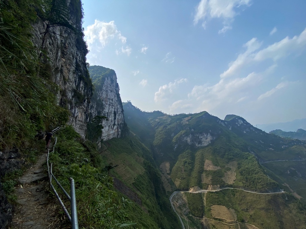
It takes travelers along a precipitous alpine path that literally hugs a sheer, chalky-white cliffside hundreds of meters above the valley below. There’s not much else to say; the trail is mostly paved and easy to follow, though crumbling in some places. Bring a camera!
You can begin this route either from the Bảo Tàng Con Đường Hạnh Phúc monument at Ma Pi Leng Pass or—if coming counterclockwise around the loop, from Mèo Vạc—by parking at the Mã Pì Lèng EcoLodge and walking uphill until you meet the trail. Halfway along, you can cut off the trail and shorten the hike, finishing below the white cliffs at the Ma Pi Leng Homestay & Restaurant. Expect to take around two hours one-way for the entire route.
TIP: You may see local youths riding their motorbikes up the path from Ma Pi Leng Pass. Do not attempt this. Tourists have died doing so, and after around ¼ of the way, even bikes cannot continue, so it’s really not worth it.
This short hike is just off the road at Quản Bạ Pass and is well worth a half-hour detour. While the pass itself is often pretty crowded from loop riders, few people actually take the time to walk up to the viewpoint. You’ll need to pay a dollar or so, but it’s well worth it. Buy a coffee at the stand across the street and enjoy it from the viewpoint atop the hill.
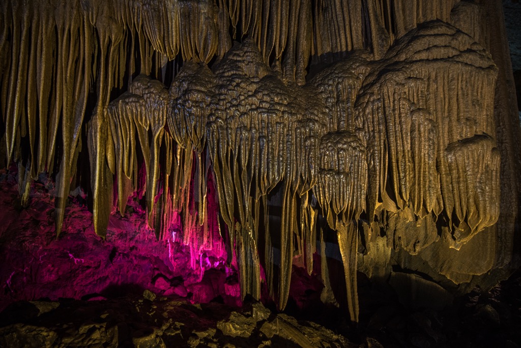
There are dozens of caves to be explored along the loop, but one of the most accessible is Lung Khuy in Tam Sơn, just north of Heaven’s Gate (above). This cave was only discovered in 2015 and is characteristic of the karst plateau that dominates the Đồng Văn region. A 1-kilometer (0.6 mi) walkway takes you through the cave.
As you pass through Quản Bạ and head towards Đồng Văn, don’t miss the Hmong palace in Sà Phìn. This villa was built in 1921 for a Hmong king who supported the French colonizers and remains remarkably well-preserved today, with twin white towers
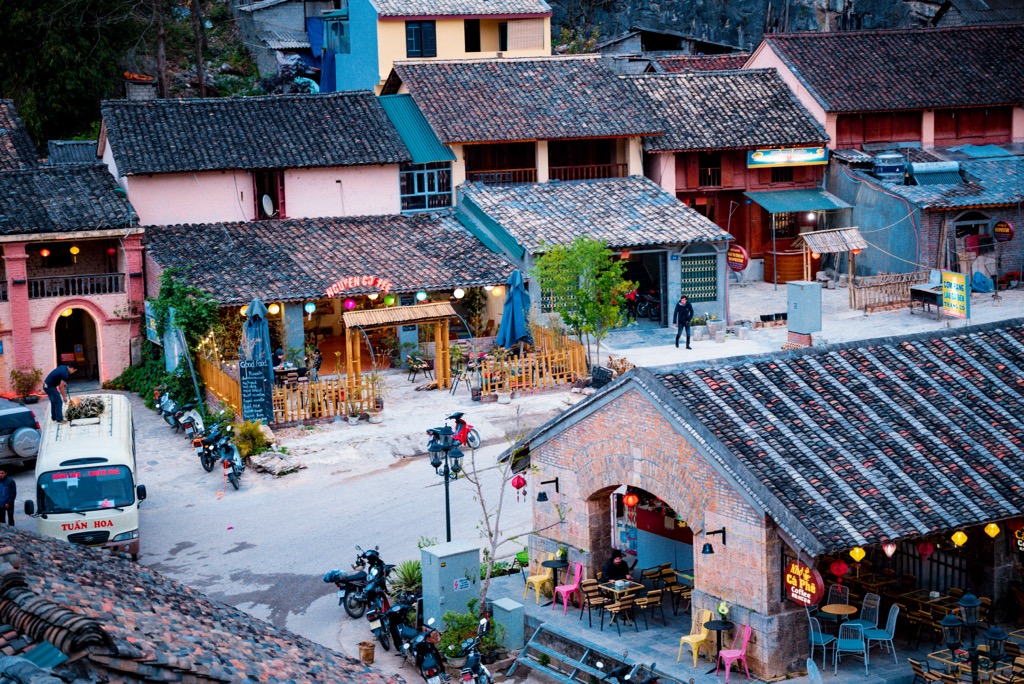
Of all the towns in the Hà Giang loop, Đồng Văn is the only one that “must” be visited to say you completed the loop, as it’s the northernmost point on the trip. The winding alpine roads between Đồng Văn and Mèo Vạc are generally regarded as the most beautiful of the entire loop.
Don’t miss the “Ancient Town” in the center of Đồng Văn, where you can purchase a number of local handcrafts, produce, and traditional cuisine, as well as the picturesque Lung Cu Flag Tower outside of town. Climbing the road up to the ruins of Don Cao (High Fortress) is another worthy adventure. This lofty viewpoint gives you a 360-degree panorama of the surrounding wilderness.
TIP: This author stayed at the Nhà Cổ Lao Xa Homestay outside of Đồng Văn, in the hilltop village of Lao Xa. I strongly recommend these guys; they helped me fix a flat tire on my motorbike, cooked excellent food, performed traditional Hmong music, and cultivated an all-around good vibe.
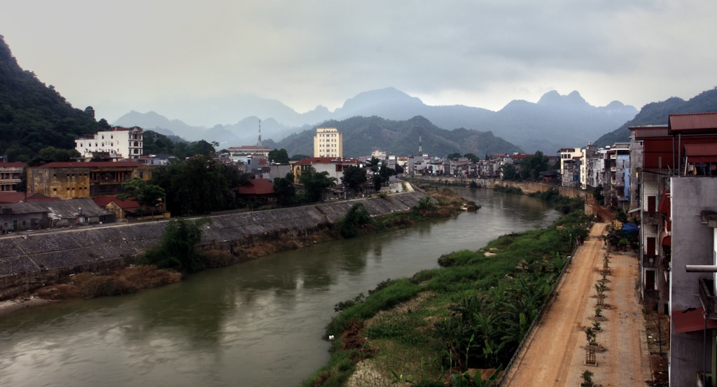
Hà Giang City (pop. 55,000), on the banks of the Sông Lô, is the only “city” in Hà Giang province and the starting point for any adventures. While the city is primarily worthwhile as a jumping-off point for the smaller towns and wilderness of the province, there is good food and a few sights.
These include the town’s bustling Central Square, the Provincial Museum celebrating the province’s 19 ethnolinguistic groups, and the one-hour hike up to Núi Cấm (Forbidden Mountain) viewpoint near the Buddhist temple Chùa Hộ Quốc. Hà Giang is five to six hours by car from Hanoi, Vietnam’s capital.
TIP: This author stayed at the Phoenix Hotel in Hà Giang and was highly impressed by the spacious rooms, cleanliness, and sumptuous breakfast buffet. I also stayed in villas at the more remote Sky Bay Ha Giang and appreciated the value, outdoor pool, big showers, and home-cooked food.


.jpg)
.jpg)
.jpg)