
Scan the QR code and open PeakVisor on your phone
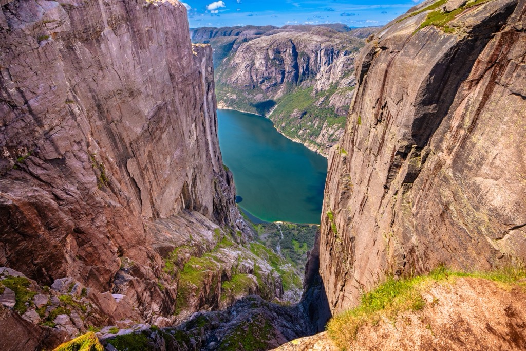
Norway is a highly mountainous country in northwestern Europe, a land of fjords, glaciers, jagged peaks, and exquisite beauty. Norway contains 161650 named mountains, the highest and most prominent of which is Galdhøpiggen (2,469 m / 8,100 ft) - the highest point in Scandinavia.
Located in northwestern Europe, Norway (Norge / Noreg / Sorga / Vuodna / Nöörje) is a large, mostly coastal country with a rugged topography. Norway covers an area of some 385,207 sq. kilometres (148,729 sq. miles), which makes it the 67th largest country in the world. However, with a population of around 5.4 million people, it ranks just 118th in terms of population.
The country shares a land border with Sweden, Finland, and Russia. The border between Norway and Sweden is approximately 1,630 kilometres (1,010 miles) long. Meanwhile, Norway’s border with Finland is just 736 km (457 mi) long, and the country’s border with Russia’s Pechengsky District (Пе́ченгский райо́н / Peisen) is only 195 km (121 mi) long.
While Norway only shares a land border with three other countries, it has several maritime borders. In particular, Norway has a maritime border with the United Kingdom and the Faroe Islands (Denmark) in the North Sea and with Denmark through the Skagerrak. It also has a maritime border with Russia in the Barents Sea.
Officially, Norway is divided into 11 different administrative regions called counties (fylker). Before 2017, there were 19 counties, though the government officially reduced the total number to 11 in January 2020. Moreover, Norway has traditionally been divided into five geographical regions, rooted in topographical, cultural, and historical connections.
The country also has a number of overseas territories which are not part of any county. The two northern hemisphere territories - Svalbard and Jan Mayen - are considered unincorporated regions of the country, and only Svalbard has a permanent civilian population (Jan Mayen has just a military base).
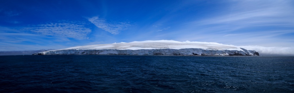
Meanwhile, the southern hemisphere territories in the Subantarctic and Antarctic—Peter I Island (Peter I Øy), Bouvet Island (Bouvetøya), and Queen Maud Land (Dronning Maud Land)—are considered dependencies. None of Norway’s southern dependencies has a permanent population.
Aptly named, the Northern Norway (Nord-Norge / Nord-Noreg) region is the northernmost part of the country. It includes the counties of Troms og Finnmark and Nordland, which are about 35% of mainland Norway’s total area.
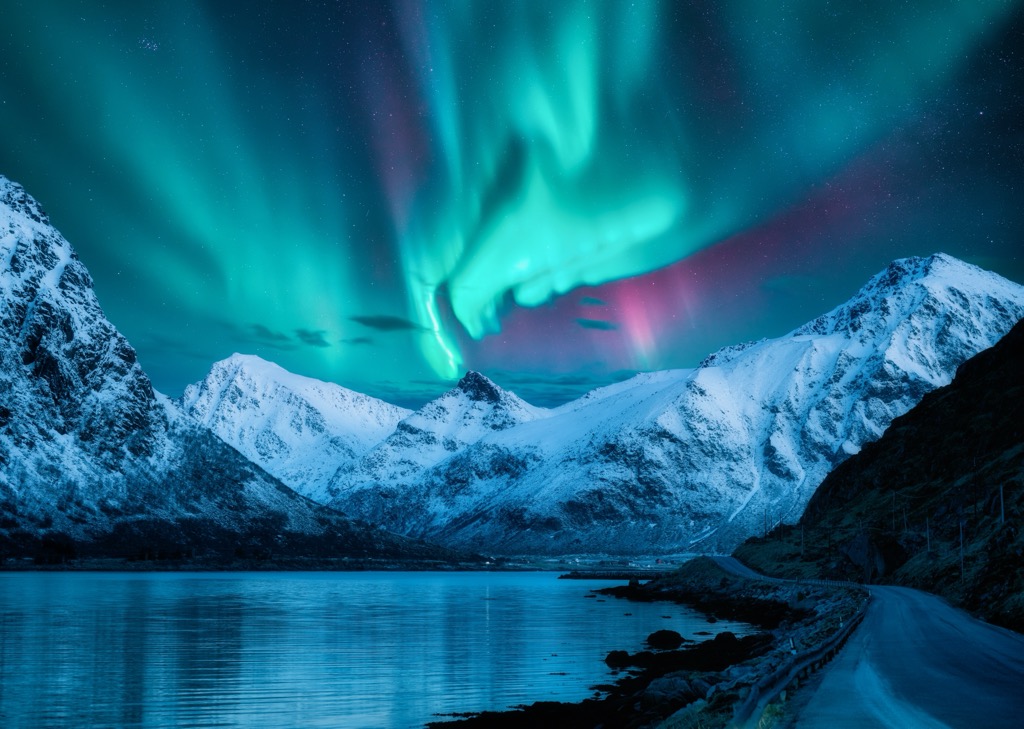
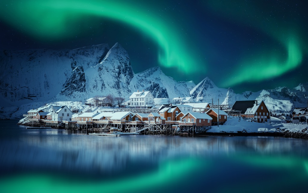
Often called the land of the midnight sun, much of Northern Norway is located above the Arctic Circle. As a result, it is a great place to see the northern lights in the winter months or to experience all-day sunlight in the summer.
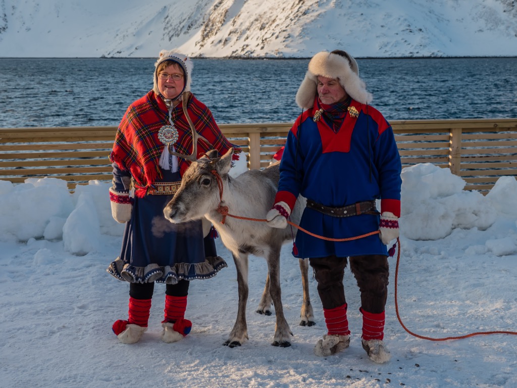
Northern Norway is a multicultural region home to Norwegians, the Sami people, Kvens, and a sizable Russian population.
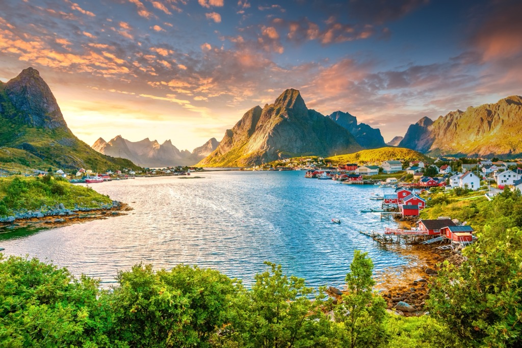
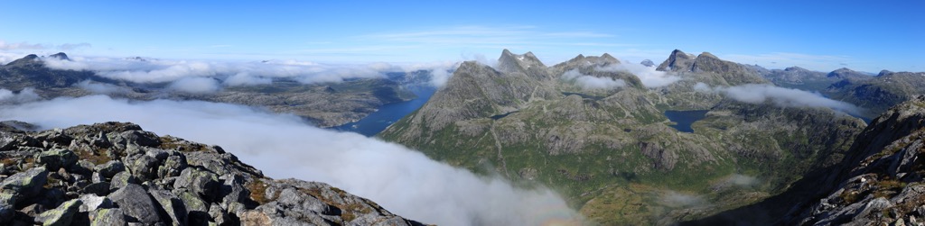
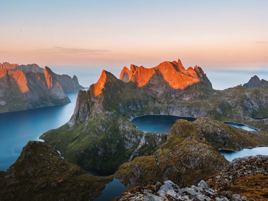
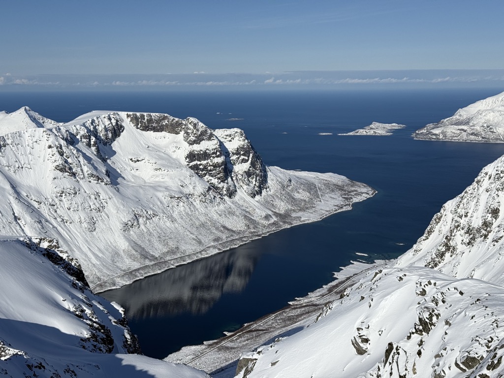
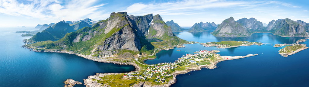
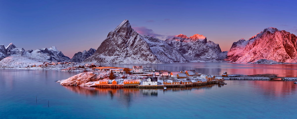
Topographically, the region is quite diverse, with fjords, islands, alpine terrain, glaciers, and spruce forests. It’s also known for being home to the Lofoten archipelago, a truly stunning collection of mountainous islands.
Northern Norway is a notably excellent place to hike, ski tour, climb, or partake in any other outdoor adventure, thanks to its many national parks and recreation areas. The region has over a dozen national parks, including:
Norway also contains many nature reserves and conservation areas, such as:
Located just to the south of Northern Norway in the central part of the country, Trøndelag (Midt-Norge / Midt-Noreg) is one of the country’s most agricultural regions. Containing just one country, Trøndelag, the region contains 38 municipalities and some sizable cities, including Trondheim and Steinkjer.
Trøndelag is known for its arts scene, as well as its unique cuisine. It’s especially known for a regional moonshine that is traditionally used to make a mixed drink called karsk when mixed with coffee.
Although Trøndelag isn’t as mountainous as the regions to the north or south, it does contain some national parks and nature reserves, such as:
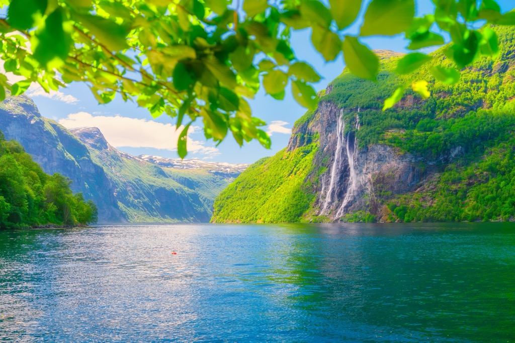
The Western Norway region (Vestlandet) is a rugged coastal area encompassing all of southwestern Norway. It includes the counties of Møre og Romsdal, Vestland, and Rogaland and is home to about one-fourth of Norway’s population.
Due to its coastal location, Western Norway has a historical connection with other nearby countries and territories, such as Iceland, the Faroe Islands, Denmark, the Netherlands, Ireland, and the United Kingdom - particularly when it comes to the Isle of Man, the Orkney Islands, the Shetland Islands, and many of the Hebridean Islands in Scotland. During the Norse period, many people left what is Western Norway and settled throughout the North Atlantic.
As the third-largest region in the country by area, Western Norway is home to a great diversity of landscapes. This includes glacially-capped peaks, sandy beaches, and massive cliffs. Moreover, the region has a number of national parks and nature reserves, including:
As the name suggests, Southern Norway (Sørlandet) includes the southernmost part of the country, which is normally defined as the county of Agder (formerly Vest-Agder and Aust-Agder).
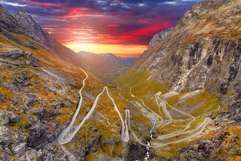
The region is known for being a hub for shipping, recreation, and commerce within Norway. Unlike many of the more northern areas of the country, Southern Norway is hilly, rather than heavily mountainous, though there are plenty of sizable valleys and fjords.
There are quite a few national parks and nature reserves in Southern Norway, such as:
The only part of Norway to have completely land-locked counties, Eastern Norway (Østlandet / Austlandet), is the most populous part of the country and one of its most mountainous regions. Home to Oslo, the country’s capital, Eastern Norway includes the counties of Innlandet, Vestfold og Telemark, Viken, and Oslo.
Eastern Norway contains the country’s highest peak, Galdhøpiggen (2,469 m / 8,100 ft), as well as several other major mountainous areas. It also includes important valleys like Østerdal, Valdres, and Numedal.
Additionally, Eastern Norway contains the historic Telemark region, sometimes referred to as the birthplace of skiing.
In addition to being home to about half of Norway’s population, Eastern Norway also has the country’s densest concentration of national parks. This includes:
There are also many nature reserves and conservation areas in Eastern Norway, such as:
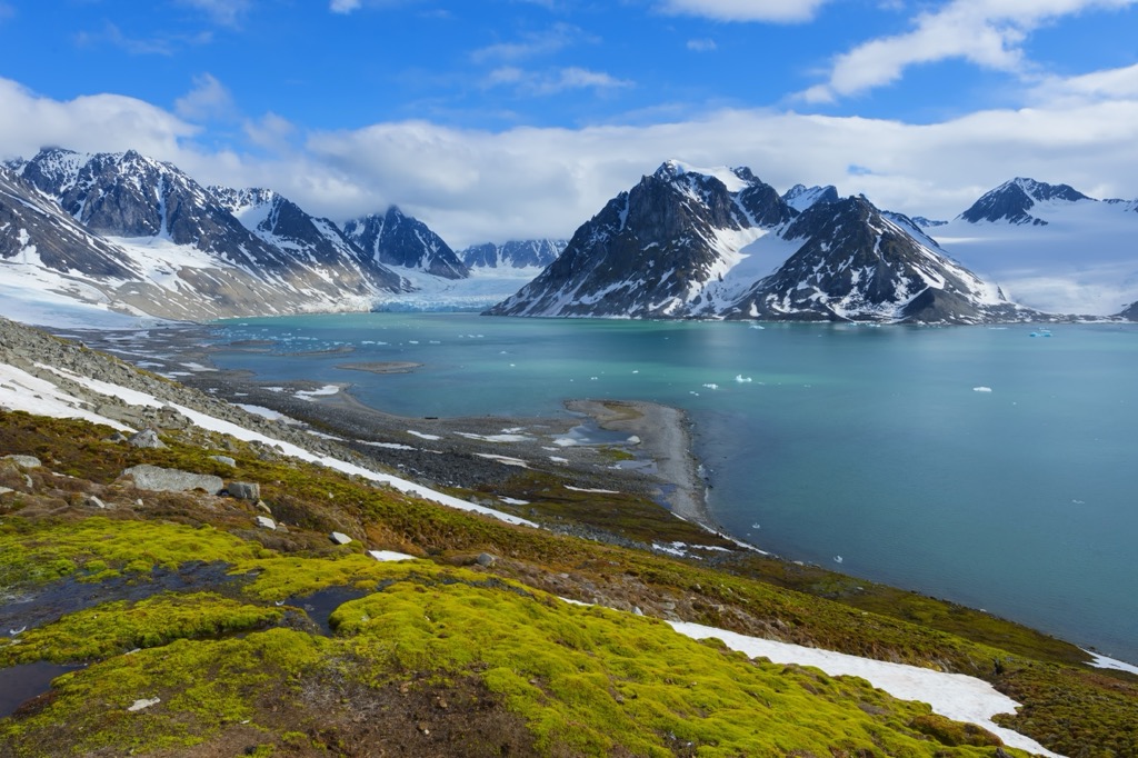
The northernmost part of Norway, Svalbard, is an unincorporated, locally administered archipelago in the Arctic Ocean. Also called Spitsbergen or Spitzbergen in some languages (though in English Spitsbergen refers solely to the main island of the archipelago), Svalbard is located between 74º and 81º North and has a long history of being used for whaling and coal mining by Basque, Norwegian, English, and Russian sailors and prospectors, among others.
After the Svalbard Treaty of 1920 and the Svalbard Act of 1925, the archipelago became part of the Kingdom of Norway. However, Svalbard is unique insofar as it is a free economic zone, a demilitarized zone, and is open to settlers from around the world. It is also a major station for scientific research, particularly in the town of Ny-Ålesund.
While most residents of Svalbard live in Longyearbyen on the main island of Spitsbergen in Isfjorden, other settlements include Barentsburg and Ny-Ålesund. There are also international research stations scattered around the archipelago.
Much of Svalbard is publicly owned land, and a large portion is protected as national park, nature reserve, and bird reserve. Some of the protected areas on the archipelago include:
Norway’s other northern territory, Jan Mayen, is a small island just 55 km (34 mi) long in the middle of the Arctic Ocean. The island is located 600km (370 mi) to the northeast of Iceland, 500km (310 mi) from Greenland, and 1,000 km (620 mi) from Norway, so it’s not exactly the easiest place to get to.
Much of Jan Mayen is mountainous, with the volcano Beerenberg taking up much of the island's northern half. The island is used as a military and meteorological outpost and has no permanent residents.
Supplies are brought multiple times each year by plane, though the island’s landing strip is for official use only. Visitors traveling by boat or ship can often make landings on the island with the military base commander’s permission. However, harsh weather and rough seas often make landing on the island a significant challenge.
Due to the country’s vast land area, the geologic history of Norway is complex. The majority of the country’s rocks are quite old, with some dating back nearly 2.7 billion years. Evidence of metamorphism is apparent throughout Norway, with gneisses found throughout much of the country.
The country has also experienced several igneous intrusions over the years, with many large outcroppings of granites throughout the southern half of Norway. Moreover, there are some sizable outcroppings of sedimentary rock, particularly in the country's eastern half.
Much of the country’s mountains are believed to have formed around 400 million years ago during the Devonian and Ordovician, when Norway was actually located in the tropics. During this time, a major mountain-building event known as the Caledonian orogeny helped create the mountains in Ireland, Scotland, Svalbard, eastern Greenland, Norway, Sweden, and other parts of northern Europe.
This mountain-building event led to the formation of most of Scandinavia’s major mountains, collectively called the Scandinavian Mountains.
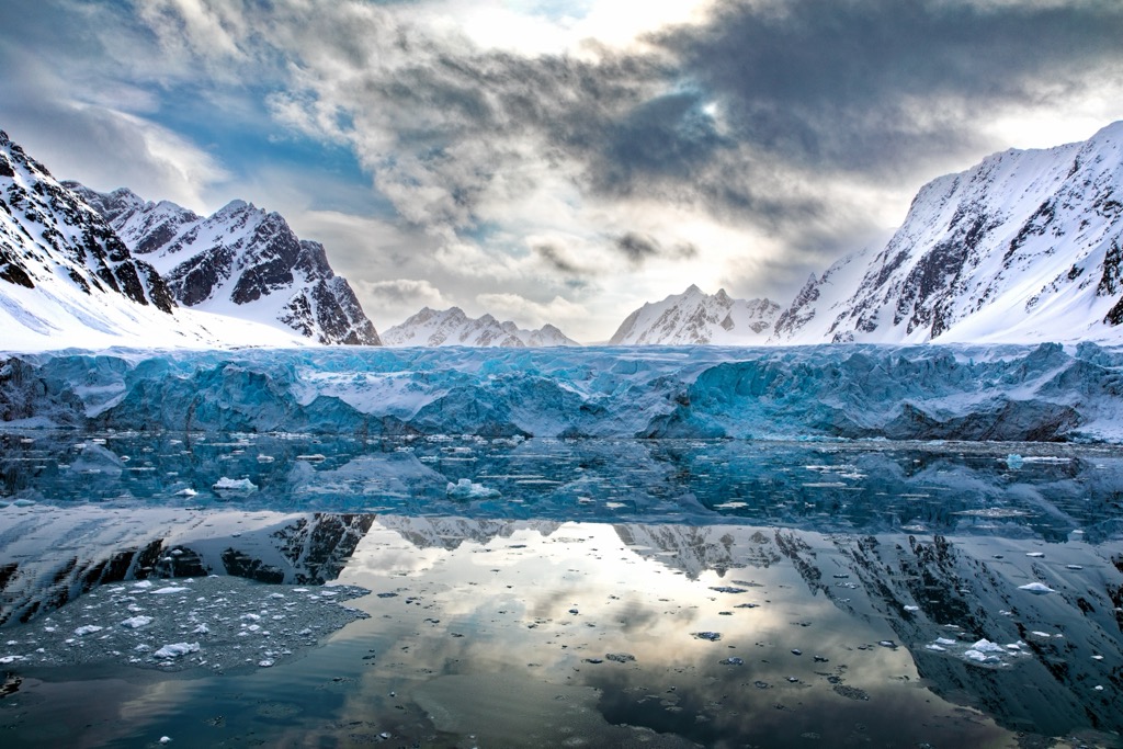
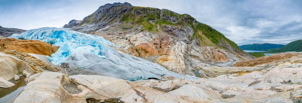
Much of Norway was covered in ice in recent years, particularly during the Pleistocene. This glacial maximum helped carve out many of the topographical features in Norway today, such as the country’s fjords and large valleys. Moreover, there are still large glaciated areas in mainland Norway and Svalbard.
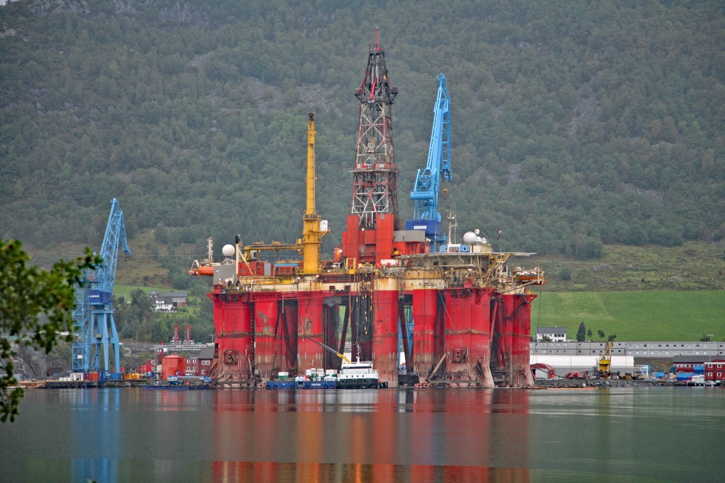
Norway is also a particularly resource-rich country. It has many large reserves of petroleum, nickel, titanium, natural gas, olivine, limestone, coal, and iron ore. In fact, Norway is the world’s fifth-largest oil exporter and third-largest exporter of natural gas, thanks to its many offshore oil rigs.
Major peaks in Norway include Galdhøpiggen, Glittertinden, Store Skagstølstinden, Velspiggen, and Surtningssue.
Thanks to Norway’s large land area and significant variations in latitude, it is home to a wide range of flora and fauna. The country comprises many different climatic regions, each with its unique ecosystems.
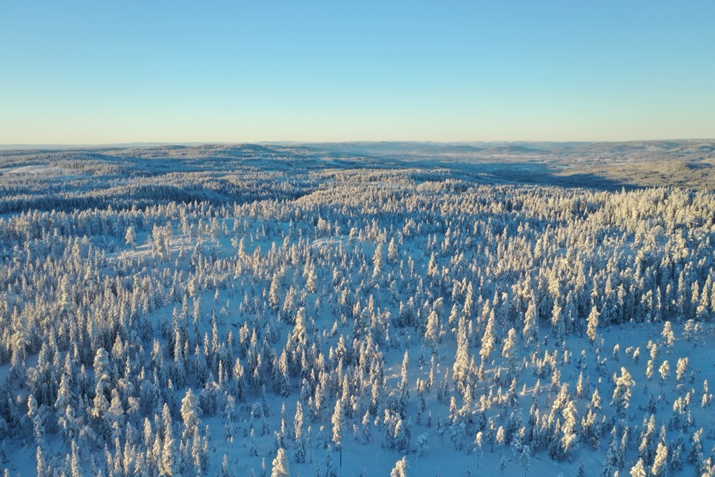
While the southernmost parts of the country are home to limetrees, oak, Norway maple, cherry, hazel, beech, yew, and holly, the majority of the country’s forested region is home to boreal woodlands. The most typical species found in these boreal forests is Norway spruce; one can also find mountain birch, aspen, pine, and other similar trees throughout the region.
Meanwhile, the highest elevation regions of Norway are home to alpine tundra, which actually covers about one-third of the country’s land, even after excluding Jan Mayen and Svalbard. Here, the dominant plant species are heathers, shrubs, heaths, grasses, and a variety of wildflowers.
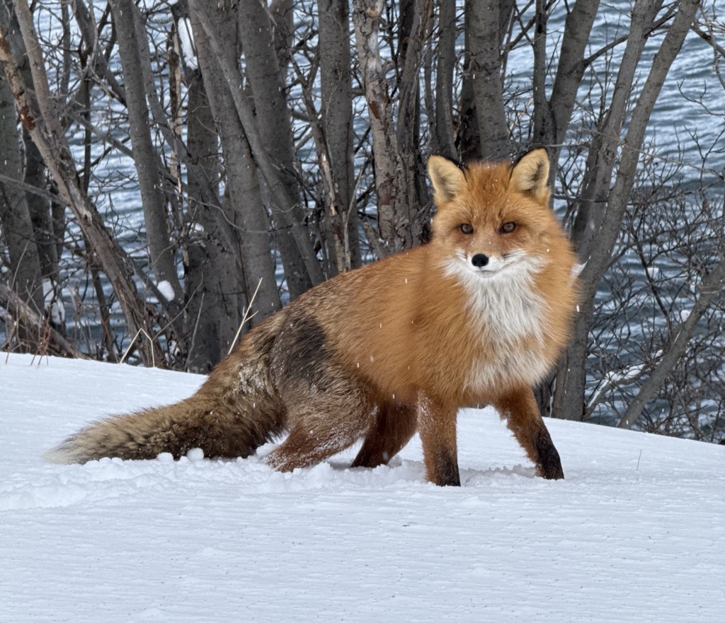
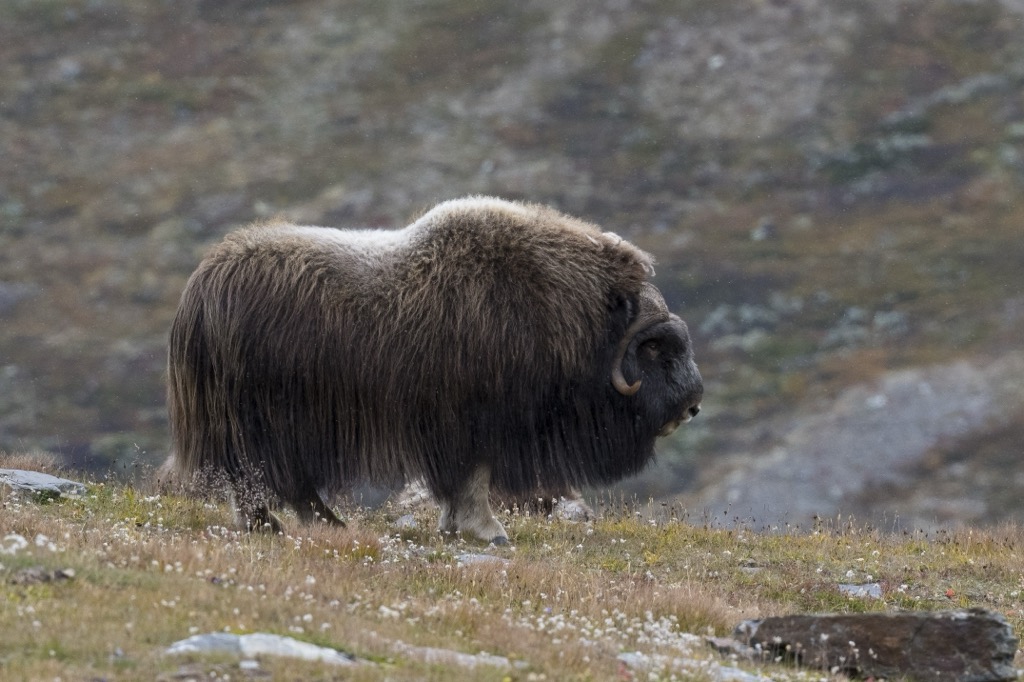
As far as animals go, Norway contains a wide array of wildlife species. Animals include wild boar, red fox, muskox, fallow deer, elk (Alces alces), red deer, roe deer, and reindeer. Other major species include Eurasian lynx, European polecat, Eurasian wolf, brown bears, Arctic foxes, European badgers, stoats, pine martens, and wolverines.
Marine mammals include walrus, hooded seals, grey seals, harp seals, ringed seals, common seals, bearded seals, sperm whales, narwhals, bowhead whales, humpback whales, minke whales, blue whales, and sei whales. Svalbard also has a significant population of polar bears, though they are not generally found in mainland Norway.
People have inhabited the land now part of the Kingdom of Norway for about 10,000 years.
Stone Age peoples in the region were mostly nomadic, though Bronze Age inhabitants of Scandinavia started to move toward more agricultural societies. About 3,000 years ago, people who spoke Uralic languages (similar to modern Finnish, Estonian, and Hungarian) migrated to the region and formed a group known as the Sami people.
By the first century CE, Roman influence started to reach the Nordic Region, leading to trade with the Romans and cultural exchange. Not long after, however, the Vikings became the dominant people in what is now Norway and much of Scandinavia around the 8th century CE.
The Vikings, being quite industrious and keen to travel in search of riches and arable farmland, often settled in other nearby islands, such as the Shetland Islands, the Orkney Islands, the Faroe Islands, and the British Isles, including the Hebrides, Ireland, Greenland, and Iceland, during the 8th through 12th centuries.
During the Middle Ages, much of Norway’s southern inhabitants converted to Christianity, and the majority of the country’s southern half was broken up into chiefdoms. The early 14th century was mostly peaceful and saw increased trade and prosperity.
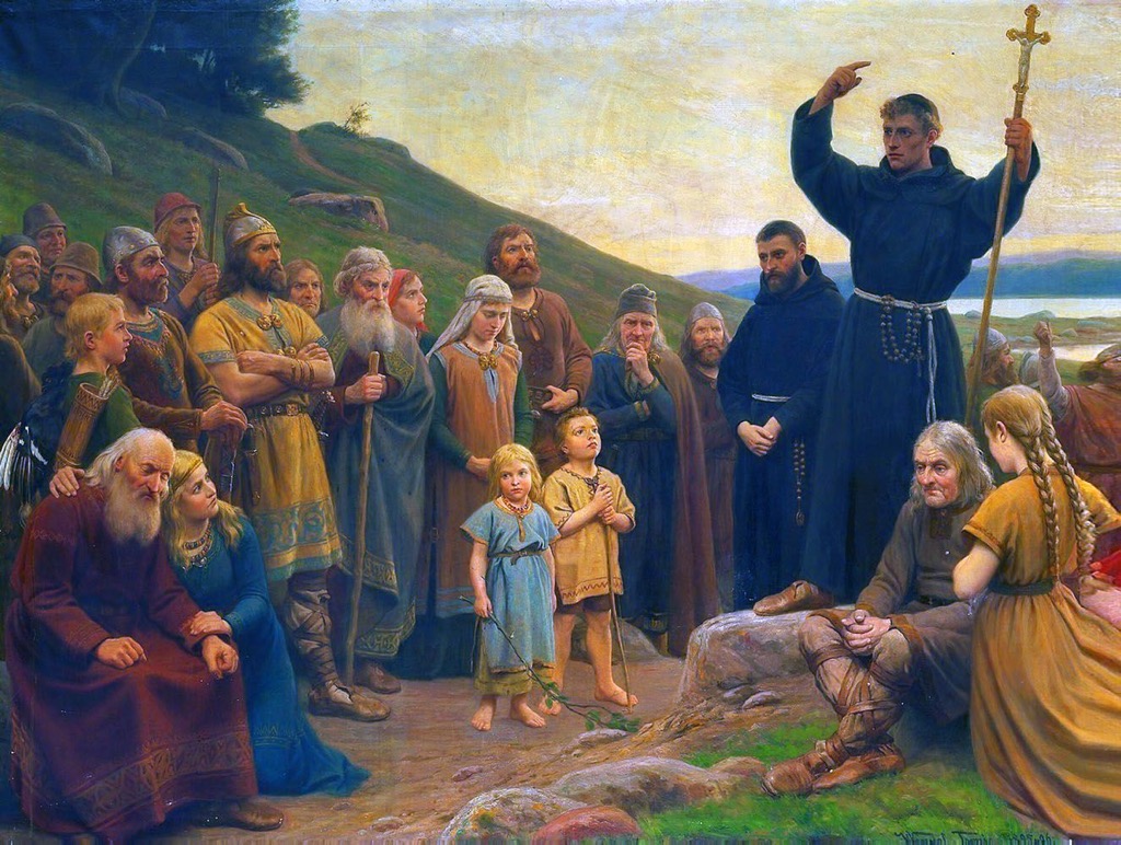
After the arrival of the Bubonic Plague in the mid-1300s, however, about one-third of Norway’s population died, with communities completely wiped out. By 1380, Olaf II of Denmark, who had inherited both the Danish and Norwegian crowns, united the two countries.
Olaf II’s successor, Margaret I, later created the Kalmar Union between Norway, Sweden, and Denmark, though Sweden eventually left the union in 1523. This led to a long period of Danish rule over Norway, which also saw a number of wars between the combined Denmark-Norway and Sweden.
By 1807, Norway and Denmark had entered the Napoleonic Wars, joining France in their ill-fated efforts. This eventually hurt the Norwegian economy, and in 1809, Sweden invaded Norway, leading to the cession of Norway to Sweden in 1814.
During the mid-19th century, Norway saw a boom in its timber and shipping industries. The country also joined the Scandinavian Monetary Union in 1875 and introduced the Norwegian krone, which remains the country’s currency to this day.
By the end of the century, there was a major labor movement in the country as well as widespread support for an independent Norway. In 1905, Norway’s Parliament voted to dissolve the union between Norway and Sweden. Prince Carl of Denmark then became King Haakon VII of Norway after a plebiscite in 1905.
Early 20th-century Norway saw some exciting outdoor adventure-related successes for the country, including Roald Amundsen’s successful sail across the Northwest Passage in 1906, his trek to the South Pole in 1911, and his flight over the North Pole in 1926.
Norway was committed to neutrality in World War II, though the Germans later invaded in 1940, occupying the country until the end of the war. After the war, Norway became a founding member of NATO. The country also joined the Nordic Passport Union and the Nordic Council in the 1950s.
With the discovery of considerable oil resources in the North Sea in the 1960s and 1970s, Norway saw an economic boom. Norway rejected a chance to join the European Union in the 1990s, though it later joined the European Economic Area and the Schengen Area. The country also hosted the 1994 Winter Olympics in Lillehammer.
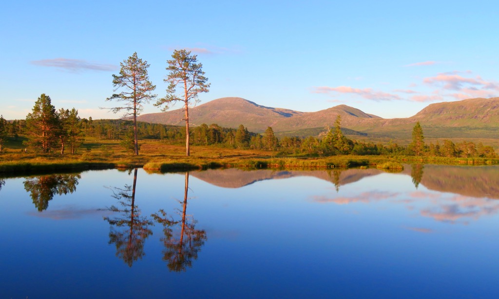
These days, Norway has a strong economy and is often ranked high on international lists of quality of life and citizen satisfaction. The country is well-known for its outdoor opportunities and is a major destination for mountain lovers everywhere.
If you’re looking to hike and adventure, Norway is the place to be. Here are some of the most popular hiking areas in the country:
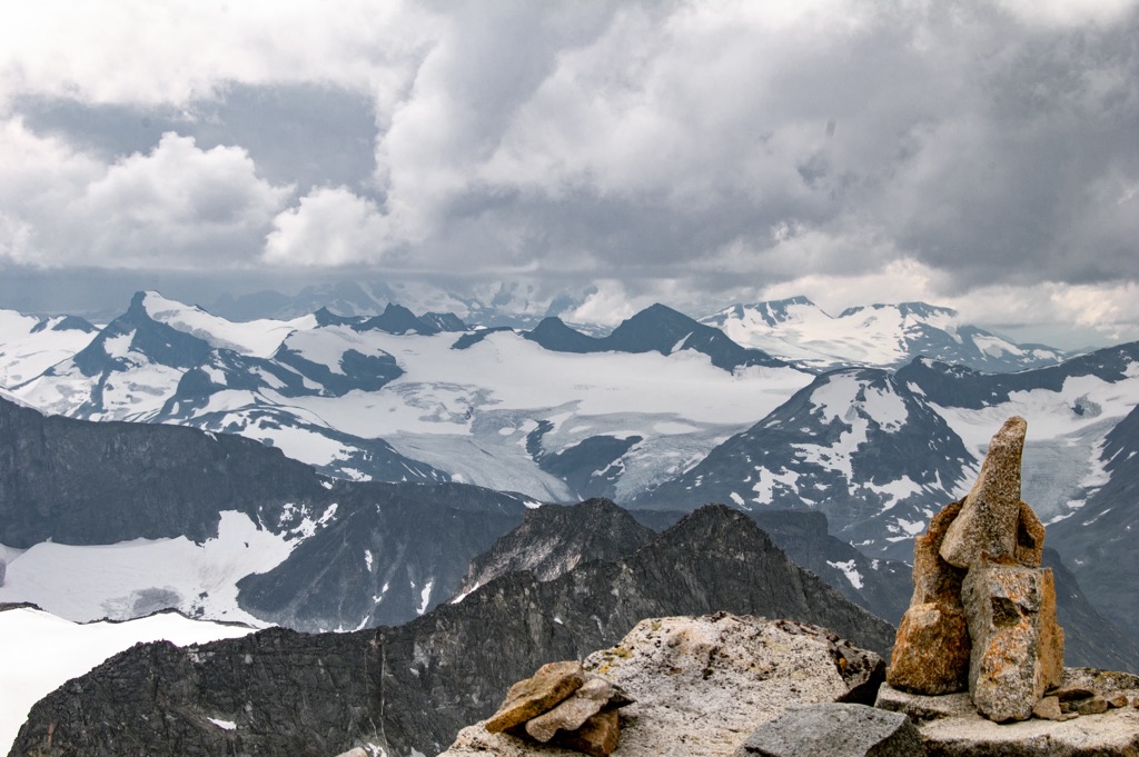
Jotunheimen National Park (Jotunheimen nasjonalpark) is located along the border of Eastern and Western Norway in the central part of the country. It contains 324 named mountains, the highest and most prominent of which is Galdhøpiggen.
In addition to being home to Norway’s highest mountain, Jotunheimen National Park is one of the country’s premier hiking destinations. Some of the many great trails in the park include paths to Besseggen Ridge, Knutshø, Fanaråkhytta, and, of course, Galdhøpiggen.
Located in Eastern Norway, Rondane National Park (Rondane nasjonalpark) was Norway’s first national park and one of its most popular hiking areas. The park contains 170 named mountains, the highest and most prominent of which is Rondslottet.
Rondane is known for its great mountain scenery and geological formations. There are quite a few waterfalls in the park, as well as plenty of opportunities to spot wildlife, such as muskoxen.
Dovrefjell-Sunndalsfjella National Park (Dovrefjell-Sunndalsfjella nasjonalpark) is situated on the border between Eastern and Western Norway. It contains 282 named mountains, the highest and most prominent of which is Snøhetta.
The park is home to a mostly intact alpine ecosystem, originally designated to preserve the region’s biodiversity. It has one of the last remaining wild reindeer populations of Beringia origin and is popular for its beautiful mountain views.
Blåfjella-Skjækerfjella National Park (Blåfjella-Skjækerfjella nasjonalpark) is situated in Trøndelag and is the third largest national park in the country. The park contains 213 named mountains, the highest and most prominent of which is Midtiklumpen.
Blåfjella-Skjækerfjella is a popular hiking, hunting, and fishing destination, and it has a number of great huts which are open to overnight visitors. It also contains many Sami cultural sites dating back thousands of years.
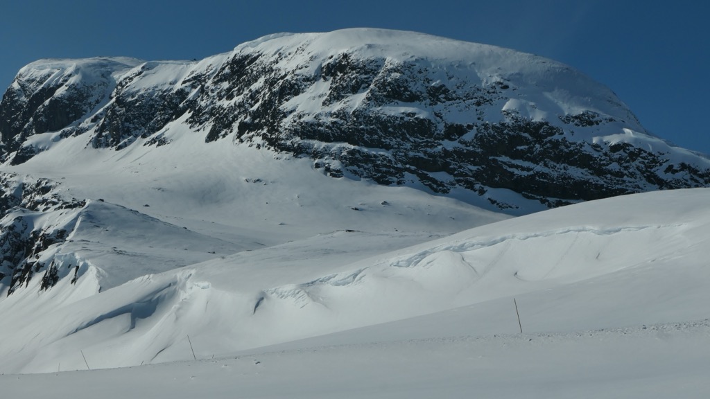
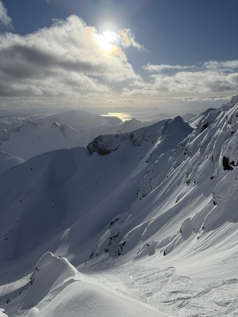
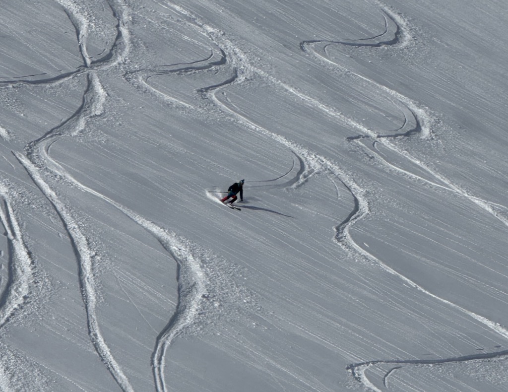
As good as Norway is for hiking, it’s even more legendary for skiing. The country is considered a mecca by backcountry skiers and snowboarders from all over the world. Norway’s biggest advantages include the incredible terrain, the epic snowfall amounts, and the low sun angle and cold temperatures due to its northern latitude.
Anybody venturing into Norway’s backcountry, especially during winter, should take note that the weather in Norway is volatile. Forecasts generally work only for the following day. Therefore, you’ll confirm the next day’s ski adventure the night before.
Due to the strong, coastal winds, you often need to search for protected areas like small valleys and couloirs. Ridgelines are often out of the question due to winds. Additionally, massive cornices are commonplace in Norway due to the heavy snow and strong winds. Be aware.
Don’t expect much in the way of sunshine during your ski trip here. You’ll see a lot of intermittent clouds, overcast, snow, wind, and fog. As Norwegian skiers say, any weather is good weather, unless it rains.
It’s best to go for two weeks to ensure an adequate number of weather windows. Coming for just one week, it’s possible that your entire trip may be marred by bad weather, although you can usually ski in the trees during storms. The treeline typically extends around 500 meters above sea level.
Norway has a maritime snowpack. Due to coastal influence, the snow quality in Norway is generally denser than in the Alps. You can also expect wind-affected snow, especially near the coast.
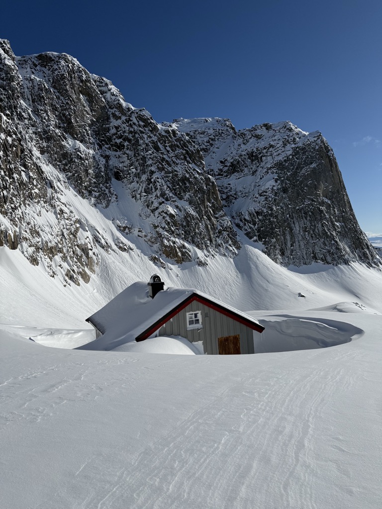
There are plenty of mountain huts in Norway, though their setup differs from the Alps. Most huts are self-serve, like luxury bivouac cabins. However, although you won’t get a three-course meal, they are warm and well-equipped. Huts are also often buried in snow, so you’ll have to dig them out with your avalanche shovel.
Lastly, many of the best ski touring routes, especially in the north, are on islands or otherwise require the crossing of fjords via ferry. In our experience, most car rental providers adopt the PayPass program. There’s no fiddling around with tickets; the payment will be deducted from your deposit (confirm with your rental provider).
Just three to four hours by car from Oslo, Jotunheimen National Park is easy to reach and ranks among Norway’s top ski touring hotspots. Jotunheimen—meaning the home of the giants—is home to towering plateaus and narrow couloirs, as well as extensive glacier skiing. The park also draws Nordic skiers and kite-skiers.
While there are a lifetime of lines here, the standout is the legendary Haute Route (Høgruta), a six-day journey traversing nearly 80 kilometers (50 miles) and linking together seven 2,000-meter peaks and eight glaciers. Each day covers around 15 km (9 miles), climbing 1,000 to 1,500 meters (3,300 ft to 4,900 ft) across some of Norway’s most iconic summits, including the country’s highest, Galdhøpiggen (2,469 m / 8,100 ft) and Glittertind (2,464 m / 8,084 ft).
Lofoten is another famous destination located along the North-central Norwegian coast. Here, you can ski from sea to summit and back again. The best season is late February to early May, though things deteriorate rapidly after that. Head farther north to Tromsø and Svalbard for May skiing.
The mountains around Svolvær and Laupstad on Austvågøy, such as Saufjellet, Pilan, Torskmannen, and Småtindane, are often the top choice for reliable snow and exciting terrain. When conditions line up, Vestvågøy and Flakstadøy also deliver—summits like Justadtind, Himmeltind, and Stornappstind offer striking lines and panoramic views that make your uphill efforts well worth it.
Even if the snow is mediocre, the views of the spiky Lofoten peaks will make up for it. If you can get some clear weather, that is.
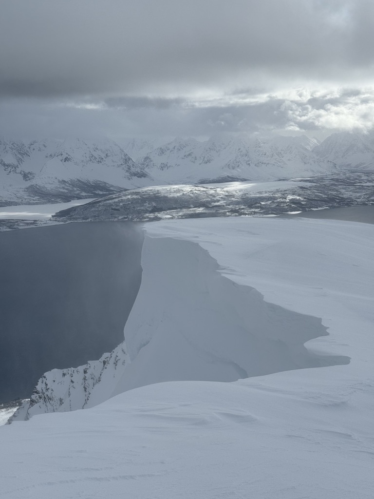
Northern Norway is where the best ski touring takes place, and it’s where most international visitors choose to go for the best conditions and terrain opportunities. PeakVisor took a trip here in April 2025, so we’ve got plenty of beta and photos to showcase.
If you come to Norway to ski, there’s a good chance you’ll experience Tromsø. It’s home to an international airport with plenty of direct flights from European cities, and it’s the hub for anyone touring in the north.
However, Tromsø isn’t just a travel stop; it’s a hub for skiing on its own. PeakVisor spent a week touring around here. The terrain is typical snowy Norwegian fjordland, with fantastic sea views. Follow the links to reach the PeakVisor Ski Touring Map.
On Kvaloya Island, we did Styrmannstinden in absolutely perfect weather, which is uncommon for Norway. In fact, it was the best weather of the trip. The skiing highlight also took place on Kvaloya Island, on a lesser-known peak called Skittentinden. A winding, pleasant ascent leads to a descent along a southwest-facing couloir, with some of the season’s best snow.
Another island near Tromsø is called Ringvassoya. There’s a classic skitour called “Rema 1000,” named after a local supermarket chain. Technically, it’s the northern summit of Solltinden, and received its nickname due to its precise altitude of 1000 meters.
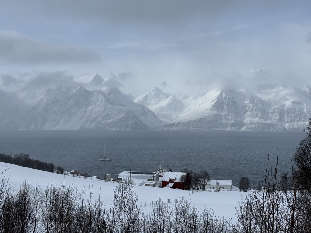
We also visited Ullstinden, the northern tip of the Tromsdalen area with a view towards open sea and the western side of the Lyngen Alps, and Sondre Bentsjordtinden, near Malangenfjord. Both mountains are technically part of the Norwegian mainland, rather than islands.
Somewhat isolated from the mainland, Senja’s mountains offer ski touring for aficionados who want wild access and remote adventures. Popular peaks like Husfjellet, Keipen, Skolpan, and Kvænan are perched above stunning fjords, with impressive views from the summits. When weather or snow conditions are less favorable, it’s worth exploring more sheltered areas in the central or inland parts of Senja, such as Kaperdalen, or heading to the mainland—for instance, Kvittind near Finnsnes.
Dyrøy Island is less frequented but offers great potential for ski touring due to its mountainous terrain. With a bit of research, you’ll find excellent options; safer tours include Dyrøygommen and Bergsheia.
The ferry route from Brensholmen to Botnhamn on Senja departs less than an hour's drive from Tromsø airport.
The Lyngen Alps are probably the most frequented locale for ski touring, especially for international visitors. Tafeltinden is one of the most frequented classics.
Another lesser-known highlight is Litletinden, just over a 30-minute drive from Tromsø. Due to the topography, the approach valley is highly protected from wind, which preserves soft snow for longer.
The Lingen Alps are also notably more serious than other regions of Norway. The mountains are steep, with Alaska-like spines and large cornices. Be sure to do your own research before heading out here, or connect with Tromsø Ski Guides. PeakVisor used these guys for our 2025 trip, and we highly recommend them!
Located at the 74th to 81st parallel, Svalbard is positively polar. Like Greenland and Antarctica, the archipelago is essentially covered by an ice sheet. The ski season persists well into summer, often until the end of June; you’re skiing under the midnight sun. It’s the most exotic place to ski tour in Norway and the most committing.
Svalbard is becoming immensely popular for guided expeditions. However, it’s much trickier to organize your own trip here. It’s not the terrain, it’s just logistics. For example, you’ll have to carry around a rifle in case of polar bear attacks.
Longyearbyen, a small coal mining town that is one of the few population centers, is the most popular place to stay if you don’t want to do a full-scale backcountry expedition. Trollsteinen (849 m / 2,785 ft) is the most popular ski descent near town.
PeakVisor has been a leader in the augmented reality 3D mapping space for the better part of a decade. We’re the product of nearly a decade of effort from a small software studio smack dab in the middle of the Alps. Our detailed 3D maps are the perfect tool for hiking, ski touring, biking, and alpinism.
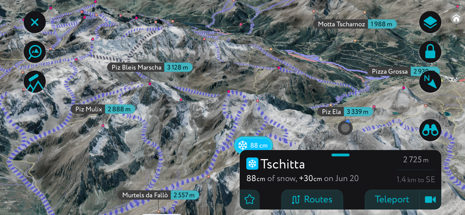
In addition to the visually stunning maps, PeakVisor's advantage is its variety of tools for the backcountry:
Norway is home to some fantastic cities and towns that are well worth a visit if you’re venturing to the country for some outdoor adventure. Here are some of the best places to stay during your trip:
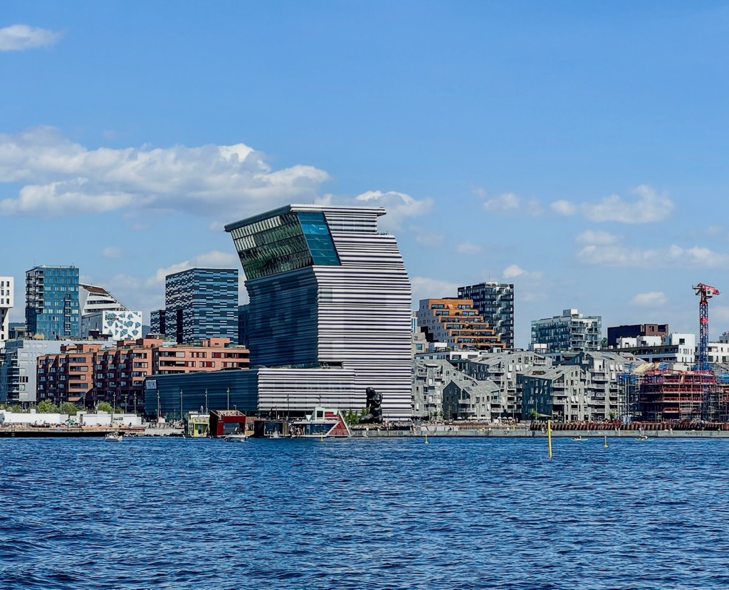
Norway's capital and largest city, Oslo, is home to about 700,000 residents. Oslo is located in Eastern Norway near the country’s southern border with Sweden. Despite being one of the most expensive places in the world to live, Oslo is frequently ranked high in terms of livability.
Oslo has the country’s largest airport and fantastic train links to the rest of the country. With a bit of planning, it’s possible to fly into Oslo and take a train straight to the Norwegian countryside, where you can start your adventures.
Norway’s second-largest city, Bergen, is home to just under 300,000 residents who live in the western part of the country. Bergen’s mountain scenery and coastal location make it a great place to visit all year long. The city is accessible by boat, air, road, and train, so it’s easy to get to from Oslo.
Located in Trøndelag, Trondheim is the third largest city in Norway with about 200,000 residents. It has a surprisingly mild climate for its latitude and is known for its beautiful cityscape and historic sites. Trondheim is also home to Norway’s largest university (the Norwegian University of Science and Technology), so students make up much of the city’s population.
One of Northern Norway’s largest communities, Tromsø is located 350 km (217 mi) north of the Arctic Circle. The city has a population of about 65,000 people and is one of the largest fishing ports in the country. It is also a great place to visit in its own right, thanks to its excellent access to the country’s best ski touring.
The city has a recently expanded international airport with direct connections to many European cities. Once you’ve arrived, the city is full of coffee shops and relaxed vibes; it’s often called the “Paris of the North.” The University of Tromsø – The Arctic University of Norway means a youthful, college-town spirit. The Tromsøbadet is home to a swimming pool, fitness center, and climbing gym, among many other public amenities.
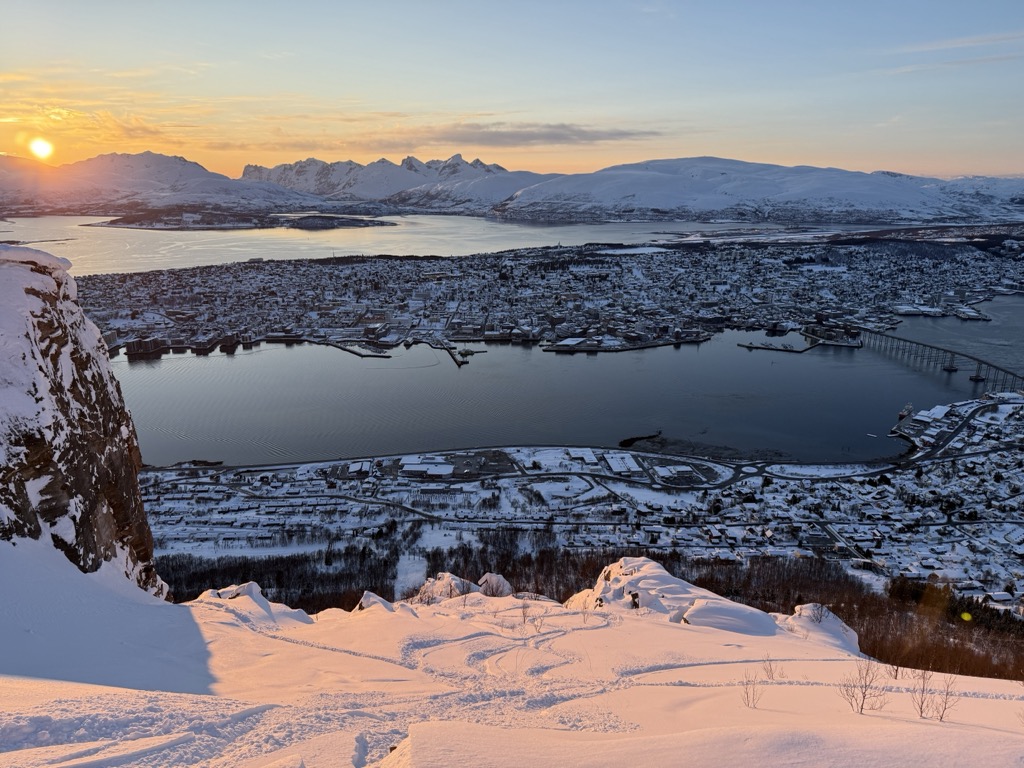
PeakVisor readers won’t want to miss the Fjellheisen Cable Car, which takes visitors about 400 meters (1,300 ft) above Tromsø. It’s more than just incredible views of the city and the surrounding fjords; the cable car’s long operating hours allow northern lights viewing during nighttime.
Last but not least are Tromsø’s unparalleled ski touring opportunities. As mentioned, the city has become a mecca for backcountry skiers worldwide. Local islands, like Kvaloya and Ringvassoya, provide easy access to touring. However, the big prize is the Lyngen Alps, which offer a lifetime of epic tours just an hour’s drive from Tromsø.


ultra
glacier
volcano
norway-ultras


