
Scan the QR code and open PeakVisor on your phone
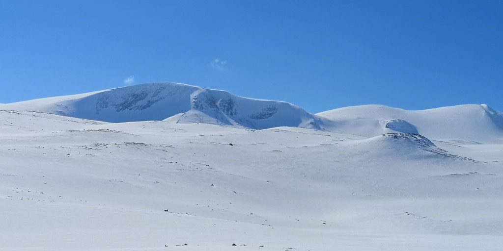
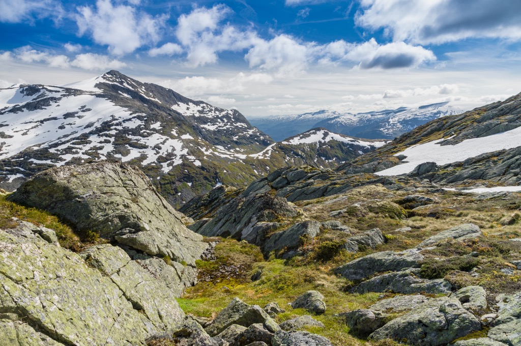
Breheimen National Park (Norwegian: Breheimen nasjonalpark) is situated in Vestland and Innlandet counties in Norway. The park is defined by sweeping glaciers and rugged peaks that tower over 2,000 meters (6,561 ft) high. There are 251 named peaks in the park with the tallest and most prominent being Store Hestbreapiggen at 2,172 m (7,126 ft) tall with 872 m (2,861 ft) of prominence.
Breheimen National Park spans across Vestland and Innlandet counties in central Norway. The park is part of a network of national parks which surround the wilderness, mountains, and glaciers that define the region.
The entire national park spans 1,691 sq. km (653 sq. miles) and covers a diverse array of terrain. This geographic region is home to some of both the wettest and driest places in all of Norway while elevations range from around sea level up to the summit of Store Hestbreapiggen.
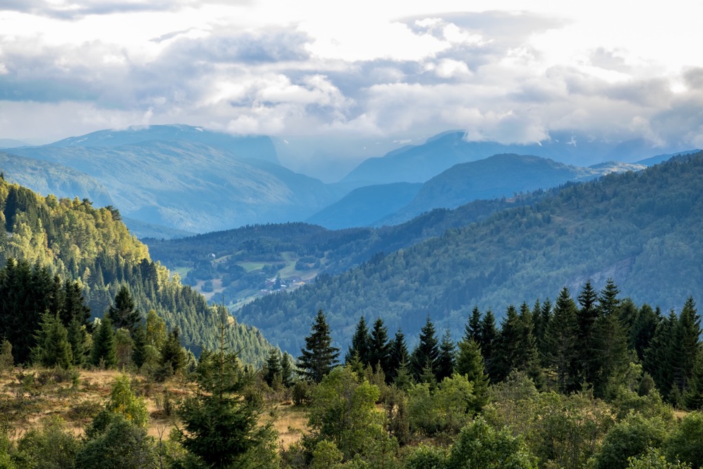
Terrain ranges from vast glaciers, lush valleys, rugged mountains, and transhumance farms. Portions of the Jostedal glacier lie within the park while the vast majority of the glacier lies in Jostedalsbreen National Park.
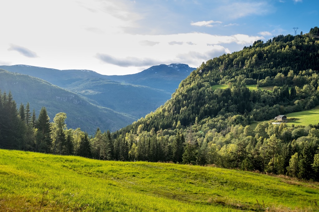
The western stretches of the park feature more dramatic changes in elevation than other regions of the park. Here hikers will find steep mountains and valleys amidst the stunning glaciers.
Terrain in the eastern region of the park features more gradual changes in elevation. This is due to both the type of bedrock in the region and the varied pressure caused from glacial retreating. Pre-glacial terrain is common throughout this eastern region.
The valley of Dummdalen lies within the park boundaries and features the largest limestone caves in all of southern Norway. These magnificent caves have been carved out by the waterways over the course of thousands of years.
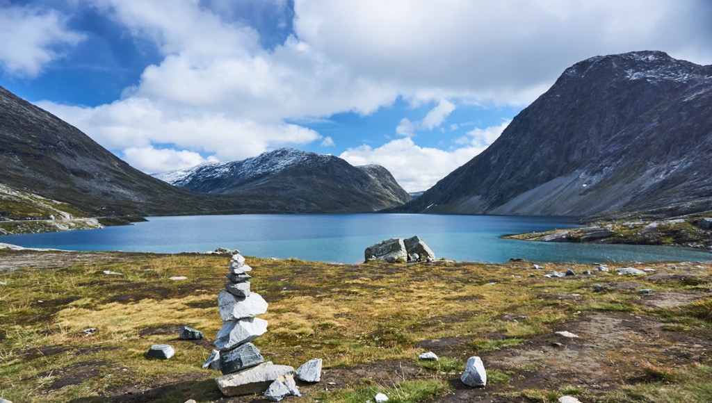
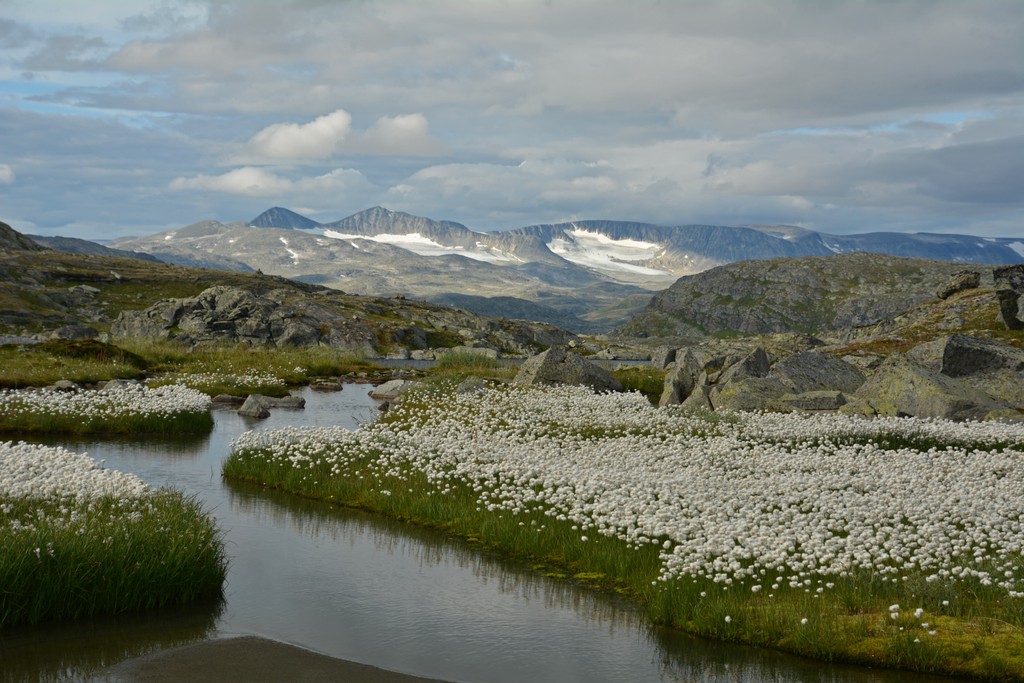
Throughout the park lies a multitude of creeks and streams, connecting the various glaciers, lakes, and nearby fjords. Some of the larger lakes in the region include Illvatnet, Storevatnet, Liavatnet, and Raudalsvatnet. The most well-known waterfall in the park is Drivansdesfossen which lies in the valley of Mørkridsdalen.
Additionally, Breheimen National Park is surrounded by other popular outdoor recreation areas. Jostedalsbreen National Park lies directly west while Reinheimen National Park is to the north. Both Jotunheimen and Langsua National Parks are situated to the southeast.
The geological history of the region has been defined by the formation of Scandinavian Mountains and the widespread glaciation, both which continue to shape the land today. The Scandinavian Mountains span throughout nearly all of Norway and extend into the countries of Sweden, and Finland.
The peaks in the park are also part of the Brehiemen mountain range, a small subrange of the greater Scandinavian Mountains.
The base of the peaks both within and surrounding the park began forming during the Caledonian orogeny. This major mountain building period took place around 490 to 390 million years ago.
During the Scandian phase of the Caledonian orogeny, widespread tectonic shifting led to the collision of Laurentia and Baltica. The force from this collision led to the formation of the base of the peaks throughout present-day Norway, occurring around 420 to 405 million years ago.
The Jostedal Glacier, which lies directly west of the park, has drastically shaped the landscape that is visible today. Vast glaciers once covered the entire region spanning far beyond those that are currently in the park.
As the glaciers began to melt, gravity pulled them towards the ocean. This gravitational pull led to the dramatic changes in elevation and fjords that define western Norway while the eastern stretches of the park feature more gradual changes in elevation.
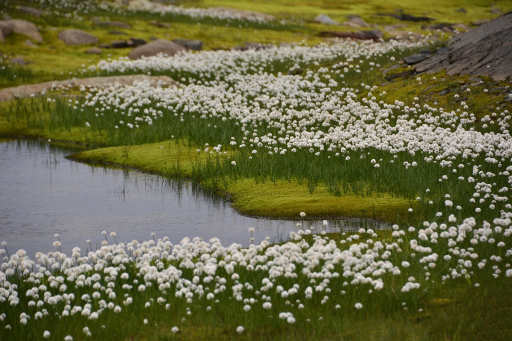
The glaciers in the area also carved out the u-shaped valleys, moraines, and lush alpine terrain that has enabled both flora and fauna to flourish.
Bedrock in the western stretches of the park consists primarily of hard Precambrian bedrock. This gneiss is referred to as “gråstein” which translates to gray rock. Bedrock in the eastern region of the park is marked by softer schists.
Major peaks within the Breheimen National Park include Store Hestbreapiggen, Skridulaupen, Hestedalshøgdi, Tverrådalskyrkja, and Liabrekulen.
Flora and fauna vary greatly throughout the park due to its multitude of unique landscapes and ecosystems.
The wilderness regions of the park are home to populations of deer, wolverine, lynx, and herds of wild reindeer. While the reindeer can be found throughout the park, deer are more common in the valleys while moose may be spotted in the eastern stretches of the park.
Other common animals include falcons, buzzards, golden eagles, and the rare white-backed woodpecker. Though there is a relatively large population of wolverines in the park, hikers are unlikely to spot these elusive creatures.
Transhumance farming is still present throughout the region, with dairy farming and herds of cows being the most common. Hikers are likely to encounter grazing livestock amidst the stunning wilderness.
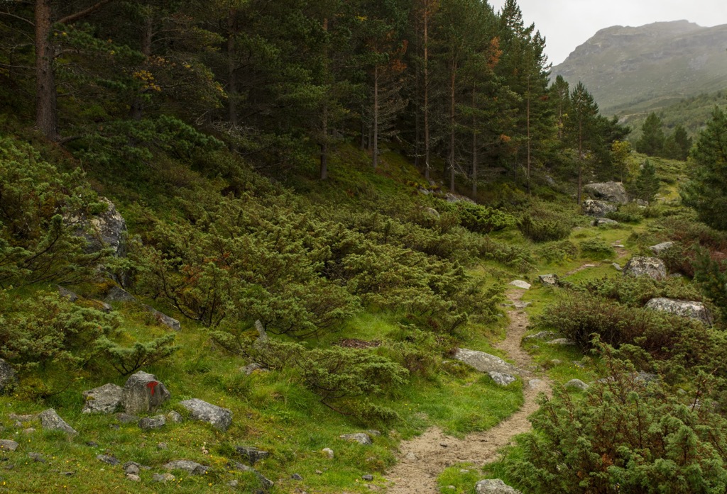
Lower elevations are marked by a forested landscape featuring elm, willow, birch, and rowan trees. At higher elevations the forest begins to thin, giving way to alpine terrain. Here hikers will find low growing grasses, shrubs, lichen, and flowers such as the lady's-slipper orchid.
The land within and surrounding Breheimen National Park has been inhabited by humans for thousands of years. Remnants of hunting camps in other nearby national parks date back as early as the Stone Age.
Settlements in the area are thought to date back to both the Bronze and Iron Ages. The park marks part of an ancient trade route which began in Sunnmøre. The route then traveled through Lom and Skjåk before entering the Gudbrandsdalen valley to reach eastern Norway.
For hundreds of years this route was used by various people for trading salt, grain, and fish. Small settlements began growing along the route, offering safe stops for those making the strenuous journey.
Many of these early settlements were situated near lakes and rivers amidst the lush and fertile valleys of the region. A “Royal Road” decree was enacted during the fifteenth century which required the people of Lom to ensure the route was kept safe and clear for travelers.
Many of these early settlements were centered around farming which is still present today. The practice of transhumance farming has long since allowed the people of the region to work with the seasons, allowing livestock to graze at various elevations.
Populations steadily grew in the area though no major cities have ever been established. During the late 20th century, many of the national parks in the area were established to help preserve the natural beauty and wildlife of the region.
Breheimen National Park was officially established in 2009. The name “Breheimen” translates to “Home of the Glaciers”. Small glaciers and arms of the Jostedal Glacier can be found within the region, giving the park its name.
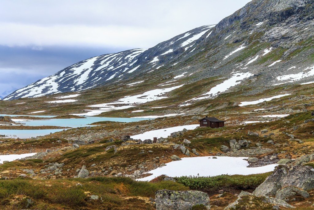
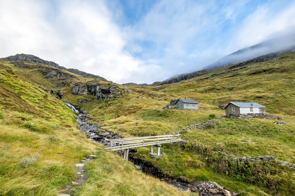
Today there are over 300 km (186 miles) of hiking trails throughout the park though many are not well marked due to the minimal amount of visitors to the region. Unmanned huts can be found in the park, allowing hikers to experience a sheltered and remote evening surrounded by wilderness.
Breheimen National Park is home to stunning hiking routes featuring varying landscapes. Below are a few of the most popular hiking routes in the park:
Mefjellstien is a shorter and more accessible route located along the southern edge of the national park. The loop trail is relatively flat yet features dramatic views throughout. Hikers are surrounded by views of Fanaråken while hundreds of lakes extend in each direction.
Stone sculptures created by the artist Knut Wold lie in the area, adding to the landscape. Hikers can complete this short loop or extend it a few kilometers to explore the Mefjellstien mountain landscape. The short loop is 3.2 km (2 miles) in length and features 79 m (259 ft) of elevation gain.
The route to the summit of Tverreådalskyrkja is a challenging and rewarding hike situated at the southern end of Liavatnet. The trail begins by climbing steadily through the forested landscape before reaching the alpine terrain.
Here the vegetation begins to thin, giving way to barren ridgelines, rock fields, and rushing rivers. Once at the summit hikers have views of Tafjordfjella in the north and the Jostedal Glacier. Those completing this route should stay on marked paths and avoid crossing the glacier. The out and back route is 20 km (12.5 miles) and features 1,493 m (4,898 ft) of total elevation gain.
The Vangsen route begins amidst the forested floor of the valley. The trail climbs steadily through the forested landscape before the flora thins, giving way to sweeping views of the valley below as Jostedalselva runs through it.
From the summit hikers have views of both Breheimen National Park and Jostedalsbreen National Park. Hikers should ensure they have clear weather before beginning this hike as weather can change quickly atop of the peaks. The out and back trail is 6 km (3.7 miles) in length and features 709 m (2,326 ft) of total elevation gain.
Looking for a place to stay near the Breheimen National Park? Here are some of the best cities and villages to check out in the region:
Lom lies along the eastern edge of the national park, surrounded by the mountainous landscape of Norway. The small village is a gateway to multiple national parks, situated between Breheimen, Jotunheimen, and Reinheimena.
The National Park Village is home to 2,350 residents and lies at the base of Lomseggen. Despite its relatively small population, Lom attracts tourists throughout the year who come to visit the stunning natural beauty of the region.
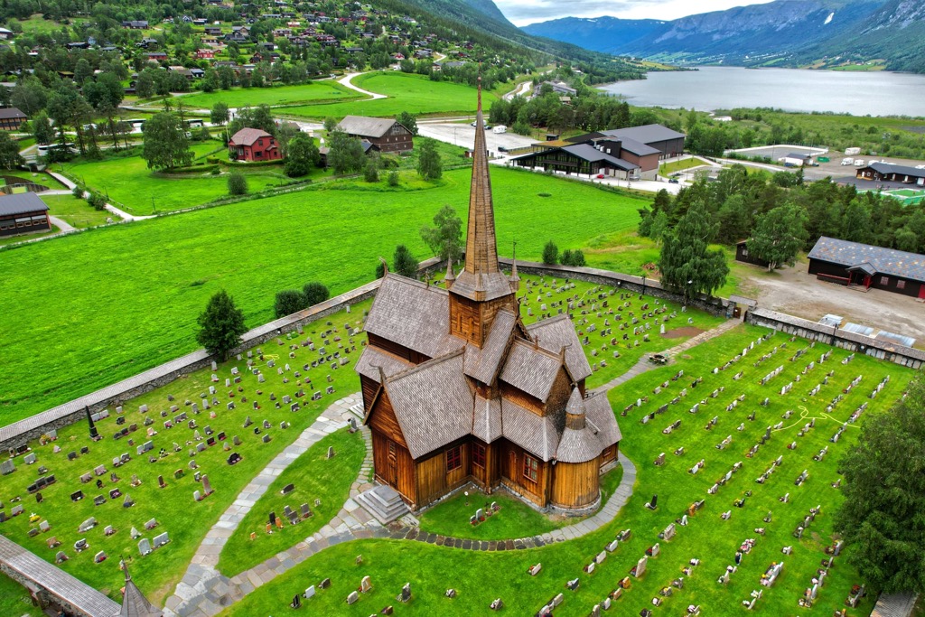
The population swells the most during the summer months for those coming to hike the nearby mountains. River Bøvra runs through the center of the village, cascading down from the mountains above. The downtown streets feature a few local restaurants, bakeries, museums, and a church dating back to 1150.
Bergen marks the closest major city to the national park, situated a four and a half hour drive to the south. Home to around 286,000 residents, Bergen marks the second most populous city in the country. Surrounded by both mountains and the ocean, Bergen is nicknamed the “city of seven mountains”.
Mount Fløyen is the most well-known of the nearby mountains and can be reached by foot or by railway from the city center. A medieval fortress and castle mark the ancient city center. Each year this portion of the city hosts the Bergenfest music festival.
Despite the relatively large size of Bergen, the city is just a few hours from some of the most stunning fjords in the country. Visitors and locals alike can make a day trip to explore the famous Hardengerfjord and the Sognefjord.
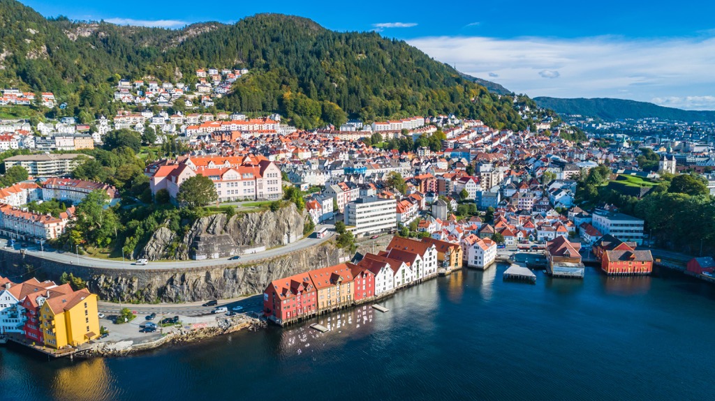
The Brygeen Wharf and colorful wooden houses mark the downtown streets along with local shops, restaurants, and bakeries. Bergen is also home to the University of Bergen which features around 30,000 students.


