Scan the QR code and open PeakVisor on your phone
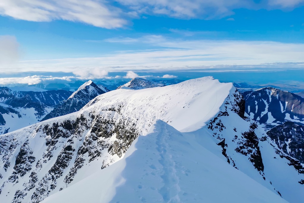
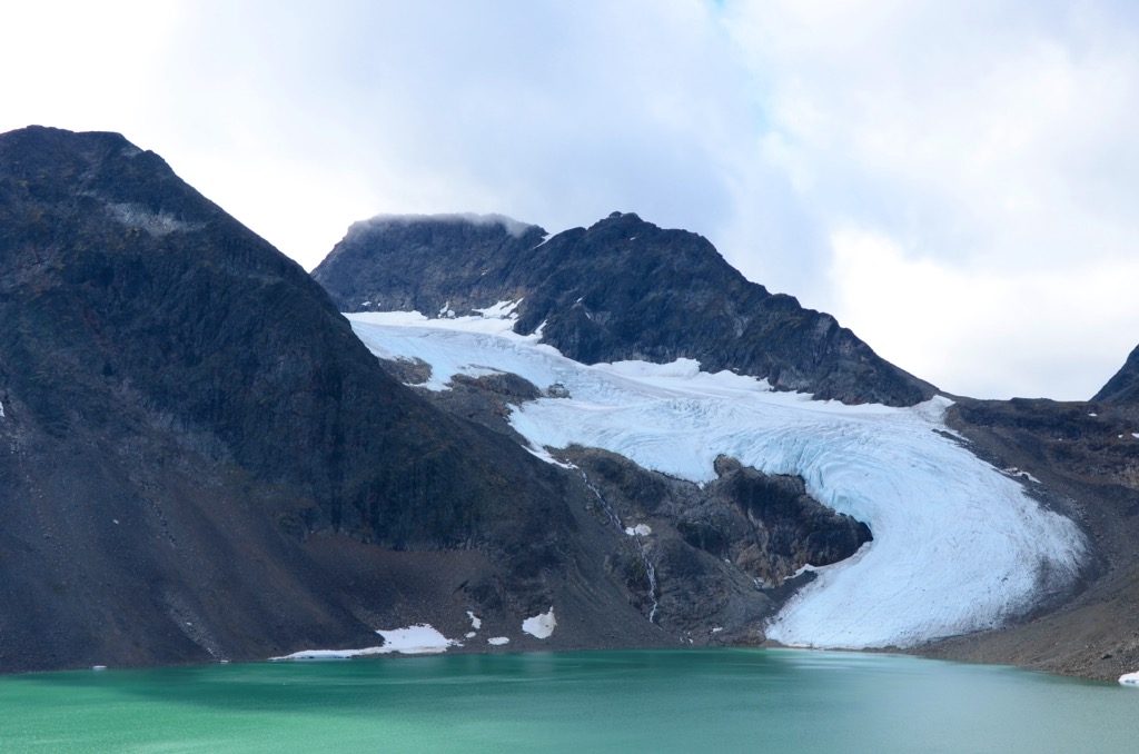
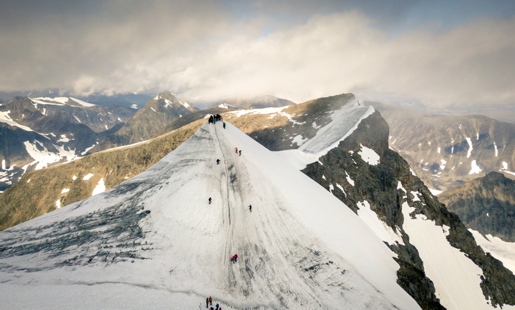
Sweden is a country on the Scandinavian Peninsula in Northern Europe. Sweden has a whopping 13918 named mountains occupying 2/3 of its territory, also defined by its pristine wild nature with pine forests, lakes, and archipelagos. The main feature of Sweden’s mountainous topography is the Scandinavian Mountains, Europe’s longest mountain range. The double-headed Kebnekaise Massif contains the country's highest peak, Kebnekaise nordtoppen (2,096 m / 6,876 ft), while the most prominent mountain is Kebnekaise sydtoppen (1,763 m / 5,784 ft). Syntoppen is the southern summit of the massif, which decreases each summer since it’s capped by a melting glacier.
Sweden’s territory covers 450,295 sq km (173,860 sq mi), making it the fifth largest in Europe and the largest in Scandinavia.
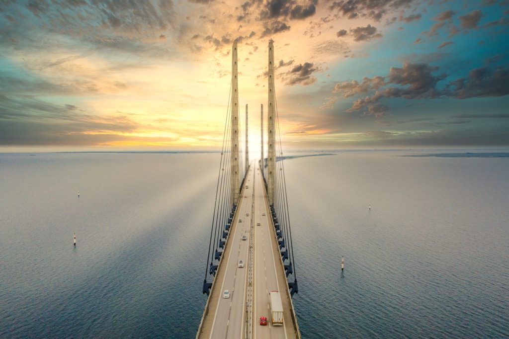
The country shares a massive border to the west with Norway. Meanwhile, it’s separated from neighboring Denmark by a channel of the North Sea; the 8 km (4.9 mi) Øresund Bridge connects the two countries. To the east, northern Sweden shares a land border with Finland by land, while the Gulf of Bothnia of the Baltic Sea separates the southern two-thirds of each country. The Baltic Sea is also the country’s water border with Germany, Poland, Estonia, and the other Baltic states to the south.
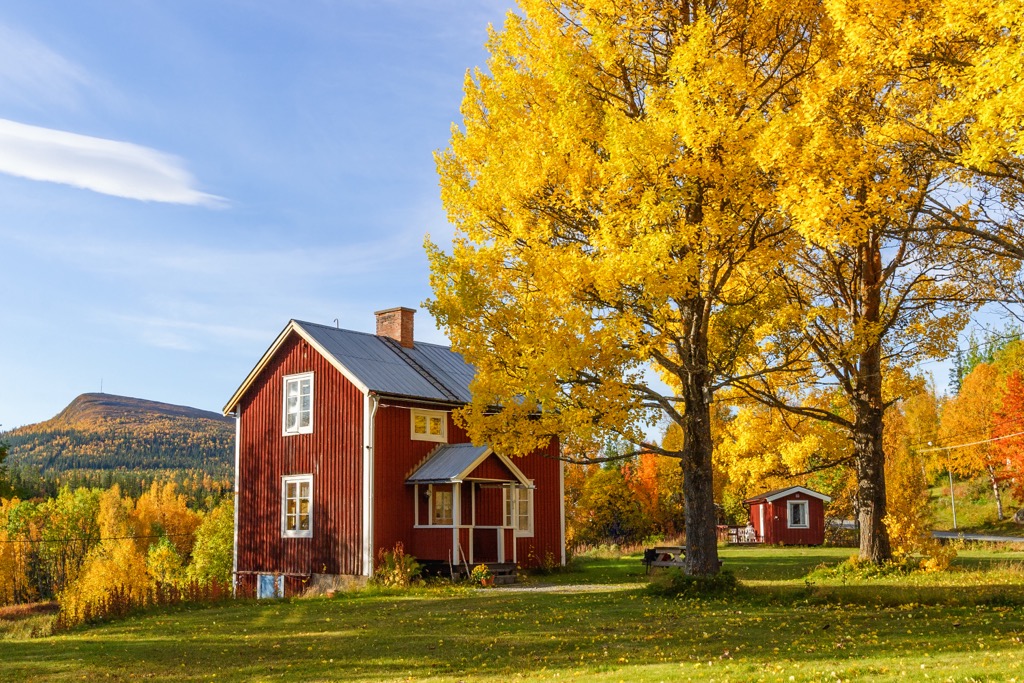
Sweden consists of three large historical regions: Götaland in the south, Svealand in the center, and Norrland in the northern half. During the Middle Ages, the country also included a fourth eastern region, Österland, comprising present-day Finland. These regions are further divided into 21 counties (Swedish: län), with the most populated being Stockholm, Skåne, and Västra Götaland. Stockholm (the nation’s capital), Malmö, and Gothenburg are the three most populated cities and are all located on the coast.
The country, especially the north, is sparsely populated; Sweden has a population density of 25.5 inhabitants per square kilometer (66/sq mi), with 87.5% living in urban areas. Nearly all cities are concentrated in the south and central regions. Thus, most of the country’s northern two-thirds features a population density of less than ten inhabitants per square kilometer.
Sweden’s name in Swedish is Sverige (say that ten times fast). Sverige comprises the ancient Scandinavian words ‘svea’ and ‘rige’ and means ‘one’s own.’
Sweden's landscape, climate, and ecology are diverse. One of the main factors in this diversity is the country’s extraordinary length, occupying 55 - 69 degrees north latitudes (about the distance from San Diego to Seattle).
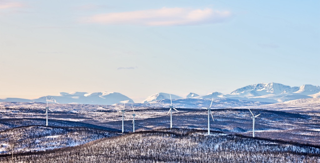
Mountainous terrain occupies much of Sweden. The most prominent range is the Scandinavian Mountains in the northwest.
Glaciers cover many high mountain peaks in the north. While these mountains don’t feature high elevations, they are within the Arctic Circle and are thus considerably glaciated. There are approximately 300 glaciers in Sweden, with a total area of 198.8 sq km (76.5 sq mi). Stockholm University offers a Glaciers and High Mountain Environments course for prospective students interested in Glaciology.
The Plain, also known as the Central Swedish Lowland, extends throughout much of the country's south. These are Sweden’s main agricultural lands.
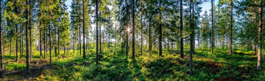
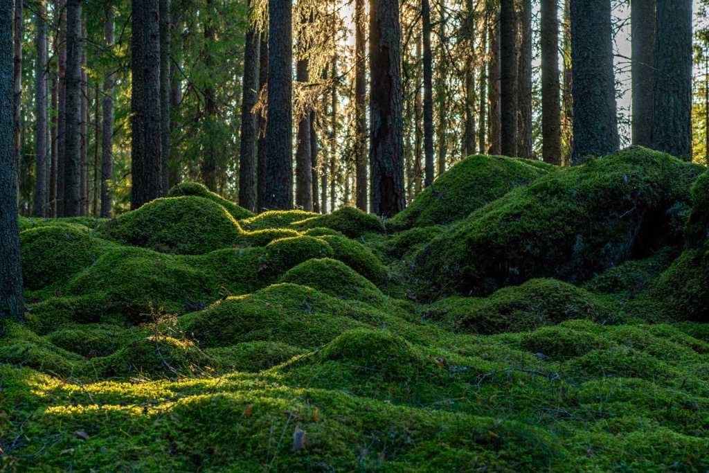
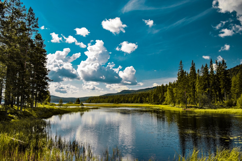
Forests comprise 69% of Sweden's territory, making it the second most forested state in the world after Finland (70% forested). In the south, more mixed forests dominate. The north features pines, spruces, firs, and other evergreens, consistent with other boreal forests across the world’s upper latitudes.
The tundra is in the northernmost part of Sweden. The Swedish Lapland is the land of Saami reindeer breeders, northern lights (aurora borealis), and vast boreal forests and grasslands. It is the land of the midnight sun and, conversely, months of pure darkness around the Winter Solstice. The region is part of the greater Lapland, covering all of north Fennoscandia (Scandinavia plus the Kola Peninsula in Russia).
Lakes comprise much of Sweden’s territory; an estimated 9% of the country is lakes. The abundance of freshwater lakes is consistent with other northern regions once covered in ice sheets. The country’s largest lake, Vänern, is the third largest in Europe after Ladoga and Onega in the Republic of Karelia in Russia. Sweden has about 95,700 lakes (in comparison, neighboring Finland has twice as many - 189,000). Wetlands also comprise a significant portion of the forests and tundra.
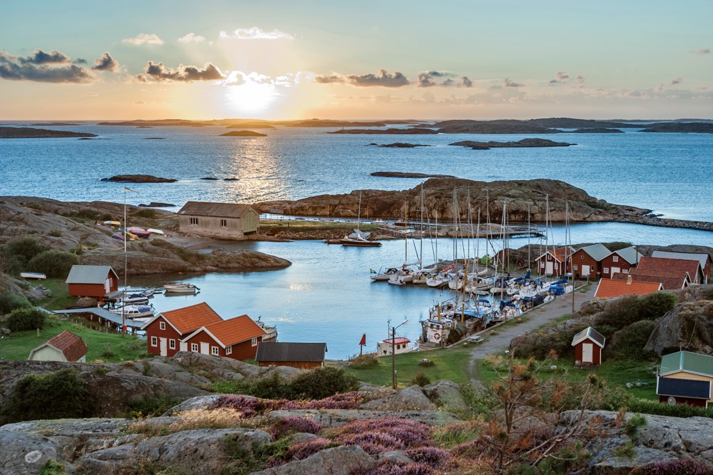
Sweden’s coastline includes 267,570 rocky islands, most gathered in archipelagos, including the Stockholm Archipelago. Sweden’s largest islands, Gotland and Öland, are in the Baltic Sea south of Stockholm.
Sweden's official tourist offices are in almost every city, regardless of size. In an age where the internet is increasingly misleading and profit-focused, an old-fashioned in-person stop at a tourist center is an excellent way to quickly gather lots of information for your trip. Visit Stockholm Contact Center is a one-stop shop for information on Stockholm and the rest of the country - most people who visit Sweden will spend at least some time in Stockholm.
Royal Djurgården Visitor Center
Djurgårdsvägen, 2, Stockholm, Sweden
Open every day, 9 a.m. to 5 p.m.
+46086677701
info@royaldjurgarden.se
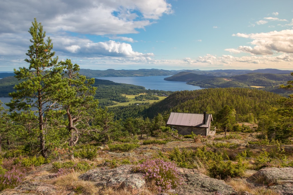
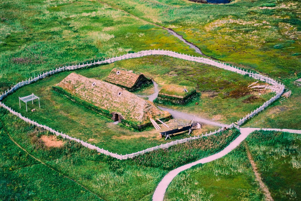
Mjältön Island in the Höga Kusten.
The two main features of Sweden’s Geology are a formation called the Baltic Shield and millions of years of Quarternary glacial advance and retreat.
The Baltic Shield, also known as the Fennoscandian Shield, is one of the Earth's most ancient and stable geological regions. It encompasses a vast area in northern Europe, covering parts of Sweden, Finland, Norway, Russia, and the Baltic States (Estonia, Latvia, and Lithuania).
The shield is known for its geological stability. Unlike most other regions on Earth, it has not experienced significant tectonic plate movements or mountain-building events for billions of years. Sweden’s mountains are ancient features and have been worn down to relative stubs due to billions of years of erosion and millions of years of glacial movement. Like the US Appalachian Mountains, these peaks are comparatively gentle, featuring moderate elevation and “rolling” terrain.
Archipelagos and glacial rebound are another important consequence of the most recent Ice Age. Massively thick ice sheets weighed down the Baltic Shield for tens of thousands of years, causing the crust to actually sink. As the ice sheet has receded, the crust is slowly rebounding, creating a tapestry of land and water. These archipelagos will evolve significantly over the following millennia as sea level rise interacts with the continual rebound of the crust.
Sweden is also rich in many mineral deposits, such as iron ore. The adventure town of Kiruna, in the country’s far north, doubles as a base for a massive iron ore mining operation.

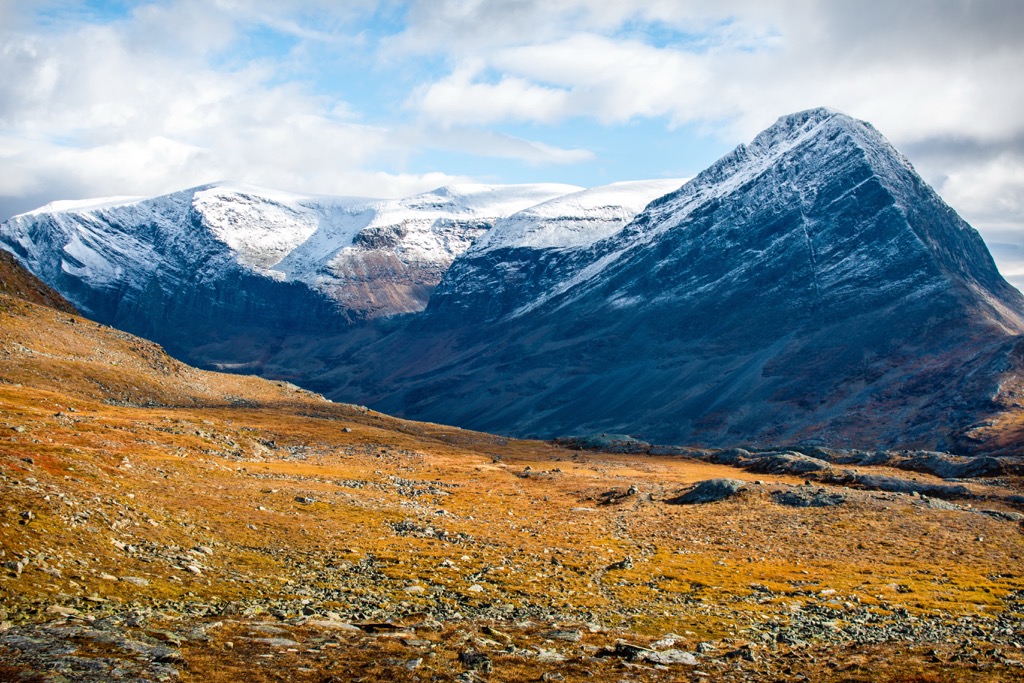
Mountains, uplands, hills, and rocky islands between 50 and 2,000 m (6,561 ft) cover five main areas in Sweden: the Scandinavian Mountains, Norrland Terrain, the High Coast of Sweden, the Stockholm Archipelago, and the South Swedish Highlands.
This is Sweden's most prominent range, featuring the highest of the country’s 13918 named mountains. It straddles the nation’s northwestern frontier along the border with Norway. Sweden’s territory encompasses the eastern portion of the Scandinavian Mountains, Europe’s longest mountain range at 1,762 km (1,095 mi).
The Kebnekaise Massif, the most significant sub-range of Sweden’s Scandinavian Mountains, hosts two of the highest peaks. Kebnekaise nordtoppen (northern) and Kebnekaise sydtoppen (southern) have similar heights of about 2,096 m (6,876 ft). However, only the Kebnekaise nordtoppen is a so-called “fixed mountain.” The sydtoppen is covered by a steadily melting glacier and has been losing elevation.
Sweden’s 12 mountains over 2,000 m (6,561 ft) include Sarektjåhkkå (2,089 m / 6,853 ft), Kaskasatjåkka (2,076 m / 6,811 ft), and Nordtoppen (2,060 m / 6,758 ft).
Other famous peaks include Helagsfjället (1,796 m / 5,892 ft), Storsylen (1,762 m / 5,780 ft), Åreskutan (1,420 m / 4,660 ft), and Södra Storfjället (1,252 m / 5,801 ft).
Norrland Terrain (Norrlandsterräng) refers to the lower forested areas of the north, outside the Scandinavian Mountains. The region’s core is the Swedish Lapland.
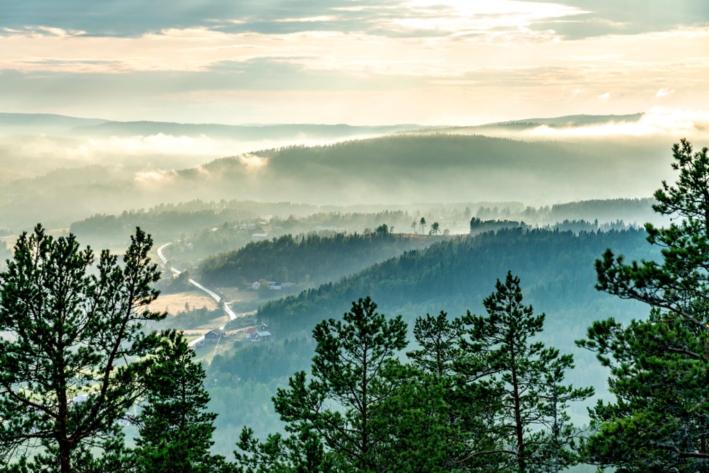
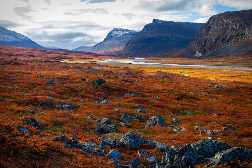
Höga Kusten (the high coast) is a high seashore of up to 300 m (983 ft) and about 130 km (80.7 mi) long. It is on the east coast of Sweden, in the northeastern province of Ångermanland, and is centered around the municipalities of Kramfors, Härnösand, Sollefteå, and Örnsköldsvik. The area is an example of the aforementioned post-glacial rebound, where the land gradually rises as glaciers melt. The phenomenon was first observed and researched in this region. Over the millennia since the last ice age, the land has elevated by an impressive 300 meters, contributing to the region's distinctive cliffs.
The High Coast of Sweden is now a UNESCO site, along with the Kvarken Archipelago, a similar area on the opposite shore of the Baltic Sea in Finland.
The archipelago begins within the city limits of Stockholm (hence the name), a city on an island itself. The archipelago stretches as much as 60 km (37 mi) from the coast, including some 30,000 rocky islands of varying sizes.
Sydsvenska Höglandet, or the South Swedish Highlands, are similar to the Norrland Terrain and represent the mountains around 100–200 m (328–656 ft). The highest is Skuruhatt (302 m / 990 ft) in Eksjö municipality.
While inherently not as diverse as warmer climates, Sweden's ecology is defined by relatively pristine ecosystems, especially for Europe, where humans have had more impact than any other place on Earth.
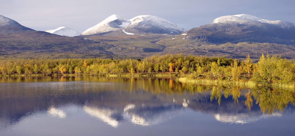
Generally speaking, Sweden’s climate can be described as mainly temperate. Despite the latitude, the northwestern mountains of the Scandinavian range are the only regions qualifying as polar tundra.
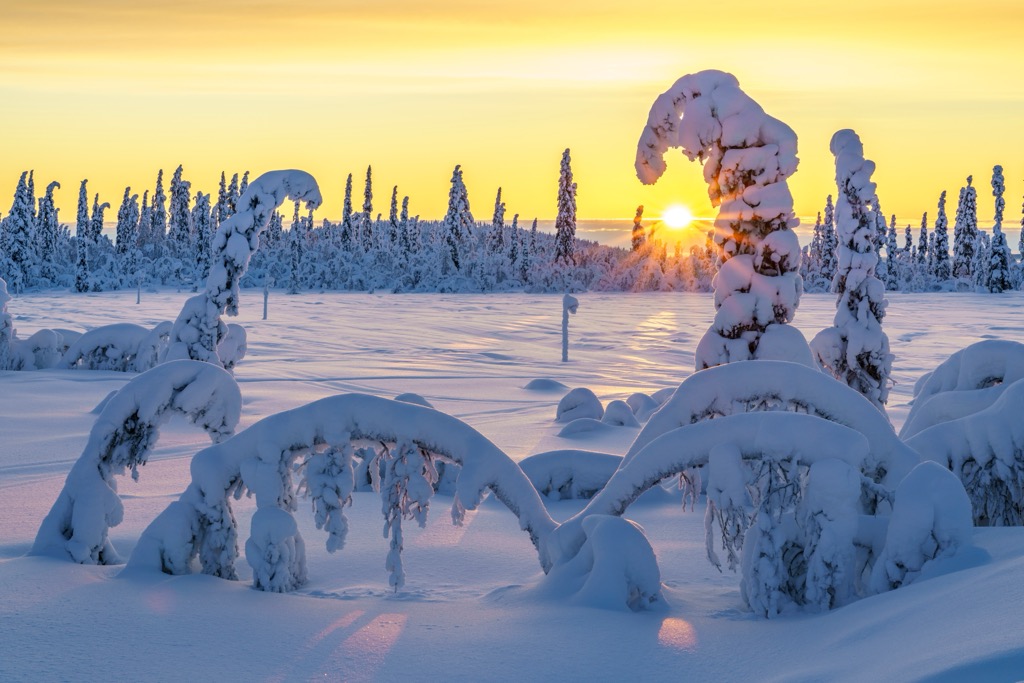
The southern coastal areas are oceanic, featuring mild summers and winters with relatively little temperature gradient between the two. The mid-latitudes feature a warm-summer-humid-continental climate, while most of the northern two-thirds of the country are subarctic, defined by vast evergreen and boreal forests.
Summer in Sweden is pleasant, with temperatures rarely climbing above 30℃ (86℉). Winters can often dip below -30℃ (-22℉) in the north, but the southern coastal regions stay mild year-round, with only a few days below freezing.
Throughout the planet, the most biodiverse regions are the tropics. On average, biodiversity decreases as you move toward the poles. This is a function of time; specifically, the amount of uninterrupted time species have had to evolve, colonize, and fulfill various ecological niches that have been created.
Sweden is no exception. While it is certainly a pristine place (especially the north) with plenty of species, the whole country was locked under a thick ice sheet just 15,000 years ago. Thus, it doesn’t have the diversity of, say, a country like Brazil, which has remained continuously forested for tens of millions of years.
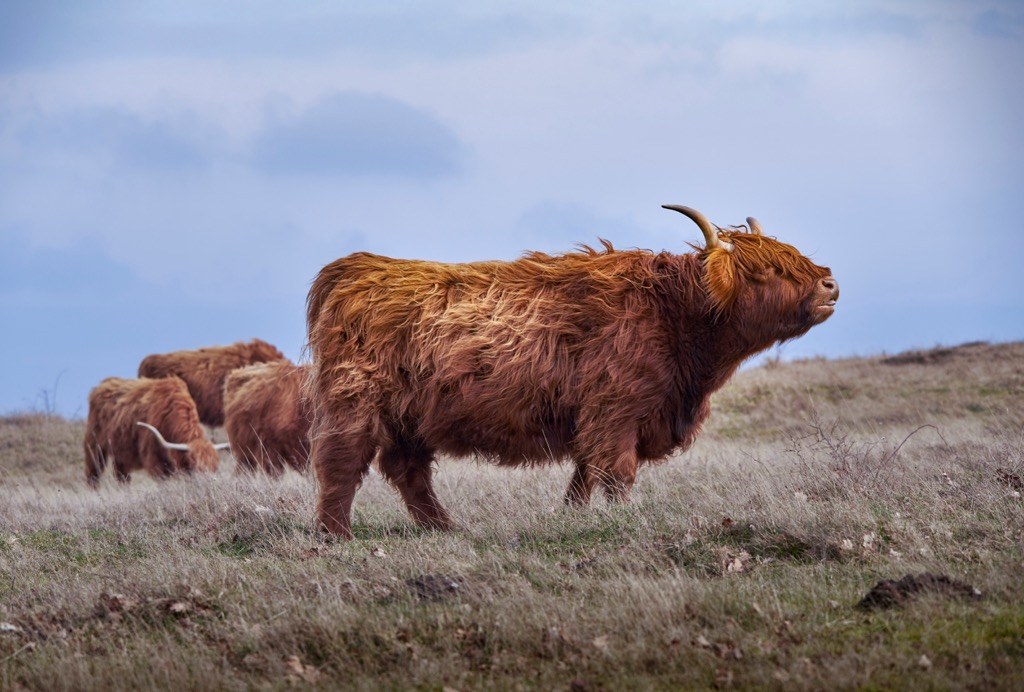
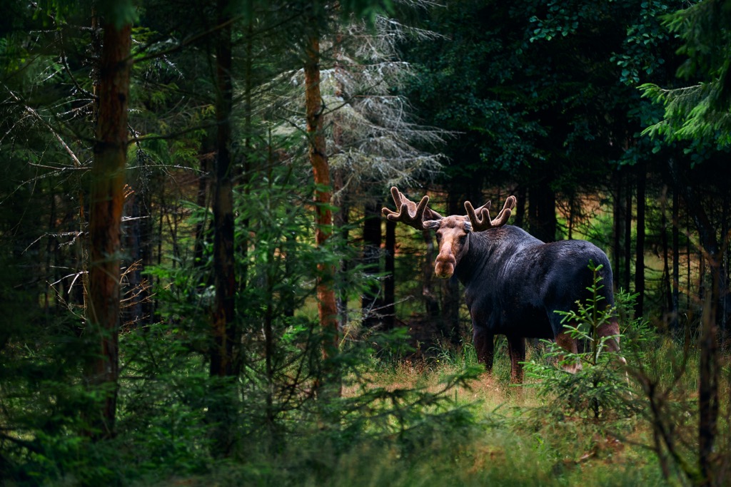
Sweden’s fauna includes significant populations of moose, reindeer, European badgers, red foxes, and wolves. Less common animals include lynx and brown bears. All of these species are more abundant in the forests farther north.
Neighboring Norway is renowned for its salmon. Sweden also has salmon populations spawning in its major rivers, including the Mörrumsån. Other freshwater fish species include pike, popular throughout Sweden's thousands of lakes, and brown trout.
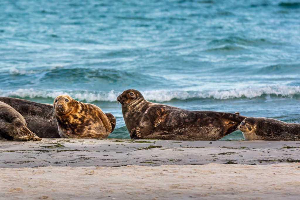
The rocky shores of Sweden’s coastline attract cod, herring, and salmon, as well as their predators, harbor and grey seals. Avain residents include such charismatic species as ospreys, golden eagles, and snowy owls.
Sweden's extensive coniferous forests are particularly prevalent in the northern and central regions of the country and are dominated by Scots pine (Pinus sylvestris) and Norway spruce (Picea abies). Meanwhile, in southern Sweden, where the climate is milder, deciduous trees like oak (Quercus robur), beech (Fagus sylvatica), and birch (Betula pendula) are more common.
In the northern reaches above the Arctic Circle and the alpine regions of the mountains, you'll find hardy, low-growing plants adapted to extreme cold and short growing seasons. Examples include Arctic poppies (Papaver radicatum) and alpine bistort (Polygonum viviparum).
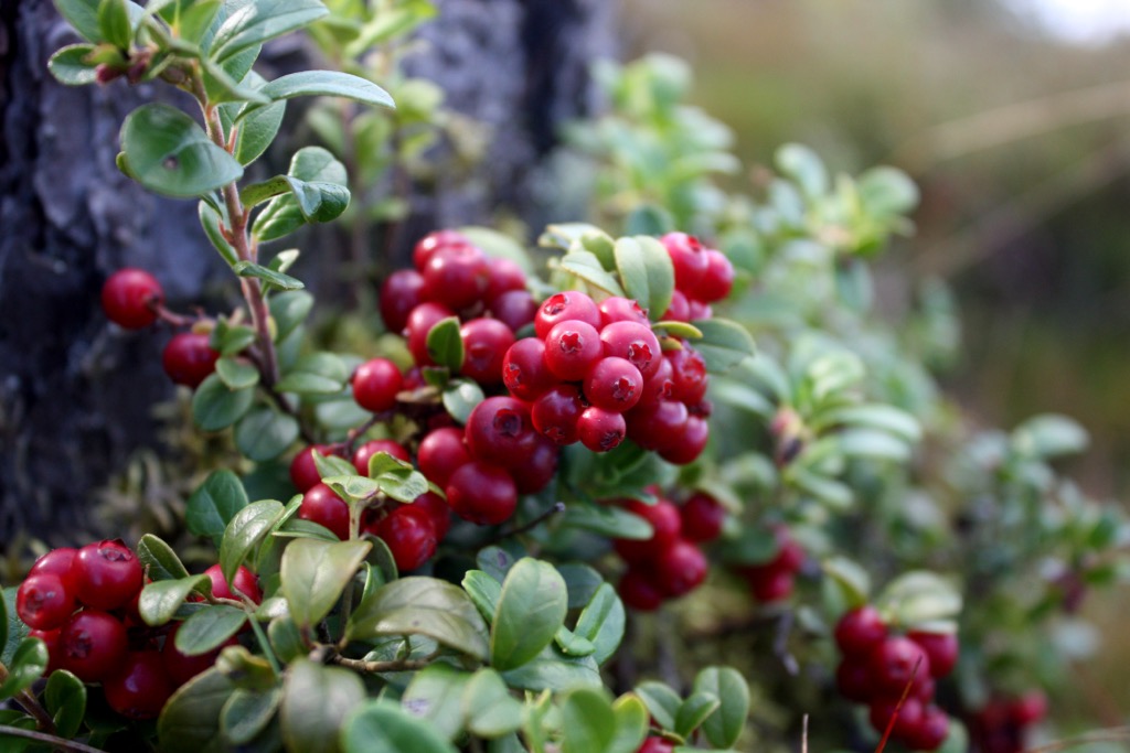
Perhaps nowhere is more synonymous with berry foraging than Scandinavia. The Swedish countryside is rich in edible plants, including wild berries like lingonberries, bilberries, blueberries, and cloudberries. These berries are used in traditional Swedish cuisine, including Sami cooking, and are popular foraging items.
In 1967, Sweden was the world's first country to enact an environmental protection act, then hosted the initial United Nations conference on global environmental concerns in 1972. Since then, Sweden has been a model of Western environmental stewardship, achieving economic growth - the country ranks 7th in HDI (compared to 21st in the US, a much more consumptive nation) - while concurrently reducing carbon emissions and curbing pollution.
Approximately 60 percent of Sweden's national energy supply is sourced from renewable resources. The nation has enacted comprehensive legislation to diminish greenhouse gas emissions further, aiming to be fossil-free by 2045.
Nevertheless, Sweden is a Western nation with a relatively high per-capita emissions ranking. While the government has put remarkable effort into sustainability, conservation is a bit of a different tale. Sweden’s last Old-growth forests are on pace to disappear in 50 years at current rates. Like nearly all of Europe, the original landscape has been altered by humans at some point or another. The forests and mountain regions in the country’s north and west are the exception.
Sweden has 30 National Parks totaling 735,000 hectares (1,836,580 acres), about 1.7% of the nation’s territory. Numerous other types of protected areas are also designated throughout the country. The most famous national parks include:
Humans have inhabited Sweden for a long time, but not as long as in continental Europe further south. Neanderthals and early Homo sapiens were restricted by the giant ice sheet covering much of present-day Scandinavia. It wasn’t until about 12,000 years ago that the first hunter-gatherers ventured north to what is now Skåne, which, at the time, constituted the edge of the ice.
These tribes evolved in relative isolation over the next 10,000 years into what could be considered modern-day Swedish identity. The Roman historian Tacitus first described the Swedes (Suiones) in the first century AD.
Swedes are known to have been pioneers in the history of skiing. Whether the sport originated here, in northern Russia, or even Asia is debatable. Parallel evolution may have occurred, meaning the technology behind skiing was invented by multiple cultures unknowingly. Either way, historians have unearthed skis dating back as late as 4,500 BC in peat bogs of Sweden. Modern skiing was born in neighboring Norway, where the first organized ski events began in the early 19th century.
Vikings began a period of greater Scandinavian power about 1,300 years ago. Vikings traveled east and south, reaching as far as Baghdad. They likely founded the Kievan Rus’, the origin of modern-day Ukraine. Sweden expanded during the Swedish Empire to include modern-day Sweden and Finland.
Sweden did not industrialize as fast as other European countries during the 19th century. It was not a power player in WWI or II and has been criticized for staying neutral and even allowing German troops to cross their territory. However, the country was also spared much of the destruction of Southern Europe during this time.
Sweden has since developed into a thriving Western democracy with an extremely high Human Development Index (HDI) and a life expectancy topping 83 years. The country has embraced a culture of outdoor recreation, with 5,500 nature reserves, dozens of national parks, and a law that allows you to camp anywhere. Historically, the Swedish diet is healthy, with large quantities of lean protein, like fish, as well as vegetables and berries.

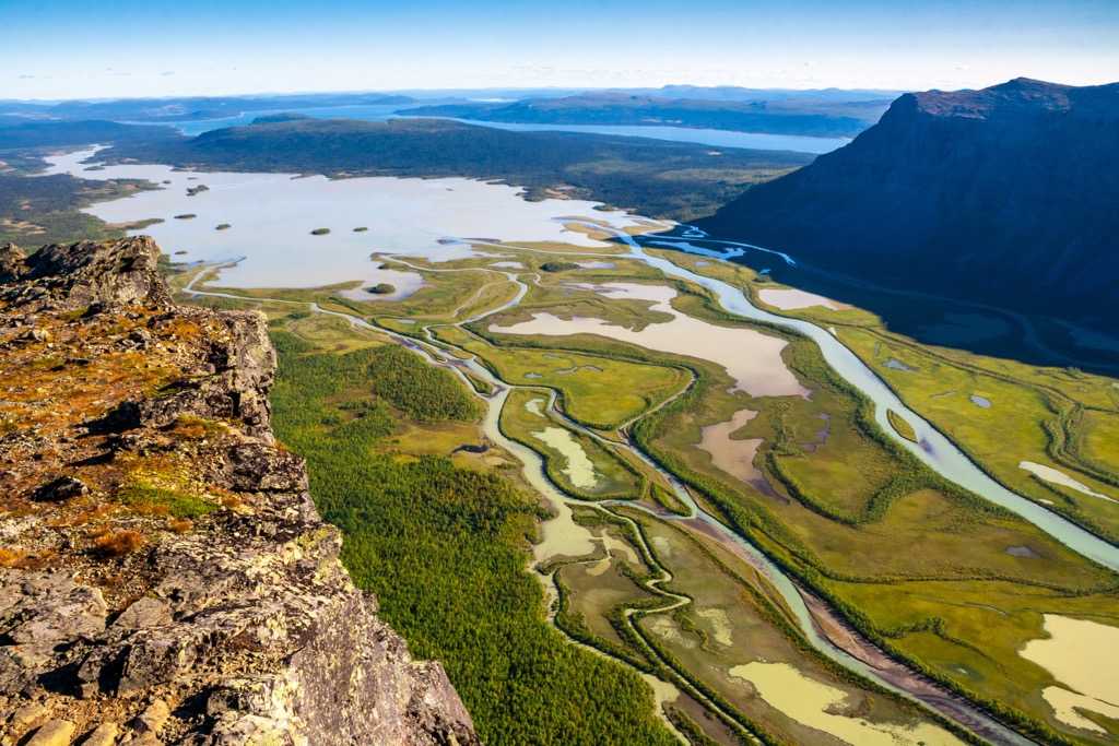
Sweden has 30 national parks. In the Scandinavian Mountains, Sarek National Park features the Kebnekaise Massif, with 6 of Sweden’s 12 mountains above 2,000 m (6,561 ft).
Abisko National Park is north of Sarek and attracts hikers with its popular backpacking route, Kungsleden (King’s Trail), and Sweden’s largest alpine lake, Torneträsk. Tyresta National Park, closest to Stockholm, is known for its gorge and one of Sweden's largest virgin pine forests.
Then there are about 5,500 nature reserves in Sweden, though this is a malleable statistic; they add about 100 annually.
Suffice to say, there’s a lot of hiking to be had in Sweden.
Two famous and even longer hiking trails cross Sweden from Finland to Norway. In the south, the St. Olav Pilgrim Trail (St. Olavsleden) - 600 km (372 mi) - follows in the footsteps of Norway’s King Olav Haraldsson. In the north, the Arctic Trail (Nordkalott) - 800 km (497 mi) - traverses the vast and wild spaces of the Arctic tundra.
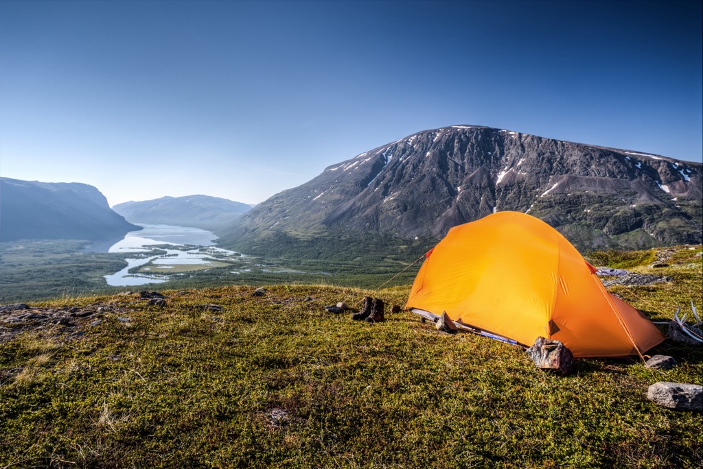
Like most mountainous Western countries, the accommodations include mountain cabins, such as huts, lodges, hostels, and hotels.
However, Sweden features a unique Allemansrätten (Right of Public Access) law that allows residents and visitors to camp anywhere they’d like, as long as it’s 70 m (230 ft) from a private house. You also can’t camp on cultivated land, in some restricted areas of National Parks, or take up residence in other people's houses. Remember, a “don’t disturb, don’t destroy” policy exists. You can’t just build a bonfire in somebody’s yard and burn the place down. Just be respectful because these laws make Sweden one of the easiest countries to explore on a budget.
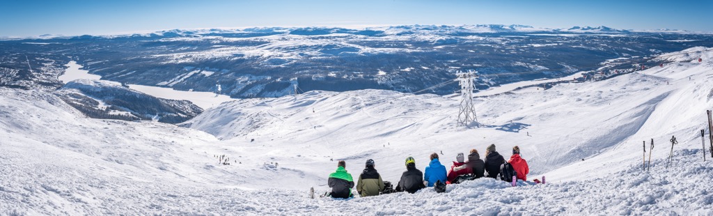
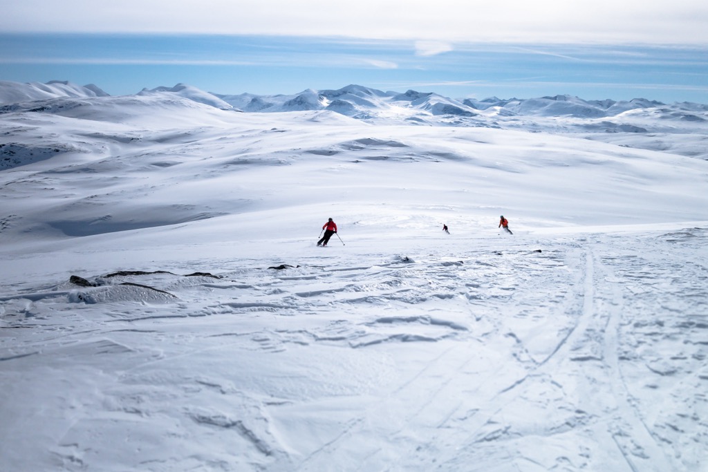
Sweden is home to 256 ski resorts. The largest of these is Åre in Jämtland County, including three main ski areas: Åre Björnen, Åre By, and Åre Högzon. The resort offers 91 km (56.4 mi) of slopes and 34 ski lifts.
Other major ski resorts in Jämtland County include Tänndalen, Lofsdalen, Ramundberget, Bydalsfjällen–Bydalen, Trillevallen, Duved/Tegefjäll, Klövsjö/Storhogna, and Vemdalsskalet, all with more than 20 km (12 mi) of slopes and more than five ski lifts.
The Dalecarlia region also caters well to skiers. Its largest resort, Tandådalen/Hundfjället (don’t confuse it with Tänndalen; they have very similar names), has more than 45 km (28 mi) of slopes. Other resorts in the region are Lindvallen/Högfjället, Kläppen, and Stöten.
The largest ski resort near Stockholm is Romme Alpin, with more than 20 km (12.4 mi) of slopes.
For those in search of a true adventure, check out Riksgransen and Abisko, both far north of the Arctic Circle. Nearly all the terrain here is off-piste. These resorts are challenging to get to and don’t even open until the end of February; it’s mostly dark until then. However, Riksgransen can keep lift-access skiing open until June.
Learn more about these and other ski resorts in Sweden, including open and closed ski lifts and slopes, at the World Mountain Lifts section on the PeakVisor site.
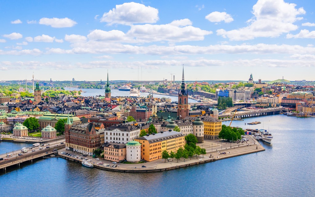
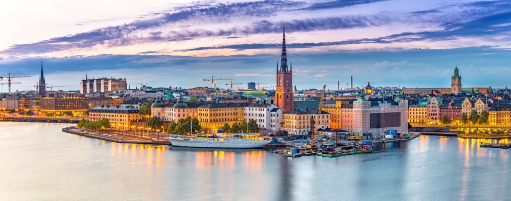
While Europe’s recreational opportunities are some of the world’s best, the continent is equally renowned for its cities. Stockholm is to Sweden, as Paris is to France. If you’re heading to Sweden for a backpacking trip or National Parks tour, it’s still worth stopping over in Stockholm and experiencing the country's best city.
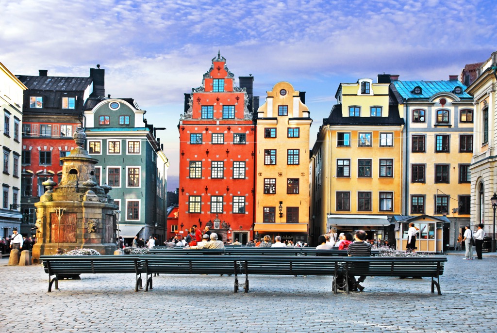
Communication is simple because English is so widely spoken. In my experience, Swedes speak English as a second language better than any other European nationality. The Subway is clean and easy, but you may want to walk everywhere and enjoy the cobblestone streets and colorful townhouses. The city is on an archipelago spread across 14 islands, earning it the nickname “Venice of the North.” I’ve also heard that nickname refer to other canaled cities, like Amsterdam, but either way, you’re surrounded by water in Stockholm.
I’ve heard countless Swedes complain about Stockholm in the wintertime (they come down to ski in France), when there are only 5 hours of daylight, and the city is shrouded in a cold fog. The best time to visit is undoubtedly the summer and fall. The Fotografiska and Vasa Museum are excellent indoor activities while wandering around the Gamla Stan (Old Town), Djurgården, or Södermalm neighborhoods is perfect for pleasant weather.
Marstrand is a coastal town established in the 13th century and situated in Sweden's Västra Götaland County along the nation’s southeastern coast. Marstrand is proximate to nature; Kosterhavet and Tiveden National Parks aren’t far, and Vänern, Sweden’s largest lake, is just a bit northeast.
The town is nestled across two islands in the northeastern Kattegat Sea and sits under the imposing shadow of Carlsten, a formidable 17th-century stone fortress. Thanks to its charming harbor full of boats, and the annual Match Cup Sweden sailing race, Marstrand is often referred to as the sailing capital of Sweden.
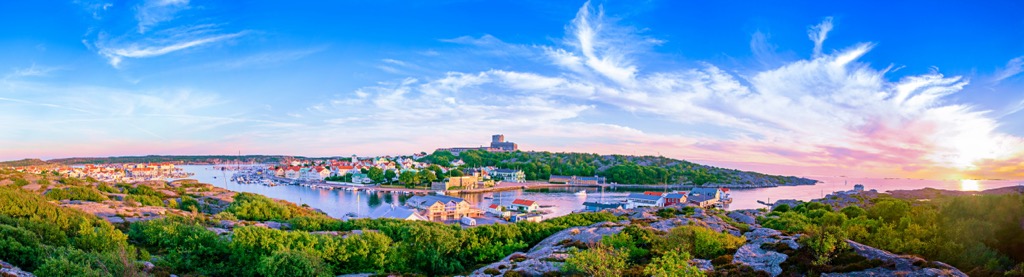
Nearly all tourists visit Marstrand during the summer season. Its meandering streets are lined with cottages. For those with an appetite for contemporary culture, Marstrand offers the Strandverket Art Museum, a venue known for its frequent exhibitions of modern Swedish art.
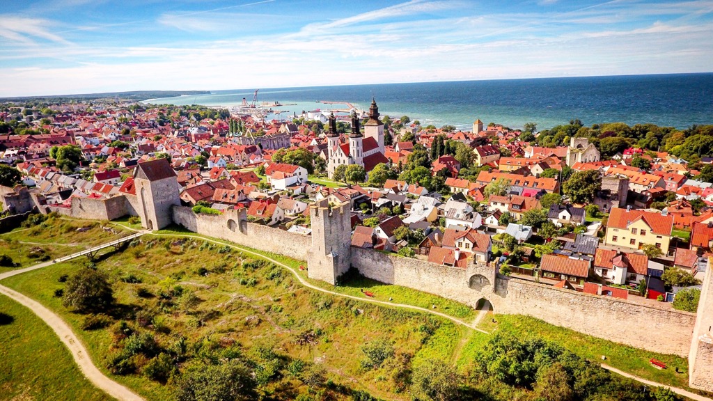
Visby is Gotland Island’s sole town; the rest of the island contains small settlements and villages but no other towns. It’s an impeccably preserved medieval town that received UNESCO World Heritage status in 1995. Visby features a collection of fairytale cottages and churches, but its town wall - one of the best preserved in the world - reflects the former might of this once powerful port.
The town's medieval heritage is celebrated every August through the annual Medeltidveckan festival. The town comes alive with medieval markets, jousting tournaments, and period attire. Visby is home to the Visby Botanical Garden, a culinary scene with a variety of restaurants and cafes, and the esteemed Gotland Art Museum.
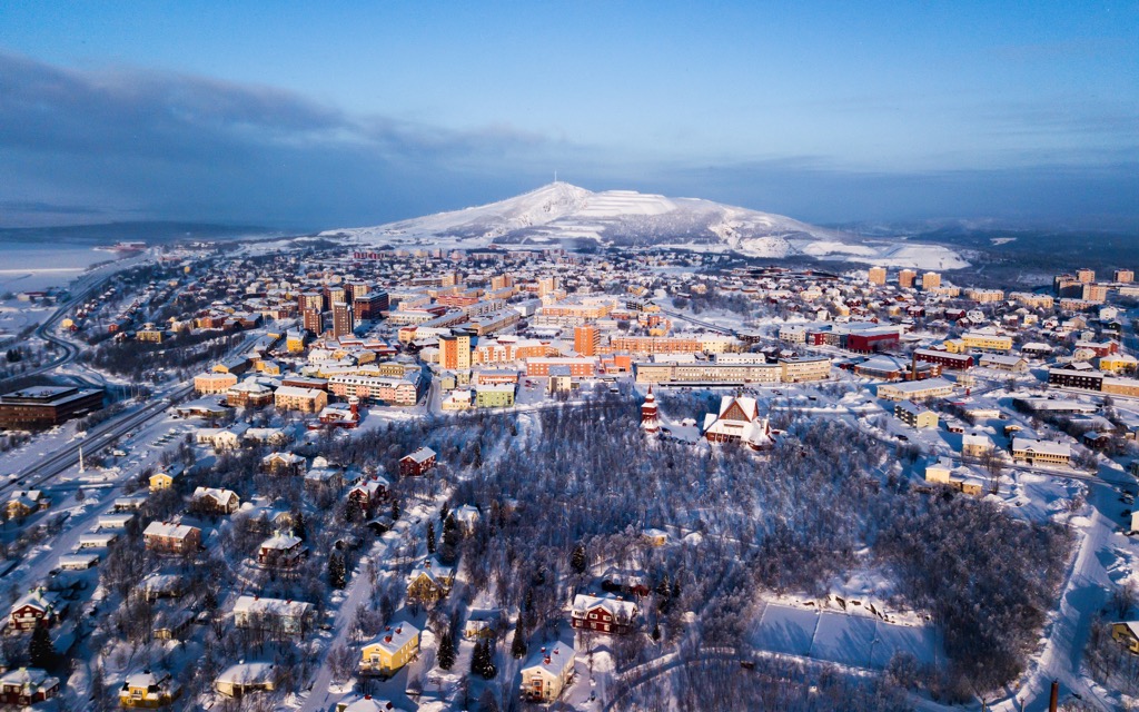
Kiruna, Sweden's northernmost town, is nestled in the heart of Swedish Lapland. The region is surrounded by lakes and mountains, with alpine cottages and homesteads set amidst deep forests. Kiruna will likely be a base for adventurers exploring Sweden’s wildest realms. Sweden’s most visited National parks, including Abisko, Sarek, Stora Sjöfallet, and Padjelanta, are all near Kiruna.
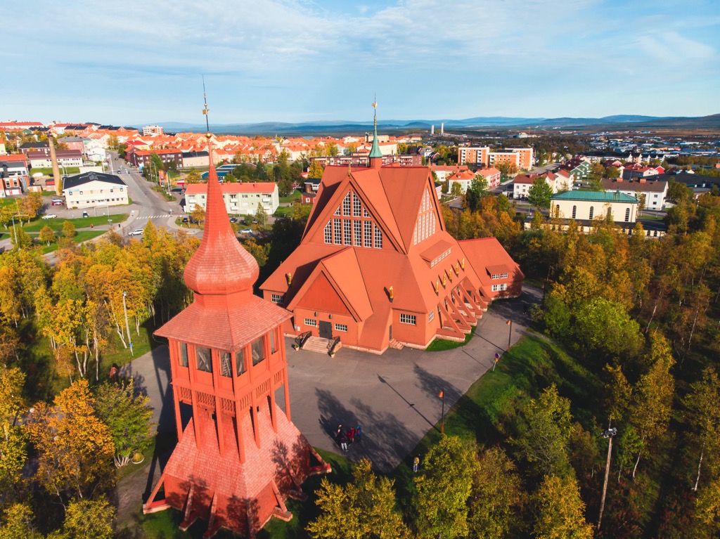
Kiruna’s value to outdoors folks mostly lies in its access to wild spaces. However, it’s also a cute little town in its own right, home to Kiruna Kyrka, a church constructed in the early 20th century. Kiruna also claimed, for a period, to be the ‘largest’ city in the world, as it had incorporated over 20,000 sq. km into its ‘city limits.’
Kiruna is also undergoing a significant transformation, gradually being relocated a few kilometers east of its current location. The iron ore mine, to which the town owes its existence, has extracted enough materials out of the earth below the town that subsidence, or the gradual sinking of the ground, has become a problem.