
Scan the QR code and open PeakVisor on your phone
Stockholms län is home to 232 named mountains. The highest is Tornberget at 111 m.
Stockholm County is the capital of Sweden’s 21 regions in Scandinavia in northern Europe. The main feature of Stockholm mountains is an archipelago of the same name, consisting of about 30,000 rocky islands—one of the largest in the world. This incredibly scenic place is also one of the symbols of the whole of Sweden and attracts outdoor enthusiasts due also to a large number of hiking trails and distinctive Swedish culture. There are 232 named mountains in Stockholm County. The highest and most prominent mountain is Tornberget (111 m / 364 ft).
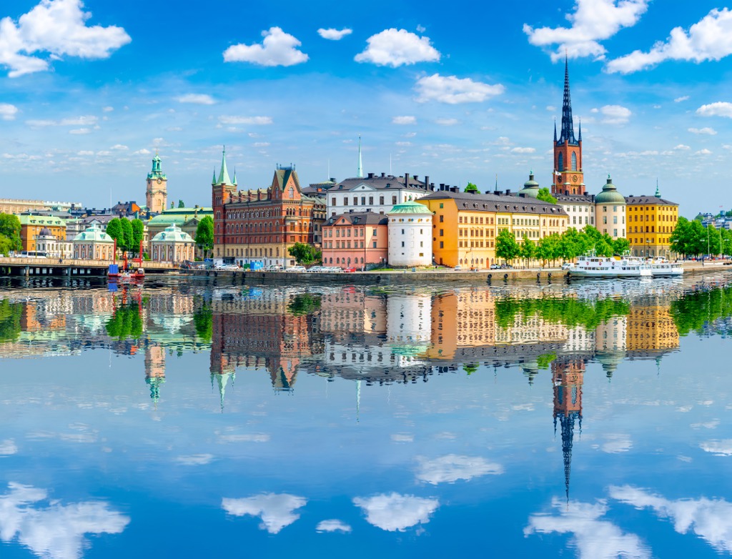
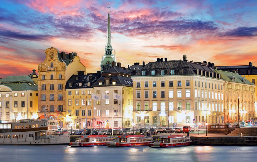
According to the most widespread version, the name of the country comes from two words. "Stock" is a modified "stäk", which means “pile barriers”. The Swedes installed into the seabed in the straits of the archipelago to obstruct the passage of enemy ships (the ancient Scandinavians in general are known for their bellicosity). "Holm" is an “islet”, as evidenced by the names of the three islets in the center of the city—Stadsholmen, as well as Riddarholmen and Helgeandsholmen, on which its Old Town known as Gamla stan in Swedish is located. So Stockholm is an “Islet(s) on pil barriers”. The original name of the region is Stockholms län, where "län" is the local name for the English "county".
Stockholm County, with its name capital, Stockholm, which is also the capital of the whole country, is located in eastern Sweden.
The region borders modern Uppsala County in the north and Södermanland County in the south.
Interestingly, the region was separated into an independent administrative unit relatively recently. Previously it was divided between two of the 25 historic provinces of Sweden: Uppland (Roslagen) and Södermanland (Södertörn).
Internally, the county consists of 26 municipalities, including the largest Stockholm. It is also the most populous city in all of Scandinavia, with 2.5 million people, if you count its entire metropolitan area. It, in turn, is divided into three districts: Stockholm City Center (Innerstaden), South Stockholm (Söderort), and West Stockholm (Västerort).
Finally, Stockholm County is part of Svealand, one of the three largest regions of the country along with Götaland to the south and Norrland to the north.
Besides air travel, the fastest and easiest way to get to Stockholm is by train or bus from Oslo in Norway and Copenhagen in Denmark and by water from Turku and Helsinki in Finland and Tallinn in Estonia.
I first got to Stockholm using the latter option in the summer of 2012 on the Tallink Silja Line ferry. The second largest company is the Viking Line. The journey will take all night, but the wait is worth it—you’ll pass through the Stockholm Archipelago in the morning.
A few tips:

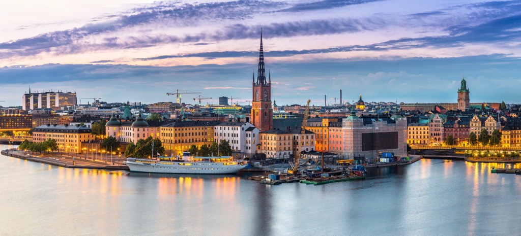
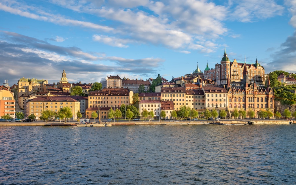
The main feature of the region’s landscape, the Stockholm Archipelago, begins right in the center of the Swedish capital on the three aforementioned islands: Stadsholmen, Riddarholmen, and Helgeandsholmen, on which the city was founded. As it grew, it occupied more and more islands, the number of which reached 14, including Beckholmen, Djurgården, Kastellholmen, and others.
The archipelago goes 60 km (37 mi) into the Baltic Sea, one of the main seas of northern Europe, which washes Sweden's shores from the east. In terms of the number of islands (about 28,000–30,000), it is the largest of several archipelagos of Sweden, the second largest in the Baltic Sea after the neighboring Archipelago Sea off the western coast of Finland (40,000), and the third largest in the world after it, as well as the Canadian Arctic Archipelago (36,000) and Thirty Thousand Islands (30,000)—two Canadian archipelagos. The largest and most important islands of the Stockholm Archipelago are Dalarö, Finnhamn, Nässlingen, Grinda, Husarö, Ingarö, Ljusterö and others.
But the archipelago consists not only of islands but many peninsulas, too. The largest one is the Södertörn Peninsula south of downtown Stockholm.

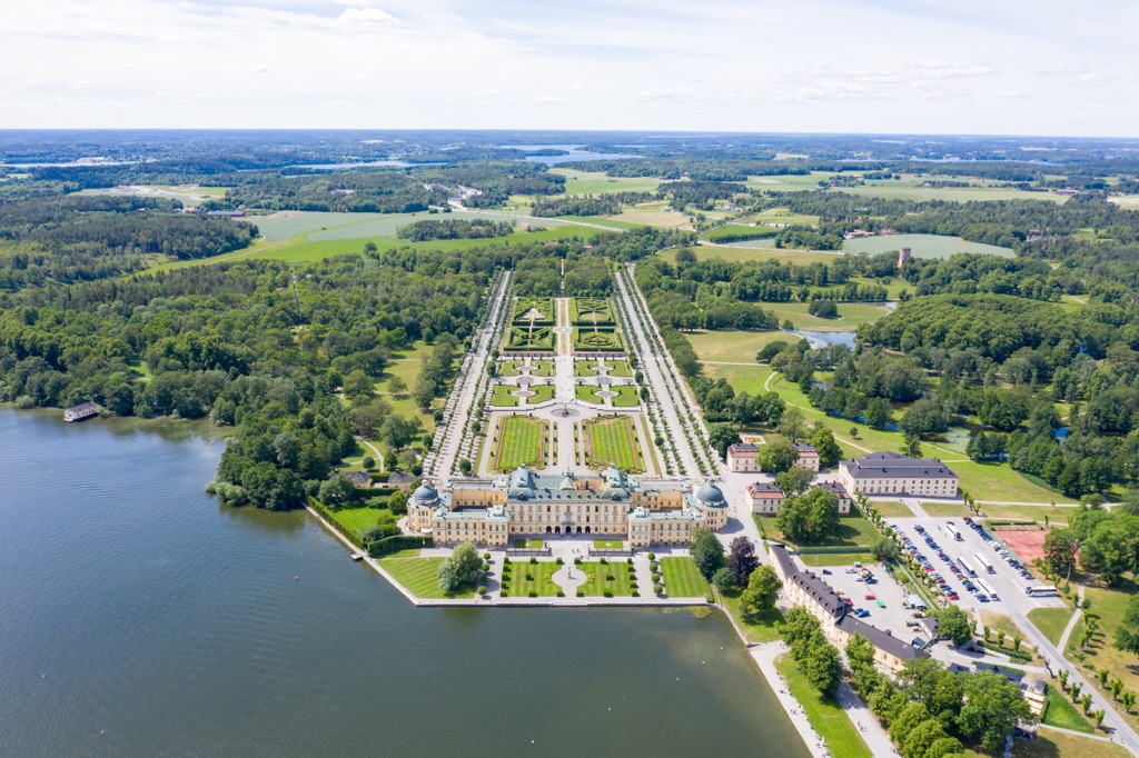
The second main feature of the region's landscape is the vast Mälaren Lake, which lies immediately to the west of the city. In fact, Stockholm stands between the sea and the lake. This is the third largest lake in the country after the neighboring Vänern and Vättern with 120 km (74.5 mi). Within the lake are also dozens of islands, the most famous of which is Björkö. It is known for Birka, one of the major trading settlements of the Viking Age, which was founded around AD 750 and existed for about 200 years. Together with Hovgården on the neighboring island of Adelsö, it forms a UNESCO site, one of 15 in the country. In other words, it is a must-visit place in Stockholm Country and in the whole of Sweden. You can learn more about the Vikings on-site at the namesake Birka Viking Museum. (Another must-visit and even more famous open air museum in Stockholm Country is Skansen.)

Finally, in a broader landscape sense, Stockholm County belongs to the Central Swedish Lowland, one of several major geographical regions of the country, occupying its central and southeastern parts (the others are the Scandinavian Mountains, High Coast of Sweden, Norrland Terrain, and South Swedish Highlands). But it is not absolutely flat, there are low mountains.

The 232 named mountains of Stockholm County are located both on the mainland and on the islands of the archipelago, i.e. evenly distributed over its territory. Wherever you go, you will find hills and rocky islands that are free viewing platforms. Their low altitude compared to the real mountains is more than compensated by the magnificent views of northern nature, which you will not find in the Alps, the Himalayas, or the Cascade Mountains. This is what people come here for.
Among the individual famous peaks of the region, there are several:
Of course, you're also interested in the southernmost spurs of the Scandinavian Mountains, the closest to Stockholm. They are located 400 km (248 mi) northwest in Dalarna County, also known as Dalecarlia. The main town of the area is Sälen in Malung-Sälen municipality. Its highest peak is Storvätteshågna (1204 m / 3950 ft). It is also the nearest major ski resort to Stockholm, about which I will tell you more next, as well as about some others.

Stockholm County is one of several top hiking destinations in Sweden, along with the Scandinavian Mountains and both coasts: the west and the east. Inside the county, there are several major hiking areas of different sized and long hiking trails of different lengths and levels of difficulty. Next, I will briefly tell you about the main ones:
First, you can go hiking within Stockholm city limits by going to the Royal National City Park (Kungliga Nationalstadsparken), the first natural area of this format in the world.
Second, the region is home to 2 of Sweden’s 30 national parks: Tyresta National Park and Nature Reserve and Ängsö National Park. The first one is on the mainland and famous for the oldest pine forest in the south of Sweden, which is up to 400 years old. The second one is on the archipelago and is famous as one of the first in the country with a lot of old Scandinavian farms. However, you can reach the latter only by water.

Thirdly, and anyway, the archipelago of Stockholm itself, which is managed by the Archipelago Foundation is essentially one big area for hiking and other activities, where, unlike Ängsö Island, many of the islands can be reached by land. In particular, there are 38 small reserves on the archipelago, often repeating the outlines of individual islands or groups of islands: Arholma, Biskopsö, Björnö, and others. Another magnificent reserve in the archipelago, which is located south of the Södertörn Peninsula, is also very famous, in particular, because of the picturesque bridges between its islands.
Similar to the previous subsection, among the three long hiking trails in Stockholm County, as well as the neighboring Uppsala County in the north and Södermanland County in the south, I can recommend the following:
There is also an even longer hiking trail from Finland to Norway or vice versa that cross the south of Sweden—the St. Olav Pilgrim Trail (St. Olavsleden) of 600 km (372 mi), in the footsteps of Norway’s King Olav Haraldsson, who once walked it.

Sälen is not only the largest ski resort to Stockholm but one of the main resorts in the country as a whole. In fact, it is a series of five ski areas around the village of the same name with 161 km (mi) of slopes and 131 ski lifts in total, namely:
But if you're not going to go far out of Stockholm, but still want to go skiing, in the country you will find several smaller resorts. In addition to Väsjöbacken with 1.5 km (1 mi) of slopes and 7 ski lifts, there are Flottsbro Alpin (2.7 km / 1.6 mi of slopes and 3 ski lifts), Hammarbybacken (2 km / 1.2 mi of slopes and 2 ski lifts), and Ekebyhovsbacken (1.2 km / 0.7 of slopes and 2 ski lifts).
Learn more about ski resorts in Dalecarlia and other parts of Sweden in the World Mountains Lifts section of PeakVisor site, including real-time open and closed ski lifts and slopes.

Before or after your hike, visit one of Sweden's official tourist offices, which can be found in almost every city, regardless of size. However, the main one, Visit Stockholm Contact Center, prefers to communicate online in the spirit of the times. But it has several offices in the city that you can visit in person, for example:
Royal Djurgården Visitor Center
Djurgårdsvägen, 2, Stockholm, Sweden
Open every day from 9 am to 5 pm
+46086677701
When hiking and traveling in Stockholm County you can find almost any type of accommodation: hostels and hotels, apartments, cottages and holiday homes, saunas, picnic cabins, campsites, and others.
For those who want to escape from Stockholm far away to the wild islands of the archipelago and looking for places to stay, the Archipelago Foundation also operates two open huts: Kulans Uddar Open Hut in Storö-Bockö-Lökaö Nature Reserve also known as Möja Nature Reserve (Möjaskärgården) on Bergbo Storö Island in Möja Archipelago, one of the many smaller cluster of islands inside the Stockholm Archipelago; and Myggskären Open Hut on Fjärdlång Island, two remote islands north and south of Stockholm with open sea views.
Both huts are free and ready for up to 4 people, but they can't be booked in advance—you can only find out about availability on the spot. The maximum duration of stay is two nights per person.
So in any case, if you manage to get to these remote islands, take a tent with you, which in Sweden as elsewhere in Scandinavia is allowed to pitch everywhere, even on private property. Keep in mind, however, that camping outside equipped sites is forbidden within nature reserves and national parks, as is making campfires during the wildfires warning period.
Learn more about accommodation options in Stockholm County on Swedishtouristassociation.com.
In addition to Stockholm itself and the other places I have already listed in the guide, the largest cities and resorts in Stockholm County are Upplands Väsby on the mainland, as well as Norrtälje and Nynäshamn on the archipelago in its northern and southern parts, respectively. Also the small town of Vaxholm is popular with tourists, the closest of these to Stockholm.
From my experience the latter seemed to me too touristy because of its large defensive Vaxholm Fortress built in 1548—its main attraction. So I would recommend Nynäshamn on the southernmost tip of the Södertörn Peninsula, which is a large but very cozy seaport. I think it had more of a “wild archipelago spirit”. In addition, it can be reached by direct train from Stockholm, while Vaxholm only by bus. However, I managed to visit both cities in one day, spending half a day each.
The official websites of these cities are Upplandsvasby.se, Vaxholm.se, Norrtalje.se, and Nynashamn.se.


Yes. Stockholms län has 232 named mountains. The highest is Tornberget at 111 m.
The highest mountain in Stockholms län is Tornberget, at 111 m.
Stockholms län has 232 named mountains.


