Scan the QR code and open PeakVisor on your phone
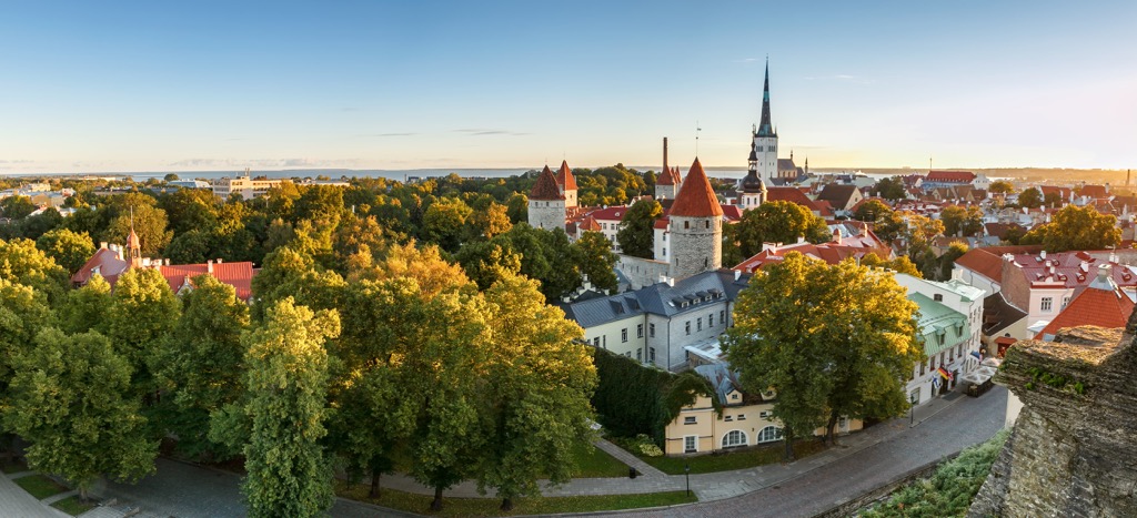
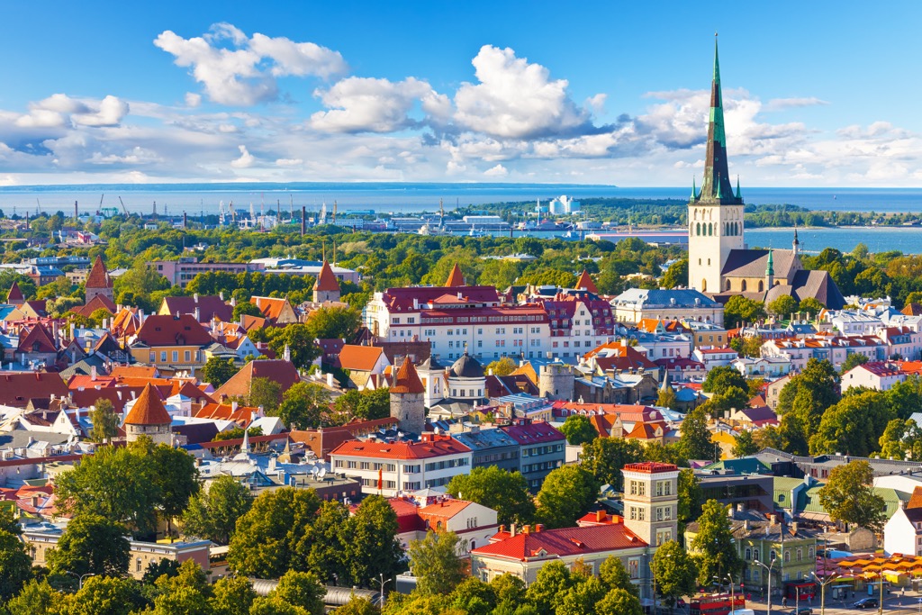
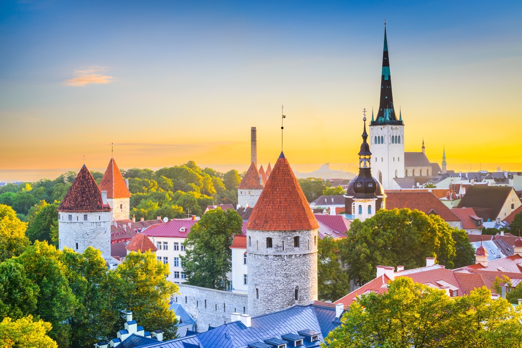
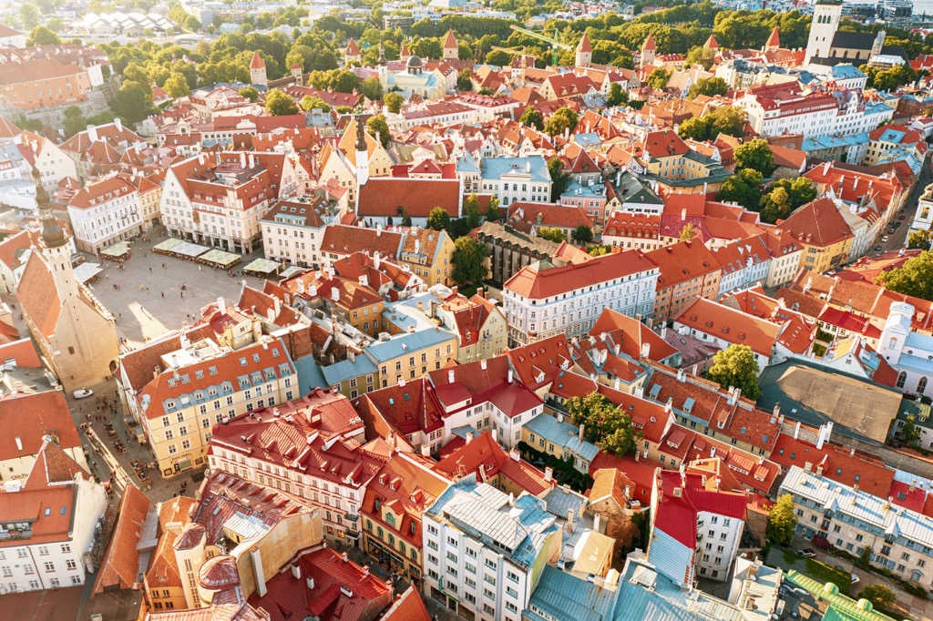
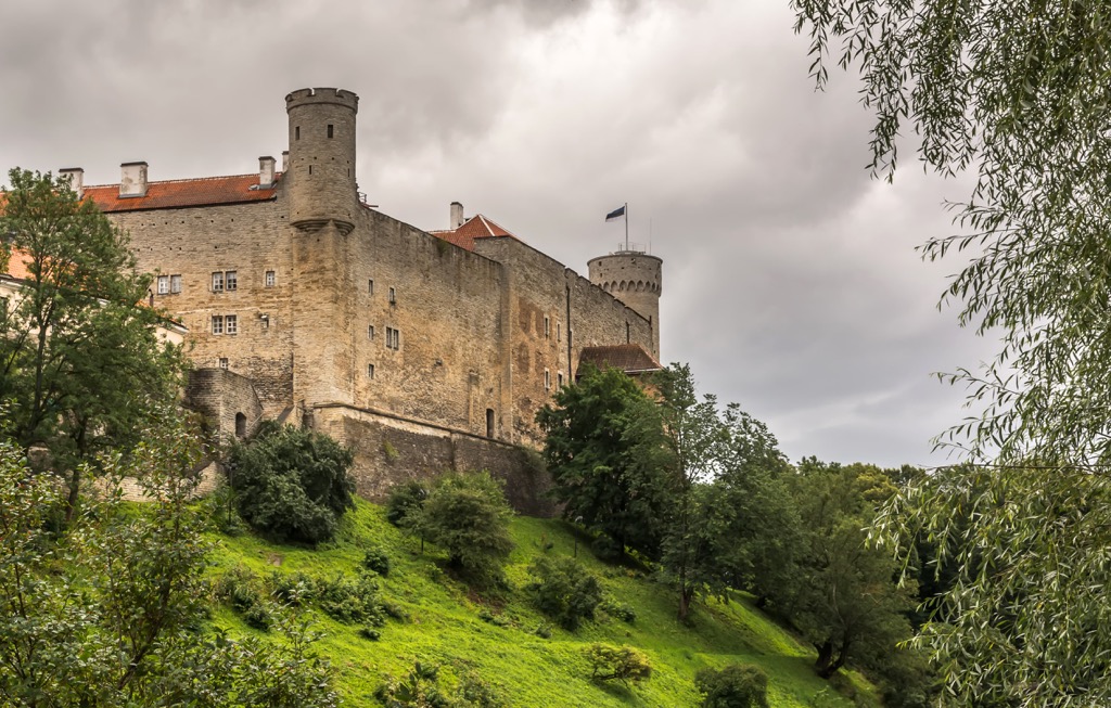
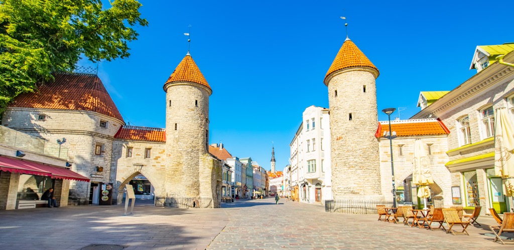
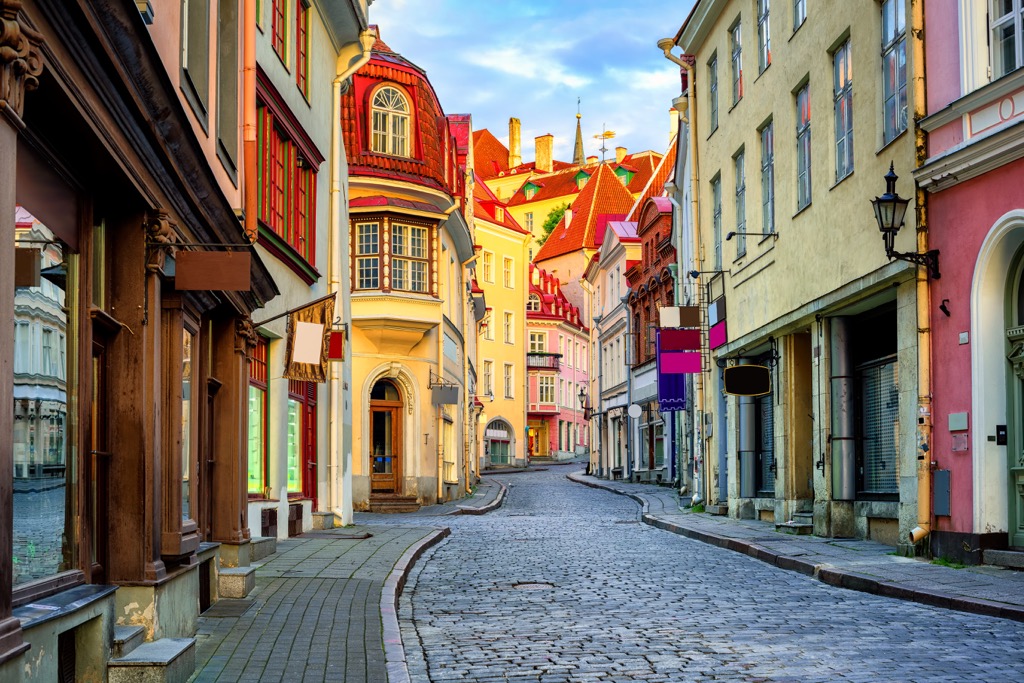
Estonia is one of the three Baltic countries in northeastern Europe. The main feature of Estonia mountains is Toompea Hill (62 m / 203 ft), which hosts the Tallinn Old Town—the very center of the capital of the state, which is one of the best preserved medieval architectural complexes in Europe and a UNESCO World Heritage Site. Estonia is also famous for its picturesque indented coastline on the Baltic Sea with high rocky capes with lighthouses and other points of interest, as well as the large inner forested and swampy lands full of long hiking trails. In total there are 182 named mountains in Estonia. The highest and the most prominent mountain is Suur Munamägi (321 m / 1053 ft).
The name of the country comes from the Latin word Aesti. This is how the Roman historian Tacitus first described the people who inhabited this part of the Baltic region in his treatise “Germania". The name was further modified to Aestii, Astui, Aest, Esti, and others.
The territory itself was called Estia and Hestia by the Romans. The ancient Scandinavian sagas also contain references to the people of the future Estonia, whose country they called Eistland, which means “Eastern Land”.
Until the 18th and 19th centuries Estonians called themselves "maarahvas", which literally means “people of the land”, i.e. those engaged in farming. Tacitus also speaks of their efforts in this matter. He also reports that Esti was one of the tribes engaged in collecting Baltic amber (fossil resin up to 40 million years old from which jewelry is made) and exporting it to the Roman Empire.
After gaining its first-ever independence from the Russian Empire in 1918, the country became known as Estonia in a more modern manner. Before that, it had also been part of Sweden and the Livonian Order under the rule of Germans.
In other words, Estonia is a nation on the far (relative to Scandinavia) eastern shore of the Baltic Sea, which predominantly farmed and harvested amber for export to the Romans.
The geography of Estonia is relatively simple and not difficult to understand.
It is one of three Baltic states in northeastern Europe with an area of 45.339 sq km (17.505 sq mi). The other two larger Baltic countries are Latvia, with which it borders to the southwest, and Lithuania, which in turn borders Latvia. To the east of Estonia is Novgorod Oblast of Russia, and to the north, if you cross the Gulf of Finland of the Baltic Sea, is the Uusimaa region of Finland.

Internally, the country is divided into five major geographical, administrative and tourism regions: the capital city of Tallinn, North Estonia, South Estonia, West Estonia, and the Islands.
These regions are further divided into 15 counties: the capital Harju, Hiiu, Ida-Viru, Jõgeva, Järva, Lääne, Lääne-Viru, Põlva, Pärnu, Rapla, Saare, Tartu, Valga, Viljandi, and Võru.
Extreme points of Estonia are Vaindloo Island (north); Narva Town (east); Karisöödi village, Rõuge Parish, Võru County (south); and Nootamaa Island (west).
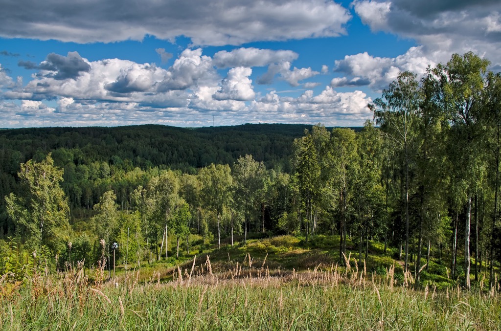
The main features of the landscape of Estonia, in addition to the low mountains, which I will tell you about right next, are the Baltic Sea coast with many islands, forests, multiple lakes and rivers, and one unexpected feature that you definitely do not know about (so read this section to the end).
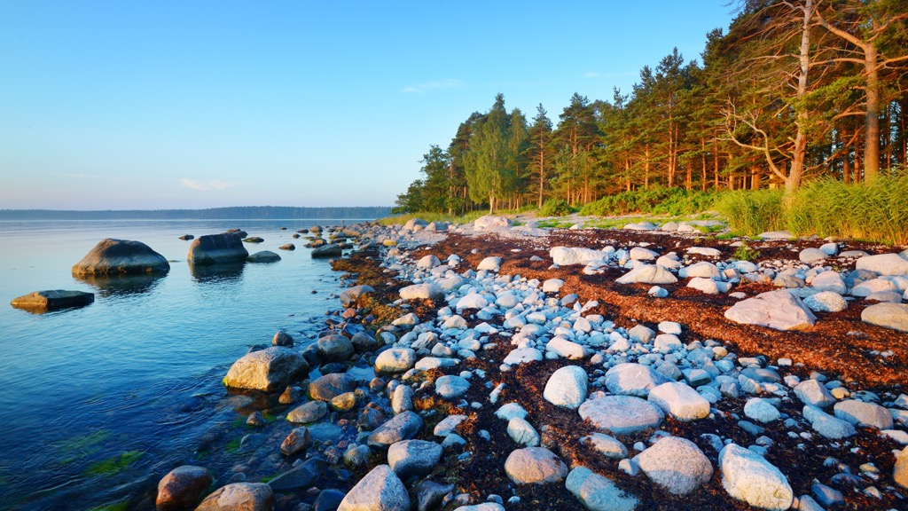
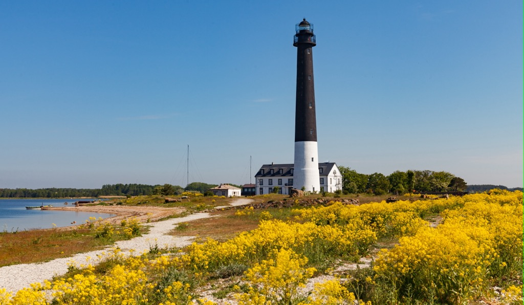
Baltic Sea. Estonia’s 3794 km (2357 mi) long coastline, covering at least half of the country’s borders, is washed by the Baltic Sea. To the north, it is the Gulf of Finland, and to the west, the Gulf of Riga, named after the Latvian capital. The coast, especially in the north, is strongly indented by peninsulas with high rocky headlands, separated by bays with long sandy beaches. In particular, there are four well-known peninsulas east of Tallinn in Lahemaa National Park: Juminda, Pärispea, Käsmu, and Vergi with Kolga, Hara, Eru, and Käsmu bays between them.
Islands. Estonia has more than 2000 islands in the Baltic Sea, of which the two largest are Saaremaa and Hiiumaa. They are followed by Muhu, Vormsi, and Kihnu. All these islands are inhabited.
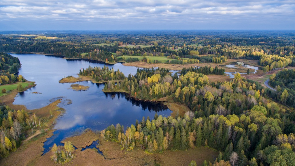
Lakes and rivers. There are also more than 1000 lakes of glacial origin in Estonia. The largest of them, Peipus Lake, in the east of the country, Estonia shares with Russia. The country’s largest inland lake, Võrtsjärv, is in the south. Another large body of water worth noting is Ülemiste Lake just south of Tallinn. However, lakes occupy only 5% of the country, unlike neighboring Finland, where there are 188,000 of them. The most notable rivers in Estonia are the Võhandu and Narva.
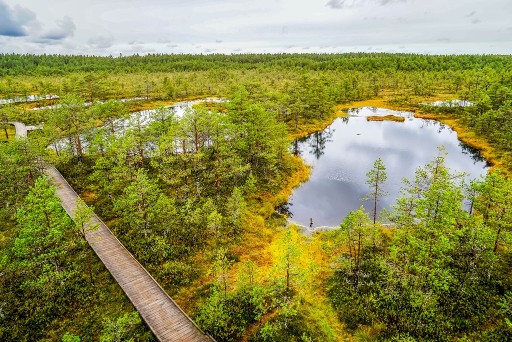
Forests. Dense and wild pine, spruce, and birch forests, on the contrary, are the most noticeable element of the country’s landscape. They cover more than 50% of its territory and also include numerous bogs. The most famous of them—Viru Bog—is also one of the main attractions of Lahemaa National Park. According to Visitestonia.com, “the bog is the oldest organic landscape of Estonia, reaching in some cases up to 10,000 years of age.”

An unexpected feature. On the largest Estonian island, Saaremaa, there are nine confirmed impact meteoritic craters in the forest, the largest of which is 100 m (328 ft) in diameter. Formed around 1530–1450 BC, today they look like small ponds of perfectly flat round shape filled with water. The place is known as Kaali Crater after the name of the neighboring village. So, while on the island, do not miss them to surprise friends with an amazing story from a trip to a country that is considered quite relaxed or even boring, and difficult to find adventure in.
Generally speaking, Estonia is a mostly flat country without high mountains, located on the East European Plain, covering all of Eastern Europe from Germany in the west and the Caucasus Mountains in the south to the Ural Mountains in Russia in the east and north. However, Estonia is not without uplands and other interesting geological features. So, all the mountains of the country can be divided into two large groups:
The Limestone Plateaus of North Estonia covers the northern part of the country and consists of three parts: the Harju Plateau, the Viru Plateau, and the Pandivere Upland.
The Harju-Viru Plateau is part of the North Estonia Klint, which in turn is part of the larger Baltic Klint, an erosional limestone escarpment that stretches 1200 km (745 mi) from Sweden’s two largest islands in the Baltic Sea—Gotland and Öland—across Estonia to Leningrad Oblast and Ladoga Lake in the Republic of Karelia in Russia.
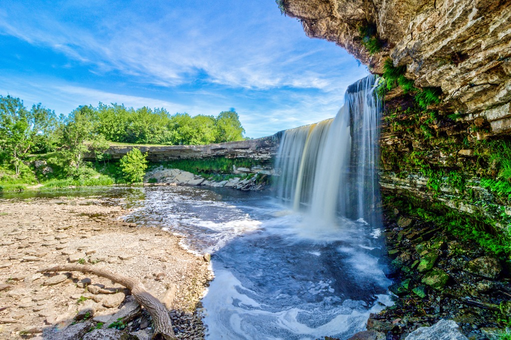
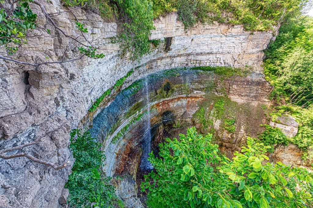
The Klint explains the presence of high cliffs on the coast of the Baltic Sea in Estonia. The highest of them is Ontika Limestone Cliff (55 m / 180 ft), located east of Tallinn. More: It is the highest point of the entire Baltic Klint. The cliff is also known for the Valaste Waterfall, also the highest in Estonia (30 m / 98 ft), which flows down from it.
The Estonian islands are not without peaks either. For example, Raunamägi (65 m / 213 ft) and Tornimägi (75 m / 246 ft) are the two highest peaks of the country’s two largest islands: Saaremaa and Hiiumaa.
The Toompea Hill (62 m / 203 ft)—the most famous mountain in the country, where Tallinn Old Town is located, is also part of the same North Estonia Klint.
The Pandivere Upland also belongs to it. This is the only one of the five uplands of Estonia, located in the north of the country, southeast of Tallinn. The highest peak of the upland is Emumägi Hill (171 m / 561 ft). It also includes a series of five hills over 100 m (328 ft), which are the highest points of the capital Harju County: Määramägi (112 m / 367 ft), Pukimägi (111 m / 364 ft), Niinemägi (109 m / 357 ft), Laudissalu mägi (105 m / 344 ft), and Rõõsamägi (105 m / 344 ft), which stretch out in a ridge.
Note that the names of all mountains end in “mägi,” which literally means “mountain” in Estonian, while “mäed” is a lesser mountain or “hill,” as in the case of Suured mäed. Actually, in Estonia almost all mountain names, with few exceptions, end in “mägi” or “mäed”. You can check that right on the page of this guide in the box to the left.
The Uplands and Depressions of South Estonia are the true mountains of the country, both in height and territory. They are a series of four uplands located in the very south of the country. These include the Haanja Upland, the Otepää Upland, the Karula Upland, and the Sakala Upland, in descending order of height and size at the same time.
Haanja Upland is the most important of them, located on the border with Latvia and Russia. It includes the two highest mountains of Estonia, Suur Munamägi (321 m / 1053 ft) and Vällamägi (307 m / 1007 ft), which are also the only peaks higher than 300 m (984 ft), the others are lower. Suur Munamägi is also the highest in all three Baltic countries (the highest mountains in Latvia and Lithuania are Gaizina Kalns (311 m / 1020 ft) and Aukštojas (303 m / 994 ft), respectively). Its name translates as the "Great Egg Mountain".
Another feature of both highest peaks, as well as many other Estonian mountains, is that they host high observation towers that add to their relatively low height and allow a view of tens of kilometers (miles) in all directions. To be exact, in the case of Suur Munamägi it is plus 29.1 m (95.4 ft) and visibility of 50 km (31 mi) on a clear day.
Speaking about the size, the length of the Haanja Upland from north to south is 30 km (19 mi), and from west to east is 40 km (25 mi), so it is quite large.
The upland is also a natural area with the same name—the Haanja Nature Park, formed to protect the main mountainous region of the country, which includes 41 peaks in total. The upland continues into neighboring Latvia as the Alūksne Upland or the East Vidzeme Upland.
Good to know also that there are over 30 other peaks higher than 200 m (656 ft) in Estonia, most of which are also located in the Haanja Upland and the Otepää Upland.
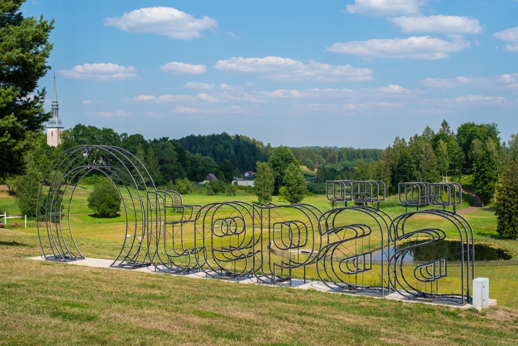
Otepää Upland is the second highest and about the same size and number of mountains in the country, located north of Haanja. The highest and best-known mountain in this upland is Kuutsemägi (223 m / 731 ft), but many, like Väike Munamägi (207 m / 679 ft), also exceed 200 m (656 ft), followed by lower paks like Päitsikmägi (170 m / 557 ft), and others.
The upland is also a protected area of the same name, the Otepää Nature Park.
The Karula Upland and Sakala Upland are the last two of Estonia’s five uplands, which play a smaller role in the landscape, as they are much lower and smaller in size, and are therefore less well known. The former borders Otepää and is separated from it only by the Valga and Hargla depressions (finally, here they are from the subtitle of this section), the latter is situated to the west of it.
However, they have approximately the same geological characteristics as their more important neighbors, and therefore they cannot be excluded from the “Mountains of Estonia”. This is confirmed, for example, by the fact that Karula is also the eponymous Karula National Park, one of six in the country.
Estonia has a lot of natural areas and long hiking trails, of which you are sure to find something to suit your trip.
According to the Environmental Board of the Republic of Estonia (Keskkonnaamet), there are 962 different protected areas in Estonia, including national and nature parks, nature and landscape reserves, that occupy more than 23% of the country, not counting the numerous recreational areas.
National Parks. The oldest (1971), largest, and most famous national park in Estonia is Lahemaa National Park. It is located just an hour’s drive from the capital city of Tallinn and is suitable for day hikes and longer hikes with trails ranging from a few to tens of kilometers (miles). The other five are Karula National Park, Soomaa National Park, Vilsandi National Park, Matsalu National Park, and Alutaguse National Park.
Nature Parks. Two of the most famous nature parks I’ve already mentioned above, but here they are again if you started reading the guide from this section: Haanja Nature Park and Otepää Nature Park corresponding to the two main mountain regions. There is also Naissaare Nature Park on the Naissaar island near Tallinn.
Nature Reserves. Of all the natural areas, Estonia has the largest number of nature reserves (230+). They are “scattered” throughout the country. The largest and best known—Põhja-Kõrvemaa Nature Reserve—is also located in the capital Harju County. Other important reserves are Viidumäe Nature Reserve, Silma Nature Reserve, Nigula Nature Reserve, Endla Nature Reserve, Alam-Pedja Nature Reserve, Peipsiveere Nature Reserve, and Piusa Caves Nature Reserve.
Landscape Reserves. It is the same type of natural area as the previous one but with focus on landscape features as the name suggests. Two of the most famous areas of this type are Osmussaare Landscape Reserve and Vormsi Landscape Reserve.
Recreational Areas. Many individual mountains in the country are also recreational areas with observation towers and other sites. For example, Vällamägi Recreation Area around the Estonia’s second highest peak, Väike Munamägi in Otepää Uplands, which is also a ski slope, or Tellingumäe Recreational Areas with views over the meadows along the Mustjõe River on the in Estonia-Latvia border.
On a separate note is also the Aruküla Hill Recreation Area in Kaarepere municipality, a point on the Struve Geodetic Arc (UNESCO World Heritage List). It is a survey circuit created by astronomer Friedrich Georg Wilhelm Struve to calculate the exact size and shape of the Earth, consisting of 265 such points from the Arctic Ocean to the Black Sea.
Estonia has an extensive network of marked long hiking trails that also cover the entire territory of the country. At the same time they are conveniently marked in sections from 10 to 100 km (6 to 62 mi), depending on the route, but usually about 20 km (12 mi), which an average person can pass in a day. Of all the routes, there are three main ones:
The Baltic Coastal Hiking Route. This is a long hiking route along the entire southern coast of the Baltic Sea within all three Baltic countries: Lithuania, Latvia, and Estonia, where it ends in Tallinn. The Estonian part called Ranniku matkarada is 622 km (386 mi) or 30 days of hiking. The route surface is different and includes asphalt, gravel, and dirt roads, trails, sidewalks, wooden paths, sandy, pebble, and rocky beaches, and seaside meadows.
The Baltic Forest Hiking Trail. This is an alternative to the marine route, the name of which clearly indicates that it is in contrast, mostly through the woods of the same countries. In Estonia the trail is called Metsa matkarada and it runs from Otepää Upland strictly along the country’s eastern border with Russia until it reaches Tallinn. The route is 720 km (447 mi) or 35–38 days of hiking. Types of surface also include everything, which are clearly described on the official website of both trails, under the common name of https://baltictrails.eu, so you can choose sections with more forestry trails.
RMK National Hiking Route (RMK matkatee). This is the longest national trail in Estonia, or rather a series of four trails combined into a hiking network, which was gifted to the country and its visitors in 2018 for the 100th anniversary of independence by the State Forest Management Center (Riigimetsa Majandamise Keskus, RMK)—hence the first three letter its name. Routes go to all four corners of the world (Estonia), and also take in the country’s second-largest island, Hiiumaa. The official site of the itinerary is Loodusegakoos.ee ("Together with Nature"). It also provides additional information about the natural areas through which the route passes.
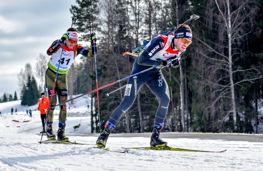
Estonia is not the most skiing country in Europe. There are only six ski resorts, of which the three largest have only a little over 2 km (1.2 mi) of slopes to offer, namely: Kütiorg Ski Resorts, Kuutse Hill-Otepää, and Kiviõli Ski Resort.
There is also the locally famous Tehvandi K90 Ski-jumping Hill, part of Tehvandi Sport Center in the Otepää Upland. In addition to the actual certified ski jump on which local athletes prepare for various competitions, as well as other sportive facilities, it hosts the second highest (34 m / 112 ft) viewing tower after Suur Munamägit.
However, cross-country skiing is very popular with many more trails for tens of kilometers (miles), which you can find on the same resorts and other places.
Learn more about ski resorts in Europe and around the world in World Mountain Lifts, including open and closed slopes and lifts.
While hiking in Estonia, visit the official tourist office of Tallinn to find out more information on the spot, ask for advice, pick up a map, and the like.
Tallinn Tourist Information Center
Niguliste 2, 10146, Tallinn, Harju County, Estonia
+3726457777
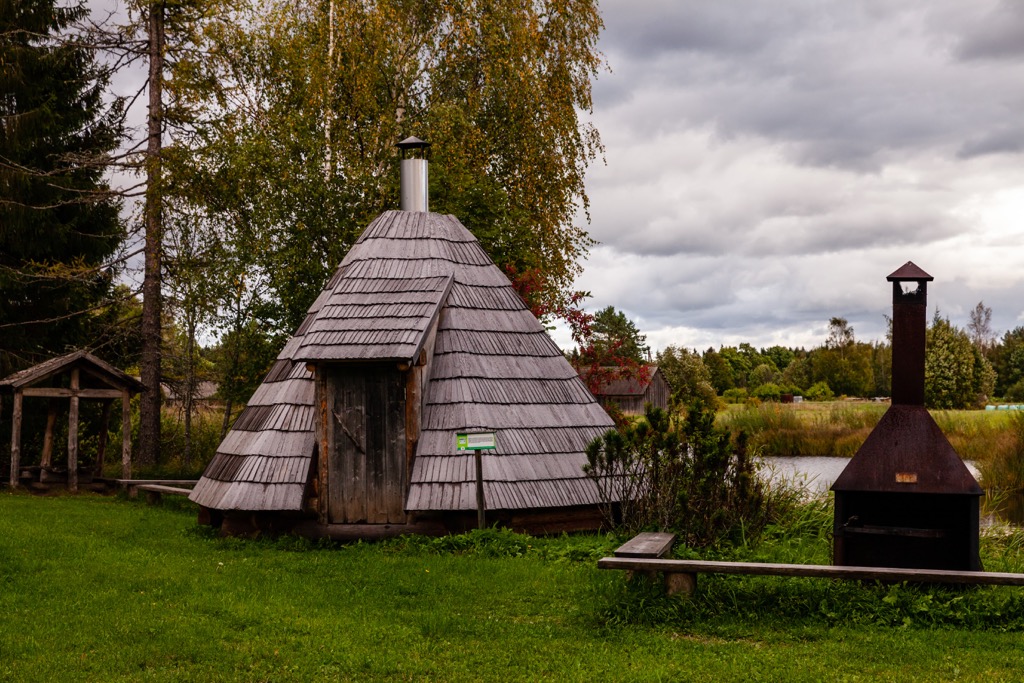
The main places for sleeping while hiking in Estonia are various resting places, campfire sites, campsites and campgrounds, free always open forest huts and rental huts.
So the system of overnight accommodation during active recreation in general is similar to that of Finland and the Scandinavian countries (Norway, Sweden, Denmark and Iceland). If you have been hiking in one of them, you know what to expect in terms of accommodation in Estonia.
For example, each of these types of accommodation can be found in Lahemaa National Park, Haanja and Otepää nature parks, nature reserve, and on the long hiking trails I told you about.
After Tallinn with 438,341 inhabitants, the nine largest Estonian cities and towns are Tartu, Narva, Pärnu, Kohtla-Järve, Kuressaare, Laagri, Jüri, Viimsi, and Viljandi with 16,875 residents. But after Tartu, most of them are small towns and resorts at the same time.
Of course, given the relatively small size of the country, Tallinn is a must-visit. The choice of further places depends on the landscape you are interested in. In short, for long sandy beaches go to Pärnu on the west coast or Kuressaare on Saaremaa Island, and for history and culture go to Narva in the east with its famous Hermann Castle or simply Narva Castle built in 1256. (In general, Estonia is famous for its castles, fortresses, and the like.)
The largest settlements in "Mountain Estonia" are Otepää village, located right in the center of the Otepää Upland and the namesake nature park, and Võru on a small picturesque lake—the closest to Haanja Upland.