
Scan the QR code and open PeakVisor on your phone
Republic of Karelia is home to 894 named mountains. The highest is Hositunturi at 592 m.
The Republic of Karelia is one of the 86 regions of Russia and one of the main places for outdoor recreation residents of Saint Petersburg and Moscow. The republic is located on the north and northwest of the country along the Russian Federation’s border with Finland. Karelia boasts pine forests, two huge lakes, beautiful rocky islands, and a collection of low-elevation mountains. There are 894 named mountains in the republic, the highest of which is Hositunturi (592 m / 1,942 ft), and the most prominent of which is Gora Nuorunen (577 m / 1,893 ft).
The name “Karelia” derives from that of Karelia, which is a historic and cultural region in southern and eastern Finland as well as western and northern Russia. The Karelians are an ethnic group that traditionally lived throughout this region.
The Karelians speak Karelian, which is an officially recognized minority language in both the Republic of Karelia in Russia and Finland as a whole. Karelian is a Balto-Finnic language and it is similar to Finnish, though it differs slightly in vocabulary, tone, and expression.
The Karelians call their homeland Karjala. However, while the origin of the word is unclear, it’s believed that Karjala derives from the modern Finnish karja, which means “herd.” This may refer to animal husbandry, a common method of subsistence in this region for thousands of years.
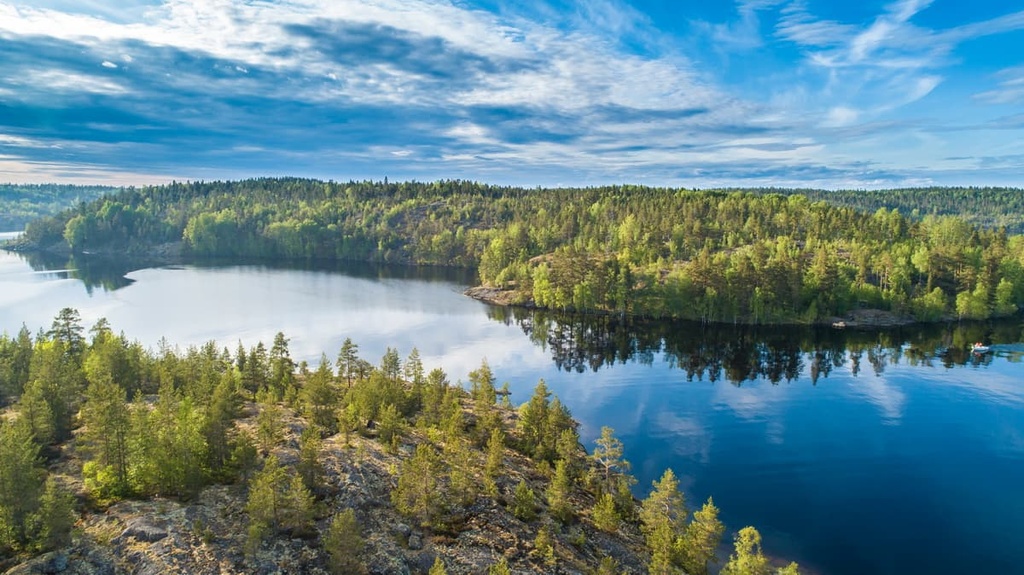
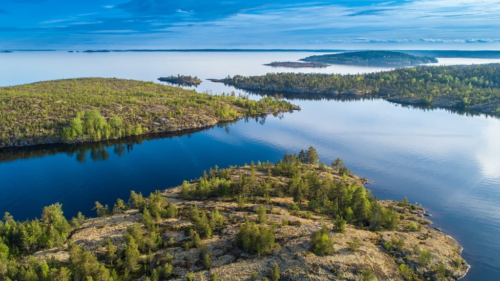
The Republic of Karelia is located in the northwest of Russia between three large bodies of water: Ladoga Lake to the west, Onega Lake to the east, and the White Sea in the north. In the north it borders Finland.
But this is not enough to understand exactly where the Republic of Karelia is. The region of Karelia has a complicated geography. Here are three key things to keep in mind when discussing the geography of the Republic of Karelia and that of Karelia as a whole:
First, the Republic of Karelia is a major part of the larger Karelia region, which also includes North Karelia and South Karelia in Finland.
Second, the cultural region of Karelia in Russia consists of four smaller subregions:
Therefore, in addition to the two Finnish subregions, there are a total of six Karelia subregions.
Third, Karelia is also divided into East Karelia (Russian) and West Karelia (Finnish). In this now imaginary map, the Karelian Isthmus and the north of Ladoga Lake belong to Finland, not Russia, as was the case before 1944, when Finland lost parts of its territory after the Winter War (November 30, 1939—March 3, 1940) with the Soviet Union.
The total area of the Republic of Karelia is 180,500 sq. km (7,142 sq. mi). It is the seventeenth largest region of Russia by area, given that it is the largest country in the world. For comparison, in case you are reading this guide in the United States, it is bigger than the state of New York, which is 141,300 sq km (54,556 sq mi). However, California and Alaska are much larger than the republic.

There are three main ways to get to the Republic of Karelia: from St. Petersburg, from Finland, and from Moscow.
The Republic of Karelia itself has three main cities, located, respectively, on its three large bodies of water: Sortavala on Ladoga Lake, Petrozavodsk (the capital and largest city of Karelia) on Onega Lake, and Belomorsk on the White Sea.
Where to go depends on what you want to visit and where you’re coming from. For the first trip, I would choose Ladoga Lake and for the second and third, Onega Lake or the White Sea. It is quite possible to visit all of these places in one trip, but you will need at least a week.
To get to these places:
It is better to come to Karelia separately, well prepared and for a longer period of time, than just as a day trip or long weekend from nearby St. Petersburg on the way to Finland or Moscow.
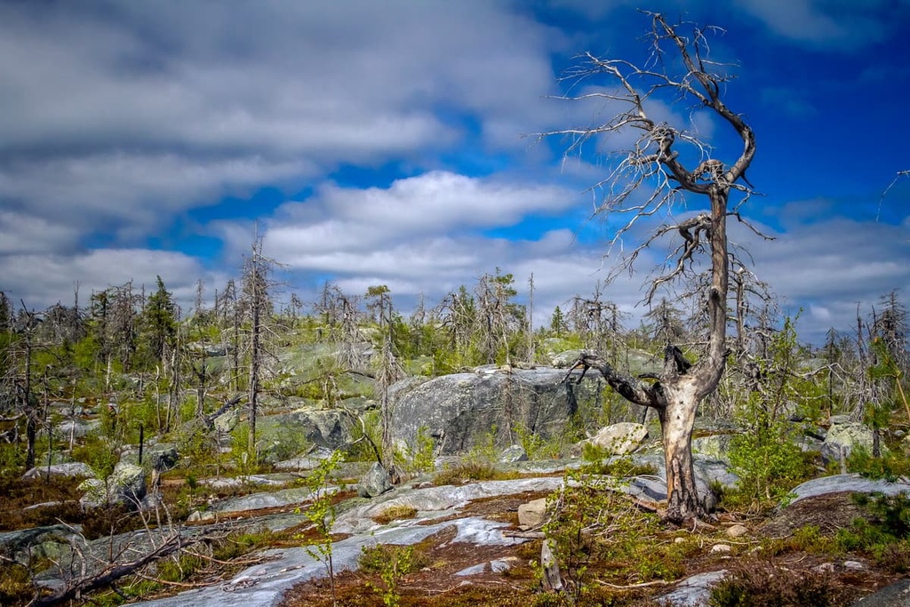
Granites, gneisses, shales, and quartzites are the main types of rocks that exist in the Republic of Karelia.
To see them, you don’t need to be a geologist. All these rocks can be seen on the surface in the region in the form of the mountains, cliffs, and boulders in the forests, as well as on the shores of lakes, and even in the lakes as islands.
The smooth shape of many of the rock formations in the region is also one of the defining features of Karelia. These rocks look as if someone had polished them. Here such rocks are called “ram foreheads” because they look like the smooth foreheads of rams.
The reason for this is that this area was once covered by a glacier that encapsulated the entirety of Northern Europe. The glacier retreated, leaving well-polished and eroded rocks in its wake and freeing the current landscape of Karelia from the ice.
These Karelian rocks are parts of the Baltic Shield—one of the oldest layers of the Earth’s crust with an estimated age of 1.5 to 3 billion years old. It lies beneath the base of all of Scandinavia, including Finland, the Kola Peninsula of Russia, and the Republic of Karelia.
In Karelian, you can find deposits of gold, copper, iron, nickel, zinc, and the rare shungite mineral, which is only mined here. It is believed to have a healing effect, so it is one of the tourist symbols of Karelia, which you can buy in every souvenir shop.
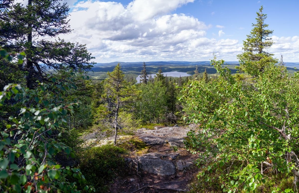
The landscape of such a large and rich natural region like the Republic of Karelia is difficult to describe in short words, but I will try. Here are the three main features that characterize it, in addition to the vast pine, spruce, and mixed forests that occupy most of the region:
Most of Karelia is a plain, covered with low hills and cliffs between 100 and 200 m (328 and 656 ft) in elevation. They are located in the center of the region. Local geologists and geographers like to say that this is the ground floor of the general Karelian topography.
In the south, on the shores of the Ladoga and Onega lakes, and in the north, on the shores of the White Sea, there are mostly plains, formed by marine and lake sediments. But here you can also find small hills of up to 50 m (164 mi) in elevation. Sometimes it is enough to simply climb such little hills to have a great view on the lake.
The highest mountains of Karelia, which are about 600 m (1,968 ft) high, are situated along the western border of the region, which is also the border with Finland. You will learn more about these mountains, as well as all the important peaks of the region, later in the guide.
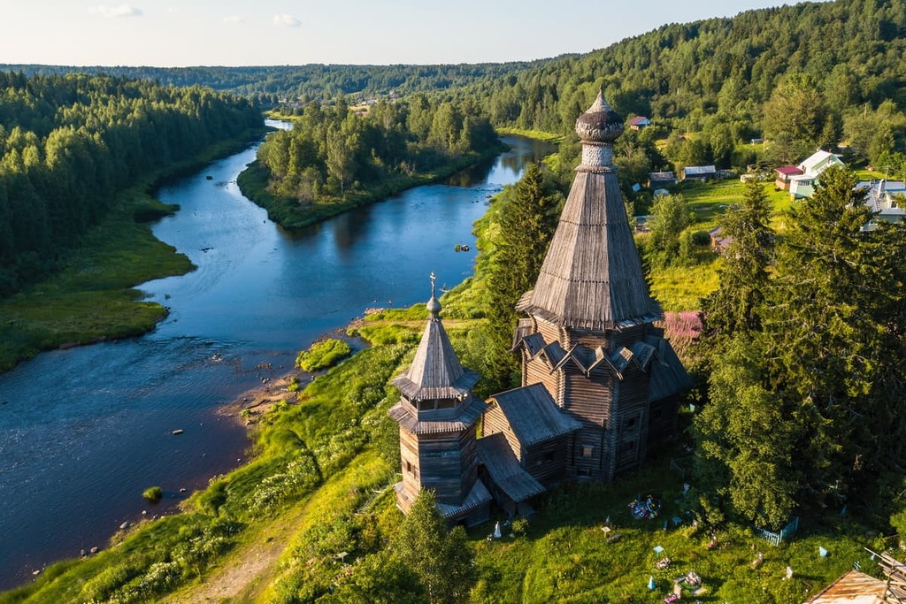
There are many rivers in the Republic of Karelia that are popular among the locals as a place to go rafting, kayaking and canoeing. Almost all the main rivers such as Shuya, Suna, Vodla, Vyg, Kem, Pista, and Olonka, among others, are suitable for this purpose.
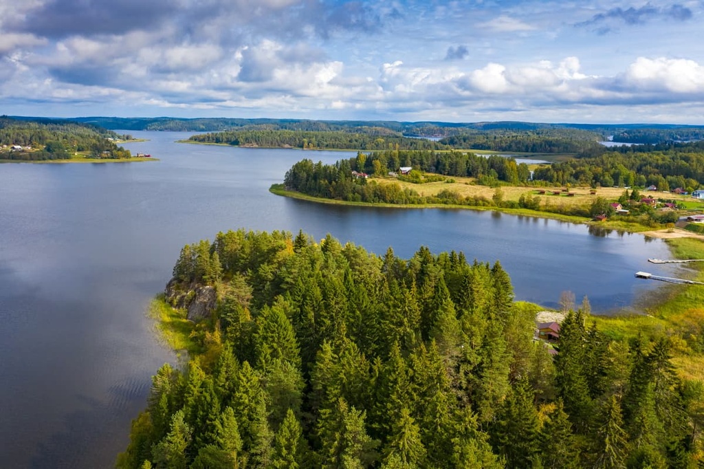
In addition to the two main lakes, there are also many other fairly large bodies of water including Syamozero, Segoozero, Vygozero, Potoozero, Vodlozero, and Pyaozero. Yes, the suffix -ozero means “lake” in Russian. The lakes are also popular as recreational destinations, including for swimming, boating, and, of course, fishing.
I could also say that here, in the Republic of Karelia, we have not one, but three seas, and even an ocean. This is because the White Sea is connected to the Baltic Sea through the White Sea—Baltic Canal. Secondly, the White Sea is part of the Barents Sea of the Arctic Ocean.
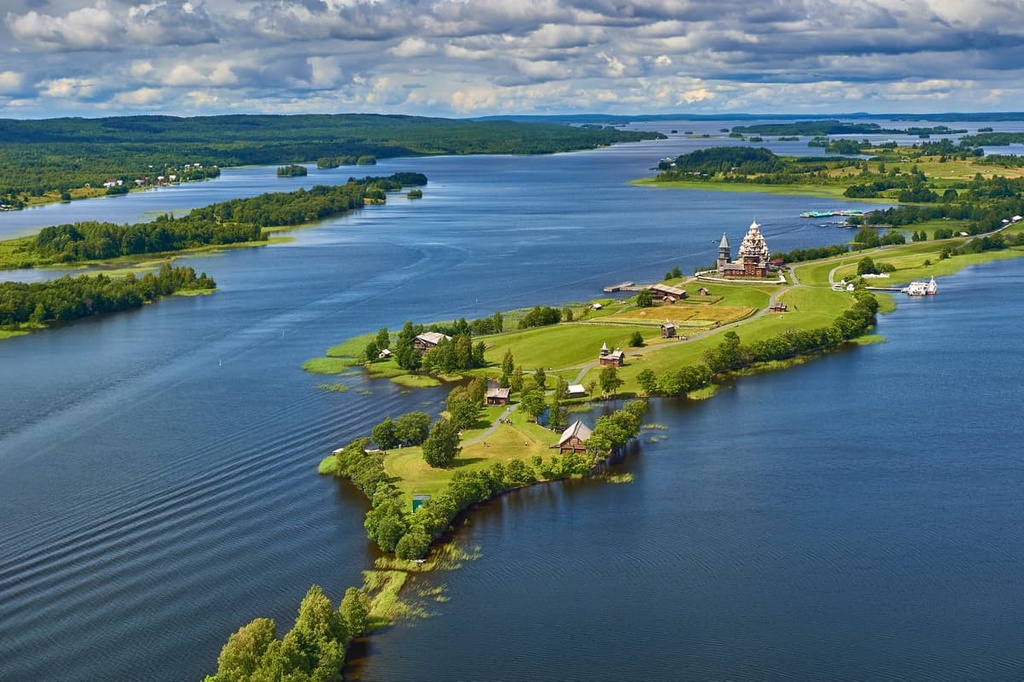
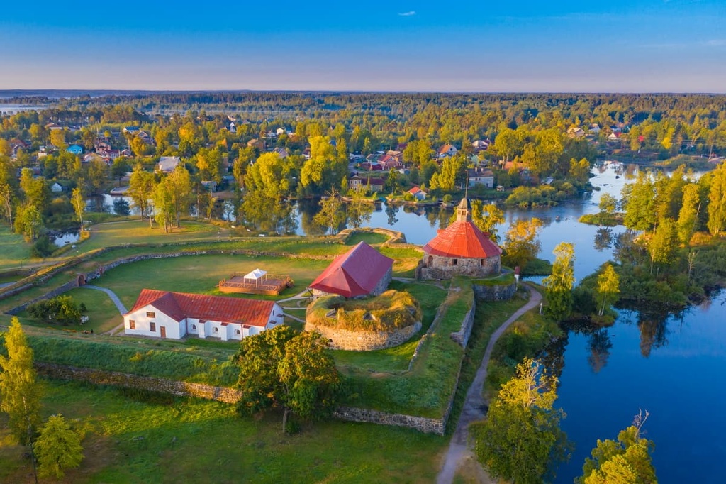
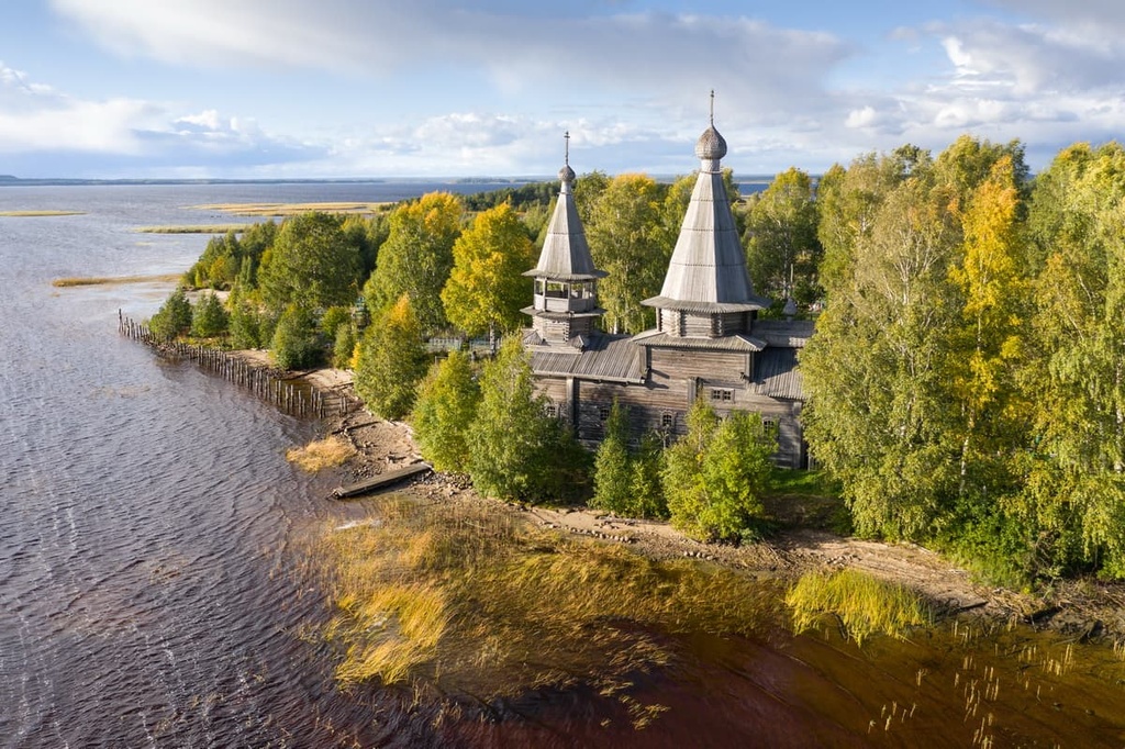
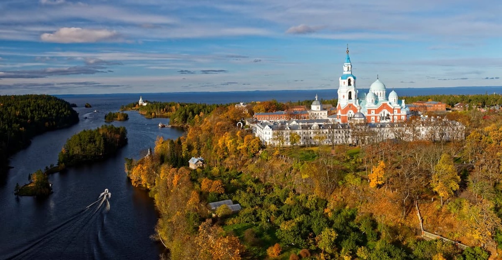
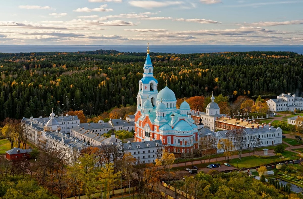
There are literally thousands of islands and peninsulas in the lakes of Karelia, three of which are considered the main religious centers of northern Russia—Valaam Island in Ladoga Lake, Kizhi Island in Onega Lake, and Solovki Islands in the White Sea, although the latter belongs to the neighboring Arkhangelsk region.
The island of Kizhi, in particular, is part of the Onega Peninsula—the largest in the region. It is the main cultural region of the Russian north, where many old wooden buildings (houses, churches, and other similar structures) have been preserved. It is also where all the Russian fairy tales, folk songs, and legends come from.

If you prefer active recreation to history, culture and religion, I recommend you to go to the Koyonsaari Island in the Ladoga Lake, which I visited myself in July 2020. You can kayak here, go hiking, and simply live on its shores in a tent for weeks. It is also home to the largest sandy beach in all of Ladoga.
Karelians are Finno-Ugric people or Baltic Finnic people, most of whom live in the regions of North and South Karelia in Finland, as well as the neighboring region of the Republic of Karelia in Russia, and the Baltic countries.
There are only about 88,850 Karelians in the world, about 25,000 of whom live in Finland. The majority of ethnic Karelians live in Russia, as this part of the region is much larger than its Finnish counterpart.
The Karelians can trace their history back to at least the early Middle Ages when they were mentioned in written sources in the seventh century. But as a single nation, they were formed on the Karelian Isthmus during the late Middle Ages.
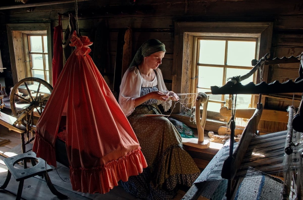
For centuries, Karelians have lived (and they still live) by hunting and fishing, and different kinds of agriculture. However, while there are no large cities in either the Finnish or the Russian parts of Karelia, the region has a rapidly developing outdoor tourism industry.
From my personal experience, Karelians do not differ very much from one another in a cultural sense in the different parts of the region, as, for example, Italians from the north and the south of Italy. Nevertheless, there are some slight differences between the Finnish and Russian parts of Karelia
In Finland, Karelians are also one of the leading ethnic groups alongside the Finns. Much of what we know about the country and why we love it comes from Karelia. For example, the famous lake landscapes and the Karelian pies (karjalanpiirakka) of Finland are Karelian.
Finland's main book, the national epic Kalevala, was even written based on numerous oral legends and songs that come from Karelia. Moreover, its author, the Finnish journalist, Elias Lönnrot, collected these legends in several villages that are now in the Republic of Karelia in Russia.
There were three main periods in the history of Karelia:
Most likely, the region of Karelia will never be a single entity on a geopolitical map, but it remains one in cultural terms. In this way, it is similar to the Dolomites in Italy and Austria.
By the way, there are many such regions in the world—the Basque Country between Spain and France, Patagonia between Argentina and Chile, the Cyclades Islands between Greece and Turkey, and many others.
The flora and fauna of the Republic of Karelia are typical of this geographical area, which is similar to that of the regions of the far north.
Most of the territory of Karelia is covered with dense pine and spruce forests, in which there are not many hiking trails. But, people often come here to pick numerous edible mushrooms and berries (cowberries, blueberries, cranberries, cloudberries, strawberries, etc.) every year from mid July to late October.
In addition to pines, birch, aspen, alder, and other trees grow in Karelia. In particular, the second most important tree in the region is considered to be the Karelian birch. In fact, this is one of the most valuable wood species in the world, thanks to the very beautiful wood with patterns. It is used to make various things for home decoration.
Rocks in the region are usually covered with various lichens and mosses. On the northern border of the republic, you can find tundra plants. Furthermore, about one-third of the territory of the whole region is occupied by swampy forests and marshes.
While Russian bears do not walk the streets of Karelian cities, it is not uncommon to see a bear here near a village. For example, I saw two cubs when I spent the night in a tent under a mountain near Sortavala. They smelled food cooking on a fire and tried to meet with me, but I scared them with my camera flash when I tried to take a picture.
Other large and medium-sized animals found in these forests are wolf, fox, hare, elk, reindeer, wild boar, lemming, and others. In total, there are over 370 species of animals in Karelia.
Almost all the northern birds live here: loons, geese, ducks, the white grouse, and many others. I like most of all to watch the first ones. They usually live in pairs on lakes, where they come for the summer season to breed. Divers can be seen almost in all lakes.
In the lakes and rivers, there are a huge number of fish including burbot, brown trout, brook trout, whitefish, and lake smelt. If you need advice about fishing, go straight to the locals.

All the highest mountains, which are located in the north and west of the republic, belong to the two main mountain ranges—Maanselkä and the West Karelian Uplands.
Maanselkä is a mountain range in northeastern Finland that actually stretches from Norway and Russian Murmansk Oblast in the north to Karelia in the south along the entire Russian-Finnish border. The range forms an arc up to 75 km (46.6 mi) wide and more than 750 km (466 mi) long.
The average height of these mountains is 300–400 m (984–1,312 ft). The highest peak is Sokosti (718 m / 2,355 ft), which is located in the Urho Kekkonen National Park of Finland.
This range is home to both Urho Kekkonen National Park and Lemmenjoki National Park.
The West-Karelian Uplands are a southern part of the Maanselkä. The average height of these mountains is 200–300 m (656–984 ft).
Two other ridges that we can find in the Republic of Karelia are the Windy Belt range (Vetryanni Poyas in Russian), which goes from the neighboring Arkhangelsk Oblast to Karelia, and the plateau-like marshy Olonets-Shokshinsky Upland, which reaches up to 300 m (984 ft) high, to the west of Onega Lake.
Next, I will tell you about the 15 main mountains (gora in Russian), moving from the north of the region and the White Sea southward to the two large lakes:
Hositunturi is the highest mountain of the Maanselkä ridge and in the entirety of the Republic of Karelia. It is located in the north of the region on the border with Murmansk Oblast.
From the top of the mountain, you can see many other ranges in the republic as well as in Finland. It is located in a large wilderness area.
Gora Nuorunen is the second-highest mountain in Karelia. It is also the most prominent. In some Russian language sources, it is considered the highest.
The peak is located on the south of Paanajärvi National Park. It is considered the “pearl” of the park, and one of the most popular hiking trails in the region leads to the mountain.
Myantyutunturi is the second highest mountain in the national park. Its summit also offers an excellent view of Paanajärvi Lake.
However, the mountain is best known for the Mäntyukoski Waterfall, which is 9 m (29.5 ft) high and consists of five tiers. The water in the falls originates in the depths of the mountains.
Gora Kivakka is another famous mountain in the same park. It is popular because it is much easier to climb than Nuorunen. There is also an equipped trail to the peak. The mountain is also located a little closer to the beginning of the park.

Gora Pyaynur is interesting and beloved by locals and tourists because it resembles the classic peaks of the Himalaya or the Alps.
It is located on the shore of the beautiful Tsipringa Lake to the west of Paanajarvi National Park. You can reach the summit of Pyaynur on foot.
Vottovaara is a mountain in the central part of the Maanselkä mountain range. It is known as the most mythical mountain in the region.
It is believed that the peak has special electromagnetic fields. According to those who have been here, the compass often does not work here, making it a great place to test your PeakVisor skills.
Gora Revyazhya is the highest peak on the western shore of the White Sea near the village of Kem. It is difficult to reach, so it is better to go from Kem to the Kuzova Archipelago, a series of 16 islands that look like rocky domes showing out of the water. The biggest and highest islands are Russky Kuzov (123 m / 404 ft) and Nemetsky Kuzov (118 m / 287 ft).
Girvas volcano is one of the main peaks of Karelia. It is the remains of an ancient extinct volcano that is estimated to be 2–3 billion years old.
At that time, the height of the mountain reached 6,000 m (19,685 f). It is located in the Suna River near the village of the same name near Petrozavodsk. Here you can see the former crater and traces of lava.
The “Chortov Stul” (“Devil’s Chair”) mountain is the most famous peak in its immediate area. It is located half an hour by bus from Petrozavodsk near the Botanical Garden of the local state university.
This mountain is considered to be a geological monument as it is a part of the former Big Vaara volcano. The rock is shaped like a chair with a back. From the rock, there is a beautiful view of the city.
Gora “Sampo” is a small summit 10 km (6.2 mi) from Petrozavodsk, which makes it one of the main attractions of the city. It became popular after the release of the Russian film of the same name, the plot of which is based on the epic Kalevala. Sampo means “the mill.”
Riuttavuori is a famous mountain located on Riyekkalansari Island—the largest in Ladoga Lake, near the town of Sortavala. A 10 km (6.2 mi) long unpaved road leads to the mountain. From the peak, you can enjoy a stunning view of the skerries of Ladoga Lake, which was depicted on the 500 Finnish marks (markkaa) banknote in 1878.
Vahtimäki is the highest peak on Honkasalo Island in the north of Ladoga Lake. The island is the most distant from the mainland in this part of the lake, so the Finns used this mountain as an observation point. Therefore the mountain is also called the “Roof of Ladoga.”
Mount of Olives in Valaam is the most famous peak in a collection of about a dozen peaks that’s located on the main island of the Valaam Archipelago. The mountain offers a magnificent view of Malaya Nikonovskaya Bay, one of the bays of the archipelago.
Note that the original Mount of Olives (818 m / 2,683 ft) or Mount Olivet is a mountain ridge east of Jerusalem’s Old City.
Paasonvuori, or Mount Paaso, is a picturesque rocky hill and a popular observation point among locals and tourists on the outskirts of Sortavala. In ancient times, there was another settlement of the Finns, and in the twelfth century, it was a defensive fortress of the Novgorodians. From its top, you can clearly see the city and Ladoga Lake.
Hiydenvuori is a mountain located near the picturesque village of Hiidenselga, which is located right on the north shore of Ladoga Lake. The mountain is known not only for its beautiful views but also for the cave in which, according to Finnish legends, an evil spirit named Hiisi lives.
Surimyäki is a mountain on the Tervu Peninsula in Ladoga Lake. It is known as a great place for outdoor activities on the lake. The summit can be reached on foot from the village with the same name, Tervu, which is located at the very beginning of the peninsula.
The main thing to know about hiking in Russia and Karelia, in particular, is that there are far fewer marked hiking trails here due to the poorer overall development of hiking infrastructure in the region.
While for Europeans, hiking is a recreational activity, which involves overnight stays in mountain huts, for Russians, hiking usually involves camping in the wilderness with a tent, when you carry everything with you and make a fire to cook food. If you want to go hiking in Karelia, you need to have orientation skills so you don’t get lost.
Nevertheless, in the Republic of Karelia, there are several areas where you can hike and mountain bike on the marked trails, sleep in various types of huts, and order other services including sauna, guided tours, snowmobile trips, kayaking, and more.
Here are some of the most popular recreation areas in the region:
Four of more than 60 national parks of Russia are located in Karelia, including:
In 2021, the Republic of Karelia finally created the Ladoga Skerries National Park on the northern shore of the lake, after years of struggle between outdoor enthusiasts, environmentalists, the state, and local businesses, which usually do not want to give away areas for conservation purposes.
The main feature of the park is more than 650 rocky islands (skerries) that resemble Norwegian fjords. This is a unique natural area, not only in Karelia but all over the world. This is just maybe the best place in the republic.
In Karelia, it is also possible to visit two large and well-known nature reserves: Kivach Nature Reserve near the Petrozavodsk with the largest waterfall in the region (10.7 m / 35.1 ft), and Kostomuksha Nature Reserve in the northwest, which is famous for the lake Kamennoye, which has 96 islands, and a special species of salmon from the Red Book.
Separately, I’d like to mention the world-famous Kizhi Museum and Nature Reserve, one of the largest open-air museums in Russia. It is home to examples of unique northern architecture, including the ensemble of Kizhi Pogost, a UNESCO World Heritage Site. It is located on an island in Onega Lake.
Other parks include:
If you want to go on a long hike in Karelia and not get lost, it is better to choose one of the three national parks with marked hiking trails. Below I’ve compiled the list of the main trails, as well as some unmarked but not difficult trails in wide open terrain:
Marked Trails
Unmarked Trails

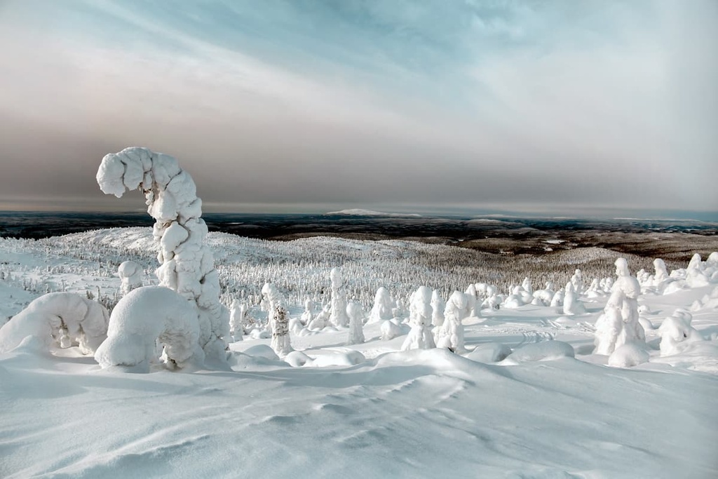
If you find yourself in the Republic of Karelia in the middle of Russian winter with a clear desire to go skiing, you can rest easy knowing that there are plenty of opportunities for adventure.
You can find slopes right in the capital of the region, the city of Petrozavodsk. There are three places for skiing—all located close to one another—just about 20 minutes by car or bus from the city center:
The largest ski resort in the republic, "Yalgora," is located 30 km (18.6 mi) from the town in the Prionezhsky district, near the village of Pinguba, on the Onega Peninsula.
The maximum elevation of the resort is 121 m (396 ft). Two lifts will take you to the slopes. There are four runs, including:
There is also a set of tracks for cross-country skiing with a total distance of 2.5 km (1.5 mi).
Check out a map of the Yalgora Ski Resort on the resort’s official website.
There are other resorts in the republic but they are very small. In general, for skiing, it is better to go to neighboring Finland, where you will find 75 resorts.
The Republic of Karelia and its capital, Petrozavodsk, is one of the few provincial places where I regularly meet foreign tourists. From communication with the director of the main local travel company I also know that tourists from all over the world come to the region. However, many tourists stay in the city and visit the main attractions of the region, but they don’t make it to the region’s most remote corners.
The majority of the Russian population does not speak English, although many learn the language in school, which is compulsory. People just don’t use it in daily life, so if you need advice, go to the main tourist center of the Republic of Karelia, where there are staff who certainly speak English.
Here, you can also buy a map of the region, find out the schedule of buses, trains and lake ferries that run to the island of Kizhi, and solve other issues.
Tourist Information Center of the Republic of Karelia
Karla Marx Prospect
14, Petrozavodsk
185035, Russia
Monday to Friday, 10 am to 6 pm
+78142764835
Also note that the emergency phone number in the region is 112.

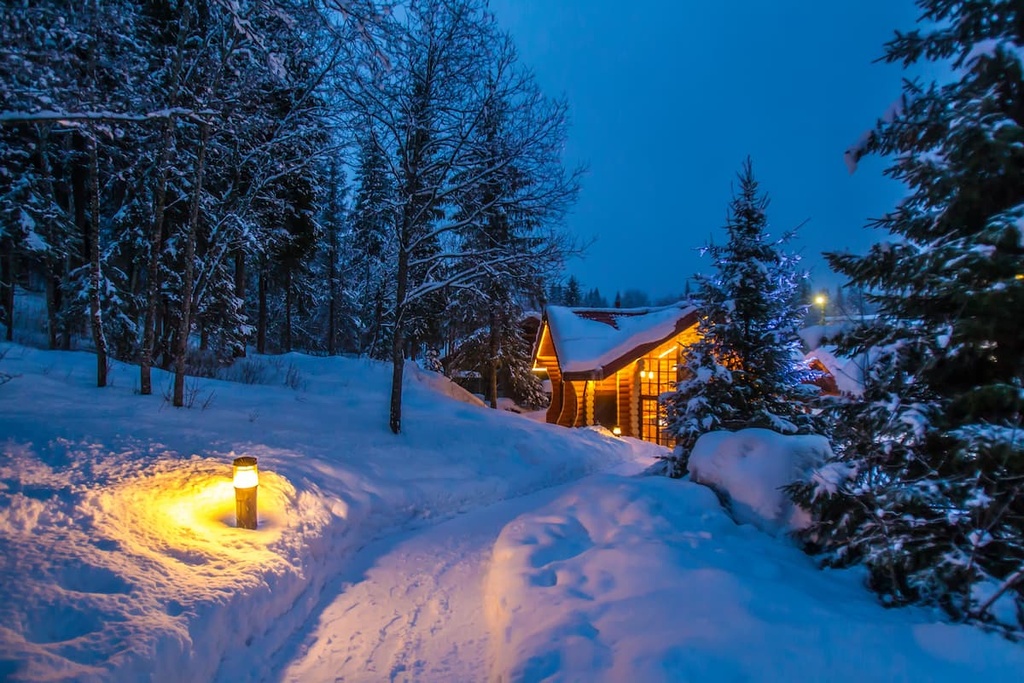
The easiest, cheapest, and most popular type of accommodation when hiking in the Republic of Karelia is a tent. Nowadays you can find tents weighing only 1 kg (2.2 lb) or even less. I recommend that you always take one with you when hiking, as well as some cooking equipment—even if you plan to look for overnight accommodations.
In almost all national parks and nature reserves in Karelia, you can also rent an izba for 2 or more people. This is a typical Russian summer house or a forest hut. Usually, it has a bed, a table, and a place to cook. Often, the huts have baths or saunas outside the main building.
For example, in Paanajarvi National Park, the largest in Karelia, there are 17 such huts. In other parks, there may be less. The huts must be booked in advance by contacting the park staff by mail or phone.
Before and after the hike you can find a hotel, an apartment on Airbnb, or a cottage in Petrozavodsk and its neighborhoods. From my experience, there are practically no good apartments for rent in Sortavala, as it is a very small town, but it has a few hotels and a lot of cottages, as well. Websites of local travel companies are usually in Russian, so it is better to use Airbnb or a similar platform to search.
There are no large cities like St. Petersburg in the Republic of Karelia. The region is considered a province of Russia: it is a place of a slow life, it's cheaper to live here, and there's more nature around. The two main cities are:
This is the capital of the Republic of Karelia with 280,771 inhabitants (2021), located 500 km (310 mi) from St. Petersburg on the western shore of Onega Lake.
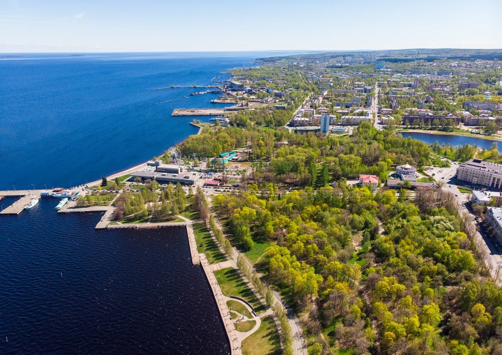
The city is considered a “younger brother” of St. Petersburg. The most famous Russian tsar Peter I founded Petrozavodsk at around the same time as St. Petersburg in 1703.
Petrozavodsk was the second most important industrial center in the north of the Russian Empire. The tsar built several factories to make weapons from cast iron and other minerals that were mined throughout Karelia. The name of the city means "The city of Peter's factory.”
The three main architectural and cultural attractions of the city:
Official tourist site: VisitPetrozavodsk.ru.
This is the second most important city in Karelia. It is located 277 km (172 mi) from St. Petersburg on the northern shore of Ladoga Lake. It is quite a small and very cozy city with 18,704 inhabitants (2021).
It is a Swedish-Finnish town that first became a part of Russia under the Treaty of Nystad of 1721 with Sweden. Still, there are a lot of Finnish houses and other objects of infrastructure in the town. Walking Sortavala, you may feel like you are more like Finland than in Russia.
From 1918 to 1940 ,the city was part of Finland, which got its independence for the first time in history a year earlier after the revolution in Russia. But, after the end of the Winter War between Russia and Finland, Sortavala again became part of Russia, or rather—the USSR at that time.
The three main architectural and cultural attractions of the city include:
Official tourist site: Ticrk.ru


Yes. Republic of Karelia has 894 named mountains. The highest is Hositunturi at 592 m.
The highest mountain in Republic of Karelia is Hositunturi, at 592 m.
Republic of Karelia has 894 named mountains.


