
Scan the QR code and open PeakVisor on your phone
South Karelia is home to 26 named mountains. The highest is Haukkavuori at 173 m.
South Karelia the southeasternmost of Finland’s 19 administrative regions. The region is part of the larger Southern Finland region and is the traditional land of the Karelian people. The main natural feature of South Karelia is Saimaa Lake—the largest in the country—and its associated geopark, which is home to the endangered Saimaa ringed seal. There are 26 named mountains in South Karelia, the highest and most prominent of which is Haukkavuori (173 m / 568 ft).
The name of the Karelia region comes from the name of the ethnic group that has inhabited the region for countless years: the Karelians.
Karelians have their own language, Karelian, which is an officially recognized minority language in Finland and the Republic of Karelia in Russia. The language belongs to the group of Balto-Finnic languages. It slightly differs from Finnish in its manner of speech, vocabular, and expressions.
In Karelian, the name for Karelia is slightly different: Karjala. We do not know exactly where the word comes from, but in modern Finnish its root, karja, which means “herd,” refers to animal husbandry.
South Karelia is located in the Southern Finland region of Finland right on the border with the larger Republic of Karelia in Russia. The total area of South Karelia is 6,873 sq. km (2,654 sq. mi). It borders the North Karelia and South Savo regions to the north, and the Kymenlaakso region to the west.
Culturally, South Karelia seeps into all these neighboring regions, meaning that Karelians don’t just live within geographic boundaries. In an even broader sense, South Karelia is also part of one big cultural region called Karelia, which includes other parts of what is now Finland and the Russian Federation. Read more about Karelia in the guide to the Republic of Karelia in Russia.
However, Karelia should not be confused with the Finnish Lakeland. Lakeland is not an administrative, but rather, a tourist region, which includes more than a hundred thousand lakes in Eastern Finland, Southern Finland and Central Finland. That being said, Karelia forms a huge part of Lakeland.
You can get to South Karelia from Helsinki in around 2 hours and 30 minutes by car (230 km / 142.9 mi to the capital of the region, Lappeenranta). There is also great public transport, including buses (Matkahuolto and Onnibus) and VR.fi trains.
The nearest town in Russian Karelia is Vyborg (1 hour by car or 63.7 km / 39.5 mi). There are buses, too, from the local bus companies but you need to know some Russian to organize the trip. A great solution for those who are not as confident in their Russian skills could be the European BlaBlaCar car-sharing service, which is extremely popular among locals in Russia.
Another great option for traveling to South Karelia from Vyborg (or vice versa) is the famous Saimaa Canal between Saimaa Lake and Vyborg Bay of the Gulf of Finland. You can try to arrange a ferry trip on Gosaimaa.com (Russian) and Saimaatravel.fi (Finnish-English).
Additionally, there is an international airport in Lappeenranta, the region’s capital city. The nearest major airports are located in Helsinki and Saint Petersburg, Russia.
The Baltic Shield is the main segment of the Earth’s crust, which is located under the territory of the whole of Scandinavia, including Karelia and Finland. It is a very old segment of crust that dates back approximately 1.5 to 3 billion years.
But if you look closer, the territory of South Karelia is considered a part of two smaller (or younger) geological segments called the Svecofennian orogen and Jotnian sediment. They were formed during the Proterozoic (2.5 billion to 541 million years ago).
Granites, gneisses, shales, and quartzites are the main rocks in South Karelia. In particular, if you see red colored granite rocks, you can know that it is the typical rocks of this area of these above-mentioned segments.
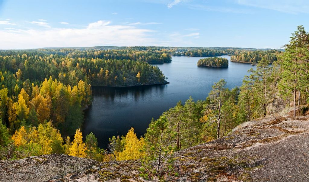
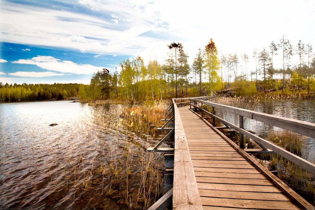
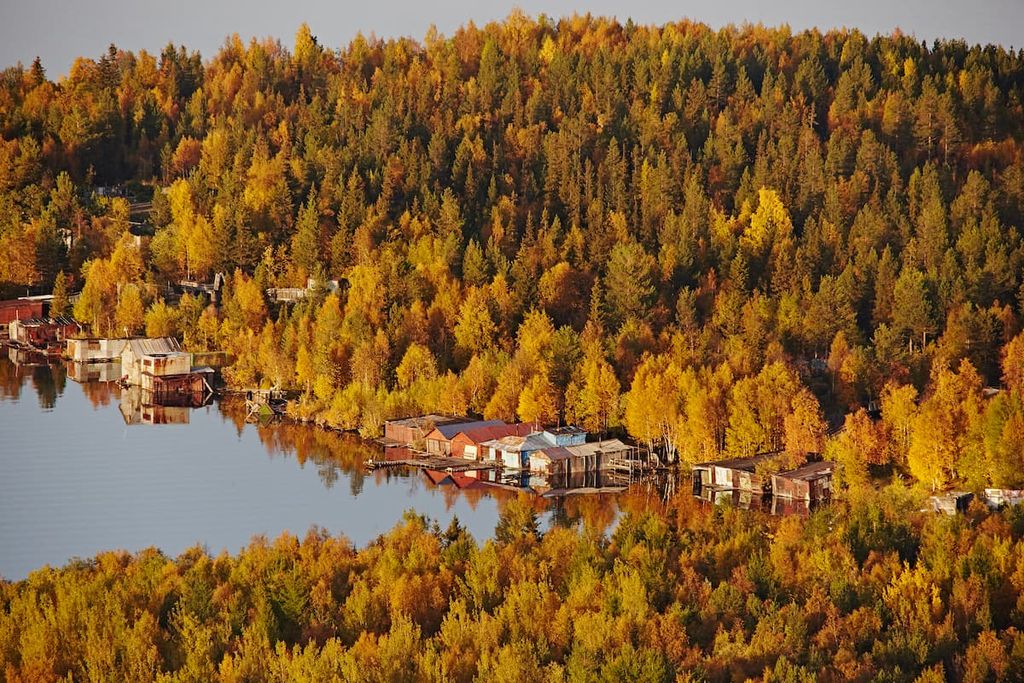
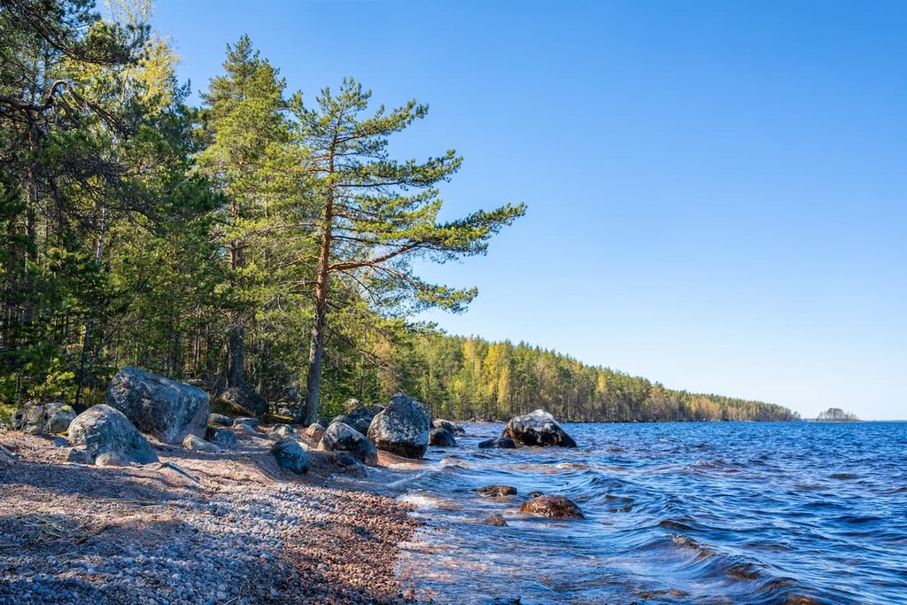
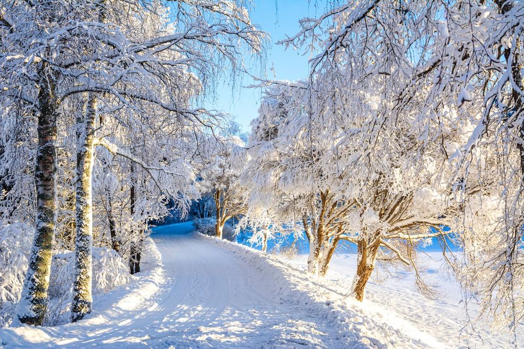
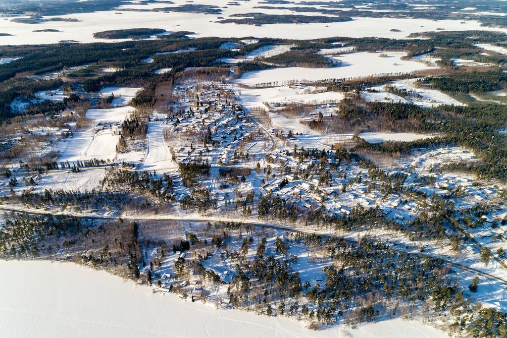
The landscape of South Karelia is characterized by endless wild pine and spruce forests, low hills up to 200 m (656 ft) high, and idyllic farmland landscapes with many wooden eighteenth and nineteenth century houses. But the main feature is the numerous lakes, including Saimaa Lake, which dominates the region's landscape.
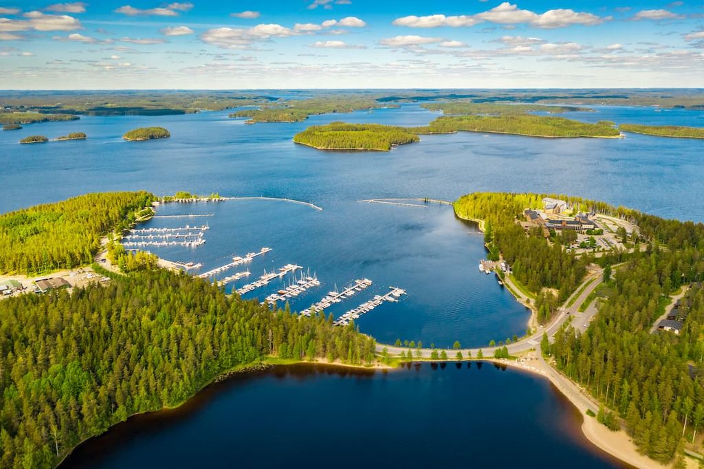
It is the largest lake in Finland with a total area of 4,400 sq km (1,700 sq mi). In fact, it is part of a network of eight large lakes that stretches from south to north and includes Pihlajavesi Orivesi, Haukivesi, Puruvesi, Pyhäselkä, Enonvesi, Pyyvesi, and Ukonvesi, all of which are connected by natural channels.
The largest and southernmost of these lakes is Saimaa Lake itself. It is located in the middle of the regions of South Karelia and South Savo. The whole lake system of Saimaa is also the fourth largest lake in Europe after Ladoga and Onega lakes in the Republic of Karelia in Russia, and Vänern Lake in Sweden.
Here are its main characteristics of Saimaa:
Saimaa Lake was formed as a result of tectonic shifts and faults in the Earth’s crust. The landscape was later flattened during the retreat of the glaciers that once covered all of Northern Europe. This explains the lake’s numerous rugged shorelines and glacial erratics.
The main feature of the lake itself is the Saimaa ringed seal, which is considered a symbol of South Karelia and one of the symbols of the whole of Finland. Due to global climate change, it is on the verge of extinction. There are only about 400 individuals left in the lake according to data from 2018.
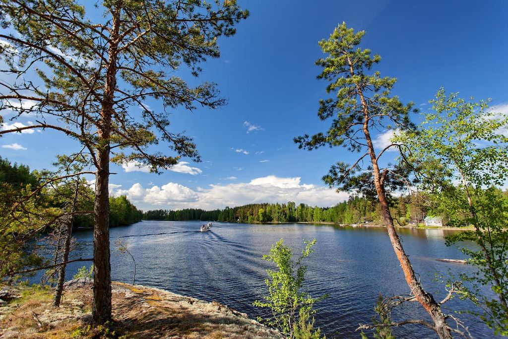
To see the seals, you can take a tour on the M/S Carelia, which travels daily on Saimaa. There are day cruises, bus and ship combinations, and lake tours. For example, there is a popular route from Lappeenranta to Puumala and Savonlinna. The cruise season is usually from the end of June to mid-August.
Another way to see the seals is to visit Linnansaari National Park in the neighboring region of South Savo, which is also home to these amazing animals.
There are no mountain ranges in South Karelia, nor in South Finland. But this does not mean that there are no mountains in Finland—that just they are very old and not as high as they used to be. These mountains are called the Karelides. The height of these mountains is not more than 300 m (984 ft).
They begin in the neighboring region of North Karelia and stretch all along the eastern border of the country to the north of Lapland. Most of the peaks in this northernmost region of Finland are also Karelides, and only a small part of them in the northwest on the border with Norway belongs to the high Scandinavian Mountains.
Nevertheless, in Southern Finland, you can find 22 low peaks located along the border with Russia, which was formed in the same way as the a bit higher Karelides as a result of various geological processes.
Here are the two of the most famous peaks that you should definitely visit during your travels:
Haukkavuori is the highest peak in South Karelia. The name translates as “Eagle Mountain.” It is not uncommon to see and hear these wild birds on the top of the peak.
Haukkavuori features an impressively high, large and wide cliff, the summit of which offers a stunning view of neighboring Sarajärvi Lake and the endless pine forests of the region from its 80 m (262 ft) vantage point.
Another great fact that could inspire to visit and climb this mountain is that Haukkavuori was also a historical marker on the first boundary between the Kingdom of Sweden and the Novgorod Republic, which is mentioned in the Treaty of Nöteborg—the first peace treaty to establish borders between the two countries on August 12, 1323, after 30 years of war.
The mountain is also mentioned in other similar treaties that were signed later, such as the Treaty of Teusina (1595) and the Treaty of Nystad (1721). So, it is a really important mountain for Finns.
The mountain is located just 14 km (8.6 mi) from the town of Simplete, which, in turn, is located 94 km (58.4 mi) from the regional capital, the town of Lappeenranta. It will take you around 1 hour and 20 minutes by car to get to this place.
The Haukkavuori Nature Trail leads through the forest to the summit and back from the nearest parking lot of the same name, which is located around 1 km (0.6 mi) away. The whole round trip is 4.4 km (2.7 mi), or 2 hours 30 minutes of hiking with an ascent of 165 m (541 ft).
Near the mountain, in the parking area, you will find a campfire site and a lean-to shelter where you can rest and even spend a night.
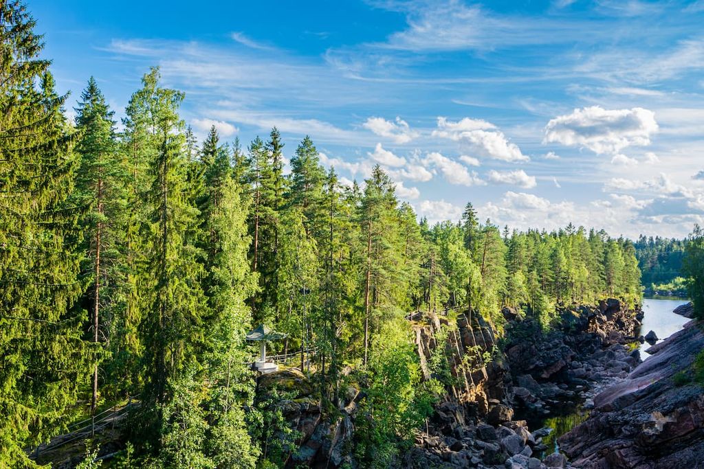
Keltavuori is another famous rock in South Karelia. It is located 17.6 km (10.9 mi) from Lappeenranta on a small picturesque Humaljarvi Lake.
Keltavuori is not high, but it features impressive cliff with large vertical and horizontal walls very similar to the famous peaks of El Capitan (2,371 m / 7,778 ft) and the Half Dome (2,894 m / 8,838 ft) in the Yosemite National Park in Sierra Nevada in the United States. Of course, this is just my opinion, but I’d say the comparison is fairly accurate.
However, unlike El Cap and Half Dome, the most beautiful views of this mountain are only accessible by boat. You will need to use the same waterway also to see its main feature—the rock drawings of ancient people from the Neolithic, made about 7,000–3,500 years ago. There are several human figures depicted on the rock, which can be seen with the naked eye, thanks to the fact that they are also colored in red.
Similar rock paintings can be found in many other places throughout Finnish and Russian Karelia, including the petroglyphs of the White Sea and Onega Lake in Russia, which recently made the UNESCO World Heritage List.
Ancient people in this region are believed to have painted on large rocks that they considered sacred because of their beauty, height, and location. On these wide granite canvases, they were also able to pass on knowledge of the world to future generations.
Read a little more about these artefacts in the report from the Russian researcher Julia Shpinitskaya and that of Finnish photographer Ismo Luukkonen.
Of course, South Karelia is not as popular for hiking in Finland as Lapland or even the Helsinki area, especially when it comes to long trails and overnight stays in wilderness huts, which are simply not available in the south of the country.
Nevertheless, what makes this region different from Lapland is the presence of deep pine forests, their unique and rich flora and fauna, and lakes.
Below I’ll briefly list the most important area, trails and resorts to help you to choose one or two places for your travels:
There are no national parks in South Karelia, but that doesn’t mean you can’t hike here because the entire area of Saimaa Lake is a UNESCO Geopark of the same name—Saimaa Geopark. This is a very young park, established on April 22, 2021, so you’ll likely be among the first to visit it in its new capacity.
Saimaa Geopark is a huge area covering the municipalities of Sulkava, Ruokolahti, Juva, Savitaipale, Taipalsaari, Puumala, Lappeenranta, Imatra and Mikkeli.
It is also the third geopark in the country along with Rokua National Park and Geopark in North Ostrobothnia and Lauhanvuori-Hämeenkangas—an area covering 10 municipalities in South Ostrobothnia, Satakunta, and Pirkanmaa regions.
There are a total of 160 such parks around the world in the UNESCO Geoparks Network, all of which were created to preserve and celebrate the earth’s geological heritage.
If you still prefer visiting a national park as a place for hiking, there is the Repovesi National Park right on the border with Kymenlaakso and South Savo regions, as well as no less famous Linnansaari National Park and Punkaharju Nature Reserve in South Savo.
Also don’t overlook the Riihisaari—Savonlinna Museum and Lake Saimaa Nature Centre, which is located in the town of Savonlinna. It’s a great place to visit if you want to learn more about the lake.
For those who like long walks, you can hike the Kaakkurinkierros Trail (26 km / 16.1 mi) in Repovesi National Park on the border of South Karelia. You can do it in 2 or 3 days and stay overnight in a tent or a rental hut.
There are also two geological trails for you choice in the Saimaa Geopark:
If you still prefer a bit of urban and cultural landscape, take Vuoksi Culture Route in the industrial town of Imatra—(13 km / 8 mi, 1 day). However, this is more of a casual walk than a proper wilderness hiking experience.
Another interesting long route is the Imatra—Ruokolahti—Rautjärvi Hiking Trail (89 km / 55 mi, 8–10 days), which start from Imatra Spa Hotel, goes around Ruokolahti Sports Center and ends at Simpele, the centre of Rautjärvi municipality. This route could be continued also by foot to Haukkavuori, the highest mountain in South Karelia.
South Karelia is not exactly the main Finnish region for skiing. However, there is one very small resort called Myllymäki Ski Resort that’s located 27 km (16.7 mi) from the center of Lappeenranta.
The resort has 6 ski runs of 2.4 km (1.4 mi) in total distance and four ski lifts. There are also cross-country ski tracks of 5 km (3.1 mi) in length if you find yourself excited to ski during your stay.
You can get more information about South Karelia and Saimaa Lake at the Lappeenranta Region Tourist Information Center, which is located in the center of the town.
It may be especially useful to stop by the visitor center before visiting the geopark because it is quite large and facilities are limited. Be sure to take a paper map and a couple of brochures from the visitor center, which will also serve as small souvenirs.
In the visitor center, you can also buy a couple of real souvenirs from South Karelia. The whole region, including its Russian part, is very rich in national ornaments—various patterns, symbols, and the deep meanings behind them—which are used in the creation of clothing, dishes, and other items.
Lappeenranta Region Tourist Information
Brahenkatu 5, 53100 Lappeenranta, Finland
Monday—Saturday from 10 am to 5 pm
+3585667788
Also note that 112 is the single number of the Finnish Emergency Responder Center Agency for ambulance, fire, and police calls. However, cell service may be limited in the more remote parts of the region.
Unlike in Lapland, in the southern regions of Finland, including both parts of Karelia, you will not find any open or reservable wilderness huts. Therefore, for hiking in this region it is better to have a tent with you, which you can set up anywhere—even on private land—under the “Everyman’s Right” law, which exists in Finland and many other Nordic countries.

Another option is lean-to shelters, which can usually be found in campfire sites in national parks and other natural areas. These are shelters without windows and doors. This means that these lean-tos will protect you from rain and wind but not the cold, so even in the summer, you need a warm sleeping bag for the temperature from 0 to 10 degrees Celsius.
For those who prefer more comfort, you can often choose to stay in a special rental hut. Typically, each park has at least a few of them. They cost from €40–50 to €80–100 per night. Usually people rent them in groups to share the cost.
Similarly, you can rent a typical Finnish summer cottage somewhere on the borders of the park, from where you can start your hiking adventures. This is the most popular type of accommodation in Finland, both in summer and in winter. The cottage is sure to have a sauna. There are a lot of campsites in South Karelia, too.
In all cities in South Karelia you can find rooms and apartments on Airbnb. Just keep in mind that things get busy in July and August, so plan ahead to avoid disappointment.
Here are a few interesting, in my opinion, options for accommodation in North Karelia, which you may like:
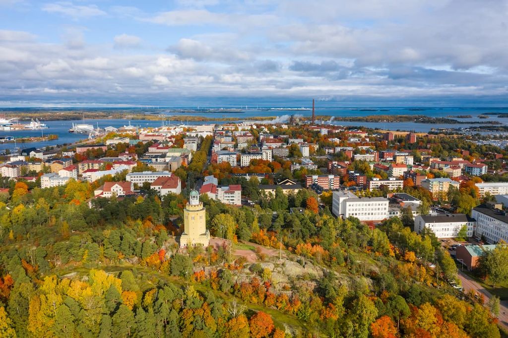
Lappeenranta is the capital of South Karelia and the major city in the southeast of the country located on the shores of Saimaa Lake just 30 km (19 mi) from the border with Russia. Therefore, the city has a big political, economic, cultural, and tourist importance. It is also the second most popular city in Finland among tourists from Russia after Helsinki.
The city was founded in 1649 by the Swedes, when Finland was part of the Kingdom of Sweden. Its founding occurred 199 years earlier than the capital of North Karelia, the city of Joensuu, founded by the Russians, who took the control of Finland after the Swedes.
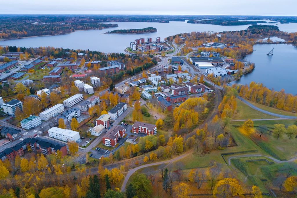
However, Lappeenranta is slightly less popular than Joensuus. Today it has 72,591 inhabitants (compared to 76,833 (2021) in Joensuu). These are the thirteenth and twelfth largest cities in Finland, respectively.
In contrast, also to Joensuu, it takes more time to see the city of Lappeenranta. I would plan a full day to get to know it well and experience the culture and the general lifestyle of this distinct region of Finland. You can even come here all year round—ok, that was a tourist cliché. It's best to avoid the long, cold, snowy, and dark Finnish winters if you don't like the cold.
The main architectural and cultural attractions of Lappeenranta include:
The official websites, which will help you to navigate further in the city are as follows: Visitlappeenranta.fi and Lappeenranta.fi.
When traveling in South Karelia, you can also stay in one of the smaller towns, including Imatra, Parikkala, Rautjärvi, Ruokolahti, Lemi, Luumäki, Taipalsaari, and the wonderful Savitaipale, which I consider one of my Finnish homes. I recommend them as an alternative to Lappeenranta for those who will find it a big and noisy city (though that's highly unlikely).


Yes. South Karelia has 26 named mountains. The highest is Haukkavuori at 173 m.
The highest mountain in South Karelia is Haukkavuori, at 173 m.
South Karelia has 26 named mountains.


